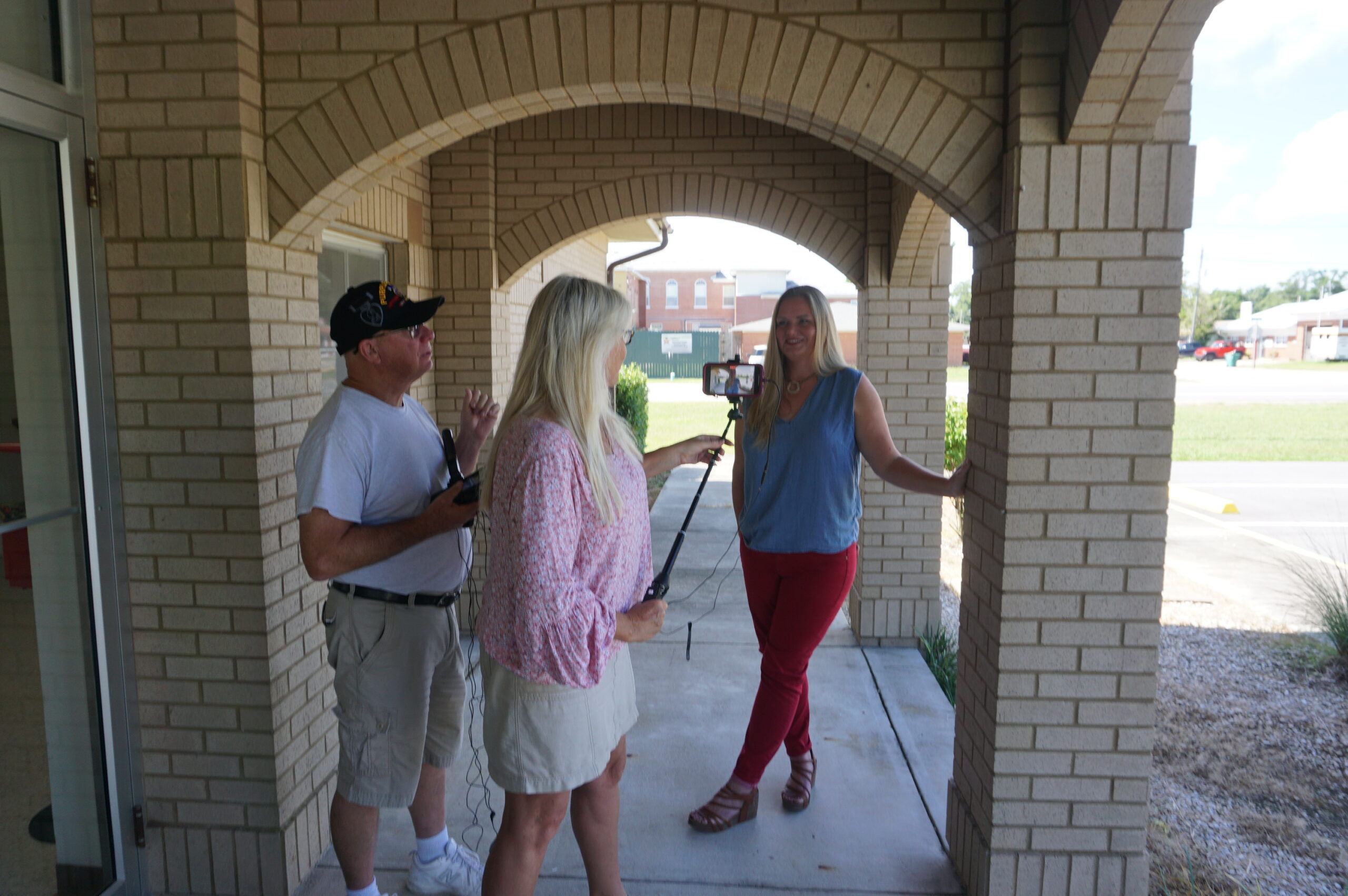
It has been a couple of months since I last posted a video of our progress in filming for Planning to Turn the Tide. That last article summarized our film efforts in Jacksonville, Florida, in September 2023, but we had another trip in the offing then, to the Texas Gulf Coast. In between, as noted in a January 1 post, I underwent prostate surgery on September 29, which required at least a month of rest and inactivity at home before venturing out again, in order to ensure successful recovery. But on November 7, I met up with videographer David Taylor at Houston Hobby Airport and we drove to Corpus Christi, where the annual conference of the Texas Chapter of the American Planning Association was getting underway. The new blog video presented here was filmed there but edited and produced later.
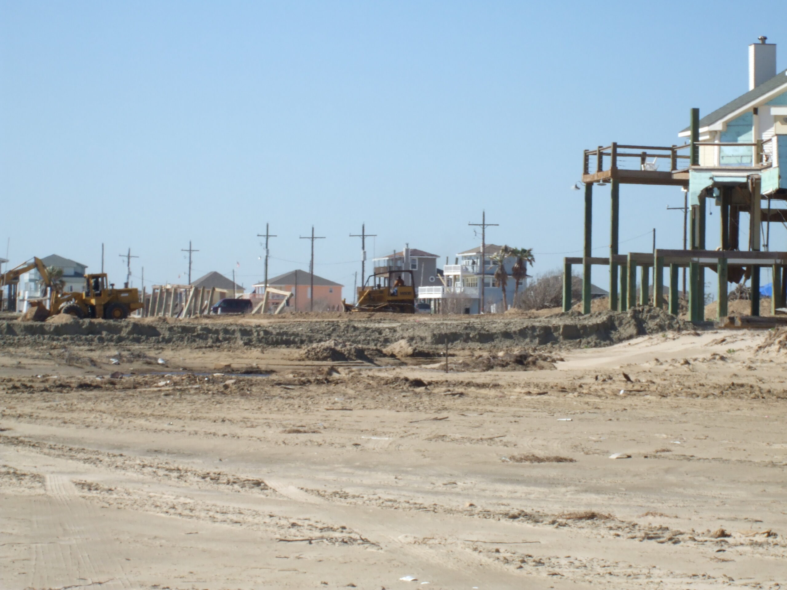
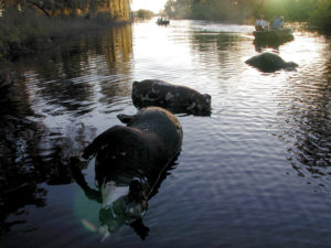
Devastation in the Bolivar Peninsula from Hurricane Ike, 2009
Despite my own challenges, what compelled this schedule was that conference at the American Bank Center in Corpus Christi because it allowed us to interview eight Texas planners who have been prominently involved in efforts to confront and address resilience issues along the Gulf Coast, where coastal storms and flooding remain major concerns. Hurricane Harvey, which struck in the fall of 2017, may be the most famous, and famously expensive, disaster of recent history in the area but is certainly not unique. People with a longer memory can cite Tropical Storm Allison, which struck Houston in 2001, and Hurricane Ike, which devastated Galveston in 2008, as part of the long parade of such events.
It is easy enough to cite shortcomings of the past that made destruction in such storms worse than it needed to be, but it is also important to note the resources that Texas has created to tackle those problems, including Texas Target Communities, a program at Texas A&M University that aids resource-challenged communities. These groups were present at the Texas APA conference, and we interviewed both Jaimie Masterson, the director of Texas Target Communities, and Shannon Van Zandt, a professor of urban planning at the Texas A&M School of Architecture, who has long researched and advocated for better affordable housing solutions in disaster recovery.
Tornado impacts in Van Zandt County, Texas, April 2017. Seven tornadoes struck the area in one evening.
I should also note that disaster resilience has been a consistent theme of the Texas Chapter. Back in November 2017, I spent time in Texas at the behest of the chapter, which asked me to facilitate and keynote a recovery workshop in Canton, Texas, following a series of tornadoes there, but I also worked with their Harvey Recovery Task Force well into 2020. The film trip grew out of that partnership, which extends even further back to my speaking at chapter conferences in El Paso and Galveston after Hurricane Ike. We want to thank the Texas Chapter for their logistical and promotional support during the conference.
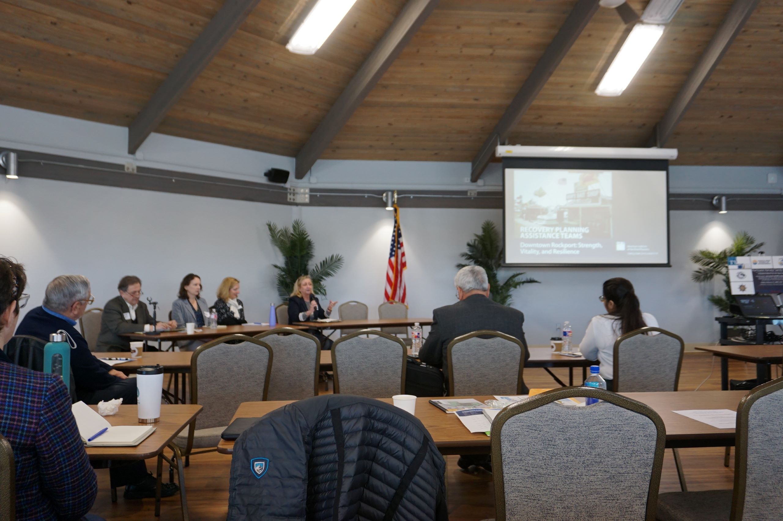
Peer exchange workshop in Rockport, February 2020, involving Harvey and Sandy recovery planners. Kim Mickelson, of Houston, with microphone, is moderating this session.
Following our time in Corpus Christi, we drove up the coast to Rockport, the site of the first landfall of Hurricane Harvey, where we interviewed four community leaders, including a city council member, the local newspaper editor, the public works director, and a former president of the local chamber of commerce, about Rockport’s experience in recovery. I have learned a great deal in recent years about Rockport, in large part because of my work with Amanda Torres, the former city planner there, now working for the Corpus Christi Planning Department, and Carol Barrett, a veteran planner now living in Austin, who led APA’s Community Planning Assistance Team in Rockport in 2019. They helped me design the Rockport case study for an interactive workshop, including both graduate students and practicing planners, that is part of a course I teach for the University of Iowa School of Planning and Public Affairs.
We ended our trip in Houston, which included a tour of largely Hispanic neighborhoods in the shadow of the city’s huge petrochemical complexes, where they face ongoing racially disparate environmental impacts. We were hosted on that tour by TEJAS Barrios, a local environmental justice advocacy group. We hope to return to Houston, but our challenge for now is to raise substantial money to try to complete the film project in the coming year. Fortunately, our core team has grown, with more hands on deck focused on fundraising. If you are willing to help, you can donate here or use the QR code below to contribute online at the APA website.
Click hereto watch the summary video about the interviews at Tampa Bay Regional Planning Council.
One of our interviews featured Jerry Stickney, Director of the Sunshine Line, a Hillsborough County agency that provides transportation for disabled and disadvantaged people, including special services during natural disasters. That last point provided the bulk of our discussion because evacuating and sheltering these people during hurricanes, major storms, and other disasters is a major responsibility, but one that ensures some degree of social equity in the face of life-threatening circumstances. Hurricane Ian could easily have become the major hurricane that finally invaded the Tampa Bay region but instead turned east further south, striking the Fort Myers area.
Cara Serra, resiliency planner for TBRPC, discussed her role in facilitating the work of the Regional Resiliency Coalition, which consists of several working groups examining regional issues concerning shoreline management, infrastructure, stormwater management, and resilient building design and land use, among other concerns. They are currently developing a Regional Resiliency Action Plan.
In the quest for regional resilience, learning lessons from disasters elsewhere plays a major role, one that has not been neglected. Sarah Vitale, planning director for TBRPC, led the development of a new iteration of Project Phoenix, originally created in 2009, to help business leaders and others in the Tampa Bay region understand what the impact of a Category 4 or 5 hurricane might be if it took aim directly at Tampa Bay, something that last happened more than a century ago, when the population was barely one-tenth
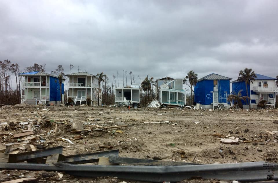
Damage from Hurricane Michael, Bay County, FL. Photo by David Taylor
of what it is now. Her training workshop includes video clips of both a simulation of such a storm and real-life stories from Mexico Beach of economic recovery from Hurricane Michael, which struck the Florida Panhandle in October 2018.
Finally, we also spoke with Sean Sullivan, the executive director of TBRPC, whose engaging New England accent kept us captivated as he outlined his vision for a six-county region that is aware of its risks and prepared to handle the impacts of climate change. It is clear that he has a committed staff that is helping to implement that vision and develop the tools for effective change in that direction.
As promised in the video link above, here are links to the film trailer and the donations page to support Planning to Turn the Tide, the documentary film for which all this work is being done:
The impacts of climate change are affecting us all, often in unexpected ways. As I write this, my own sinuses are recovering from the onslaught of smoky air, full of particulate matter, spread south by the winds from thousands of acres of Canadian forests being scorched by massive wildfires. Winds from such fires in Quebec swept through much of the Northeast two weeks ago, including New York City. Yesterday, it was the Midwest’s turn to suffer, and Chicago was one huge grey fog that burned the eyes and made even healthy people catch their breath. The Chicago Tribune reported that we had the worst air quality of 95 major cities worldwide.
If we needed a vivid illustration that climate change and its impacts know no borders, this is certainly it. That is one more reason we at HMDR find urgency in our mission to develop this film and discuss how better planning at local, regional, national, and even international levels can help us turn the rising tide of losses from natural disasters.
One reason I have long loved being an urban planner is that, ultimately, planning is about imagining a better future. Or should be, anyway. Although I was in my early thirties before I returned to school for a pair of graduate degrees in Urban and Regional Planning and Journalism (a very unusual combination, I soon learned), I was intrigued with the creative process as early as high school. At the time, I applied it mostly to writing, but I learned in college that creativity was valuable for just about any endeavor. Much later, I was enthralled when I read University of Chicago psychology professor Mihaly Csikszentmihalyi’s path-breaking 1990 book, Flow, a study of the creative process. By then, I was already in the throes of writing my own books and learning where my planning credentials could take me.
While most planners never write or publish books, we all are quite accustomed to producing plans, reports, and other documents for consumption by the public, public officials, and other decision makers. We learn how to present these materials and visualizations in public at meetings and hearings. Visual depictions, for example, of what a neighborhood not only is, but could become, are standard fare. Many of us learn to work with various kinds of visualization and design software that create renderings of future versions of boulevards and parks and other public spaces. What architects do for individual buildings, we try to do for entire neighborhoods and cities. In the process, we try to feed and amplify the public imagination for what could be, hoping to find options for improvement that will appeal to a public that may be looking for alternatives to an unsatisfactory or uninspiring status quo. Whole books and software programs, such as CommunityViz, have been devoted to sharing strategies with planners for accomplishing these visionary goals.
The written word and visualizations are two ways, often combined, for helping people see new possibilities or change the way they see the familiar. I have used them for decades, in evolving ways, to help people better understand my own planning specializations, hazard mitigation and disaster recovery. When a natural disaster such as a hurricane or earthquake has shaken a community’s assumptions about its own future, it can be time to think about rebuilding in a way that makes that community more resilient in the face of future events. I helped advance the idea of pre-disaster planning for post-disaster recovery, that is, thinking before a disaster even happens about what would expedite the recovery process and allow the community to emerge stronger and more prosperous than before. This has become known as finding the “silver lining” in the dark cloud of disaster recovery, building hope during a process that can take years or even decades in the most drastic situations.
Left to right, crew members Jim Schwab, David Taylor, and Kim Taylor Galway toast the film project at Royal Peacock, Sarasota, FL, June 18, 2023
Even when I left the American Planning Association (APA) at the end of May 2017, I largely envisioned a continuation of my hybrid journalistic and planning career in the form of books and teaching, for the most part, augmented by various consulting jobs. It was only after conversations with high school classmate David Taylor at the 50th reunion of our Brecksville, Ohio, Class of 1968 in June 2018 that another idea took shape. David, a Purple Heart Vietnam Veteran, had taken a very different path in life after recovering from war wounds, by becoming first a photographer, and later a videographer. After retiring from a marketing position with the U.S. Postal Service, he opened his own studio and has done film and photography work for veterans and environmental groups, as well as traditional assignments like weddings.
Dave had followed my career for decades, starting with the publication of my first book, Raising Less Corn and More Hell (University of Illinois Press), in 1988. As I grew into my role as a leader in hazards planning, he became fascinated with what planners do in that realm, regarding them as “unsung heroes” of the recovery process. Further conversations led to a visit to his home in Sarasota, Florida, in February 2019, which included a presentation at a Florida Atlantic University symposium in West Palm Beach, and eventually that fall into the idea of producing a video documentary about the role of planning in helping communities address threats from natural disasters and climate change. As chair-elect at the time of the APA Hazard Mitigation and Disaster Recovery Planning Division (HMDR), I took that idea to the executive committee, and they chose to sponsor the project.
Devastation from Hurricane Michael, October 2018. Photo by David Taylor
Thus began, for me, a new way of thinking about how to engage the public on these issues. I had no experience with film as a vehicle for this process, except as a viewer, but the idea captured my imagination. What can one do with film that would be different from the written word? As the script writer, how would I think about the narrative differently? Moving out of my comfort zone forced me to think even more creatively than usual, but I welcomed the experience because I sensed that it might give us a new way to capture people’s emotions and imagination around an idea whose time was overdue. The United States, and the world, were suffering ever more massive losses from natural disasters, in part as a result of climate change, and needed new ways to approach the problem. Maybe the kinetic visual impact of a film could help affect that, if crafted with the right forward-looking perspectives in mind.
It would not be easy, and I readily understood that. Moreover, the first question was how to pay for the project. Movies are inherently more expensive to produce than books, and involve at least as much work in most ways. But if we could pull this off . . . .
Fortunately, incoming chair-elect Stacy Wright was able to arrange a $5,000 donation from Atkins, a consulting firm, to start the ball rolling in the fall of 2019. I became chair of HMDR on January 1, 2020, but the COVID pandemic intervened within weeks and by March 2020, we had to shut the project down and wait for the best. It was the fall of 2021 before we were again able to move forward. We created a Video Project Advisory Committee to provide guidance on the project. It consists of leading voices in the hazards planning subfield. We also began to assemble teams of regional volunteers who could assist us with logistics and recommend leading planners for interviews and advice.
We chose to name the film Planning to Turn the Tide because of the metaphorical implications of seeking to reverse the growing tide of losses of life and property from natural and other disasters. Well aware of the impacts and trends of climate change, we know that the number and costs of America’s billion-dollar disasters has risen rapidly in recent decades. We also know that planning can make a difference.
Outdoor interview with Julie Dennis, owner of OVID Solutions (also a member of Video Project Advisory Committee) in Blountstown, Florida, July 2022. Holding camera is Kim Taylor Galway; to her left is videographer David Taylor.
In the meantime, we raised additional donations from other consulting firms* and won two small grants from the APA Divisions Council to help us get started. We announced our project in May 2022 at the APA National Planning Conference in San Diego and recorded interviews with leading hazards professionals at the Association of State Floodplain Managers annual conference two weeks later in Orlando. By mid-July, we had recorded 14 more interviews in the Florida Panhandle, mostly in Panama City, following the area’s recovery four years after Hurricane Michael struck as the first Category 5 storm to reach the U.S. mainland since Hurricane Andrew in 1992. In that visit, we had extensive support from both City Hall in Panama City and the Bay County Chamber of Commerce, which provided its board room for a recording studio for an entire day.
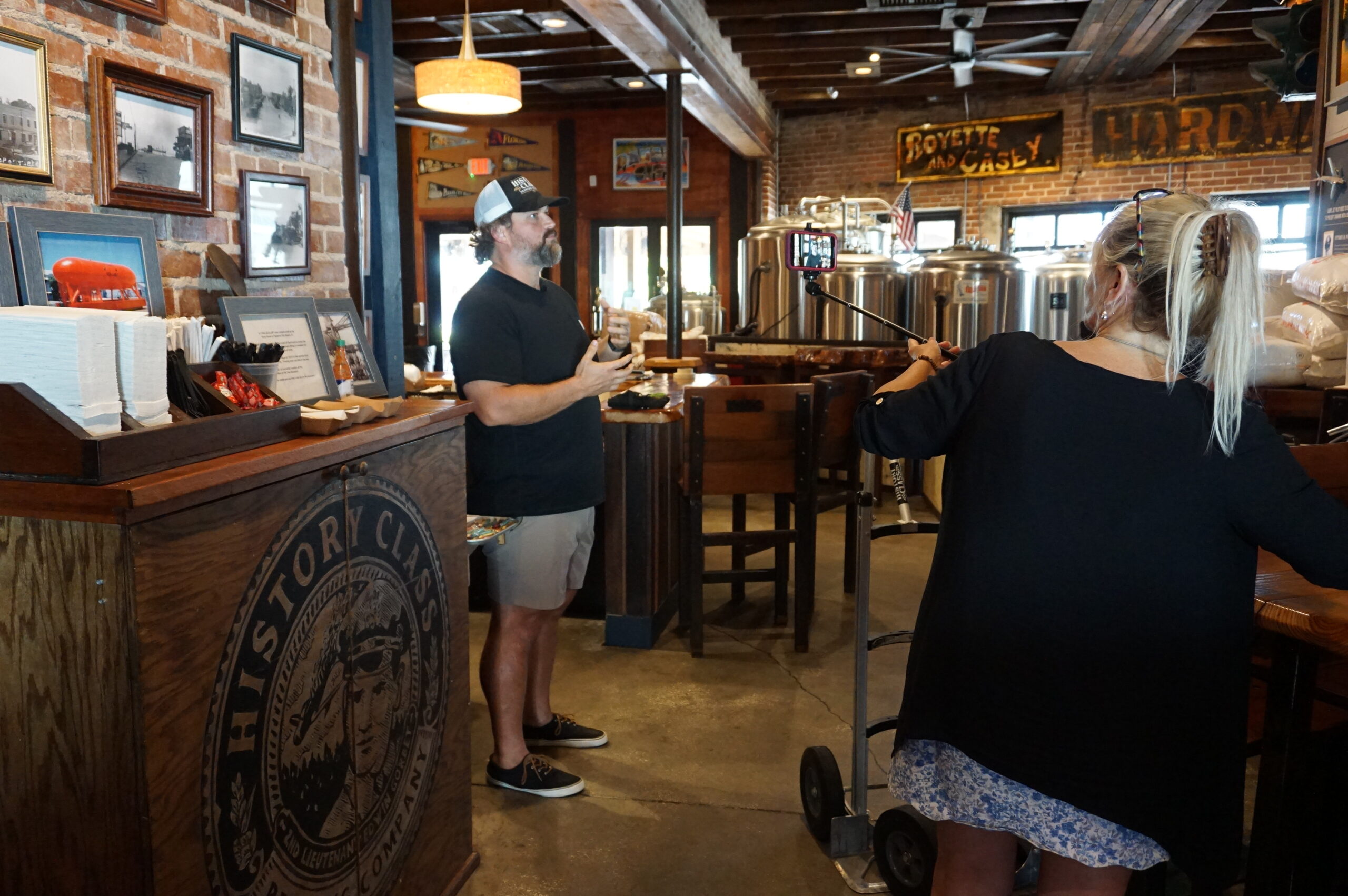
Local entrepreneur Allan Branch explains his restoration efforts at History Class Brewing in downtown Panama City, July 2022
By then, our main problem was that we needed an easy way for people interested in supporting the project to make donations. Fundraising can be hard work, but there is little reason these days to make it harder than it needs to be. APA worked with us over subsequent months to create a dedicated donations page where people could donate online. Because we were the first division in APA’s history to attempt a project like this, we were also the first to need such a mechanism, but by late March of this year, it was ready. The donations page, which you can also reach with the QR code below, channels donations directly to HMDR and tracks the donor information for us, so that we can recognize our supporters appropriately (unless they choose to be anonymous). You can help keep this project moving ahead by donating now, and I sincerely hope you choose to do so. You will be helping us sell the concept of resilient communities to America.
If you need more information on the project itself, visit our project information page. I will be adding new posts regularly as we continue our work, including short blog videos summarizing what we are doing along the way. Please stay in touch.
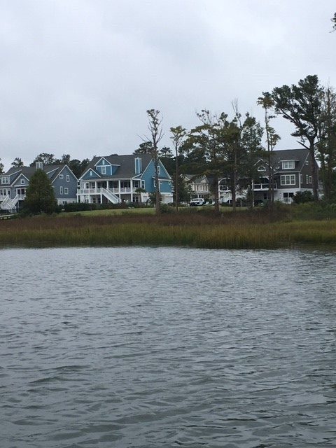
Wilmington, a charming city of just over 100,000 on the far southern edge of the North Carolina coast, has taken some hits from coastal storms in recent years, most notably Hurricane Florence in 2018. Hurricane Dorian this year posed a minor threat but mostly left a trail of 14 identified tornadoes in its wake, a phenomenon familiar in the Southeast, though their association with hurricanes may be less well known elsewhere.
Wilmington Planning Director Glenn Harbeck, who I was told was one of the most knowledgeable people in town for the purpose, on October 8 took me on a boat tour of much of the city’s interior waterfront to let me see and photograph the area along Hewletts Creek, a stream feeding into the Atlantic Ocean behind the barrier island that includes the Masonboro Island Estuarine Reserve. Glenn and his wife have lived in Wilmington for 40 years, during which, he says, they have experienced a succession of hurricanes: Diana (1984), Bertha (1996), Fran (1996), Bonnie (1998), Floyd (1999), Matthew (2016), Florence (2018), and Dorian (2019).
Why it has taken me this long to write about it is another matter related entirely to my own obligations and distractions. At the time, however, I was in Wilmington as the invited keynote speaker for the annual conference of the North Carolina chapter of the American Planning Association. That event was at the city’s convention center, which sits along the Cape Fear River, which basically serves as the city’s western edge, with suburban or unincorporated New Hanover County on the other side. Along with the adjoining Embassy Suites, the complex boasts a boardwalk that allows people to walk to restaurants and other venues in more historic quarters of the city. I joined a party of a dozen at a nearby seafood restaurant, The George on the River, and got to see much of it. Some of the boardwalk appears to need work, but I was not clear on whether that was due to hurricane damage of work in progress. But I can give The George five stars. The food was wonderful and a credit to southern coastal cuisine. (I enjoyed crab-topped salmon with garlic mashed potatoes and spicy collards. I gladly recommend it.) Added appeal derived from the outdoor seating that made for a pleasant evening setting.
But all that followed the boat tour, which came in the late
afternoon after a delayed arrival in Wilmington following a long layover in Atlanta
on the way from Chicago. The weather had been uncertain, and Glenn was a bit
concerned about concluding the trip before it turned rainy or inhospitable,
although it never did. It was simply a bit chilly, but my photos have that overcast,
gray-sky look as a result.
Compared to some prior tours I have taken of disaster sites,
this one was relatively brief with modest expectations. Nonetheless, there are
always learning opportunities, and I had never visited Wilmington before. Touring
by boat allowed a different perspective than by land. Certain factors became
readily apparent, with Glenn supplying ample explanation.
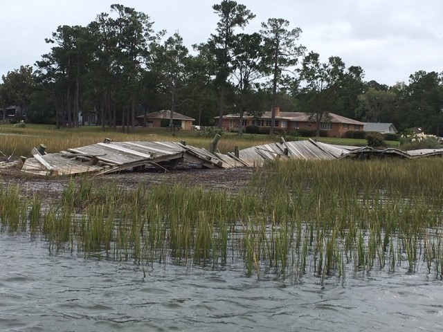
One, to be expected, was that, despite the clear dangers and mitigation challenges associated with a waterfront near the ocean in a region frequently affected by coastal storms and hurricanes, housing along Hewletts Creek remains attractive to its owners and has gained value as a result. These are people who love their boats and their access to the water, and the storms are simply part of the environment, much like a snowstorm in Chicago. Whether everyone takes all the appropriate precautions to protect those properties may be another matter, but most are at least aware of the challenges they face when hurricanes move toward North Carolina.
Because access to the water is a prized asset, most properties include piers, although shared piers are becoming more common, according to Glenn, presumably because of reduced costs and environmental impact. Those piers, however, have typically taken a beating in big storms, and Hurricane Florence contained some solid punches. One problem, he informed me, is that the buoyancy of the wood is the enemy of the piers’ survival because, as the storm surge rises and the piers rise with it, they are bent and twisted and collapse. In other words, the buoyancy of wood works against them. The photos provide ample evidence, but Glenn also told me that some had been repaired in recent months; if I had come three months earlier, the destruction would have been more evident. Past adaptation in some places was to rebuild the piers higher than before to move them above likely wave levels, but frequent storms and high storm surges have sometimes obviated the effectiveness of this approach. Instead, some pier owners are adapting with the use of Titan decking, which uses polypropylene plastic to stabilize the piers during future storms.
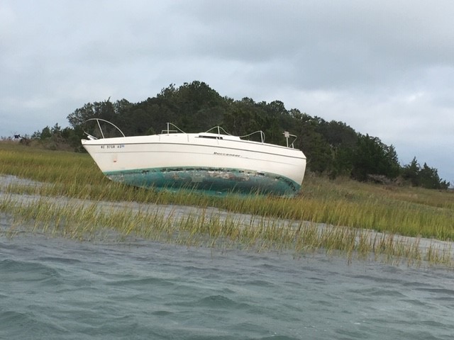
There were also, a year after Florence, remaining indications of the damages suffered to the boats themselves, which can easily be tossed about by winds and waves. We encountered one of those (below) toward the end of the tour.
It should be noted that, although it is inside Wilmington, Hewletts
Creek has a much more rural or suburban feel than the Cape Fear River
waterfront, which is near the urban heart of the city and its downtown. The
riverfront is not primarily residential but encompasses a variety of commercial
uses, including hotels and a large marina. In contrast, the waterfront along Hewletts
Creek consisted predominantly of private residential property.
I do not wish to leave the impression from this glimpse of Hewletts
Creek that what happened there is the extent of the impact of Florence. Although
I did not have time on this trip to get a thorough tour of the city, I did
receive other information from Glenn and from Christine
Hughes, a senior planner with the city for Comprehensive Planning, Design,
and Community Engagement. From her, I learned that Wilmington’s working and
low-income populations sustained a large hit on their affordable housing stock
with the loss of approximately 1,200 apartment units. In September, the
Wilmington City Council approved $27 million worth of bond issuances for the Wilmington Housing Authority. A big part of that
involved the closure of Market
North Apartments on Darlington Avenue, which will be rebuilt. That closure
forced evacuation by more than 1,000 residents. Wilmington will be recovering
from Florence for some time to come. The cost and numbers of people affected in
this housing redevelopment underscore the solemn fact that often low-income and
minority populations suffer the greatest impacts of natural disasters. Our
communities are not whole unless and until we give them high priority in recovery
planning.
It is also worth knowing that the quest for coastal
resilience is not new to Wilmington, which has engaged with federal and state
agencies for some time, as illustrated in a 2013 report on a
U.S. Environmental Protection Agency pilot project on community resilience.
Glenn Harbeck has been in his current position for more than seven years after
a long period of consulting and knows well the direction the city needs to take,
but it is a long road. Residents can learn a great deal about the progress of infrastructure
recovery projects from the city’s
online map tracking such efforts, which include street and sidewalk repairs
and stormwater management. Recovery is a complex process, as Wilmington knows
well, and future storms, climate change, and sea level rise will all surely add
to the challenges that lie ahead.
Hillsborough
County is a dense metropolitan area, anchored by the city of Tampa. Tampa and nearby
St. Petersburg, in
Pinellas County, sit on opposite
shores of Tampa Bay, a 400-square-mile
expanse of water connected to the Gulf of Mexico. Across
that gap sits the Sunshine
Skyway Bridge, a magnificent and scenic section of I-275. On a sunny day,
it displays coastal Florida in all its glory.
Eugene
Henry, like anyone else, enjoys those sunny days, but he also worries about
what may happen when the region suffers inclement weather. As Hillsborough
County’s Hazard Mitigation Program Manager, it is his job to think about how
well the area will fare under the impact of natural and other disasters, which
can include hurricanes, floods, tornadoes, sinkholes, and wildfires. At least
the first two are complicated by sea level rise, and one can easily argue that
climate change in a broader sense may well influence the damage from wildfires.
For those uninitiated in the particulars of Florida’s natural environment,
wildfires are a recurring feature. In what is ordinarily such a lush
environment fostered by rain and abundant sunshine, it takes only one drought
year amid high heat to turn dense vegetation into a tinderbox. It has happened
before, repeatedly.
But the biggest concern, by far, is the arrival of the Big
One, the high-intensity hurricane that the county readily admits it has escaped
in recent decades. In its Post-Disaster
Redevelopment Plan (PDRP), the county states forthrightly that this is
merely a matter of good fortune and that planners fully understand that the day
will surely come—and that they had best be ready for it. Disaster resilience in
the face of hurricanes is not a matter to be taken lightly with 158 miles of
shoreline along Tampa Bay, numerous rivers and streams, and numerous
vulnerable, low-lying areas. Absent serious attention to mitigation, damages
from a Category 4 or 5 hurricane, or one like Harvey that stalls and dumps
voluminous rain on an urban area, could become catastrophic.
But Tampa and Hillsborough County have been very fortunate.
The last Category 3 hurricane struck the area in 1921. What may have been a Category
4 struck in 1848, though wind speed measurements were primitive at the time,
and the U.S. had no official records yet. According to the county’s Local
Mitigation Strategy, that storm “reshaped parts of the coast and destroyed
much of what few human works and habitation were then in the Tampa Bay area.”
Tides rose 14 feet. Tampa was still a small city then, and Gene Henry wonders
about the staggering losses that might occur with a comparable event today.
I had long wanted to visit the area to see in person how
these issues are being addressed. I have known Gene for a long time, and I have
read the county’s PDRP, an extensive document laying out the county’s
preparations for recovery from disasters. But I had never been to Tampa. As the
result, however, of a personal invitation from a high school classmate, David Taylor, who now
lives in Sarasota,
my wife and I flew to Tampa February 20 and stayed with Dave and his wife,
Linda, for five days. Sarasota is about one hour’s drive south of Tampa. As
part of the trip, I arranged to meet with Gene the day after we arrived and
tour the county to see the hazard mitigation projects underway there. I also
delivered a one-hour lecture the following afternoon in West Palm Beach,
on behalf of Florida Atlantic University, as part
of a two-hour program that included a panel discussion following my talk on
“Recovery and Resilience: Facing the Disasters of the Future.” Not one to skip
a learning opportunity, Gene drove four hours from Tampa to attend the program.
But back to Hillsborough. My wife and I met Gene at the
county’s Emergency
Operations Center (EOC) around mid-morning, hopped in his county truck, and
took off. Our first stop was the Florida Center
for Design + Research, housed in the School of Architecture + Design at the
University of South Florida (USF),
Gene’s graduate alma mater. The school features an urban planning program where
he wanted us to meet Professor
Brian Cook. Planning students often take studio classes, which involve
design or research work on real-life community problems. Students learn to
define a community design or policy issue, work with clients, and try to
produce solutions that will be of some practical value to the community they
are serving. They typically work in teams. In this case, students were applying
geographic information system (GIS), or mapping, skills to determine areas of
high vulnerability to flooding and sea level rise in less affluent
neighborhoods. Gene’s county office collaborates with USF instructors to
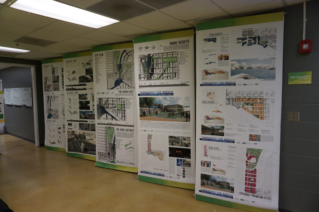
identify areas of practical concern for the students’ work. The photos show
some of the design work the students have done, the best of which is often
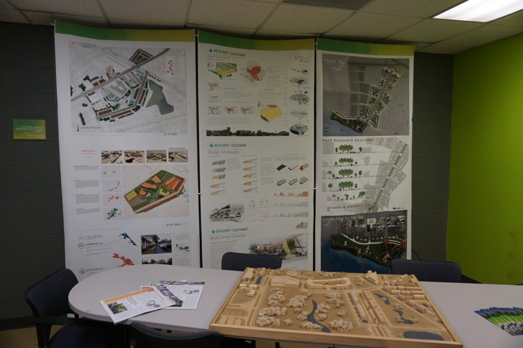
displayed in poster sessions at state and national professional planning conferences.
Posters (above and below) from the USF design studio
The most encouraging aspect of that visit was, for me, the mere fact that the students are engaging with such a pressing problem. I have researched the issue of hazards and climate change in the planning curriculum for both undergraduate and graduate degree programs in urban planning, and most such programs are lacking in this respect, a situation that is disserving the planners of tomorrow who must be well trained to come to grips with these challenges in whatever communities they end up serving. But a growing number of students are getting such training—I have myself been teaching such a course at the University of Iowa since 2008—and southern Florida is as good a laboratory as they could wish for. To see collaboration between a county agency and USF graduate students and faculty is a most welcome note.
But Gene had other places to take us in the afternoon,
besides, that is, the Cuban-themed La Teresita restaurant
where we ate lunch—a place I am willing to recommend if you ever visit Tampa.
First up in the afternoon was the University
Mall area north of downtown Tampa and just east of I-275. This involves a
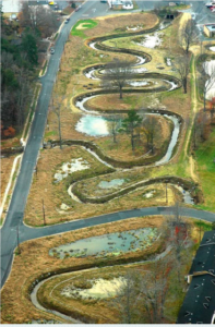
stormwater management and flood-mitigation project in an area subject to a
certain amount of repetitive loss, meaning that the same properties continue to
suffer periodic flood losses. The project removed structures while creating
additional areas for stormwater storage and reshaping a natural area known as
Duck Pond, thus creating a system for stormwater conveyance. This includes a
large stormwater pump that transfers slow-moving stormwater to areas further
downstream and, in due course, to a reservoir owned by the City of Tampa.
Before this project was initiated, storms used to inundate multifamily
apartment buildings, Gene says, as well as a nearby assisted living facility.
How does the county pay for all this? He credits a combination of local funds,
which is certainly not unusual, and federal money in the form of Hazard Mitigation
Grant Program (HMGP) funds. The latter are available as part of an overall
recovery package after a Presidential Disaster
Declaration, but require that purchased properties, once cleared, remain in
perpetual open space. The point is to ensure that a vulnerable area is not
redeveloped, thus perpetuating the problem.
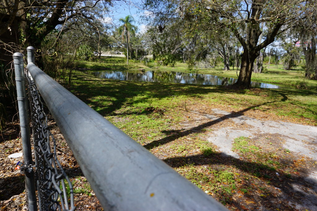
At 132nd Street, also in Tampa, another flood-mitigation
and stormwater management project presents a very different appearance. This
too was subject to repetitive loss and required protection from urban flooding,
which is typically the result of poor stormwater drainage in developed areas. The
problems can include poor water conveyance from one area to the next—the nearby
highway provided an impediment to drainage—and high levels of impervious
surface, meaning coverage with concrete and structures that limit percolation
of water into the soil. In this case, a small subdivision suffered repetitive
flooding even with small storms. Here also, the county acquired homes with HMGP
funds, which are dispensed by the Federal
Emergency Management Agency (FEMA). The streets were removed, and
stormwater ponds were added.
This was a location where the county’s partnership with USF
paid dividends. Researchers analyzed which plants were best at removing
nitrogen and other chemicals common in stormwater runoff in order to clean up
the water before it reaches Tampa Bay. Henry says this project was made
possible through a combination of local and HMGP funds in combination with
federal Community
Development Block Grant entitlement money.
I included the chain link in my photo to show that the solution may not be complete. After all, chain link fences are intended to limit access. What consideration, I asked, had been given to eventually converting this cleared area to some sort of public park and thus facilitating a public benefit? There can be challenges in part because of pollution cleanup and other public safety factors. Gene readily admitted he would love that solution, but it may take time. The adjoining neighborhood must be comfortable with that use, which can involve solving various site-related problems. A nearby church might be a potential ally, serving as a patron and watchdog, but reaching agreement about solutions and responsibilities, including ongoing maintenance and supervision, takes time. And only time will tell whether such a solution materializes with the support of local public officials.
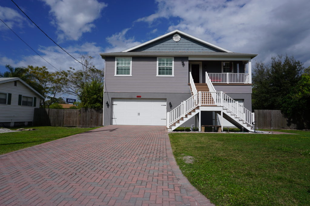
Some projects assist a single homeowner with a stubborn
problem. This is often the case with homes that are elevated, a common site in
parts of the Southeast, where coastal and riverine flooding can wreak havoc
with homes in vulnerable locations that do not necessarily require buyouts and
relocation. That was the case near Rocky Creek,
where a homeowner rebuilt a structure elevated three feet above base flood
elevation (BFE) using a combination of private funds and a Flood
Mitigation Assistance (FMA) grant from FEMA. The result is living space
that is better protected when flood waters surround the lower level.
The same story occurred at a home near the Alafia River, where
another homeowner was elevated three feet above BFE, using the same combination
of funds.
Gene also shared with us an interesting strategy at a
frequently flooded and highly vulnerable modular home park, where an area had
been cleared of its former homes to allow repopulation with recreational
vehicles (RVs). The logic is that, when flood warnings arrive, RV owners will
be able, unlike those with more stationary modular homes, to simply drive off
the site to safer areas until the emergency subsides. The initiative, Gene
says, was taken by the park’s new owner (which owns other parks nationwide), which
identified no more permanent structures in the floodway as part of its
compliance strategy after the most recent flooding event in the area.
This area is slated for RV occupancy only.
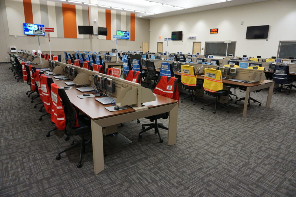
Finally, we returned to learn a little about the EOC. We
visited what is often known in such centers as the “war room,” where designated
officials meet to discuss and establish strategies for dealing with an
emergency of any sort that activates the emergency operations plan. In the
photo, each chair is designated for a specific official, with groups of people
with related tasks seated in color-coded sections of the room. Many such EOCs
are much smaller, but Hillsborough County is very urban and populated, and the
needs are complex and interrelated. It is expected that those involved will
arrive with authority to respond to the disaster, to indicate what they are and
are not capable of doing as part of the overall response to disaster. It is not
a place where one expresses a need to go back to another office and “find out.”
Hillsborough County Emergency Operations Center “war room”
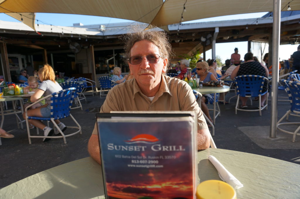
Ready to relax and enjoy a drink and a snack, we followed
Gene down the highway to the Sunset
Grill at Little Harbor, which has a beautiful view of the bay. At dusk,
numerous people followed a daily ritual of photographing the sunset over the
water. Tourist attraction it may be, as well as a local watering hole, but the
surrounding area has a significant mangrove forest and salt-bed areas that were
preserved as open space using Environmental Land Acquisition Funds from what
Gene describes as a “locally instigated preservation program.”
Hillsborough County’s Hazard Mitigation Program Manager, Eugene Henry, at rest at Sunset Grill at the end of our day-long tour.
And so, with the sun declining in the west, we sat at an
outdoor table and hashed over the world’s problems, and sometimes our own. One
point that seems clear to me is that Hillsborough County has a great deal to
offer to other jurisdictions, just as it has undoubtedly learned a great deal
as well—one reason both he and a resident scholar and Japanese graduate student
from the University of Illinois, Kensuke Otsuyama,
planned to drive to West Palm Beach the next day to hear my presentation. Although
there is sometimes a tendency for local governments to become more insular, to
allow fewer opportunities for employees like Gene to share and exchange
information in professional forums and conferences, this, I think, is always a
mistake. The growth in the value of what someone like Gene does lies in this
fruitful sharing of experience and perspectives that such opportunities allow,
and I hope that will continue, for certainly Gene made my day by sharing his
time to allow me to learn and to share with the growing readership that follows
this blog.
Supplemental Comment:
Although the hearing was held today, making live streaming a
moot point, significant written and recorded testimony on hazard mitigation and
climate resilience issues occurred before the U.S. House Appropriations
Subcommittee on Transportation, Housing, and Urban Development. Yesterday, the
following link was made available from several sources including the American Planning
Association (APA) to provide access to this testimony and information:
Representatives from APA, PEW, Houston Public Works,
Rutgers University, and the Town of Arlington, MA are delivering testimony to
the Transportation and Housing and Urban Development (THUD) congressional
subcommittee tomorrow, March 13th at 10:00 a.m. EST. THUD, a part of
the House Committee on Appropriations, writes laws that fund the federal
government’s important responsibilities. The testimony is available for
streaming here:
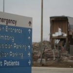
Just nine days ago, on November 15, I stood in front of two successive audiences of long-term health care practitioners to present workshops at a conference in Wisconsin Dells discussing, of all things, “Fundamentals of Planning for Post-Disaster Recovery.” Where, some might ask, is the nexus between these two subjects?
Patients who survived evacuations from New York City area hospitals, six in the city itself and one just outside, during Hurricane Sandy would know. People with disabilities, the elderly, the ill are especially vulnerable during disasters, and moving them out of harm’s way is no picnic. They cannot just grab the keys to their cars and drive out of town ahead of the storm. Evacuating them is a major undertaking that must be well-planned.
And so, our fields of expertise converged. I discussed what I knew from urban planning, but I invited input from their experiences in handling such situations. Some had not yet experienced a disaster, but others had, and their numbers in the health care field are growing, as doctors and nurses find clinics and hospitals impacted by wildfires in California, and hurricanes, floods, and tornadoes elsewhere. Mine was not the only presentation related to such concerns. The keynote by Desiree Matel-Anderson, founder of the Field Innovation Team and a Federal Emergency Management Agency (FEMA) advisor, detailed personal interactions with disasters. Others focused on emergency management. The audience needed to know about new regulations and laws, such as those promulgated in 2016 by the Centers for Medicare and Medicaid Services (CMS) or the Disaster Recovery Reform Act (DRRA), passed in October as a
Photo by Kristina Peterson
rider on the FAA Reauthorization Act. DRRA outlines new responsibilities for the FEMA administrator in providing training to local officials and utility providers in planning for emergencies for nursing homes, clinics, and hospitals, and for the Federal Highway Administration regarding evacuations for these facilities, prisons, and certain classes ofdisadvantaged persons. I told the nurses and administrators in my audience they needed to prepare for these new responsibilities. There seems to be a growing conviction in Congress and federal agencies that health care institutions need to be better prepared to protect their patients during disasters. In the light of events dating back to Hurricane Katrina, that does not seem unreasonable.
To some extent, I believe it is the growing engagement of the urban planning profession with natural hazards that is facilitating a re-engagement of the profession with public health practitioners. I say “re-engagement” because the two fields grew up together, at least in North America. In the late 1800s and early 1900s, industrializing, rapidly growing American cities were often festering incubators for diseases because of pollution, overcrowding, and fire and other hazards. The Great Chicago Fire of 1871 laid the groundwork for major reforms related to building codes, helping to create the largely masonry-based architecture now predominant in the city. Activists like Jane Addams inveighed against oppressive health conditions for the working class. There was an urgent need for both better planning and public health measures that would prevent the spread of disease, and the two professions matured accordingly. At the same time, civil engineers took growing responsibility for developing the sanitary infrastructure cities needed, such as sewer treatment systems and effective drainage, a topic I addressed in a keynote in September 2015 in Boston for the American Society of Civil Engineers’ Coasts, Oceans, Ports and Rivers Institute (COPRI) annual conference. All three professions grew up in the same cradle, addressing urgent societal needs for health care, better urban design, and public sanitation.
Scene on the Jersey Shore after Hurricane Sandy.
All of this is a long, but I think crucial, introduction to a book by Michael R. Greenberg and Dona Schneider, Urban Planning & Public Health: A Critical Partnership, published by APHA Press. I had planned to review it earlier, but recent events expanded the context for its importance. Greenberg, a long-time planning colleague and professor at Rutgers University in New Jersey, previously authored Protecting Seniors Against Environmental Disasters(Routledge, 2014), a book inspired in part by his own experience with elderly parents during Hurricane Sandy. He is certainly familiar with the territory. Schneider, also at Rutgers, brings the perspective of a public health expert.
The book reads mostly like a textbook and thus may be of most valuable to instructors willing to acquaint students in both fields with their organic relationship to each other and why the partnership is important today. Admittedly, the problems are not the same. We no longer face the scourge of tuberculosis, and smokestacks no longer belch particulates as freely as they once did. The water is less polluted. But our society is creating other problems of a momentous nature, including climate change and the resulting increased severity of weather-related disasters. Under the Trump administration and various less environmentally friendly state administrations, there have been concerted efforts to retreat from previous initiatives aimed to clear the skies and foster environmental justice. It is thus imperative that we have trained, knowledgeable, and articulate professionals who can advocate for the public interest when powerful political forces push in other directions.
The book makes powerful arguments in this context for the salience of a collaborative assault on the threats posed to our communities by natural hazards, using the tools of both public health and planning to analyze the threats and identify meaningful solutions. Not everything needs to happen at a macro level, either; in fact, planners and public health officials often are at their best in examining trends at the neighborhood and community level to find very geographically specific solutions to localized but persistent problems.
The authors are methodical, laying a groundwork in the first three chapters for understanding the building blocks of the two professions and their integral relationships. One can easily detect the influence of Greenberg’s long and distinguished career on both a practical and theoretical level as he discusses the impacts of various approaches to zoning, such as the use of downzoning to protect open lands and natural resources and the use of special districts, as in Austin, Texas, to protect the environmentally sensitive Edwards Aquifer through measures such as integrated pest management practices, which reduce the use of toxic chemicals that can enter the water supply. And the connection to natural disasters? Even recent history has revealed the vulnerability of Texas to prolonged drought, making the protection of water supplies essential to public health and welfare.
Recognizing the modern context for their focus on this “critical partnership,” the authors have included significant material on the role of risk and hazard mitigation analysis in planning, with a whole chapter on “Keeping People Out of Harm’s Way.” As with much of the book, it leads students on a path through the critical minutiae of planning and public health analysis, including case studies at various levels of analysis—for example, a brief but close look at the Galveston City Hazard Mitigation Plan.
Other sections address critical current issues such as the availability of healthy foods in poor communities, and how that can be addressed through laws, community organizations, and better resources; how to redevelop safe community assets from former brownfield sites; and potentially evaluating the benefits and drawbacks of major regional development proposals. In short, this is not bedtime reading for most laypeople, but it is solid instructional material for aspiring young professionals and may be useful as well to community advocates who are willing to learn the nuts and bolts of using planning to achieve better public health results in their neighborhoods and communities. As such, it is a timely and needed addition to the literature.
This post will be brief. Rather than ask you to read my thoughts, I want you to listen–hard. It has long been known among disaster recovery planners that lower-income citizens are considerably more vulnerable to disasters largely because of the marginal resilience of most low-income housing. The affluent can afford to build fortresses, some of which may still be lost to the elements, but those in second-rate housing, poorly maintained multifamily buildings, and most certainly the homeless, face life-or-death dilemmas when disaster strikes in any form. They live with mold without the resources to make expensive repairs. They face shortages of affordable housing. Federal programs designed to help them often fall short.
Few people have worked harder to remedy these problems than John Henneberger, a 2014 MacArthur Fellow and the executive director of Texas Housers, a nonprofit advocacy organization that has been working with low-income communities in tracking recovery from Hurricane Harvey. This link will take you directly to a podcast page on the American Planning Association website to hear a 46-minute interview with Henneberger about this experience.
The podcast, the first in a series called Resilience Roundtable, is the product of collaboration between the APA technical staff in Chicago and the Professional Development Committee (PDC) of the APA Hazard Mitigation and Disaster Recovery Planning Division, of which I am currently chair-elect. In that capacity, I organized and have led the PDC. More such podcasts will be released in coming weeks, but this is the first, and we are very proud to introduce John Henneberger to a new audience. His message is detailed, highly informed, and eloquent. Please check it out.
Before I leave the soapbox, I wish also to provide you to a link to a recent study detailing why minorities are more vulnerable to the impacts of wildfires, a subject that has not been explored widely in the past. “The Unequal Vulnerability of Communities of Color to Wildfire,” available online as linked, was printed in the journal Plos One, and enriches our awareness of equity issues in disaster.
Explaining the frustrations of first responders in searching Mexico Beach, Florida, for survivors after Hurricane Michael, Brock Long, administrator of the Federal Emergency Management Agency, told Associated Press, “Very few people live to tell what it’s like to experience storm surge, and unfortunately in this country we seem not to learn the lesson.” Mexico Beach was ground zero for landfall of the hurricane a few days ago.
But then Long was much more direct: “When state and local officials tell you to get out, dang it, do it. Get out.”
The desire or willingness to “ride it out” among people who think the storm will never be as bad as they are told is unquestionably one of the most troubling facets of disaster response, especially when there is adequate warning.
There are disasters, of course, where adequate warning is either extremely difficult or nearly impossible. I still vividly recall one evening in 1979, when, living in Ames, Iowa, I was awakened from a second-story bedroom at about 3 a.m. by the loudest roar I had ever heard. I turned to the window to see total darkness, and aside from the howling winds, no clue of what was unfolding. When it finally passed, I went back to sleep. The next morning, I learned from the newspaper that a small tornado had struck about a mile away, lifting the roofs from seven homes before skipping off into the sky again. On the other hand, we had no cell phones and no reverse 911 in 1979.
Wildfires often give but a few minutes of warning, and earthquakes generally none at all. Hurricanes are different, at least today. In 1900, when more than 6,000 residents of Galveston were swept to sea in the deadliest storm in American history, they had no meaningful warning. In 2018, we have the best satellites the federal government and private money can buy, and we typically know at least 48 hours in advance that a coastal storm is coming, although its strength can change quickly. What we surely know in any case is that, if you live on the Gulf Coast or the Atlantic Coast in the U.S., you can expect hurricanes. Only the frequency and severity vary, and they are not always predictable. But people generally have plenty of time to learn what to do when the time comes. The rest is a matter of cooperation.
There is, of course, the question of why people choose to live in the most vulnerable locations. Early in my quarter-century of involvement in hazards planning, I borrowed
No question about it. The seashore can be a profoundly attractive place in calm weather. The question is both how we build and where we build, and, in the process, what burdens we place on first responders.
the title of a 1987 mystery thriller, The Fatal Attraction, to describe the psychology of our very human attraction to seashores, wooded mountains, and beautiful sunrises. Living on the seashore can be indescribably beautiful under blue skies and balmy breezes. There is nothing wrong with enjoying all that under the right circumstances, but it is critical that we begin to learn our own limitations in adapting to such environments, the need to build appropriately in such locations, and when it is time to simply “get out,” as Long suggested. If we don’t do these things, we are often placing inexcusable burdens on first responders who must dig our dead or injured bodies from the wreckage or save our homes from raging wildfires.
In short, there are times in life when we must be willing to think about more than ourselves. Saving our own skin in the face of oncoming natural disaster is not only not selfish; it is downright thoughtful with regard to the burdens otherwise placed on police, firefighters, and emergency medical personnel.
I am aware that the issue is bigger than I have just described. In another month, I will be speaking about post-disaster recovery to an audience of long-term care health professionals. As a society, we also have obligations to ensure that the elderly live in homes that are removed from floodplains and other hazards, that children attend schools that are as safely located as possible, and that we do not force the poor and disadvantaged into neighborhoods that are at risk and where no one else would wish to live. In New Orleans during Hurricane Katrina, the system failed thousands of poor people who did not own cars by failing to provide means for carless evacuation. The sheer number of such people was never a secret to officials in Louisiana, but good planning never happened before it was too late. All that said, those who have the means should have the willingness to consider both where they choose to live or build and to evacuate when told to do so.
We can all hope that the body count from Hurricane Michael remains low. As of the moment I am writing this, authorities have counted 17 deaths, but it may rise.
Long-term recovery awaits communities affected by either Florence or Michael. As always, serious questions can be posed about where and how to rebuild, whether we can make communities more resilient against future disasters, and what vision states and communities should have as they move forward. In its Influencers series, the Charlotte Observer asked what leaders thought North Carolina could do for coastal and inland communities affected by flooding from coastal storms. Interestingly, many cited setbacks from the coast, accounting for climate change (something the Republican-dominated legislature has explicitly chosen not to do), and keeping new development out of floodplains. All these efforts would make it easier to plan evacuations in the first place. The issue is whether North Carolina, or any other state in the path of such storms, can muster the political will to do what is right.
And whether people who live in highly vulnerable locations can heed the call when told to evacuate.
Flooding in Rosewood in Horry County, SC, September 24, 2018 (All photos by Allison Hardin with exceptions of FEMA photo from Hurricane Floyd and Charlotte image.)
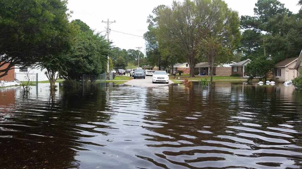
It has been a few weeks of drought on this blog, but just the opposite in North Carolina, where Hurricane Florence dropped up to 30 inches of rain in some locations, and floods migrated downstream via numerous rivers to swamp cities both inland and near the coast. Now, Hurricane Michael threatens to compound the damage as it migrates northeast from its powerful Category 4 assault on the Florida Panhandle, with storm surges up to 14 feet in areas just east of the eye, which made landfall near Panama City.
The blog drought was the result of both a bit of writer’s block, mostly induced by a busy schedule that included two conference trips over the past three weeks, combined with a bit of fatigue and a few significant diversions of my personal time. But that may be okay. My intent was to write about the recent hurricane along the East Coast, and sometimes letting the subject ferment in the mind results in a more thorough and insightful perspective. I hope that is the result here.
Storms never happen in a vacuum. In a world with relatively few uninhabited places, their impact is the result more of patterns of human development and the legacy of past choices in land use and building practices than of the storm itself, which is, after all, simply a natural and very predictable event. Hurricanes were part of the natural cycle on this earth long before humans took over the planet (or thought they did).
Hurricane wind warning at bridge in Socastee, South Carolina
But they appear to be getting worse, and climate change, most of it almost surely attributable to human activity, is an increasingly evident factor. Meteorologist Ken Kunkel, affiliated both with the National Oceanic and Atmospheric Administration and North Carolina State University, stated that Florence produced more rain than any other storm in the last 70 years except for Hurricane Harvey last year. According to Kunkel, five weather stations over an area of 14,000 square miles in the Carolinas recorded an average of 17.5 inches. Harvey’s average was 25.6 inches. By comparison, Chicago averages about 37 inches for an entire year. Such heightened precipitation levels are in line with expected impacts of climate change.
What became obvious to me early on was that Florence would rehash a certain amount of unfortunate North Carolina history regarding feedlot agriculture. I am familiar with that history because 20 years ago I authored a Planning Advisory Service Report (#482) for the American Planning Association, titled Planning and Zoning for Concentrated Animal Feeding Operations. (In that same year, APA also published PAS 483/484, Planning for Post-Disaster Recovery and Reconstruction, for which I was the lead author and project manager.) I want to emphasize that what happened in North Carolina was not unusual. Nationwide, many states have laws dating to the 1950s that exempt all or most agricultural operations from county zoning ordinances. Most of these were intended to create a friendly regulatory environment for family farms, and they were often followed by other “right-to-farm” laws designed to shield farmers using conventional farming methods from nuisance lawsuits. Only later, as the large feedlots known also by the acronym “CAFO” became widespread, did it become clear that such exemptions, by then fiercely defended by industry groups, became giant loopholes for the detrimental environmental impacts of such operations. This story has been repeated in Iowa, Missouri, Utah, and numerous other states.
In North Carolina in 1991, State Senator Wendell Murphy, who owned a direct interest in the growing Murphy Family Farms, engineered passage of a law widening the state’s exemptions to include CAFOs. Within two years, as I noted in the report, North Carolina’s hog population shot up from 2.8 million to 4.6 million. Today, the number is at least 9 million. A public backlash at the impacts of CAFOs resulted in a new law in 1997 that included a moratorium on new waste lagoons, but by then, although the hogs were firmly ensconced in a growing number of feedlots, the figurative horse was out of the barn. Many counties in eastern North Carolina, where the industry was concentrated, were slow or reluctant to use their newly regained powers. In any case, various large operators were effectively already grandfathered into continued existence. Today, consolidation within the industry has left Smithfield Foods in possession of most of the business in North Carolina, yet Smithfield itself was acquired by the Chinese-owned WH Group several years ago.
Grenville, NC, September 24, 1999 — The livestock loss and potential health hazard to Eastern North Carolina is huge. Here volunteers have towed in dead and floating cattle from a nearby ranch at Pactolus, NC (just North of Greenville), trying to remove them as fast as possible to lower the potential health hazards associated. Photo by Dave Gatley/ FEMA News Photo
Fast forward to this year and Hurricane Florence, presuming a surfeit of lessons to be learned from the 1999 disaster as well as later storms. As Emily Moon notes in the Pacific Standard, North Carolina has had opportunities over the past 20 years to introduce serious regulatory change, but various factors foiled those chances, and North Carolina remains the nation’s second-largest hog producer, having pushed aside every state but Iowa. The industry has evolved, but the problem remains. The state has bought out 46 operations since 1999 and shut down their lagoons, but the vast majority remain in operation. The numbers changed in Florence—more than 3 million chickens and 5,500 hogs dead and afloat in the flood waters—but the devastation rooted in CAFO practices continued. Coal ash landfills associated with power stations added to the environmental impacts. And the beat goes on, in a part of the state heavily populated by African-Americans, many too poor and powerless to challenge the system effectively without outside help.
Flooding at Arrowhead Development in Myrtle Beach, SC, September 26, 2018
Still, there are significant lessons available from Hurricane Florence outside the realm of mass production of poultry and hogs, and I want to offer a positive note. One is that, while only about 35 percent of properties at risk of flooding in North Carolina have flood insurance, which is available from the National Flood Insurance Program, neighboring South Carolina ranked second in the nation with 65 percent coverage. While I do not know all the details behind that sizable difference, it seems to me there is surely something to be learned from a comparison of these results and how they were achieved. They come in the context of a “moonshot” by the Federal Emergency Management Agency to double flood insurance coverage nationally by 2022. That will happen when South Carolina becomes the norm rather than the exception. Sometimes we can use these events to push in the right direction. Texas, for instance, has added 145,000 new flood insurance policies in effect since Hurricane Harvey; the question will be whether the new awareness wears off as memory of Harvey fades, or whether the state can solidify those gains. For that matter, can the states in the Southeast—the Carolinas, Georgia, and Florida—leverage the lessons of Florence and Michael to push in the same direction?
Hidden Valley drainage restoration project, Charlotte, NC. Image courtesy of Tim Trautman.
Recently, Bloomberg Business Newsoffered an example within North Carolina of how differently floodplains could be managed by highlighting the case of Charlotte and Mecklenburg County. I worked for several years in a series of training workshops on flood resilience with Tim Trautman, the manager for the engineering and mitigation program for Mecklenburg Storm Water Services, so I am familiar with their intriguing story. The county for many years has used a stormwater utility fee on property owners to fund its own hazard mitigation program, using the money to buy out flood-prone properties and increase open space in its floodplains. The result has been a significant reduction in flood-prone land and buildings. The question is not whether Charlotte is successful, but what state and federal programs and authorities can do to encourage and support such efforts and make them more commonplace.
Every serious disaster offers lessons and opportunities, and I am not attempting here to pick on North Carolina alone. Other states face their own challenges; Iowa, for one, is undergoing a somewhat muted debate about the impact of its own farm practices on downstream flooding and water quality, in part as an outgrowth of the 2008 floods. What is important is that we use these windows of opportunity, the “teachable moments,” as they are sometimes known, to initiate the changes that are surely needed for the long term in creating more resilient, environmentally healthy communities. What we do not need is a natural disaster version of Groundhog Day.
Cover of NIBS Interim Study from Marathon, Florida. “These modern, mitigated homes withstood Hurricane Irma. They are elevated to withstand high water and their roofs are constructed to withstand up to 220 mph winds. Good mitigation learns from mistakes to build more resilient communities.” Photo by Howard Greenblatt, FEMA,, November 22, 2017.
The original report was a landmark in hazard mitigation research in its own right, finding that the nation eventually saved $4 in costs from disaster losses for every dollar of federal money invested in hazard mitigation, a remarkable return on investment by any standard. That report also differentiated specific savings related to specific disaster types ranging from $1.50 per dollar for earthquake mitigation efforts to $9 for flood-related mitigation investments. In short, presuming that specific projects merited investment based on cost-benefit comparisons, the U.S. could prevent a world of pain with timely and effective investments in mitigation projects to reduce such losses.
Still, over the years, the federal government has provided far more money after disasters to support mitigation against future disasters by more generously funding post-disaster programs, primarily the Hazard Mitigation Grant Program (HMGP), than pre-disaster programs such as the Pre-Disaster Mitigation (PDM) program, authorized under the Disaster Mitigation Act (DMA) of 2000 (Sec. 203 of the Stafford Act, 42 U.S.C. 5133). Pilot funding actually began in 1997 under the Federal Emergency Management Agency’s (FEMA) Project Impact, which was terminated by the George W. Bush administration, but by then the DMA was law, and so was PDM. However, secure funding is another matter, and over the years, PDM has been subjected to a roller coaster ride of erratic congressional appropriations. Disregarding the Project Impact years through FY2002, appropriations have ranged from a peak of $150 million when the fund was established in FY2003, to $35.5 million in FY2012, to $25 million in FY2014 following an attempt by the U.S. Department of Homeland Security to zero out the fund and merge it into a single mitigation account, a ploy that did not succeed in Congress. Now the trend is in the opposite direction, with $90 million allocated in FY2017, and dramatically more under consideration for FY2019. In June, the Senate was looking at a proposed allocation of $246 million (House version), according to Meredith Inderfurth, Washington liaison of the Association of State Floodplain Managers. That is the same amount allocated the previous year, so one can hope PDM is stabilizing at a higher level. One must realize, also, that what is proposed from the administration of the moment is not necessarily what is disposed by Congress, where appropriations committees may act under significantly different influences from those affecting the White House.
What is the difference between PDM and HMGP? Most simply, PDM provides funding under a competitive grant system to communities for proposed projects to implement hazard mitigation before disaster strikes, under what some call “blue skies.” By contrast, HMGP funding is a percentage of overall disaster assistance following a presidentially declared disaster. That percentage has varied over time and among states; those with enhanced state hazard mitigation plans, which must meet higher standards and show a deeper state commitment to mitigation, receive a higher percentage of overall disaster assistance in HMGP funds. Currently, for states with enhanced plans, that amounts to 20 percent of overall assistance, in other words, $200 million in HMGP for every billion dollars of disaster aid. The amounts are smaller, beginning with 15 percent for the first $2 billion of aid, and shrinking as percentages of higher levels, for states without enhanced plans. The states then distribute this money to local jurisdictions for specific projects. But no HMGP money exists without a declared disaster.
However, at least the recent revived congressional interest in funding PDM suggests that the emphasis is changing, and it is no accident that this is happening after the release of the NIBS interim report. The $4 savings calculation from the 2004 report has been widely disseminated and quoted in disaster management circles. The new report accentuates that good news with increased savings estimates based on complex studies that have dug much more deeply into the logic of how those savings should be calculated. To be honest, I will not confess to following all the detail in 344 pages of text and appendices in the new report. Economics is not my field. My trust in the numbers, however, grows out of both admiration for the stellar collection of scholars involved in the study and an ability to at least follow the logic of their arguments, if not the details of every calculation. I can at least follow the logic of the methodology, which appears very sound.
What did they find? The report established a new, higher overall savings ratio of $6 for every federal dollar invested in hazard mitigation by “select federal agencies.” It did this by establishing methodology for including new but relevant factors into the cost-benefit calculations the study used. The new study goes farther by also examining investments “to exceed select provisions of the 2015 model building codes,” for which it found a 4-1 benefit-cost ratio. In the latter case, this meant that the analysis focused on those mitigation efforts that used stricter standards for building resilience than those in the model codes. It should be noted here that neither model codes, propagated by nonprofit code development organizations that research the effectiveness of various building standards and promulgate such codes for use by local governments, nor federal mitigation requirements, such as those in the National Flood Insurance Program, prohibit local governments from “going the extra mile” to strengthen protection against various potential disasters.
Like the 2004 study, this one also sought to establish more specific benefit-cost ratios for particular disaster types, for which the efficacy of mitigation investments can vary. Nevertheless, all proved positive to differing degrees. Flood mitigation led the pack, as it did in the earlier study, with a 7-1 ratio for federal investments and 5-1 for exceeding 2015 model code requirements. Investments for exceeding codes for hurricane storm surge bore a 5-1 benefit, but an inadequate sample for federal investments prevented the study from producing a ratio for federal investments. Wind mitigation was 5-1 for both analyses; earthquake and wildland-urban interface yielded 3-1 advantages for federal investments and 4-1 for code exceedance. Overall, however, the dominant area of U.S. losses in disasters has always come from flooding, generally by a very wide margin.
As I noted, a good deal of the refinement materialized from the study’s ability to quantify some aspects of future cost savings that were often left out of the equation in past analyses and in traditional benefit-cost analyses. Rather than paraphrase, I will simply offer the study’s own summary from page 9:
The Interim Study quantified a number of benefits from mitigation, including reductions in:
Future deaths, nonfatal injuries, and PTSD
Repair costs for damaged buildings and contents
Sheltering costs for displaced households
Loss of revenue and other business-interruption costs to businesses whose property is damaged
Loss of economic activity in the broader community
Loss of service to the community when fire stations, hospitals, and other public buildings are damaged
Insurance costs other than insurance claims
Costs for urban search and rescue
All these are important facets of the overall costs of disasters, many of which have been hard to quantify in the past. That is what makes this update so significant. What will make it more valuable is for advocates of effective hazard mitigation, whether experts or ordinary citizens, to learn the basic facts of these findings and share them with policy makers at local, state, and federal levels of government, so that it becomes clear that simply rebuilding the same structures in the same hazardous locations after each disaster constitutes a massive lost opportunity. The staggering losses last year from Hurricanes Harvey, Irma, and Maria, combined with the wildfires in California, should be a wake-up call. We can avoid a great deal of tragedy with smart investments in mitigation at all levels of government. Download or scan this study, at least read the summary, and be prepared to make the basic case. It is the fiscally conservative thing to do, in view of the hundreds of billions of dollars that have been poured into disaster recovery.