by admin | Mar 13, 2026 | Aging, Books, Careers, Chicago, Civil rights, Climate, Disaster, Disaster policy, Disaster Recovery, Emergency Management, Government, Hazard Mitigation, History, Hurricanes, Immigration, Minnesota, Natural Hazards, Personal history, Politics, Public policy, Public safety, Resilience, Social Equity, Texas, War, Wildfire
Given the almost comically corrupt nature of Kristi Noem’s administration of the Department of Homeland Security (DHS) as its Secretary, I half-expected that her inevitable meltdown after the most recent Senate hearing would lead to flying monkeys celebrating as...

by admin | Dec 26, 2024 | Careers, Climate, Disaster, Disaster Recovery, Education, Floodplain management, Hazard Mitigation, History, Iowa, Natural Hazards, Personal history, Public policy, Resilience, Retirement, Texas, Urban Planning, Weather
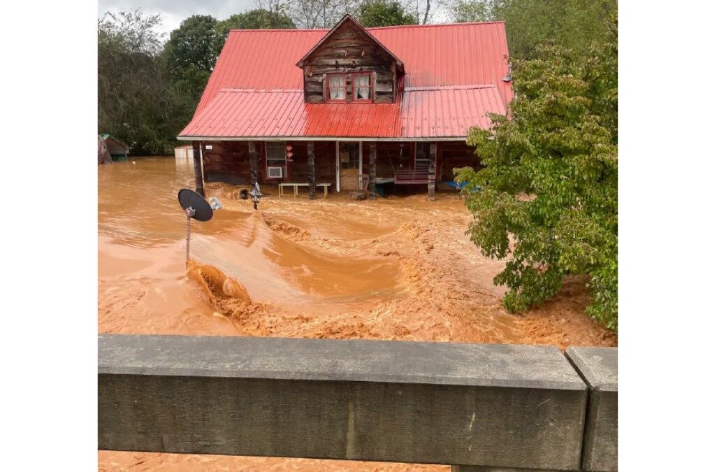
About the time the rising Cedar River crested in downtown Cedar Rapids, Iowa, on June 13, 2008, a torrential downpour from an incoming thunderstorm joined forces with it to create the perfect flood. In the previous flood of record in the city, the river had reached 20...
by admin | Aug 12, 2024 | Careers, Coronavirus, Disaster, Disaster Recovery, Government, Hazard Mitigation, History, Hurricanes, Natural Hazards, Parks, Recreation, Resilience, Retirement, Urban Planning, Water
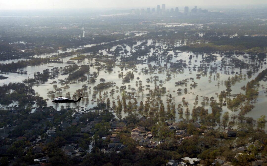
Let’s try to imagine: You are the chief executive officer for a 1,300-acre public park in New Orleans, the largest in the city, although it does not belong to the city. It is incorporated under the state of Louisiana. You spend the weekend of Friday, August 26, 2005,...
by admin | Feb 8, 2024 | Activism, Climate, Coastal Management, Disaster, Disaster Recovery, Hazard Mitigation, History, Hurricanes, Natural Hazards, Personal health, Resilience, Social Equity, Texas, Tornado, Weather
It has been a couple of months since I last posted a video of our progress in filming for Planning to Turn the Tide. That last article summarized our film efforts in Jacksonville, Florida, in September 2023, but we had another trip in the offing then, to the Texas...
by admin | Nov 17, 2023 | Climate, Coastal Management, Disaster Recovery, Florida, Hazard Mitigation, Natural Hazards, Personal health, Resilience, Texas
How does a regional planning council plan for and demonstrate local climate resilience in a state like Florida? One answer is diligence—establishing clear goals and the means of measuring progress toward achieving them, even in the face of some political skepticism...
by admin | Oct 18, 2023 | Climate, Disaster, Disaster policy, Disaster Recovery, Emergency Management, Floodplain management, Floodplain management, Government, Hazard Mitigation, History, Iowa, Natural Hazards, Public safety, Resilience, Urban Planning, Weather
In the latter half of June 2008, it was hard to imagine Cedar Rapids as the city it had been just one month earlier. A massive flood along the Cedar River clobbered the city with a classic double whammy: About the time existing flood crests that had already swamped...