
by admin | Feb 4, 2026 | Chicago, Climate, Coastal Management, Disaster, Florida, Hurricanes, Insurance, Iowa, Journalism, Movies, Parks, Personal history, Restaurants, Sports, Tornado, Urban Planning, Weather
It was about 11:15 a.m. on Sunday, January 25, when my United Airlines flight from Sarasota, Florida, landed at O’Hare International Airport, and I finally started getting text messages again. The very first one was from Angel, our 22-year-old grandson, whom I had...
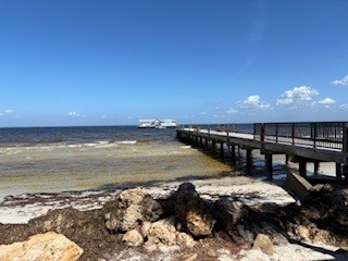
by admin | Nov 4, 2024 | Climate, Coastal Management, Disaster, Emergency Management, Floodplain management, Florida, Geography, Hurricanes, Natural Hazards, Resilience, Weather
Barrier islands serve a purpose in nature’s scheme, offering a barrier of sorts to the movement of storm surge and high tides to the continental mainland. In both the Southeastern U.S. and the Texas Gulf Coast, such islands abound, but we have often ignored the power...
by admin | Feb 8, 2024 | Activism, Climate, Coastal Management, Disaster, Disaster Recovery, Hazard Mitigation, History, Hurricanes, Natural Hazards, Personal health, Resilience, Social Equity, Texas, Tornado, Weather
It has been a couple of months since I last posted a video of our progress in filming for Planning to Turn the Tide. That last article summarized our film efforts in Jacksonville, Florida, in September 2023, but we had another trip in the offing then, to the Texas...
by admin | Nov 17, 2023 | Climate, Coastal Management, Disaster Recovery, Florida, Hazard Mitigation, Natural Hazards, Personal health, Resilience, Texas
How does a regional planning council plan for and demonstrate local climate resilience in a state like Florida? One answer is diligence—establishing clear goals and the means of measuring progress toward achieving them, even in the face of some political skepticism...
by admin | Aug 29, 2023 | Climate, Coastal Management, Colorado, Disaster, Disaster policy, Emergency Management, Floodplain management, Hazard Mitigation, Movies, Natural Hazards, Resilience, Social Science, Urban Planning, Wildfire
As previous installments of our blog video series have indicated, the production team for Planning to Turn the Tide spent a great deal of time in June and July first in Florida, then on a two-week road trip to Colorado and Iowa from Chicago to capture additional...
by admin | Aug 4, 2023 | Climate, Coastal Management, Disaster, Emergency Management, Floodplain management, Florida, Government, Hazard Mitigation, Infrastructure, Natural Hazards, Public safety, Resilience, Urban Planning, Weather
In last week’s post, I discussed on our video blog the interviews we had conducted for Planning to Turn the Tide in Sarasota County, Florida, during our mid-June trip through southwestern Florida. Today, we wrap up the Florida trip with a brief video blog about our...