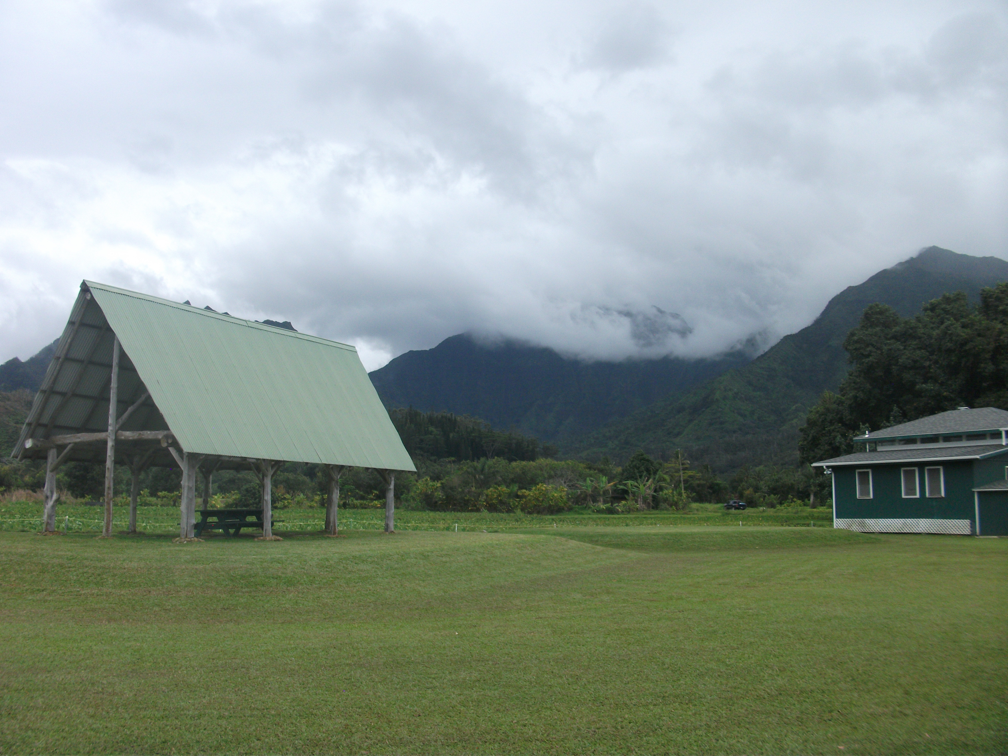
In the past two installments about Hawaii, I focused on our first two days there, one for me on Kaua’i, the second with my wife and grandson in Honolulu. This third installment will round out the story.
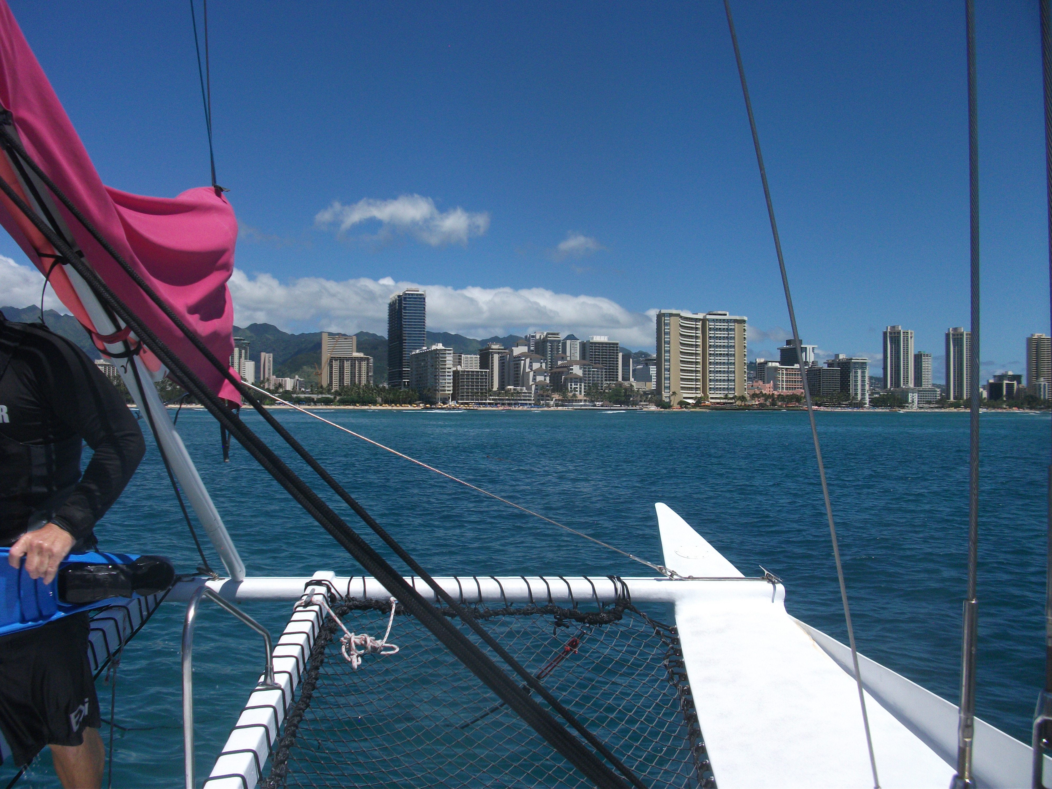
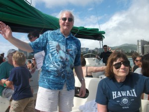
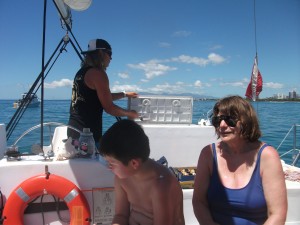
First, the catamaran trip: Since all work and no fun in Hawaii makes even the most diligent planner a dull boy, I wasted no time following suit when my colleague Carolyn Harshman indicated that she intended to spend Sunday afternoon sailing with Maitai Catamaran, her favorite voyaging firm in the islands. She had already spent some time out on the west end of the island at a beach in far better shape than Waikiki where, as she noted, the reef is “pretty beat up” because of overuse and the impact of tourism. Still, this was not a snorkeling voyage. I signed us up before we ever left Chicago, got tickets on the same trip, and we all set sail on Sunday afternoon from a beach near the heart of Waikiki. For 90 minutes, we sailed out toward Diamond Head, took in the sights and the Honolulu skyline, and enjoyed the splash of sea water amid only moderately choppy wave
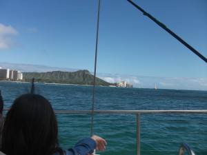
View of Diamond Head from the Maitai Catamaran.
And what is more fun than sailing on a sunny day?
Small surprise, the crew offers maitais on board, along with other beverages, and my wife and I both imbibed. As the captain noted, “If you drink more, you see more,” which is undoubtedly true for at least some passengers. Midway through the voyage, I chided the young lady who served them for making them “too salty.” “Me?” she exclaimed with mock annoyance. “The waves!” Had I been drinking my maitai with some serious effort instead of merely nursing it, the waves at the midpoint of our excursion might not have had a chance to splash so much sea water into my glass. The taste of what remained gradually evolved to a saltier expression, but it was not entirely bad. Given that I was on the water for a mere 90 minutes and not dependent on such beverages for days, whatever additional thirst the drink engendered could be handled once I was landward again. Once we were, however, Carolyn proceeded to lend her snorkeling goggles to Angel and took him out in the shallow surf to learn to view the world below the surface, which he did with gusto while Jean and I merely rinsed the sand from our feet and enjoyed watching him have fun.I was aware from our schedule—and from the hotel’s shuttle driver—that we would be walking back to the hotel about the same time that the Honolulu Festival parade was making its way down Kalakaua Blvd. Sure enough, we found it within a few blocks of our catamaran site, wave after wave of marchers coming down the street in the late afternoon sun. We found a corner that seemed to be dominated by a long green dragon waiting to be deployed while various other squads made their way eastward.
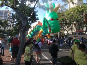
The green dragon bides his time.
Watching a parade in Honolulu is very different in one major respect from watching one anywhere else in the United States. My wife and I had the privilege two years ago of being in Honolulu at the time of the annual Kamehameha Day parade, which celebrates the legacy of the Hawaiian king who, early in the 19th century, became the first to unite the islands into a single nation. Kamehameha, who actually hailed from the “Big Island,” Hawaii, made the decision, after conquering Oahu, to locate his capital where it is today. He started a significant legacy of nation building in the face of European colonialism that, for better or worse, succumbed to U.S. annexation by the end of the same century. By then, he was long gone. What remains is a deeply changed Polynesian culture that nonetheless retains essential elements of its heritage even as it has become a minority in its own land.
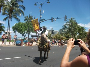
Part of the 2012 Kamehameha Day celebration
The parade is, for starters, the least Euro-centric of any you will see in the U.S. Hawaii is a deeply polyglot, multicultural society today, and the Honolulu Festival featured units of Japanese, Taiwanese, Chinese, Korean, and Filipino heritage, as well as Hawaiians, with at most a modicum of European presence. Each group contributes a colorful chapter to the state’s history and culture. Hawaii is today the only state represented by a female Hindu in the U.S. House of Representatives, and virtually no one cares. Hawaii today takes the notion of the great American melting pot to a whole new level. Each parade is a colorful expression of that state of affairs, although the Kamehameha Day parade rightfully emphasizes a great deal more of native Hawaiian heritage, with the royalty of each island having the chance to be recognized as such as they move down the street on horseback.
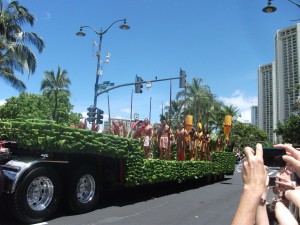
Another element of the 2012 Kamehameha parade.
Monday was less exciting for me, except for a small mistake that woke me up far too early. I had agreed to meet my two colleagues in the lobby of the hotel at 6:45 a.m. to walk to the Hawaii Convention Center several blocks away. For some reason I woke before 5 a.m. to use the bathroom. When I returned, I saw what I thought was 5:59 on the hotel clock, and I turned off the alarm on my cell phone and began to get ready, feeling there was no need to let it ring at 6 a.m. and awake my two roommates if I was already up. By what I thought was 6:45, I got off the elevator, looked around the lobby, saw no one, and concluded that I was a little bit late and they had left without me. I began to head in the direction of the convention center but got confused at a T-section at the end of Hobron St., so I called Carolyn, thinking she might already be there, but no answer. I called Gregg, who did answer but said he did not understand why I was asking, as he himself had not even left his house yet. Shocked, I asked, “What time is it?”
Barely 6:00, I learned. I had fooled myself into getting up an hour early. Humbled by my own foolishness, I walked back to the corner of Hobron and Ala Moana Blvd., dragged my gear into the McDonald’s, and ordered an early breakfast before coming back to the hotel, where I met Gavin and Carolyn at the appointed hour. Meanwhile, Carolyn had gotten my message and tried to call back, puzzled by the whole affair until I explained it in person.
I used my standard excuse for such early morning follies. I had not yet had my first cup of coffee. After all, I got that at McDonald’s.
The three of us spent our day at the Hawaii Convention Center, presenting a demonstration version of a planned training workshop at the Pacific Risk Management Ohana (PRiMO) conference, getting feedback, and seeing how things might work. I won’t pursue that here, but one regret is that the convention center, with all the urban setting of Honolulu lying beyond its admittedly gorgeous windows, lacks much in the way of lunchtime attractions for its visitors. Across the street are one Japanese and one Korean restaurant, but the average visitor would be hard pressed to find time for sit-down operations during a convention lunch hour. The alternative is a Subway, which is okay, but hardly unique. As for myself, by the time I was done spending 20 minutes speaking with a consultant who wished to consult me, my time for grabbing anything before we had to commence again was less than 40 minutes. A sandwich from Subway was the only option.
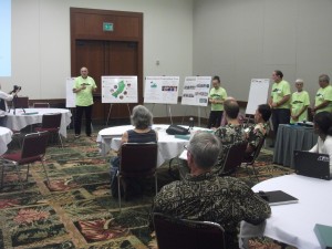
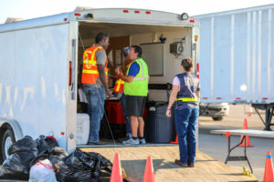
A volunteer team from Manoa explains its preparations for disaster at the PRiMO conference.
Perhaps for that reason, after it was over, I insisted on walking our family trio back east down Ala Moana to a place I had noticed earlier, Cheeseburger Waikiki. With a name like that, I can only imagine what some readers may be thinking, and it certainly has some conventional elements, but it is also open air, dimly lit, with a charming semitropical ambience. The menu features some options I might not find in Chicago—like an island cheeseburger, consisting, of course, of a burger topped with Colby Jack cheese, but cooked in barbecue sauce and topped with a succulent fresh layer of pineapple, with, of course, tomato and lettuce as options to top it off or eat separately. No need for catsup on this one, though we could put that on the basket of onion rings we all shared. Frankly, without breaking the bank, this was one of the best cheeseburgers I have had in some time. At the end, we let Angel choose a dessert, which was an ice cream brownie of some sort, and we all shared before we waddled our way back to the hotel for the evening and watched television before falling asleep. After settling for McDonald’s for breakfast and Subway at noon, I was satisfied that I had finally gotten a decent meal for the day. And I was tired.
I set aside all of Tuesday as family time before we left Hawaii on Wednesday. We got a second opportunity to satisfy my culinary curiosity, this time going out for breakfast at an upstairs hole in the wall called Goofy, right on Ala Moana just a few blocks east of the hotel. Apparently a favorite of surfers, it features locally grown food, and the online menu shows a map of the islands and what ingredients come from where. It is not terribly expensive; you can eat breakfast for about $10 to $12 and get the highest quality in the bargain. I chose the salmon and spinach eggs benedict, which include fresh kale and Okinawan purple potatoes, and your choice of wheat or taro muffin. Going extra-local, I chose the taro muffin, made from the starchy root vegetable popular in Hawaii that is also the source of poi. The resulting purple-colored muffins are quite tasty, but so are the purple potatoes, which seem like a cross between regular potatoes and sweet potatoes, both in texture and taste. While the menu does not sport calorie and vitamin counts, my guess is that my $14 choice was pretty high on the nutrition scale in addition to being one of the more interesting I have had in some time, topped off with more than one coffee refill. I should note that Hawaiian coffee, in my experience, is much smoother and less acidic than many other varieties. I brought home a bag of both Kona and Hanalei Roasters, the latter acquired during the Friday trip to Kaua’i.
Jean had wanted to schedule a snorkeling tour and found one for Tuesday that left from behind the Sheraton Waikiki, which sports a rather gorgeous open-air hallway to the beach, which we traversed, although, having not had sense to shop elsewhere earlier, I raced back to acquire an overpriced cap to protect my head from the sun aboard the boat. Out we pranced, when the hour came, through the hot sand to the boat to hop aboard another catamaran, this time with the express purpose of climbing out on the open water. We were told to expect to sightings of sea turtles, and we were not disappointed, although it took a while. Our snorkeling site was over what we were told was a turtle “cleansing station,” but frankly, I am not sure what was down there other than water. If there was a reef, it was truly too beaten up, as Carolyn suggested, to be visible. If there were turtles, I didn’t see them.
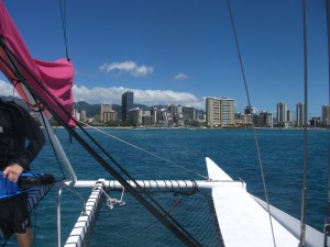
The skyline of Honolulu from our catamaran.
I admit to a major handicap in this respect. Those who have read my inaugural blog posting from two years ago know that I am highly dependent on my glasses for sight. There are places that sell or rent “prescription goggles,” meaning those that fit over eyeglasses, but this boat was not so equipped. I could only leave my glasses off in the pockets of my shorts, don my goggles with no visual aids, and dive to see what I could. While I enjoyed the swim, if there was something to see, I did not see it. In the summer of 2002, however, I had done the same thing in the Caribbean off the coast of the Dominican Republic and saw an unmistakably colorful reef, so I have my doubts. Moreover, neither Jean nor Angel raved about any colorful reefs from their own swimming, though they were somewhat less adventurous than I, even with our floating “noodles” in place, in joining the larger crowd from the boat on the open water. I wonder.
Angel and Jean aboard for snorkeling on our last full day in Hawaii.
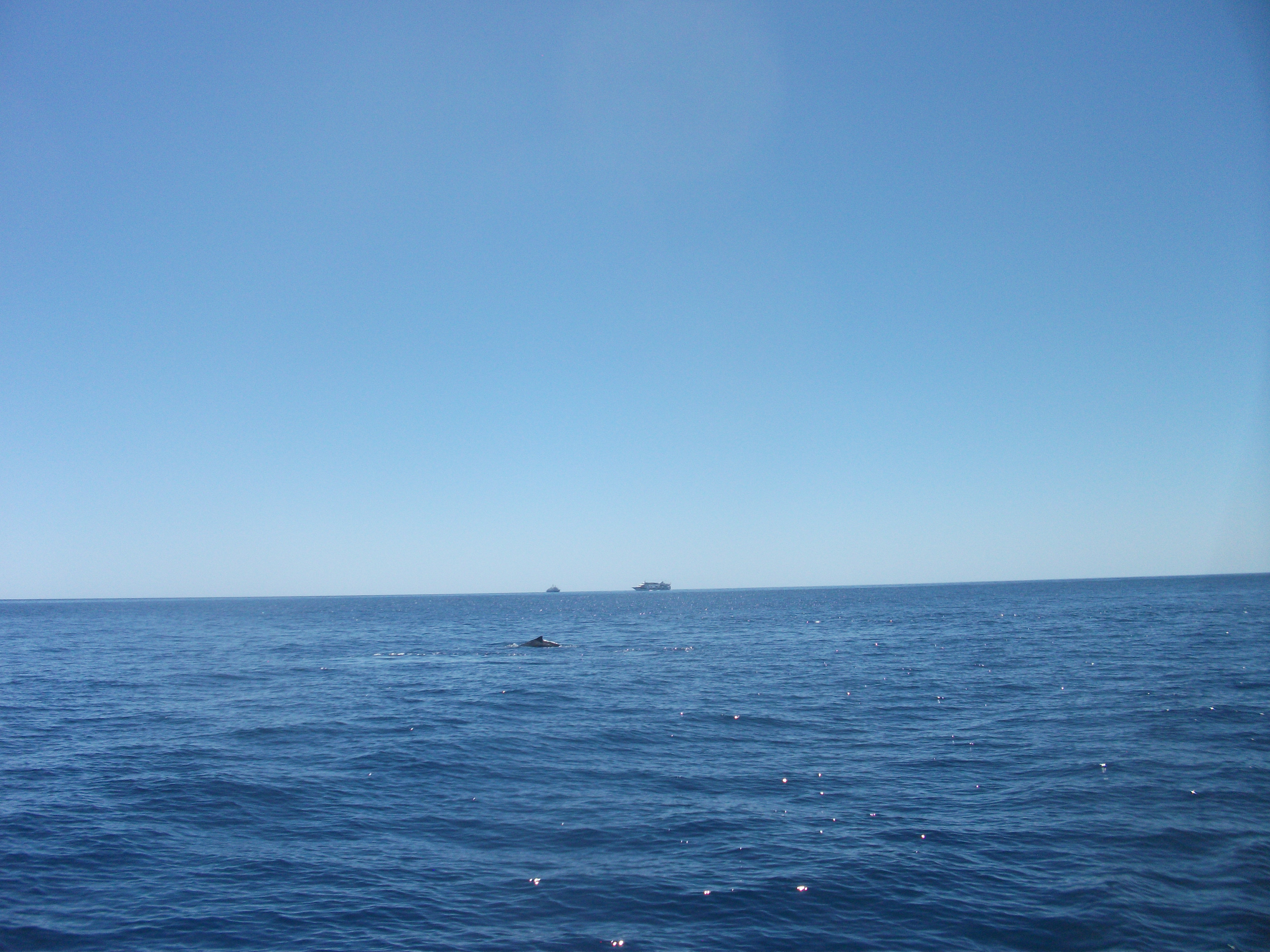
Eventually, after about half an hour of flotation in the open sea, we all climbed back aboard the boat for more sightseeing. Several times we were pointed to whales popping out of the ocean—I don’t believe any were actually breaching—and turned our heads in one direction or another to see them. Periodically, turtles surfaced as well. Because of restrictions that require tour boats to maintain safe distances from these species, the view was always from some distance, which is entirely appropriate. The whales are well aware we are there, and vice versa, and zoom lenses were invented for a purpose. In due course, we concluded our trip, came ashore, and walked back to our hotel for the final time before enjoying dinner around the corner at a convenient Red Lobster.
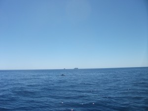
Ahoy! A whale in the distance.
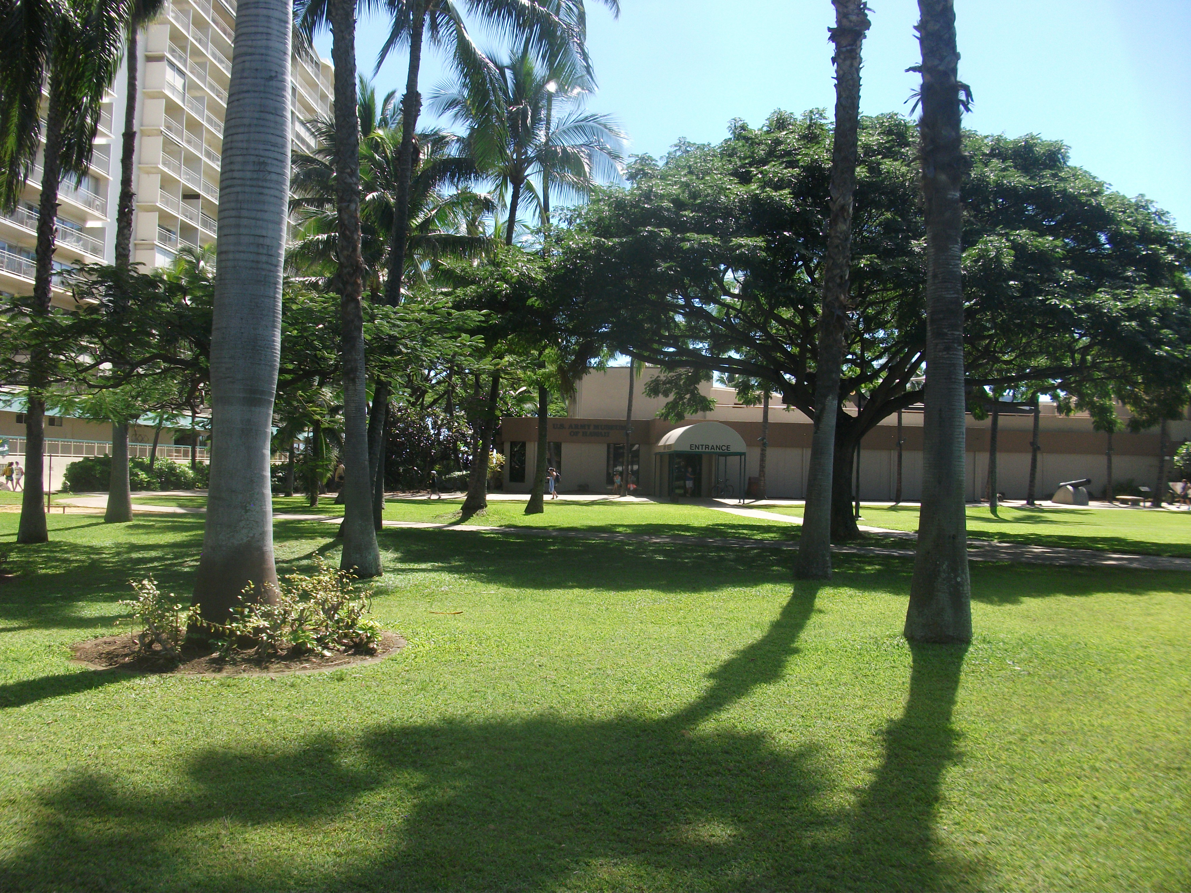
But not before taking an unplanned detour into the free-admission U.S. Army Museum of Hawaii, which sits on Kalia Road along the beach in a building saved from the wrecking ball. Its exhibits, in an aging but sturdy facility, begin with the military history of native Hawaii, through the period of Kamehameha as he adapted European weapons for his conquest of other islands to unify Hawaii, through annexation and the Spanish-American conflict, which involved some major action in the Pacific by which America acquired the Philippines and Guam, into World War I, and finally to the attack on Pearl Harbor and the conflict with Japan that followed. While I would have preferred to see much more substance concerning the politically touchy subject of just how the U.S. came to acquire Hawaii, something I addressed briefly last June in my discussion of the legacy of Ray Bradbury, I nonetheless appreciated much of the rest of the effort to display the more recent history.
The U.S. Army Museum of Hawaii
Hawaii was clearly a strategic location in World War II, and suffered for it. What my wife and I found particularly moving, however, was a video tribute to the Nisei soldiers, those second-generation Japanese-American young men born in the U.S., who fought in that war in Europe. The video details the saga of the “404” regiment that liberated not only Bruyeres in France but the concentration camp at Dachau. The interviews, especially those of Holocaust survivors who encountered these remarkable soldiers, brought tears to my eyes. One Jewish lady interviewed for the film, a teenager at the time the camp was freed, remembers one of these soldiers simply saying to her, “From my God to your God, you’re liberated.” This liberation of Dachau by the Nisei troops was a new piece of history for me, something of which I had been previously blissfully unaware. It reminded us of just how much American history remains hidden from most of us, but for such documentary efforts.
At that point, we were satisfied with our visit, and our dinner was almost anticlimactic. We retired early for our departure the next morning on a 6:25 a.m. flight from Honolulu International Airport, eventually arriving on a delayed flight from San Francisco at Chicago’s O’Hare at midnight—in a city still lightly covered with snow.
Jim Schwab