A bit more than a month ago, I introduced this blog audience to Planning to Turn the Tide, the film project being undertaken by the APA Hazard Mitigation and Disaster Recovery Planning Division. I noted that we would be rolling out a series of updates as we completed work on new trips around the country, but the first was in Southwest Florida in late June of this year. A week later, we shared the first blog video discussing our progress, focusing on a series of interviews with planners and others at the Tampa Bay Regional Planning Commission. Today, I am sharing the second blog video, which discusses our subsequent work in Sarasota County.
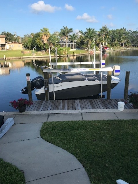
Phillippi Creek in southern Sarasota County
Click here to watch the summary video about the interviews we conducted in Sarasota County.
SW Florida, USGS map. Sarasota is midway along the central coast in this section.
One key point throughout the discussions was that Hurricane Ian at one point had been projected to move through Sarasota County before weather patterns in the Gulf of Mexico pushed it eastward into Lee County and Fort Myers instead. That near-miss still allows Sarasota County officials, like those further north in Tampa Bay, to make the point that preparation for a direct hit in a future storm is the entire region’s best bet.
Except for one unrelated post on July 4, it has been a while until now. David Taylor and I left Chicago on a road trip on July 6 to film in Colorado and Iowa, returning on July 18. The delay since then in putting this series back on track arose from both a short-term illness and a long to-do list of other tasks once I was back home, but here we are. We have much more to share now about Florida, Colorado, and Iowa to keep readers aware of our progress, so please keep tuning in every few days. We’ll be working to keep you updated.
If you wish to support the project, please use the QR code below for an online donation.
Click hereto watch the summary video about the interviews at Tampa Bay Regional Planning Council.
One of our interviews featured Jerry Stickney, Director of the Sunshine Line, a Hillsborough County agency that provides transportation for disabled and disadvantaged people, including special services during natural disasters. That last point provided the bulk of our discussion because evacuating and sheltering these people during hurricanes, major storms, and other disasters is a major responsibility, but one that ensures some degree of social equity in the face of life-threatening circumstances. Hurricane Ian could easily have become the major hurricane that finally invaded the Tampa Bay region but instead turned east further south, striking the Fort Myers area.
Cara Serra, resiliency planner for TBRPC, discussed her role in facilitating the work of the Regional Resiliency Coalition, which consists of several working groups examining regional issues concerning shoreline management, infrastructure, stormwater management, and resilient building design and land use, among other concerns. They are currently developing a Regional Resiliency Action Plan.
In the quest for regional resilience, learning lessons from disasters elsewhere plays a major role, one that has not been neglected. Sarah Vitale, planning director for TBRPC, led the development of a new iteration of Project Phoenix, originally created in 2009, to help business leaders and others in the Tampa Bay region understand what the impact of a Category 4 or 5 hurricane might be if it took aim directly at Tampa Bay, something that last happened more than a century ago, when the population was barely one-tenth
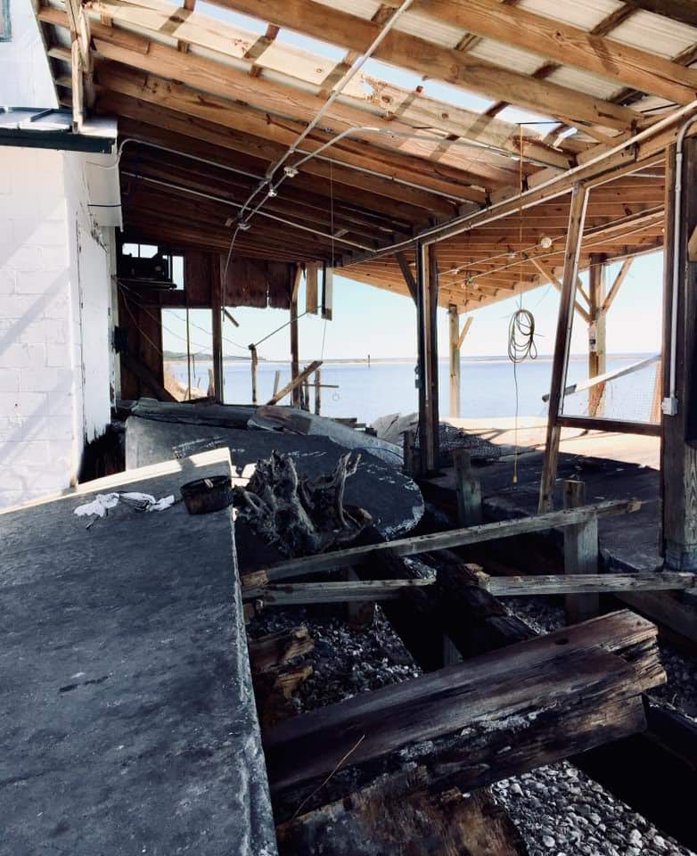
Damage from Hurricane Michael, Bay County, FL. Photo by David Taylor
of what it is now. Her training workshop includes video clips of both a simulation of such a storm and real-life stories from Mexico Beach of economic recovery from Hurricane Michael, which struck the Florida Panhandle in October 2018.
Finally, we also spoke with Sean Sullivan, the executive director of TBRPC, whose engaging New England accent kept us captivated as he outlined his vision for a six-county region that is aware of its risks and prepared to handle the impacts of climate change. It is clear that he has a committed staff that is helping to implement that vision and develop the tools for effective change in that direction.
As promised in the video link above, here are links to the film trailer and the donations page to support Planning to Turn the Tide, the documentary film for which all this work is being done:
The impacts of climate change are affecting us all, often in unexpected ways. As I write this, my own sinuses are recovering from the onslaught of smoky air, full of particulate matter, spread south by the winds from thousands of acres of Canadian forests being scorched by massive wildfires. Winds from such fires in Quebec swept through much of the Northeast two weeks ago, including New York City. Yesterday, it was the Midwest’s turn to suffer, and Chicago was one huge grey fog that burned the eyes and made even healthy people catch their breath. The Chicago Tribune reported that we had the worst air quality of 95 major cities worldwide.
If we needed a vivid illustration that climate change and its impacts know no borders, this is certainly it. That is one more reason we at HMDR find urgency in our mission to develop this film and discuss how better planning at local, regional, national, and even international levels can help us turn the rising tide of losses from natural disasters.
Hillsborough
County is a dense metropolitan area, anchored by the city of Tampa. Tampa and nearby
St. Petersburg, in
Pinellas County, sit on opposite
shores of Tampa Bay, a 400-square-mile
expanse of water connected to the Gulf of Mexico. Across
that gap sits the Sunshine
Skyway Bridge, a magnificent and scenic section of I-275. On a sunny day,
it displays coastal Florida in all its glory.
Eugene
Henry, like anyone else, enjoys those sunny days, but he also worries about
what may happen when the region suffers inclement weather. As Hillsborough
County’s Hazard Mitigation Program Manager, it is his job to think about how
well the area will fare under the impact of natural and other disasters, which
can include hurricanes, floods, tornadoes, sinkholes, and wildfires. At least
the first two are complicated by sea level rise, and one can easily argue that
climate change in a broader sense may well influence the damage from wildfires.
For those uninitiated in the particulars of Florida’s natural environment,
wildfires are a recurring feature. In what is ordinarily such a lush
environment fostered by rain and abundant sunshine, it takes only one drought
year amid high heat to turn dense vegetation into a tinderbox. It has happened
before, repeatedly.
But the biggest concern, by far, is the arrival of the Big
One, the high-intensity hurricane that the county readily admits it has escaped
in recent decades. In its Post-Disaster
Redevelopment Plan (PDRP), the county states forthrightly that this is
merely a matter of good fortune and that planners fully understand that the day
will surely come—and that they had best be ready for it. Disaster resilience in
the face of hurricanes is not a matter to be taken lightly with 158 miles of
shoreline along Tampa Bay, numerous rivers and streams, and numerous
vulnerable, low-lying areas. Absent serious attention to mitigation, damages
from a Category 4 or 5 hurricane, or one like Harvey that stalls and dumps
voluminous rain on an urban area, could become catastrophic.
But Tampa and Hillsborough County have been very fortunate.
The last Category 3 hurricane struck the area in 1921. What may have been a Category
4 struck in 1848, though wind speed measurements were primitive at the time,
and the U.S. had no official records yet. According to the county’s Local
Mitigation Strategy, that storm “reshaped parts of the coast and destroyed
much of what few human works and habitation were then in the Tampa Bay area.”
Tides rose 14 feet. Tampa was still a small city then, and Gene Henry wonders
about the staggering losses that might occur with a comparable event today.
I had long wanted to visit the area to see in person how
these issues are being addressed. I have known Gene for a long time, and I have
read the county’s PDRP, an extensive document laying out the county’s
preparations for recovery from disasters. But I had never been to Tampa. As the
result, however, of a personal invitation from a high school classmate, David Taylor, who now
lives in Sarasota,
my wife and I flew to Tampa February 20 and stayed with Dave and his wife,
Linda, for five days. Sarasota is about one hour’s drive south of Tampa. As
part of the trip, I arranged to meet with Gene the day after we arrived and
tour the county to see the hazard mitigation projects underway there. I also
delivered a one-hour lecture the following afternoon in West Palm Beach,
on behalf of Florida Atlantic University, as part
of a two-hour program that included a panel discussion following my talk on
“Recovery and Resilience: Facing the Disasters of the Future.” Not one to skip
a learning opportunity, Gene drove four hours from Tampa to attend the program.
But back to Hillsborough. My wife and I met Gene at the
county’s Emergency
Operations Center (EOC) around mid-morning, hopped in his county truck, and
took off. Our first stop was the Florida Center
for Design + Research, housed in the School of Architecture + Design at the
University of South Florida (USF),
Gene’s graduate alma mater. The school features an urban planning program where
he wanted us to meet Professor
Brian Cook. Planning students often take studio classes, which involve
design or research work on real-life community problems. Students learn to
define a community design or policy issue, work with clients, and try to
produce solutions that will be of some practical value to the community they
are serving. They typically work in teams. In this case, students were applying
geographic information system (GIS), or mapping, skills to determine areas of
high vulnerability to flooding and sea level rise in less affluent
neighborhoods. Gene’s county office collaborates with USF instructors to
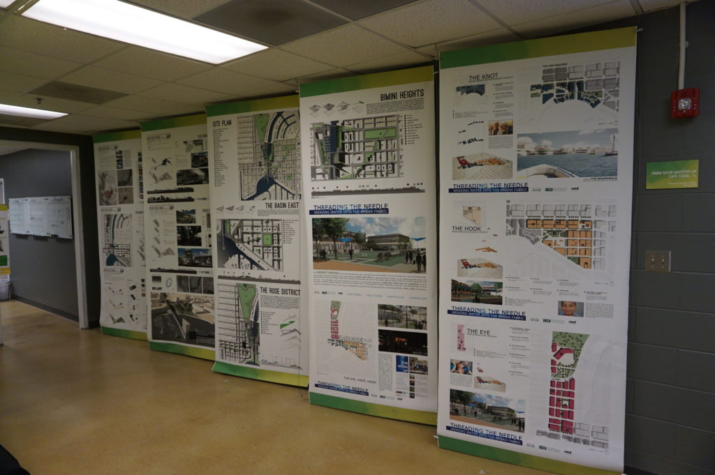
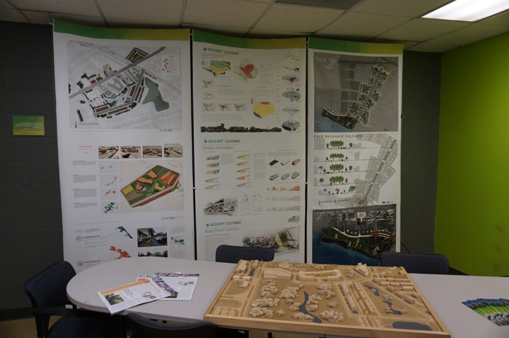
identify areas of practical concern for the students’ work. The photos show
some of the design work the students have done, the best of which is often
displayed in poster sessions at state and national professional planning conferences.
Posters (above and below) from the USF design studio
The most encouraging aspect of that visit was, for me, the mere fact that the students are engaging with such a pressing problem. I have researched the issue of hazards and climate change in the planning curriculum for both undergraduate and graduate degree programs in urban planning, and most such programs are lacking in this respect, a situation that is disserving the planners of tomorrow who must be well trained to come to grips with these challenges in whatever communities they end up serving. But a growing number of students are getting such training—I have myself been teaching such a course at the University of Iowa since 2008—and southern Florida is as good a laboratory as they could wish for. To see collaboration between a county agency and USF graduate students and faculty is a most welcome note.
But Gene had other places to take us in the afternoon,
besides, that is, the Cuban-themed La Teresita restaurant
where we ate lunch—a place I am willing to recommend if you ever visit Tampa.
First up in the afternoon was the University
Mall area north of downtown Tampa and just east of I-275. This involves a
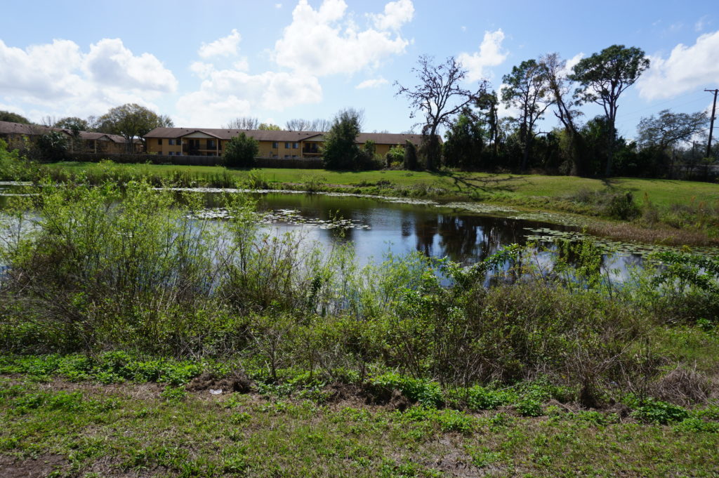
stormwater management and flood-mitigation project in an area subject to a
certain amount of repetitive loss, meaning that the same properties continue to
suffer periodic flood losses. The project removed structures while creating
additional areas for stormwater storage and reshaping a natural area known as
Duck Pond, thus creating a system for stormwater conveyance. This includes a
large stormwater pump that transfers slow-moving stormwater to areas further
downstream and, in due course, to a reservoir owned by the City of Tampa.
Before this project was initiated, storms used to inundate multifamily
apartment buildings, Gene says, as well as a nearby assisted living facility.
How does the county pay for all this? He credits a combination of local funds,
which is certainly not unusual, and federal money in the form of Hazard Mitigation
Grant Program (HMGP) funds. The latter are available as part of an overall
recovery package after a Presidential Disaster
Declaration, but require that purchased properties, once cleared, remain in
perpetual open space. The point is to ensure that a vulnerable area is not
redeveloped, thus perpetuating the problem.
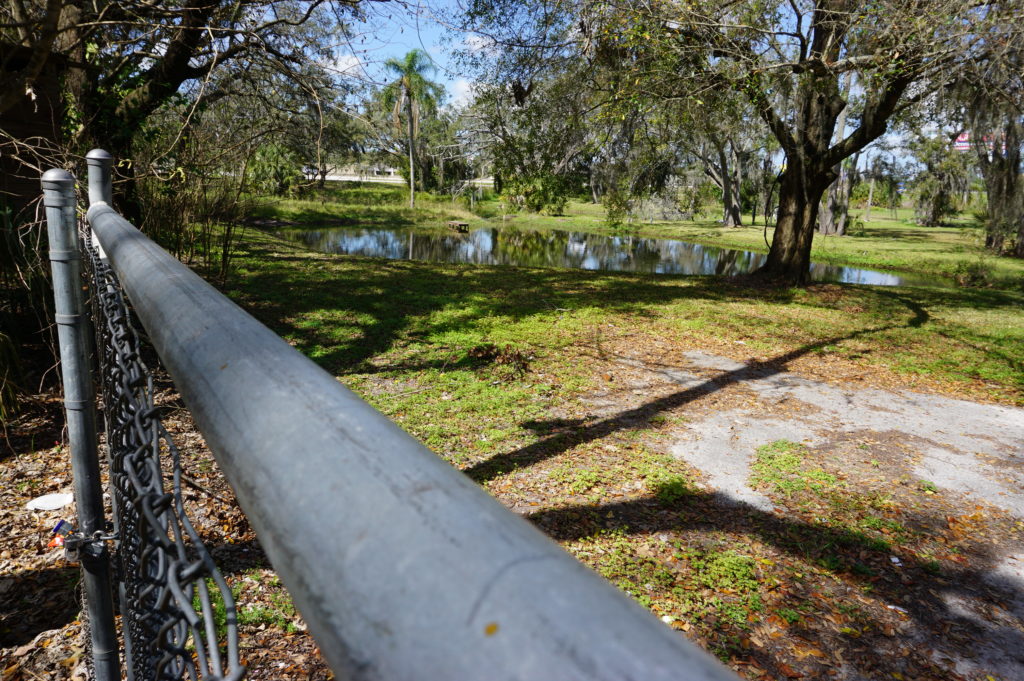
At 132nd Street, also in Tampa, another flood-mitigation
and stormwater management project presents a very different appearance. This
too was subject to repetitive loss and required protection from urban flooding,
which is typically the result of poor stormwater drainage in developed areas. The
problems can include poor water conveyance from one area to the next—the nearby
highway provided an impediment to drainage—and high levels of impervious
surface, meaning coverage with concrete and structures that limit percolation
of water into the soil. In this case, a small subdivision suffered repetitive
flooding even with small storms. Here also, the county acquired homes with HMGP
funds, which are dispensed by the Federal
Emergency Management Agency (FEMA). The streets were removed, and
stormwater ponds were added.
This was a location where the county’s partnership with USF
paid dividends. Researchers analyzed which plants were best at removing
nitrogen and other chemicals common in stormwater runoff in order to clean up
the water before it reaches Tampa Bay. Henry says this project was made
possible through a combination of local and HMGP funds in combination with
federal Community
Development Block Grant entitlement money.
I included the chain link in my photo to show that the solution may not be complete. After all, chain link fences are intended to limit access. What consideration, I asked, had been given to eventually converting this cleared area to some sort of public park and thus facilitating a public benefit? There can be challenges in part because of pollution cleanup and other public safety factors. Gene readily admitted he would love that solution, but it may take time. The adjoining neighborhood must be comfortable with that use, which can involve solving various site-related problems. A nearby church might be a potential ally, serving as a patron and watchdog, but reaching agreement about solutions and responsibilities, including ongoing maintenance and supervision, takes time. And only time will tell whether such a solution materializes with the support of local public officials.
Some projects assist a single homeowner with a stubborn
problem. This is often the case with homes that are elevated, a common site in
parts of the Southeast, where coastal and riverine flooding can wreak havoc
with homes in vulnerable locations that do not necessarily require buyouts and
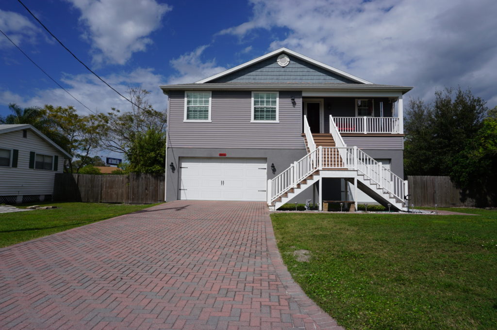
relocation. That was the case near Rocky Creek,
where a homeowner rebuilt a structure elevated three feet above base flood
elevation (BFE) using a combination of private funds and a Flood
Mitigation Assistance (FMA) grant from FEMA. The result is living space
that is better protected when flood waters surround the lower level.
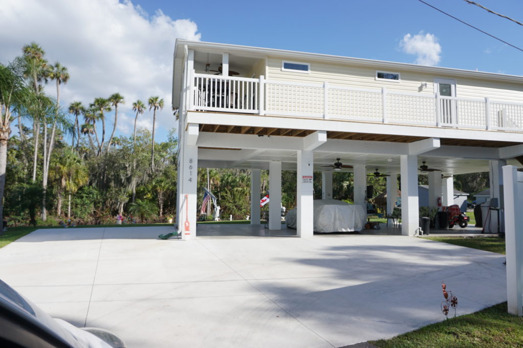
The same story occurred at a home near the Alafia River, where
another homeowner was elevated three feet above BFE, using the same combination
of funds.
Gene also shared with us an interesting strategy at a
frequently flooded and highly vulnerable modular home park, where an area had
been cleared of its former homes to allow repopulation with recreational
vehicles (RVs). The logic is that, when flood warnings arrive, RV owners will
be able, unlike those with more stationary modular homes, to simply drive off
the site to safer areas until the emergency subsides. The initiative, Gene
says, was taken by the park’s new owner (which owns other parks nationwide), which
identified no more permanent structures in the floodway as part of its
compliance strategy after the most recent flooding event in the area.
This area is slated for RV occupancy only.
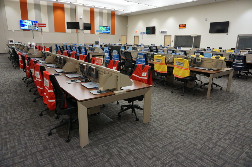
Finally, we returned to learn a little about the EOC. We
visited what is often known in such centers as the “war room,” where designated
officials meet to discuss and establish strategies for dealing with an
emergency of any sort that activates the emergency operations plan. In the
photo, each chair is designated for a specific official, with groups of people
with related tasks seated in color-coded sections of the room. Many such EOCs
are much smaller, but Hillsborough County is very urban and populated, and the
needs are complex and interrelated. It is expected that those involved will
arrive with authority to respond to the disaster, to indicate what they are and
are not capable of doing as part of the overall response to disaster. It is not
a place where one expresses a need to go back to another office and “find out.”
Hillsborough County Emergency Operations Center “war room”
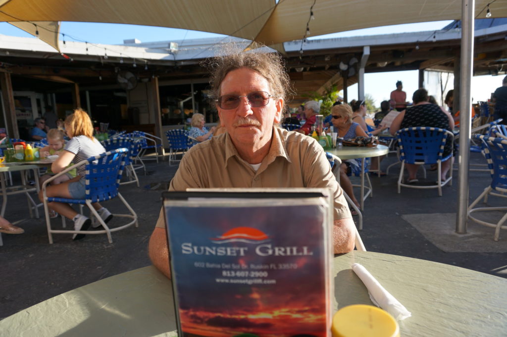
Ready to relax and enjoy a drink and a snack, we followed
Gene down the highway to the Sunset
Grill at Little Harbor, which has a beautiful view of the bay. At dusk,
numerous people followed a daily ritual of photographing the sunset over the
water. Tourist attraction it may be, as well as a local watering hole, but the
surrounding area has a significant mangrove forest and salt-bed areas that were
preserved as open space using Environmental Land Acquisition Funds from what
Gene describes as a “locally instigated preservation program.”
Hillsborough County’s Hazard Mitigation Program Manager, Eugene Henry, at rest at Sunset Grill at the end of our day-long tour.
And so, with the sun declining in the west, we sat at an
outdoor table and hashed over the world’s problems, and sometimes our own. One
point that seems clear to me is that Hillsborough County has a great deal to
offer to other jurisdictions, just as it has undoubtedly learned a great deal
as well—one reason both he and a resident scholar and Japanese graduate student
from the University of Illinois, Kensuke Otsuyama,
planned to drive to West Palm Beach the next day to hear my presentation. Although
there is sometimes a tendency for local governments to become more insular, to
allow fewer opportunities for employees like Gene to share and exchange
information in professional forums and conferences, this, I think, is always a
mistake. The growth in the value of what someone like Gene does lies in this
fruitful sharing of experience and perspectives that such opportunities allow,
and I hope that will continue, for certainly Gene made my day by sharing his
time to allow me to learn and to share with the growing readership that follows
this blog.
Supplemental Comment:
Although the hearing was held today, making live streaming a
moot point, significant written and recorded testimony on hazard mitigation and
climate resilience issues occurred before the U.S. House Appropriations
Subcommittee on Transportation, Housing, and Urban Development. Yesterday, the
following link was made available from several sources including the American Planning
Association (APA) to provide access to this testimony and information:
Representatives from APA, PEW, Houston Public Works,
Rutgers University, and the Town of Arlington, MA are delivering testimony to
the Transportation and Housing and Urban Development (THUD) congressional
subcommittee tomorrow, March 13th at 10:00 a.m. EST. THUD, a part of
the House Committee on Appropriations, writes laws that fund the federal
government’s important responsibilities. The testimony is available for
streaming here: