When a law makes a powerful impact over time, it is sometimes hard to remember what life was like before it was enacted. In U.S. history, for example, both Social Security and, later, Medicare, created a new reality for the elderly that makes it almost impossible for most people to imagine what old age meant before they took effect. They are so much a part of the fabric of American life that some people even forget (or never learn) the social and political debates that produced them. That sort of obtuse amnesia was in evidence as Tea Party protests materialized in response to the Affordable Care Act, aka Obamacare, in which some carried signs that read, “Keep Your Government Hands Off My Medicare.” Ponder that conundrum for a while.
Few laws match the scale of impact of those two examples, but many have significant impacts that receive less attention, at least among the general public. One that is reaching its twentieth anniversary is the Disaster Mitigation Act (DMA), signed into law by President Clinton on October 30, 2000. After a decade of expensive disasters in the 1990s—Hurricane Andrew (1992), the Midwest floods (1993), the Northridge earthquake (1994), and Hurricanes Fran (1996) and Floyd (1997)—Congress realized that the nation needed greater accountability from states and local governments in addressing hazard mitigation challenges before disasters occurred. The carrot and the stick were combined in this instance in a requirement that states (including territories and the District of Columbia) and local and tribal governments prepare and adopt hazard mitigation plans that won the approval of the Federal Emergency Management Agency (FEMA) as meeting the standards of the act and its accompanying regulations as a condition of eligibility for FEMA hazard mitigation grants. Put simply, no plan, no money. Few state and local officials wish to find themselves in that position after a major disaster.
Congress went one step further. Previously, most such grants came through the Hazard Mitigation Grant Program (HMGP), created under the Stafford Act in 1988, the basic law structuring the federal disaster response system, under which every state has some sort of parallel emergency management agency. The problem with HMGP has always been that the money is made available as part of a presidential disaster declaration, using a percentage of overall disaster assistance to determine the amount available. That money goes to the affected states, which are responsible for local allocations. But that means that a state must experience a natural disaster to be eligible for such money. Admittedly, it then becomes useful for mitigating future disasters, but it did nothing to avert the most recent event. In fact, communities that had become adept at mitigating hazards with their own resources often complained that they got no federal assistance because they were doing too good a job of preventing losses. Davenport, Iowa, for example, long ago refused Army Corps offers to build levees along the Mississippi River and opted for a riverfront park that allowed the water to flow without damaging buildings in its downtown. Davenport has not always avoided flood impacts, but it has certainly minimized them.
In DMA, Congress added a new Pre-Disaster Mitigation (PDM) grant program. Instead of being triggered by disaster declarations, it was an annual grant competition, in which state and local governments submitted proposals for projects that would reduce losses of life and property in future events. Its major flaw was that PDM relied on annual congressional appropriations, which predictably ebbed and flowed and often was grossly underfunded. In 2018, in the Disaster Recovery Reform Act, Congress finally opted to stabilize funding by creating a formula by which six percent of total annual disaster relief outlays would be swept into a single pot by FEMA for grants under a new program that FEMA has labeled Building Resilient Infrastructure and Communities (BRIC), which I discussed in a post here in early August. The resulting 2020 grant funds total roughly $500 million, a far cry from years past when the total congressional allocation was often as little as $25 million, which barely put a dent in the mitigation needs of a nation as vast as the U.S.
But the real question after two decades is, How has DMA changed the landscape of American planning and disaster management? Clearly, we have not solved all problems. For one thing, climate change has accelerated and complicated matters significantly. While Congress unquestionably has dithered a great deal on climate issues, DMA was never aimed directly at climate change. Instead, it aimed to create a climate of state, tribal and local responsibility and accountability for planning for hazard mitigation while making federal funding available to support such planning. In fact, federal assistance for such planning is built into the law. Have governments responded?
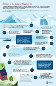
DMA timeline produced by FEMA, reused from FEMA website. To expand, click here.
The unequivocal answer is yes. By 2002, once FEMA had finalized its guidance for the mitigation planning process, Clackamas County, Oregon, became the first local jurisdiction to win approval for its plan. Within a few years, every state and territory had an approved plan in place. Winning compliance from most local jurisdictions understandably took longer, but today FEMA can claim that more than 23,000 local units of government have approved plans, as do 239 tribal governments, which together cover more than 84 percent of the U.S. population. The gaps in coverage are primarily in rural areas, many of which suffer from low governmental capacity—a subject that can still be addressed in future outreach by FEMA—and some of which simply choose not to plan, presumably not seeing the consequences as outweighing the burden of the work involved.
In the meantime, many professional and intergovernmental associations have done considerable outreach to their own members to explain the benefits of hazard mitigation planning beyond simple eligibility for grants. For example, during my tenure at the American Planning Association, we used a FEMA contract to produce a Planning Advisory Service Report on the benefits of integrating such planning throughout the local planning process, including comprehensive plans, capital improvements programming, and the land-use regulations that implement mitigation intentions, such as zoning, floodplain management, and subdivision ordinances. We published Hazard Mitigation: Integrating Best Practices into Planning in 2010. The concept of integrated planning has enjoyed significant increased attention throughout the second decade of DMA and has become a staple of FEMA guidance for local hazard mitigation planning.
There are many ways to review this history, which may even be worth an entire book. As for what we have achieved, the Natural Hazards Center, based at the University of Colorado, asked me to moderate a webinar on October 13. “The Disaster Mitigation Act of 2000: Twenty Years of Promise, Pitfalls, and Progress from a Planning Perspective,” in which I was joined by three experienced and insightful panelists from state, county, and federal government, provides a fast-paced, one-hour summary of the successes, shortcomings, and future challenges of DMA as part of the Center’s Making Mitigation Work webinar series, and the recorded version is available at the link above. I thank NHC Director Lori Peek for having invited me to lead this discussion.
Make it your DMA anniversary experience. Trust me, it will be worth your time.
Hillsborough
County is a dense metropolitan area, anchored by the city of Tampa. Tampa and nearby
St. Petersburg, in
Pinellas County, sit on opposite
shores of Tampa Bay, a 400-square-mile
expanse of water connected to the Gulf of Mexico. Across
that gap sits the Sunshine
Skyway Bridge, a magnificent and scenic section of I-275. On a sunny day,
it displays coastal Florida in all its glory.
Eugene
Henry, like anyone else, enjoys those sunny days, but he also worries about
what may happen when the region suffers inclement weather. As Hillsborough
County’s Hazard Mitigation Program Manager, it is his job to think about how
well the area will fare under the impact of natural and other disasters, which
can include hurricanes, floods, tornadoes, sinkholes, and wildfires. At least
the first two are complicated by sea level rise, and one can easily argue that
climate change in a broader sense may well influence the damage from wildfires.
For those uninitiated in the particulars of Florida’s natural environment,
wildfires are a recurring feature. In what is ordinarily such a lush
environment fostered by rain and abundant sunshine, it takes only one drought
year amid high heat to turn dense vegetation into a tinderbox. It has happened
before, repeatedly.
But the biggest concern, by far, is the arrival of the Big
One, the high-intensity hurricane that the county readily admits it has escaped
in recent decades. In its Post-Disaster
Redevelopment Plan (PDRP), the county states forthrightly that this is
merely a matter of good fortune and that planners fully understand that the day
will surely come—and that they had best be ready for it. Disaster resilience in
the face of hurricanes is not a matter to be taken lightly with 158 miles of
shoreline along Tampa Bay, numerous rivers and streams, and numerous
vulnerable, low-lying areas. Absent serious attention to mitigation, damages
from a Category 4 or 5 hurricane, or one like Harvey that stalls and dumps
voluminous rain on an urban area, could become catastrophic.
But Tampa and Hillsborough County have been very fortunate.
The last Category 3 hurricane struck the area in 1921. What may have been a Category
4 struck in 1848, though wind speed measurements were primitive at the time,
and the U.S. had no official records yet. According to the county’s Local
Mitigation Strategy, that storm “reshaped parts of the coast and destroyed
much of what few human works and habitation were then in the Tampa Bay area.”
Tides rose 14 feet. Tampa was still a small city then, and Gene Henry wonders
about the staggering losses that might occur with a comparable event today.
I had long wanted to visit the area to see in person how
these issues are being addressed. I have known Gene for a long time, and I have
read the county’s PDRP, an extensive document laying out the county’s
preparations for recovery from disasters. But I had never been to Tampa. As the
result, however, of a personal invitation from a high school classmate, David Taylor, who now
lives in Sarasota,
my wife and I flew to Tampa February 20 and stayed with Dave and his wife,
Linda, for five days. Sarasota is about one hour’s drive south of Tampa. As
part of the trip, I arranged to meet with Gene the day after we arrived and
tour the county to see the hazard mitigation projects underway there. I also
delivered a one-hour lecture the following afternoon in West Palm Beach,
on behalf of Florida Atlantic University, as part
of a two-hour program that included a panel discussion following my talk on
“Recovery and Resilience: Facing the Disasters of the Future.” Not one to skip
a learning opportunity, Gene drove four hours from Tampa to attend the program.
But back to Hillsborough. My wife and I met Gene at the
county’s Emergency
Operations Center (EOC) around mid-morning, hopped in his county truck, and
took off. Our first stop was the Florida Center
for Design + Research, housed in the School of Architecture + Design at the
University of South Florida (USF),
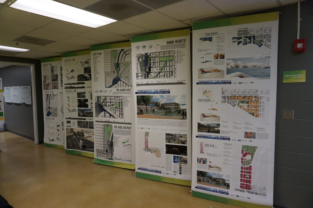
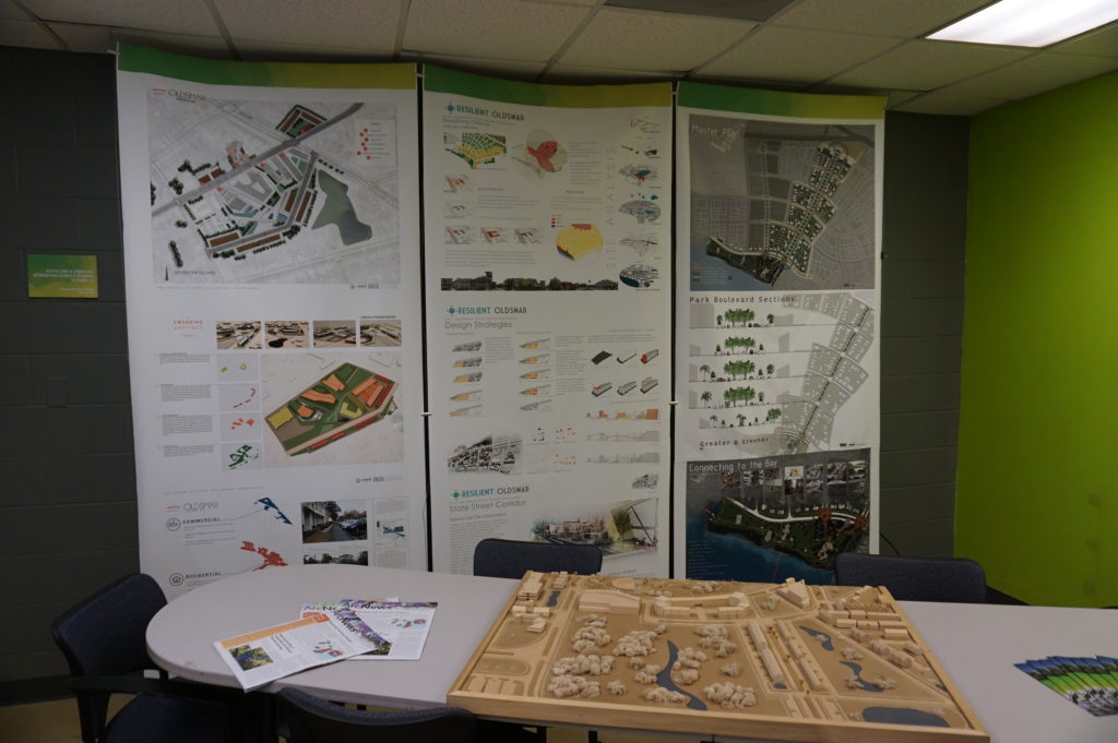
Gene’s graduate alma mater. The school features an urban planning program where
he wanted us to meet Professor
Brian Cook. Planning students often take studio classes, which involve
design or research work on real-life community problems. Students learn to
define a community design or policy issue, work with clients, and try to
produce solutions that will be of some practical value to the community they
are serving. They typically work in teams. In this case, students were applying
geographic information system (GIS), or mapping, skills to determine areas of
high vulnerability to flooding and sea level rise in less affluent
neighborhoods. Gene’s county office collaborates with USF instructors to
identify areas of practical concern for the students’ work. The photos show
some of the design work the students have done, the best of which is often
displayed in poster sessions at state and national professional planning conferences.
Posters (above and below) from the USF design studio
The most encouraging aspect of that visit was, for me, the mere fact that the students are engaging with such a pressing problem. I have researched the issue of hazards and climate change in the planning curriculum for both undergraduate and graduate degree programs in urban planning, and most such programs are lacking in this respect, a situation that is disserving the planners of tomorrow who must be well trained to come to grips with these challenges in whatever communities they end up serving. But a growing number of students are getting such training—I have myself been teaching such a course at the University of Iowa since 2008—and southern Florida is as good a laboratory as they could wish for. To see collaboration between a county agency and USF graduate students and faculty is a most welcome note.
But Gene had other places to take us in the afternoon,
besides, that is, the Cuban-themed La Teresita restaurant
where we ate lunch—a place I am willing to recommend if you ever visit Tampa.
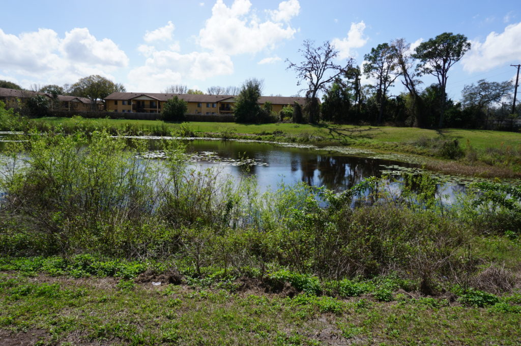
First up in the afternoon was the University
Mall area north of downtown Tampa and just east of I-275. This involves a
stormwater management and flood-mitigation project in an area subject to a
certain amount of repetitive loss, meaning that the same properties continue to
suffer periodic flood losses. The project removed structures while creating
additional areas for stormwater storage and reshaping a natural area known as
Duck Pond, thus creating a system for stormwater conveyance. This includes a
large stormwater pump that transfers slow-moving stormwater to areas further
downstream and, in due course, to a reservoir owned by the City of Tampa.
Before this project was initiated, storms used to inundate multifamily
apartment buildings, Gene says, as well as a nearby assisted living facility.
How does the county pay for all this? He credits a combination of local funds,
which is certainly not unusual, and federal money in the form of Hazard Mitigation
Grant Program (HMGP) funds. The latter are available as part of an overall
recovery package after a Presidential Disaster
Declaration, but require that purchased properties, once cleared, remain in
perpetual open space. The point is to ensure that a vulnerable area is not
redeveloped, thus perpetuating the problem.
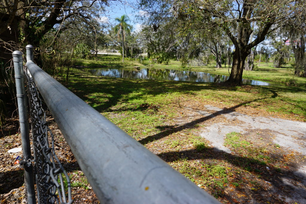
At 132nd Street, also in Tampa, another flood-mitigation
and stormwater management project presents a very different appearance. This
too was subject to repetitive loss and required protection from urban flooding,
which is typically the result of poor stormwater drainage in developed areas. The
problems can include poor water conveyance from one area to the next—the nearby
highway provided an impediment to drainage—and high levels of impervious
surface, meaning coverage with concrete and structures that limit percolation
of water into the soil. In this case, a small subdivision suffered repetitive
flooding even with small storms. Here also, the county acquired homes with HMGP
funds, which are dispensed by the Federal
Emergency Management Agency (FEMA). The streets were removed, and
stormwater ponds were added.
This was a location where the county’s partnership with USF
paid dividends. Researchers analyzed which plants were best at removing
nitrogen and other chemicals common in stormwater runoff in order to clean up
the water before it reaches Tampa Bay. Henry says this project was made
possible through a combination of local and HMGP funds in combination with
federal Community
Development Block Grant entitlement money.
I included the chain link in my photo to show that the solution may not be complete. After all, chain link fences are intended to limit access. What consideration, I asked, had been given to eventually converting this cleared area to some sort of public park and thus facilitating a public benefit? There can be challenges in part because of pollution cleanup and other public safety factors. Gene readily admitted he would love that solution, but it may take time. The adjoining neighborhood must be comfortable with that use, which can involve solving various site-related problems. A nearby church might be a potential ally, serving as a patron and watchdog, but reaching agreement about solutions and responsibilities, including ongoing maintenance and supervision, takes time. And only time will tell whether such a solution materializes with the support of local public officials.
Some projects assist a single homeowner with a stubborn
problem. This is often the case with homes that are elevated, a common site in
parts of the Southeast, where coastal and riverine flooding can wreak havoc
with homes in vulnerable locations that do not necessarily require buyouts and
relocation. That was the case near Rocky Creek,
where a homeowner rebuilt a structure elevated three feet above base flood
elevation (BFE) using a combination of private funds and a Flood
Mitigation Assistance (FMA) grant from FEMA. The result is living space
that is better protected when flood waters surround the lower level.
The same story occurred at a home near the Alafia River, where
another homeowner was elevated three feet above BFE, using the same combination
of funds.
Gene also shared with us an interesting strategy at a
frequently flooded and highly vulnerable modular home park, where an area had
been cleared of its former homes to allow repopulation with recreational
vehicles (RVs). The logic is that, when flood warnings arrive, RV owners will
be able, unlike those with more stationary modular homes, to simply drive off
the site to safer areas until the emergency subsides. The initiative, Gene
says, was taken by the park’s new owner (which owns other parks nationwide), which
identified no more permanent structures in the floodway as part of its
compliance strategy after the most recent flooding event in the area.
This area is slated for RV occupancy only.
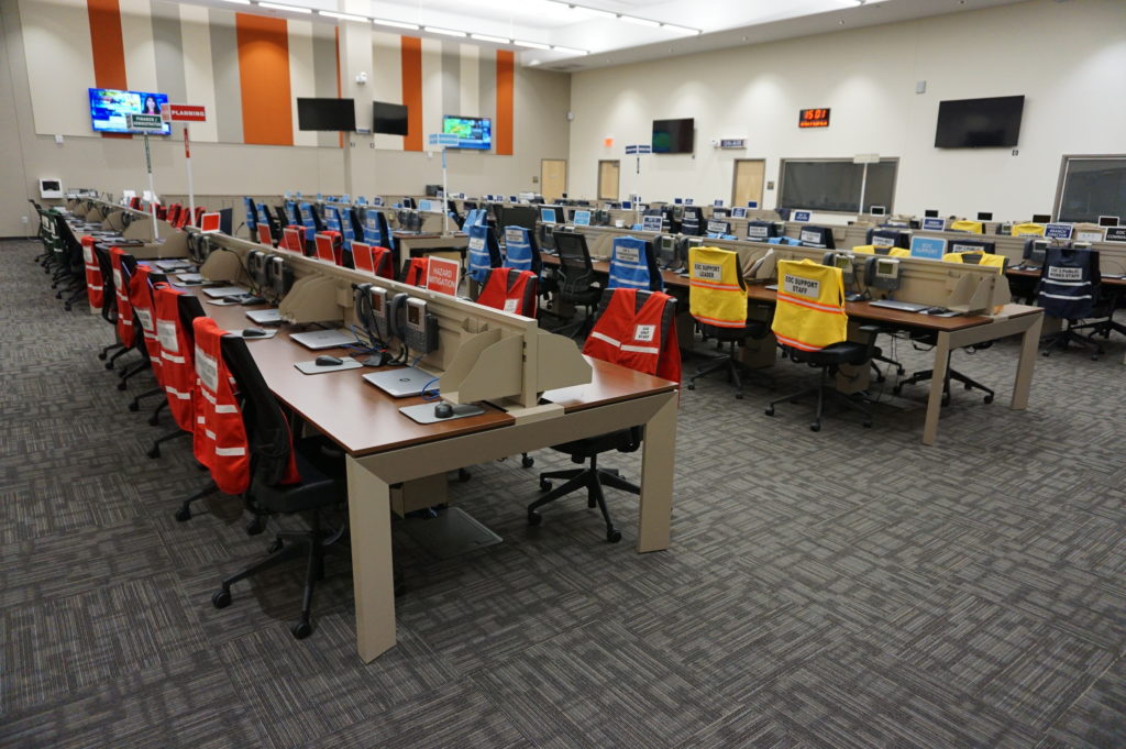
Finally, we returned to learn a little about the EOC. We
visited what is often known in such centers as the “war room,” where designated
officials meet to discuss and establish strategies for dealing with an
emergency of any sort that activates the emergency operations plan. In the
photo, each chair is designated for a specific official, with groups of people
with related tasks seated in color-coded sections of the room. Many such EOCs
are much smaller, but Hillsborough County is very urban and populated, and the
needs are complex and interrelated. It is expected that those involved will
arrive with authority to respond to the disaster, to indicate what they are and
are not capable of doing as part of the overall response to disaster. It is not
a place where one expresses a need to go back to another office and “find out.”
Hillsborough County Emergency Operations Center “war room”
Ready to relax and enjoy a drink and a snack, we followed
Gene down the highway to the Sunset
Grill at Little Harbor, which has a beautiful view of the bay. At dusk,
numerous people followed a daily ritual of photographing the sunset over the
water. Tourist attraction it may be, as well as a local watering hole, but the
surrounding area has a significant mangrove forest and salt-bed areas that were
preserved as open space using Environmental Land Acquisition Funds from what
Gene describes as a “locally instigated preservation program.”
Hillsborough County’s Hazard Mitigation Program Manager, Eugene Henry, at rest at Sunset Grill at the end of our day-long tour.
And so, with the sun declining in the west, we sat at an
outdoor table and hashed over the world’s problems, and sometimes our own. One
point that seems clear to me is that Hillsborough County has a great deal to
offer to other jurisdictions, just as it has undoubtedly learned a great deal
as well—one reason both he and a resident scholar and Japanese graduate student
from the University of Illinois, Kensuke Otsuyama,
planned to drive to West Palm Beach the next day to hear my presentation. Although
there is sometimes a tendency for local governments to become more insular, to
allow fewer opportunities for employees like Gene to share and exchange
information in professional forums and conferences, this, I think, is always a
mistake. The growth in the value of what someone like Gene does lies in this
fruitful sharing of experience and perspectives that such opportunities allow,
and I hope that will continue, for certainly Gene made my day by sharing his
time to allow me to learn and to share with the growing readership that follows
this blog.
Supplemental Comment:
Although the hearing was held today, making live streaming a
moot point, significant written and recorded testimony on hazard mitigation and
climate resilience issues occurred before the U.S. House Appropriations
Subcommittee on Transportation, Housing, and Urban Development. Yesterday, the
following link was made available from several sources including the American Planning
Association (APA) to provide access to this testimony and information:
Representatives from APA, PEW, Houston Public Works,
Rutgers University, and the Town of Arlington, MA are delivering testimony to
the Transportation and Housing and Urban Development (THUD) congressional
subcommittee tomorrow, March 13th at 10:00 a.m. EST. THUD, a part of
the House Committee on Appropriations, writes laws that fund the federal
government’s important responsibilities. The testimony is available for
streaming here:
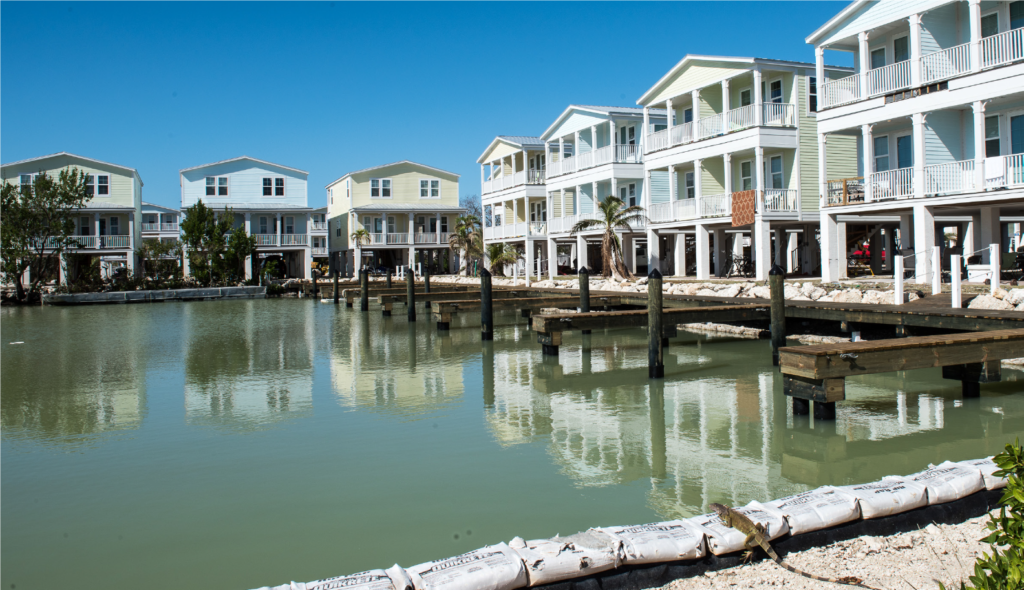
Cover of NIBS Interim Study from Marathon, Florida. “These modern, mitigated homes withstood Hurricane Irma. They are elevated to withstand high water and their roofs are constructed to withstand up to 220 mph winds. Good mitigation learns from mistakes to build more resilient communities.” Photo by Howard Greenblatt, FEMA,, November 22, 2017.
The original report was a landmark in hazard mitigation research in its own right, finding that the nation eventually saved $4 in costs from disaster losses for every dollar of federal money invested in hazard mitigation, a remarkable return on investment by any standard. That report also differentiated specific savings related to specific disaster types ranging from $1.50 per dollar for earthquake mitigation efforts to $9 for flood-related mitigation investments. In short, presuming that specific projects merited investment based on cost-benefit comparisons, the U.S. could prevent a world of pain with timely and effective investments in mitigation projects to reduce such losses.
Still, over the years, the federal government has provided far more money after disasters to support mitigation against future disasters by more generously funding post-disaster programs, primarily the Hazard Mitigation Grant Program (HMGP), than pre-disaster programs such as the Pre-Disaster Mitigation (PDM) program, authorized under the Disaster Mitigation Act (DMA) of 2000 (Sec. 203 of the Stafford Act, 42 U.S.C. 5133). Pilot funding actually began in 1997 under the Federal Emergency Management Agency’s (FEMA) Project Impact, which was terminated by the George W. Bush administration, but by then the DMA was law, and so was PDM. However, secure funding is another matter, and over the years, PDM has been subjected to a roller coaster ride of erratic congressional appropriations. Disregarding the Project Impact years through FY2002, appropriations have ranged from a peak of $150 million when the fund was established in FY2003, to $35.5 million in FY2012, to $25 million in FY2014 following an attempt by the U.S. Department of Homeland Security to zero out the fund and merge it into a single mitigation account, a ploy that did not succeed in Congress. Now the trend is in the opposite direction, with $90 million allocated in FY2017, and dramatically more under consideration for FY2019. In June, the Senate was looking at a proposed allocation of $246 million (House version), according to Meredith Inderfurth, Washington liaison of the Association of State Floodplain Managers. That is the same amount allocated the previous year, so one can hope PDM is stabilizing at a higher level. One must realize, also, that what is proposed from the administration of the moment is not necessarily what is disposed by Congress, where appropriations committees may act under significantly different influences from those affecting the White House.
What is the difference between PDM and HMGP? Most simply, PDM provides funding under a competitive grant system to communities for proposed projects to implement hazard mitigation before disaster strikes, under what some call “blue skies.” By contrast, HMGP funding is a percentage of overall disaster assistance following a presidentially declared disaster. That percentage has varied over time and among states; those with enhanced state hazard mitigation plans, which must meet higher standards and show a deeper state commitment to mitigation, receive a higher percentage of overall disaster assistance in HMGP funds. Currently, for states with enhanced plans, that amounts to 20 percent of overall assistance, in other words, $200 million in HMGP for every billion dollars of disaster aid. The amounts are smaller, beginning with 15 percent for the first $2 billion of aid, and shrinking as percentages of higher levels, for states without enhanced plans. The states then distribute this money to local jurisdictions for specific projects. But no HMGP money exists without a declared disaster.
However, at least the recent revived congressional interest in funding PDM suggests that the emphasis is changing, and it is no accident that this is happening after the release of the NIBS interim report. The $4 savings calculation from the 2004 report has been widely disseminated and quoted in disaster management circles. The new report accentuates that good news with increased savings estimates based on complex studies that have dug much more deeply into the logic of how those savings should be calculated. To be honest, I will not confess to following all the detail in 344 pages of text and appendices in the new report. Economics is not my field. My trust in the numbers, however, grows out of both admiration for the stellar collection of scholars involved in the study and an ability to at least follow the logic of their arguments, if not the details of every calculation. I can at least follow the logic of the methodology, which appears very sound.
What did they find? The report established a new, higher overall savings ratio of $6 for every federal dollar invested in hazard mitigation by “select federal agencies.” It did this by establishing methodology for including new but relevant factors into the cost-benefit calculations the study used. The new study goes farther by also examining investments “to exceed select provisions of the 2015 model building codes,” for which it found a 4-1 benefit-cost ratio. In the latter case, this meant that the analysis focused on those mitigation efforts that used stricter standards for building resilience than those in the model codes. It should be noted here that neither model codes, propagated by nonprofit code development organizations that research the effectiveness of various building standards and promulgate such codes for use by local governments, nor federal mitigation requirements, such as those in the National Flood Insurance Program, prohibit local governments from “going the extra mile” to strengthen protection against various potential disasters.
Like the 2004 study, this one also sought to establish more specific benefit-cost ratios for particular disaster types, for which the efficacy of mitigation investments can vary. Nevertheless, all proved positive to differing degrees. Flood mitigation led the pack, as it did in the earlier study, with a 7-1 ratio for federal investments and 5-1 for exceeding 2015 model code requirements. Investments for exceeding codes for hurricane storm surge bore a 5-1 benefit, but an inadequate sample for federal investments prevented the study from producing a ratio for federal investments. Wind mitigation was 5-1 for both analyses; earthquake and wildland-urban interface yielded 3-1 advantages for federal investments and 4-1 for code exceedance. Overall, however, the dominant area of U.S. losses in disasters has always come from flooding, generally by a very wide margin.
As I noted, a good deal of the refinement materialized from the study’s ability to quantify some aspects of future cost savings that were often left out of the equation in past analyses and in traditional benefit-cost analyses. Rather than paraphrase, I will simply offer the study’s own summary from page 9:
The Interim Study quantified a number of benefits from mitigation, including reductions in:
Future deaths, nonfatal injuries, and PTSD
Repair costs for damaged buildings and contents
Sheltering costs for displaced households
Loss of revenue and other business-interruption costs to businesses whose property is damaged
Loss of economic activity in the broader community
Loss of service to the community when fire stations, hospitals, and other public buildings are damaged
Insurance costs other than insurance claims
Costs for urban search and rescue
All these are important facets of the overall costs of disasters, many of which have been hard to quantify in the past. That is what makes this update so significant. What will make it more valuable is for advocates of effective hazard mitigation, whether experts or ordinary citizens, to learn the basic facts of these findings and share them with policy makers at local, state, and federal levels of government, so that it becomes clear that simply rebuilding the same structures in the same hazardous locations after each disaster constitutes a massive lost opportunity. The staggering losses last year from Hurricanes Harvey, Irma, and Maria, combined with the wildfires in California, should be a wake-up call. We can avoid a great deal of tragedy with smart investments in mitigation at all levels of government. Download or scan this study, at least read the summary, and be prepared to make the basic case. It is the fiscally conservative thing to do, in view of the hundreds of billions of dollars that have been poured into disaster recovery.
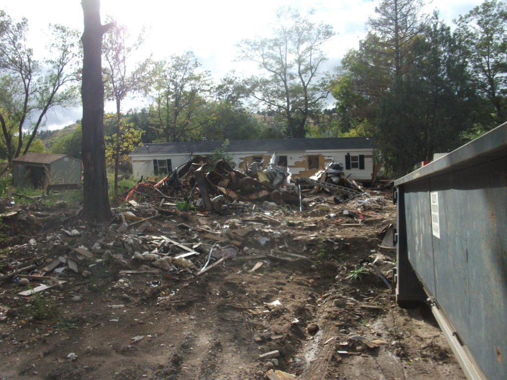
Flooded property in Lyons, Colorado, after the St. Vrain River flooded in September 2013.
There is that old saying that, if it ain’t broke, don’t fix it. To that, one might add that, if you’re thinking about fixing it anyway, you may want to clarify exactly how you wish to improve things and why you think the improvement will be better.
In a February 27 notice in the Federal Register, the Federal Emergency Management Agency (FEMA) proposed a major change in long-standing hazard mitigation rules regarding grants for acquisitions of flooded properties that made almost no effort to meet that test. I wish I had noticed it earlier because the deadline for comments was April 30. I submitted a brief comment on that date and tried to rally others on Facebook, but the truth is that this one got away from me. I was busy on other fronts. I have subsequently spent a few days gathering background information.
Here’s the bottom line: For 30 years since the passage of the Stafford Act, which provides the basic framework of most federal disaster law, federal hazard mitigation grant programs have required that lands being acquired from property owners whose homes have been flooded must be placed into perpetual open space following demolition of the structures. The clear intent is to reduce the ongoing exposure of the federal government and the National Flood Insurance Program to repeated losses by precluding further development in those flood-prone areas. By and large, those grants go through state and local governments, which then maintain those open spaces and must periodically certify to FEMA that the lands remain in that status. Today, those grant programs include not only the Hazard Mitigation Grant Program (HMGP), a sometimes-substantial source of mitigation funding that is available after a presidentially declared disaster; the Pre-Disaster Mitigation (PDM) program, created as part of the Disaster Mitigation Act of 2000, which amended the Stafford Act; and Flood Mitigation Assistance (FMA), part of which deals with Severe Repetitive Loss properties, which make up a disproportionate share of overall flood claims.
In the notice, FEMA has announced a new option to allow owners of flooded properties to retain the underlying land while being paid to demolish the structures, thereby permitting them to eventually rebuild on that same flood-prone land. Because mitigation grants have gone from FEMA through states to local governments, those governments have been responsible for the open space programs that result. This new approach would allow the property owner the option of taking the grant directly from FEMA. In its comments on the proposal, ASFPM noted that, in the 2004 NFIP reform legislation, it supported providing FEMA the option to deal directly with property owners, mostly because some local governments have lacked the capacity to monitor the open space requirements, but it still expected that FEMA would consult with those governments before using that option as a means of maintaining consistency with state and local hazard mitigation policy. The current notice makes no mention of such coordination.
Elevation of flooded properties remains a viable option in many cases.
It is not as if these owners do not have other options for mitigating future flood damage, including elevation of residential structures above the 100-year base flood elevation established on FEMA flood insurance rate maps, or floodproofing the structure. But, the thinking seems to be, some owners will be more willing to demolish if they can retain the land. One possibility for some might be to retain the land, rebuild in due course, and flip the improved property while leaving the NFIP with continued flood loss exposures. How that helps federal taxpayers or other flood insurance rate payers is not especially clear.
The Federal Register announcement does nothing to make that clear. If you follow the link and read the notice, you are likely to experience my reaction, which was that I felt left in the dark regarding the rationale for making this move, which is not explained. Nor does FEMA provide any data to support the idea that this initiative would do anything to reduce flood losses. The opposite could easily prove true.
In an April 26 article in Insurance Journal, former FEMA administrator Craig Fugate offers some support for the new option by noting that placing land in permanent open space through a buyout is often a “hard sell.” That may well be, but it is partly because the solution is meant to be effective and lasting. It is also not as if the approach has lacked success. As NRDC notes in its comments, citing ASFPM case studies, more than 30,000 floodplain properties have been removed from development since 1993, many of them following major cataclysms such as the 1993 and 2008 Midwest floods and various hurricanes.
Perhaps more telling is the question of homeowners’ motivation in making the difficult decision to sell and relocate. The idea that people would necessarily prefer to be able to rebuild in the same location is not as clear or straightforward as some might assume, though there are, no doubt, advocates of property rights who would prefer to create the new option. But this emotional decision contains some factors that should not be ignored. Perhaps straight to the point is this comment from American Rivers:
Our experience working with floodplain managers has taught us that convincing property owners to accept a buyout is an emotional and difficult decision, and many are only willing to accept the buyout offer after they are assured that the property will be preserved as open space for the good of the public. Offering direct grants that allow new construction where a structure was demolished could be at odds with local hazard mitigation plans and efforts to acquire flood prone properties for open space. FEMA should instead be working to support the implementation of open space goals in local and state hazard mitigation grants.
In other words, many of those choosing a buyout, having suffered the damages of severe and repetitive losses from flooding, and aware of the larger issues concerning the public good in these situations, would rather ensure that nothing like this happens again, at least in their community. But what happens to the motivation undergirding their willingness to sell if they become acutely aware that their neighbors now have the option of prolonging the pain by not placing the land in permanent open space? Will they still feel that they are accomplishing anything by pursuing the traditional option? In any event, are these not the people whose choices we most want to honor for the greater good of the community?
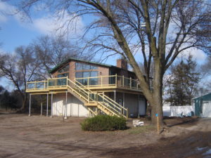
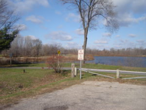
City-acquired open space in Cedar Falls, Iowa, near the Cedar River.
The essential reason all this is important is that we have learned much over the years about the natural and beneficial functions of floodplains, which include soil enrichment, wildlife habitat, reduced flood severity, and reductions in erosion and stormwater runoff, to name a few, in addition to the potential recreational functions of waterfront parks and open space. All this is in addition to the fiscal benefits of reducing future floodplain losses in the areas affected. If all that is not reason enough for FEMA to pause, rethink the question, and at least offer some solid scientific and economic documentation of the benefits of the proposed new approach, then I am not sure what is. Otherwise, count me a serious skeptic.