Disaster Mitigation Act at Twenty

When a law makes a powerful impact over time, it is sometimes hard to remember what life was like before it was enacted. In U.S. history, for example, both Social Security and, later, Medicare, created a new reality for the elderly that makes it almost impossible for most people to imagine what old age meant before they took effect. They are so much a part of the fabric of American life that some people even forget (or never learn) the social and political debates that produced them. That sort of obtuse amnesia was in evidence as Tea Party protests materialized in response to the Affordable Care Act, aka Obamacare, in which some carried signs that read, “Keep Your Government Hands Off My Medicare.” Ponder that conundrum for a while.

Few laws match the scale of impact of those two examples, but many have significant impacts that receive less attention, at least among the general public. One that is reaching its twentieth anniversary is the Disaster Mitigation Act (DMA), signed into law by President Clinton on October 30, 2000. After a decade of expensive disasters in the 1990s—Hurricane Andrew (1992), the Midwest floods (1993), the Northridge earthquake (1994), and Hurricanes Fran (1996) and Floyd (1997)—Congress realized that the nation needed greater accountability from states and local governments in addressing hazard mitigation challenges before disasters occurred. The carrot and the stick were combined in this instance in a requirement that states (including territories and the District of Columbia) and local and tribal governments prepare and adopt hazard mitigation plans that won the approval of the Federal Emergency Management Agency (FEMA) as meeting the standards of the act and its accompanying regulations as a condition of eligibility for FEMA hazard mitigation grants. Put simply, no plan, no money. Few state and local officials wish to find themselves in that position after a major disaster.

Congress went one step further. Previously, most such grants came through the Hazard Mitigation Grant Program (HMGP), created under the Stafford Act in 1988, the basic law structuring the federal disaster response system, under which every state has some sort of parallel emergency management agency. The problem with HMGP has always been that the money is made available as part of a presidential disaster declaration, using a percentage of overall disaster assistance to determine the amount available. That money goes to the affected states, which are responsible for local allocations. But that means that a state must experience a natural disaster to be eligible for such money. Admittedly, it then becomes useful for mitigating future disasters, but it did nothing to avert the most recent event. In fact, communities that had become adept at mitigating hazards with their own resources often complained that they got no federal assistance because they were doing too good a job of preventing losses. Davenport, Iowa, for example, long ago refused Army Corps offers to build levees along the Mississippi River and opted for a riverfront park that allowed the water to flow without damaging buildings in its downtown. Davenport has not always avoided flood impacts, but it has certainly minimized them.

In DMA, Congress added a new Pre-Disaster Mitigation (PDM) grant program. Instead of being triggered by disaster declarations, it was an annual grant competition, in which state and local governments submitted proposals for projects that would reduce losses of life and property in future events. Its major flaw was that PDM relied on annual congressional appropriations, which predictably ebbed and flowed and often was grossly underfunded. In 2018, in the Disaster Recovery Reform Act, Congress finally opted to stabilize funding by creating a formula by which six percent of total annual disaster relief outlays would be swept into a single pot by FEMA for grants under a new program that FEMA has labeled Building Resilient Infrastructure and Communities (BRIC), which I discussed in a post here in early August. The resulting 2020 grant funds total roughly $500 million, a far cry from years past when the total congressional allocation was often as little as $25 million, which barely put a dent in the mitigation needs of a nation as vast as the U.S.

But the real question after two decades is, How has DMA changed the landscape of American planning and disaster management? Clearly, we have not solved all problems. For one thing, climate change has accelerated and complicated matters significantly. While Congress unquestionably has dithered a great deal on climate issues, DMA was never aimed directly at climate change. Instead, it aimed to create a climate of state, tribal and local responsibility and accountability for planning for hazard mitigation while making federal funding available to support such planning. In fact, federal assistance for such planning is built into the law. Have governments responded?
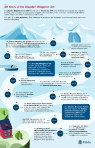
DMA timeline produced by FEMA, reused from FEMA website. To expand, click here.

The unequivocal answer is yes. By 2002, once FEMA had finalized its guidance for the mitigation planning process, Clackamas County, Oregon, became the first local jurisdiction to win approval for its plan. Within a few years, every state and territory had an approved plan in place. Winning compliance from most local jurisdictions understandably took longer, but today FEMA can claim that more than 23,000 local units of government have approved plans, as do 239 tribal governments, which together cover more than 84 percent of the U.S. population. The gaps in coverage are primarily in rural areas, many of which suffer from low governmental capacity—a subject that can still be addressed in future outreach by FEMA—and some of which simply choose not to plan, presumably not seeing the consequences as outweighing the burden of the work involved.

In the meantime, many professional and intergovernmental associations have done considerable outreach to their own members to explain the benefits of hazard mitigation planning beyond simple eligibility for grants. For example, during my tenure at the American Planning Association, we used a FEMA contract to produce a Planning Advisory Service Report on the benefits of integrating such planning throughout the local planning process, including comprehensive plans, capital improvements programming, and the land-use regulations that implement mitigation intentions, such as zoning, floodplain management, and subdivision ordinances. We published Hazard Mitigation: Integrating Best Practices into Planning in 2010. The concept of integrated planning has enjoyed significant increased attention throughout the second decade of DMA and has become a staple of FEMA guidance for local hazard mitigation planning.

There are many ways to review this history, which may even be worth an entire book. As for what we have achieved, the Natural Hazards Center, based at the University of Colorado, asked me to moderate a webinar on October 13. “The Disaster Mitigation Act of 2000: Twenty Years of Promise, Pitfalls, and Progress from a Planning Perspective,” in which I was joined by three experienced and insightful panelists from state, county, and federal government, provides a fast-paced, one-hour summary of the successes, shortcomings, and future challenges of DMA as part of the Center’s Making Mitigation Work webinar series, and the recorded version is available at the link above. I thank NHC Director Lori Peek for having invited me to lead this discussion.

Make it your DMA anniversary experience. Trust me, it will be worth your time.

Jim Schwab

Reducing Risk from Natural Hazards

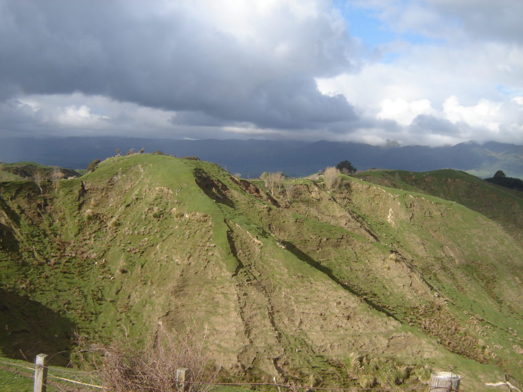
Eroded hillsides have helped push New Zealand to adopt its own approach to risk reduction.

Late in 2017, I received an inquiry from Oxford University Press. Professor Ann-Margaret Esnard at the Urban Studies Institute at Georgia State University had recommended me for an assignment they had in mind to add an article to their growing specialty encyclopedia on natural hazards, the Oxford Research Encyclopedia of Natural Hazard Science. They needed someone to write a peer-reviewed article about “Planning Systems for Natural Hazard Risk Reduction,” using roughly 10,000 words plus appropriate graphics and illustrations. We discussed why they saw me as an appropriate candidate for the job, and I accepted the assignment.

Over the following few months early last year, I spent many hours over several weeks fashioning the article. Although I started out with a clear vision of my subject matter, I also explored and sought more international material than I had ever previously examined. By the spring of 2018, I submitted my draft. Over subsequent months, it underwent editing, peer review, revision, and proofreading, and then final preparation for online publication. Today, I received the announcement. It is online and available to the public.

So, the question for most readers, even those already immersed in the subject matter of natural hazards, is, “What do you mean by planning systems”? Oxford did not venture a specific definition of what they had in mind; they left that to me. I decided that the answer was “essentially a layer of guidance or legal requirements that sit atop plans of any type at any governmental level at or below the source of that guidance.” In other words, the system describes what a plan should look like, or what is expected of a plan that complies with the framework that is established. A planning system is a statutory or programmatic framework for a specific type of plan, in this case, one that aims to reduce losses from natural hazard events.

This had long been important to me. As far back as 2002, while I was at the American Planning Association (APA), I had arranged a contract between APA and the Institute for Business and Home Safety (IBHS) under which APA researched and described state laws that related to planning for natural hazards, updated annually until 2010, when IBHS decided to discontinue the contract. An elaborate matrix detailed which states prescribed planning to address hazards and what they required, suggested, or allowed, supplemented by explanations of specific items in a key code and by color-coded maps. In 2007, I convinced the Federal Emergency Management Agency (FEMA) to underwrite an APA project that examined how communities could better integrate hazard mitigation priorities into local planning processes. The result was a 2010 Planning Advisory Service Report, Hazard Mitigation: Integrating Best Practices into Planning. That has led to elaboration of FEMA guidance on this point, as well as playing a role in more recent guidance to communities from the State of Colorado on resilience, spurred by the September 2013 “mountain monsoon” flooding that afflicted the state. The point is that I have been pursuing this subject for nearly 20 years. I understood why Oxford had approached me for this task.

The encyclopedia article allowed me to expand the subject in new ways, and for those readers curious to explore the topic, I hope it proves useful. Just follow the links in the first paragraph of this post to my article or the encyclopedia more generally, which provides a wealth of knowledge on the larger subject of natural hazards. I hope it provides planners and others in the professional community engaged with natural hazard issues an analytical framework for thinking about how we can tackle these issues.

But that is not all. The concept behind the APA/IBHS work has been revived. Immediately after leaving APA, under a short-term consulting contract, I helped APA prepare a new grant proposal for FEMA’s Cooperating Technical Partners program to revive the state statutory summary in an updated and expanded framework. Although that is not yet complete, PDF summaries of the state-level planning framework for all 50 states are available. Click here for the landing page with an introduction to the overall project. Then stay tuned for the findings and overall summary of the project, which are yet to come.

Jim Schwab

FEMA Needs to Think about This One

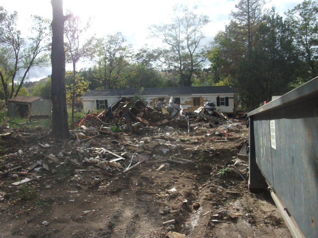
Flooded property in Lyons, Colorado, after the St. Vrain River flooded in September 2013.

There is that old saying that, if it ain’t broke, don’t fix it. To that, one might add that, if you’re thinking about fixing it anyway, you may want to clarify exactly how you wish to improve things and why you think the improvement will be better.

In a February 27 notice in the Federal Register, the Federal Emergency Management Agency (FEMA) proposed a major change in long-standing hazard mitigation rules regarding grants for acquisitions of flooded properties that made almost no effort to meet that test. I wish I had noticed it earlier because the deadline for comments was April 30. I submitted a brief comment on that date and tried to rally others on Facebook, but the truth is that this one got away from me. I was busy on other fronts. I have subsequently spent a few days gathering background information.

I am very glad that a few national organizations like the Association of State Floodplain Managers (ASFPM), American Rivers, and the Natural Resources Defense Council (NRDC) found time to file substantial objections to FEMA’s notice on Property Acquisitions and Relocation for Open Space (Docket ID: FEMA-2018-0006). Their objections raise profound questions about both the process and the substance of FEMA’s proposed changes. Others have also submitted comments.

Here’s the bottom line: For 30 years since the passage of the Stafford Act, which provides the basic framework of most federal disaster law, federal hazard mitigation grant programs have required that lands being acquired from property owners whose homes have been flooded must be placed into perpetual open space following demolition of the structures. The clear intent is to reduce the ongoing exposure of the federal government and the National Flood Insurance Program to repeated losses by precluding further development in those flood-prone areas. By and large, those grants go through state and local governments, which then maintain those open spaces and must periodically certify to FEMA that the lands remain in that status. Today, those grant programs include not only the Hazard Mitigation Grant Program (HMGP), a sometimes-substantial source of mitigation funding that is available after a presidentially declared disaster; the Pre-Disaster Mitigation (PDM) program, created as part of the Disaster Mitigation Act of 2000, which amended the Stafford Act; and Flood Mitigation Assistance (FMA), part of which deals with Severe Repetitive Loss properties, which make up a disproportionate share of overall flood claims.

In the notice, FEMA has announced a new option to allow owners of flooded properties to retain the underlying land while being paid to demolish the structures, thereby permitting them to eventually rebuild on that same flood-prone land. Because mitigation grants have gone from FEMA through states to local governments, those governments have been responsible for the open space programs that result. This new approach would allow the property owner the option of taking the grant directly from FEMA. In its comments on the proposal, ASFPM noted that, in the 2004 NFIP reform legislation, it supported providing FEMA the option to deal directly with property owners, mostly because some local governments have lacked the capacity to monitor the open space requirements, but it still expected that FEMA would consult with those governments before using that option as a means of maintaining consistency with state and local hazard mitigation policy. The current notice makes no mention of such coordination.

Elevation of flooded properties remains a viable option in many cases.

It is not as if these owners do not have other options for mitigating future flood damage, including elevation of residential structures above the 100-year base flood elevation established on FEMA flood insurance rate maps, or floodproofing the structure. But, the thinking seems to be, some owners will be more willing to demolish if they can retain the land. One possibility for some might be to retain the land, rebuild in due course, and flip the improved property while leaving the NFIP with continued flood loss exposures. How that helps federal taxpayers or other flood insurance rate payers is not especially clear.

The Federal Register announcement does nothing to make that clear. If you follow the link and read the notice, you are likely to experience my reaction, which was that I felt left in the dark regarding the rationale for making this move, which is not explained. Nor does FEMA provide any data to support the idea that this initiative would do anything to reduce flood losses. The opposite could easily prove true.

In an April 26 article in Insurance Journal, former FEMA administrator Craig Fugate offers some support for the new option by noting that placing land in permanent open space through a buyout is often a “hard sell.” That may well be, but it is partly because the solution is meant to be effective and lasting. It is also not as if the approach has lacked success. As NRDC notes in its comments, citing ASFPM case studies, more than 30,000 floodplain properties have been removed from development since 1993, many of them following major cataclysms such as the 1993 and 2008 Midwest floods and various hurricanes.

Perhaps more telling is the question of homeowners’ motivation in making the difficult decision to sell and relocate. The idea that people would necessarily prefer to be able to rebuild in the same location is not as clear or straightforward as some might assume, though there are, no doubt, advocates of property rights who would prefer to create the new option. But this emotional decision contains some factors that should not be ignored. Perhaps straight to the point is this comment from American Rivers:

Our experience working with floodplain managers has taught us that convincing property owners to accept a buyout is an emotional and difficult decision, and many are only willing to accept the buyout offer after they are assured that the property will be preserved as open space for the good of the public. Offering direct grants that allow new construction where a structure was demolished could be at odds with local hazard mitigation plans and efforts to acquire flood prone properties for open space. FEMA should instead be working to support the implementation of open space goals in local and state hazard mitigation grants.

In other words, many of those choosing a buyout, having suffered the damages of severe and repetitive losses from flooding, and aware of the larger issues concerning the public good in these situations, would rather ensure that nothing like this happens again, at least in their community. But what happens to the motivation undergirding their willingness to sell if they become acutely aware that their neighbors now have the option of prolonging the pain by not placing the land in permanent open space? Will they still feel that they are accomplishing anything by pursuing the traditional option? In any event, are these not the people whose choices we most want to honor for the greater good of the community?

City-acquired open space in Cedar Falls, Iowa, near the Cedar River.

The essential reason all this is important is that we have learned much over the years about the natural and beneficial functions of floodplains, which include soil enrichment, wildlife habitat, reduced flood severity, and reductions in erosion and stormwater runoff, to name a few, in addition to the potential recreational functions of waterfront parks and open space. All this is in addition to the fiscal benefits of reducing future floodplain losses in the areas affected. If all that is not reason enough for FEMA to pause, rethink the question, and at least offer some solid scientific and economic documentation of the benefits of the proposed new approach, then I am not sure what is. Otherwise, count me a serious skeptic.

Jim Schwab