Digital Coast Act Becomes Real

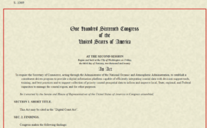
Last Wednesday, December 2, the U.S. Senate passed the Digital Coast Act in a final vote that sent the legislation to President Trump for his signature. If that happens, it may provide a very useful gift to thousands of coastal communities wrestling with a wide variety of coastal zone management challenges.

For more than a decade, the National Oceanic and Atmospheric Administration (NOAA) has sponsored through its Office of Coastal Management a program that has racked up stellar achievements while awaiting congressional blessing of its existence. Digital Coast began as an effort, in collaboration with five nongovernmental partners, to share federal geospatial data and tools with communities in ways that did not require a Ph.D. scientist to interpret them for local government uses.

Geospatial technology, not a familiar term for the average American, refers to “modern tools contributing to the geographic mapping and analysis of the Earth and human societies,” according to the American Association for the Advancement of Science (AAAS). In a coastal context, that includes tools for measuring, projecting, and visualizing sea level rise, as well as monitoring land uses and land cover in coastal areas, and mapping offshore areas as well. The mission of Digital Coast was to make these tools ever more useful for local government planners, resource managers, economic development agencies, and others with some sort of meaningful engagement with coastal issues and data.

Why is that important? For starters, because more than half of the U.S. population now lives in counties along either an oceanic or Great Lakes coast, and that percentage is growing. It matters greatly where these counties, and their cities, allow new development, how they court economic growth, and how they manage coastal resources, including marine life, tidal wetlands, and offshore resources, as well as ports and near-shore transportation. These coastal areas are huge drivers of the overall U.S. economy, and better data, and better access to data, will deeply affect the American future.

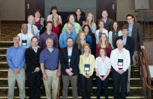
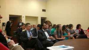
Digital Coast partners and staff at a 2015 meeting. I am at front row, right. 

Improving that access and making tools easier to use, and data more understandable, has been the mission of the Digital Coast Partnership that was assembled from 2008 on, initially with five organizations: Association of State Floodplain Managers (ASFPM); The Nature Conservancy (TNC); National Association of Counties (NACo); National States Geographic Information Council (NSGIC); and Coastal States Organization (CSO). In the summer of 2010, the American Planning Association joined the partnership, an initiative I led as manager of APA’s Hazards Planning Center. Allison Hardin, a planner for the city of Myrtle Beach, South Carolina, and immediate past chair of APA’s Hazard Mitigation and Disaster Recovery Planning Division (which I now chair), reports that in 2009, she vigorously advocated for the addition of APA. At the time, Allison, a certified floodplain manager, was helping to represent ASFPM in the partnership. Today, there are eight nongovernmental partners, all of which serve as links to professional user communities to ensure widespread uptake of the data, tools, and resources available from Digital Coast. The two additions have been the Urban Land Institute and National Estuarine Research Reserve Association.

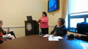
Allison Hardin speaking at Capitol briefing. 

So, what difference does statutory authorization of Digital Coast make? According to John Palatiello, president of John M. Palatiello & Associates, Inc., a government relations and association management firm representing the surveying, mapping, GIS, and geospatial community, which helped lead the effort to get the act passed: “The Digital Coast Act will enable NOAA to partner with other government entities and the private sector to help protect and promote America’s coasts and shorelines. This legislation creates a program to utilize the extensive capabilities, competence, and qualifications of private sector geospatial professionals to provide the surveying, charting, remote sensing, and geospatial data of America’s coasts, harbors, ports, shorelines and ocean resources for economic growth, recreational activities, conservation, and resilience of our fragile coastal environment.” Put more simply, the new law stabilizes the authorization and budgetary support for Digital Coast within NOAA. There were times in the past when this was less than a sure thing. Now, its codification makes its program status official.
Digital Coast Act briefing, with NOAA Digital Coast staff Miki Schmidt (left) and Josh Murphy (right), standing near door.

But Digital Coast, I can attest from personal experience, has a remarkably astute and dedicated professional staff in love with public service. The Act itself begins with this finding: “The Digital Coast is a model approach for effective Federal partnership with State and local government, nongovernmental organizations, and the private sector.” It goes on to note, a few paragraphs later, some of the needs that Digital Coast can help address, including flood and coastal storm surge prediction, hazard risk and vulnerability assessment, and community resilience, as well as ecosystem health. I applauded the program more than six years ago on this blog.
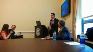
Briefing at the Capitol: APA Policy Director Jason Jordan at the mike; ASFPM Executive Director Chad Berginnis to his right.

It is important to note that this legislation is not the product of some recent brainstorm, but of a slow, steady process of building support, starting with a handful of legislators from both parties who saw its value. Perhaps most notable was Sen. Tammy Baldwin (D-WI), accompanied in the House by Rep. Dutch Ruppersberger (D-MD), who noted in a press release that he had been advocating such action for nearly a decade. But Republican support came from Rep. Don Young (R-AK) and Sens. Lisa Murkowski and Dan Sullivan, both of Alaska, the state with by far the longest coastline. All of them, along with the Digital Coast partners, plus the indefatigable John Byrd of MAPPS, pushed relentlessly, year after year, to find the support necessary to move the bill across the legislative goal line. They have at last succeeded.

Jim Schwab

Gratitude on Parade #3

GRATITUDE ON PARADE
#gratitudeonparade
[Partners of] the National Oceanic and Atmospheric Administration‘s Digital Coast program are hosting a meeting in Washington, D.C., today of the Digital Coast Partnership, an assortment of eight national nonprofit organizations willing to support geotechnical services to coastal communities across the U.S. The Digital Coast staff have been leading this effort for more than a decade, and the result is better decision making on coastal land use and resource management among the communities using Digital Coast tools and resources.

I attended these meetings and participated in Digital Coast projects until I left the American Planning Association, one of those partners, in 2017. But as of 2010, when APA joined the partnership, I found the entire enterprise a magnificent example of positive federal engagement with local governments and user communities in need of better data and easier ways to access data. And I made some fast friends because of the quality of the staff.

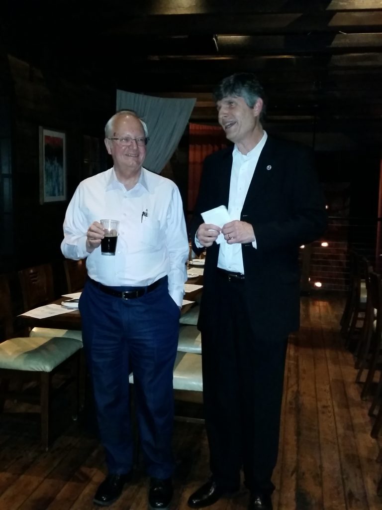
Leading that effort was one remarkable human being, Miki Schmidt, who has been with NOAA that entire time. Miki has a positive, can-do attitude, and helped me learn a great deal about what positive federal outreach could look like. We had numerous valuable conversations about how to move forward, and Miki repeatedly expressed his gratitude to APA for becoming part of the entire effort. But he deserves recognition for doing a top-notch job year after year, and empowering a staff that couldn’t be better. Near the end of my era, also, as depicted in the photo below, he organized a retirement “roast” at a restaurant during a NOAA Coastal GeoTools Conference. I could not have asked for a nicer tribute.

James Schwab CORRECTION: I did not realize that NOAA was caught up in the federal government shutdown and NOAA staff are not present at the meeting mentioned in the first sentence. it is a tribute to the success of the partnership, however, that the National Association of Counties, one of the partners, is hosting and the partners are proceeding with the meeting on their own. I just did not realize that was the case. Let us all hope that, one day, these shutdowns will be a thing of the past that is no longer an acceptable practice.

Miki, at right, prior to dinner that included a retirement roast.

Posted on Facebook 1/15/2019

GRATITUDE ON PARADE
#gratitudeonparade
I am not done singing the praises of Digital Coast nor of expressing my gratitude to outstanding staff of that program. If I had an opportunity to nominate someone for Liaison of the Year, someone with an outstanding sense of customer relations, it would surely be Susan Fox, who actually works with the Baldwin Group on behalf of NOAA, and has served for several years as a Digital Coast liaison with the American Planning Association. I had the honor to work with her while managing APA’s Hazards Planning Center into 2017. She is enthusiastic, positive, very well-organized, and incredibly supportive. Just like Miki Schmidt, about whom I wrote yesterday, she is a pillar of the Digital Coast program. Thank you, Susan, for all you do.

Susan in Manhattan for dinner during APA National Planning Conference, 2017.

Posted on Facebook 1/16/2019

GRATITUDE ON PARADE

#gratitudeonparade

Continuing with my tributes to Digital Coast staff, I must now know mention the invaluable Josh Murphy, who works from NOAA’s headquarters in Silver Spring, Maryland. Josh was the creative soul who helped negotiate a HUD-funded, NOAA-sponsored project led by AECOM but involving Digital Coast partners (APA, NACo, ASFPM) to work with two pilot communities (Brevard County, FL, and San Luis Obispo County, CA) to help operationalize concepts for integrating resilience and hazard mitigation priorities into the local planning process. This is rather advanced stuff and requires some real skill to manage, but we all did it together, advancing the frontiers of planning. And we had Josh to thank for making it all possible. He is one of NOAA’s truly valuable assets.

Courtesy of Shannon Burke

Posted on Facebook 1/17/2019

GRATITUDE ON PARADE
#gratitudeonparade
As I complete this round of gratitude to Digital Coast staff, I wish to make clear that there are many others at NOAA for whom we should all be grateful beyond those I have highlighted. But I do want to close by mentioning the remarkable Lori Cary-Kothera, whose consistent demonstrations of enthusiasm, high intelligence, and dedication have also helped the partners to succeed in their efforts both to support the Digital Coast program and to advance their own respective projects and services to coastal communities. Lori is one of those rare people you can count on for positive advice and support. She is also a welcome beacon of warmth and humanity.

Courtesy of Shannon Burke

Posted on Facebook 1/18/2019

Jim Schwab

Aligning Planning and Public Health

Just nine days ago, on November 15, I stood in front of two successive audiences of long-term health care practitioners to present workshops at a conference in Wisconsin Dells discussing, of all things, “Fundamentals of Planning for Post-Disaster Recovery.” Where, some might ask, is the nexus between these two subjects?

Patients who survived evacuations from New York City area hospitals, six in the city itself and one just outside, during Hurricane Sandy would know. People with disabilities, the elderly, the ill are especially vulnerable during disasters, and moving them out of harm’s way is no picnic. They cannot just grab the keys to their cars and drive out of town ahead of the storm. Evacuating them is a major undertaking that must be well-planned.

And so, our fields of expertise converged. I discussed what I knew from urban planning, but I invited input from their experiences in handling such situations. Some had not yet experienced a disaster, but others had, and their numbers in the health care field are growing, as doctors and nurses find clinics and hospitals impacted by wildfires in California, and hurricanes, floods, and tornadoes elsewhere. Mine was not the only presentation related to such concerns. The keynote by Desiree Matel-Anderson, founder of the Field Innovation Team and a Federal Emergency Management Agency (FEMA) advisor, detailed personal interactions with disasters. Others focused on emergency management. The audience needed to know about new regulations and laws, such as those promulgated in 2016 by the Centers for Medicare and Medicaid Services (CMS) or the Disaster Recovery Reform Act (DRRA), passed in October as a

Photo by Kristina Peterson

rider on the FAA Reauthorization Act. DRRA outlines new responsibilities for the FEMA administrator in providing training to local officials and utility providers in planning for emergencies for nursing homes, clinics, and hospitals, and for the Federal Highway Administration regarding evacuations for these facilities, prisons, and certain classes ofdisadvantaged persons. I told the nurses and administrators in my audience they needed to prepare for these new responsibilities. There seems to be a growing conviction in Congress and federal agencies that health care institutions need to be better prepared to protect their patients during disasters. In the light of events dating back to Hurricane Katrina, that does not seem unreasonable.

To some extent, I believe it is the growing engagement of the urban planning profession with natural hazards that is facilitating a re-engagement of the profession with public health practitioners. I say “re-engagement” because the two fields grew up together, at least in North America. In the late 1800s and early 1900s, industrializing, rapidly growing American cities were often festering incubators for diseases because of pollution, overcrowding, and fire and other hazards. The Great Chicago Fire of 1871 laid the groundwork for major reforms related to building codes, helping to create the largely masonry-based architecture now predominant in the city. Activists like Jane Addams inveighed against oppressive health conditions for the working class. There was an urgent need for both better planning and public health measures that would prevent the spread of disease, and the two professions matured accordingly. At the same time, civil engineers took growing responsibility for developing the sanitary infrastructure cities needed, such as sewer treatment systems and effective drainage, a topic I addressed in a keynote in September 2015 in Boston for the American Society of Civil Engineers’ Coasts, Oceans, Ports and Rivers Institute (COPRI) annual conference. All three professions grew up in the same cradle, addressing urgent societal needs for health care, better urban design, and public sanitation.

Scene on the Jersey Shore after Hurricane Sandy.

All of this is a long, but I think crucial, introduction to a book by Michael R. Greenberg and Dona Schneider, Urban Planning & Public Health: A Critical Partnership, published by APHA Press. I had planned to review it earlier, but recent events expanded the context for its importance. Greenberg, a long-time planning colleague and professor at Rutgers University in New Jersey, previously authored Protecting Seniors Against Environmental Disasters (Routledge, 2014), a book inspired in part by his own experience with elderly parents during Hurricane Sandy. He is certainly familiar with the territory. Schneider, also at Rutgers, brings the perspective of a public health expert.

The book reads mostly like a textbook and thus may be of most valuable to instructors willing to acquaint students in both fields with their organic relationship to each other and why the partnership is important today. Admittedly, the problems are not the same. We no longer face the scourge of tuberculosis, and smokestacks no longer belch particulates as freely as they once did. The water is less polluted. But our society is creating other problems of a momentous nature, including climate change and the resulting increased severity of weather-related disasters. Under the Trump administration and various less environmentally friendly state administrations, there have been concerted efforts to retreat from previous initiatives aimed to clear the skies and foster environmental justice. It is thus imperative that we have trained, knowledgeable, and articulate professionals who can advocate for the public interest when powerful political forces push in other directions.

The book makes powerful arguments in this context for the salience of a collaborative assault on the threats posed to our communities by natural hazards, using the tools of both public health and planning to analyze the threats and identify meaningful solutions. Not everything needs to happen at a macro level, either; in fact, planners and public health officials often are at their best in examining trends at the neighborhood and community level to find very geographically specific solutions to localized but persistent problems.

The authors are methodical, laying a groundwork in the first three chapters for understanding the building blocks of the two professions and their integral relationships. One can easily detect the influence of Greenberg’s long and distinguished career on both a practical and theoretical level as he discusses the impacts of various approaches to zoning, such as the use of downzoning to protect open lands and natural resources and the use of special districts, as in Austin, Texas, to protect the environmentally sensitive Edwards Aquifer through measures such as integrated pest management practices, which reduce the use of toxic chemicals that can enter the water supply. And the connection to natural disasters? Even recent history has revealed the vulnerability of Texas to prolonged drought, making the protection of water supplies essential to public health and welfare.

Recognizing the modern context for their focus on this “critical partnership,” the authors have included significant material on the role of risk and hazard mitigation analysis in planning, with a whole chapter on “Keeping People Out of Harm’s Way.” As with much of the book, it leads students on a path through the critical minutiae of planning and public health analysis, including case studies at various levels of analysis—for example, a brief but close look at the Galveston City Hazard Mitigation Plan.

Other sections address critical current issues such as the availability of healthy foods in poor communities, and how that can be addressed through laws, community organizations, and better resources; how to redevelop safe community assets from former brownfield sites; and potentially evaluating the benefits and drawbacks of major regional development proposals. In short, this is not bedtime reading for most laypeople, but it is solid instructional material for aspiring young professionals and may be useful as well to community advocates who are willing to learn the nuts and bolts of using planning to achieve better public health results in their neighborhoods and communities. As such, it is a timely and needed addition to the literature.

Jim Schwab