Podcast on Hawaii Volcano Recovery

Volcanoes pose a unique challenge for hazard mitigation and post-disaster recovery in the parts of the world where they occur. In the United States, these regions are along the Pacific Rim and in the middle of the ocean itself—in other words, the Pacific Northwest, Alaska, and Hawaii. In Hawaii, an archipelago that grew from volcanic eruptions over millions of years, all active volcanoes are located on the island of Hawai’i, also known as the Big Island because, as Hawai’i County planner Douglas Le notes, the land area of all the other major islands could be fit into this one land mass.

As I have done with previous installments of the American Planning Association’s Resilience Roundtable podcast series, for which I have been host for the last year and a half, I am providing this brief introduction with a link to the podcast on the APA website. The series is sponsored by the APA Hazard Mitigation and Disaster Recovery Planning Division, of which I am currently chair.

The subject of this podcast is Hawai’i County’s planning for recovery from the numerous impacts of the 2018 Kilauea volcanic eruption, which buried homes in its path and disrupted life in several subdivisions on a largely rural and agricultural island. The issues involve displacement, social equity, native land rights, environmental quality, and economic recovery, to name a few. Please take time to listen to this 52-minute exchange between me and Douglas Le, disaster recovery officer for the county planning department, and learn more than you may have imagined about how planning can help address this fascinating problem.

Click here to listen.

Jim Schwab

Climate Solutions, Off the Shelf

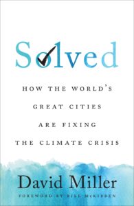
About six weeks ago, as the Biden administration was first asserting its priorities regarding climate change and the environment, I reviewed a book about the positive actions already being taken by cities around the world in addressing the climate crisis. The important takeaway was that, while climate policy languished or moved backwards under the Trump administration, cities and their mayors had not waited for national governments to act. They had instead taken the initiative.

But city governments are not alone. Architects, planners, engineers, and even developers have innovated in their own ways. In late 2019, Chicago architect Douglas Farr provided me with a copy of his book, Sustainable Nation: Urban Design Patterns for the Future, and I promised to review it. It is a sizeable, oversize, 400-page tome, but don’t let that intimidate you, even if I got sidetracked for numerous reasons and only a year later decided to devour the book from cover to cover. That is not necessary for everyone. The book functions much like an encyclopedia, reference work, or anthology. Farr solicited specialized contributions from numerous practitioners and experts. Pick a chapter, pick your favorite subtopic, or dive in randomly. You won’t fail to learn something, as I did, despite my general familiarity with Farr’s subject matter.

My timing in finally reviewing the book has proven fortuitous, in a way. It allows me to expand the message of the review of David Miller’s Solved, a much shorter book by a single author. Miller essentially is a success storyteller; Farr is a documenter. Both serve a purpose.

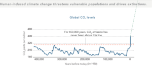
For 650,000 years, global carbon dioxide emissions have never been above the read line. They are now. All graphics courtesy of Farr Associates

Farr starts his book with a “Where We Are” section that includes color-coded maps documenting the huge disparities around the world in longevity (50-59 years in much of Africa, 70-79 in the U.S., above 80 in Japan, Australia, Canada, and Europe, in poverty, gender inequality, and so forth. A simple chart of global CO2 levels demonstrates that, within our lifetimes, we have nearly doubled atmospheric carbon dioxide concentrations to levels not seen in the last 650,000 years. A parade of such graphics makes clear that ours is a planet on a collision course with natural reality.

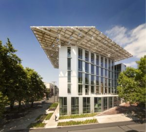
The Bullitt Center. Copyright Nic Lenoux for the Bullitt Center.

But such searing images also clarify the importance of examples of what can be done. Farr leads us to the specific example in Seattle of the Bullitt Center, which he terms the “most sustainable office building in the world.” Composting toilets use an average of two tablespoons of water per use. There are no parking spaces, but there is 243 square meters of rooftop green space. The Bullitt Center earned designation as one of the first eight buildings to achieve full certification under the Living Building Challenge, and the first office building.

But no one in Seattle wants it to retain such titles. They would rather see new buildings and new developments claim new titles and surpass the Bullitt Center’s achievements as we move toward an entire new sustainable society. Farr takes us from “our default world” to “our preferred future,” with a procession of examples of how this can be done, then leads readers to a theory of change that discusses how we make change happen, over what timelines, and how we can step on the gas with “acceleration strategies” to make practical impacts on climate change happen more quickly.

But it is in the final section, “The Practice of Change,” which dominates more than half the book, where Farr enlists a variety of expert contributors to share the methods and designs that will carry us forward to reduce climate impacts and ultimately create a more livable society. This is not just about innovative building design but about human relationships. Mary Nelson, president and CEO emeritus of Chicago’s Bethel New Life Inc., and one of the pioneers of Chicago neighborhood change whom I most admire, discusses how we build strong relationships between people and place (spoiler alert: it involves hard work). Others describe the value of participatory art in communities or the need to transform public spaces into welcoming places (Fred Kent, president, Project for Public Spaces). Get the point? Architectural or planning solutions that have no human connection of involvement beyond an elite are dead letters in promoting real social change that will have any impact on our climate crisis. It’s all about us, whether the subject is local food culture, local planning checkups, ore re-envisioning underutilized space to promote equitable prosperity. Every single example has its champion in this book, someone who has worked on solutions and involved people in finding answers.

For a moment, I’d like to focus on contributions by two colleagues with whom I have worked, David Fields and Tom Price, to make the point. Fields is a veteran transportation planner now working in Houston as the city’s chief transportation planner, who discusses how elements of the urban setting such as residential density and mixed land uses that put homes within walking distance of retail, or put homes above ground-floor retail, can reduce vehicle trips by up to 90 percent, thus helping to reverse the tremendous negative impact of the automobile on the world’s climate, to say nothing of air quality. Price, on the other hand, is a civil engineer, instructs us on how to use “every project as an opportunity to process rainwater and stormwater,” while demanding beauty through improved design. His articles remind me of a lesson I learned years ago, after Hurricane Katrina, through a project in New Orleans called the Dutch Dialogues, in which the American Planning Association and others engaged with Dutch planners and engineers to promulgate the idea of seeing water not as the enemy but as a resource for enhancing urban quality of life. We need to find ways to help move water elegantly through the city instead of constantly finding ways to bury it, hide it, or divert it.

Whether the subject is community theater, transportation, or architectural styles that build housing affordability and reduced heating and cooling demands to reduce greenhouse gas emissions, the overall point is not only repetitive but cumulative: For many of the challenges that climate change poses to our communities, we already know the answers if we are willing to explore the most innovative, effective, and creative approaches that others have already used. Yes, we have a new administration willing to rejoin the Paris climate accord and invest in solutions to climate change. That is important, as we need to push envelopes constantly and with urgency. But we dare not ignore the answers that are all around us in the innovations that are already helping our communities adapt to a carbon-neutral, democratic, more equitable future. They embody the lessons that, through replication, will accelerate our shift to a green future that eases the existential climate crisis of our planet.

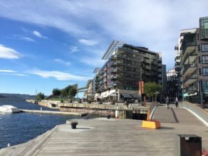
The sweet-spot scale in action in Oslo, Norway. Copyright Jason F. McLennan.

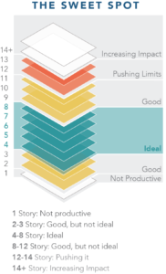
Perhaps two points in Farr’s book, side by side, will help illuminate the point. One is a segment by Jason F. McLennan, founder of the Living Building Challenge. He defines something he calls the “sweet spot” in the sustainable urban fabric, buildings between four and eight stories high. These are buildings not so high as to isolate people on upper floors from fellow human beings at ground level. The building is also not so tall that reliance on energy-consuming elevators drives high energy demand for the building merely to function. There is a place for taller buildings, but the combination of density and manageable energy demand with the potential to minimize demands on the environment exists in that “sweet spot.” Subsequent examples in the same section

The sweet spot defined. Modified by Farr with permission from Jason F. McLennan.

proceed to elaborate on ways we already know to produce affordable, carbon-neutral housing. At the end of the book, in contrast, Farr makes his plea, in large part to fellow architects, to “end the race to build the world’s tallest building,” detailing the negative effects of such edifices on public health, safety, and welfare, and ending with a quote from Sherrilyn Kenyon, “Just because you can doesn’t mean you should.” Indeed. That is the fundamental point of stranded carbon, that is, leaving fossil fuels unburned, in the ground, and shifting to a renewable energy economy.

Much of the secret of achieving this goal lies in knowing when to stop doing the wrong things and how to enable our society to do more of the green things. This being merely a blog post, I cannot attempt to share all the specific points Farr and his contributors make concerning street design, building envelopes, solar power, social equity, and commitment to environmental health. But I can urge you to seek out his book, in a library, online, or in a bookstore, to find the examples you need for the situation your own community faces in crafting a more sustainable future. This is the activist’s and practitioner’s manual to help get you started. Let’s all engage in some creative thinking and problem solving.

Jim Schwab

Practical Approaches to Climate Change

One of the more remarkable facets of the political debate over climate change is the almost knee-jerk rejection among conservative skeptics of the science is that they abandon the same can-do spirit of capitalism that they would otherwise adopt when defending the ability of the private sector to solve other problems. Confronted with the necessity of worldwide action to reduce the global disturbances that are driving increased weather volatility and more powerful disasters, they suddenly are filled with doubt about the ability of either public or private sectors, or both together, to successfully shift our energy consumption to less carbon-intensive solutions. They become, in short, the “cannot-do” crowd. Suddenly, there are massive technological and economic obstacles to converting the world economy to solar energy, wind power, geothermal, and just about any energy solution that does not involve fossil fuels.

They suddenly cease to be the advocates of practical problem solving. They must then cover this logical inconsistency by insisting that there is no problem to solve. When science demonstrates otherwise, massive volumes of science such as reports of the Intergovernmental Panel on Climate Change, the National Climate Assessment, and numerous other sources, walls of doubt are constructed that soon take on dimensions of absurdity. I even had one relative tell me that scientists find evidence of climate change because that is what funders want, and if we only stopped funding the research, perhaps the truth would emerge. He was not joking.

With a spate of executive orders on climate having been issued by President Joseph Biden’s White House since taking office, this seems like an ideal time to highlight a book I recently completed that focuses on practical solutions. I had intended to read and review Solved: How the World’s Great Cities Are Fixing the Climate Crisis (University of Toronto Press, 2020) before the holidays, but perhaps now, with the Biden inauguration behind us, is the best time to introduce this work by David Miller, former mayor of Toronto, the largest city in Canada.

Biden’s executive orders focus, of course, on federal actions he can take immediately without Congress, such as rejoining the Paris Climate Accord and reinstating EO 13690, an Obama executive order that established the Federal Flood Risk Management Standard, which President Trump had rescinded in 2017. I am glad to see this guidance reestablished.

David Miller, former mayor of Toronto. Photo borrowed from Wikipedia.

But there is a much larger point that I wish to make by highlighting Miller’s book. It is that many of the solutions this nation and world so badly need as a means of reversing the deleterious impacts of climate change not only already exist but are actively being pursued or implemented by cities throughout the world. Municipal governments have in many cases become the can-do laboratories, often with the help of private-sector partners who are also committed to creating a sustainable economy, without necessarily waiting for more sluggish national governments to act. We do, of course, want the U.S. and other national governments to act because what they do matters. But the blueprint for solving many climate challenges with infrastructure initiatives is readily available.

Miller’s book follows a standard formula of briefly introducing us to what various cities, including Toronto, have been doing over the past two decades to reduce their carbon footprints while making urban areas more appealing and convenient places to live. In separate chapters describing creative local initiatives around energy and electricity; existing and new buildings; public transportation; personal and other transportation; and waste management, Miller walks us through major projects undertaken in a variety of cities around the world.

But he starts with a chapter about the importance of plans and why they matter, for which the answer in part is that they demonstrate commitment on the part of city leadership to articulate climate challenges and then outline solutions with target dates for meaningful accomplishments. He notes that, in a two-week period in April 2019, Los Angeles, New York, and Vancouver all launched climate plans “whose ambitions matched the requirements of science” but also, in the first two cases, recognized that climate change is “inherently unjust” and that “issues of equity and inclusion must be addressed by the plan if it is to succeed.” The importance of cities is that planning is integral to the role of city governments, which manage numerous functions that are both close to the ground and require integrated strategies to ensure that the work moves forward in a cohesive fashion. As an example, he cities the need in Toronto at one point to alter a particular bylaw to ensure the issuance of permits for solar thermal heating installations. Attention to details of a highly practical nature is the essence of success. They are what cities do, or should, anyway.

That attention to detail, however, can help create a roadmap for federal and state or provincial initiatives, which is one reason that presidents like Biden often recruit mayors for cabinet and other programmatic positions where such practical experience can help shape success at a larger scale. They are not the only people who can provide a practical perspective, and not all do, but those who have experimented in addressing practical climate-related problems can be valuable problem solvers.

In the arena of energy, Miller cites the example of Austin, Texas, which plans by 2022 to end the use of coal for electric power production, but needs energy that is “flexible, reliable, and predictable,” which has meant expanding renewable sources but also looking at storage mechanisms ranging from batteries to thermal storage to compressed air. Subsidies and incentives for residential homeowners support installation of rooftop solar energy, but Austin Energy is also helping the city meet its goal of 65 percent generation from renewables by 2025 with industrial-scale solar installations and wind energy. Municipal utilities such as that in Los Angeles have additional latitude to help cities meet such commitments.

Cities vary, as does the mixture of their greenhouse gas emissions. In a city as dense as New York, for example, transportation becomes a smaller proportional contributor because so many people rely on mass transit or simply walk. Buildings, on the other hand, which are often massive consumers of electricity and natural gas, contribute 73 percent of New York’s greenhouse gas emissions, compared to 21 percent for transportation and 5 percent for waste. But building upgrades such as more efficient water heaters, heating systems, and insulation make a huge difference. Miller details how New York, under Mayor Michael Bloomberg, tapped market forces, including disclosure and training to make inefficiencies more visible, and mandates through permitting systems, to drive positive change. The goal, he says, is net zero emissions by 2050 and a 40 percent emissions reduction from 2005 levels by 2030.

One could go on with numerous examples from the transportation and waste management sectors, and Miller does, but the point is that, despite the need to reverse much of the negative policy direction of the Trump years and set bold climate goals for the future, many of the solutions already exist. In many cases, national governments, including the U.S. federal government, can closely study what their cities are already accomplishing, or have accomplished, and adapt those solutions to a larger scale, making the results and their feasibility clearer and more visible.

Still, this is not subject matter for Pollyanna types, but for pragmatists willing to roll up their sleeves. As Anne Hidalgo, the mayor of Paris, home of the Paris Climate Accord, notes in her afterword, “We have shown the world the potential for city-based action to dramatically lower greenhouse gas emissions and get the world on track to halve emissions by 2030. However, we must be realistic: our goals will take significant time and effort to achieve.”

No better time to start than now. That part, at least, seems perfectly clear to the new Biden administration. Little more than a week into his term, they seem to be moving quickly.

Jim Schwab

Digital Coast Act Becomes Real

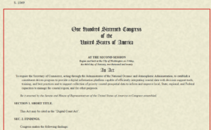
Last Wednesday, December 2, the U.S. Senate passed the Digital Coast Act in a final vote that sent the legislation to President Trump for his signature. If that happens, it may provide a very useful gift to thousands of coastal communities wrestling with a wide variety of coastal zone management challenges.

For more than a decade, the National Oceanic and Atmospheric Administration (NOAA) has sponsored through its Office of Coastal Management a program that has racked up stellar achievements while awaiting congressional blessing of its existence. Digital Coast began as an effort, in collaboration with five nongovernmental partners, to share federal geospatial data and tools with communities in ways that did not require a Ph.D. scientist to interpret them for local government uses.

Geospatial technology, not a familiar term for the average American, refers to “modern tools contributing to the geographic mapping and analysis of the Earth and human societies,” according to the American Association for the Advancement of Science (AAAS). In a coastal context, that includes tools for measuring, projecting, and visualizing sea level rise, as well as monitoring land uses and land cover in coastal areas, and mapping offshore areas as well. The mission of Digital Coast was to make these tools ever more useful for local government planners, resource managers, economic development agencies, and others with some sort of meaningful engagement with coastal issues and data.

Why is that important? For starters, because more than half of the U.S. population now lives in counties along either an oceanic or Great Lakes coast, and that percentage is growing. It matters greatly where these counties, and their cities, allow new development, how they court economic growth, and how they manage coastal resources, including marine life, tidal wetlands, and offshore resources, as well as ports and near-shore transportation. These coastal areas are huge drivers of the overall U.S. economy, and better data, and better access to data, will deeply affect the American future.

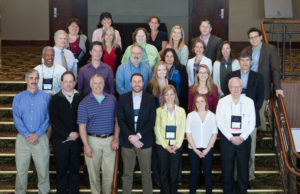
Digital Coast partners and staff at a 2015 meeting. I am at front row, right. 

Improving that access and making tools easier to use, and data more understandable, has been the mission of the Digital Coast Partnership that was assembled from 2008 on, initially with five organizations: Association of State Floodplain Managers (ASFPM); The Nature Conservancy (TNC); National Association of Counties (NACo); National States Geographic Information Council (NSGIC); and Coastal States Organization (CSO). In the summer of 2010, the American Planning Association joined the partnership, an initiative I led as manager of APA’s Hazards Planning Center. Allison Hardin, a planner for the city of Myrtle Beach, South Carolina, and immediate past chair of APA’s Hazard Mitigation and Disaster Recovery Planning Division (which I now chair), reports that in 2009, she vigorously advocated for the addition of APA. At the time, Allison, a certified floodplain manager, was helping to represent ASFPM in the partnership. Today, there are eight nongovernmental partners, all of which serve as links to professional user communities to ensure widespread uptake of the data, tools, and resources available from Digital Coast. The two additions have been the Urban Land Institute and National Estuarine Research Reserve Association.

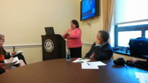
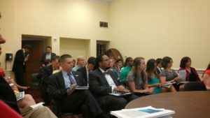
Allison Hardin speaking at Capitol briefing. 

So, what difference does statutory authorization of Digital Coast make? According to John Palatiello, president of John M. Palatiello & Associates, Inc., a government relations and association management firm representing the surveying, mapping, GIS, and geospatial community, which helped lead the effort to get the act passed: “The Digital Coast Act will enable NOAA to partner with other government entities and the private sector to help protect and promote America’s coasts and shorelines. This legislation creates a program to utilize the extensive capabilities, competence, and qualifications of private sector geospatial professionals to provide the surveying, charting, remote sensing, and geospatial data of America’s coasts, harbors, ports, shorelines and ocean resources for economic growth, recreational activities, conservation, and resilience of our fragile coastal environment.” Put more simply, the new law stabilizes the authorization and budgetary support for Digital Coast within NOAA. There were times in the past when this was less than a sure thing. Now, its codification makes its program status official.

Digital Coast Act briefing, with NOAA Digital Coast staff Miki Schmidt (left) and Josh Murphy (right), standing near door.

But Digital Coast, I can attest from personal experience, has a remarkably astute and dedicated professional staff in love with public service. The Act itself begins with this finding: “The Digital Coast is a model approach for effective Federal partnership with State and local government, nongovernmental organizations, and the private sector.” It goes on to note, a few paragraphs later, some of the needs that Digital Coast can help address, including flood and coastal storm surge prediction, hazard risk and vulnerability assessment, and community resilience, as well as ecosystem health. I applauded the program more than six years ago on this blog.

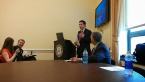
Briefing at the Capitol: APA Policy Director Jason Jordan at the mike; ASFPM Executive Director Chad Berginnis to his right.

It is important to note that this legislation is not the product of some recent brainstorm, but of a slow, steady process of building support, starting with a handful of legislators from both parties who saw its value. Perhaps most notable was Sen. Tammy Baldwin (D-WI), accompanied in the House by Rep. Dutch Ruppersberger (D-MD), who noted in a press release that he had been advocating such action for nearly a decade. But Republican support came from Rep. Don Young (R-AK) and Sens. Lisa Murkowski and Dan Sullivan, both of Alaska, the state with by far the longest coastline. All of them, along with the Digital Coast partners, plus the indefatigable John Byrd of MAPPS, pushed relentlessly, year after year, to find the support necessary to move the bill across the legislative goal line. They have at last succeeded.

Jim Schwab

Charting a Path to Sustainability

A presidential transition has always been a time to look forward in American history, anticipating change, contemplating new directions. Sometimes we like the new direction, sometimes we don’t; sometimes we think it just doesn’t go far enough to remedy the problems we face. But never have we faced the narcissistic spectacle of a president unwilling to release his grip on power. Every president before Donald Trump has been enough of a patriot to cooperate with a new president of the opposite party, and losing candidates who never ascended to the White House have been willing to concede. It is extremely unfortunate that some Americans are trying to deny others the right to focus on defining a more positive future.

But they are only trying because the right to map out an alternative future is still ours. The capacity to imagine a different future is one of the defining characteristics of a society that is capable of renewal, resilience, and sustainability. It is vitally important that civic leaders, academics, and authors help us clarify the truth of our past and map out paths to a better future. And, presidential transitions notwithstanding, it can and should happen below the national level, to help states and communities explore their unique history and their opportunities.

It is in that context that I wish to introduce readers to Green, Fair, and Prosperous: Paths to a Sustainable Iowa, the work of Charles E. Connerly, who by next summer will be retiring as professor and the director of the University of Iowa School of Urban and Regional Planning, recently renamed the School of Planning and Public Affairs after Connerly’s successful push to incorporate a Master’s in Public Affairs to the program’s offerings. Connerly has been at Iowa since 2008 since migrating back to his Midwestern roots after a long tenure at Florida State University in Tallahassee. As a matter of full disclosure, he was also responsible for hiring me as an adjunct assistant professor to teach one course each fall that has come to be known as Planning for Disaster Mitigation and Recovery. His many years at Florida State, working alongside Robert Deyle, a colleague who worked with me on disaster issues as far back as the 1990s, made him supremely aware of the importance of addressing hazards in the planning process. I was hired in the immediate aftermath of the massive 2008 floods in Iowa.
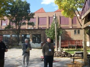
Connerly (in gray jacket) during a 2014 field trip of post-flood redevelopment in Cedar Rapids.

Connerly is truly a comprehensive thinker in the best planning tradition, and this book shows it. While I am certain, because of publishing schedules, that he had completed his manuscript before the death of George Floyd at the hands of Minneapolis police over the Memorial Day weekend, his book is incredibly timely in the fall of 2020 because of his focus on the history of racial and ethnic disparities in Iowa. In fact, Chapter 4 is simply titled, “Why Is Iowa So White?”

Indeed, that is a very good question. It is not just a matter of Iowa being farm country. After growing up in the Cleveland metro area in Ohio, then moving to Iowa in January 1979 before ultimately enrolling in graduate school at the University of Iowa, I remember being struck by the apparent lack of diversity, especially outside the handful of cities above, say, 50,000 people. There is, after all, industry in these cities, and industry has often attracted multiracial work forces. Unless, that is, political and social forces intervene to prevent such an outcome. Most people, however, never notice such forces at work and never learn about them in school. History can be very silent about such matters unless diligent researchers insist on exposing that legacy to sunshine, aka “the best disinfectant.”

Connerly digs deep on this topic, all the way back to antebellum Iowa politics. Sitting just north of Missouri, a slave-holding border state, Iowa was both a frontier of the Underground Railroad and a harbor of typical northern mixed feelings about African Americans. In 1850, Iowa was no less than 99.8 percent white, and did not dip below 99 percent, Connerly notes, until 1970. Since then, there has been a substantial growth in minority populations. But African Americans have historically been concentrated in just four urban counties. All that said, it was also the Iowa Democratic caucuses in 2008 that launched Barack Obama on a streaking path to the presidency. What accounts for this paradoxical history?

From the early days of statehood, Iowa suffered from a typical northern moral conflict between supporting emancipation and not particularly wanting too many blacks in the neighborhood. That is not putting too fine a point on the matter. Connerly notes that before the Civil War, Iowa had enacted laws banning blacks from the state. The territory avoided enacting such black codes to win statehood, but once that was achieved, Iowa legislators had no problem backtracking on the issue. The bottom line was that Iowans, overall, opposed slavery but did not necessarily favor civil rights for freed slaves.

That changed somewhat after the Civil War, with Radical Republicans pushing through changes that liberalized matters considerably, but it was only following World War II and through the Civil Rights movement of the 1960s that serious, permanent change began to occur. By that time, however, previous history had done its work in making African Americans largely feel unwelcome. Iowa stayed overwhelmingly white, but not entirely by accident. At the same time, the state has been receptive to refugees, for example, after the Vietnam war, and remarkably progressive on some other issues. Northwest Iowa elected the remarkably ignorant Steve King to Congress, but Republicans themselves dethroned him in this year’s June primary.

Prior to white settlement and the rise of modern agriculture, much of the Iowa landscape enjoyed by Indians consisted of prairie. Photo by Suzan Erem

Connerly writes that African Americans were not the only minorities to feel the impact of 19th-century American racism. Before European settlement, which took place in earnest only after Iowa became part of the United States following the Louisiana Purchase, fourteen Native American nations had, over millennia, occupied some part of what became Iowa. Before the 1800s, their interaction with Europeans was largely through trade, but eventually their land ended up in the hands of white settlers. The short answer as to how that happened is simple: “We took it from them.” Today, only the Mesquaki settlement in Tama remains as a reminder of the formerly dominant Native American presence.

The Hispanic presence, and that of various Asian minorities, is a product of more recent history, some of it involving the evolution of labor relations, particularly in agriculture and meat processing plants, but today there is a distinct, but distinctly disadvantaged, Hispanic presence. It is no accident that earlier this year, some of the most intense controversy over coronavirus spread in states like Iowa, Nebraska, and South Dakota involved minority workers in the meat-packing industry and deficiencies in safety protocols among the companies involved. In a whole chapter dealing with labor issues over time in both the food and agricultural equipment industries, one can see the steady decline of leverage among white-dominated labor unions and the rise of cheap labor and mass production within the industry as it is today. It is hardly a stretch to suggest that these social and economic changes have had profound impacts on, and implications for, the future of Iowa’s economy and society. Iowa did not shift from supporting Obama in 2008 and 2012 to Trump in 2016 and 2020 without some massive strains within the body politic. How those tensions are resolved will go a long way toward determining whether Iowa can chart a successful path to a sustainable future, as Connerly’s book suggests. Iowans will have serious work ahead in improving social equity while adjusting to a changing demographic makeup across the state.

But I do not wish to create the impression that the book is strictly focused on such demographic issues, as important and critical as they are. It is important to notice that Connerly has tied together the issues of environmental health, fairness, and prosperity in his title. His larger point is that all these questions are inextricably related. To quote some planners I have known, “Everything is connected to everything else.”

Connerly takes us on a detailed, well-documented tour not only of Iowa’s demographic history, but of its environmental and economic history as well. Iowa clearly entered statehood as a predominantly rural, agricultural state, though not necessarily producing the corn and soybeans that predominate now. Originally, in fact, it grew more wheat, but trends shifted to corn and hogs. But the state is still heavily dependent on agriculture, with 43 percent of its 2015 manufacturing centered on either food processing or machinery used in agricultural production. These two gave rise in the twentieth century to some powerful unions representing workers who were largely able to achieve a blue-collar version of middle-class prosperity. Hogs, supported by state laws exempting agriculture from county zoning laws, gave rise to the growth of concentrated animal feeding operations (CAFOs) in the past 40 years, and the meat-packing industry itself became more concentrated and able to mechanize increasingly and replace high-wage jobs with lower-wage mass production and weaker unions. The people working in the newer factories are definitely more racially diverse but definitely not more empowered and definitely paid less. The growing inequities have resulted in a shrinking middle class.

One factor that distinguished the Iowa packing plants prior to the major, union-busting shifts of the 1970s and 1980s was that the plants were closer to the farms, and thus, unlike larger plants in Chicago and Kansas City, bought animals directly from farmers. Connerly maps out the consequences in urban development for Iowa, namely, that Iowa never developed the metropolitan magnets of neighboring states like Minnesota, Missouri, and Illinois because of the dominance of the Twin Cities, Chicago, and Kansas City, and instead has a number of smaller cities, the largest being Des Moines, which has about 215,000 people, though the entire metro area is about three times that size. Smaller cities have mostly grown around agriculture-related industries.

All this has had significant consequences not only for quality of life but the quality of the environment, with water quality problems arising from rural land use issues such as CAFOs, soil erosion, and nitrate concentrations in groundwater. Connerly’s final chapter asks whether Iowa truly is the “best state in the nation,” a title bestowed in 2018 by U.S. News and World Report. As a former Iowan, I do not offer this review as a way of trashing the state, nor does Connerly offer his book in that spirit, but the question is an opportunity to explore the complexity of a state that too many elsewhere see as simply white and rural. Iowa, with the right policies, the right incentives, and the right opportunities, has the potential to create a healthy environment and economy, but it must examine current trends and determine how to reverse those that are moving the state in the wrong direction. The last chapter is a succinct compendium of recommendations for moving Iowa toward a growing middle class, a healthier environment with better recreational opportunities, and a progressive approach toward making agriculture more ecologically sound and resilient in the face of natural hazards, most notably, floods.

Testing facility of the Iowa Flood Center, 2019.

The state has created some interesting mechanisms for doing this, but has a stubborn habit in recent years of shooting itself in the foot. In 1987, the legislature wisely passed the Groundwater Protection Act, which created the Aldo Leopold Center for Sustainable Agriculture at Iowa State University, which has done remarkable research on establishing a balance between economic and environmental needs in agricultural practices. Yet, in recent years, the legislature has significantly limited state funding for the center at the behest of corporate agricultural interests. In 2010, following the devastating floods in 2008, the legislature funded creation of the Iowa Flood Center at the University of Iowa, which has become a model in advancing flood prediction and mitigation that other states are considering copying, yet some question the need for continued funding. It is almost as if Iowa wants to replicate the larger national battle between science and an increasingly poisonous distrust of “experts.” Would it not be better to marshal and support the best intellectual resources Iowa can muster for an assessment of the opportunities that lie ahead?

Connerly points out, in contrast, how Iowa could take the lead in solving problems like climate change and excessive nutrient runoff in the Mississippi River basin that leads to both groundwater contamination locally and hypoxia in the Gulf of Mexico. This last chapter is the biggest single reason to read the book, but its logic is only fully clear after reading the thorough research that precedes it.

My final comment is that it may seem that this is a book that is primarily or perhaps solely relevant to Iowans. I think that conclusion, however, would be short-sighted. While I am profoundly aware of the many books others have produced about other states, regions, and metropolitan areas across the U.S., I think it is vitally important that other scholars across the nation undertake similar efforts to assess the path to sustainability for their own states, regions, and cities. We could sorely use such a book in Illinois, and the same is probably true for every neighboring state. As I suggested at the outset, it is not enough to chart a new national path. We need these serious explorations at subnational levels as well. In that sense, I believe Connerly has done a major service for the Hawkeye state. I’d like to see more such books.

Jim Schwab

Truly Hard Wind

What in the U.S. Midwest would spur comparisons to a hurricane? What could spread damage over an equally wide area? It is a good bet that most people are unfamiliar with the word “derecho,” which comes from Spanish, meaning “straight,” but such a storm made itself felt just three weeks ago in Iowa, Illinois, and Indiana, as well as parts of Nebraska and Wisconsin. The Spanish word with an adopted meaning in English refers to such a storm’s powerful straight-line winds, as opposed to another adapted Spanish word, “tornado,” literally meaning “turned,” which, of course, refers to a cyclonic, or spinning, meteorological phenomenon.

The Event

On August 10, a derecho took shape in eastern Nebraska and the southeastern corner of South Dakota early in the morning. The city of Omaha suffered some of the initial damage, with an estimated 57,000 people losing power. But as it roared across the center of Iowa, the storm, as derechos often do, rapidly gained wind speed until estimated winds of 140 miles per hour struck Cedar Rapids and surrounding Linn County in eastern Iowa. Nearby Iowa City, home of the University of Iowa, also suffered extensive damage. Derechos can and typically do strike with little warning, unlike hurricanes, but even at speeds of 90 to 100 mph, in this case, it still takes hours to cross Iowa from west to east, and even longer to reach Illinois and Indiana.

Thus, my first warning of what was to come, sitting here in Chicago, was a telephone alert from the University of Iowa around noon that day. I get such alerts because I am on the faculty, although I now teach remotely as an adjunct. But our landline and my cell phone are on the system, so the alerts come automatically. Fortunately, that gave me most of the afternoon to prepare for what was coming, which arrived in our area around 3:45 p.m. Winds and rain pounded on our skylights for nearly 45 minutes, leaving numerous branches and twigs on the ground from our stately American elm, which towers above our house and garage and has probably withstood other storms for at least a century. It was already huge when we built our house in 1994, and we chose to make it sure it remained. Even this storm caused it only minor damage.

The same could not be said of many street trees in parts of Chicago. Trees often collapsed on top of parked cars, leaving many owners to bemoan what became of their vehicles—or, in some cases, the roofs of their homes.

Even the repose of the dead was not left undisturbed. Graceland Cemetery, one of the more famous in Chicago, faces months of repairs and replanting and is closed for six weeks. The storm uprooted about 40 trees and damaged numerous gravestones and monuments. It had become a popular place for peaceful strolls and contemplation during the months of coronavirus-induced shutdown. After the storm, it was a visual mess that will cost about $250,000 to repair.

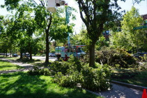
Removing damaged trees in Chicago’s Rogers Park.

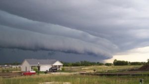
One lesser-known by-product of derechos is tornadoes, which can be spun off from the shelf cloud as it moves through an area. In Chicago, two tornadoes, one EF-1 in the Rogers Park neighborhood along Lake Michigan near the city line with Evanston, literally buzzsawed trees in an area of densely built multifamily housing and small

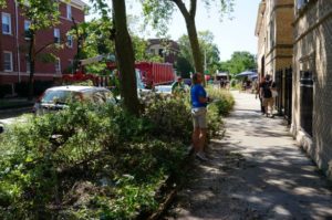
Insurance claims agents inspect building damage in Rogers Park.

businesses. A few days later, I visited the area to shoot photos that appear here. At first, driving up Greenwood Avenue, I wondered where the damage was. But as I drove further north and approached W. Jarvis Ave., the answer became starkly obvious. I could not drive beyond that corner because the street was blocked; Jarvis was one way going east, but Jarvis east of Greenwood was also blocked. City trucks were removing damaged trees. After finding a way to park without impeding traffic, I encountered insurance agents on the ground shooting outside photos of nearby buildings, presumably for damaged masonry. Any damaged cars had already been removed.

That tornado, and another that reportedly skipped across the Eisenhower Expressway (I-290) on the West Side, dramatically demolished for some an old urban myth that tornadoes don’t strike urban areas. People believe this for various reasons, including how they think tall buildings disrupt wind circulation, but trust me: I’ve been involved in disaster recovery long enough to know that tornadoes do not discriminate against smaller towns. Rogers Park is very urban. Tornadoes go where they please. This specific tornado eventually skipped out over the lake, becoming a waterspout. But it left its mark.

The storm, by the way, ultimately spun off at least 17 documented tornadoes, mostly in northern Illinois, but a few in Wisconsin and Indiana. All were either EF-1 or EF-0 on the Enhanced Fujita scale. But by far, most of the damage resulted from the straight-line winds themselves, which were often in the range of 90 to 100 mph, with a top measured speed of 126 mph in Atkins, Iowa, making them basically of tornado or hurricane strength. And they sped, over the course of a single afternoon, across all or parts of several states.

By 4:30, the storm had continued its march into northwest Indiana, where it finally petered out. But what happened along the way?

Iowans can attest that it functioned across much of their state like a Category 2, maybe even Category 3, hurricane. Lyz Lenz, a columnist for the Cedar Rapids Gazette, noted in a guest column for the Washington Post four days later that the winds had damaged “more than 10 million acres, or 43 percent, of the state’s corn and soybean crop.” The reduction in harvest in Iowa is likely to be between one-fourth and one-half. The heading on her column referred to the storm as an “inland hurricane” that most people had not heard about. The damage was massive enough to be visible in satellite images.

The damage was not just to crops on the ground, but to hundreds of millions of bushels in storage bins on farms and in commercial storage facilities, according to the Iowa Department of Agriculture. Toppled grain bins were a common site.

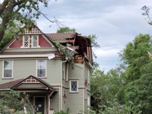
Damage to Chinese House roof in Grinnell. Photo by Rachel Bly.

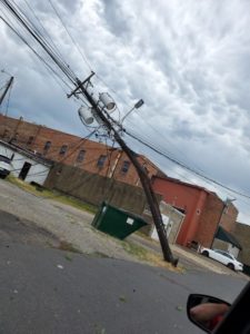
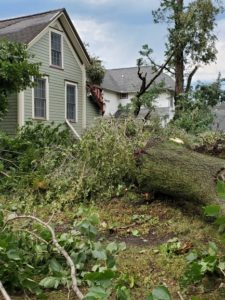
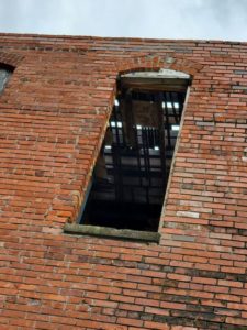
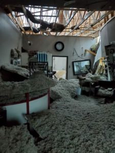
Despite those staggering figures, that was only the beginning. Between Indiana and Iowa, four people died from either falling trees or electrocution, and, in one case, a mobile home tipped over by high winds. Losses of electric power affected approximately 585,000 Iowans, or roughly 20 percent, while 1.9 million lost power in neighboring Illinois. Tree damage in Linn County totaled in the hundreds of thousands, and most buildings suffered anywhere from mild to catastrophic damage. In small towns, like Grinnell, building damage and tree damage to cars was also extensive. Here, I wish to thank Rachel Bly, director of Conference Operations and Events for Grinnell College, for sending me dozens of photographs she shot after the event. Bly, I might note, has a certificate in emergency management from Park University in addition to her MPA from Drake University. The images she shared help convey some reality to the trauma that occurred. Hundreds of other small communities suffered similar impacts. Not surprisingly, Gov. Kim Reynolds issued a state disaster declaration by August 14 for 25 counties, and has sought a federal declaration from President Trump, citing an estimated $4 billion in damages. By August 19, Trump had signed a declaration for Public Assistance (PA) but not Individual Assistance (IA) for Iowa. PA provides aid for restoring public infrastructure, such as roads and bridges and community facilities, while IA provides direct aid to individuals for reasons such as loss of housing.

Power line damage in Grinnell. Photo by Rachel Bly.

Photo by Rachel Bly

Roof seen through the window. Photo by Rachel Bly.

Inside a damaged salon in Grinnell. Photo by Rachel Bly.


Derechos as a Natural Hazard

All this raises the question of what we know about derechos as a wind-related hazard. I will confess that I spent most of my life never having heard the word, let alone understanding what it meant. It is not the most common occurrence, but it certainly ranks among the most destructive. To my surprise, I learned from Wikipedia that the term was coined in 1888 by a German-American scientist, Gustavus Detlef Hinrichs, who had emigrated to St. Louis just before the Civil War. He wrote in the American Meteorological Journal about a storm that struck Iowa in 1877 and described its unique characteristics. Nonetheless, even in the Midwest today, many people are unfamiliar with the term—until they hear it on the news, as they did on August 10 amid storm warnings.  

The gust front “arcus” cloud on the leading edge of a derecho-producing storm system. The photo was taken on the evening of July 10, 2008 in Hampshire, Illinois. Credit: Brittney Misialek. From National Weather Service website.

There are several types of derechos, but the National Weather Service describes a derecho as a “widespread, long-lived windstorm that is associated with a band of rapidly moving showers as thunderstorms.” More specifically, it defines the phenomenon as a swath of damage that “extends more than 240 miles (about 400 kilometers) and includes wind gusts of at least 58 mph (93 km/h) or greater along most of its length.” In plain English, this is a huge, regional storm, not some localized thunderstorm. It exhibits straight-line winds that can be at least double the minimum in the definition, and the August 10 event involved winds far above 58 mph in most locations. Like all such storms, it is a product of unstable atmospheric systems, in this case typically involving a bow-shaped front in a large squall line.

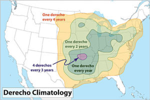
The storms are typically a mid-latitude phenomenon, making North America and the Midwestern U.S. particularly susceptible, but they occur elsewhere in the world as well, including southern latitudes (southeastern Brazil and Argentina), South Africa, China, and even eastern Europe, where a derecho struck parts of Estonia in August 2010, and near Berlin in Germany in 2002. The August 10 event was not the first one I have witnessed in Chicago—another struck in July 2011 and disabled electric power for nearly a million people—but it was certainly the largest in a long time.

70% of all derechos occur between the months of May-August (the warm season). The other 30% occur during the cool season. From National Weather Service website.

As a mitigation planning response, almost no hazard mitigation plan (produced for FEMA approval as a condition of eligibility for federal hazard mitigation grants) for any state or community east of the Rockies (with the possible exception of Florida) should fail to identify derechos as a potential hazard. Moreover, especially in the Midwest, it may be time for states and communities to reexamine their building codes for wind resistance as a means of limiting future damages from derechos. Finally, it may also be time for many communities to examine more closely their urban forestry programs for adequate attention to hazardous tree management. That does not mean refusing to plant trees or removing them unnecessarily as a mindless precaution. It does mean engaging professional urban foresters in an assessment of the urban tree canopy with an eye to ensuring forest health and removing those trees that are most likely to fail under severe wind pressure. Already, the call has arisen for such reforms in Chicago. It is time for planners, environmentalists, disaster professionals, open space advocates, and concerned citizens to seize the moment while they have the public’s attention.

Jim Schwab

One BRIC at a Time

One of the long-standing questions concerning national disaster policy is why a state or community needs to suffer a presidentially declared disaster in order to be eligible for federal hazard mitigation grants to help improve its resilience against storms, floods, earthquakes, and wildfires, or other possible calamities. Ever since passage of the Stafford Act in 1988, most or all federal support for hazard mitigation projects has depended on a disaster happening first, which then triggered a spigot of grants for risk-reduction projects under the Hazard Mitigation Grant Program (HMGP), run by the Federal Emergency Management Agency (FEMA). It was almost a perverse twist on the famous alleged Willie Sutton justification for robbing banks. Why suffer a major natural disaster? Because that’s where the money is.

But not necessarily any longer. FEMA’s new Building Resilient Infrastructure and Communities (BRIC) program is a major new source of money available on a competitive basis through applications from local governments seeking to reduce risk through hazard mitigation projects. Over the last two years, FEMA has shaped BRIC, responded to public and stakeholder feedback on its plans, and finally, released those plans earlier this summer, followed in early August by release of its Notice of Funding Opportunity for states and communities. Those jurisdictions can apply between late September and January 29, 2021, the deadline for submitting proposals. Importantly, the program continues FEMA’s decade-long march toward encouraging the integration of hazard mitigation planning throughout a community’s entire range of plans to ensure a more holistic approach with a better prospect of effective implementation. This policy dates back to a seminal 2010 report by the American Planning Association and beyond, but  it is good to see it reinforced.

Breaking New Ground

BRIC began with provisions in the Disaster Recovery Reform Act (DRRA), passed by Congress in 2018 as part of a larger bill that primarily reauthorized the Federal Aviation Authority but included miscellaneous additional measures dealing with disaster policy and sports medicine. Of such bargaining are sausages made in the Capitol, but the specific provisions authorizing what FEMA chose to label BRIC were born of years of complaints and frustration among disaster professionals about sporadic and inconsistent federal funding for hazard mitigation projects before instead of after disasters. The Disaster Mitigation Act of 2000 authorized a Pre-Disaster Mitigation (PDM) program, but for the past two decades its funding has relied on the whims of Congress. In some years, that provided as little as $25 million for a national competition. Sometimes the threat of termination hung over the program. Such minuscule funding produced both inconsistent results and great uncertainty from year to year among potential grant recipients. Almost no one was happy with the program. BRIC now replaces PDM.

Under Section 1234 of DRRA, Congress authorized a new pre-disaster hazard mitigation grant program that would no longer rely on annual congressional allocations but instead will use an annual calculation of 6 percent of annual post-disaster funding for relief from presidentially declared disasters. FEMA will determine that number from estimates six months afterwards, and annually transfer those dollars into the BRIC fund. For Fiscal Year 2020, that will amount to $500 million, of which $33.6 million will be directly allocated to the 50 states, District of Columbia, and U.S. territories. A separate $20 million set-aside will fund tribal governments for BRIC grants. The remaining $446.4 million are available through the new national grant competition. That amount far exceeds any annual allocations from Congress for PDM. While DRRA states that this money is available to states with presidential disaster declarations in the previous seven years before a specific grant opportunity, in fact, all states and territories currently qualify under that criterion.

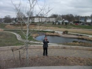
Antelope Valley flood reduction project, Lincoln, Nebraska

A FEMA fact sheet makes clear that BRIC also establishes new priorities for this assistance by providing incentives for:

  • public infrastructure projects;
  • projects that mitigate risk to one of more lifelines;
  • projects that incorporate nature-based solutions; and
  • adoption and enforcement of modern building codes.

I will return to these goals later in this post because all are important and some deserve further explanation. It is worth noting, however, that much of the new focus grew out of extensive stakeholder feedback as FEMA solicited input, and that feedback is documented in a separate FEMA report.

FEMA has also undertaken an extensive education effort to ensure that potential applicants are well informed on their options for grant proposals. The agency produced a series of five weekly one-hour webinars in July, some of which, in my opinion, are distinctly more informative than others. But their utility may vary with the existing knowledge and experience of those watching, so what is clear to me may be new to others. The best, again in my opinion, detail issues connected with the last three goals in the bullet list above. All were recorded and are available online.

Using BRIC Funds

The very first BRIC webinar spelled out the guiding principles for the new program, which are designed to support community capability and capacity building:

  • encourage and enable innovation
  • promote partnerships
  • enable large infrastructure and projects
  • maintain flexibility
  • provide consistency

The clarity of priorities, focus on building local capacity for hazard mitigation, and streamlining of grant processes, among other factors, outline major differences from the previous PDM program, which suffered from inconsistencies that stemmed in large part from the erratic nature of its funding. The emphasis in selecting projects for support will turn toward their potential for risk reduction, innovation in planning and implementation, focus on addressing future climate, development, and demographic conditions, and support of community lifelines, among other factors as well as considering the types of populations affected by the projects and the partnerships and outreach outlined in the proposals.

Also important is that DRRA provided BRIC with a broad mandate for supporting the local adoption and enforcement of modernized building codes to better address protection against natural hazards. The new law also empowers FEMA to use BRIC to support technical assistance to communities, as well as reimbursing pre-award costs, that is, money expended for project development costs prior to grant approval, so long as the project is ultimately funded. Previously, communities could only use grant money for expenses incurred once the project had begun.

DRRA also expressed specific support for wildfire and wind hazard mitigation initiatives in Section 1205 and earthquake early warning systems in Section 1233. Projects addressing these types of mitigation will have clear support for BRIC funding approval as a result.

Building Codes

Section 1206 of DRRA addresses the need to provide stronger mitigation grant support for projects advancing the adoption of building codes that mitigate natural hazards. Codes adopted by local governments using BRIC grant support must conform to the latest published codes promulgated by organizations like the International Codes Council, which maintains a library of digital codes at the linked site. Permissible activities in this area under the BRIC guidelines include evaluation of the adoption or implementation of new codes in reducing risk; the enhancement of existing adopted codes; and the improvement of work force skills among the enforcement staff.

Building codes have assumed an increasing importance with the realization over many years of their cost-effectiveness in reducing losses. Despite residual resistance in some quarters to increased regulation through such codes, they are a clear asset in the hazard mitigation toolbox. The earthquake that struck Anchorage, Alaska, in November 2018 provided abundant illustration of the merits of mandatory building codes with dramatically shrunken damages compared to the 1964 earthquake that shattered much of the city. Likewise, experience in Florida has shown that stronger codes with adequate enforcement has driven down losses. Following the stark realities exposed by Hurricane Katrina, Louisiana adopted mandatory statewide building codes in 2006. Many other examples of improved building codes are readily available, pertaining not only to earthquake and hurricane wind damage but to wildfires and other hazards that can be mitigated through better building standards. Building and landscaping codes can be enhanced with design manuals and other outreach to builders and the public, such as the ignition-resistant design manual produced by the city of Colorado Springs, which has faced and learned from repeated wildfire events.

Grant applicants have other resources to which they can turn for information and support on building practices, including the BuildStrong Coalition, the Federal Alliance for Safe Homes (FLASH), and the Insurance Institute for Business and Home Safety, a research entity supported by the insurance industry that includes test laboratories for determining the efficacy of various building materials and approaches. FEMA also has web-based resources on building codes.

Community and Infrastructure Lifelines

The concept of lifelines in a hazard mitigation context may be new to some, though the name itself is intuitively simple. Simply put, lifelines are important community services that exist to alleviate threats to life and property. Emergency managers have long used the term “critical facilities” to refer to those buildings and structures that must survive disaster impacts in order to provide continuous essential services such as transportation, public safety, shelter, and power to a community. But lifelines are more than physical assets; they are also systems that must be able to continue to function in an emergency or disaster. In BRIC, these are now the targets of focused mitigation projects, which can include efforts to strengthen and build the resilience of any systems and institutions within seven categories:

  • safety and security;
  • food, water, and shelter;
  • health and medical;
  • energy;
  • communications;
  • transportation;
  • hazardous materials

FEMA introduced the concept of community lifelines in the fourth edition of the National Response Framework. The FEMA website includes a free download of its Community Lifelines Toolkit. Basically, the idea is to allow BRIC grants to support projects that reduce risk to these lifelines and help stabilize them quickly after a disaster occurs. These can include stormwater management projects,  tsunami safety measures, infrastructure safety upgrades, and retrofits to essential buildings such as hospitals and shelters.

Nature-based Solutions

I will admit that, to me, some of the most intriguing initiatives within BRIC may focus on supporting green infrastructure, which is essentially what FEMA is labeling nature-based solutions. The central idea is to use the natural ecosystem services within a community or region to ameliorate the impacts of natural hazards by letting nature do what nature has always done best. FEMA has shown similar fascination with the concept by issuing a 30-page guide for local communities that outlines what these solutions can look like and how they function. These approaches have gained popularity in part as a response to climate change, but they are larger than that because they often address at least part of the problems associated with flooding and sea-level rise at less cost, often significantly less cost, than “gray” infrastructure or engineered structural solutions. In the final BRIC webinar, Sarah Murdock, Director of Climate Resilience Policy for The Nature Conservancy, noted that coastal wetlands had prevented an estimated $625 million in property damage during Hurricane Sandy. In various states

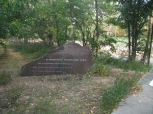
River restoration along St. Vrain River after 2013 Colorado floods

and cities, nature-based solutions have included green roofs, rain gardens, permeable pavements, living shorelines, and a growing array of other innovative design solutions to long-standing problems like stormwater management, urban heat islands, building energy demand, and urban flooding.

A great deal of research, case study documentation, and tool development has occurred in recent years with respect to nature-based solutions. For instance, Digital Coast, a program of the National Oceanic and Atmospheric Administration, features tools such as the State of High Tide Flooding and Annual Outlook, the Climate Resilience Toolkit, and the Climate Explorer. NOAA also provides a variety of other technical assistance, for instance, through Regional Climate Centers and Sea Grant College Programs. Many states provide their own research and technical assistance, for example, through state climatologists, represented collectively the American Association of State Climatologists. Urban planners can access additional design ideas through the American Planning Association publication Green Infrastructure: A Landscape Approach. The U.S. Army Corps of Engineers has provided its own online atlas called Engineering with Nature that discusses the multiple benefits of these approaches. Finally, I would be remiss not to mention the stellar contribution of The Nature Conservancy with its web-based resource, Naturally Resilient Communities, an effort to which I can proudly claim to have contributed during my tenure at APA.

Outlook

The most promising feature of BRIC is that, because it was authorized by Congress in DRRA with a secure source of ongoing annual funding, it is not dependent on the shifting whims of presidential administrations. It has a solid chance of building an effective constituency among grant recipients pursuing projects that are highly likely over time to demonstrate their own worth so long as the program is administered with an eye to its goals and fundamental objectives. I am not trying here to be encyclopedic but to provide an entry point to the range of resources and possibilities that community applicants and advocates can use to ensure the success of BRIC. Given the steady rise in the costs of natural disasters, driven in part by climate change but also by demographic shifts and public policy decisions, making a difference by helping to drive down such costs is a national necessity. BRIC opens a new door toward wise investments to help achieve this goal. This nation needs some creative disaster problem solving backed by new resources.

Jim Schwab
 

Plotting Post-Pandemic Recovery

Photo by Carolyn Torma

In recent years, the development of local or regional recovery plans following major natural disasters has become increasingly common. The Federal Emergency Management Agency has long encouraged such planning, and I led the production of two major FEMA-funded reports from the American Planning Association on the topic—Planning for Post-Disaster Recovery and Reconstruction (PAS 483/484, 1998) and Planning for Post-Disaster Recovery: Next Generation (PAS 576, 2014). I’ve spoken repeatedly on the topic, trained planners, and valued the collective knowledge of the two teams we assembled to make those projects happen. The underlying idea is to help a community assess its losses, reassess its goals, and find the silver lining in the dark cloud of the disaster that will allow it to rebuild better and stronger than before. This is the central concept of community resilience: the capacity to learn from such events, adapt to the changes they require, and move forward.

The idea of natural disasters has generally encompassed those caused primarily by meteorological and geological disturbances, such as storms and earthquakes, though it includes impacts exacerbated by human mistakes in building and planning. Disasters necessarily involve the collision of natural forces with the human and built environment, which has caused some people to question the very use of the word “natural” in connection with disasters. Personally, I am comfortable with the term “natural disaster” so long as we understand that no disaster exists without this interaction.

But there are those disasters where damage to the built environment is a secondary consideration, and the loss of lives is primary. Drought is somewhere in the middle. Damage to structures can occur, but only as the result of the slow, nagging loss of moisture in the air and soil. Heat waves can take hundreds of lives without affecting a single structure, though they can put enormous stress on energy and transportation infrastructure.

Pandemics, however, fall into another category entirely as biological disasters. They occur when bacteria or viruses emerge in the environment and attack humans before we have developed any effective immunity or vaccines. The current COVID-19 crisis fits this mold precisely. It can be far more devastating than a natural disaster simply because it can roam far more freely across the planet, as did the 1918 influenza pandemic, striking down hundreds of thousands if not millions of people. Before the era of modern medicine, pandemics like the bubonic plague in the Middle Ages could kill half of the affected population. Even without vaccines, we at least have the huge advantage of understanding how such microbial threats spread. Our disadvantage in the U.S. has been national leadership, starting with the President, that has been psychologically allergic to scientific advice. The result has been needless loss of life on a colossal scale.

It was a matter of time before some community, even without such federal leadership, applied many of the principles of recovery planning to the coronavirus pandemic. One critical question related to recovery is identifying the point at which the crisis is over, or at least waning. In natural disasters, drought being again the exception, this point becomes clear within a matter of days, or even hours in the case of tornadoes, as the storm passes. However, weather systems such as that which produced the 1993 Midwest floods, can last for weeks or even an entire summer. But at some point, it becomes clear that the emergency is over, and planning for long-term recovery can begin. In the absence of a vaccine, however, it is less clear when we can use the “all clear” signal for a pandemic. Right now, in the U.S., it is painfully clear that the rush to reopen is producing unconscionable and shocking consequences across the South and Southwest, and in a few other locations as well. It is incredibly hard, perhaps even impossible, to plan meaningfully for recovery when you are still stoking the fire by facilitating the spread of the virus.

Nonetheless, some states, notably including New York, much of New England, and Illinois, have fought hard against the odds to bring down infection rates, which are now a fraction of what they were in April or May. Their victory remains tenuous, considering the larger national crisis that remains a growing threat to public health, but Chicago under Mayor Lori Lightfoot has announced a list of states whose residents must quarantine for 14 days upon arrival, notably including Florida, Arizona, and Texas. Later, Iowa was added. By July 17, the Cook County Department of Public Health expanded that quarantine area to include all of suburban Cook County except a handful of suburbs that maintain their own health departments, and 17 states are on the list with new case rates exceeding 15 per 100,000 people per day. While it is nearly impossible to monitor all arrivals, the message is clear: We don’t want to re-create the problems we so recently overcame.

That is the context in which a large Recovery Task Force the city assembled released a recent report, Forward Together: Building a Stronger Chicago, which examines how Chicago could build a vibrant recovery from the coronavirus experience. Because such reports, especially those involving dozens of contributors and participants, are never crafted overnight, it is worth noting that the effort was launched on April 23, at a time when the outcome was far from clear. Neither the city nor the state could be certain then how long the problem would last or whether the stay-at-home orders and other measures would succeed at all in the near term. As of July 18, Illinois had dramatically increased its testing rate and brought its positivity rate for coronavirus tests down to 2.9 percent, well below most rates elsewhere, although it remains higher in Chicago at 5.4 percent.

So far, the strict measures announced in March have produced measured success, and the task force used that time to look farther down the road to the kind of city that might emerge from this ordeal. Forward Together is, to be clear, not a true recovery plan; it is billed as an “advisory report.” But it is the closest thing to a recovery plan that I have seen so far, and merits scrutiny and consideration for what it offers. (New York Mayor Bill de Blasio promised his own “road map to recovery” on April 26.)

The task force itself was broadly based. Lightfoot co-chaired it with Samuel Skinner, a businessman, lawyer, and political operative who served as both Secretary of Transportation and White House Chief of Staff under President George H.W. Bush. He has a long track record in public affairs. Committee chairs and members included elected officials, among them Cook County Board President Toni Preckwinkle, who was Lightfoot’s run-off opponent in the 2019 mayor election, labor and community representatives, business leaders, academicians, and civic leaders, including some prominent activists. The task force was broadly inclusive, which bodes well for public buy-in on the resulting recommendations. Moreover, the report shows significant evidence of wide community outreach, including a youth forum that tapped the ideas of teens and young adults.

Like all big cities, Chicago has witnessed significant disparities in impacts of the pandemic on specific disadvantaged groups, including the elderly, but also Blacks and Latinx residents. While these two groups each comprise 28 percent of Chicago’s population, they respectively comprise 30 and 48 percent of the cases of coronavirus and 44 and 32 percent of the resulting deaths. This is an important backdrop to the discussion of goals in the report.

The report discusses four specific initiatives to move the city forward and address many of the inequities and vulnerabilities exposed by the coronavirus. Invest South/West aims to bring public and private investment to those neighborhoods in the city that have suffered historic disinvestment, and where COVID-19 rates have generally been highest. Racial and ethnic inequities in coronavirus impact have been notably more severe among both Blacks and Latinx residents, in large part because of lower levels of insurance coverage but also because of differences in job exposures, poverty levels, and living conditions. Solutions Toward Ending Poverty (STEP) is a new program, announced in February by Lightfoot, that is attempting to identify evidence-based metrics that can plot a road map toward reducing urban poverty in Chicago. We Will Chicago—Citywide Plan aims over three years to develop what amounts to a comprehensive plan, something lacking in Chicago until now. The report says We Will Chicago “will encompass all elements of citywide planning.” Finally, Chicago Connected will aim to shrink the digital gap between more affluent and poorer neighborhoods by making broadband more readily available, a need whose urgency has clearly been exposed by the closing of schools and the challenges of assisting children from poorer households with remote learning.

A significant part of the report focuses on the economic development opportunities that Chicago can pursue to restore prosperity as the pandemic recedes. It is clear that certain categories of jobs—food service, retail, administrative, and manufacturing, but also arts and entertainment and personal services—have suffered the brunt of economic displacement from the pandemic. The report notes the opportunity for Chicago, as a result of some economic changes wrought by the pandemic, including shifts to online retail, to focus on transportation, distribution, and logistics (TDL) segments of the economy. These would take advantage of a longstanding Chicago advantage as a transportation hub.

TDL, however, faces its own challenges of inequitable opportunity. Food insecurity represents a serious challenge in “food desert” neighborhoods. Resolving those inequities is the intended purpose of the four initiatives, but it is hardly a challenge that will be resolved overnight. It has taken years of unequal opportunity, to say nothing of deliberate discrimination, to create the current dilemma. Failure to address these problems will slow down or even stagnate Chicago’s recovery from the current crisis.

The report makes what strikes me as an honest effort to address social services gaps that, if anything, grew under the previous administration of Mayor Rahm Emanuel, who closed some mental health centers in a bid to reduce budget deficits. The problem is that such reduced access to services only exacerbates problems among those needing such help and may increase other costs as a result. For example, a significant proportion of the inmates at the Cook County Jail (and many others around the nation) suffers from mental illness.

There is an urgent need to restore those services, but more importantly, the report shows that mental health services are far more prevalent on a per-person basis in more affluent, whiter neighborhoods than in poorer areas. For instance, 48 percent of whites with mental illness were receiving services in 2015, but just 31 percent of both Blacks and Latinx with mental illness were doing so. A map toward the end of the report shows differences shows a variation in presence of mental health providers ranging from zero or well below 0.25 per thousand residents in certain poorer areas of the city to well over 2 in predominantly white, middle-class areas and hundreds per thousand in downtown Chicago, a district well-nigh inaccessible to many South Side residents.

This may reflect, among other things, a disproportionate presence of white professionals in mental health and a need to bring more minority psychiatrists and psychologists to those neighborhoods. Reopening clinics in the neediest areas of the city would be a major step forward. As for the connection to coronavirus, the stress induced by greatly increased unemployment, to say nothing of job pressures within health care, can contribute to mental health challenges. Perhaps the most noteworthy proposal in this section of the plan is the recommendation to create a dedicated 211 line whereby residents can access a wide range of social services. It strikes me as essential, also, to reduce pressure on police to respond to personal mental health crises by instead responding to such incidents, to the extent possible, with mental health professionals and social workers.

As I noted, this is framed as an “advisory report.” I strongly suspect, however, given the tenor of the moment, that its recommendations will find widespread support among Chicagoans. What remains to be seen is how well voters and aldermen hold the administration’s feet to the fire to make it all happen. It is not enough to have confidence in a mayor who seems determined to make it happen. Implementation will require broad-based commitment to achieving the goals the report lays out. That includes embedding those goals in the comprehensive planning process that We Will Chicago envisions, and enacting measures to move them forward.

What is important about this effort for the rest of the country is the very idea of mounting such a broad-based effort to produce a forward-looking analysis of how our cities can recover from the coronavirus pandemic. Many may first have to learn how mayors and governors can exert the leadership, and evince the humility to consider the science, necessary to get the virus under control, as many other countries in Europe and Asia have done. These leaders must also be open to hearing from a widely representative cross-section of their citizens in preparing similar reports. Pandemic recovery planning is for all of us an experiment that can build on the foundations of other kinds of recovery plans while recognizing and thoroughly exploring the unique features of this monumental public health challenge. It is no small matter, and should not be treated as such, politics notwithstanding.

Jim Schwab
 

Community Planning and Pandemics Podcast

Periodically, I have linked blog readers directly to a new podcast in the Resilience Roundtable series, produced by the American Planning Association and hosted by the APA Hazard Mitigation and Disaster Recovery Planning Division. Last fall, I became the moderator of this series, and the last, pre-pandemic podcast interviewed Florida planning consultant Julie Dennis about her experiences in recovery planning for Hurricanes Irma and Michael.

Earlier this month, however, we shifted gears, and I interviewed Dr. Monica Schoch-Spana, a medical anthropologist and research fellow at the Johns Hopkins University Center for Health Security. Our topic was community planning and pandemics, and she shared numerous insights into the public health and community planning aspects of dealing with a pandemic like COVID-19. Most readers already know that I have written repeatedly about some aspects of the pandemic since March, but Monica in this interview sheds light on several other features of our current situation that I had not yet illuminated, in part because I lack her specific technical background.

Therefore, I am happy to provide this link to the new 40-minute podcast.

Jim Schwab
The Need for Resilient Infrastructure

This summer, the Federal Emergency Management Agency (FEMA) is at last rolling out its Building Resilient Infrastructure and Communities (BRIC) program, and its first Notice of Funding Opportunity will likely be issued in September. In July, FEMA is airing a series of five weekly webinars to introduce BRIC to communities and state officials around the nation. BRIC is the practical result of provisions in the Disaster Recovery Reform Act, passed by Congress in 2018, to create a secure funding stream for what was formerly the Pre-Disaster Mitigation program. I plan to discuss all that in coming weeks on this blog.

But the personal impact on me was to remind me to attend to an egregious oversight on my part that began earlier this year with the release by the American Planning Association (APA) of a new Planning Advisory Service Report, Planning for Resilient Infrastructure. I read it, attended to some other business in Texas and Nebraska in late February and early March, and along came the coronavirus, upending most of my existing personal and professional plans and refocusing my attention. But it is time for me to give this report the attention it deserves.

First, there is the question of why it deserves attention. The National Oceanic and Atmospheric Administration (NOAA), which funded the project led by the Association of State Floodplain Managers (ASFPM), which partnered with APA, chose their joint proposal in funding the first round of projects under its Coastal Resilience Grants Program in 2016. As Jeffrey Payne, director of NOAA’s Office for Coastal Management, states in his preface, “Tomorrow isn’t what it used to be. Increasingly, coastal conditions include all the risks of the past, but risks that are amplified by a changing climate, rising seas, and more rapidly fluctuating Great Lakes.”

In the interest of full disclosure, I was involved with ASFPM executive director Chad Berginnis in co-authoring the proposal for this project in the summer of 2015. (After I left APA, ASFPM hired me back as a consultant in later stages of the effort to help refine and focus the PAS Report.) Our intent was both simple and bold. Local governments spend tens of billions of dollars annually on the construction and maintenance of various kinds of infrastructure. Much of that infrastructure, related to essential services including water, wastewater, and transportation, is subject to the impacts of climate change. While, as Payne goes on to state, this is true away from the coast as well, some of those impacts are particularly significant and noticeable in coastal states and communities. In short, a great deal of taxpayer money is at stake regarding the ability of that infrastructure to withstand future climate conditions and natural disasters. Planning for greatly increased resilience is a recipe for improved fiscal stability. This holds true even if, as planned by statute, a greater share of that funding for hazard mitigation projects comes from FEMA through BRIC. Taxpayers are taxpayers, whether the money used is federal, state, or local.

All that said, the serious work of completing the work fell to Joseph DeAngelis at APA, now the manager of the APA Hazards Planning Center, and Haley Briel, a research specialist for the Flood Science Center at ASFPM, along with Michael Lauer, a planning consultant with deep experience in growth management programs in southeastern coastal states.

Global average sea level rise from 1880 to the present, based on tide gauges and satellite measurements (US EPA). Reuse courtesy of APA.

Their collaborative report addresses the most significant issues of infrastructure resilience. Particularly in areas subject to coastal storms, these involve not just the impacts of major disasters but the everyday nuisance impacts of flooding because of high tides atop sea level rise that already are yielding closed streets and parks and flooded basements. Urban flooding has become a “thing” where the term never used to be heard. They include a small table with projections by the U.S. Global Change Research Program showing ranges of sea level rise between 0.5 and 1.2 feet by 2050, and 1 to 4 feet by 2100. Of course, these are rough ranges in part because various geological conditions, such as erosion or glacial rebound, cause different results from one region to another, although most of the East Coast faces serious problems over the coming century. A major part of the problem is that sea level rise amplifies the impact of high tides in storms, leading to increased flooding and erosion that is already evident in low-lying cities like Norfolk, Virginia, or Miami. The authors note that, “Over the last half-century alone, with just one to three inches of average sea level rise, daily high-tide flooding has become up to 10 times more frequent” in American coastal communities. Even in Midwestern communities, including those along the Great Lakes, problems result from climate-driven increases in high-precipitation storms that frequently overwhelm stormwater drainage systems built in an earlier era based on other, less challenging, assumptions.

Storm surge heights are cumulatively based on the mean sea level, the height of the tide, and the high volume of water pushed toward the shore by coastal storms (National Hurricane Center). Reuse courtesy of APA.

It is natural that a planning document is going to assert a role for planners in addressing these problems. The role the report asserts is entirely logical, starting with “assessing long-term infrastructure needs and understanding future risks to infrastructure assets.” Equally logical, however, is that the report builds upon prior APA literature to outline the need for coordinated action through the plan-making process to integrate climate risk into local plans as a means of “capturing the future conditions to which existing infrastructure and any planned infrastructure projects will be subjected.” Put simply, if the local planning process does not identify those risks and provide clear recommendations for creating resilient infrastructure, it is not likely to materialize in any coherent and consistent fashion. The third chapter outlines a step-by-step approach (see illustrations below) for developing an inventory of local infrastructure, identifying risks, and moving toward an effective plan for adaptation.

The process for conducting an infrastructure vulnerability assessment (Joseph DeAngelis). Reuse courtesy of APA for both diagrams.


A project or asset’s vulnerability to flood impacts is a product of its exposure, sensitivity, and adaptive capacity (Joseph DeAngelis).

Later, the report provides some examples of what such consistent planning for resilient infrastructure may look like. Its case study of San Francisco’s approach to assessing sea-level-rise impacts outlines how the Sea Level Rise Committee of the city’s Capital Planning Committee (CPC), a body responsible for overseeing capital investments for infrastructure, recommended using the upper end of estimates from a National Research Council report for the West Coast. These were fed into a CPC guidance document for assessing vulnerability and supporting adaptation to sea level rise, a primary outcome of climate change. Without engaging the full details here, the bottom line is that the City and County of San Francisco was working from a single play book for climate adaptation of project life cycles for future infrastructure. Capital planning could thus proceed in a more standardized manner based on common assumptions. The report also uses an extensive example from Toledo, Ohio, the site of one of two pilot projects supported by the ASFPM/APA project. Toledo, sitting on the shores of Lake Erie, has suffered from stormwater flooding and is approaching the problem with a mixture of green infrastructure and analysis of social vulnerability in affected neighborhoods. The report elsewhere delves into questions and methods of documenting and addressing environmental justice and social and racial inequities in environmental protection through appropriate local capital planning projects.

Both cases highlight the value for local planners of establishing credible data sources, which often rest within federal agencies such as NOAA and the U.S. Environmental Protection Agency. But, as one chapter illustrates, these can include experienced national nonprofits as well, such as Climate Central. Unquestionably, however, the best single assemblage of data and tools is NOAA’s own Digital Coast website. Planners can access additional high-quality resources on climate through other NOAA programs such as the Regional Climate Centers, located at a series of universities across the nation, and the Regional Integrated Sciences and Assessments, where RISA staff work directly with climate scientists to communicate the science to the public and local officials.

Just as important as understanding where to find the proper data and tools, however, is a knowledge of best practices in local capital improvements planning, the development of effective standards, guidelines, and regulations for creating resilient infrastructure, and, finally, the best means for financing such long-term investments in infrastructure, especially with an eye to climate resilience. Each of these three topics is covered in separate chapters in the second half of the report.

View of part of the Jersey Shore after Hurricane Sandy, February 2013.

Ultimately, the real challenge for local planners is overcoming a natural discomfort with the inherent uncertainties in planning for infrastructure that must withstand the impacts of climate change within a range of assumptions that, in part, depend on federal and even international action to mitigate rising global temperatures as a result of greenhouse gas emissions. Planners, and the communities they serve, must adjust to those uncertainties and the inherent complexities they embody. Planning, however, has always been a speculative enterprise riddled by uncertainties, yet cities have embraced assumptions about population growth, demographic change, and economic scenarios that have often been equally uncertain, for none of us has a crystal ball. What we do know, however, is the direction of existing and accelerating trends, and climate change is no myth. We are ultimately better off, and will better invest public resources, by anticipating climate change with the best projections available, so that our communities are not overwhelmed by future storms, sea level rise, and storm surge. We cannot say we did not see it coming. We can only hope to say we used a wise approach based on the best data available to avoid catastrophe for ourselves and future generations in the communities we serve.

Jim Schwab