Charting a Path to Sustainability

A presidential transition has always been a time to look forward in American history, anticipating change, contemplating new directions. Sometimes we like the new direction, sometimes we don’t; sometimes we think it just doesn’t go far enough to remedy the problems we face. But never have we faced the narcissistic spectacle of a president unwilling to release his grip on power. Every president before Donald Trump has been enough of a patriot to cooperate with a new president of the opposite party, and losing candidates who never ascended to the White House have been willing to concede. It is extremely unfortunate that some Americans are trying to deny others the right to focus on defining a more positive future.

But they are only trying because the right to map out an alternative future is still ours. The capacity to imagine a different future is one of the defining characteristics of a society that is capable of renewal, resilience, and sustainability. It is vitally important that civic leaders, academics, and authors help us clarify the truth of our past and map out paths to a better future. And, presidential transitions notwithstanding, it can and should happen below the national level, to help states and communities explore their unique history and their opportunities.

It is in that context that I wish to introduce readers to Green, Fair, and Prosperous: Paths to a Sustainable Iowa, the work of Charles E. Connerly, who by next summer will be retiring as professor and the director of the University of Iowa School of Urban and Regional Planning, recently renamed the School of Planning and Public Affairs after Connerly’s successful push to incorporate a Master’s in Public Affairs to the program’s offerings. Connerly has been at Iowa since 2008 since migrating back to his Midwestern roots after a long tenure at Florida State University in Tallahassee. As a matter of full disclosure, he was also responsible for hiring me as an adjunct assistant professor to teach one course each fall that has come to be known as Planning for Disaster Mitigation and Recovery. His many years at Florida State, working alongside Robert Deyle, a colleague who worked with me on disaster issues as far back as the 1990s, made him supremely aware of the importance of addressing hazards in the planning process. I was hired in the immediate aftermath of the massive 2008 floods in Iowa.

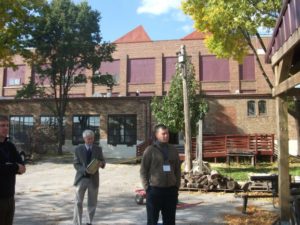
Connerly (in gray jacket) during a 2014 field trip of post-flood redevelopment in Cedar Rapids.

Connerly is truly a comprehensive thinker in the best planning tradition, and this book shows it. While I am certain, because of publishing schedules, that he had completed his manuscript before the death of George Floyd at the hands of Minneapolis police over the Memorial Day weekend, his book is incredibly timely in the fall of 2020 because of his focus on the history of racial and ethnic disparities in Iowa. In fact, Chapter 4 is simply titled, “Why Is Iowa So White?”

Indeed, that is a very good question. It is not just a matter of Iowa being farm country. After growing up in the Cleveland metro area in Ohio, then moving to Iowa in January 1979 before ultimately enrolling in graduate school at the University of Iowa, I remember being struck by the apparent lack of diversity, especially outside the handful of cities above, say, 50,000 people. There is, after all, industry in these cities, and industry has often attracted multiracial work forces. Unless, that is, political and social forces intervene to prevent such an outcome. Most people, however, never notice such forces at work and never learn about them in school. History can be very silent about such matters unless diligent researchers insist on exposing that legacy to sunshine, aka “the best disinfectant.”

Connerly digs deep on this topic, all the way back to antebellum Iowa politics. Sitting just north of Missouri, a slave-holding border state, Iowa was both a frontier of the Underground Railroad and a harbor of typical northern mixed feelings about African Americans. In 1850, Iowa was no less than 99.8 percent white, and did not dip below 99 percent, Connerly notes, until 1970. Since then, there has been a substantial growth in minority populations. But African Americans have historically been concentrated in just four urban counties. All that said, it was also the Iowa Democratic caucuses in 2008 that launched Barack Obama on a streaking path to the presidency. What accounts for this paradoxical history?

From the early days of statehood, Iowa suffered from a typical northern moral conflict between supporting emancipation and not particularly wanting too many blacks in the neighborhood. That is not putting too fine a point on the matter. Connerly notes that before the Civil War, Iowa had enacted laws banning blacks from the state. The territory avoided enacting such black codes to win statehood, but once that was achieved, Iowa legislators had no problem backtracking on the issue. The bottom line was that Iowans, overall, opposed slavery but did not necessarily favor civil rights for freed slaves.

That changed somewhat after the Civil War, with Radical Republicans pushing through changes that liberalized matters considerably, but it was only following World War II and through the Civil Rights movement of the 1960s that serious, permanent change began to occur. By that time, however, previous history had done its work in making African Americans largely feel unwelcome. Iowa stayed overwhelmingly white, but not entirely by accident. At the same time, the state has been receptive to refugees, for example, after the Vietnam war, and remarkably progressive on some other issues. Northwest Iowa elected the remarkably ignorant Steve King to Congress, but Republicans themselves dethroned him in this year’s June primary.
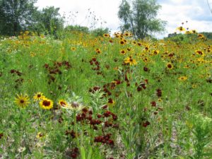
Prior to white settlement and the rise of modern agriculture, much of the Iowa landscape enjoyed by Indians consisted of prairie. Photo by Suzan Erem

Connerly writes that African Americans were not the only minorities to feel the impact of 19th-century American racism. Before European settlement, which took place in earnest only after Iowa became part of the United States following the Louisiana Purchase, fourteen Native American nations had, over millennia, occupied some part of what became Iowa. Before the 1800s, their interaction with Europeans was largely through trade, but eventually their land ended up in the hands of white settlers. The short answer as to how that happened is simple: “We took it from them.” Today, only the Mesquaki settlement in Tama remains as a reminder of the formerly dominant Native American presence.

The Hispanic presence, and that of various Asian minorities, is a product of more recent history, some of it involving the evolution of labor relations, particularly in agriculture and meat processing plants, but today there is a distinct, but distinctly disadvantaged, Hispanic presence. It is no accident that earlier this year, some of the most intense controversy over coronavirus spread in states like Iowa, Nebraska, and South Dakota involved minority workers in the meat-packing industry and deficiencies in safety protocols among the companies involved. In a whole chapter dealing with labor issues over time in both the food and agricultural equipment industries, one can see the steady decline of leverage among white-dominated labor unions and the rise of cheap labor and mass production within the industry as it is today. It is hardly a stretch to suggest that these social and economic changes have had profound impacts on, and implications for, the future of Iowa’s economy and society. Iowa did not shift from supporting Obama in 2008 and 2012 to Trump in 2016 and 2020 without some massive strains within the body politic. How those tensions are resolved will go a long way toward determining whether Iowa can chart a successful path to a sustainable future, as Connerly’s book suggests. Iowans will have serious work ahead in improving social equity while adjusting to a changing demographic makeup across the state.

But I do not wish to create the impression that the book is strictly focused on such demographic issues, as important and critical as they are. It is important to notice that Connerly has tied together the issues of environmental health, fairness, and prosperity in his title. His larger point is that all these questions are inextricably related. To quote some planners I have known, “Everything is connected to everything else.”

Connerly takes us on a detailed, well-documented tour not only of Iowa’s demographic history, but of its environmental and economic history as well. Iowa clearly entered statehood as a predominantly rural, agricultural state, though not necessarily producing the corn and soybeans that predominate now. Originally, in fact, it grew more wheat, but trends shifted to corn and hogs. But the state is still heavily dependent on agriculture, with 43 percent of its 2015 manufacturing centered on either food processing or machinery used in agricultural production. These two gave rise in the twentieth century to some powerful unions representing workers who were largely able to achieve a blue-collar version of middle-class prosperity. Hogs, supported by state laws exempting agriculture from county zoning laws, gave rise to the growth of concentrated animal feeding operations (CAFOs) in the past 40 years, and the meat-packing industry itself became more concentrated and able to mechanize increasingly and replace high-wage jobs with lower-wage mass production and weaker unions. The people working in the newer factories are definitely more racially diverse but definitely not more empowered and definitely paid less. The growing inequities have resulted in a shrinking middle class.

One factor that distinguished the Iowa packing plants prior to the major, union-busting shifts of the 1970s and 1980s was that the plants were closer to the farms, and thus, unlike larger plants in Chicago and Kansas City, bought animals directly from farmers. Connerly maps out the consequences in urban development for Iowa, namely, that Iowa never developed the metropolitan magnets of neighboring states like Minnesota, Missouri, and Illinois because of the dominance of the Twin Cities, Chicago, and Kansas City, and instead has a number of smaller cities, the largest being Des Moines, which has about 215,000 people, though the entire metro area is about three times that size. Smaller cities have mostly grown around agriculture-related industries.

All this has had significant consequences not only for quality of life but the quality of the environment, with water quality problems arising from rural land use issues such as CAFOs, soil erosion, and nitrate concentrations in groundwater. Connerly’s final chapter asks whether Iowa truly is the “best state in the nation,” a title bestowed in 2018 by U.S. News and World Report. As a former Iowan, I do not offer this review as a way of trashing the state, nor does Connerly offer his book in that spirit, but the question is an opportunity to explore the complexity of a state that too many elsewhere see as simply white and rural. Iowa, with the right policies, the right incentives, and the right opportunities, has the potential to create a healthy environment and economy, but it must examine current trends and determine how to reverse those that are moving the state in the wrong direction. The last chapter is a succinct compendium of recommendations for moving Iowa toward a growing middle class, a healthier environment with better recreational opportunities, and a progressive approach toward making agriculture more ecologically sound and resilient in the face of natural hazards, most notably, floods.

Testing facility of the Iowa Flood Center, 2019.

The state has created some interesting mechanisms for doing this, but has a stubborn habit in recent years of shooting itself in the foot. In 1987, the legislature wisely passed the Groundwater Protection Act, which created the Aldo Leopold Center for Sustainable Agriculture at Iowa State University, which has done remarkable research on establishing a balance between economic and environmental needs in agricultural practices. Yet, in recent years, the legislature has significantly limited state funding for the center at the behest of corporate agricultural interests. In 2010, following the devastating floods in 2008, the legislature funded creation of the Iowa Flood Center at the University of Iowa, which has become a model in advancing flood prediction and mitigation that other states are considering copying, yet some question the need for continued funding. It is almost as if Iowa wants to replicate the larger national battle between science and an increasingly poisonous distrust of “experts.” Would it not be better to marshal and support the best intellectual resources Iowa can muster for an assessment of the opportunities that lie ahead?

Connerly points out, in contrast, how Iowa could take the lead in solving problems like climate change and excessive nutrient runoff in the Mississippi River basin that leads to both groundwater contamination locally and hypoxia in the Gulf of Mexico. This last chapter is the biggest single reason to read the book, but its logic is only fully clear after reading the thorough research that precedes it.

My final comment is that it may seem that this is a book that is primarily or perhaps solely relevant to Iowans. I think that conclusion, however, would be short-sighted. While I am profoundly aware of the many books others have produced about other states, regions, and metropolitan areas across the U.S., I think it is vitally important that other scholars across the nation undertake similar efforts to assess the path to sustainability for their own states, regions, and cities. We could sorely use such a book in Illinois, and the same is probably true for every neighboring state. As I suggested at the outset, it is not enough to chart a new national path. We need these serious explorations at subnational levels as well. In that sense, I believe Connerly has done a major service for the Hawkeye state. I’d like to see more such books.

Jim Schwab

One BRIC at a Time

One of the long-standing questions concerning national disaster policy is why a state or community needs to suffer a presidentially declared disaster in order to be eligible for federal hazard mitigation grants to help improve its resilience against storms, floods, earthquakes, and wildfires, or other possible calamities. Ever since passage of the Stafford Act in 1988, most or all federal support for hazard mitigation projects has depended on a disaster happening first, which then triggered a spigot of grants for risk-reduction projects under the Hazard Mitigation Grant Program (HMGP), run by the Federal Emergency Management Agency (FEMA). It was almost a perverse twist on the famous alleged Willie Sutton justification for robbing banks. Why suffer a major natural disaster? Because that’s where the money is.

But not necessarily any longer. FEMA’s new Building Resilient Infrastructure and Communities (BRIC) program is a major new source of money available on a competitive basis through applications from local governments seeking to reduce risk through hazard mitigation projects. Over the last two years, FEMA has shaped BRIC, responded to public and stakeholder feedback on its plans, and finally, released those plans earlier this summer, followed in early August by release of its Notice of Funding Opportunity for states and communities. Those jurisdictions can apply between late September and January 29, 2021, the deadline for submitting proposals. Importantly, the program continues FEMA’s decade-long march toward encouraging the integration of hazard mitigation planning throughout a community’s entire range of plans to ensure a more holistic approach with a better prospect of effective implementation. This policy dates back to a seminal 2010 report by the American Planning Association and beyond, but  it is good to see it reinforced.

Breaking New Ground

BRIC began with provisions in the Disaster Recovery Reform Act (DRRA), passed by Congress in 2018 as part of a larger bill that primarily reauthorized the Federal Aviation Authority but included miscellaneous additional measures dealing with disaster policy and sports medicine. Of such bargaining are sausages made in the Capitol, but the specific provisions authorizing what FEMA chose to label BRIC were born of years of complaints and frustration among disaster professionals about sporadic and inconsistent federal funding for hazard mitigation projects before instead of after disasters. The Disaster Mitigation Act of 2000 authorized a Pre-Disaster Mitigation (PDM) program, but for the past two decades its funding has relied on the whims of Congress. In some years, that provided as little as $25 million for a national competition. Sometimes the threat of termination hung over the program. Such minuscule funding produced both inconsistent results and great uncertainty from year to year among potential grant recipients. Almost no one was happy with the program. BRIC now replaces PDM.

Under Section 1234 of DRRA, Congress authorized a new pre-disaster hazard mitigation grant program that would no longer rely on annual congressional allocations but instead will use an annual calculation of 6 percent of annual post-disaster funding for relief from presidentially declared disasters. FEMA will determine that number from estimates six months afterwards, and annually transfer those dollars into the BRIC fund. For Fiscal Year 2020, that will amount to $500 million, of which $33.6 million will be directly allocated to the 50 states, District of Columbia, and U.S. territories. A separate $20 million set-aside will fund tribal governments for BRIC grants. The remaining $446.4 million are available through the new national grant competition. That amount far exceeds any annual allocations from Congress for PDM. While DRRA states that this money is available to states with presidential disaster declarations in the previous seven years before a specific grant opportunity, in fact, all states and territories currently qualify under that criterion.

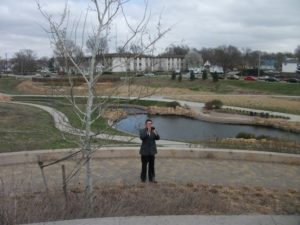
Antelope Valley flood reduction project, Lincoln, Nebraska

A FEMA fact sheet makes clear that BRIC also establishes new priorities for this assistance by providing incentives for:

  • public infrastructure projects;
  • projects that mitigate risk to one of more lifelines;
  • projects that incorporate nature-based solutions; and
  • adoption and enforcement of modern building codes.

I will return to these goals later in this post because all are important and some deserve further explanation. It is worth noting, however, that much of the new focus grew out of extensive stakeholder feedback as FEMA solicited input, and that feedback is documented in a separate FEMA report.

FEMA has also undertaken an extensive education effort to ensure that potential applicants are well informed on their options for grant proposals. The agency produced a series of five weekly one-hour webinars in July, some of which, in my opinion, are distinctly more informative than others. But their utility may vary with the existing knowledge and experience of those watching, so what is clear to me may be new to others. The best, again in my opinion, detail issues connected with the last three goals in the bullet list above. All were recorded and are available online.

Using BRIC Funds

The very first BRIC webinar spelled out the guiding principles for the new program, which are designed to support community capability and capacity building:

  • encourage and enable innovation
  • promote partnerships
  • enable large infrastructure and projects
  • maintain flexibility
  • provide consistency

The clarity of priorities, focus on building local capacity for hazard mitigation, and streamlining of grant processes, among other factors, outline major differences from the previous PDM program, which suffered from inconsistencies that stemmed in large part from the erratic nature of its funding. The emphasis in selecting projects for support will turn toward their potential for risk reduction, innovation in planning and implementation, focus on addressing future climate, development, and demographic conditions, and support of community lifelines, among other factors as well as considering the types of populations affected by the projects and the partnerships and outreach outlined in the proposals.

Also important is that DRRA provided BRIC with a broad mandate for supporting the local adoption and enforcement of modernized building codes to better address protection against natural hazards. The new law also empowers FEMA to use BRIC to support technical assistance to communities, as well as reimbursing pre-award costs, that is, money expended for project development costs prior to grant approval, so long as the project is ultimately funded. Previously, communities could only use grant money for expenses incurred once the project had begun.

DRRA also expressed specific support for wildfire and wind hazard mitigation initiatives in Section 1205 and earthquake early warning systems in Section 1233. Projects addressing these types of mitigation will have clear support for BRIC funding approval as a result.

Building Codes

Section 1206 of DRRA addresses the need to provide stronger mitigation grant support for projects advancing the adoption of building codes that mitigate natural hazards. Codes adopted by local governments using BRIC grant support must conform to the latest published codes promulgated by organizations like the International Codes Council, which maintains a library of digital codes at the linked site. Permissible activities in this area under the BRIC guidelines include evaluation of the adoption or implementation of new codes in reducing risk; the enhancement of existing adopted codes; and the improvement of work force skills among the enforcement staff.

Building codes have assumed an increasing importance with the realization over many years of their cost-effectiveness in reducing losses. Despite residual resistance in some quarters to increased regulation through such codes, they are a clear asset in the hazard mitigation toolbox. The earthquake that struck Anchorage, Alaska, in November 2018 provided abundant illustration of the merits of mandatory building codes with dramatically shrunken damages compared to the 1964 earthquake that shattered much of the city. Likewise, experience in Florida has shown that stronger codes with adequate enforcement has driven down losses. Following the stark realities exposed by Hurricane Katrina, Louisiana adopted mandatory statewide building codes in 2006. Many other examples of improved building codes are readily available, pertaining not only to earthquake and hurricane wind damage but to wildfires and other hazards that can be mitigated through better building standards. Building and landscaping codes can be enhanced with design manuals and other outreach to builders and the public, such as the ignition-resistant design manual produced by the city of Colorado Springs, which has faced and learned from repeated wildfire events.

Grant applicants have other resources to which they can turn for information and support on building practices, including the BuildStrong Coalition, the Federal Alliance for Safe Homes (FLASH), and the Insurance Institute for Business and Home Safety, a research entity supported by the insurance industry that includes test laboratories for determining the efficacy of various building materials and approaches. FEMA also has web-based resources on building codes.

Community and Infrastructure Lifelines

The concept of lifelines in a hazard mitigation context may be new to some, though the name itself is intuitively simple. Simply put, lifelines are important community services that exist to alleviate threats to life and property. Emergency managers have long used the term “critical facilities” to refer to those buildings and structures that must survive disaster impacts in order to provide continuous essential services such as transportation, public safety, shelter, and power to a community. But lifelines are more than physical assets; they are also systems that must be able to continue to function in an emergency or disaster. In BRIC, these are now the targets of focused mitigation projects, which can include efforts to strengthen and build the resilience of any systems and institutions within seven categories:

  • safety and security;
  • food, water, and shelter;
  • health and medical;
  • energy;
  • communications;
  • transportation;
  • hazardous materials

FEMA introduced the concept of community lifelines in the fourth edition of the National Response Framework. The FEMA website includes a free download of its Community Lifelines Toolkit. Basically, the idea is to allow BRIC grants to support projects that reduce risk to these lifelines and help stabilize them quickly after a disaster occurs. These can include stormwater management projects,  tsunami safety measures, infrastructure safety upgrades, and retrofits to essential buildings such as hospitals and shelters.

Nature-based Solutions

I will admit that, to me, some of the most intriguing initiatives within BRIC may focus on supporting green infrastructure, which is essentially what FEMA is labeling nature-based solutions. The central idea is to use the natural ecosystem services within a community or region to ameliorate the impacts of natural hazards by letting nature do what nature has always done best. FEMA has shown similar fascination with the concept by issuing a 30-page guide for local communities that outlines what these solutions can look like and how they function. These approaches have gained popularity in part as a response to climate change, but they are larger than that because they often address at least part of the problems associated with flooding and sea-level rise at less cost, often significantly less cost, than “gray” infrastructure or engineered structural solutions. In the final BRIC webinar, Sarah Murdock, Director of Climate Resilience Policy for The Nature Conservancy, noted that coastal wetlands had prevented an estimated $625 million in property damage during Hurricane Sandy. In various states

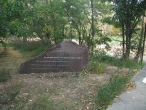
River restoration along St. Vrain River after 2013 Colorado floods

and cities, nature-based solutions have included green roofs, rain gardens, permeable pavements, living shorelines, and a growing array of other innovative design solutions to long-standing problems like stormwater management, urban heat islands, building energy demand, and urban flooding.

A great deal of research, case study documentation, and tool development has occurred in recent years with respect to nature-based solutions. For instance, Digital Coast, a program of the National Oceanic and Atmospheric Administration, features tools such as the State of High Tide Flooding and Annual Outlook, the Climate Resilience Toolkit, and the Climate Explorer. NOAA also provides a variety of other technical assistance, for instance, through Regional Climate Centers and Sea Grant College Programs. Many states provide their own research and technical assistance, for example, through state climatologists, represented collectively the American Association of State Climatologists. Urban planners can access additional design ideas through the American Planning Association publication Green Infrastructure: A Landscape Approach. The U.S. Army Corps of Engineers has provided its own online atlas called Engineering with Nature that discusses the multiple benefits of these approaches. Finally, I would be remiss not to mention the stellar contribution of The Nature Conservancy with its web-based resource, Naturally Resilient Communities, an effort to which I can proudly claim to have contributed during my tenure at APA.

Outlook

The most promising feature of BRIC is that, because it was authorized by Congress in DRRA with a secure source of ongoing annual funding, it is not dependent on the shifting whims of presidential administrations. It has a solid chance of building an effective constituency among grant recipients pursuing projects that are highly likely over time to demonstrate their own worth so long as the program is administered with an eye to its goals and fundamental objectives. I am not trying here to be encyclopedic but to provide an entry point to the range of resources and possibilities that community applicants and advocates can use to ensure the success of BRIC. Given the steady rise in the costs of natural disasters, driven in part by climate change but also by demographic shifts and public policy decisions, making a difference by helping to drive down such costs is a national necessity. BRIC opens a new door toward wise investments to help achieve this goal. This nation needs some creative disaster problem solving backed by new resources.

Jim Schwab
 

Unequal Exposure

On April 29, I will be moderating “Demanding Equity: Planning for Post-Disaster Recovery,” a 45-minute session in a special three-day virtual conference of the American Planning Association, NPC20 @HOME. The online conference is an attempt to replace the experience of the canceled National Planning Conference, which would have taken place in Houston, April 25-28. For the first time in APA history, the annual event will not go forward as planned. Like numerous other conferences, it was untenable to assemble thousands of participants in the middle of the coronavirus pandemic. But it is possible to provide a decent educational opportunity in its place by broadcasting and recording distance learning and letting participants ask questions remotely.

But why do I mention this one session, when APA is offering two dozen? Because it touches on some issues so central to the social and economic impacts of coronavirus, and speaks so directly to what planners and planning can do as we recover from this experience, that I wanted to highlight the subject in this post. It has been said often that the coronavirus does not discriminate. That may be true, but our society has done so and still does, often in ways people are reluctant to consider or admit. The result is that, as happens with most disasters, minorities and low-income people, those with fewer opportunities in life or greater exposure to danger, are disproportionately affected. And so it will be when the histories of this pandemic are written. The evidence is already stark enough for passionate discussion.

To give credit where it is due, the session was the brainchild of Adrian Freund, a veteran, semi-retired planner in Oregon. Before the NPC was canceled, however, Adrian was hospitalized (not because of coronavirus) and realized he would be unable to go to Houston. He reached out through a former president of APA, David Siegel, also of Oregon, to ask me to take over, and I agreed. We are on the same page on this issue. When APA decided to replace NPC with NPC20 @HOME, this was one of the sessions they felt must be included, and I reassembled the speakers to modify our plans for the new format.

All of them have a ton of wisdom to contribute on the subject. Shannon van Zandt is a professor of urban planning and department head at Texas A&M, and has authored numerous articles and led many projects on subjects related to equity in disaster recovery, particularly in the Texas context in which she works. Marccus Hendricks, an assistant professor of planning at the University of Maryland, is a Texas A&M graduate who has focused on infrastructure issues and environmental justice, writing his doctoral thesis on stormwater management in Houston. Chrishelle Palay is director at the HOME Coalition in Houston. Obviously, the panel has strong Texas roots, but there are few states where one can get better insights into the impacts of environmental inequities.

But it is the screaming headlines of the past week that have brought renewed attention to the issue in the context of coronavirus. In Chicago, we have learned that African Americans are dying from the virus at six times the rate of whites. Gary, a predominantly African American city, is the new coronavirus hot spot in Indiana. It is also where it gets personal for me. A 12-year-old granddaughter lives there and, as of yesterday (April 10), appears to have COVID-19 symptoms. Her mother called and was asked not to bring her to a hospital, but to isolate her at home. She will not be tested because, as everywhere else, this nation has not gotten its act together on testing. Will she even be included in the statistics, then, as a known case? Good question. I have no idea how Indiana is tallying such numbers. But she is in for a rough ride in the immediate future, and Gary and surrounding Lake County are certainly not fully prepared.

But what is happening in Chicago, as numerous commentators and public health officials have noted in the past week, is not only not unique, but to be expected. Detroit is emerging as a hotspot with major disparities in racial impact. State health data reveal that, while blacks make up 14 percent of Michigan’s population, they account for one-third of the cases and 40 percent of the deaths so far. In Louisiana, with one-third of the population, blacks account for 70 percent of the deaths. New Orleans has clearly emerged as a southern hot spot for coronavirus infections. Across the nation, one can find similar racial disparities.

Beneath those figures, however, are other disparities that weave in and out of racial and ethnic numbers. Age is perhaps the best-known factor, but so are many others. People in low-income service jobs, for instance, to the extent that they are still working, are more dependent on public transit and much less likely to be able to work from home like white-collar professionals. Public transit contributes greatly to mobility in urban centers, but does little for social distancing. It is still unclear just how transit will be affected for the long term, although it remains a vital link to jobs for many of the working poor. But coronavirus is clearly challenging the economic viability of many transit systems, one reason they were the target of assistance in the CARES Act.

It goes without saying that health care workers are significantly more exposed, but they are not just doctors. Their ranks include nurses, nursing assistants, and many others, some with much lower incomes, who nonetheless are risking their lives every day. Some of them work in nursing homes, which have not been the focus of any noticeable attention at the federal level. There are many ways to slice and dice the data to identify patterns of exposure, including those for access to health care, quite possibly the single most important factor driving disparities in this particular disaster. Lack of insurance coverage and inability to afford adequate health care leave many people untouched by the system and untested until it is too late. Poor or nonexistent health insurance coverage, especially for undocumented immigrants, accompanied by food deserts in many inner-city neighborhoods, endemic poverty in many rural areas and small towns, and exposure to job-related ailments, can produce numerous chronic conditions that make exposure to a new virus fatal or disastrous instead of merely survivable.

It remains remarkable, in view of these factors, that the Trump administration can maintain its drumbeat of opposition to the Affordable Care Act, including the recent refusal to allow newly jobless Americans to sign up for coverage. But this is one of many ways in which this nation, through both federal and state policy, continues to resist expanded, let alone universal, health care coverage to shore up health care deficiencies for the most vulnerable among us. There is both a meanness and short-sightedness that underlies much of this resistance. As I noted just two weeks ago, these health care vulnerabilities, with all the racial and socioeconomic inequities they embody, form the weak links in the chain of overall vulnerability for our communities when pandemic strikes.

And that brings me back to the point of the session I will moderate. One essential element of the planner’s skill set should be demographic analysis. The coronavirus pandemic highlights the critical value of addressing public health in comprehensive plans and other efforts to chart the future of cities, counties, and regions. Issues of national health care policy may be well beyond the reach of planners and their communities, but exposing the glaring disparities that have been made evident as the data on coronavirus cases grows is critical to knowing how resilient our communities are or how resilient we can make them. Access to health care is not merely a matter of insurance, as important as that is. It is also affected by the practices of local hospitals, the access to open spaces for densely populated areas, environmental regulations controlling industrial pollutants, public education around personal health, access to healthy food, the quality of our food distribution systems, and a myriad of other considerations that can be addressed to one degree or another through local or regional planning and through policy commitments to social equity.

That is precisely why, as the White House dithers, and federal management of the coronavirus crisis continues to fall short, dozens if not hundreds of mayors and governors and other local and state officials have stepped up to fill the gap. It is sad that there is not better national leadership in this crisis, but we are learning who our real leaders are. Enabling planners and other policy makers to support those officials with essential and meaningful data is an ongoing task, but if we are going to emerge from this disaster in a better place, identifying the inequities that weaken our communities and finding ways to build resilience across those weak links is going to be essential. There is no good alternative.

Jim Schwab
Awesome Natural Attraction in Nebraska

Last week, I was in Kearney, Nebraska, for three days, attending and speaking at the Nebraska Planning and Zoning Association annual conference. But that is merely an excuse for being in the right place at the right time, for once in my life, to see one of nature’s more spectacular wonders—the migration of the sandhill cranes. I was told that a nature reserve had estimated their total presence at about 600,000 birds.

In their annual migration from South America, they all funnel through about a 90-mile stretch of the Platte River in Nebraska each spring, right around this time. They come by the thousands. It is easy to see what may attract them. The river is very wide but shallow, just inches deep. Away from predators such as coyotes, they can cluster overnight in the water, then move once dawn brings the rising sun to the landscape. Even before dawn in the chilly March morning, you can hear their awking and cawing, but it becomes a roar once they soar into the sky. I am reluctant to try harder to describe the sound; you simply need to hear it.

On their way north, after the Platte River stopover, they again spread out across a range from eastern Russia along the Pacific Coast through Alaska and Canada. According to the Audubon Field Guide, they feed on a variety of grains and small animals. Their young are able to fly within 75 days but accompany their parents for their first nine to ten months, joining the migration. They prefer marshy vegetation and shallow water for nesting sites.

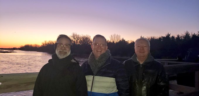
I credit Chad Nabity, who helped organize the Kearney conference, for inviting me to join the small delegation that met at 5:50 a.m. on Friday morning (March 6) in the chilly morning air to walk down a trail to the wooden bridge across the river at the Fort Kearny State Recreation Area. There we waited in the early morning dark, gloves on to keep our camera hands warm, for the sudden movement of masses of birds, which you can watch for yourself below. Thanks to Chad Nabity for sharing his video file and the photo below of three of us at the bridge.

Left to right: Joel Albizo, executive director, American Planning Association; Kurt Christiansen, APA President; myself

Jim Schwab

Costly Coastal Arrogance

In the days shortly after World War II, writes Gilbert M. Gaul in The Geography of Risk, Morris Shapiro and his family were busy building their own version of Levittown, the famed suburban tract housing development of Long Island, on a barrier island in southern New Jersey known as Long Beach Island. The place had largely been the preserve of fishing villages in earlier years, but Shapiro had a vision, one he passed along to his son, Herbert, in due time.

Shapiro drained and built on what we now call wetlands, but in the 1940s, environmental values were a weak reed for resisting the onslaught of developers who believed in the next big real estate trend and the willingness of small villages to grow with them. And so, Morris persuaded Herbert to buy land around Barnegat Bay, and the few hunters and watermen who understood the value of salt marsh in preserving wildlife habitat were pushed aside. The suburbanization of the Jersey Shore soon took hold.

Nature heals its own wounds when the landscape is healthy, but damage to the built environment can be another matter altogether. Gaul details the impacts of the Ash Wednesday storm that struck the New Jersey coast in the spring of 1962, providing the nation with its first television-era glimpse of disasters yet to come and the high costs of having compromised the protective dunes and wetlands and installed thousands of bungalows on a narrow, highly vulnerable strip of land along the sea. “Nearly all the 5,361 homes on Long Beach Island . . . were damaged,” Gaul tells us, “including 1,000 that were severely impaired and 600 that were destroyed.”

As always, the immediate focus was on rebuilding, with urgent reminders from legislators and others of the economic value of shoreline development (but not its costs). In the face of that Category 5 juggernaut, Gov. Richard Hughes bravely proposed a six-month moratorium on new development, supported by the U.S. Army Corps of Engineers, and a ban on rebuilding along a 100-foot buffer along the beach. Looking back, it seems visionary for its time in anticipating the problems that would otherwise follow, and it attracted precisely the blowback we have come to expect. Federal support for rebuilding came from the Kennedy administration, and the long drift toward increased federal responsibility for recovery was underway.

Gaul goes on to detail the long tale of Jim Mancini, both developer and mayor of Long Beach Island, and cheerleader in chief for the coastal towns and what they saw as their inevitable growth. Still, governors and environmental officials in New Jersey were periodically game for a new try at restraining a situation where local officials controlled building and zoning while state taxpayers provided millions of dollars to repair storm damage and infrastructure. Gov. Brendan Byrne was next in 1979, starting with a conference on the future of the New Jersey shore, followed by initiatives from the state Department of Environmental Protection and the introduction of the Dune and Shorefront Protection Act in the legislature.

Predictably, the mayors rebelled, led by Mancini, who organized 1,500 protesters to attend a July 1980 hearing at the St. Francis Community Center in Brant Beach. Robert Hollenbeck, chairman of the Senate Energy and Natural Resources Committee, essentially presided over an ambush in which he was repeatedly shouted down by angry homeowners. Once again, the opportunity to take a creative regulatory approach to controlling shoreline damage was driven into wholesale political retreat. By the time Superstorm Sandy delivered its legendary hit in October 2012, it was all over but the shouting. The administration of Gov. Chris Christie was not about to seriously challenge the home rule prerogatives that dominate the politically fragmented landscape of New Jersey township government. The tough questions would have to wait.

What Gaul outlines in New Jersey, of course, has occurred in other forms in other places from the Carolinas to Florida to Texas over the subsequent decades. Gaul takes us to all these locations as the book progresses. What we have seen, time and again, are the costly consequences of a pattern of coastal development that has placed increasing quantities of homes and properties in harm’s way, then begged or even demanded that states and the federal government rescue the storm-damaged communities even as they fight bitterly against regulatory measures aimed at reducing future costs by restricting unwise development.

Of course, by now there are many residents caught in the middle. But surely, it is not impossible to sympathize with their plight and be willing to assist those who seek alternatives, while refusing to continue subsidizing unwise new development or bailing out those who refuse to accept the reality of the risks they have assumed. What is clear is that tough decisions await, and the public does not have endless resources. Wiser development and rebuilding decisions are imperative.

Not surprisingly, Gaul, a veteran Pulitzer Prize-winning author and reporter, is a New Jersey native. But he is also an astute historian and researcher who writes with a well-informed passion that brings us, in the end, to the fateful season of 2017—the year of Hurricanes Harvey, Irma, and Maria—and then 2018, when all looked calm on the meteorological front until Florence took its toll in North Carolina, followed by Category 5 Michael in the Florida Panhandle. Climate change, inducing hurricanes that become slow-moving rain bombs that flood cities like Houston, is still “not a thing” in the Trump White House. Neither, for the most part, are buyouts of repetitively flooded homes, even as the nation desperately needs to find ways to live more resiliently in the face of the risks it has embedded on its coastal landscapes.

But the costs keep climbing, and it is not impossible to imagine a serious political reckoning under a different administration with a more realistic handle on the stakes involved, which run into the trillions of dollars. It is not impossible, for instance, to imagine a $250 billion disaster if a catastrophic hurricane took direct aim at one of Florida’s major cities. For that reason alone, Gaul’s book may be worth a read. We need to improve the quality and depth of the conversation around issues with such drastic fiscal impact.

Jim Schwab

Climate News from Florida and California

Warning to readers: This is not my usual single-focus essay. It is a collage of news from two coastal states with an assortment of serious natural hazards challenges—Florida and California. In recent years, their politics has tended to diverge widely, but perhaps we are seeing a welcome convergence to some degree around climate issues. It is about time: Both face severe and unrelenting challenges, and there is little time to waste in identifying and implementing effective solutions.

Let’s start with Florida.

For starters, they are getting significant help from The Nature Conservancy (TNC), an organization that has long performed great work in preserving open space and researching the values of green infrastructure. For years, I have heard about the merits of coastal mangroves in mitigating hazards such as storm surge and coastal erosion. Recently, TNC employed an insurance industry catastrophe model to quantity the economic benefits of mangrove forests for reducing coastal storm damages in Collier County, and from Hurricane Irma, which struck parts of Florida in 2017. For those unfamiliar with the area, Collier County is in southwest Florida running from Naples on the Gulf of Mexico coast east into the Big Cypress Nature Preserve, which lies just north of Everglades National Park.

To quote the TNC website, “Many areas in the county received over $1 million in benefits every year in flood damage reduction benefits due to the mangroves in front of them.” Moreover, “Mangroves averted $1.5 billion in storm damages, amounting to a 25% savings in counties that have mangroves. They also protected more than 626,000 people across Florida.” You can access the full report, Valuing the Flood Risk Reduction Benefits of Florida’s Mangroves, here.

While TNC could be expected to take climate change and natural hazards seriously, Florida Republican officials are another matter. It is thus heartwarming to learn in a new Associated Press article that first-term Gov. Ron DeSantis has helped turn the page, along with some Republican lawmakers, on the climate denial that prevailed under his predecessor and now current U.S. Senator, Rick Scott. It also appears that Sen. Marco Rubio has joined a bipartisan Senate Climate Solutions Caucus launched in October. While one should not expect the sort of wholehearted embrace of climate issues that one sees among progressive Democrats, that is not necessary for one to appreciate the value of a return to a bipartisan approach to an issue where Republican support (and connection to reality) has in recent years been woefully lacking, especially under President Trump. Shifting public perceptions have driven political change in both California and Florida, and it is about time. Southern Florida has been awash in nuisance flooding driven by sea level rise, and pollution has threatened the environmental viability of the Everglades. If Republicans are finding a need to appeal to voters through climate action, that is, on balance, a far better thing for the political system than a hyper-partisan battle of acceptance of reality versus denial. It is also not surprising that two highly vulnerable states with major natural hazard threats would be in the forefront.

Of course, California under former Gov. Jerry Brown went all in on confronting climate change, in part because of the motivating impact of increasingly frequent and violent wildfires and lengthening wildfire seasons. If anything, current Gov. Gavin Newsom may be picking up the pace, but it is worth nothing that even former Republican Gov. Arnold Schwarzenegger has long acknowledged climate change and advocated effective state and federal action in response. But let me keep this post short and to the point. I recently taped some introductory material for new additions to the American Planning Association’s Resilience Roundtable podcast series, for which I will soon be moderating several new installments to be released in the coming year. But two new podcasts involve interviews by Prof. William Siembieda of California Polytechnic State University in San Luis Obispo, with planners from Butte County. The first is already available, in which he discusses the impact and recovery from the Camp Fire, which destroyed much of the city of Paradise, with senior planner Dan Breedon. The second interview will appear on the Resilience Roundtable page soon.

Jim Schwab

Discovering a Piece of Chicago

It is possible to live in a city as large as Chicago and be blissfully unaware of some wonderful things. Chicago, after all, includes 2.7 million people spread over 227 square miles. My wife and I have lived here since 1986, but we do not spend much of our time traversing unfamiliar neighborhoods. Like most people, we have well-worn paths, and at times we visit new areas where we know people and learn from them. Also, like most people with cars, we drive by certain areas without taking time to really see all that they contain, as one might on foot. Because I walk through my own neighborhood, I know a great deal about what is happening. But there are others where I have not a clue.

Chicago is nothing, however, if not full of pleasant surprises. Never mind unpleasant headlines or presidential tweets about crime rates. There are reasons why millions of people still live here. I discovered one this Labor Day weekend through sheer serendipity. I participated in a small workshop at a home on North Virginia Avenue, a street I had never visited before. I looked it up on Google maps and discovered that the homes on the west side of the street border a great park along the North Channel of the North Branch of the Chicago River, a drainage canal built more than a century ago. This channel extends straight north from where it joins the North Branch around Carmen St., just south of Foster Avenue, a major east-west artery that extends from Lake Michigan through Chicago’s North Side into the northwestern suburbs.

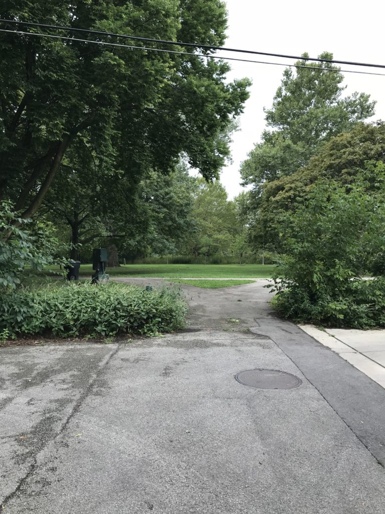
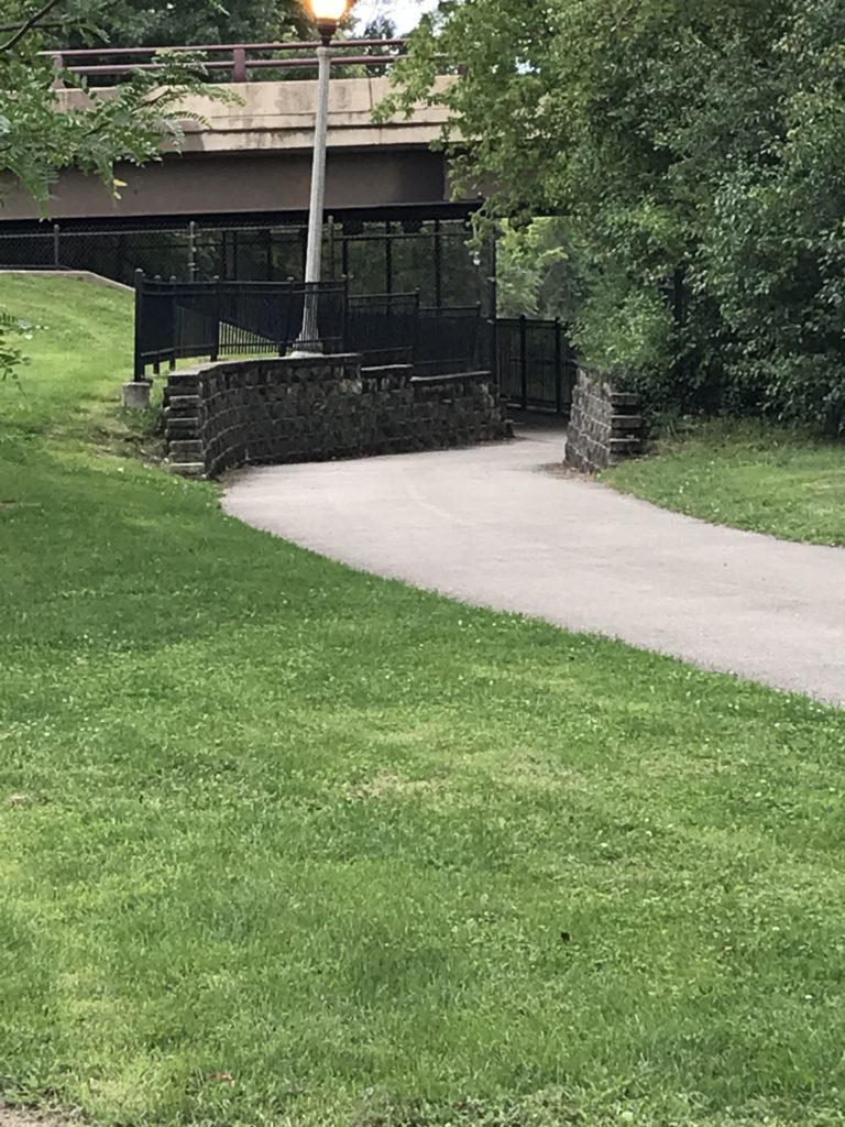
Entrance to Legion Park from Ardmore St.

What I saw on the map invited me to explore after I left the event, a little more than half a mile north of Foster, several miles from downtown. I soon realized what a gorgeous asset this neighborhood has just beyond its western edge, and what a gorgeous day I had chosen for my short walk. As at other corners along N. Virginia Avenue, Ardmore terminates on a short stub that opens onto a trail inside Legion Park.

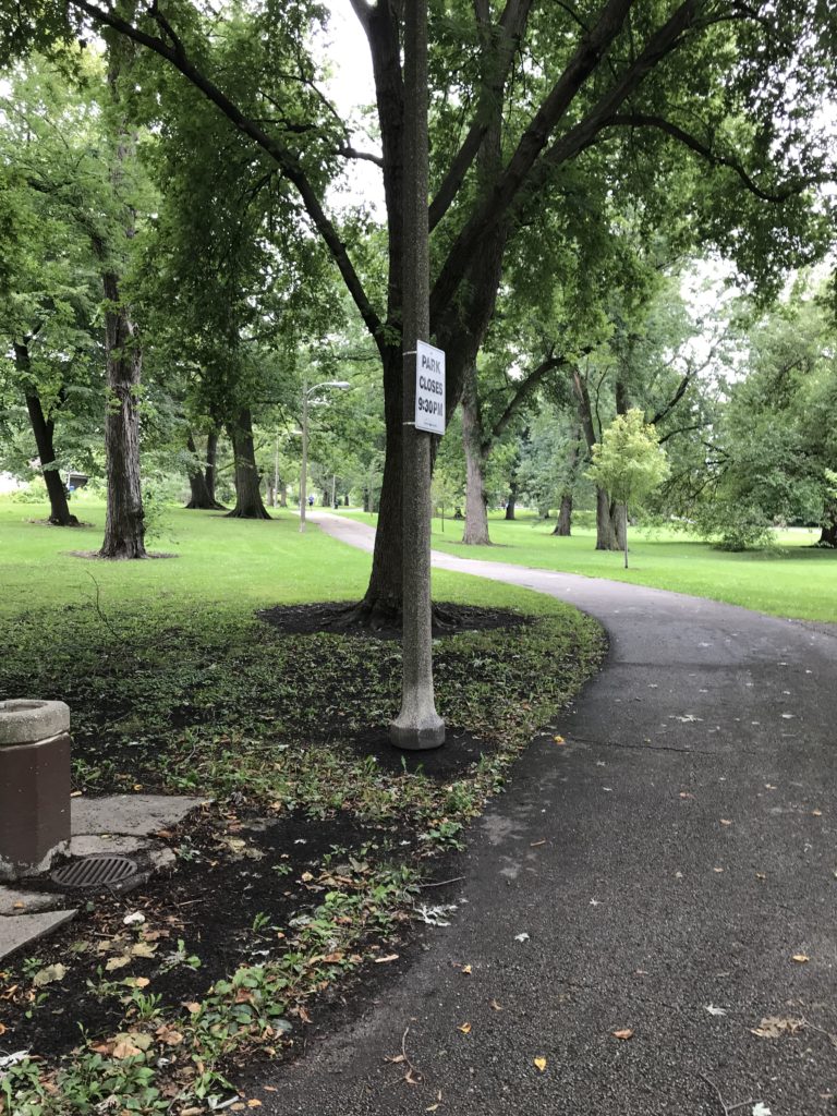
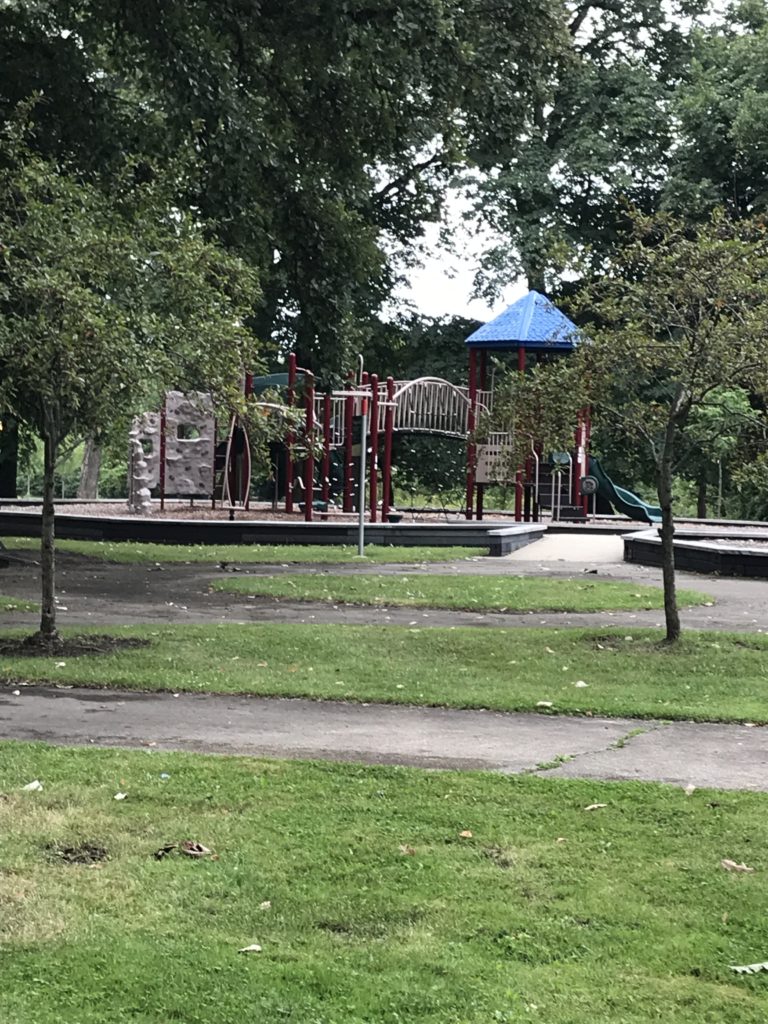
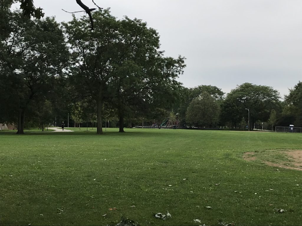
A couple of asphalt paths provide walking, jogging, and bicycle trails with a very modest amount of traffic behind an area largely composed of single-family homes. Between the paths stand a variety of well-maintained deciduous trees whose shade both quiets and cools the park space. As I walked south toward Bryn Mawr Avenue, a major street with a bridge over the channel, the Legion Park Playground, a small haven for children needing adventure and exercise, loomed ahead. A mother and two daughters were using the merry-go-round. In the distance, on the far trail, came bicyclists who never noticed my small camera and did not need to. It was past 1 p.m. on a Sunday afternoon, and it was all so peaceful I could have sat and communed with nature for hours, undisturbed. Someday I may return for that purpose, but today I wanted to explore.

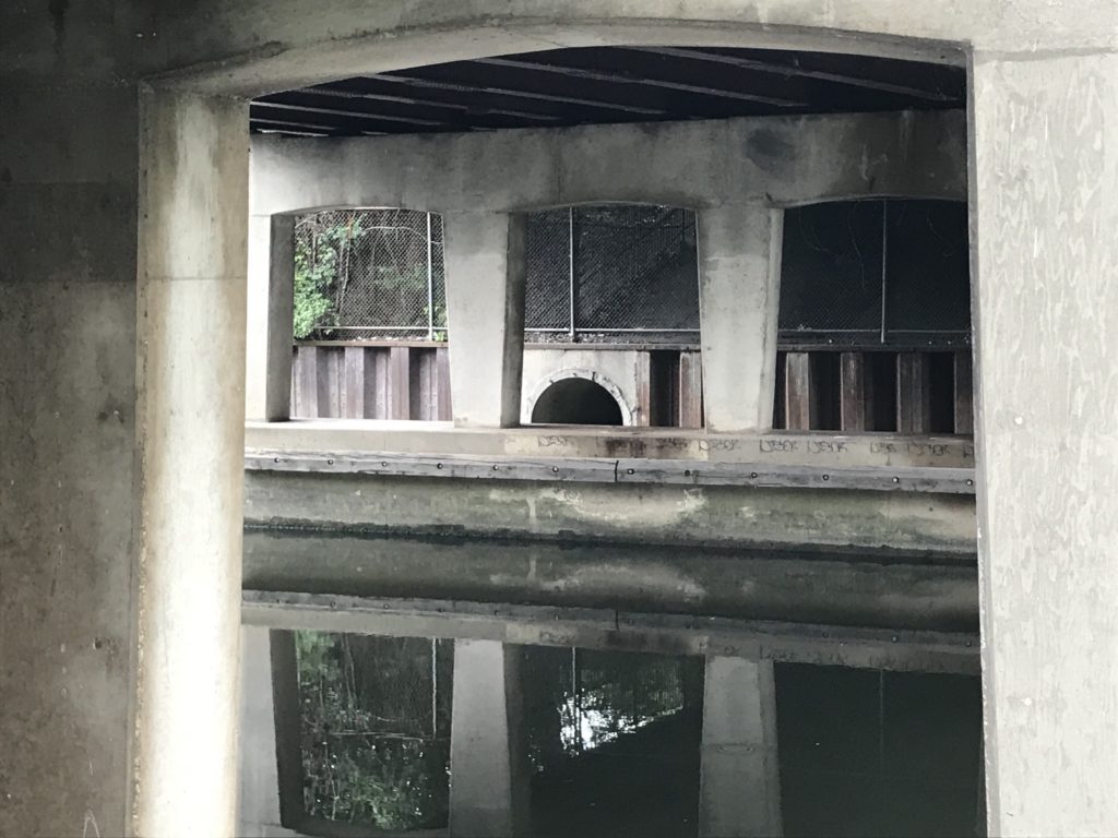
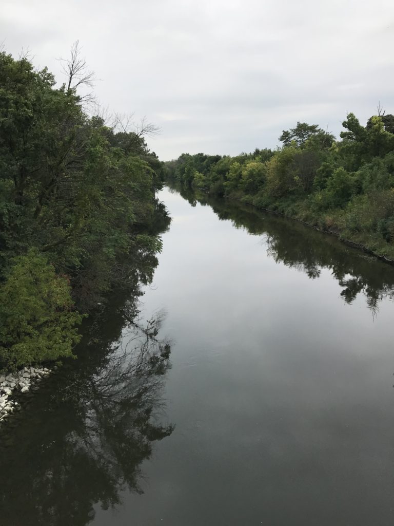
Exploration led me to a follow a cross-path to the North Shore Channel trail closer to the water, which, for the most part, lay hidden behind a screen of forest and uncut grasses, but the trail now led closer to the water by passing under the street above, leading me to a brick wall topped by wrought-iron fencing. Inside the tunnel I found the concrete support system for the road above, the sort of infrastructure that reminds you of what is necessary to allow a road to cross the waterway with minimal disturbance. If it was quiet in the park, it was even quieter down here. The water may not have been especially clean, but in its stillness, it provided a vivid reflection of both the steel girders and the verdant growth above it.

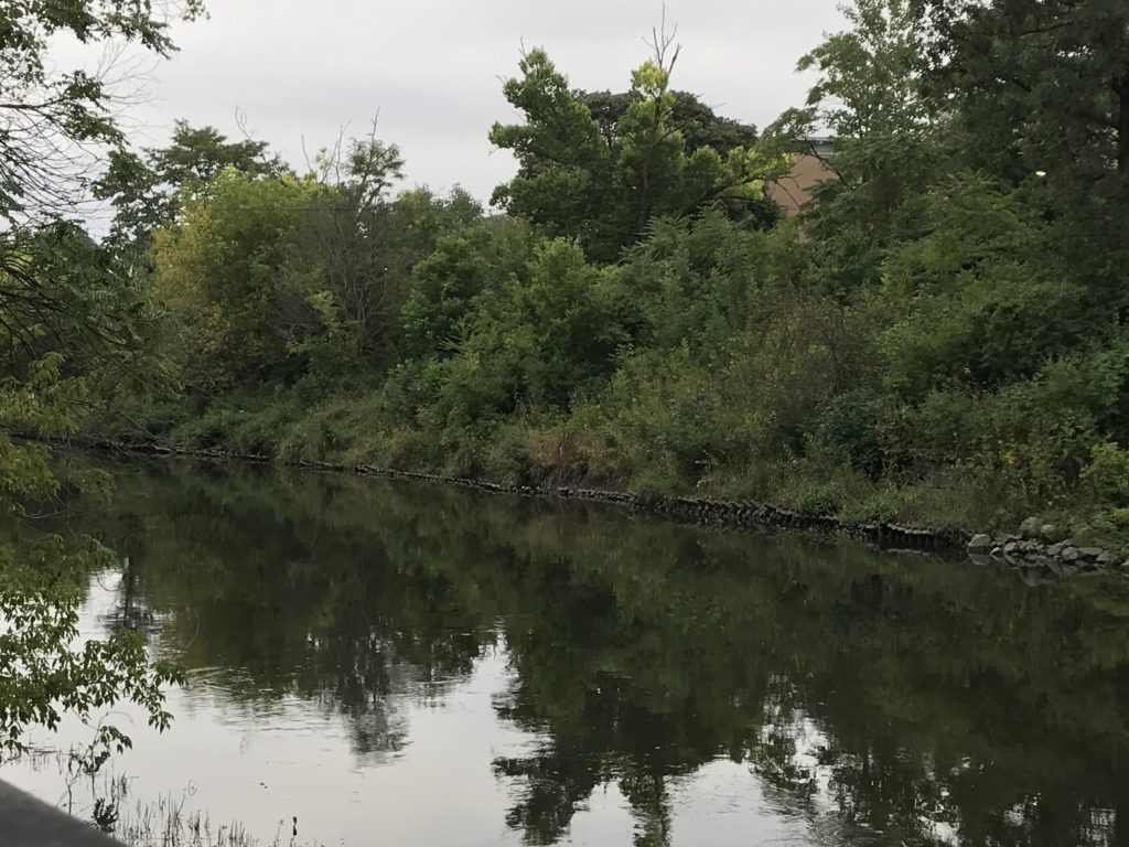
And then, just a few feet away, the waterway emerged in full daylight, with all the foliage that grew above its banks, all the way down to the riprap at the water’s edge. In a matter of seconds, I found myself south of Bryn Mawr, with a whole new section of the park emerging with its own paths, its own playground, and its own softball diamond. I quickly realized that the park was the backdrop to North Side Preparatory High School, which fronts on Kedzie Avenue, but enjoys a remarkable backyard view for those with the wisdom to take it all in.

All this took me perhaps 20 minutes of a slow stroll, with time to shoot photographs. I am aware from the map, and from the sight lines of the channel, that the park extends much farther both south and north from what I saw. But it reminded me, with my own knowledge of the urban landscape as a planner, that cities sometimes, accidentally or intentionally, remember that the best use of a floodplain often is open space, not development, and that the result can be a beautiful asset for the areas around it that are above the water. In Legion Park, even with what to my knowledge is a minimal history of flooding, there is ample room for the water to overflow its banks while harming nothing. The natural environment responds to the freedom we have allowed it and provides us with solitude, and beauty, and an abundance of ecological services. The city can co-exist with its riparian corridors, which afford habitat and recreation in the same space.

Chicago, in recent years, has been discovering that the sacred community space it has preserved so doggedly along its lakefront can and should include its riverfronts as well. The city has cleaned up and improved its Riverwalk along the main channel of the Chicago River downtown, a development I profiled on this blog about three years ago. In this morning’s Chicago Tribune, I read of new kiosk vendors doing business in a new covered space below Wacker Drive along the Riverwalk. But the Chicago River and its tributaries extend much farther into the heart of the city, and they can all serve a purpose in making the city more livable. In fact, in these less populated, less densely developed areas, the very openness and the greater stillness can inspire a spirituality that is harder to achieve in the downtown canyons that linger below skyscrapers and honking traffic. In Legion Park, I could not even hear the traffic. I could only see it in the distance—or witness it on two wheels as someone bicycled past me. What a magnificent gift. We should appreciate such treasures for all they are worth.

Jim Schwab

Great Lakes Merit Protection

I grew up near the shores of Lake Erie, in suburban Cleveland. After a seven-year stint in Iowa and Nebraska, I ended up in Chicago, where I have lived since 1985. The Great Lakes have been part of my ecological and geographic consciousness for essentially 90 percent of my lifetime. As an urban planner, that means I am deeply aware of their significance on many levels.

It will surprise no one, then, that as a planner who has focused heavily on environmental and natural hazards issues, I have been involved in projects aimed at protecting that natural heritage. As manager of the Hazards Planning Center at the American Planning Association (APA), I involved APA as a partner with the Association of State Floodplain Managers (ASFPM) as ASFPM developed its Great Lakes Coastal Resilience website with National Oceanic and Atmospheric Administration (NOAA) support. Later, I prepared a successful grant for support from NOAA’s Sectoral Applications Research Program for a project on integrating climate change data into local comprehensive and capital improvements planning. In that project, APA collaborated with the Chicago Metropolitan Agency for Planning and the University of Illinois. That project, which involved work with five pilot communities in the Chicago metropolitan area, was (and still is) ongoing when I left APA at the end of May 2017. The aim was to develop applicable models for such planning for other communities throughout the Great Lakes region.

It is thus always encouraging to see others pick up the same mantle. It was hardly surprising that the Environmental Law & Policy Center (ELPC), a long-time Chicago-based staple of the public interest community, would see fit to do so. On March 20, in concert with the Chicago Council on Global Affairs, ELPC released “An Assessment of the Impact of Climate Change on the Great Lakes,” with 18 scientists contributing to the 74-page report. I spoke two weeks later with Howard Learner, the long-time president and executive director of ELPC, about the rationale and hopes for the report.

The impact of adding one more report to the parade is cumulative but important. Learner explained that national studies, particularly the National Climate Assessment, mention regional impacts of climate change, but that drilling down to the impacts on a specific region and making local and state decision makers aware of the issues at those levels was the point. Thus, he asked Don Wuebbles, an atmospheric scientist at the University of Illinois and a science adviser to ELPC, to assemble a team of experts for the purpose. Wuebbles recruited most of the team, with the goal not only of identifying problems but of developing or pinpointing solutions. Repeatedly, Learner emphasized the public policy role of ELPC as a “problem-solving” institution. The intended audience was governors, provincial ministers, congressional delegations from Great Lakes states, and other public officials, providing them with an assessment of the state of the science concerning the Great Lakes.

I won’t even attempt to review all the data in the report, but certain points are essential to an adequate public understanding. For one, the Great Lakes are simply huge and constitute a very complex ecosystem in a heavily populated region of more than 34 million people in the U.S. and Canada, the vast majority of whom repeatedly express support for protection of the Great Lakes in public opinion polls. It is the largest freshwater group of lakes on the planet, and second largest in volume. It is a binational ecosystem that demands cooperation across state, provincial, and national boundaries. It is home to 170 species of fish and a $7 billion fisheries industry. It has long been home to one of the most significant industrial regions of both nations. What happens here matters.

The term “lake effect” is most often associated with the Great Lakes because their sheer mass has a measurable impact on local and regional weather patterns. Winds pick up considerable moisture that often lands downwind in the form of snowstorms and precipitation. For instance, any frequent visitor of farmers’ markets along the Great Lakes is likely to be aware of western Michigan’s “fruit belt” offerings of apples, cherries, pears, and other crops dependent on the lake effect.

Figure 3. Observed changes in annually-averaged temperature (°F) for the U.S. states bordering the Great Lakes for present-day (1986–2016) relative to 1901–1960. Derived from the NOAA nClimDiv dataset (Vose et al., 2014). Figure source: NOAA/NCEI (Both images reprinted from report courtesy ELPC.

Figure 4. Projected change in annually-averaged temperature (°F) for U.S. states bordering the Great Lakes from the (a) higher (RCP8.5) and (b) lower (RCP4.5) scenarios for the 2085 (2070-2099) time period relative to 1976-2005. Figure source: NOAA/NCEI

The lake effect, of course, is a part of the natural system in a region carved out of the landscape by melting glaciers at the end of the last Ice Age. Recent climate change is another matter. The region has already experienced a 1.6° F. increase in average daily temperatures in the 1985-2016 period as compared to the 1901-1960 average. Those increases are expected to accelerate over the remainder of this century. It is not just temperatures that change, however, because changing weather patterns as a result of long-term climate change result in altered precipitation patterns. Summer precipitation is predicted to decline by 5 to 15 percent, suggesting some increased propensity for drought, while winter and spring precipitation will increase, producing an increased regional propensity for spring flooding. Increased intensity of major thunderstorm events will exacerbate the vulnerability of urban areas to stormwater runoff, resulting in increased “urban flooding,” often a result of inadequate stormwater drainage systems in highly developed urban areas. That, in turn, has huge implications for municipal and regional investments in stormwater and sewage treatment infrastructure. In addition, heat waves can threaten lives and public health. Public decision makers ignore these implications at the fiscal and physical peril of their affected communities.

Among those impacts highlighted in the report is the increased danger of algal blooms in the Great Lakes as a result of changing biological conditions. The report notes that the largest algal bloom in Lake Erie history occurred in 2011, offshore from Toledo, Ohio, affecting drinking water for a metropolitan area of 500,000 people.

There is also danger to the stability of some shoreline bluffs, an issue highlighted on the Great Lakes Coastal Resilience website, as a result of reduced days of ice cover during the winter. While less ice cover may seem a minor problem to some, in fact it means changes in water density and seasonal mixing patterns in water columns, but it also means the loss of protection from winter waves from storm patterns because the ice cover prevents those waves from reaching the shore until the spring melt. The result is increased shoreline erosion.

All of that harks back to the central question of my interview with Learner: What do you hope to achieve? “The time for climate action is now,” he insisted, noting that the Trump presidency has been “a step back,” making it important for cities and states to “step up with their own climate solutions.” Learner hopes the report at least provides a “road map” for governors and Canadian premiers to focus their actions on the impact of climate change on the Great Lakes, such as “extreme weather events.”

Curiously, one arena in which new action may be possible is the city of Chicago itself, which on April 2 elected a new mayor, Lori Lightfoot. Media attention has focused on the fact that she is both the first gay mayor and the first African-American female mayor in the city’s history, but equally significant is her history as a former federal prosecutor who campaigned against corruption. Learner notes that outgoing Mayor Rahm Emanuel convened a Chicago Climate Summit in November 2017, and that ELPC is now “looking to Mayor Lightfoot to step up Chicago’s game” to benefit both the local economy and environment with a stronger approach to climate change.

The same can be said, of course, for numerous other municipalities choosing new leadership and for the new governors of the region, including J.B. Pritzker in Illinois. They all have much work to do, but an increasing amount of research and guidance with which to do it.

Jim Schwab

Romping through South Florida

Two weeks ago, I spun a narrative about hazard mitigation in Hillsborough County, Florida, based on both prior knowledge and a personal tour conducted by long-time colleague Eugene Henry. Today, a full month or more after that visit, I add notes about touring the Sarasota area with my personal friend and high school classmate, David Taylor.  David is a Vietnam veteran and professional photographer who was part of the Brecksville (Ohio) High School class of 1968. Yes, we graduated in the middle of it all in the late 1960s.

Unlike me, David was drafted into the army. I maintained a student deferment initially, then went untouched by the draft lottery, which reached 125 the year I surrendered my deferment. Numbers were based on the number pulled for your birth date. Mine was 135. Such was the luck of the draw in those days. In less than two months on the ground in Vietnam, David was badly injured in a mortar explosion, evacuated to a hospital and sent home. His injuries were more than severe enough to terminate his service. He spent months in rehab. When it became clear that cold weather aggravated his disabilities, he moved to Florida. He has lived there ever since. He and his wife, Linda, now live in a small home in a subdivision near the water in Sarasota.

His long tenure in Florida has allowed him ample time to learn the sights and sounds of his adopted home. One thing my wife and I learned from staying with him for five days is that Dave is relentlessly curious. He attended and videotaped my February 22 lecture for Florida Atlantic University in West Palm Beach, then loaded the 37-gb high-res recording on a flash drive. Download it to your laptop when you get back, then reload the flash drive with as many documents and photos about your work as will fit on it, he told me.

I don’t think Dave completely understood. I could give him nearly everything I have and never fill up a drive of that size. But Dave lives in the film world, and all the reports I have downloaded as PDFs and all the still photos I have ever taken will never equal more than a fraction of that memory. I gave him all I could.

More importantly, however, Dave took us on some tours to take maximum advantage of the two days we had remaining after returning from West Palm Beach (a 3 ½-hour drive across the southern interior of Florida). From an environmental standpoint, it is important to know that Florida is a more diverse state than outsiders may realize and that, due to rapid urbanization in the past few decades, it also faces environmental challenges and threats of significant proportions. The state has been wrestling with many of these for a long time. The fate of the Everglades triggered one of the most notable environmental policy battles in American history, but there are many smaller issues as well, many engendering serious public health concerns as well.

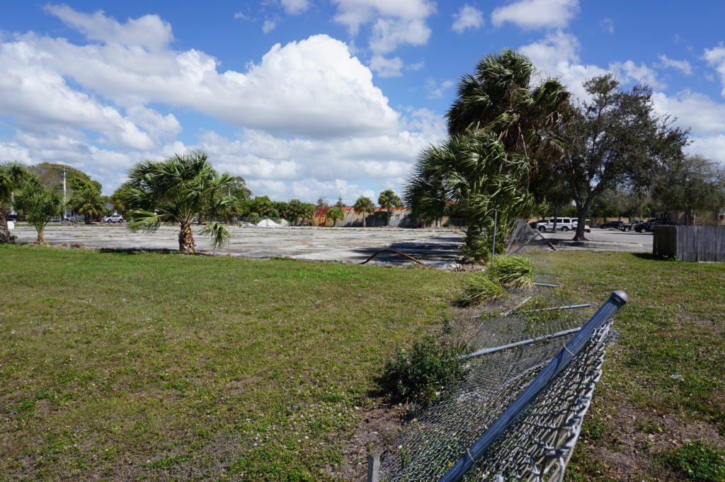
One to which Dave took us, new to me, was the American Beryllium site on Tallevast Road in Sarasota. Now abandoned, the site hosted a manufacturing facility for machine parts of the Loral Corporation, parent company of American Beryllium, for more than 30 years until 1996. The operations created beryllium dust that contaminated the soil and groundwater. Lockheed Martin acquired the plant in 1996 and closed it down. Subsequent investigations discovered the contamination and documented the need for cleanup of what was then a brownfield site. By 2008, the Agency for Toxic Substances and Disease Registry (ATSDR) of the U.S. Department of Health and Human Services completed its own assessment of the health risks, concluding that, while there was a wide margin of possibilities given the combination of contaminants including trichloroethylene in the beryllium-containing metals on the site, there was a definite public health hazard. Previous use of groundwater by local residents and employees, which by then had ceased, posed a credible risk of kidney cancer, liver cancer, leukemia, and lymphoma. By 2004, all nearby residents had been using municipal water, but the long-term legacy could not be ignored.

Fence provides no real security for American Beryllium site.

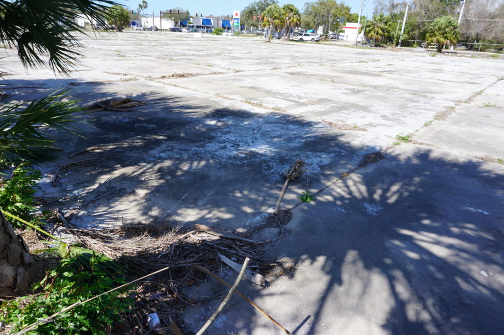
The site today is mostly an empty lot next to a golf course. There is a fence around it that, frankly, is not well maintained, but how much danger the site poses at this point, I do not know. The empty lot looks rather forlorn, yet the area around it contains a fair amount of operative commerce. When, if ever, the site will be ready for reuse remains to be seen. Mostly, it is a sobering reminder of our past use and misuse of such toxic materials in manufacturing processes and the problems they often leave behind. Beryllium is a divalent element, a strong metal with high thermal stability that is useful in aerospace applications, certainly of interest to a firm like Lockheed Martin. But often in the past, manufacturing firms took inadequate measures to prevent the sort of pollution that materialized on this site. The result is a long-standing eyesore for Sarasota.

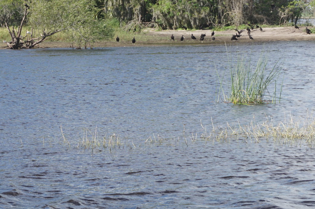
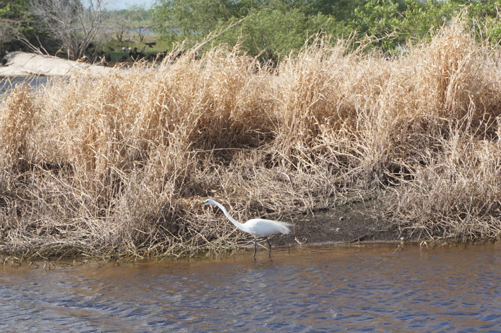
But there were other things to see in the area, like Myakka River State Park, which features a wildlife preserve that is worth visiting and attracts many visitors. Park officials are often available to explain the wildlife you are seeing, such as snowy egrets, cypress trees, vultures, and, of course, alligators. The vultures seemed exceptionally calm and contented, so Dave and I concluded that they had already had their fill for the day.

Vultures line the shore of the river.

Unable to stop myself—we have a growing collection of souvenir mugs in our cupboards—I bought a reasonably priced mug from the gift shop with the state park logo embedded in the ceramic. Our children one day, when we are no longer breathing, may wonder “Myakka what?” and pass it on to the nearest Salvation Army store, but we will enjoy it for the next 20 years, or until one of us accidentally drops it on the floor (whichever comes first). Who knows when we will be back?

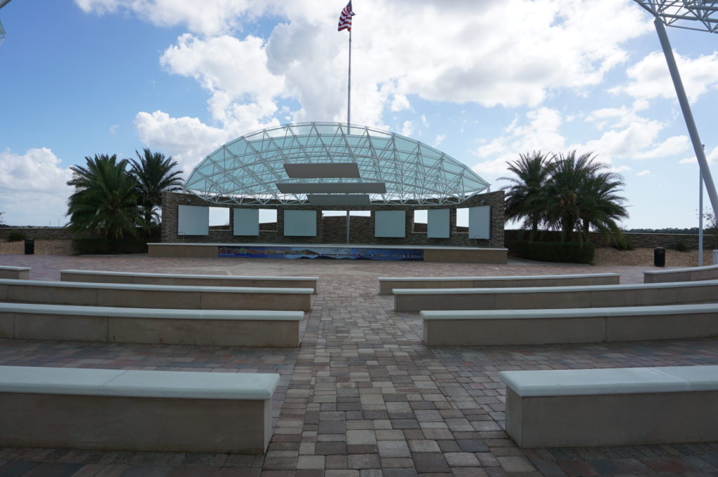
David has vivid memories of his Vietnam experiences, and to some extent, like most Purple Heart veterans, of the trauma involved in his experience. This remains no small part of his semi-retired life, in which he is also enrolled in film and history classes at nearby State College of Florida, and continues part-time photographic work. So, he took us to the Sarasota National Cemetery, where veterans may choose to be buried, and where he has attended and participated in numerous ceremonies. Kiosks exhibit photos documenting the veteran experience as far back as World War I but as recent as Afghanistan. The growing Florida population including the elderly means a growing number of veterans for whom the cemetery may be a final resting place. It is always a sobering encounter with reality to visit such a place—to realize how many lives are affected, for good or ill, by the nation’s struggles throughout our history. One does not have to agree with a particular war, and I have certainly disagreed with some, to recognize the magnitude of the sacrifice of those in uniform and the respect they deserve. Just gazing out at a wide field of gravesites should be enough to convey the message. War is no trifling thing. We invariably owe our veterans a serious explanation when we send them into battle.

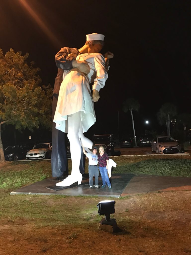
On that Saturday evening, however, it was time for fun, and Dave and Linda took us to a comedy club, McCurdy’s Comedy Theater and Humor Institute, which was great fun, and on the way back to their home, we stopped at the “Kissing Sailor” statue, developed from an iconic photo of a sailor embracing his beloved on the streets of Manhattan as the official surrender of Japan and the end of World War II were announced. Each couple shot photos of the other standing beneath this unique feature of the urban landscape in Sarasota.

Dave and Linda beneath the Kissing Sailor.

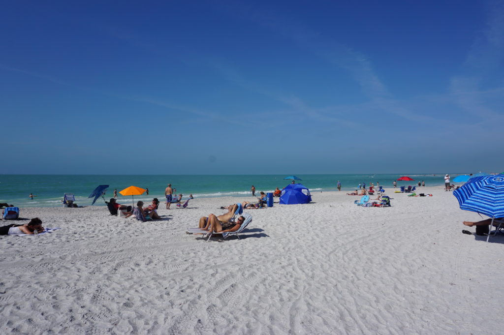
The next morning, with our free time waning before driving to the Tampa International Airport, we all made one last stop, at the Ken Thompson Park. What would Florida be without its beaches? Ken Thompson, the namesake of the park, was a long-time city manager in Sarasota. More importantly, the beach, like the rest of southern Florida, was 84° F. and sunny, with plenty of people resting on the sand and taking in the scenery of the Gulf Coast. Not far away are opportunities to follow a boardwalk through a small forest. It is small wonder in such a setting that Florida might beckon to anyone used to northern weather in the winter, but duty called, and Chicago is very nice once spring arrives.


In fact, I took so long to write this story that it is here. Tomorrow I plan to take time to ride my bicycle on the 606 Trail, whose story I told in this blog when it opened nearly four years ago. Snow? It happens, but it’s over for now, just a fading memory.

Jim Schwab

Aligning Planning and Public Health

Just nine days ago, on November 15, I stood in front of two successive audiences of long-term health care practitioners to present workshops at a conference in Wisconsin Dells discussing, of all things, “Fundamentals of Planning for Post-Disaster Recovery.” Where, some might ask, is the nexus between these two subjects?

Patients who survived evacuations from New York City area hospitals, six in the city itself and one just outside, during Hurricane Sandy would know. People with disabilities, the elderly, the ill are especially vulnerable during disasters, and moving them out of harm’s way is no picnic. They cannot just grab the keys to their cars and drive out of town ahead of the storm. Evacuating them is a major undertaking that must be well-planned.

And so, our fields of expertise converged. I discussed what I knew from urban planning, but I invited input from their experiences in handling such situations. Some had not yet experienced a disaster, but others had, and their numbers in the health care field are growing, as doctors and nurses find clinics and hospitals impacted by wildfires in California, and hurricanes, floods, and tornadoes elsewhere. Mine was not the only presentation related to such concerns. The keynote by Desiree Matel-Anderson, founder of the Field Innovation Team and a Federal Emergency Management Agency (FEMA) advisor, detailed personal interactions with disasters. Others focused on emergency management. The audience needed to know about new regulations and laws, such as those promulgated in 2016 by the Centers for Medicare and Medicaid Services (CMS) or the Disaster Recovery Reform Act (DRRA), passed in October as a

Photo by Kristina Peterson

rider on the FAA Reauthorization Act. DRRA outlines new responsibilities for the FEMA administrator in providing training to local officials and utility providers in planning for emergencies for nursing homes, clinics, and hospitals, and for the Federal Highway Administration regarding evacuations for these facilities, prisons, and certain classes ofdisadvantaged persons. I told the nurses and administrators in my audience they needed to prepare for these new responsibilities. There seems to be a growing conviction in Congress and federal agencies that health care institutions need to be better prepared to protect their patients during disasters. In the light of events dating back to Hurricane Katrina, that does not seem unreasonable.

To some extent, I believe it is the growing engagement of the urban planning profession with natural hazards that is facilitating a re-engagement of the profession with public health practitioners. I say “re-engagement” because the two fields grew up together, at least in North America. In the late 1800s and early 1900s, industrializing, rapidly growing American cities were often festering incubators for diseases because of pollution, overcrowding, and fire and other hazards. The Great Chicago Fire of 1871 laid the groundwork for major reforms related to building codes, helping to create the largely masonry-based architecture now predominant in the city. Activists like Jane Addams inveighed against oppressive health conditions for the working class. There was an urgent need for both better planning and public health measures that would prevent the spread of disease, and the two professions matured accordingly. At the same time, civil engineers took growing responsibility for developing the sanitary infrastructure cities needed, such as sewer treatment systems and effective drainage, a topic I addressed in a keynote in September 2015 in Boston for the American Society of Civil Engineers’ Coasts, Oceans, Ports and Rivers Institute (COPRI) annual conference. All three professions grew up in the same cradle, addressing urgent societal needs for health care, better urban design, and public sanitation.

Scene on the Jersey Shore after Hurricane Sandy.

All of this is a long, but I think crucial, introduction to a book by Michael R. Greenberg and Dona Schneider, Urban Planning & Public Health: A Critical Partnership, published by APHA Press. I had planned to review it earlier, but recent events expanded the context for its importance. Greenberg, a long-time planning colleague and professor at Rutgers University in New Jersey, previously authored Protecting Seniors Against Environmental Disasters (Routledge, 2014), a book inspired in part by his own experience with elderly parents during Hurricane Sandy. He is certainly familiar with the territory. Schneider, also at Rutgers, brings the perspective of a public health expert.

The book reads mostly like a textbook and thus may be of most valuable to instructors willing to acquaint students in both fields with their organic relationship to each other and why the partnership is important today. Admittedly, the problems are not the same. We no longer face the scourge of tuberculosis, and smokestacks no longer belch particulates as freely as they once did. The water is less polluted. But our society is creating other problems of a momentous nature, including climate change and the resulting increased severity of weather-related disasters. Under the Trump administration and various less environmentally friendly state administrations, there have been concerted efforts to retreat from previous initiatives aimed to clear the skies and foster environmental justice. It is thus imperative that we have trained, knowledgeable, and articulate professionals who can advocate for the public interest when powerful political forces push in other directions.

The book makes powerful arguments in this context for the salience of a collaborative assault on the threats posed to our communities by natural hazards, using the tools of both public health and planning to analyze the threats and identify meaningful solutions. Not everything needs to happen at a macro level, either; in fact, planners and public health officials often are at their best in examining trends at the neighborhood and community level to find very geographically specific solutions to localized but persistent problems.

The authors are methodical, laying a groundwork in the first three chapters for understanding the building blocks of the two professions and their integral relationships. One can easily detect the influence of Greenberg’s long and distinguished career on both a practical and theoretical level as he discusses the impacts of various approaches to zoning, such as the use of downzoning to protect open lands and natural resources and the use of special districts, as in Austin, Texas, to protect the environmentally sensitive Edwards Aquifer through measures such as integrated pest management practices, which reduce the use of toxic chemicals that can enter the water supply. And the connection to natural disasters? Even recent history has revealed the vulnerability of Texas to prolonged drought, making the protection of water supplies essential to public health and welfare.

Recognizing the modern context for their focus on this “critical partnership,” the authors have included significant material on the role of risk and hazard mitigation analysis in planning, with a whole chapter on “Keeping People Out of Harm’s Way.” As with much of the book, it leads students on a path through the critical minutiae of planning and public health analysis, including case studies at various levels of analysis—for example, a brief but close look at the Galveston City Hazard Mitigation Plan.

Other sections address critical current issues such as the availability of healthy foods in poor communities, and how that can be addressed through laws, community organizations, and better resources; how to redevelop safe community assets from former brownfield sites; and potentially evaluating the benefits and drawbacks of major regional development proposals. In short, this is not bedtime reading for most laypeople, but it is solid instructional material for aspiring young professionals and may be useful as well to community advocates who are willing to learn the nuts and bolts of using planning to achieve better public health results in their neighborhoods and communities. As such, it is a timely and needed addition to the literature.

Jim Schwab