Lasting Lessons in Resilience

In the latter half of June 2008, it was hard to imagine Cedar Rapids as the city it had been just one month earlier. A massive flood along the Cedar River clobbered the city with a classic double whammy: About the time existing flood crests that had already swamped upstream Cedar Falls hit Cedar Rapids, a severe thunderstorm reached the city to compound the impact. The river, which runs through downtown in this city of 130,000 people, reached a flood level of 31.2 feet, besting the all-time previous record of 20 feet, reached in 1851 and 1929.

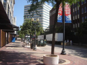
Downtown Cedar Rapids undergoing debris removal, late June 2008

Flood waters covered 14 percent of the city, more than 10 square miles. About 10 percent of the city’s population was evacuated from the deluge. Highway ramps became inaccessible, and at one point, a bus carrying prisoners from the county jail stayed just inches ahead of the rising waters to make its escape. City Hall, unfortunately situated on Mays Island in the middle of the river, was underwater, and governmental operations were moved to high ground elsewhere. In the end, nearly 1,300 flood-damaged homes were demolished, many making way for permanent open space as the city used federal hazard mitigation grants to acquire the properties with deed restrictions. Amazingly, as city officials have often said, there were no deaths due to the flood.

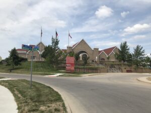
Relocated Czech & Slovak National Museum following June 2008 flood, Cedar Rapids

The avoidance of loss of life can be credited to the city and Linn County’s rapid response, which was not limited to emergency management. Within days, the Cedar Rapids City Council adopted a set of recovery goals that guided planning for long-term recovery for months and years afterwards. It shifted outside consulting contracts from riverfront planning to flood recovery. And it moved forward with a litany of creative approaches to business restoration, employment stabilization, and affordable housing development. Cedar Rapids became a living laboratory for community resilience.

For that reason, we made a special point during our Colorado to Iowa road tour for the film Planning to Turn the Tide, the documentary project of the APA Hazard Mitigation and Disaster Recovery Planning Division, to interview five essential city staff members on Tuesday, July 18, before closing out our trip by heading back to Chicago. These included City Manager Jeff Pomeranz and Community Development Director Jennifer Pratt.

Click here to hear two Cedar Rapids officials—Jennifer Pratt and Brenna Fall—discuss why they are supporting the HMDR film project.

These lessons have had lasting impacts in Cedar Rapids, which also suffered massive tree canopy devastation, as well as building damage, from an August 2020 derecho whose worst winds, exceeding 140 mph, swept through Linn County, including several suburbs. Taking climate change seriously, the city also last year adopted its own climate action plan. Cedar Rapids has quite probably done more to attack these problems in a forward-looking fashion than any other city in Iowa.

In coming weeks, this blog will feature new video clips from a four-day visit to the Florida APA conference in Jacksonville in early September. Meanwhile, plans are afoot for a November trip to Texas to capture additional content from the Texas APA conference in Corpus Christi, follow a mobile workshop exploring Hurricane Harvey recovery in Rockport, a Gulf Coast city where Harvey first made landfall in September 2017, and visit environmentally disadvantaged communities in the Houston area and record interviews with planners and activists there. Those posts will acknowledge the gracious support we are already receiving from several organizations and institutions in Texas.

To support the HMDR film-making effort, use either the donations link here or the QR code below. We will acknowledge all donors, whose help we greatly appreciate. Make this your film too as we move forward.

Jim Schwab

Filming at the Omni

As previous installments of our blog video series have indicated, the production team for Planning to Turn the Tide spent a great deal of time in June and July first in Florida, then on a two-week road trip to Colorado and Iowa from Chicago to capture additional content.

Click here to see the short video taped at the Omni Interlocken Hotel and Resort in Broomfield, Colorado.

From July 9-12, we attended and filmed at the Natural Hazards Workshop, held at the Omni, completing eleven interviews with leading planners and hazards experts:

This range of expertise became available to us largely because of the enthusiastic support of the Natural Hazards Center, part of the University of Colorado, and its executive director, Lori Peek, who arranged meeting room space where we could set up equipment, and to which we could direct those willing to be interviewed for the film. In addition, I was able to scout plenary and breakout sessions for promising speakers, some of whom are on the list above, to supplement those I contacted ahead of time.

Natural Hazards Workshop Barbecue on closing night, University of Colorado Stadium (Folsom Field), July 2013

It may be obvious, at least to those experienced in such productions, that a one-hour documentary can use only a small fraction of the recordings we have gathered to date, but the beauty lies in our ability to identify those segments that will best help tell the larger story and illuminate the issues involved in planning for resilient communities in the face of natural disasters and climate change. Each of these highly trained and knowledgeable individuals gave us new perspectives and ideas to think about as we develop our film. The end product will be richer for it. But it is also likely that we will find other ways to use some of the material that does not make it into the initial film efforts, in part because the APA Hazard Mitigation and Disaster Recovery Planning Division, which is sponsoring and supporting the project, has other avenues for offering public and professional education on hazards.

And who is to say that, as time goes on, and with additional resources, this is our one and only film? If you wish to support our efforts, please use the QR code below to make a secure donation.

Jim Schwab

Addressing Hazards in Sarasota County

A bit more than a month ago, I introduced this blog audience to Planning to Turn the Tide, the film project being undertaken by the APA Hazard Mitigation and Disaster Recovery Planning Division. I noted that we would be rolling out a series of updates as we completed work on new trips around the country, but the first was in Southwest Florida in late June of this year. A week later, we shared the first blog video discussing our progress, focusing on a series of interviews with planners and others at the Tampa Bay Regional Planning Commission. Today, I am sharing the second blog video, which discusses our subsequent work in Sarasota County.

Phillippi Creek in southern Sarasota County

Click here to watch the summary video about the interviews we conducted in Sarasota County.

Those interviews included:

SW Florida, USGS map. Sarasota is midway along the central coast in this section. 

One key point throughout the discussions was that Hurricane Ian at one point had been projected to move through Sarasota County before weather patterns in the Gulf of Mexico pushed it eastward into Lee County and Fort Myers instead. That near-miss still allows Sarasota County officials, like those further north in Tampa Bay, to make the point that preparation for a direct hit in a future storm is the entire region’s best bet.

Except for one unrelated post on July 4, it has been a while until now. David Taylor and I left Chicago on a road trip on July 6 to film in Colorado and Iowa, returning on July 18. The delay since then in putting this series back on track arose from both a short-term illness and a long to-do list of other tasks once I was back home, but here we are. We have much more to share now about Florida, Colorado, and Iowa to keep readers aware of our progress, so please keep tuning in every few days. We’ll be working to keep you updated.

If you wish to support the project, please use the QR code below for an online donation.

Jim Schwab

Tampa Bay and the Quest for Resilience

In my last blog post, I discussed the origins of a current active film effort, Planning to Turn the Tide, which I have been leading on behalf of the APA Hazard Mitigation and Disaster Recovery Planning Division. This post, which includes the first of a series of blog videos recorded during our travels, discusses what we learned during our meetings and interviews around Tampa Bay, especially during an afternoon at the Tampa Bay Regional Planning Council (TBRPC) in Pinellas Park, Florida, just north of St. Petersburg.

Click here to watch the summary video about the interviews at Tampa Bay Regional Planning Council.

One of our interviews featured Jerry Stickney, Director of the Sunshine Line, a Hillsborough County agency that provides transportation for disabled and disadvantaged people, including special services during natural disasters. That last point provided the bulk of our discussion because evacuating and sheltering these people during hurricanes, major storms, and other disasters is a major responsibility, but one that ensures some degree of social equity in the face of life-threatening circumstances. Hurricane Ian could easily have become the major hurricane that finally invaded the Tampa Bay region but instead turned east further south, striking the Fort Myers area.

Cara Serra, resiliency planner for TBRPC, discussed her role in facilitating the work of the Regional Resiliency Coalition, which consists of several working groups examining regional issues concerning shoreline management, infrastructure, stormwater management, and resilient building design and land use, among other concerns. They are currently developing a Regional Resiliency Action Plan.

In the quest for regional resilience, learning lessons from disasters elsewhere plays a major role, one that has not been neglected. Sarah Vitale, planning director for TBRPC, led the development of a new iteration of Project Phoenix, originally created in 2009, to help business leaders and others in the Tampa Bay region understand what the impact of a Category 4 or 5 hurricane might be if it took aim directly at Tampa Bay, something that last happened more than a century ago, when the population was barely one-tenth

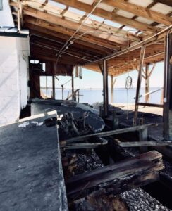
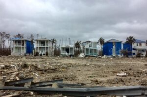
Damage from Hurricane Michael, Bay County, FL. Photo by David Taylor

of what it is now. Her training workshop includes video clips of both a simulation of such a storm and real-life stories from Mexico Beach of economic recovery from Hurricane Michael, which struck the Florida Panhandle in October 2018.

Finally, we also spoke with Sean Sullivan, the executive director of TBRPC, whose engaging New England accent kept us captivated as he outlined his vision for a six-county region that is aware of its risks and prepared to handle the impacts of climate change. It is clear that he has a committed staff that is helping to implement that vision and develop the tools for effective change in that direction.

As promised in the video link above, here are links to the film trailer and the donations page to support Planning to Turn the Tide, the documentary film for which all this work is being done:

Film Trailer

Donations Page (QR code below)

Supplemental note:

The impacts of climate change are affecting us all, often in unexpected ways. As I write this, my own sinuses are recovering from the onslaught of smoky air, full of particulate matter, spread south by the winds from thousands of acres of Canadian forests being scorched by massive wildfires. Winds from such fires in Quebec swept through much of the Northeast two weeks ago, including New York City. Yesterday, it was the Midwest’s turn to suffer, and Chicago was one huge grey fog that burned the eyes and made even healthy people catch their breath. The Chicago Tribune reported that we had the worst air quality of 95 major cities worldwide.

If we needed a vivid illustration that climate change and its impacts know no borders, this is certainly it. That is one more reason we at HMDR find urgency in our mission to develop this film and discuss how better planning at local, regional, national, and even international levels can help us turn the rising tide of losses from natural disasters.

Jim Schwab

Envisioning a More Resilient Future

One reason I have long loved being an urban planner is that, ultimately, planning is about imagining a better future. Or should be, anyway. Although I was in my early thirties before I returned to school for a pair of graduate degrees in Urban and Regional Planning and Journalism (a very unusual combination, I soon learned), I was intrigued with the creative process as early as high school. At the time, I applied it mostly to writing, but I learned in college that creativity was valuable for just about any endeavor. Much later, I was enthralled when I read University of Chicago psychology professor Mihaly Csikszentmihalyi’s path-breaking 1990 book, Flow, a study of the creative process. By then, I was already in the throes of writing my own books and learning where my planning credentials could take me.

While most planners never write or publish books, we all are quite accustomed to producing plans, reports, and other documents for consumption by the public, public officials, and other decision makers. We learn how to present these materials and visualizations in public at meetings and hearings. Visual depictions, for example, of what a neighborhood not only is, but could become, are standard fare. Many of us learn to work with various kinds of visualization and design software that create renderings of future versions of boulevards and parks and other public spaces. What architects do for individual buildings, we try to do for entire neighborhoods and cities. In the process, we try to feed and amplify the public imagination for what could be, hoping to find options for improvement that will appeal to a public that may be looking for alternatives to an unsatisfactory or uninspiring status quo. Whole books and software programs, such as CommunityViz, have been devoted to sharing strategies with planners for accomplishing these visionary goals.

The written word and visualizations are two ways, often combined, for helping people see new possibilities or change the way they see the familiar. I have used them for decades, in evolving ways, to help people better understand my own planning specializations, hazard mitigation and disaster recovery. When a natural disaster such as a hurricane or earthquake has shaken a community’s assumptions about its own future, it can be time to think about rebuilding in a way that makes that community more resilient in the face of future events. I helped advance the idea of pre-disaster planning for post-disaster recovery, that is, thinking before a disaster even happens about what would expedite the recovery process and allow the community to emerge stronger and more prosperous than before. This has become known as finding the “silver lining” in the dark cloud of disaster recovery, building hope during a process that can take years or even decades in the most drastic situations.

Left to right, crew members Jim Schwab, David Taylor, and Kim Taylor Galway toast the film project at Royal Peacock, Sarasota, FL, June 18, 2023

Even when I left the American Planning Association (APA) at the end of May 2017, I largely envisioned a continuation of my hybrid journalistic and planning career in the form of books and teaching, for the most part, augmented by various consulting jobs. It was only after conversations with high school classmate David Taylor at the 50th reunion of our Brecksville, Ohio, Class of 1968 in June 2018 that another idea took shape. David, a Purple Heart Vietnam Veteran, had taken a very different path in life after recovering from war wounds, by becoming first a photographer, and later a videographer. After retiring from a marketing position with the U.S. Postal Service, he opened his own studio and has done film and photography work for veterans and environmental groups, as well as traditional assignments like weddings.

Dave had followed my career for decades, starting with the publication of my first book, Raising Less Corn and More Hell (University of Illinois Press), in 1988. As I grew into my role as a leader in hazards planning, he became fascinated with what planners do in that realm, regarding them as “unsung heroes” of the recovery process. Further conversations led to a visit to his home in Sarasota, Florida, in February 2019, which included a presentation at a Florida Atlantic University symposium in West Palm Beach, and eventually that fall into the idea of producing a video documentary about the role of planning in helping communities address threats from natural disasters and climate change. As chair-elect at the time of the APA Hazard Mitigation and Disaster Recovery Planning Division (HMDR), I took that idea to the executive committee, and they chose to sponsor the project.

Devastation from Hurricane Michael, October 2018. Photo by David Taylor

Thus began, for me, a new way of thinking about how to engage the public on these issues. I had no experience with film as a vehicle for this process, except as a viewer, but the idea captured my imagination. What can one do with film that would be different from the written word? As the script writer, how would I think about the narrative differently? Moving out of my comfort zone forced me to think even more creatively than usual, but I welcomed the experience because I sensed that it might give us a new way to capture people’s emotions and imagination around an idea whose time was overdue. The United States, and the world, were suffering ever more massive losses from natural disasters, in part as a result of climate change, and needed new ways to approach the problem. Maybe the kinetic visual impact of a film could help affect that, if crafted with the right forward-looking perspectives in mind.

It would not be easy, and I readily understood that. Moreover, the first question was how to pay for the project. Movies are inherently more expensive to produce than books, and involve at least as much work in most ways. But if we could pull this off . . . .

Fortunately, incoming chair-elect Stacy Wright was able to arrange a $5,000 donation from Atkins, a consulting firm, to start the ball rolling in the fall of 2019. I became chair of HMDR on January 1, 2020, but the COVID pandemic intervened within weeks and by March 2020, we had to shut the project down and wait for the best. It was the fall of 2021 before we were again able to move forward. We created a Video Project Advisory Committee to provide guidance on the project. It consists of leading voices in the hazards planning subfield. We also began to assemble teams of regional volunteers who could assist us with logistics and recommend leading planners for interviews and advice.

We chose to name the film Planning to Turn the Tide because of the metaphorical implications of seeking to reverse the growing tide of losses of life and property from natural and other disasters. Well aware of the impacts and trends of climate change, we know that the number and costs of America’s billion-dollar disasters has risen rapidly in recent decades. We also know that planning can make a difference.

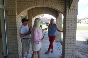
Outdoor interview with Julie Dennis, owner of OVID Solutions (also a member of Video Project Advisory Committee) in Blountstown, Florida, July 2022. Holding camera is Kim Taylor Galway; to her left is videographer David Taylor.

In the meantime, we raised additional donations from other consulting firms* and won two small grants from the APA Divisions Council to help us get started. We announced our project in May 2022 at the APA National Planning Conference in San Diego and recorded interviews with leading hazards professionals at the Association of State Floodplain Managers annual conference two weeks later in Orlando. By mid-July, we had recorded 14 more interviews in the Florida Panhandle, mostly in Panama City, following the area’s recovery four years after Hurricane Michael struck as the first Category 5 storm to reach the U.S. mainland since Hurricane Andrew in 1992. In that visit, we had extensive support from both City Hall in Panama City and the Bay County Chamber of Commerce, which provided its board room for a recording studio for an entire day.

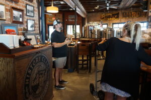
Local entrepreneur Allan Branch explains his restoration efforts at History Class Brewing in downtown Panama City, July 2022

By then, our main problem was that we needed an easy way for people interested in supporting the project to make donations. Fundraising can be hard work, but there is little reason these days to make it harder than it needs to be. APA worked with us over subsequent months to create a dedicated donations page where people could donate online. Because we were the first division in APA’s history to attempt a project like this, we were also the first to need such a mechanism, but by late March of this year, it was ready. The donations page, which you can also reach with the QR code below, channels donations directly to HMDR and tracks the donor information for us, so that we can recognize our supporters appropriately (unless they choose to be anonymous). You can help keep this project moving ahead by donating now, and I sincerely hope you choose to do so. You will be helping us sell the concept of resilient communities to America.

If you need more information on the project itself, visit our project information page. I will be adding new posts regularly as we continue our work, including short blog videos summarizing what we are doing along the way. Please stay in touch.

Jim Schwab

*Early Supporters:

Atkins

APA Divisions Council

Michael Baker International

JEO Consulting

Association of State Floodplain Managers (in-kind donation)

Jim Schwab Consulting LLC

OVID Solutions

Richard Roths, AICP

Clarion Associates

Punchard Consulting


Softly Persuasive Planning Pioneer

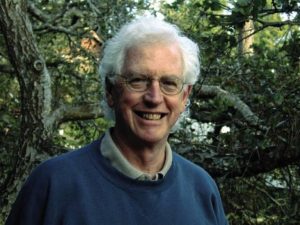
Photo from David Topping’s Facebook posting of his father’s passing.

I first met Ken Topping at the American Planning Association (APA) office in Chicago on a cold day in January 1994. Chicago was suffering one of its classic Arctic blasts at something like -20°F. Ken, a tall, very polite, and articulate gentleman, had his heavy winter coat for the ride back to O’Hare International Airport toward the end of the day. On January 17, just a day or so before he arrived in Chicago, the Northridge Earthquake struck Los Angeles, an area where he had worked for many years. Ken, who was already developing a significant history of advancing what was then the nascent role of urban planning in responding to disasters, became immediately involved. Exactly one year later, on January 17, 1995, the Great Hanshin earthquake leveled much of Kobe, a major city in Japan. With his extensive acquaintances there, Ken was again on the scene.

At the time, I gently needled him that trouble followed him wherever he traveled. But the reality was that Ken took the lead in planning solutions to some of the world’s most vexing environmental challenges: natural disasters. It took years for me to understand the degree to which that initial meeting with Ken changed my life and my perspectives on what I wanted to accomplish as a professional planner. Ken lured me into the world of disaster recovery and resilience planning in a way no one else did.

When we met, it was Bill Klein, then the research director at APA, who introduced us. Just a few months before, Bill, who had somehow negotiated a modest contract with the Federal Emergency Management Agency (FEMA) to produce a Planning Advisory Service (PAS) Report on planning for post-disaster recovery, offered me the opportunity to manage the project. This was not because I had any great expertise in the subject. It was because no one else at APA did, either, but I at least had a strong background in environmental planning, and disasters are, at least in part, an environmental problem. Actually, I learned, they are many problems rolled into one, and what I was about to undertake was a challenge well above any I had encountered before, even though I was already completing a book—my second—about environmental justice. But that left the question of why Ken Topping, with noteworthy contributions to the disaster field behind him, should be dealing with a greenhorn like me.

That’s not the way he saw it. Or ever saw it. If Bill had confidence in me, then for Ken it was a chance to mentor someone new to the field and help shape the project at its roots. Over the next few years, as the project grew and expanded from its original ambitions, Ken introduced me to numerous players in this then small arena of planning to reduce the impacts of natural hazards. I did not fully appreciate the significance of some of the people I met, a fact I still regret, but it was all such new territory that I did not always fully understand who was who.

Leaders of Tomorrow

My experience with Ken was far from unique. He mentored, nurtured, and influenced the professional development of people who became some of my best professional friends and colleagues in the growing subfield of hazards planning.
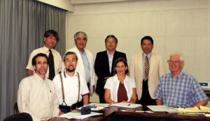
Ken and US-Japan team members meeting with community leaders of the Shin-Nagata North neighborhood that was heavily damaged in the 1995 Kobe earthquake. On the front row from left to right are: Robert Olshansky, Laurie Johnson, Kazuyoshi Ohnishi, and Ken Topping (U.S. team leader). Photo provided by Laurie Johnson.

Robert Olshansky, now professor emeritus at the University of Illinois and living in the Bay Area, met Topping and Laurie Johnson, then a young planner with a bachelor’s degree in geophysics, at a conference of the Central United States Earthquake Consortium in June 1994 in Louisville, Kentucky. The conference, which I also attended, drew mostly engineers, so these three planners “stayed up late in animated conversation,” Rob recalls. Frankly, I don’t remember much of what I did there, but I do recall meeting Laurie either there or a month later at the Natural Hazards Workshop in Boulder, Colorado. I was very much the newcomer to this business back then, in any case. But Rob, Laurie, and Ken engaged in a round of post-Northridge earthquake research meetings in California, which led to a proposal, led by Topping, to compare the Northridge and Kobe earthquake recovery experiences. Eventually funded by the National Science Foundation (NSF), their work began in 1998, but the important facet was that it involved extensive international collaboration between this American trio and four Japanese researchers. It was Ken who introduced Rob and Laurie to Japanese planning. Rob confesses he had never been to Asia before the Kobe earthquake, but he and Laurie developed close connections in Japan who remain good friends 25 years later. Rob says it was Ken who insisted on the close collaboration with the Japanese and helped select the neighborhoods they chose for comparative study.
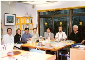
Ken with the US-Japan team conducting a long-term comparative study of rebuilding in Los Angeles and Kobe following the 1994 and 1995 earthquakes, respectively, during a team meeting in 2000 in Kobe. Left to right are: Robert Olshansky, Laurie Johnson, Ikuo Kobayashi, Hisako Koura, Yoshiteru Murosaki (Japan team leader), Kazuyoshi Ohnishi, and Ken Topping (U.S. team leader). Photo provided by Laurie Johnson.

The remarkable aspect of all this for Laurie Johnson, now a prominent hazard planning consultant based in San Rafael, California, was Ken’s acceptance and support though, she says, “I was barely in my 30s and had only a few years of relevant professional experience” when they first met. Their first contact, she says, came in 1990, when Ken spoke at the International Symposium on Rebuilding after Earthquakes, hosted at Stanford University by Spangle Associates, the firm for which she was then working. Spangle had produced a study that was among the first I studied in this emerging field, examining four case studies of post-disaster recovery. It profoundly influenced my view of what happens to communities in a disaster.

Ken, says Laurie, “wowed the group with his presentation on LA’s efforts to prepare a first-ever, pre-disaster recovery plan for the city before a major disaster like an earthquake struck.” Ken was then the planning director of Los Angeles. Fortunately, a draft of what became the Los Angeles Recovery and Reconstruction Plan had been completed when the Northridge earthquake occurred. The city formally adopted it a year later. Another NSF study led by Spangle Associates, in which Laurie was involved, found “that the plan was instrumental in contributing to the high level of staff performance” after the earthquake, helping most city departments to understand their responsibilities and prepare to perform them.

Innovations

By the mid-1990s, Ken was a tall, white-haired gentleman in his 50s, a strong intellect with a gentle voice. In coming years, in part working on the project I was leading, he made a significant impression on our colleagues at FEMA. Terry Baker, former National Team Leader for Hazard Mitigation Planning, recalled him as “always generous with his time and thoughts. A luminary in the field, although you wouldn’t know that from his kind and down-to-earth demeanor.” Similarly, Cecelia Rosenberg, who served as both project officer and grants manager at FEMA, recalls his “softly persuasive ways and quiet wisdom.” He was never a loud voice, but people knew they were speaking with someone who mattered.

He mattered because of a history of innovations, a willingness to try new things to solve emerging problems. He was well ahead of most planners in recognizing how planning could be used to reduce disaster risk. In a career that that was already well underway amid the environmental planning revolution of the 1970s, he consistently found ways to generate meaningful change. By 1973, he was planning director in San Bernardino County, California, where, as California Polytechnic State University-San Luis Obispo (Cal Poly) Professor William Siembieda notes, he “created one of the first wildfire mitigation programs and an overlay zone on 19,000 square miles of desert land for future regional conservation.”

Ken’s spirit of innovation was not limited to southern California. It was a hallmark of his career. Working with me and a team of contributors to Planning for Post-Disaster Recovery and Reconstruction (PAS 483/484, 1998), his singular contribution lay in crafting a model ordinance for post-disaster recovery that is still in use today. The model offers local governments a means of structuring governance of the recovery process after a major or catastrophic disaster, assigning responsibilities among city agencies and empowering them to handle such urgent tasks as post-disaster demolition and intergovernmental coordination. It helps them create order out of chaos with a management structure for long-term recovery that can be activated as soon as the city declares an emergency. It expedites recovery by saving precious time after disaster strikes. I can state with certainty that no more than a handful of jurisdictions had adopted any similar approach prior to the release of our report.

More than a dozen years later, after I had convinced FEMA to fund an overhaul of the original post-disaster study, adding a bevy of online resources to a new report (Planning for Post-Disaster Recovery: Next Generation, PAS 560, 2014), Ken sought to update the model ordinance as part of the project. When I directed his attention to what I considered an important innovation by the city of Cedar Rapids, Iowa, after its massive 2008 flood, he did not hesitate to contact former Community Development Director Christine Butterfield for details. The new model thus included language requiring municipal licensing of building repair contractors to prevent the sort of fraudulent repairs that had been rife in places like New Orleans after Hurricane Katrina. Ken knew a good idea when he saw one, and Cedar Rapids had done something important. A major contributor to the later PAS Report was Laurie Johnson, who produced two of the most important chapters, dealing with the recovery planning process and implementation of recovery plans. Like me, under Ken’s influence, Laurie had come a very long way in the planning field since first meeting Ken.

Bill Siembieda says this focus on innovation was also evident in Ken’s relationship with Cal Poly, which began in the spring of 2000 and lasted two decades. Ken was a part-time lecturer and George Hasslein Chair in the College of Architecture and Environmental Design, City and Regional Planning Department. His efforts included an international symposium on risk reduction, multidisciplinary courses focused on mitigation and risk reduction, and work with state agencies, most notably on the 2010 California Multi-Hazard Mitigation Plan, in which “he created a set of working groups within the state government” to discuss topics of mutual interest. He believed strongly in the value of cross-disciplinary discussions to achieve a more integrated approach to solving problems.

This focus on integration led to Ken’s involvement in what I regarded as my own signature project, which resulted in the PAS Report, Hazard Mitigation: Integrating Best Practices into Planning (PAS 560, 2010). For his accomplishments and leadership in city planning and management, environmental and hazard resilience planning, Ken was inducted into the College of Fellows of the American Institute of Certified Planners in 2000 and honored with a special session at the 2019 conference of the California chapter of APA.

Multiple Dimensions

Ken died on March 5 from complications of Parkinson’s Disease at 85. He and his wife, Phyllis, spent the last year or so in San Clemente Villas in a seacoast town in Southern California. I had a few last conversations by phone with him after that move from Cambria, California, where he had served at one point as the general manager for the Cambria Community Services District and later chaired the San Luis Obispo County Planning Commission, where he demonstrated his penchant for conservation by helping establish the Fiscalini Ranch as a Pacific Ocean coastal bluff park. Siembieda credits Ken’s “great persistence” and a “willingness to put time and energy into each work product” for his vision to support large solar farms in the county and his opposition to a “large petroleum industry oil train project.”

In one of those calls, he shared with me that he had recently fallen while trying to maneuver his walker in a parking lot. It was clear that time was taking its toll, but in a later call, ever cheerful, he gently told me how much he admired my own career path. He seldom missed an opportunity to encourage the people he had mentored.
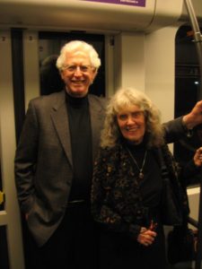
Ken with Phyllis, his wife. From David Topping’s Facebook notice about his father’s passing.

One of the more fascinating aspects of his own story, however, was his birth in 1935 in Kobe, Japan, to a pair of American Baptist missionaries. Before the outbreak of World War II, his family found it necessary to return to the United States, where he grew up in San Francisco and Boulder, Colorado, before the family returned to Japan after the war. He later returned to the U.S. for college at the University of Redlands in California, where he met Phyllis, with whom he had two sons, and earned a degree in sociology, followed by further studies at the University of North Carolina at Chapel Hill. They returned to California, where Ken began a career as a regional planner in Los Angeles but also earned a Masters in Public Administration in 1972 from California State University, Los Angeles. That led to his becoming planning director for San Bernardino County in 1973, and later the city of Los Angeles, appointed in 1986 by Mayor Tom Bradley. One of his achievements was Los Angeles’s first zoning update using geographic information systems (GIS), then a new technology.

The environment was clearly one of his high priorities, something readily apparent in April 2012, when he and Phyllis walked my wife, Jean, and me through the Fiscalini Ranch Preserve before treating us to lunch at a local Cambria restaurant. But he also had a deeply empathetic personal side. I had been in Los Angeles the prior week at the APA National Planning Conference (NPC), much of which became for me a daunting experience as I suffered an attack of prostatitis, though I did not know the diagnosis before visiting a local urgent care center. Exhibiting my stubborn streak, on a Saturday evening early in the conference, I showed up in a hotel meeting room after getting dressed, despite feeling drained and weak, to lead a meeting of the project team for the Next Generation project. Ken took one look at me and would have none of it. His personal touch was evident as he turned to Kathy Smith, our FEMA project officer, and said, “Look at him. He’s in no condition to run a meeting.” At Ken’s urging, It was rescheduled subsequently for a remote meeting from Cal Poly the day after our visit to Cambria.

Ken seated along with children and staff at the Morioka Kindergarten in 2013. Photo provided by Laurie Johnson.

Laurie Johnson believes many of Ken’s finer traits can be attributed to his exposure to Japan. She recalls “a beautiful tribute to Ken and his family’s ties to Japan organized by Professor [Haruo] Hayashi (Kyoto University) and colleagues” in March 2013. They were documenting recovery efforts in northern Japan following the 2011 Tohoku earthquake and tsunami, but the group visited a kindergarten founded in the city of Morioka by Ken’s grandmother more than a century earlier. “The kindergartners assembled and tried to sit patiently as the history was explained and Ken was honored,” she says. “They then sang a song, “Small Garden,” that his grandmother had taught her classes many years ago and which classes still sing today.”

From David Topping’s Facebook notice of his father’s passing.

Ken tapped a beat, she says, which reminded her that Ken had taught himself to play the bass and guitar and had played before for the joint research team at home in Cambria in 2002. Music was another element of his humanity and family life (including a family band), and that focus influenced his two sons to pursue careers in music. Ken went on that day at the school to remind the children to continue to learn as they grew up, how he was there himself to learn about the earthquake, and about the value of friends around the world. “So please be my friend, too,” he told them, “and keep learning all of your lives so that you can help make the world a better place.”

Connecting People

As that vignette illustrates, there was nothing more important for Ken Topping than connecting people, particularly people of talent and determination, with the resources and networks they needed to succeed at making the world a better place. And that mission spanned international boundaries.

Professor Norio Maki of Kyoto University was one of those who benefited. He describes Topping as “my mentor on planning.” In addition to working with Ken in Japan, he learned greatly from collaboration on a project in Marikina, a city in the Philippines. The goal was to develop an earthquake mitigation plan through workshops with city staff. In what he describes as “real on-the-job training,” Ken advised him on workshop presentations and the use of GIS. Despite his university degrees, he says, “I think I got my degree in planning from Ken.”

Rob also facilitated Rob Olshansky’s now permanent connection to Japan. Ken helped arrange for Rob to follow him in a one-year visiting fellowship at Kyoto University, with Professor Hayashi. The cultural shift could have been deeply challenging, but Rob brought his children along for “a life-changing year at school in Japan.” Ken advised him on “important Japanese etiquette do’s and don’ts, in addition to navigating the Japanese train system.” Eight years later, Rob was able to pay it forward by doing the same favor for another visiting professor, Jim Goltz. And so the waves of influence move forward. Rob also believes that a book he and Laurie co-authored, After Great Disasters (reviewed on this blog), “would never have happened without Ken’s influence.”

I could go on, and Rob, Laurie, Terry, Cecelia, Bill, and Norio submitted numerous and extensive comments for my use, but the overall point seems clear. Ken is gone, but as with all such special and creative people, the lesson for the rest of us is simple—to continue to extend that positive influence into future generations in our chosen field. And beyond, wherever possible. I hope we are still doing that, in our own ways.

Jim Schwab

Outthink Wildfire—a Podcast Conversation

It is evident with each increasingly serious and increasingly long wildfire season in the West and South that American still has serious public policy work to do in confronting this hazard. Recently, the National Fire Protection Association unveiled its new policy initiative, Outthink Wildfire, aimed at highlighting the need to move beyond current reactive strategies to widespread adoption and enforcement of building codes, adoption of wiser land-use regulations, and building substantial public pressure to make changes happen quickly.

The American Planning Association has released a new episode in the Resilience Roundtable series of podcasts, sponsored by the APA Hazard Mitigation and Disaster Recovery Planning Division, in which I interview Michele Steinberg, Wildfire Division Manager at NFPA, about this initiative and what results it may produce in reducing wildfire hazards.

Click here to listen to the podcast.

Jim Schwab

In Harm’s Way or Dodging Disaster?

President Joe Biden’s $2.3 trillion infrastructure bill aims to fix much that is ailing in America, and its sheer size is drawing predictable—and short-sighted—fire from Republicans in Congress. The nation has a great deal of aging infrastructure, which will eventually pose a massive challenge to economic development. But the American Jobs Plan also takes aim at a growing, urgent, and critical need for infrastructure to cope with the impacts of climate change. These affect many kinds of infrastructure, including transportation, water, wastewater, and energy and communications systems. There is nothing patriotic, it seems to me, in being so oppositional as to allow our nation to deteriorate, Texas-style, in the face of changing climate conditions. There is also nothing about what happened in Texas with frozen energy systems that contradicts “global warming.” The research clearly shows that climate instability, including seemingly less predictable winter storms, is part of the overall impact of a generally warming climate. Nobody but a charlatan ever promised that climate change would be a simple topic.

Earlier this year, I reviewed a book by a former Toronto mayor about what cities are doing about climate change. Later, I reviewed Doug Farr’s elaborate tome on how the design professions are providing solutions to climate challenges in new forms of housing and urban development. In addition, a year ago, I reviewed a new Planning Advisory Service Report by the American Planning Association on planning for infrastructure resilience. I remain committed to highlighting resources for planners, public officials, and interested citizens on issues of climate resilience.

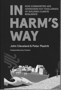
In this post, I feature a new book on community solutions to climate resilience. In Harm’s Way, by John Cleveland and Peter Plastrik, provides a set of detailed ideas for building climate resilience in our communities. In my view, its dominant values in contributing to the discussion of climate change and community adaptation center on two crucial issues: first, how to finance investments in climate resilience, and second, how to build the policy foundations for managing retreat from the most vulnerable coastal areas as a means of avoiding major “natural” disasters. The two co-authors bring interesting backgrounds for such discussion. Cleveland is executive director of the Innovation Network for Communities (INC) and a member of the Boston Green Ribbon Commission, a group of business and civic leaders supporting the Boston Climate Action Plan. Plastrik is vice-president of INC and co-author of an Island Press book on networking for social change.

The Biden plan faces a challenging uphill climb toward passage in Congress. The money it promises for what it offers to do is heavily dependent on changes in corporate taxation that may face daunting opposition in Congress. In any case, even passage of the plan does not necessarily mean that every valuable potential investment at the local level in more resilient infrastructure will be assured of adequate funding, nor does it mean that local leaders will always agree with federal priorities for their own communities. The struggle to implement the plan will face years of challenges. In short, this is an important time for the vital discussion by Cleveland and Plastrik on how we can best find the money for essential investments in climate resilience.

Financing climate resilience is essentially an exercise in risk management. The first ingredient in successful risk management is recognition of the problem, which at a national scale has been a political football because of right-wing denial that a problem exists. For four years, this denial was centered in the White House, but the nation clearly chose a sea change on climate policy in the 2020 election. But that does not mean that nothing was happening outside the Trump administration—far from it. Local financial innovations were afoot in numerous American communities, including large cities like Boston, Miami, and San Francisco. Indeed, networks of such cities have been exploring avenues for fostering climate-related investments. The issue in many cases, because local governments seldom have large stores of cash awaiting brilliant ideas, is hunting for money in the financial markets. In many ways, the hunt for climate-resilient investments is a race against time for cities that may face climate-related disasters that may cost far more in damages than the investments they are contemplating to prevent such outcomes. Misalignments between resources and needs are commonplace, the environmental burdens of climate change, particularly on low-income and minority neighborhoods, are often enormous, and public revenue is often insufficient to address the problem. The authors thus focus on the need for innovations in climate resilience finance to meet this challenge. Given the likelihood that at least some of the Biden plan will require some level of local and state matching funds, this issue will remain potent. The authors outline a range of tools for creating these new financial structures. This task is far from impossible, however. Bond-rating firms and others are already recognizing the inherent risks involved in ignoring climate change. Why not invest on the positive side through mitigation and adaptation?

Case studies are always helpful in making clear that some community, somewhere, is at least testing solutions, many of them proving successful. The authors outline a playbook for paying for climate resilience, using eight examples in which communities have generated local revenue, imposed land-use costs on unwise development, leveraged development opportunities to achieve climate resilience, and pursued equity, among other options. Local governments in fact have a range of regulatory tools and incentives they use to leverage many other decisions by businesses and residents, many of the options, such as floodplain management rules, are already common. What is needed is the imagination for new ideas on how to use those tools, as well as accessible guidance on how well those ideas are working and under what circumstances. One city highlighted in this chapter is Norfolk, Virginia, a low-lying city on the Atlantic coast that faces a future laden with nuisance flooding due to sea level rise. Its system of four color-coded zones indicates relative levels of safety or vulnerability as a means of directing redevelopment to safer areas while demarcating those in need of protection. Zoning may not seem like a financial issue, but it is a quintessential financial tool in dictating what sort of development is permissible in what location, thus channeling investment to those areas the city deems acceptable for certain purposes. The problem is that the power of zoning has not always been used with a vivid awareness of the environmental hazards that are tied to urban geography.

In the U.S. system, municipalities are creations of the states, which establish the rules under which cities operate. Notwithstanding the magnitude of federal largesse, it is thus also fitting that the book contains a chapter on how states can help communities invest in climate resilience. States can serve as both barriers to and intentional supporters of local innovations in financing climate resilience.

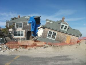
Collapsed houses after Hurricane Sandy on the Jersey shore. The results of climate-driven disasters are seldom pretty.

In the end, however, all of this depends to some degree on political will, a subject addressed in a final chapter on managed retreat under the caption, “Can it happen here?” Communities have long shied away from open discussion of retreat from the shoreline or highly volatile riverfronts. Seashore land has historically been some of the most valuable real estate in the nation, and not only because it can become a haven for rich owners of second homes, but because beaches attract tourism and harbors attract economic development and transportation infrastructure. What public official wants to say no to new shoreline development, let alone talk of managing retreat from existing settlements? Yet the sheer long-term cost of such reluctance to lead with courage is something I discussed in another book review early last year. The Geography of Risk was a book that detailed wave after wave of catastrophic destruction on the New Jersey barrier islands as a result of investments by entrenched real estate interests that resisted risk-based land-use reforms.

But Cleveland and Plastrik insist that retreat will happen, and the question is not if, but when, and under what circumstances. Basically, they say, in coastal areas threatened by climate change and sea level rise, retreat will be driven either by disasters, or by the market, or by plans. In the first instance, nature itself will make decisions that force painful choices that we cannot control. In the second, recognizing the inherent dangers of such stubborn persistence, market forces will withdraw investment from areas that are no longer viable as a result of climate change, with major losses for those who either lack the means to move or who fail to read the tea leaves. The final choice, plan-driven retreat, is the only one that allows the community some degree of sovereignty in the matter, deliberating about the direction of retreat, the means of financing it, and ways of mitigating financial consequences for those involved. The problem is finding articulate, visionary leadership that can lead the community to its moment of truth.

Jim Schwab

Podcast on Hawaii Volcano Recovery

Volcanoes pose a unique challenge for hazard mitigation and post-disaster recovery in the parts of the world where they occur. In the United States, these regions are along the Pacific Rim and in the middle of the ocean itself—in other words, the Pacific Northwest, Alaska, and Hawaii. In Hawaii, an archipelago that grew from volcanic eruptions over millions of years, all active volcanoes are located on the island of Hawai’i, also known as the Big Island because, as Hawai’i County planner Douglas Le notes, the land area of all the other major islands could be fit into this one land mass.

As I have done with previous installments of the American Planning Association’s Resilience Roundtable podcast series, for which I have been host for the last year and a half, I am providing this brief introduction with a link to the podcast on the APA website. The series is sponsored by the APA Hazard Mitigation and Disaster Recovery Planning Division, of which I am currently chair.

The subject of this podcast is Hawai’i County’s planning for recovery from the numerous impacts of the 2018 Kilauea volcanic eruption, which buried homes in its path and disrupted life in several subdivisions on a largely rural and agricultural island. The issues involve displacement, social equity, native land rights, environmental quality, and economic recovery, to name a few. Please take time to listen to this 52-minute exchange between me and Douglas Le, disaster recovery officer for the county planning department, and learn more than you may have imagined about how planning can help address this fascinating problem.

Click here to listen.

Jim Schwab

Disaster Mitigation Act at Twenty

When a law makes a powerful impact over time, it is sometimes hard to remember what life was like before it was enacted. In U.S. history, for example, both Social Security and, later, Medicare, created a new reality for the elderly that makes it almost impossible for most people to imagine what old age meant before they took effect. They are so much a part of the fabric of American life that some people even forget (or never learn) the social and political debates that produced them. That sort of obtuse amnesia was in evidence as Tea Party protests materialized in response to the Affordable Care Act, aka Obamacare, in which some carried signs that read, “Keep Your Government Hands Off My Medicare.” Ponder that conundrum for a while.

Few laws match the scale of impact of those two examples, but many have significant impacts that receive less attention, at least among the general public. One that is reaching its twentieth anniversary is the Disaster Mitigation Act (DMA), signed into law by President Clinton on October 30, 2000. After a decade of expensive disasters in the 1990s—Hurricane Andrew (1992), the Midwest floods (1993), the Northridge earthquake (1994), and Hurricanes Fran (1996) and Floyd (1997)—Congress realized that the nation needed greater accountability from states and local governments in addressing hazard mitigation challenges before disasters occurred. The carrot and the stick were combined in this instance in a requirement that states (including territories and the District of Columbia) and local and tribal governments prepare and adopt hazard mitigation plans that won the approval of the Federal Emergency Management Agency (FEMA) as meeting the standards of the act and its accompanying regulations as a condition of eligibility for FEMA hazard mitigation grants. Put simply, no plan, no money. Few state and local officials wish to find themselves in that position after a major disaster.

Congress went one step further. Previously, most such grants came through the Hazard Mitigation Grant Program (HMGP), created under the Stafford Act in 1988, the basic law structuring the federal disaster response system, under which every state has some sort of parallel emergency management agency. The problem with HMGP has always been that the money is made available as part of a presidential disaster declaration, using a percentage of overall disaster assistance to determine the amount available. That money goes to the affected states, which are responsible for local allocations. But that means that a state must experience a natural disaster to be eligible for such money. Admittedly, it then becomes useful for mitigating future disasters, but it did nothing to avert the most recent event. In fact, communities that had become adept at mitigating hazards with their own resources often complained that they got no federal assistance because they were doing too good a job of preventing losses. Davenport, Iowa, for example, long ago refused Army Corps offers to build levees along the Mississippi River and opted for a riverfront park that allowed the water to flow without damaging buildings in its downtown. Davenport has not always avoided flood impacts, but it has certainly minimized them.

In DMA, Congress added a new Pre-Disaster Mitigation (PDM) grant program. Instead of being triggered by disaster declarations, it was an annual grant competition, in which state and local governments submitted proposals for projects that would reduce losses of life and property in future events. Its major flaw was that PDM relied on annual congressional appropriations, which predictably ebbed and flowed and often was grossly underfunded. In 2018, in the Disaster Recovery Reform Act, Congress finally opted to stabilize funding by creating a formula by which six percent of total annual disaster relief outlays would be swept into a single pot by FEMA for grants under a new program that FEMA has labeled Building Resilient Infrastructure and Communities (BRIC), which I discussed in a post here in early August. The resulting 2020 grant funds total roughly $500 million, a far cry from years past when the total congressional allocation was often as little as $25 million, which barely put a dent in the mitigation needs of a nation as vast as the U.S.

But the real question after two decades is, How has DMA changed the landscape of American planning and disaster management? Clearly, we have not solved all problems. For one thing, climate change has accelerated and complicated matters significantly. While Congress unquestionably has dithered a great deal on climate issues, DMA was never aimed directly at climate change. Instead, it aimed to create a climate of state, tribal and local responsibility and accountability for planning for hazard mitigation while making federal funding available to support such planning. In fact, federal assistance for such planning is built into the law. Have governments responded?

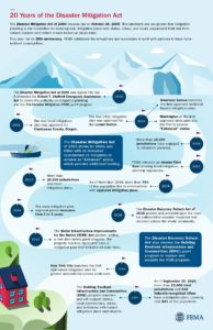
DMA timeline produced by FEMA, reused from FEMA website. To expand, click here.

The unequivocal answer is yes. By 2002, once FEMA had finalized its guidance for the mitigation planning process, Clackamas County, Oregon, became the first local jurisdiction to win approval for its plan. Within a few years, every state and territory had an approved plan in place. Winning compliance from most local jurisdictions understandably took longer, but today FEMA can claim that more than 23,000 local units of government have approved plans, as do 239 tribal governments, which together cover more than 84 percent of the U.S. population. The gaps in coverage are primarily in rural areas, many of which suffer from low governmental capacity—a subject that can still be addressed in future outreach by FEMA—and some of which simply choose not to plan, presumably not seeing the consequences as outweighing the burden of the work involved.

In the meantime, many professional and intergovernmental associations have done considerable outreach to their own members to explain the benefits of hazard mitigation planning beyond simple eligibility for grants. For example, during my tenure at the American Planning Association, we used a FEMA contract to produce a Planning Advisory Service Report on the benefits of integrating such planning throughout the local planning process, including comprehensive plans, capital improvements programming, and the land-use regulations that implement mitigation intentions, such as zoning, floodplain management, and subdivision ordinances. We published Hazard Mitigation: Integrating Best Practices into Planning in 2010. The concept of integrated planning has enjoyed significant increased attention throughout the second decade of DMA and has become a staple of FEMA guidance for local hazard mitigation planning.

There are many ways to review this history, which may even be worth an entire book. As for what we have achieved, the Natural Hazards Center, based at the University of Colorado, asked me to moderate a webinar on October 13. “The Disaster Mitigation Act of 2000: Twenty Years of Promise, Pitfalls, and Progress from a Planning Perspective,” in which I was joined by three experienced and insightful panelists from state, county, and federal government, provides a fast-paced, one-hour summary of the successes, shortcomings, and future challenges of DMA as part of the Center’s Making Mitigation Work webinar series, and the recorded version is available at the link above. I thank NHC Director Lori Peek for having invited me to lead this discussion.

Make it your DMA anniversary experience. Trust me, it will be worth your time.

Jim Schwab