Filming on the Texas Gulf Coast

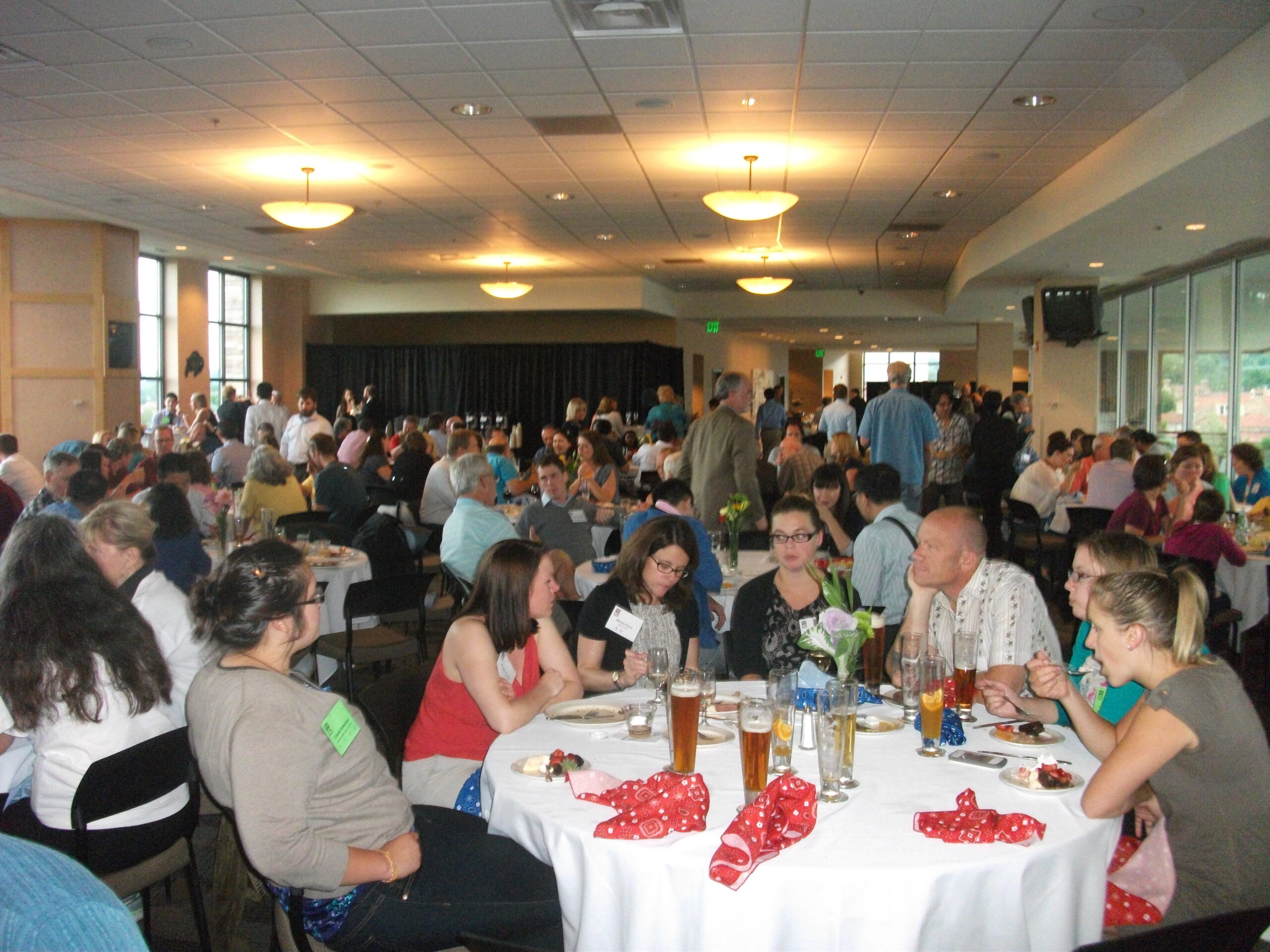
It has been a couple of months since I last posted a video of our progress in filming for Planning to Turn the Tide. That last article summarized our film efforts in Jacksonville, Florida, in September 2023, but we had another trip in the offing then, to the Texas Gulf Coast. In between, as noted in a January 1 post, I underwent prostate surgery on September 29, which required at least a month of rest and inactivity at home before venturing out again, in order to ensure successful recovery. But on November 7, I met up with videographer David Taylor at Houston Hobby Airport and we drove to Corpus Christi, where the annual conference of the Texas Chapter of the American Planning Association was getting underway. The new blog video presented here was filmed there but edited and produced later.

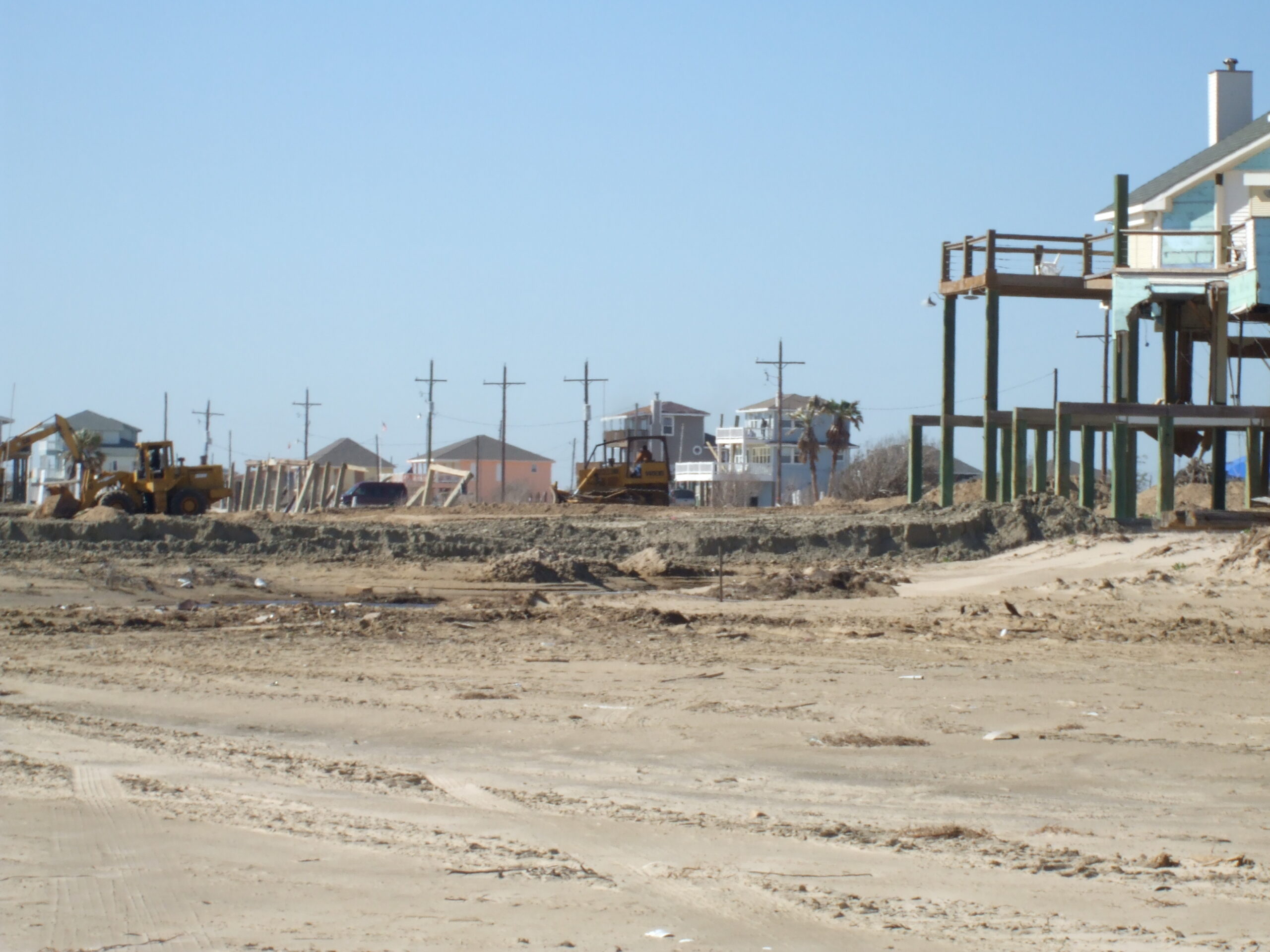
Devastation in the Bolivar Peninsula from Hurricane Ike, 2009

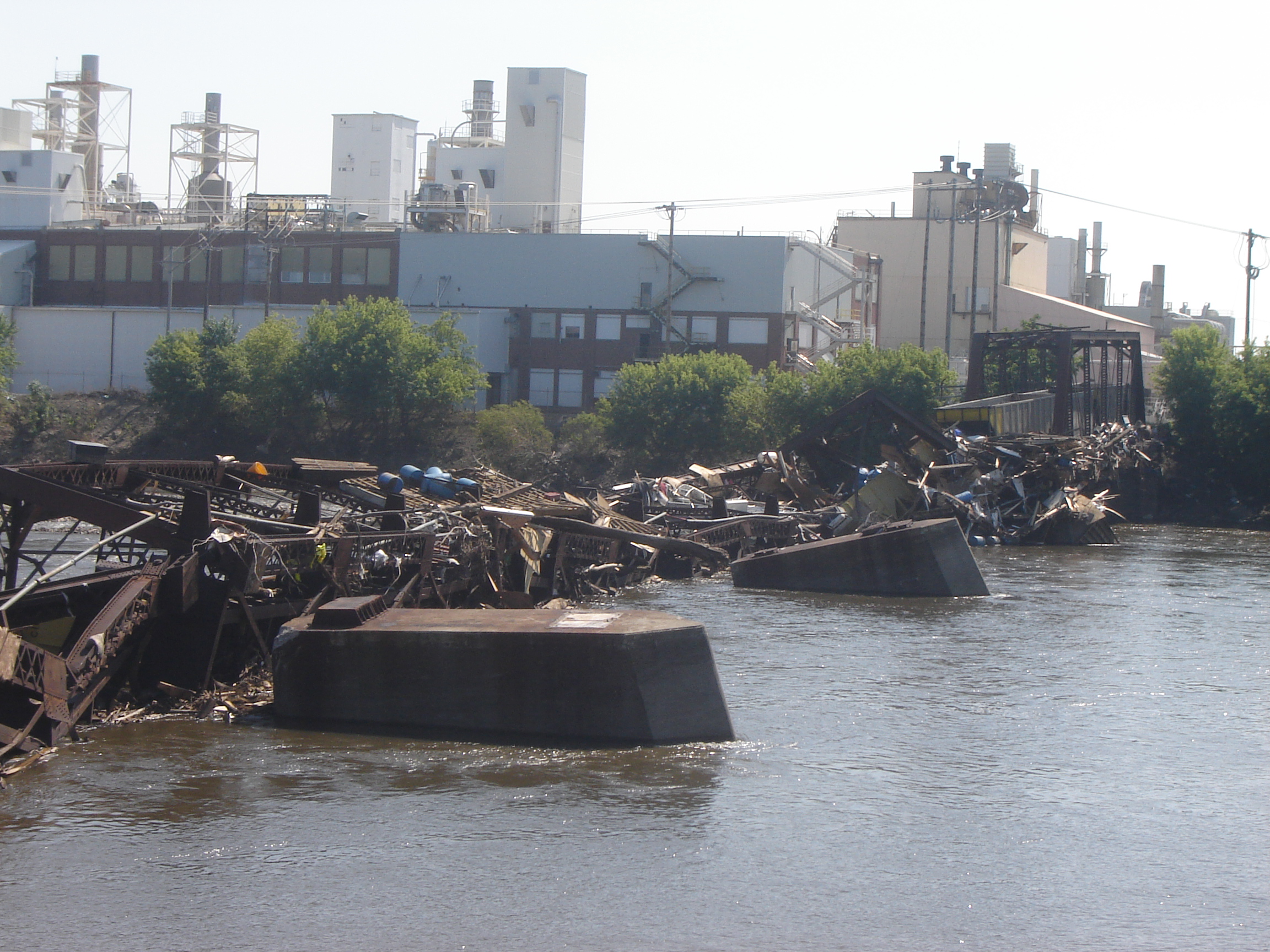
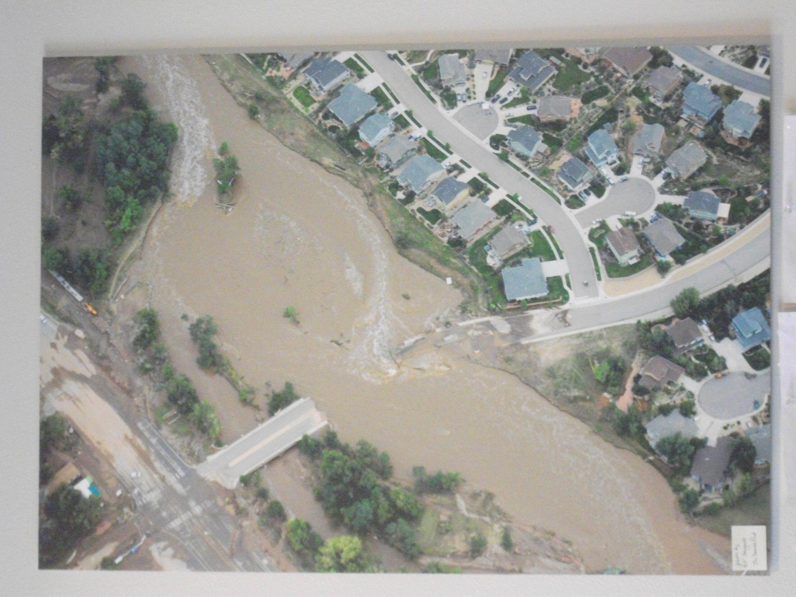
Despite my own challenges, what compelled this schedule was that conference at the American Bank Center in Corpus Christi because it allowed us to interview eight Texas planners who have been prominently involved in efforts to confront and address resilience issues along the Gulf Coast, where coastal storms and flooding remain major concerns. Hurricane Harvey, which struck in the fall of 2017, may be the most famous, and famously expensive, disaster of recent history in the area but is certainly not unique. People with a longer memory can cite Tropical Storm Allison, which struck Houston in 2001, and Hurricane Ike, which devastated Galveston in 2008, as part of the long parade of such events.

It is easy enough to cite shortcomings of the past that made destruction in such storms worse than it needed to be, but it is also important to note the resources that Texas has created to tackle those problems, including Texas Target Communities, a program at Texas A&M University that aids resource-challenged communities. These groups were present at the Texas APA conference, and we interviewed both Jaimie Masterson, the director of Texas Target Communities, and Shannon Van Zandt, a professor of urban planning at the Texas A&M School of Architecture, who has long researched and advocated for better affordable housing solutions in disaster recovery.

Tornado impacts in Van Zandt County, Texas, April 2017. Seven tornadoes struck the area in one evening.

I should also note that disaster resilience has been a consistent theme of the Texas Chapter. Back in November 2017, I spent time in Texas at the behest of the chapter, which asked me to facilitate and keynote a recovery workshop in Canton, Texas, following a series of tornadoes there, but I also worked with their Harvey Recovery Task Force well into 2020. The film trip grew out of that partnership, which extends even further back to my speaking at chapter conferences in El Paso and Galveston after Hurricane Ike. We want to thank the Texas Chapter for their logistical and promotional support during the conference.

Peer exchange workshop in Rockport, February 2020, involving Harvey and Sandy recovery planners. Kim Mickelson, of Houston, with microphone, is moderating this session.

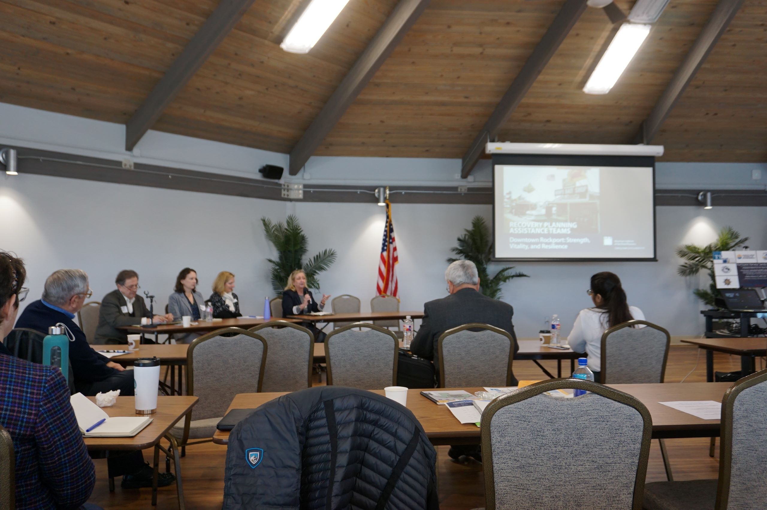
Following our time in Corpus Christi, we drove up the coast to Rockport, the site of the first landfall of Hurricane Harvey, where we interviewed four community leaders, including a city council member, the local newspaper editor, the public works director, and a former president of the local chamber of commerce, about Rockport’s experience in recovery. I have learned a great deal in recent years about Rockport, in large part because of my work with Amanda Torres, the former city planner there, now working for the Corpus Christi Planning Department, and Carol Barrett, a veteran planner now living in Austin, who led APA’s Community Planning Assistance Team in Rockport in 2019. They helped me design the Rockport case study for an interactive workshop, including both graduate students and practicing planners, that is part of a course I teach for the University of Iowa School of Planning and Public Affairs.

We ended our trip in Houston, which included a tour of largely Hispanic neighborhoods in the shadow of the city’s huge petrochemical complexes, where they face ongoing racially disparate environmental impacts. We were hosted on that tour by TEJAS Barrios, a local environmental justice advocacy group. We hope to return to Houston, but our challenge for now is to raise substantial money to try to complete the film project in the coming year. Fortunately, our core team has grown, with more hands on deck focused on fundraising. If you are willing to help, you can donate here or use the QR code below to contribute online at the APA website.


Jim Schwab

APA Chapters Step Up to Host Film Project

Over the past few months, we have posted ten short blog videos detailing the progress of Planning to Turn the Tide, the documentary on planning for resilience against natural disasters being produced by the American Planning Association’s Hazard Mitigation and Disaster Recovery Planning Division. In this post, we highlight the support of APA Chapters by featuring a staff member from APA Florida, Suzie Gray, who talks about her role at the APA Florida conference we visited in Jacksonville in early September.

Florida APA annual conference reception at Hyatt Regency Jacksonville

From our first interactions with Florida Chapter representatives and staff, they have been enthusiastic about supporting the project. Not only did they supply numerous contacts, suggesting people for interviews or information, but they also extended a gracious invitation for us to visit their annual conference in Jacksonville, which took place September 5-8. We have forged similar alliances with other APA chapters since then, one of which was illustrated in Colorado in July, and most recently in Texas, the subject of upcoming blog videos. These are really important opportunities for professional collaboration and support within the framework of a larger professional organization, but it also affords us an effective base of operations during a conference, especially in the use of space suitable for recorded interviews.

Click here to watch the video featuring Suzie Gray discussing her work with us under the banner of the Florida APA Chapter.

The core team of the HMDR video project wishes to thank APA Florida staff and volunteers for their wonderful assistance in putting us in touch with the best planning voices in their state and lending their credibility to what we are trying to accomplish. Our challenge would be much greater without them.

To support the HMDR film-making effort, use either the donations link here or the QR code below. We will acknowledge all donors, whose help we greatly appreciate. Make this your film too as we move forward.

Jim Schwab

Lasting Lessons in Resilience

In the latter half of June 2008, it was hard to imagine Cedar Rapids as the city it had been just one month earlier. A massive flood along the Cedar River clobbered the city with a classic double whammy: About the time existing flood crests that had already swamped upstream Cedar Falls hit Cedar Rapids, a severe thunderstorm reached the city to compound the impact. The river, which runs through downtown in this city of 130,000 people, reached a flood level of 31.2 feet, besting the all-time previous record of 20 feet, reached in 1851 and 1929.

Downtown Cedar Rapids undergoing debris removal, late June 2008

Flood waters covered 14 percent of the city, more than 10 square miles. About 10 percent of the city’s population was evacuated from the deluge. Highway ramps became inaccessible, and at one point, a bus carrying prisoners from the county jail stayed just inches ahead of the rising waters to make its escape. City Hall, unfortunately situated on Mays Island in the middle of the river, was underwater, and governmental operations were moved to high ground elsewhere. In the end, nearly 1,300 flood-damaged homes were demolished, many making way for permanent open space as the city used federal hazard mitigation grants to acquire the properties with deed restrictions. Amazingly, as city officials have often said, there were no deaths due to the flood.

Relocated Czech & Slovak National Museum following June 2008 flood, Cedar Rapids

The avoidance of loss of life can be credited to the city and Linn County’s rapid response, which was not limited to emergency management. Within days, the Cedar Rapids City Council adopted a set of recovery goals that guided planning for long-term recovery for months and years afterwards. It shifted outside consulting contracts from riverfront planning to flood recovery. And it moved forward with a litany of creative approaches to business restoration, employment stabilization, and affordable housing development. Cedar Rapids became a living laboratory for community resilience.

For that reason, we made a special point during our Colorado to Iowa road tour for the film Planning to Turn the Tide, the documentary project of the APA Hazard Mitigation and Disaster Recovery Planning Division, to interview five essential city staff members on Tuesday, July 18, before closing out our trip by heading back to Chicago. These included City Manager Jeff Pomeranz and Community Development Director Jennifer Pratt.

Click here to hear two Cedar Rapids officials—Jennifer Pratt and Brenna Fall—discuss why they are supporting the HMDR film project.

These lessons have had lasting impacts in Cedar Rapids, which also suffered massive tree canopy devastation, as well as building damage, from an August 2020 derecho whose worst winds, exceeding 140 mph, swept through Linn County, including several suburbs. Taking climate change seriously, the city also last year adopted its own climate action plan. Cedar Rapids has quite probably done more to attack these problems in a forward-looking fashion than any other city in Iowa.

In coming weeks, this blog will feature new video clips from a four-day visit to the Florida APA conference in Jacksonville in early September. Meanwhile, plans are afoot for a November trip to Texas to capture additional content from the Texas APA conference in Corpus Christi, follow a mobile workshop exploring Hurricane Harvey recovery in Rockport, a Gulf Coast city where Harvey first made landfall in September 2017, and visit environmentally disadvantaged communities in the Houston area and record interviews with planners and activists there. Those posts will acknowledge the gracious support we are already receiving from several organizations and institutions in Texas.

To support the HMDR film-making effort, use either the donations link here or the QR code below. We will acknowledge all donors, whose help we greatly appreciate. Make this your film too as we move forward.

Jim Schwab

Striving for Flood Resilience in Iowa

Collapse of the CRANDIC railroad bridge during the 2008 floods in Cedar Rapids, Iowa

In 2008, much of Iowa experienced such massive floods that 10 percent of Cedar Rapids was evacuated, books were being rescued from the basement of the University of Iowa Library, and homes were under water in Cedar Falls. Dozens of other Iowa communities faced flood waters to varying degrees, all remembering that it was only 15 years earlier that they had dealt with another massive emergency in the Midwest floods of 1993. After billions of dollars of damage and thousands of lost homes, Iowans were forced to confront the fact that so-called 100-year floods might in fact be far more frequent events of the future and that climate change was a reality for the Midwest as well as coastal states.

It was in this environment of concern about how Iowa would cope with future flood emergencies and disasters that the Iowa Legislature decided in 2009 to establish the Iowa Flood Center (IFC). Born of cooperative discussions between IIHR—Hydroscience and Engineering at the University of Iowa and state leaders, the Iowa Flood Center became a leading model for state technical outreach to communities regarding flood mitigation, flood awareness, and warning systems, including an extensive system of stream gauges. Centered at the Stanley Hydraulics Laboratory along the Iowa River, the Center manages the Iowa Flood Information System, a platform that gives communities across the state easy access to inundation maps, alerts, and real-time data on stream conditions.

Over intervening years, I have occasionally worked with staff at the Iowa Flood Center. In addition to their collaborative work in one flood recovery consulting project for the Iowa Economic Development Authority in which I participated, I also have hosted Associate Director Nate Young as a guest speaker in my University of Iowa School of Planning and Public Affairs class, “Planning for Disaster Mitigation and Recovery.” In every instance I have seen, IFC has been a class act. Visitors from other states have been intrigued with the Center as a model for their own states.

It should be no surprise at this point that I decided early on that our film project, Planning to Turn the Tide, needed to include some content about the work of the Iowa Flood Center and the changes it has introduced to flood preparation and recovery in Iowa. On July 17, as David Taylor and I were making our way back east from Colorado, we stopped in Iowa City for the purpose of taping an interview with IFC Director Witold Krajewski, a veteran environmental engineer who has become intimately familiar with the hazard mitigation and planning needs of the hundreds of small communities, as well as larger cities, throughout a state that has seen more than its fair share of flood disasters. We also met with Kate Giannini, Iowa Watershed Approach Program Manager, about access for our film project to flood footage and other resources from the Iowa Flood Center that would help tell the story visually as well as in words.

Click here to watch the blog video about our visit to Iowa City.

As always, if you wish to support the Planning to Turn the Tide documentary film project, use this link or the QR code below to access our donations link on the APA website. We can use your help and will truly appreciate the support.

Jim Schwab

Who’s Gonna Watch This Movie?

The field production of Planning to Turn the Tide, the documentary film project of the American Planning Association’s Hazard Mitigation and Disaster Recovery (HMDR) Planning Division, has involved dozens of local volunteers and supporters in several states spread from Florida to California. In recent blog posts, I have been sharing our progress but not always featuring some of those volunteers. That is about to change.

Some of those volunteers were interviewed for the film because we felt that their experience and expertise supported our educational objectives for the project. Others have helped us identify people who should be interviewed, and others have led us on tours or directed us to other resources we needed to know about.

Molly Mowery, the Chair-elect of HMDR, has served as all of the above and been a great supporter. She is also the executive director of the Community Wildfire Planning Center, based in Colorado, and has spent years consulting with communities about better planning strategies to address wildfire hazards. In a recorded interview you can watch here, Molly and I discussed what we hoped to achieve in the film.

Steven Williams discusses post-fire rebuilding in Superior

David Taylor and I had visited with Lisa Ritchie, currently the planning manager for the city of Erie, Colorado, but formerly with Louisville, and Steven Williams, the planning manager for Superior earlier in the day on Friday, July 14. Lisa and Steve took us on walking tours of areas in both Louisville and Superior where hundreds of homes had burned in what started as a grass fire on December 30, 2021, now known as the Marshall Fire. Lisa and Steve helped author a report published by the Urban Land Institute studying the causes and consequences of that fire, which has also been examined by Boulder County Emergency Management, and recommending policies and regulations.

Rebuilding underway in Louisville, July 2023

Later that same day, David and I also recorded an early evening interview with Lori Hodges, the emergency management director for Larimer County, a vast area north of Boulder, whose largest city is Fort Collins, the home of Colorado State University. Lori provided a highly articulate argument for coordinating emergency management with comprehensive planning and other strategic county services to achieve a more holistic approach to building community resilience. She is an exemplar of a new generation of emergency managers who apply a much wider lens to their profession than has traditionally been the case. A new day of interdisciplinary collaboration in local government is dawning. It is a day I advocated more than a decade ago in the APA report, Hazard Mitigation: Integrating Best Practices into Planning. I have long believed that all communities will be better off when city planners and emergency managers, among other local officials, are meeting at the same table to find ways to make their communities safer and more resilient. People like Lori are making it happen.

If you wish to support our efforts, please use the QR code below to make a secure donation.

Jim Schwab

Decade of Recovery and Resilience in Colorado

Victoria Simonsen discussing a map of the town’s flood damage with visitor, 2014

Ten years ago this month, Colorado faced a crisis. Following previous years of drought and wildfires, Rocky Mountain monsoon rains dumped a year’s worth of precipitation on the Front Range in a single day. Water poured down mountainsides that were sometimes so parched and scorched from previous high heat and fires that they could not absorb the rainfall, which then carried mud and debris downhill through the towns in its path. One of those towns was Lyons, which we visited on July 13 to interview Town Administrator Victoria Simonsen, who has remained on the job through thick and thin, helping to guide a remarkable recovery. But she also helped arrange for us to interview homeowner Priscilla Cohan, who is also a local artist, and Neil Sullivan, owner of the St. Vrain Market local grocery store. He has also served on the town’s planning commission, and his wife served two terms as mayor during the recovery.

Click here to watch the blog video recorded in Lyons.

I had previously visited Lyons twice in the early years after the flood, discussing some of the situation in an early blog post here. During the same time, a Community Planning Assistance Team (CPAT) from the American Planning Association spent several days visiting Lyons and producing a report with its own recommendations for moving forward. Lyons received other outside help too, from agencies like the Federal Emergency Management Agency, of course, but also from entities like the planning school at the University of Colorado at Denver.

Aerial view of damage to bridge over St. Vrain River in September 2013

Now, the town is moving forward this month with a commemoration of that infamous flood that divided this Rocky Mountain hillside community into six islands divided by flood waters, compounding the difficulties of search and rescue until the flood waters receded. Why did we go there now? We wanted to capture this story and learn how it fit into a larger story of the State of Colorado building capacity for local governments to develop resilience in the face of cascading disasters like drought, wildfires, landslides, and flooding. We will integrate that story into the final film product for Planning to Turn the Tide, made possible by the assistance of people like Simonsen and numerous other volunteers from the Colorado APA Chapter and the Colorado planning community.

If you wish to support this endeavor, please use the QR code below or link here.

Jim Schwab

Filming at the Omni

As previous installments of our blog video series have indicated, the production team for Planning to Turn the Tide spent a great deal of time in June and July first in Florida, then on a two-week road trip to Colorado and Iowa from Chicago to capture additional content.

Click here to see the short video taped at the Omni Interlocken Hotel and Resort in Broomfield, Colorado.

From July 9-12, we attended and filmed at the Natural Hazards Workshop, held at the Omni, completing eleven interviews with leading planners and hazards experts:

This range of expertise became available to us largely because of the enthusiastic support of the Natural Hazards Center, part of the University of Colorado, and its executive director, Lori Peek, who arranged meeting room space where we could set up equipment, and to which we could direct those willing to be interviewed for the film. In addition, I was able to scout plenary and breakout sessions for promising speakers, some of whom are on the list above, to supplement those I contacted ahead of time.

Natural Hazards Workshop Barbecue on closing night, University of Colorado Stadium (Folsom Field), July 2013

It may be obvious, at least to those experienced in such productions, that a one-hour documentary can use only a small fraction of the recordings we have gathered to date, but the beauty lies in our ability to identify those segments that will best help tell the larger story and illuminate the issues involved in planning for resilient communities in the face of natural disasters and climate change. Each of these highly trained and knowledgeable individuals gave us new perspectives and ideas to think about as we develop our film. The end product will be richer for it. But it is also likely that we will find other ways to use some of the material that does not make it into the initial film efforts, in part because the APA Hazard Mitigation and Disaster Recovery Planning Division, which is sponsoring and supporting the project, has other avenues for offering public and professional education on hazards.

And who is to say that, as time goes on, and with additional resources, this is our one and only film? If you wish to support our efforts, please use the QR code below to make a secure donation.

Jim Schwab

Heading Out on the Film Trail

The view from this week’s brief video blog is from Chicago’s 606 Trail, but David Taylor, our videographer for Planning to Turn the Tide, and I were actually headed out on a much longer trail for nearly two weeks. In a car containing his video equipment, we departed Chicago on Thursday, July 6, and drove across Illinois, Iowa, and Nebraska to arrive two days later in Broomfield, Colorado, the site of the 2023 annual Natural Hazards Workshop. We returned to Chicago on Tuesday evening, July 18.

Click here to view this new video blog installment in our ongoing series.

Why such a long road trip for this documentary film of the APA Hazard Mitigation and Disaster Recovery Planning Division? We had long hoped that we could combine travel to Colorado and Iowa in a single trip. This project, dependent on grants and individual and corporate donations, does not thrive on an expensive news media budget. It is driven by a great deal of volunteer support from planners and supporters of the planning community across the country, and specifically by ad hoc groups organized in the locations where we have chosen to film segments that we think will be of the greatest educational and inspirational value in the final product. Part of the answer, therefore, lies in a diligent frugality with our donors’ money.

Flying is inevitable to some locations. In this case, however, an extensive network of grassroots contacts let us bring several elements of the production together in a short, concentrated time scale. First, we are extremely grateful to the University of Colorado’s Natural Hazards Center, which welcomed our operation enthusiastically at its conference at the Omni Interlocken Hotel and Resort in Broomfield, which took place July 9-12. Their embrace allowed us to film interviews at the hotel throughout the conference.

At the same time, support from the Colorado Chapter of the American Planning Association, as well as other volunteers, made it possible to arrange meaningful visits to communities along the Front Range that have been affected over the past decade by drought, wildfire, and flooding, and to interview people who could share their knowledge and experience, which will be detailed in upcoming blog posts over the next few weeks. That filled out the first week.

Over the following weekend, we made our way back east again to Iowa, stopping in Iowa City and Cedar Rapids to discuss some meaningful Iowa planning innovations at both the state and local levels, dealing mostly with floods but also larger implications of climate change. I will note here that, while we stayed overnight in Lincoln on this return trip, we experienced what I had already seen in Chicago two weeks earlier: significant air pollution sweeping through Nebraska as a result of drifting smoke from raging wildfires in Canada.

Chad Nabity

Little more than a week earlier, on our way out to Colorado, we had stopped in Grand Island, Nebraska, to visit on a late Friday afternoon with Chad Nabity, AICP, the planning director for Hall County and Grand Island. Chad is the sort of remarkable professional who loves to give back to his profession. He currently serves the American Planning Association as Chair of the Divisions Council, of which HMDR is a member. In our chat at his office in City Hall, as well as at a nearby chocolate shop, he discussed Grand Island’s encounters with natural disasters, which included some flooding issues but also the Night of the Twisters in 1980, when seven tornadoes visited Grand Island in rapid succession, devastating parts of the community and triggering frantic emergency response efforts. Chad himself was entering high school that year in Grand Island. Although his parents’ house suffered little damage, he says, “not the same for close friends of mine.” Later, Chad went off to college, earned his planning degree, and eventually returned as a Grand Island native in the position he now holds. Not surprisingly, Chad is also a member of HMDR.

The evening became famous enough to draw Hollywood attention, resulting in the first Family Channel movie production, titled, you guessed it, Night of the Twisters. The movie itself drew from a 1984 young adult book of the same name by Ivy Ruckman. I guess we are not the first to think of making a movie about disasters, but I confess to viewing most such movies with a jaundiced eye because of their tendency to sensationalize such events.

We are producing an educational documentary because we are more interested in telling the story of how to prevent or mitigate such hazards, how to create resilient communities, and how to persist in the long road to recovery that inevitably follows. We want to build a community of interest for better planning for disaster resilience.

If you think that is a worthwhile enterprise, I will once again mention our need for financial support. Use the QR code below or this link to help us out. We will truly appreciate it.

Jim Schwab

Fort Myers and the Impact of Hurricane Ian

In last week’s post, I discussed on our video blog the interviews we had conducted for Planning to Turn the Tide in Sarasota County, Florida, during our mid-June trip through southwestern Florida. Today, we wrap up the Florida trip with a brief video blog about our visit to Fort Myers and Fort Myers Beach, which both suffered the brunt of the impact of Hurricane Ian in September 2022. Despite repeated efforts to identify and contact planning and administrative officials in Fort Myers Beach, we never succeeded, even with the help of some area volunteers. Perhaps if we had more time in our tight schedule, we could have persisted, but my time, at least, was about to expire that weekend before flying back to Chicago on Monday, June 19. The clock ran out for us, but we did tour the city and gather extensive dashcam footage of conditions there. This Category 4 storm substantially damaged more than 1,000 homes in a city of 5,600 people.

City Hall was obliterated by Hurricane Ian, and recent news from the city indicates that the building was slated for demolition starting today. You can see a tour of the damaged City Hall on this local NBC video clip, and you can see the beginning of that process in a Fox news video.

We did, however, conduct an interview that Friday morning, June 16, with Tony Palermo, assistant director of community development for the City of Fort Myers, at that City Hall and learned a great deal about what Fort Myers had experienced. Tony generously followed with a personal tour on foot and by car of the downtown area, again allowing us to gather additional footage of the area. Many downtown businesses suffered flood damage with two to three feet of water, but nowhere near the direct impact of Fort Myers Beach. When we visited, most were back in operation.

Our upcoming video blog posts will take us to destinations in Colorado and Iowa, which videographer David Taylor and I covered during a two-week road trip from July 6-18. Stay tuned.

As always, if you wish to support the project, please use the QR code below for an online donation.

Jim Schwab

Addressing Hazards in Sarasota County

A bit more than a month ago, I introduced this blog audience to Planning to Turn the Tide, the film project being undertaken by the APA Hazard Mitigation and Disaster Recovery Planning Division. I noted that we would be rolling out a series of updates as we completed work on new trips around the country, but the first was in Southwest Florida in late June of this year. A week later, we shared the first blog video discussing our progress, focusing on a series of interviews with planners and others at the Tampa Bay Regional Planning Commission. Today, I am sharing the second blog video, which discusses our subsequent work in Sarasota County.

Phillippi Creek in southern Sarasota County

Click here to watch the summary video about the interviews we conducted in Sarasota County.

Those interviews included:

SW Florida, USGS map. Sarasota is midway along the central coast in this section. 

One key point throughout the discussions was that Hurricane Ian at one point had been projected to move through Sarasota County before weather patterns in the Gulf of Mexico pushed it eastward into Lee County and Fort Myers instead. That near-miss still allows Sarasota County officials, like those further north in Tampa Bay, to make the point that preparation for a direct hit in a future storm is the entire region’s best bet.

Except for one unrelated post on July 4, it has been a while until now. David Taylor and I left Chicago on a road trip on July 6 to film in Colorado and Iowa, returning on July 18. The delay since then in putting this series back on track arose from both a short-term illness and a long to-do list of other tasks once I was back home, but here we are. We have much more to share now about Florida, Colorado, and Iowa to keep readers aware of our progress, so please keep tuning in every few days. We’ll be working to keep you updated.

If you wish to support the project, please use the QR code below for an online donation.

Jim Schwab