Mitigation Challenges on the Florida Gulf Coast

Hillsborough County is a dense metropolitan area, anchored by the city of Tampa. Tampa and nearby St. Petersburg, in Pinellas County, sit on opposite shores of Tampa Bay, a 400-square-mile expanse of water connected to the Gulf of Mexico. Across that gap sits the Sunshine Skyway Bridge, a magnificent and scenic section of I-275. On a sunny day, it displays coastal Florida in all its glory.

Eugene Henry, like anyone else, enjoys those sunny days, but he also worries about what may happen when the region suffers inclement weather. As Hillsborough County’s Hazard Mitigation Program Manager, it is his job to think about how well the area will fare under the impact of natural and other disasters, which can include hurricanes, floods, tornadoes, sinkholes, and wildfires. At least the first two are complicated by sea level rise, and one can easily argue that climate change in a broader sense may well influence the damage from wildfires. For those uninitiated in the particulars of Florida’s natural environment, wildfires are a recurring feature. In what is ordinarily such a lush environment fostered by rain and abundant sunshine, it takes only one drought year amid high heat to turn dense vegetation into a tinderbox. It has happened before, repeatedly.

But the biggest concern, by far, is the arrival of the Big One, the high-intensity hurricane that the county readily admits it has escaped in recent decades. In its Post-Disaster Redevelopment Plan (PDRP), the county states forthrightly that this is merely a matter of good fortune and that planners fully understand that the day will surely come—and that they had best be ready for it. Disaster resilience in the face of hurricanes is not a matter to be taken lightly with 158 miles of shoreline along Tampa Bay, numerous rivers and streams, and numerous vulnerable, low-lying areas. Absent serious attention to mitigation, damages from a Category 4 or 5 hurricane, or one like Harvey that stalls and dumps voluminous rain on an urban area, could become catastrophic.

But Tampa and Hillsborough County have been very fortunate. The last Category 3 hurricane struck the area in 1921. What may have been a Category 4 struck in 1848, though wind speed measurements were primitive at the time, and the U.S. had no official records yet. According to the county’s Local Mitigation Strategy, that storm “reshaped parts of the coast and destroyed much of what few human works and habitation were then in the Tampa Bay area.” Tides rose 14 feet. Tampa was still a small city then, and Gene Henry wonders about the staggering losses that might occur with a comparable event today.

I had long wanted to visit the area to see in person how these issues are being addressed. I have known Gene for a long time, and I have read the county’s PDRP, an extensive document laying out the county’s preparations for recovery from disasters. But I had never been to Tampa. As the result, however, of a personal invitation from a high school classmate, David Taylor, who now lives in Sarasota, my wife and I flew to Tampa February 20 and stayed with Dave and his wife, Linda, for five days. Sarasota is about one hour’s drive south of Tampa. As part of the trip, I arranged to meet with Gene the day after we arrived and tour the county to see the hazard mitigation projects underway there. I also delivered a one-hour lecture the following afternoon in West Palm Beach, on behalf of Florida Atlantic University, as part of a two-hour program that included a panel discussion following my talk on “Recovery and Resilience: Facing the Disasters of the Future.” Not one to skip a learning opportunity, Gene drove four hours from Tampa to attend the program.

But back to Hillsborough. My wife and I met Gene at the county’s Emergency Operations Center (EOC) around mid-morning, hopped in his county truck, and took off. Our first stop was the Florida Center for Design + Research, housed in the School of Architecture + Design at the University of South Florida (USF), Gene’s graduate alma mater. The school features an urban planning program where he wanted us to meet Professor Brian Cook. Planning students often take studio classes, which involve design or research work on real-life community problems. Students learn to define a community design or policy issue, work with clients, and try to produce solutions that will be of some practical value to the community they are serving. They typically work in teams. In this case, students were applying geographic information system (GIS), or mapping, skills to determine areas of high vulnerability to flooding and sea level rise in less affluent neighborhoods. Gene’s county office collaborates with USF instructors to identify areas of practical concern for the students’ work. The photos show some of the design work the students have done, the best of which is often displayed in poster sessions at state and national professional planning conferences.
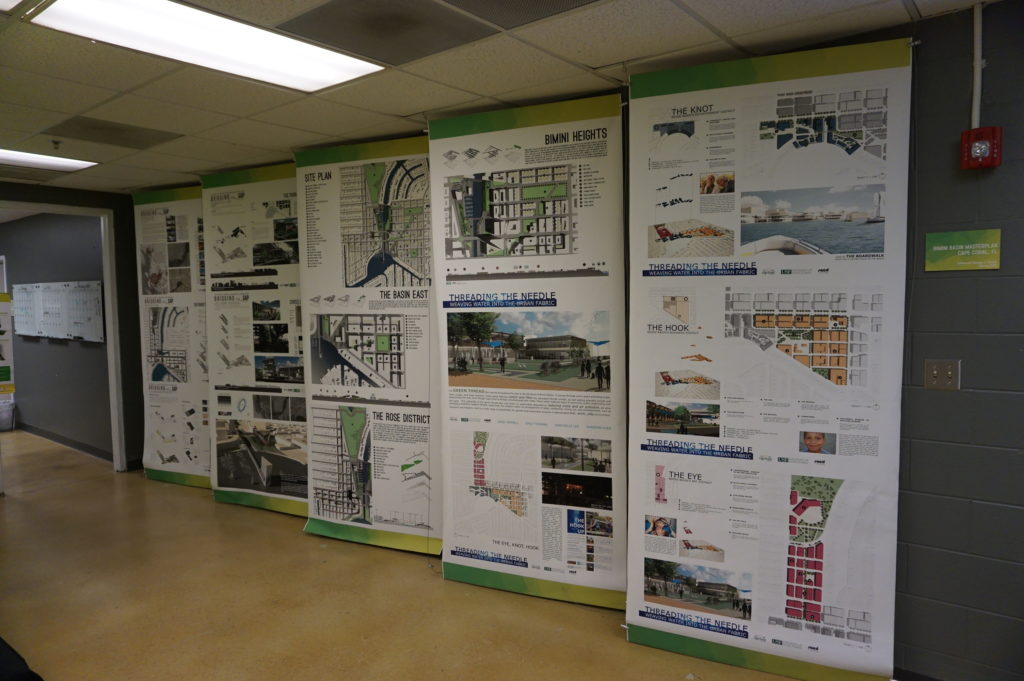
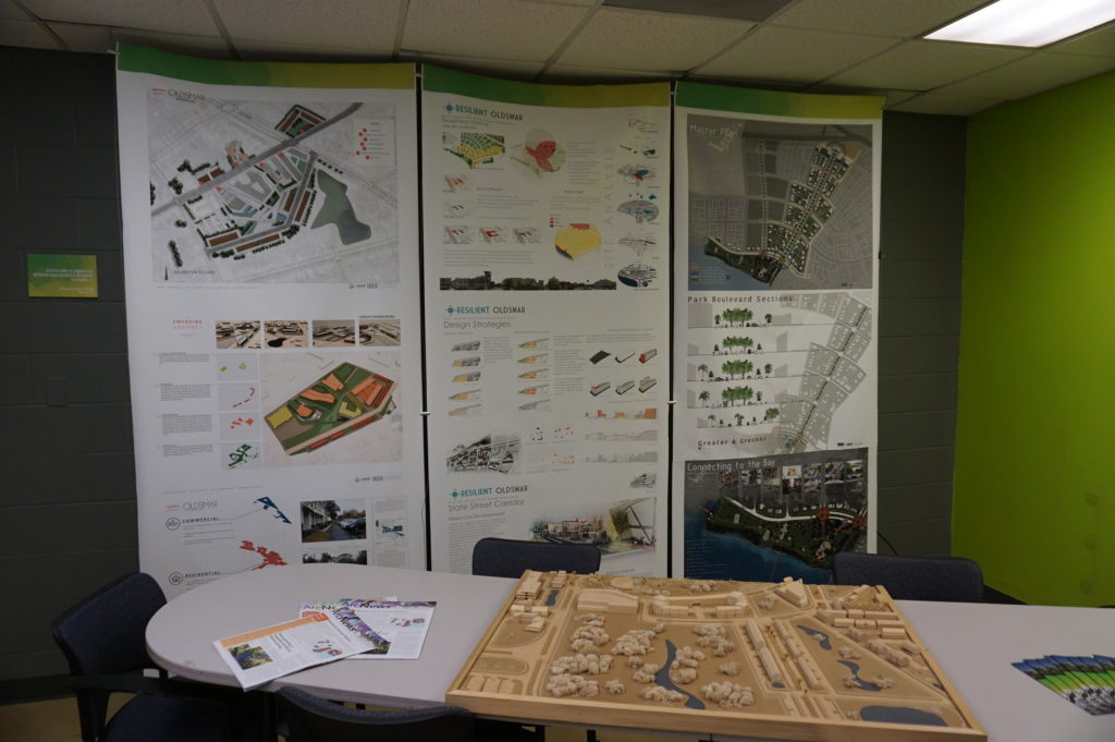
Posters (above and below) from the USF design studio

The most encouraging aspect of that visit was, for me, the mere fact that the students are engaging with such a pressing problem. I have researched the issue of hazards and climate change in the planning curriculum for both undergraduate and graduate degree programs in urban planning, and most such programs are lacking in this respect, a situation that is disserving the planners of tomorrow who must be well trained to come to grips with these challenges in whatever communities they end up serving. But a growing number of students are getting such training—I have myself been teaching such a course at the University of Iowa since 2008—and southern Florida is as good a laboratory as they could wish for. To see collaboration between a county agency and USF graduate students and faculty is a most welcome note.

But Gene had other places to take us in the afternoon, besides, that is, the Cuban-themed La Teresita restaurant where we ate lunch—a place I am willing to recommend if you ever visit Tampa.

First up in the afternoon was the University Mall area north of downtown Tampa and just east of I-275. This involves a stormwater management and flood-mitigation project in an area subject to a certain amount of repetitive loss, meaning that the same properties continue to suffer periodic flood losses. The project removed structures while creating additional areas for stormwater storage and reshaping a natural area known as Duck Pond, thus creating a system for stormwater conveyance. This includes a large stormwater pump that transfers slow-moving stormwater to areas further downstream and, in due course, to a reservoir owned by the City of Tampa. Before this project was initiated, storms used to inundate multifamily apartment buildings, Gene says, as well as a nearby assisted living facility. How does the county pay for all this? He credits a combination of local funds, which is certainly not unusual, and federal money in the form of Hazard Mitigation Grant Program (HMGP) funds. The latter are available as part of an overall recovery package after a Presidential Disaster Declaration, but require that purchased properties, once cleared, remain in perpetual open space. The point is to ensure that a vulnerable area is not redeveloped, thus perpetuating the problem.
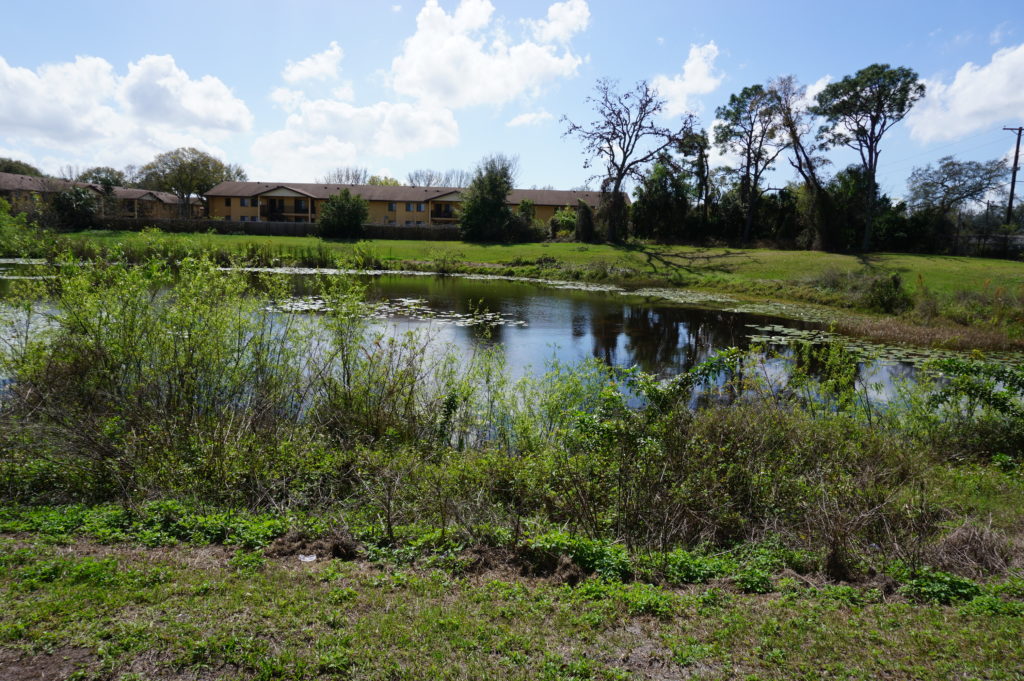
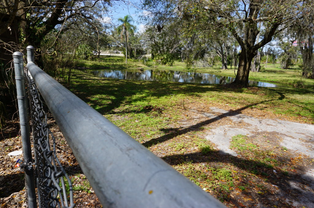
At 132nd Street, also in Tampa, another flood-mitigation and stormwater management project presents a very different appearance. This too was subject to repetitive loss and required protection from urban flooding, which is typically the result of poor stormwater drainage in developed areas. The problems can include poor water conveyance from one area to the next—the nearby highway provided an impediment to drainage—and high levels of impervious surface, meaning coverage with concrete and structures that limit percolation of water into the soil. In this case, a small subdivision suffered repetitive flooding even with small storms. Here also, the county acquired homes with HMGP funds, which are dispensed by the Federal Emergency Management Agency (FEMA). The streets were removed, and stormwater ponds were added.

This was a location where the county’s partnership with USF paid dividends. Researchers analyzed which plants were best at removing nitrogen and other chemicals common in stormwater runoff in order to clean up the water before it reaches Tampa Bay. Henry says this project was made possible through a combination of local and HMGP funds in combination with federal Community Development Block Grant entitlement money.

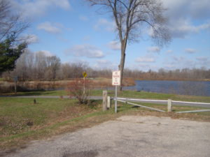
I included the chain link in my photo to show that the solution may not be complete. After all, chain link fences are intended to limit access. What consideration, I asked, had been given to eventually converting this cleared area to some sort of public park and thus facilitating a public benefit? There can be challenges in part because of pollution cleanup and other public safety factors. Gene readily admitted he would love that solution, but it may take time. The adjoining neighborhood must be comfortable with that use, which can involve solving various site-related problems. A nearby church might be a potential ally, serving as a patron and watchdog, but reaching agreement about solutions and responsibilities, including ongoing maintenance and supervision, takes time. And only time will tell whether such a solution materializes with the support of local public officials.
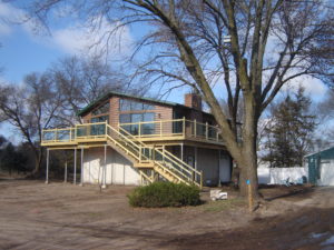
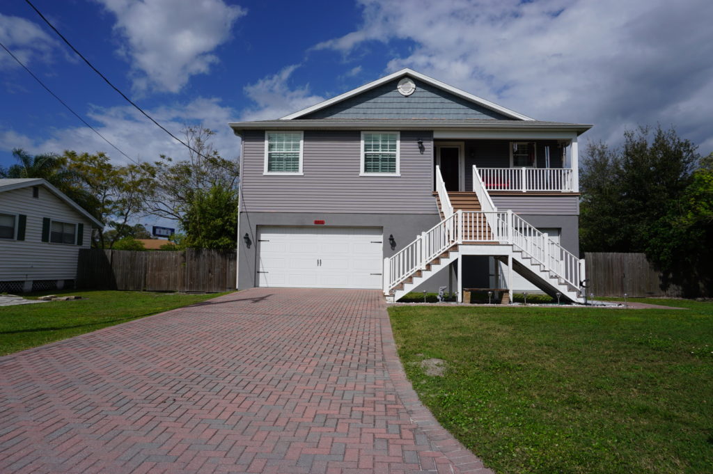
Some projects assist a single homeowner with a stubborn problem. This is often the case with homes that are elevated, a common site in parts of the Southeast, where coastal and riverine flooding can wreak havoc with homes in vulnerable locations that do not necessarily require buyouts and relocation. That was the case near Rocky Creek, where a homeowner rebuilt a structure elevated three feet above base flood elevation (BFE) using a combination of private funds and a Flood Mitigation Assistance (FMA) grant from FEMA. The result is living space that is better protected when flood waters surround the lower level.
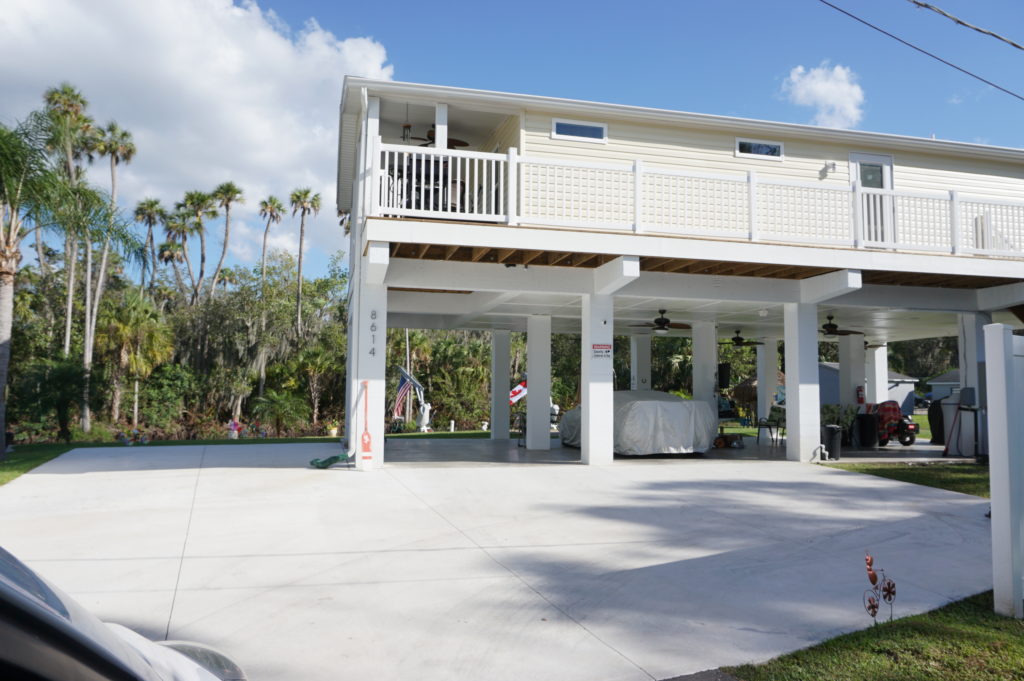
The same story occurred at a home near the Alafia River, where another homeowner was elevated three feet above BFE, using the same combination of funds.
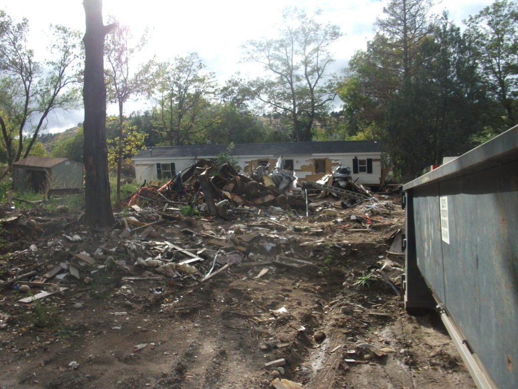
Gene also shared with us an interesting strategy at a frequently flooded and highly vulnerable modular home park, where an area had been cleared of its former homes to allow repopulation with recreational vehicles (RVs). The logic is that, when flood warnings arrive, RV owners will be able, unlike those with more stationary modular homes, to simply drive off the site to safer areas until the emergency subsides. The initiative, Gene says, was taken by the park’s new owner (which owns other parks nationwide), which identified no more permanent structures in the floodway as part of its compliance strategy after the most recent flooding event in the area.
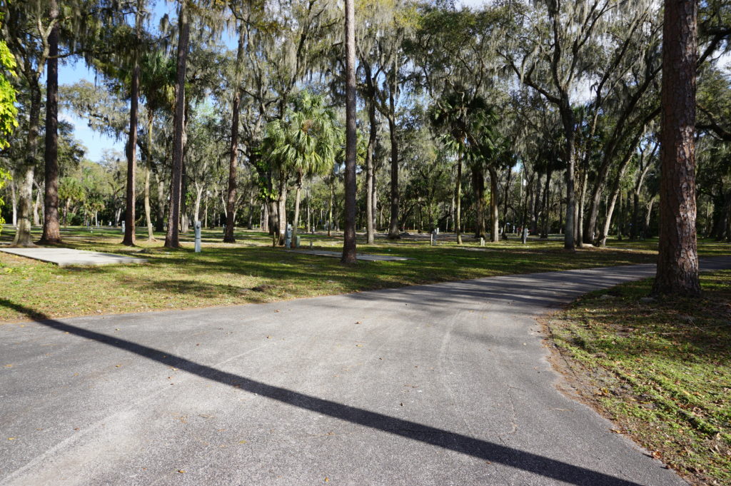
This area is slated for RV occupancy only.

Finally, we returned to learn a little about the EOC. We visited what is often known in such centers as the “war room,” where designated officials meet to discuss and establish strategies for dealing with an emergency of any sort that activates the emergency operations plan. In the photo, each chair is designated for a specific official, with groups of people with related tasks seated in color-coded sections of the room. Many such EOCs are much smaller, but Hillsborough County is very urban and populated, and the needs are complex and interrelated. It is expected that those involved will arrive with authority to respond to the disaster, to indicate what they are and are not capable of doing as part of the overall response to disaster. It is not a place where one expresses a need to go back to another office and “find out.”
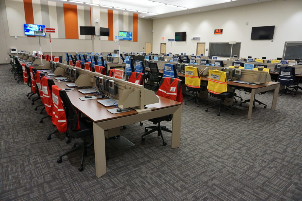
Hillsborough County Emergency Operations Center “war room”

Ready to relax and enjoy a drink and a snack, we followed Gene down the highway to the Sunset Grill at Little Harbor, which has a beautiful view of the bay. At dusk, numerous people followed a daily ritual of photographing the sunset over the water. Tourist attraction it may be, as well as a local watering hole, but the surrounding area has a significant mangrove forest and salt-bed areas that were preserved as open space using Environmental Land Acquisition Funds from what Gene describes as a “locally instigated preservation program.”
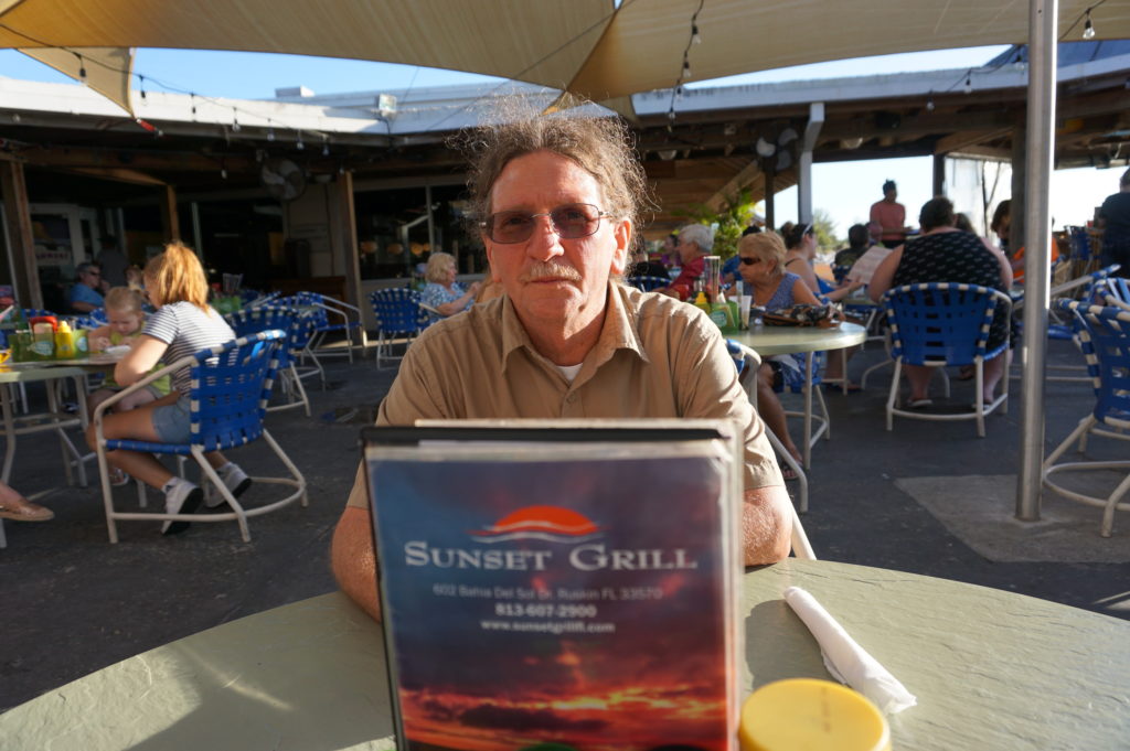
Hillsborough County’s Hazard Mitigation Program Manager, Eugene Henry, at rest at Sunset Grill at the end of our day-long tour.

And so, with the sun declining in the west, we sat at an outdoor table and hashed over the world’s problems, and sometimes our own. One point that seems clear to me is that Hillsborough County has a great deal to offer to other jurisdictions, just as it has undoubtedly learned a great deal as well—one reason both he and a resident scholar and Japanese graduate student from the University of Illinois, Kensuke Otsuyama, planned to drive to West Palm Beach the next day to hear my presentation. Although there is sometimes a tendency for local governments to become more insular, to allow fewer opportunities for employees like Gene to share and exchange information in professional forums and conferences, this, I think, is always a mistake. The growth in the value of what someone like Gene does lies in this fruitful sharing of experience and perspectives that such opportunities allow, and I hope that will continue, for certainly Gene made my day by sharing his time to allow me to learn and to share with the growing readership that follows this blog.

Supplemental Comment:

Although the hearing was held today, making live streaming a moot point, significant written and recorded testimony on hazard mitigation and climate resilience issues occurred before the U.S. House Appropriations Subcommittee on Transportation, Housing, and Urban Development. Yesterday, the following link was made available from several sources including the American Planning Association (APA) to provide access to this testimony and information:

Representatives from APA, PEW, Houston Public Works, Rutgers University, and the Town of Arlington, MA are delivering testimony to the Transportation and Housing and Urban Development (THUD) congressional subcommittee tomorrow, March 13th at 10:00 a.m. EST. THUD, a part of the House Committee on Appropriations, writes laws that fund the federal government’s important responsibilities. The testimony is available for streaming here:

https://appropriations.house.gov/legislation/hearings/stakeholder-perspectives-building-resilient-communities

APA will submit written testimony that will be put into the Congressional record. The testimony will be available on APA’s website tomorrow.

Jim Schwab

FEMA Needs to Think about This One

Flooded property in Lyons, Colorado, after the St. Vrain River flooded in September 2013.

There is that old saying that, if it ain’t broke, don’t fix it. To that, one might add that, if you’re thinking about fixing it anyway, you may want to clarify exactly how you wish to improve things and why you think the improvement will be better.

In a February 27 notice in the Federal Register, the Federal Emergency Management Agency (FEMA) proposed a major change in long-standing hazard mitigation rules regarding grants for acquisitions of flooded properties that made almost no effort to meet that test. I wish I had noticed it earlier because the deadline for comments was April 30. I submitted a brief comment on that date and tried to rally others on Facebook, but the truth is that this one got away from me. I was busy on other fronts. I have subsequently spent a few days gathering background information.

I am very glad that a few national organizations like the Association of State Floodplain Managers (ASFPM), American Rivers, and the Natural Resources Defense Council (NRDC) found time to file substantial objections to FEMA’s notice on Property Acquisitions and Relocation for Open Space (Docket ID: FEMA-2018-0006). Their objections raise profound questions about both the process and the substance of FEMA’s proposed changes. Others have also submitted comments.

Here’s the bottom line: For 30 years since the passage of the Stafford Act, which provides the basic framework of most federal disaster law, federal hazard mitigation grant programs have required that lands being acquired from property owners whose homes have been flooded must be placed into perpetual open space following demolition of the structures. The clear intent is to reduce the ongoing exposure of the federal government and the National Flood Insurance Program to repeated losses by precluding further development in those flood-prone areas. By and large, those grants go through state and local governments, which then maintain those open spaces and must periodically certify to FEMA that the lands remain in that status. Today, those grant programs include not only the Hazard Mitigation Grant Program (HMGP), a sometimes-substantial source of mitigation funding that is available after a presidentially declared disaster; the Pre-Disaster Mitigation (PDM) program, created as part of the Disaster Mitigation Act of 2000, which amended the Stafford Act; and Flood Mitigation Assistance (FMA), part of which deals with Severe Repetitive Loss properties, which make up a disproportionate share of overall flood claims.

In the notice, FEMA has announced a new option to allow owners of flooded properties to retain the underlying land while being paid to demolish the structures, thereby permitting them to eventually rebuild on that same flood-prone land. Because mitigation grants have gone from FEMA through states to local governments, those governments have been responsible for the open space programs that result. This new approach would allow the property owner the option of taking the grant directly from FEMA. In its comments on the proposal, ASFPM noted that, in the 2004 NFIP reform legislation, it supported providing FEMA the option to deal directly with property owners, mostly because some local governments have lacked the capacity to monitor the open space requirements, but it still expected that FEMA would consult with those governments before using that option as a means of maintaining consistency with state and local hazard mitigation policy. The current notice makes no mention of such coordination.

Elevation of flooded properties remains a viable option in many cases.

It is not as if these owners do not have other options for mitigating future flood damage, including elevation of residential structures above the 100-year base flood elevation established on FEMA flood insurance rate maps, or floodproofing the structure. But, the thinking seems to be, some owners will be more willing to demolish if they can retain the land. One possibility for some might be to retain the land, rebuild in due course, and flip the improved property while leaving the NFIP with continued flood loss exposures. How that helps federal taxpayers or other flood insurance rate payers is not especially clear.

The Federal Register announcement does nothing to make that clear. If you follow the link and read the notice, you are likely to experience my reaction, which was that I felt left in the dark regarding the rationale for making this move, which is not explained. Nor does FEMA provide any data to support the idea that this initiative would do anything to reduce flood losses. The opposite could easily prove true.

In an April 26 article in Insurance Journal, former FEMA administrator Craig Fugate offers some support for the new option by noting that placing land in permanent open space through a buyout is often a “hard sell.” That may well be, but it is partly because the solution is meant to be effective and lasting. It is also not as if the approach has lacked success. As NRDC notes in its comments, citing ASFPM case studies, more than 30,000 floodplain properties have been removed from development since 1993, many of them following major cataclysms such as the 1993 and 2008 Midwest floods and various hurricanes.

Perhaps more telling is the question of homeowners’ motivation in making the difficult decision to sell and relocate. The idea that people would necessarily prefer to be able to rebuild in the same location is not as clear or straightforward as some might assume, though there are, no doubt, advocates of property rights who would prefer to create the new option. But this emotional decision contains some factors that should not be ignored. Perhaps straight to the point is this comment from American Rivers:

Our experience working with floodplain managers has taught us that convincing property owners to accept a buyout is an emotional and difficult decision, and many are only willing to accept the buyout offer after they are assured that the property will be preserved as open space for the good of the public. Offering direct grants that allow new construction where a structure was demolished could be at odds with local hazard mitigation plans and efforts to acquire flood prone properties for open space. FEMA should instead be working to support the implementation of open space goals in local and state hazard mitigation grants.

In other words, many of those choosing a buyout, having suffered the damages of severe and repetitive losses from flooding, and aware of the larger issues concerning the public good in these situations, would rather ensure that nothing like this happens again, at least in their community. But what happens to the motivation undergirding their willingness to sell if they become acutely aware that their neighbors now have the option of prolonging the pain by not placing the land in permanent open space? Will they still feel that they are accomplishing anything by pursuing the traditional option? In any event, are these not the people whose choices we most want to honor for the greater good of the community?

City-acquired open space in Cedar Falls, Iowa, near the Cedar River.

The essential reason all this is important is that we have learned much over the years about the natural and beneficial functions of floodplains, which include soil enrichment, wildlife habitat, reduced flood severity, and reductions in erosion and stormwater runoff, to name a few, in addition to the potential recreational functions of waterfront parks and open space. All this is in addition to the fiscal benefits of reducing future floodplain losses in the areas affected. If all that is not reason enough for FEMA to pause, rethink the question, and at least offer some solid scientific and economic documentation of the benefits of the proposed new approach, then I am not sure what is. Otherwise, count me a serious skeptic.

Jim Schwab
Touching Sky and Sea in Norway

For three months, I have been intermittently aware that, back in August, I shared two phases of a trip to Norway that my wife and I took in July—and that I promised to complete the story with two more. At the same time, I was laying the groundwork for an entirely new phase of my career. Having left the American Planning Association (APA) at the end of May, I was planning book projects, establishing a one-person consulting firm, preparing to teach my fall course at the University of Iowa, and undertaking periodic speaking engagements. This was all part of my “five-point retirement plan,” of which the remaining piece is this blog.

Soon enough, however, given my professional focus on planning for disasters, real life overwhelmed my intentions. Even as I was laying the groundwork for Jim Schwab Consulting LLC, my consulting operation, Hurricane Harvey was blasting the Texas coast. Harvey was soon followed by Irma in Florida, then Maria in Puerto Rico, then wildfires in California. Though I have not been involved in recovery from Irma and Maria, people in Texas solicited my attention, and later I spoke at conferences in North Carolina and Utah. I am participating in a planning group for Harvey recovery, and I have undertaken some other work as well. Before I realized it, the semester was over, the holidays were upon us, and I had utterly failed to write about the rest of the Norway venture. And I do like to inject some travelogues into this blog. All disasters and policy disquisitions and no fun can make for a dull blog. (Some readers may disagree, but my mixture of subject matter seems to have broad appeal.)
Railway station in Oslo (Jean in foreground)

So. About four months ago, I left our story in Oslo after a busy Monday. Jean and I stayed overnight, packed our bags again, and got ready to travel to Bergen. The trip between those two cities is one I would recommend to anyone with the slightest appetite for dramatic scenery. But first we had to move from our hotel, the Radisson Blu Scandinavia, to the railway station. One truly neat feature of Oslo is the tram, which was included in our Oslo Pass, as was all other public transit including the subway system. The tram stopped right behind the hotel, and the railway station was only a few stops away. We had a pleasant early morning ride down the middle of the street, then crossed the street with our luggage and entered a very modern-looking station that would put us on our train to Bergen. It all seemed very convenient and well organized.

The train from Oslo to Bergen, however, is more than just well organized. Norway in a Nutshell notes that the Bergen Railway is “Northern Europe’s highest-altitude railway line.” The passenger cars indicate the altitude at each stop, so you can track your progress upward as well as across the country and downward again to the sea. The highest reading I recall was 1,224 meters, roughly 4,000 feet, but a glance out the window made clear the mountains around us touched the clouds at a slightly more rarefied level.

Once the train departs the urban environment of Oslo, the scenery changes rapidly, passing lakes and rivers and entering the interior of Norway to reveal small lowland farms in the shadows of green, often forested hills. Over a 6 ½ hour journey, the train finds its way into numerous small communities along winding valleys and into the mountains until you begin to witness snow on the peaks, even in July, where the combination of altitude and latitude make clear that Norway is never entirely green. Knowing the long history of this nation, one can only imagine how the challenges of traversing this landscape influenced first the Viking, then the medieval, Reformation, and even Enlightenment Norwegian mindset, and why the law of primogeniture combined with meager prospects for agricultural prosperity to send waves of young people to America in search of a better life. Of course, in modern times, Norwegians have found prosperity through other means, including energy development and a highly educated work force, but for many centuries most people endured a hardscrabble life in a relatively unyielding environment. That gorgeous landscape did not make life easy for those trying to survive by breeding livestock and growing crops. Even though we did not leave the train until we reached Bergen, one could feel the chilly air when the doors opened at small town stations, and knowing it was July made one wonder how cold it might be in January.

And yet there was no question that the views were strikingly beautiful–unless you were passing through one of several tunnels beneath the mountains. We were not there in the right season to attest to this, but I have read repeatedly that winds and snow in the winter make this mountainous terrain a challenging environment in which to maintain year-round train service. The Norwegians, however, are as prepared for such challenges as anyone. They keep the train moving.

In due course, of course, one reaches the peak of the journey, and the downhill ride begins, ending near the sea in Bergen, the second-largest city in Norway behind Oslo. Because of prior arrangements by Bill Mitchell at Conlin Travel, we were greeted upon our exit from the train by a local driver who turned out to be a retired police officer, a fact he revealed in the process of insisting that we buckle up before he took us to our hotel, about 15 minutes away along the harbor. From him, we learned that Bergen is a city of nearly 300,000 people, with half as many more living in the entire metropolitan area. As first-time visitors, we were about to learn just how much Bergen has to offer.

Our modest but well-appointed Clarion Hotel Admiral offered a marvelously serene waterfront setting, supported by a flotilla of sail boats, fishing boats, and larger commercial craft. Somewhere further along the coast were the large cruise ships, such as the Nordnorge, on which we would be sailing by the next evening. Bergen is largely defined by its status as a seaport on a fjord near the Atlantic Ocean, but that location makes it as scenic as any city would want to be. From a crowded waterfront, homes and other buildings seem to radiate up the slopes until they thin out and the insistent lush forest takes over. We were also lucky. We were told it had been raining for most of the month before our arrival, but that, with the emergent sunshine after some initial misty cloudiness, we had “won the weather lottery.” We were grateful for the photogenic result.

For Jean and me, after checking in and relaxing in our room, our first order of business was to meet up with personal friends who would join us on the cruise. Two of my colleagues at APA had also retired within the last few months. Carolyn Torma, formerly education director, left at the end of November 2016 and had already been traveling on her own since then. Deene Alongi, the meetings and conferences director, retired on July 12, just a few days before our trip. She and I had met over dinner about some business matters back in January, and in discussing our plans, discovered we both intended to cruise the fjords of Norway during the summer. She and Carolyn had already been making arrangements for a cruise with Hurtigruten, a Norwegian cruise company, through Mitchell, an acquaintance of Carolyn’s cousin, Carol Wargelin. Why not join forces, we decided, and book the same cruise? Using the same travel agent allowed us to connect at the same hotel, even though our three friends were arriving separately after flying straight to Bergen, letting us visit Oslo first on our own, something I wanted to do so that Jean and I could ride the train to Bergen.

In front of the downtown mall in Bergen. From left, Deene, Carolyn, Carol, and Jean.

By late afternoon, I met Deene in the lobby as she entered the hotel. Later we met Carolyn and Carol, and the five of us enjoyed dinner in Admiral’s very pleasant restaurant. Our conversation revolved around plans for the following day, for we would have until 4 p.m. to wander the city before boarding a bus to the dock to enter the cruise ship.

Although our plans evolved, Bergen made it easy to enjoy the day. We discovered the Kode museums, which line one edge of a charmingly picturesque public park anchored by a pond with a fountain but also including a gazebo and lush lawns. Using a single pass, we visited all four museums by late afternoon, punctuated by lunch at a reasonably classy diner adjoining one of them. The museums offer five daily tours in English, in addition to Norwegian. Kode 1 offers the Singer collection, a combination of Chinese porcelain, period furniture from the 16th and 17th centuries, and classic paintings, among other art, plus a splendid display of silver and gold artifacts created in the city over the past half-millennium, and the H.M. Queen Sonja “Underway,” displaying graphic and ceramic artworks sponsored by a royal who seemed to relish the chance to sponsor sculpture and craft works.


The silverwork section of Kode 1.

Kode 2 was not then open, preparing a new exhibition that opened in October. Kode 3 featured the Rasmus Meyer collection, an assortment of Norwegian paintings from 1880-1905, which is surely the golden age, with works from landscape and other

Part of the Rasmus Meyer collection.

painters like J.C. Dahl, Harriet Backer, and Theodor Kittelsen. I will not claim to be any sort of expert on the subject; in fact, I learned about some of the artists for the first time in this visit. But viewing these works up close filled me with admiration for their skills and the cultural perspectives they conveyed. There can be little doubt that Norway experienced a remarkable flowering of artistic talent in the late 19th century. And that is before we even mention the substantial display of work by Edvard Munch. The iconic The Scream, for which he is best known (and of which there are four versions), is only the beginning of Munch’s lifetime of productivity, punctuated by some tragic interludes that no doubt profoundly influenced some of his artistic idiosyncrasies. However, it would be a mistake to think that all, or even most, of his work is affected by the mental illness that ran through the family, including his father, or was dark and depressed. Indeed, there is an entire strain of cheerful nature painting within his oeuvre. Munch was clearly Norway’s artistic genius.

Finally, Kode 4 branches out beyond Norway to include numerous modern European and other artists, including Pablo Picasso, Paul Klee, Diego Rivera, and Joan Miró. But as one might expect, time ran out, and we all had to stroll back to the Admiral Hotel, retrieve our stored luggage, and await transport to the Hurtigruten dock to embark on our cruise, which will be the focus of the final installment in this series.

Jim Schwab
Park that Transformed Downtown Chicago

Ed Uhlir died Wednesday, not living long enough to enjoy another Thanksgiving because multiple myeloma overtook him at 73. But the entire Chicago region can be thankful for his quiet service to the city and for his major accomplishment as both an architect and a public servant.

In a world of “starchitects,” those designers with rock-star name recognition in their highly visible profession, his creativity was of a different and far less flamboyant sort. He succeeded in orchestrating the contributions of numerous rich, powerful, and sometimes difficult personalities to produce an outcome that changes people’s perceptions of what a major public space can be. He spent six years, starting in 1998, as the project director for Millennium Park. Mayor Richard M. Daley persuaded him to take on the role shortly after he had retired from the Chicago Park District, with plans to enter the private sector. Daley told him the job would last a couple of years. It ended up being six, but Uhlir stuck with the task until the 26-acre Millennium Park opened in 2004, completely transforming the lake side of Michigan Avenue for several blocks south from Randolph St. to Monroe St. In the process, it also transformed everyone’s sense of downtown Chicago.

During those six years, I watched from a bird’s-nest view of what is now the park because the American Planning Association (APA) was situated across Michigan Avenue from the Art Institute of Chicago and catacorner from the park’s edge. I have regretted to this day not having had the foresight to start shooting daily photos from that 12th-floor vantage point to create a record of its progress toward completion. I had the corner office closest to the action. But who knew?

Well, some did. In late June of this year, I attended, on an intermittently rainy day, a tour of Millennium Park, co-sponsored by the APA Illinois chapter and the American Society of Landscape Architects Illinois chapter. The program began in a meeting room behind the park’s amphitheater with a series of short presentations led by Uhlir, who was remarkably candid about the process of creating the park. But retirement can do that to you.

What Uhlir began with was a park design by the firm Skidmore Owings and Merrill (SOM) that he found unsatisfactory, he said, in part because it was not completely accessible, though it was based on “an extension of details from the Burnham plan.” Exactly what that meant historically was laid out by Benet Haller, who had been with the Chicago Department of Planning and Development, but now is a transit manager for Cook County. He followed Uhlir’s presentation with a discussion of the history of the downtown lakefront area that Grant and Millennium Parks now occupy, which more than a century ago grew from landfill, much of it derived from subway tunneling as the city’s transit system was built. Haller noted that the Chicago lakefront has been evolving for decades, with features like Grant Park’s iconic Buckingham Fountain emerging in the 1950s. Evolution is, of course, precisely what one would expect of a dynamic urban area. Michigan Avenue, now several blocks from the lake, gained its name from originally being along the lake. Also along that lakefront was a stretch of railroad that still provides passage for many riders into downtown along Metra’s Electric Line, now ending below ground in a station under Millennium Park.

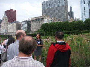
Terry Guen explains nature in the park to those in the APA/ASLA tour.

As Terry Guen, a local landscape architect who also spoke, noted, city lawyers discovered by 1998 that the city owned in fee simple the land between Randolph and Michigan, easing the task of leveraging use of the land from railroads that opposed its use for a park. In addition to the Metra station, the space below the park also contains a parking garage, making the park above, as Guen observed, “the world’s largest publicly accessible green roof.”

Achieving that status required a discreet but confident man with a sense of humor who could patiently weather the tug of war between wealthy donors (such as Penny Pritzker), who underwrote many of the most significant improvements to the park; world-famous architects like Frank Gehry; Maggie Daley, the mayor’s wife; who insisted on accessibility for the entire park; and civic and business leaders. After the initial design failed, Uhlir shifted the approach to a design competition that attracted some of the best ideas that found their way into the final scheme, including the proposal from Anish Kapoor for “Cloud Gate,” aka “the Bean,” one of the most popular aspects of the park since its opening because it allows visitors to see both themselves and the city skyline in the reflections on the perfectly buffed metal. Despite early criticism about cost overruns, the park has become the leading tourist attraction in Illinois, outpacing even Navy Pier with approximately 13 million visitors annually. It is a dynamic combination of features—the water fountain, the amphitheater, a winter skating rink, the “Bean,” and gardens that blend into an effective whole that seems always to be greater than the sum of its parts.

Part of the magic, according to Guen, came from tapping the local wisdom of “plant people, contractors, and others who knew so much about Chicago,” bringing wildflowers and prairie plants that bring an explosive mix of colors while allowing “little weed growth because the ground is so packed full of roots.” The botanical features of Millennium Park can keep a native plant enthusiast busy all summer long, even as the built features attract audiences seeking cultural experiences. For instance, the Harris Theater, on the northeast corner, attracted my wife and me on our anniversary one year to hear Roberto Bernigni perform a comic monologue followed by a recitation in Italian from Dante’s “Il Inferno.” We returned on my birthday to join a “do-it-yourself Messiah,” in which audience members participate in singing assigned parts of Georg Friedrich Handel’s famous work.

All Ed Uhlir did to make this happen was keep all the egos in check, harness them toward a common goal, and leave Chicago with a lasting civic treasure where people can rest, recreate, and relish the best the city’s culture has to offer. If that is the only legacy for which he is remembered, it is far more than most of us will ever claim. Millennium Park is now an indelible part of Chicago’s identity.

Jim Schwab

Climate Resilience on the High Plains

For those who think only in terms of the politics of red and blue states, the conference I attended March 30-31 in Lincoln, Nebraska, may seem like a paradox, if not an oxymoron. It is neither. It is a matter of looking beyond labels to facts and common sense, and ultimately toward solutions to shared problems. The problem with climate change is that the subject has been politicized into federal policy paralysis. But the scope for local and even state action is wider than it seems.

The University of Nebraska-Lincoln (UNL) Public Policy Center with support from the High Plains Regional Climate Center (HPRCC) sponsored the conference on “Utilizing Climate Science to Inform Local Planning and Enhance Resilience.” I spoke first on the opening panel. The sponsors have been working with communities across Iowa, Missouri, Kansas, and Nebraska. Planners, floodplain managers, and civil engineers from eleven municipalities in those states participated, along with UNL staff, climatologists, the Nebraska emergency manager, and myself.

My job was to provide a national perspective on the subject from a national professional organization, representing the Hazards Planning Center at the American Planning Association. I talked about two projects we are conducting with funding from the National Oceanic and Atmospheric Administration: “Building Coastal Resilience through Capital Improvements Planning” and “Incorporating Local Climate Science to Help Communities Plan for Climate Extremes.” I made light of the fact that there was not a single coastal community among the four states of the region, but I added that the lessons from the first project are still relevant because every community plans for capital improvements, which generally constitute the biggest investments they make in their future. Capital improvements cover long-term expenditures for transportation and waste and wastewater infrastructure as well as other facilities potentially affected by climate change. In the Midwest and High Plains, instead of sea level rise, communities are watching a rise in the number and severity of extreme events on both ends of the precipitation curve—in other words, both prolonged drought and more intense rainfall. Drought taxes water supply while heavy rainstorms tax local capacity to manage stormwater. Both may require costly improvements to address vulnerabilities.

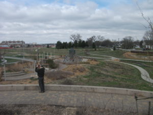
This park is part of the new urban amenity created for Lincoln residents.

I simply set the stage, however, for an increasingly deep dive over two days into the realities facing the communities represented at the workshop. Such input was an essential point of the conference. Different professionals speak differently about the problem; if planners or local elected officials are to interpret climate data in a way that makes sense politically and makes for better local policy, it is important for, say, climate scientists to understand how their data are being understood. There must also be effective information conduits to the general public, which is often confused by overly technical presentations. Moreover, what matters most is not the same for every group of listeners.

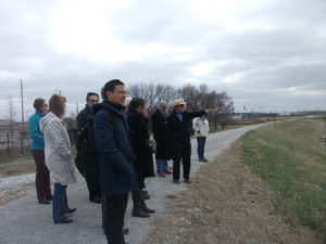
Glenn Johnson explains some of the planning of Antelope Valley.

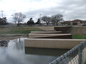
Some of the challenges, as well as the successes, were clear from presentations by two speakers who followed me to talk about the situation in Lincoln. Glenn Johnson is retired from the Lower South Platte Natural Resources District. Steve Owen is with the city’s Public Works and Utilities Department and spoke about the challenges related to water supply and quality, as well as flooding. At the end of the conference, we spent three hours touring Lincoln’s Antelope Valley project, an interesting combination of using a weir (small dam) and landscaping tools to create adequate water storage to reduce flooding in the downtown area. This had the interesting impact of removing some land from the floodplain and sparking redevelopment in what are now some of Lincoln’s most up-and-coming neighborhoods. At the same time, the project through creative urban

Now you know what a weir looks like (if you didn’t already). Photo courtesy of UNL.

design has allowed the city to create new urban park space and trails that enhance the urban experience for residents. Responding to climate and flooding challenges need not subtract from a city’s overall prospects; it can help enhance its attractiveness to both citizens and developers. The result is that good planning has helped make Lincoln a more interesting city than it might otherwise have been. That is a message worth considering amid all the political hubbub over climate change. We can create opportunity, but we must also embrace the reality. My guess is that this is why the other ten cities were present.

Jim Schwab

In the Valley of the Crooked River

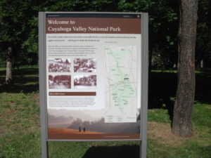
DSCF3156Two weeks ago, I wrote about Cleveland’s Flats Entertainment District, where restaurants and bars now line the sides of the once filthy Cuyahoga River that now hosts boats and rowers. The Flats is but the last reach of a river that extends south into the Akron area. What has often been far less well known to outsiders than the more notorious industrial past of the river is the beautiful, forested valley that surrounds it upstream. In fact, about the time the Cuyahoga River was making environmental history by becoming a driving force behind passage of the Clean Water Act in 1972, U.S. Rep. John Seiberling, an antiwar Democrat from Akron, was leading an effort to designate a new national park. By 1974, he had won authorization for the creation of what is now the Cuyahoga Valley National Park, which remains a hidden treasure for many. I have personally discovered from discussing our trip that many people outside Ohio do not even know that the park exists.

For some interesting background on the politics and commitment behind the drive to create the park, I recommend a book I read several years ago about the life of John Seiberling, A Passion for the Land: John F. Seiberling and the Environmental Movement, by University of Akron emeritus history professor Daniel Nelson.

As for the Cuyahoga Valley National Park: Yosemite or Yellowstone it is not. Ohio, which became a state in 1803 and rapidly urbanized and industrialized afterwards, does not offer such massive public spaces for preservation. But it does contain gorgeous smaller valleys such as the Cuyahoga where protection of the landscape was still possible in the 1970s, and land was assembled from numerous small landowners and public spaces, woven in some cases into the fabric of the existing Metroparks system. In the area that contains the park, certain places seem to take one back in time to the 19th century, when Ohio built a canal to connect the Ohio River and Lake Erie and move agricultural and other products to markets a generation before the railroads began to dominate. Towns such as Peninsula and Boston, in the heart of the upper Cuyahoga Valley, still have the small town feel of that era in many ways, and many older homes have been preserved.

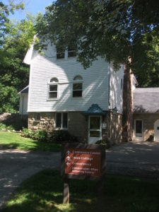
DSCF3157One, in fact, now hosts the Conservancy of the park, along Hines Hill Road just east of Boston, where one finds the visitor center. When we arrived, staffers were erecting a tent for an outdoor wedding that weekend. Curiously, we were also in town for an outdoor wedding for one of my nephews, but his was at Thorn Creek Winery in Aurora, several miles to the northeast. Although we merely stopped to investigate the scenery, and we were totally unexpected arrivals in the Conservancy office, the staff in the office treated us like honored guests, plying us with materials about the park and answering questions. Their friendliness is a tribute to the attitudes and sense of mission of both the Conservancy and the National Park Service itself.

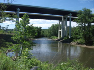
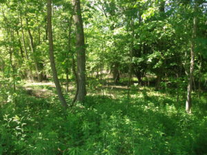
DSCF3164The park itself is a fantastic playground for hikers, bikers, backpackers, and even skiers and sledders. This is the north, after all. Near the Boston Visitor Center is the Boston Mills ski resort, offering some modest hills but great accessibility for people in the metropolitan area. But we arrived in June, and we began to wander the Towpath trail that leads away from the visitor center back into the forest, south beyond the massive bridge that carries Ohio Turnpike travelers past the Cuyahoga River below. From the height of the turnpike, one might never realize that what lies below is a national park, although it is certainly an impressive expanse of forested greenery. Down below, however, we were treated not to nature’s silence but to its music. For one thing, it was cicada season, so the buzz was all about the woods, but so were the birds, some of whom may have been feasting on cicadas. We surely could have seen other wildlife, had we come around dawn or dusk, but we were hiking in the late morning, when the deer and the rabbits and coyotes were well hidden. It is remarkable how easy it is to get away from everything, although the trails are popular enough to keep you in touch with other passing humans. The trails seemed to attract both young and elderly, providing a great excuse to all ages to stay in shape and in touch with nature. I began to wish I had tree and bird guides with me to better understand parts of my experience. If I still lived in the area, I might revisit with those guides, but it may be a while before I return.

DSCF3169Our hiking visit occurred on a Thursday. Jean and I made a return visit on Friday, but of a different nature, and one that accommodated my sister, Carol, who lives nearby in North Royalton. She joined us at the parking lot on Rockside Road in Independence at 9 a.m. for the Cuyahoga Valley Scenic Railroad, a fine way for first-time visitors (and others) to see the park and its valley from a different perspective. The CVSR is a passenger train that uses tracks that largely run along the edge of the river. It is mostly run by volunteers who simply love the job of educating people about the local environment and its history. Audio is available that allows you to hear some of that history along with what one crew member jokingly referred to as “some pretty bad music,” most of it evoking a sense of bluegrass and Civil War and the early frontier with the use of banjos and bass fiddles. Call it “mood music.” The train ride takes about an hour and a half to get to Akron before turning around and bringing you back to where it started. Along the way, there are several stops that allow riders to get off and explore and then wait for the next train coming through. Explorers may want to get the schedule before they wander off. The price is only $15; as senior citizens we got tickets for $13. The money supports the train and is well worth it for the scenery along the way.

Because the park is interwoven among small towns and private property, the park leases some land for sustainable farming of vegetables and sheep, goats, and chickens, with some of the products finding their way to the Countryside Farmers’ Markets. The Conservancy staff also noted for us that there is now a visitor home in the park called Stanford House, built in 1843. It is not a bed and breakfast because visitors are on their own in sharing the use of a kitchen, but rooms can be rented starting at $50 per night, and the home provides immediate access to the Towpath Trail and the railroad, among other attractions.

Ultimately, the Cuyahoga Valley National Park is a study in adaptation, fitting a park into the scenery of a river valley that is also at the center of the large Cleveland-Akron metropolitan area. The park has been evolving since its advent in the 1980s and will continue to evolve as conditions change. But one major contribution it has already made is to stymie the urban sprawl that has so adversely affected much of the Cleveland area and allow residents to enjoy an expanse of refreshing greenery.

One reason it has taken two weeks to return to this blog and tell the story, since we returned to Chicago on June 12, is that I left again on June 19 for Grand Rapids, Michigan, to participate in the 40th annual conference of the Association of State Floodplain Managers, which was founded about the same time the national park was being organized. Today it is a growing organization of more than 17,000 floodplain managers, about 1,000 of whom attended the conference at the DeVos Convention Center, which sits along the Grand River opposite the Gerald R. Ford Presidential Museum, to which it is connected by a stone pedestrian bridge. ASFPM members have always been familiar with nature-based strategies for reducing flood damages and preserving the quality of rivers and streams, and the conference contained numerous discussions of such approaches. It occurred to me that what I had seen in the Cuyahoga Valley was one of the best possible approaches to floodplain management, the prevention of the encroachment of development to allow nature its due, preserving a natural setting that nonetheless endows humans with wonderful opportunities for outdoor recreation and exercise in an age when public health authorities worry about an epidemic of obesity. We have to make our cities attractive places for people to get the exercise they need. Many factors in the Cleveland metropolitan area, frankly, work against that goal, but the park exemplifies it. It is modern floodplain management at its best with a healthy dose of environmental protection in the bargain. The fact that the park is sprinkled with outdoor attractions like the Blossom Music Festival only serves to enhance that goal by acquainting people with what the park has to offer.

John Seiberling was clearly a visionary in fighting for the creation of the park in Congress. But every city has its environmental champions. It is the job of the rest of us to make it politically possible for them to survive and to achieve their objectives. We all benefit from a better quality of life when they do.

As for the title of this blog post: The Cuyahoga River derived its name from the local nomenclature of the Mohawk Indians, an Iroquois nation, who referred to the river as “crooked” because of the way it winds through the landscape, hence “crooked river.” (The Seneca, also Iroquois, used a similar name.) Meandering is nature’s way of diffusing the force of flood waters while distributing silt into the rich agricultural soils along the banks. Ohio grew up on such wealth. Now it is preserving some of it.


Jim Schwab