Facing Waterfront Hazards in Wilmington

Wilmington, a charming city of just over 100,000 on the far southern edge of the North Carolina coast, has taken some hits from coastal storms in recent years, most notably Hurricane Florence in 2018. Hurricane Dorian this year posed a minor threat but mostly left a trail of 14 identified tornadoes in its wake, a phenomenon familiar in the Southeast, though their association with hurricanes may be less well known elsewhere.

Wilmington Planning Director Glenn Harbeck, who I was told was one of the most knowledgeable people in town for the purpose, on October 8 took me on a boat tour of much of the city’s interior waterfront to let me see and photograph the area along Hewletts Creek, a stream feeding into the Atlantic Ocean behind the barrier island that includes the Masonboro Island Estuarine Reserve. Glenn and his wife have lived in Wilmington for 40 years, during which, he says, they have experienced a succession of hurricanes: Diana (1984), Bertha (1996), Fran (1996), Bonnie (1998), Floyd (1999), Matthew (2016), Florence (2018), and Dorian (2019).
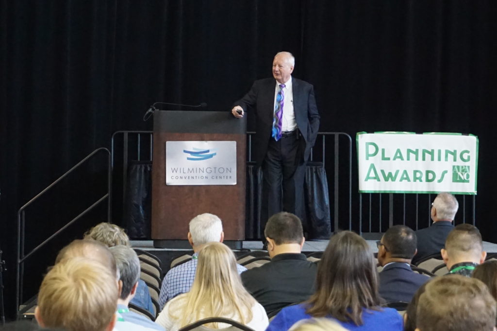
Why it has taken me this long to write about it is another matter related entirely to my own obligations and distractions. At the time, however, I was in Wilmington as the invited keynote speaker for the annual conference of the North Carolina chapter of the American Planning Association. That event was at the city’s convention center, which sits along the Cape Fear River, which basically serves as the city’s western edge, with suburban or unincorporated New Hanover County on the other side. Along with the adjoining Embassy Suites, the complex boasts a boardwalk that allows people to walk to restaurants and other venues in more historic quarters of the city. I joined a party of a dozen at a nearby seafood restaurant, The George on the River, and got to see much of it. Some of the boardwalk appears to need work, but I was not clear on whether that was due to hurricane damage of work in progress. But I can give The George five stars. The food was wonderful and a credit to southern coastal cuisine. (I enjoyed crab-topped salmon with garlic mashed potatoes and spicy collards. I gladly recommend it.) Added appeal derived from the outdoor seating that made for a pleasant evening setting.

But all that followed the boat tour, which came in the late afternoon after a delayed arrival in Wilmington following a long layover in Atlanta on the way from Chicago. The weather had been uncertain, and Glenn was a bit concerned about concluding the trip before it turned rainy or inhospitable, although it never did. It was simply a bit chilly, but my photos have that overcast, gray-sky look as a result.

Compared to some prior tours I have taken of disaster sites, this one was relatively brief with modest expectations. Nonetheless, there are always learning opportunities, and I had never visited Wilmington before. Touring by boat allowed a different perspective than by land. Certain factors became readily apparent, with Glenn supplying ample explanation.

One, to be expected, was that, despite the clear dangers and mitigation challenges associated with a waterfront near the ocean in a region frequently affected by coastal storms and hurricanes, housing along Hewletts Creek remains attractive to its owners and has gained value as a result. These are people who love their boats and their access to the water, and the storms are simply part of the environment, much like a snowstorm in Chicago. Whether everyone takes all the appropriate precautions to protect those properties may be another matter, but most are at least aware of the challenges they face when hurricanes move toward North Carolina.
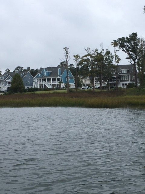
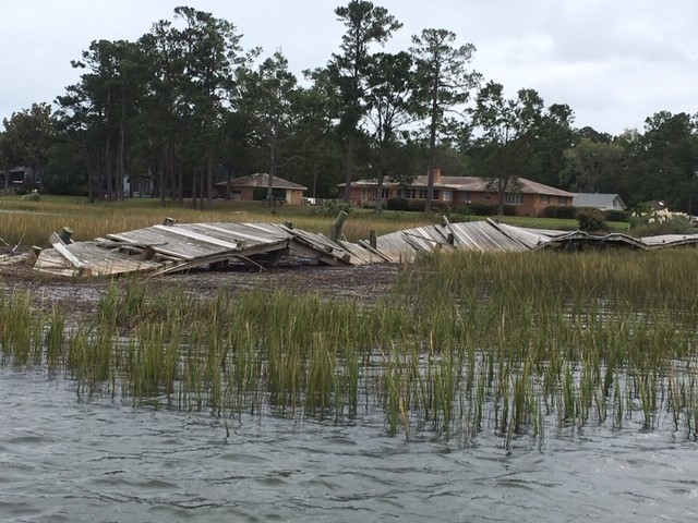
Because access to the water is a prized asset, most properties include piers, although shared piers are becoming more common, according to Glenn, presumably because of reduced costs and environmental impact. Those piers, however, have typically taken a beating in big storms, and Hurricane Florence contained some solid punches. One problem, he informed me, is that the buoyancy of the wood is the enemy of the piers’ survival because, as the storm surge rises and the piers rise with it, they are bent and twisted and collapse. In other words, the buoyancy of wood works against them. The photos provide ample evidence, but Glenn also told me that some had been repaired in recent months; if I had come three months earlier, the destruction would have been more evident. Past adaptation in some places was to rebuild the piers higher than before to move them above likely wave levels, but frequent storms and high storm surges have sometimes obviated the effectiveness of this approach. Instead, some pier owners are adapting with the use of Titan decking, which uses polypropylene plastic to stabilize the piers during future storms.
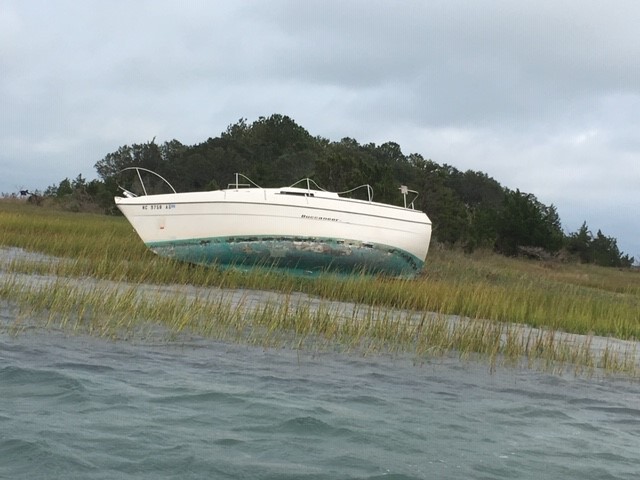
There were also, a year after Florence, remaining indications of the damages suffered to the boats themselves, which can easily be tossed about by winds and waves. We encountered one of those (below) toward the end of the tour.  
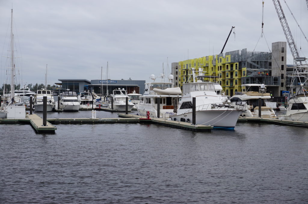
It should be noted that, although it is inside Wilmington, Hewletts Creek has a much more rural or suburban feel than the Cape Fear River waterfront, which is near the urban heart of the city and its downtown. The riverfront is not primarily residential but encompasses a variety of commercial uses, including hotels and a large marina. In contrast, the waterfront along Hewletts Creek consisted predominantly of private residential property.

I do not wish to leave the impression from this glimpse of Hewletts Creek that what happened there is the extent of the impact of Florence. Although I did not have time on this trip to get a thorough tour of the city, I did receive other information from Glenn and from Christine Hughes, a senior planner with the city for Comprehensive Planning, Design, and Community Engagement. From her, I learned that Wilmington’s working and low-income populations sustained a large hit on their affordable housing stock with the loss of approximately 1,200 apartment units. In September, the Wilmington City Council approved $27 million worth of bond issuances for the Wilmington Housing Authority. A big part of that involved the closure of Market North Apartments on Darlington Avenue, which will be rebuilt. That closure forced evacuation by more than 1,000 residents. Wilmington will be recovering from Florence for some time to come. The cost and numbers of people affected in this housing redevelopment underscore the solemn fact that often low-income and minority populations suffer the greatest impacts of natural disasters. Our communities are not whole unless and until we give them high priority in recovery planning.

It is also worth knowing that the quest for coastal resilience is not new to Wilmington, which has engaged with federal and state agencies for some time, as illustrated in a 2013 report on a U.S. Environmental Protection Agency pilot project on community resilience. Glenn Harbeck has been in his current position for more than seven years after a long period of consulting and knows well the direction the city needs to take, but it is a long road. Residents can learn a great deal about the progress of infrastructure recovery projects from the city’s online map tracking such efforts, which include street and sidewalk repairs and stormwater management. Recovery is a complex process, as Wilmington knows well, and future storms, climate change, and sea level rise will all surely add to the challenges that lie ahead.

Jim Schwab

Gratitude on Parade #9

GRATITUDE ON PARADE
#gratitudeonparade

Kristin Hoskin had been on my list for these tributes, but I thought it wise to let the dust settle after the Christchurch terrorist attack before saluting her in Gratitude on Parade. Most certainly, however, her gracious reaction to my blog post about the incident two weeks ago confirmed the very reason for including her here. She reaffirmed the New Zealand commitment to human decency.

I met Kristin in late 2007 after speaking on a panel in Reno, Nevada, at a conference of the International Association of Emergency Managers. Her question was whether I might entertain an invitation to New Zealand as a Visiting Fellow of the Centre for Advanced Engineering in New Zealand (CAENZ) at the University of Canterbury in Christchurch. Over subsequent months, arrangements were worked out between CAENZ and the American Planning Association, and my three-week absence in July and August 2008 was approved by Paul Farmer, APA’s CEO at the time. The reason for choosing me for this annual honor was my expertise in land use related to natural hazards. CAENZ wanted to inject that element into the national debate in New Zealand on natural hazards policy making.

Kristin was assigned to escort me around the country as I conducted seven workshops and seminars in both North and South Island cities, ending with a few days in Christchurch crafting a white paper before I returned home. She was a gracious host, and from her I learned a great deal about her country even as I shared detailed knowledge with New Zealand planners, emergency managers, and others about how we address those issues in the considerably more complex U.S.

For me, it was a wonderfully educational exchange of insights and information that I will never forget. It was what mutual learning should be. I would happily return to New Zealand, but life has included more than a few other adventures in the meantime. And I was at least able to include what I learned–and more–in the long article I published in January in the hOxford Research Encyclopedia of Natural Hazard Science, on “Planning Systems for Natural Hazard Risk Reduction.”

Kristin Hoskin, this tribute is for you. Bask and enjoy.


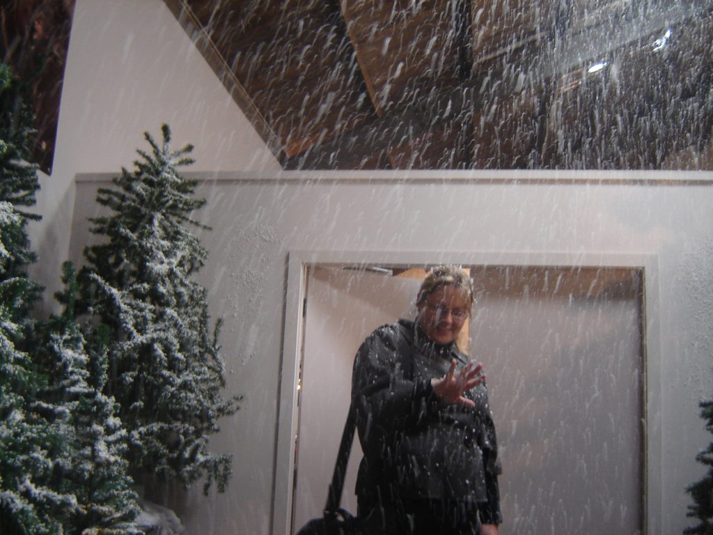
Photo taken during our fun visit to the Stansborough wool factory north of Wellington, which manufactured costumes for the Lord of the Rings movies.

Posted to Facebook 3/29/2019

Reducing Risk from Natural Hazards

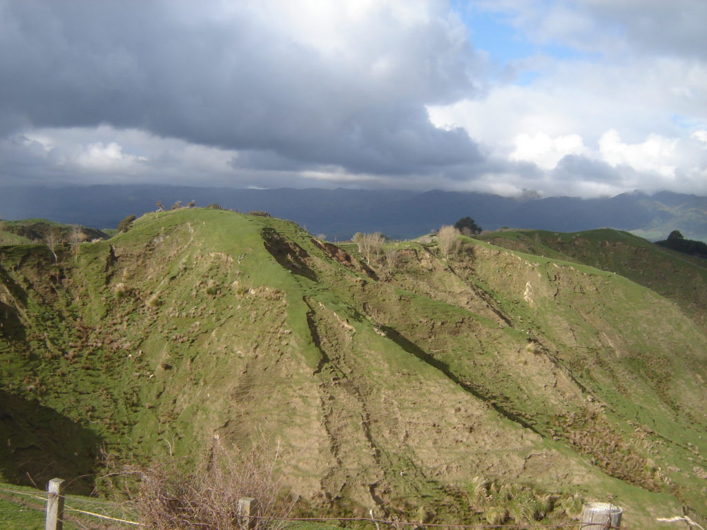
Eroded hillsides have helped push New Zealand to adopt its own approach to risk reduction.

Late in 2017, I received an inquiry from Oxford University Press. Professor Ann-Margaret Esnard at the Urban Studies Institute at Georgia State University had recommended me for an assignment they had in mind to add an article to their growing specialty encyclopedia on natural hazards, the Oxford Research Encyclopedia of Natural Hazard Science. They needed someone to write a peer-reviewed article about “Planning Systems for Natural Hazard Risk Reduction,” using roughly 10,000 words plus appropriate graphics and illustrations. We discussed why they saw me as an appropriate candidate for the job, and I accepted the assignment.

Over the following few months early last year, I spent many hours over several weeks fashioning the article. Although I started out with a clear vision of my subject matter, I also explored and sought more international material than I had ever previously examined. By the spring of 2018, I submitted my draft. Over subsequent months, it underwent editing, peer review, revision, and proofreading, and then final preparation for online publication. Today, I received the announcement. It is online and available to the public.

So, the question for most readers, even those already immersed in the subject matter of natural hazards, is, “What do you mean by planning systems”? Oxford did not venture a specific definition of what they had in mind; they left that to me. I decided that the answer was “essentially a layer of guidance or legal requirements that sit atop plans of any type at any governmental level at or below the source of that guidance.” In other words, the system describes what a plan should look like, or what is expected of a plan that complies with the framework that is established. A planning system is a statutory or programmatic framework for a specific type of plan, in this case, one that aims to reduce losses from natural hazard events.

This had long been important to me. As far back as 2002, while I was at the American Planning Association (APA), I had arranged a contract between APA and the Institute for Business and Home Safety (IBHS) under which APA researched and described state laws that related to planning for natural hazards, updated annually until 2010, when IBHS decided to discontinue the contract. An elaborate matrix detailed which states prescribed planning to address hazards and what they required, suggested, or allowed, supplemented by explanations of specific items in a key code and by color-coded maps. In 2007, I convinced the Federal Emergency Management Agency (FEMA) to underwrite an APA project that examined how communities could better integrate hazard mitigation priorities into local planning processes. The result was a 2010 Planning Advisory Service Report, Hazard Mitigation: Integrating Best Practices into Planning. That has led to elaboration of FEMA guidance on this point, as well as playing a role in more recent guidance to communities from the State of Colorado on resilience, spurred by the September 2013 “mountain monsoon” flooding that afflicted the state. The point is that I have been pursuing this subject for nearly 20 years. I understood why Oxford had approached me for this task.

The encyclopedia article allowed me to expand the subject in new ways, and for those readers curious to explore the topic, I hope it proves useful. Just follow the links in the first paragraph of this post to my article or the encyclopedia more generally, which provides a wealth of knowledge on the larger subject of natural hazards. I hope it provides planners and others in the professional community engaged with natural hazard issues an analytical framework for thinking about how we can tackle these issues.

But that is not all. The concept behind the APA/IBHS work has been revived. Immediately after leaving APA, under a short-term consulting contract, I helped APA prepare a new grant proposal for FEMA’s Cooperating Technical Partners program to revive the state statutory summary in an updated and expanded framework. Although that is not yet complete, PDF summaries of the state-level planning framework for all 50 states are available. Click here for the landing page with an introduction to the overall project. Then stay tuned for the findings and overall summary of the project, which are yet to come.

Jim Schwab

Natural Solutions for Natural Hazards

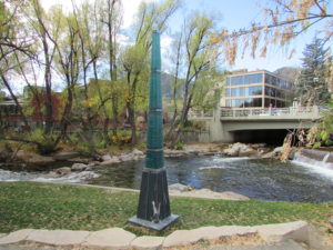
Boulder Creek, Boulder, Colorado

Boulder Creek, Boulder, Colorado

It has taken a long while in our modern society for the notion to take hold that some of the best solutions to reduce the impact of natural hazards can be found in nature itself. Perhaps it is the high cost of continuing to use highly engineered solutions to protect development that has often been sited unwisely in the first place that has finally gotten our attention. Particularly after Hurricane Sandy, however, the notion of using green infrastructure as part of the hazard mitigation strategy for post-disaster recovery began to gain traction; green infrastructure was highlighted in the federal Hurricane Sandy Rebuilding Strategy. These approaches are also known as natural or nature-based designs. They involve understanding the role natural systems play in reducing damages and in using that knowledge to deploy such solutions as part of an intelligent game plan for improving community resilience.

But where should community planners and local officials get reliable information on the best and most proven strategies for implementing green infrastructure solutions?

About a year and a half ago, researchers from The Nature Conservancy (TNC) approached me about involving the American Planning Association (APA) Hazards Planning Center in a project they were undertaking with support from the Kresge Foundation to prepare such information in the form of a green infrastructure siting guide. In the end, they also involved the Association of State Floodplain Managers (ASFPM), the National Association of Counties (NACo), the American Society of Civil Engineers, and the Boston-based design firm Sasaki Associates to assist with this effort. Over the past year or more, we have all met regularly to discuss what needed to be done and our progress in making it happen. We produced case studies, strategy briefs, and other material to populate the project’s web-based resources.

Bioswale in a subdivision development in Boulder County, Colorado.

Bioswale in a subdivision development in Boulder County, Colorado.

Last month, after all that teamwork, TNC unveiled its new website for the project, called Naturally Resilient Communities. For those interested in knowing how trees, living shorelines, dunes, coastal marshes, and oyster reefs, among other types of natural infrastructure, can help mitigate natural hazards like coastal storms and urban flooding, the website provides a serious and interactive introduction to the subject matter, backed up by numerous resources.

What is especially valuable about the website design is that it allows users multiple avenues into the specific types of information they need. Not all natural infrastructure solutions are born equal. Some are more appropriate in certain settings than others. Some work best in inland river valleys, some along coastlines, and others in mountains or high plains. Some coastal solutions work well in the rocky coastlines of California or Oregon, while others work better along Atlantic or Gulf Coast shorelines. Applying such solutions is largely a matter of learning what works best in a specific natural environment in the face of specific hazards—riverine flooding, hurricanes, thunderstorms, or other threats that communities face. It is critical to adapt the solution to the problem.

Accordingly, the website, largely the work of Sasaki Associates with vetting from the other project partners, allows users to approach the information by deciding which strategies they wish to investigate or which part of the United States is relevant. They can also look at considerations such as cost, the geographic scale of the solution (neighborhood, municipal, regional), and the type of community in question. These are precisely the frames of reference familiar to most urban planners and civil engineers who are most likely to be involved in implementing natural infrastructure projects. The emphasis throughout is on the practical, not the ideal or the ideological. A particular approach either works or does not work, but it does so in very specific settings, such as a neighborhood in a city along one of the Great Lakes or in the Southwestern desert. Context is the central question.

This memorial to Gilbert White, the pioneer of modern floodplain management, marks the high point of flooding along Boulder Creek.

This memorial to Gilbert White, the pioneer of modern floodplain management, marks the high point of flooding along Boulder Creek.

Establishing context is why the project put considerable emphasis on case studies, which cover a variety of communities around the nation. Specify, for example, Rocky Mountain West as a region and riverine flooding as a problem, and the site gives you a case study from Boulder, Colorado, that examines the alternatives considered and solutions adopted for flooding along Boulder Creek and discusses the involvement of the city and the Denver-based Urban Drainage and Flood Control District to implement a stream restoration master plan. One can also find case studies from Florida, Ohio, and numerous other locations. One can also, however, explore sections of the website devoted to additional resources and funding

sources to support green infrastructure projects. These allow the user to connect to other websites and some PDFs for additional information.

Go explore. I admit to taking pride in our involvement in this effort. It is, I think, a welcome resource and great learning tool for planners, engineers, local officials, and the interested public.


Jim Schwab

Resources for Planners to Address Hazards

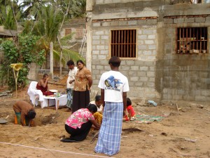
Sri Lankans dedicate new housing built in 2005, after the Indian Ocean tsunami, in a Buddhist ceremony.

Sri Lankans dedicate new housing built in 2005, after the Indian Ocean tsunami, in a Buddhist ceremony.

One benefit of increased attention to hazards and climate change within the planning profession is a growing array of valuable literature that can benefit practicing planners and widen the scope of thinking on the subject among academics. This review of books published within the past year or so is intended to highlight some of this new literature and offer some comparisons on the focus and practical value the authors provide.

Because urban planning is ultimately about people and the built environment, it may make sense to start this survey with two books that examine the context within which risk happens. Kathleen Tierney, a professor of sociology at the University of Colorado in Boulder and director of the Natural Hazards Center there, sets out in The Social Roots of Risk: Producing Disasters, Promoting Resilience (Stanford University Press, 2014) to reorient our thinking away from the idea that individual natural phenomena—earthquakes, hurricanes, floods, etc.—“cause” the death and destruction that we often associate with them. In fact, she says, the death and destruction, particularly in the modern world, is an artifact of the social decisions that produce and, equally important, distribute risk differentially among populations, often producing widely varying impacts. In the opening chapter, she states, “the organizing idea for this book is that disasters and their impacts are socially produced, and that the forces driving the production of disaster are embedded in the social order itself.”

By itself, the idea that disaster losses result from the collision of natural forces with the built environment should not surprise any planners with a modicum of intelligence. And the built environment is inevitably the result of both individual and community decisions. The devil of Tierney’s thesis lies in the details: paying attention not only to all the social, institutional, and political decisions that either enhance or mitigate risk but to how those decisions get made and for what reasons. It is clear that those impacts are anything but randomly distributed and that most are avoidable, yet the litany of losses marches on. Tierney notes that a great deal of professional attention in recent decades has focused on how people perceive risk, a legitimate area of inquiry, but not nearly as much has focused on the origins of risk and how it was socially constructed. There are reasons, after all, why a 7.0 magnitude earthquake in Haiti kills an estimated 300,000 (but who really knows?) yet only dozens at most in California, and why the 1,800 who died during Hurricane Katrina included overwhelmingly disproportionate numbers of the economically disadvantaged.

Most planners work in local or regional government, and they serve power structures that must make the decisions, even when they choose to do nothing, that affect these outcomes. In that sense, some of Tierney’s theories and conclusions may challenge our comfort zones because they imply (or state directly) a need to challenge power with regard to these issues. For precisely that reason, I recommend reading it. Most social progress results from stepping outside traditional comfort zones. For planners, it is also within our ethical and legal responsibilities to help protect public health, safety, and welfare.

Those who wish to examine more closely how differential risk affects more vulnerable subsections of community populations can follow up with a case in point provided by Michael R. Greenberg, professor at the Edward J. Bloustein School of Planning and Public Policy at Rutgers in New Jersey, where he had a front-row seat to observe Superstorm Sandy in 2012. As a baby boomer with aging parents, he says, the event inspired him to examine the issues such events pose for seniors. Protecting Seniors Against Environmental Disasters: From Hazards and Vulnerability to Prevention and Resilience (Routledge, 2014) closely dissects the vulnerabilities of the rising generation of seniors among baby boomers. It exposes the resulting collision of demographics with natural hazards and often inadequate public policy in considering the reduced resilience that may result. At the same time, he notes that many seniors in good mental and physical health can become assets in using their to help build the very resilience many communities will need in coming decades, if only their communities learn to focus these social resources to address and help solve such problems. My only regret after reading this thoughtful book is that the publisher chose to make it so expensive ($145 hardcover), but perhaps a library or electronic copy can make it more accessible.

Six authors, mostly at Texas A&M University (TAMU) have addressed the question of resilience head-on in Planning for Community Resilience: A Handbook for Reducing Vulnerability to Disasters (Island Press, 2014). Jamie Hicks Masterson, program director of Texas Target Communities (TAMU); Walter Gillis Peacock, professor in the Department of Landscape Architecture and Urban Planning and director of the Hazards Reduction & Recovery Center (TAMU); Shannon S. Van Zandt, associate professor in the department and director of the Center for Housing and Urban Development (TAMU); Himanshu Grover, assistant professor in the Department of Urban Planning and Regional Planning at the University of Buffalo; Lori Feild Schwarz, comprehensive planning manager for the City of Plano, Texas (and formerly in Galveston); and John T. Cooper, Jr., associate professor of practice in the same department at TAMU, have combined somehow to produce an almost seamless document that lays out a very practical approach to understanding and developing resilience within communities. The book is littered with tables, checklists, and exercises to walk planners and city officials through the necessary analysis to grasp the impacts of everyday planning decisions in connection with natural hazards. The book tends to rely heavily on the Texas and Gulf Coast experiences of the authors, but as they note with a wry sense of humor, “We like to say that if you can plan in Texas, you can plan anywhere.” For the practicing planner, this may well be the most useful of the five books reviewed here.

Two other books represent the rising level of interest among planners in addressing the impacts of climate change, a subject implicit, and sometimes explicitly expressed, in the three books noted above. One of these, Local Climate Action Planning (Island Press, 2012), by Michael R. Boswell, Adrienne I. Greve, and Tammy L. Seale, is actually three years old but still a very useful and well-informed primer for those planners and city officials undertaking to address climate change. The primary focus is actually not hazards but climate action plans, which focus on mitigating climate change by using public policy and planning to reduce greenhouse gas emissions. For climate change skeptics, it is worth noting that many of the resulting strategies have local environmental and economic benefits that add to the allure of effective climate action plans. While much of the book addresses techniques like inventorying local greenhouse gas emissions and developing reduction strategies, nonetheless, the authors devote one chapter to climate adaptation and outline means of assessing community sectors for vulnerability to climate change impacts.

Finally, Adapting to Climate Change: Lessons from Natural Hazards Planning (Springer, 2014), assembled from a variety of contributions by editors Bruce C. Glavovic, of New Zealand’s Massey University, and Gavin P. Smith, of the University of North Carolina at Chapel Hill, brings together the subjects of climate and natural hazards in a way that points to future successes in addressing the increased vulnerabilities associated with climate change. Unlike the other books, it is less a single narrative than an anthology using examples of climate change adaptation from around the world. It is unquestionably the most cosmopolitan and far-reaching of the five books in its aspirations for global relevance, using case studies from South Africa, Peru, New Zealand, and the South Pacific, among other locations, in addition to the United States. The two editors first met while working in different capacities along the Gulf Coast after Hurricane Katrina and have collaborated periodically ever since. Both have been anxious to explore and explain the critical roles of planning and governance in managing exposure to natural disasters, especially as “practitioners from diverse backgrounds  . . . are faced with the grand challenge of adapting to climate change. Planners who like to mine the experience of other cities and regions in case studies will find plenty to contemplate as they review the mixed international track record of community resilience in facing floods, coastal storms, and other weather-related phenomena influenced by a changing global climate with its wide-ranging variations in specific local settings. It may take a while to digest this substantial book, but it is probably well worth the effort.


Jim Schwab