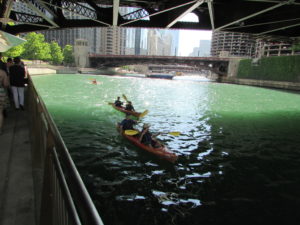
Building Codes Matter

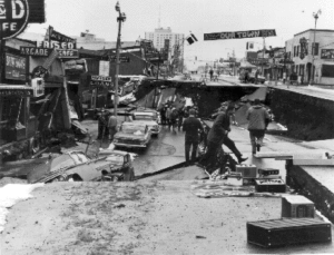
Ask Anchorage after last Friday’s 7.0 earthquake. Admittedly, this is not the biggest earthquake the area could have suffered. The famous 1964 earthquake registered at 9.2, triggered a tsunami, and killed an estimated 130 people. Still, by and large, things seemed to work as planned.

Ask the mayor. And the governor. Mayor Ethan Berkowitz says building codes and good preparation minimized structural damages. No one died. Berkowitz even stated to PBS that other cities would want to emulate Anchorage “because Anchorage did this right.” Alaska Governor Bill Walker admitted to sometimes grousing about strict building codes but conceded, “Building codes mean something,” stating that his own home suffered only minor water damage.

What worked? According to the same PBS report, “Sterling Strait, a member of the Alaska Seismic Hazards Safety Commission, said the states [Alaska and California] use the International Building Code,” which he deemed the “best available standard for seismic safety.”

This good news comes while some states and jurisdictions, in some parts of the country, still resist more stringent building codes, and when some voters still resent what they view as an imposition, sometimes even after the damage from a hurricane, flood, wildfire, or earthquake. But the higher standards matter in saving lives and preventing building collapse, which also prevents injuries. Tellingly, Anchorage hospitals reported a normal day, with no dramatic upsurge in injuries from the earthquake.

Collapse of Fourth Avenue near C Street in 1964 earthquake in Anchorage. USGS photo.

One factor working in Anchorage’s favor is its relative newness as a big city, now about 300,000 population. A city of only 3,000 as late as 1940, Anchorage grew rapidly during and after World War II, still claiming only about 100,000 at the time of the 1964 earthquake. The salient result is that, between its late start as an urban center and the destruction of many older buildings in 1964, Anchorage has far fewer legacy buildings predating modern seismic construction standards than some other cities in states like California. Many California cities, including Los Angeles and Berkeley, have spent considerable sums to subsidize seismic retrofits for older structures including highly vulnerable unreinforced masonry buildings.

As an urban planner, my own expertise lies with land use and not structural engineering, so I will not elaborate on the details of building codes as if I were an expert, but the evidence is compelling. I will note one handout I found on the Anchorage city website, however, on geotechnical investigations. It concerns a requirement for a report from a geotechnical expert and inspection requirements for structures in what are known as Hazard Zones 4 and 5, which define high levels of geological susceptibility to ground failure as result of seismic shaking. The applicable handout dates to 2006, and references a June 1989 report by Shannon & Wilson, a Seattle-based engineering firm. Those dates indicate that Anchorage has been steadily at work on this problem ever since the 1964 earthquake, not wishing to repeat or continue the vulnerabilities exposed by that event.

Without delving into technical details, the bottom line is that, in the designated areas, a civil engineer with experience in geotechnical engineering must perform an investigation of the potential extent of ground movements and soil loadings on the structure proposed, and must prepare and sign a written report showing calculations, conclusions, and recommendations for how the building will be able to withstand seismic displacements without collapsing. The work must then be performed in accordance with those recommendations, and the engineer must ensure compliance through special inspections and a signed statement that his design was followed.

This approach is hardly new but is also far from universal. I learned a good deal about it in the context of municipal requirements in Utah cities around 2005 in the process of completing production of a Planning Advisory Service Report, Landslide Hazards and Planning, by the American Planning Association, with support from the U.S. Geological Survey. Such surveys cost money, but so does wanton damage from a failure to comply.

Alaska did experience problems, but not primarily with buildings. It is still far too early for a complete survey of the damage suffered by the transportation system, and the city and state need to assess the losses due to highway collapses, structural stresses on bridges, and the like. Currently, a railroad between Anchorage and Fairbanks is not functioning. There are always challenges, and every disaster is an opportunity for reassessments and lessons learned. But one clear lesson has already emerged: Building codes matter.

Jim Schwab

Fatal Attraction

Explaining the frustrations of first responders in searching Mexico Beach, Florida, for survivors after Hurricane Michael, Brock Long, administrator of the Federal Emergency Management Agency, told Associated Press, “Very few people live to tell what it’s like to experience storm surge, and unfortunately in this country we seem not to learn the lesson.” Mexico Beach was ground zero for landfall of the hurricane a few days ago.

But then Long was much more direct: “When state and local officials tell you to get out, dang it, do it. Get out.”

The desire or willingness to “ride it out” among people who think the storm will never be as bad as they are told is unquestionably one of the most troubling facets of disaster response, especially when there is adequate warning.

There are disasters, of course, where adequate warning is either extremely difficult or nearly impossible. I still vividly recall one evening in 1979, when, living in Ames, Iowa, I was awakened from a second-story bedroom at about 3 a.m. by the loudest roar I had ever heard. I turned to the window to see total darkness, and aside from the howling winds, no clue of what was unfolding. When it finally passed, I went back to sleep. The next morning, I learned from the newspaper that a small tornado had struck about a mile away, lifting the roofs from seven homes before skipping off into the sky again. On the other hand, we had no cell phones and no reverse 911 in 1979.

Wildfires often give but a few minutes of warning, and earthquakes generally none at all. Hurricanes are different, at least today. In 1900, when more than 6,000 residents of Galveston were swept to sea in the deadliest storm in American history, they had no meaningful warning. In 2018, we have the best satellites the federal government and private money can buy, and we typically know at least 48 hours in advance that a coastal storm is coming, although its strength can change quickly. What we surely know in any case is that, if you live on the Gulf Coast or the Atlantic Coast in the U.S., you can expect hurricanes. Only the frequency and severity vary, and they are not always predictable. But people generally have plenty of time to learn what to do when the time comes. The rest is a matter of cooperation.

There is, of course, the question of why people choose to live in the most vulnerable locations. Early in my quarter-century of involvement in hazards planning, I borrowed

No question about it. The seashore can be a profoundly attractive place in calm weather. The question is both how we build and where we build, and, in the process, what burdens we place on first responders.

the title of a 1987 mystery thriller, The Fatal Attraction, to describe the psychology of our very human attraction to seashores, wooded mountains, and beautiful sunrises. Living on the seashore can be indescribably beautiful under blue skies and balmy breezes. There is nothing wrong with enjoying all that under the right circumstances, but it is critical that we begin to learn our own limitations in adapting to such environments, the need to build appropriately in such locations, and when it is time to simply “get out,” as Long suggested. If we don’t do these things, we are often placing inexcusable burdens on first responders who must dig our dead or injured bodies from the wreckage or save our homes from raging wildfires.

In short, there are times in life when we must be willing to think about more than ourselves. Saving our own skin in the face of oncoming natural disaster is not only not selfish; it is downright thoughtful with regard to the burdens otherwise placed on police, firefighters, and emergency medical personnel.

I am aware that the issue is bigger than I have just described. In another month, I will be speaking about post-disaster recovery to an audience of long-term care health professionals. As a society, we also have obligations to ensure that the elderly live in homes that are removed from floodplains and other hazards, that children attend schools that are as safely located as possible, and that we do not force the poor and disadvantaged into neighborhoods that are at risk and where no one else would wish to live. In New Orleans during Hurricane Katrina, the system failed thousands of poor people who did not own cars by failing to provide means for carless evacuation. The sheer number of such people was never a secret to officials in Louisiana, but good planning never happened before it was too late. All that said, those who have the means should have the willingness to consider both where they choose to live or build and to evacuate when told to do so.

We can all hope that the body count from Hurricane Michael remains low. As of the moment I am writing this, authorities have counted 17 deaths, but it may rise.

Long-term recovery awaits communities affected by either Florence or Michael. As always, serious questions can be posed about where and how to rebuild, whether we can make communities more resilient against future disasters, and what vision states and communities should have as they move forward. In its Influencers series, the Charlotte Observer asked what leaders thought North Carolina could do for coastal and inland communities affected by flooding from coastal storms. Interestingly, many cited setbacks from the coast, accounting for climate change (something the Republican-dominated legislature has explicitly chosen not to do), and keeping new development out of floodplains. All these efforts would make it easier to plan evacuations in the first place. The issue is whether North Carolina, or any other state in the path of such storms, can muster the political will to do what is right.

And whether people who live in highly vulnerable locations can heed the call when told to evacuate.

Jim Schwab


Taking Stock of Recent Disasters

Photo by Jeff Clevenger

We learn from disasters as we recover from them, but each disaster teaches slightly different things. Sometimes the lessons are significant and historic; in others, one community is learning what others already know or should have learned from their own past events. Some years are relatively quiescent, as 2018 so far seems to be. And some become relentless slogs, like 2017.

Adam Smith, lead scientist for the National Oceanic and Atmospheric Administration’s National Centers for Environmental Information, noted in a plenary panel in July for the 2018 Natural Hazards Workshop, in Broomfield, Colorado, that the tally for 2017 disasters had exceeded $200 billion. This is more than 40 percent of the tally so far of billion-dollar disasters for the entire decade beginning in 2010. Simply put, with three major hurricanes—Harvey, Irma, and Maria—striking parts of the southern U.S., followed in short order by some of the most expensive wildfires in California history, it was a wild, taxing year in the world of emergency management.

But our attention fades quickly. Right now, there are no equivalent disasters seizing our attention, but in time there will be. The people who remain painfully aware that recovery is a long, slow process are those directly affected, and even many of them will not fully grasp the ways in which past location choices and patterns of development have brought them to this pass. Many had no choice anyway. Our communities are frequently full of social inequities that compromise the life choices of the poor and disabled. In other cases, the losses inflicted on neighborhoods are the result of hubris on the part of developers, city officials, and homeowners themselves. It does not hurt, approximately one year after these combined events, to look at what we know so far about the recovery following them.

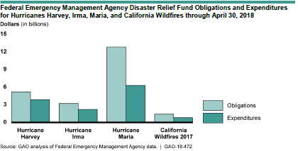
Apparently, the U.S. General Accountability Office (GAO), an arm of Congress, agreed that the time was ripe for review because it has released a study, 2017 Hurricanes and Wildfires: Initial Observations on the Federal Response and Key Recovery Challenges. Because of the severity of challenges in Puerto Rico, one may note from the graph below, reproduced from the report, that Hurricane Maria by far entailed the largest federal expenditures.

In spite of that level of effort, Puerto Rico has engendered the most significant criticism of the performance of the Federal Emergency Management Agency (FEMA). Maria struck Puerto Rico and the U.S. Virgin Islands (USVI) after Harvey had already drenched and flooded coastal Texas, and Irma had swept through much of Florida.

FEMA teams managing the distribution of water, and meals for hundreds of semi-trucks at an incident Support Base in Seguin, Texas. Photo by Dominick Del Vecchio – Aug 29, 2017

The report notes that, as a result, FEMA resources were severely stretched by then, only to have wildfires in California add to the pressure, though the personnel assigned in the last case were small compared to the hurricanes (as is typically the case). Adding to the challenge, Puerto Rico and USVI are offshore and were also poorly prepared for a Category 4 hurricane. Puerto Rico had already suffered years of neglect of crucial infrastructure, was burdened with oppressive debts, and was by far the least prosperous target of the 2017 storms. All this, combined with some incredibly inept public relations from the White House, led to a perfect storm in which nearly 3,000 people have died directly or indirectly as a result of the disaster. To my knowledge, that is a number exceeded in U.S. history only by the 1900 hurricane in Galveston, which killed more than twice as many people. The difference is that, in Puerto Rico, most people died because of blocked transportation, loss of electricity, and similar problems with critical facilities that prevented adequate transportation or medical attention in many isolated communities in the interior of the mountainous island.

Exactly what we learn from Puerto Rico remains to be seen. It is worth noting, in my view, that far more prosperous Hawaii has coped well with admittedly less-challenging disasters in recent years, in large part because state government has practiced response and committed resources to the problem. I say this despite being aware of gaps in Hawaii recovery planning that merit further attention. But if Puerto Rico is a logistical challenge for mainland responders, Hawaii is even more remote but better prepared. The difference in economic circumstances, however, is a dramatic and powerful variable in this comparison, as is Hawaii’s statehood. It is also worth noting that Hawaii is a long chain of islands, and storms (or volcanoes) never affect all at the same time. Effectively, that has always meant that emergency resources in Hawaii have been able to be moved from one or more islands to another that has been hit by a storm. All of Puerto Rico was devastated almost on the same day, with internal transportation, communications, and electric power nearly brought to a standstill, making access to many villages nearly impossible.

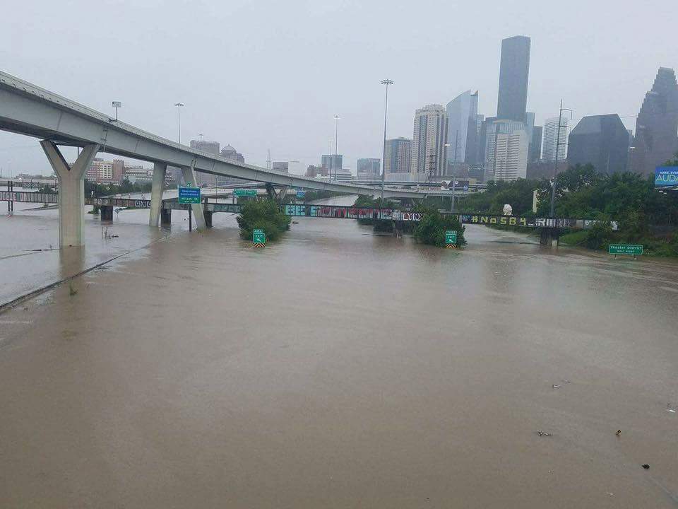
If Puerto Rico, followed closely by USVI, is the direst case for long-term recovery, there nonetheless remain serious challenges in Texas, not only in Houston but in dozens of other counties along the Gulf Coast. A recent Washington Post article used the term “Harvey homeless” to describe thousands of Texas families living in whatever parts of their flooded homes they have salvaged while struggling to accumulate the resources to repair the rest. They live with mold, dust, and any other environmental contaminants that endure in essentially unusable parts of their homes. In all, according to the Texas Department of Public Safety, at least 175,000 Texas homes were “badly damaged” by Hurricane Harvey, and 80 percent lacked flood insurance, thus relying on much smaller federal disaster payments (averaging $4,203) than flood insurance would have afforded. If there is one powerful lesson in Texas, it concerns public education on the value of flood insurance, particularly in the many areas outside the 100-year floodplain. Unfortunately, much of the public retains the illusion that flood insurance is either unnecessary or unavailable outside the legally defined floodplain. Yet Harvey’s 60 inches of rain in some parts of metropolitan Houston left vast areas beyond the regulatory flood boundaries under water because water does not care about such artificial boundaries. It goes where gravity compels it to go. Moreover, years of loose land-use regulation over the past half-century of rapid growth have expanded the floodplain and put numerous neighborhoods in greater danger than they faced in the past.

Moreover, as John Henneberger, executive director of the nonprofit advocacy group Texas Housers, noted in his keynote at the Natural Hazards Workshop, Texas does not have a noteworthy history of attention to social equity in disaster recovery. Henneberger called for a new model of disaster recovery in which we seek to use recovery planning to overcome racial and economic inequities, stating that “the legal framework already exists” in federal programs like Community Development Block Grant—Disaster Recovery (CDBG-DR) to “overcome inequalities,” but the rules are not always followed. Thus, his top recommendation for reform was simply to “obey the law” regarding the conditions that apply to state and local use of CDBG-DR funds.

Finally, Bloomberg Business Week chose recently to examine the questions surrounding rebuilding after the California wildfires. With a population already approaching 40 million, the state is under intense pressure to build adequate housing amid rising housing costs. California has repeatedly toughened its building codes in response to wildfire threats but faces a legacy problem of homes built under earlier standards. Not often known outside wildfire research circles is the fact that the average home contains seven to eight times the density of combustible materials as the surrounding forest in the wildland-urban interface. That means that every home that catches fire or explodes is a huge matchstick endangering every other home in its immediate vicinity. When one considers that California is unquestionably the most progressive state in tackling wildfire problems, one understands that the problem of retrofitting older homes built to lower building code standards—or none at all in some other western states—is a lingering and potentially very expensive problem. The dilemma serves to illuminate the value of pre-planning for recovery, learning how to seize the “teachable moment” for reform, to reduce the scope of the problem. The article also notes that, if California is to reduce pressure to build in the forest, its cities must be prepared to allow greater density to relieve the housing crisis in a state where a shortage of affordable housing has yielded a concomitant problem of growing homelessness. And so, we see why urban planning needs both to be holistic in its approach to social problems and guided by wise state policy with supporting resources. We all still have a long way to go.

This blog post can never be long enough to explore all these issues in depth. But in coming weeks and months, I hope to delve into specific issues more deeply, share interviews with individual experts, and explore what needs to be done. I am also watching intently for new books that will shed light on new solutions. One just arrived today. Stay tuned.

Jim Schwab

Kickstarting Urban Innovations

We often hear from conservatives that the public sector is inherently inefficient, lacking the competitive pressures that drive innovation. A great deal of the evidence seems anecdotal, although it’s not hard to come by. The work of most public agencies is at least somewhat more visible than that of most corporations. People build long memories, for instance, of long lines for driver’s license renewals. Today, however, most of us renew online unless there is some reason we need to retake the test or replace a lost license quickly. How often do we remember the agencies that have created more modern customer service operations? I read in the Chicago Tribune’s endorsement today of Cook County treasurer Maria Pappas for re-election that, in the past 20 years, she had reduced her staff from 250 to 88.5, while also digitizing more than 4.7 million pages of old records. Was anyone noticing?

Count me a skeptic on the broad theory of greater efficiency in the private sector. I’ve long been more inclined to assess efficiency and innovation on a case-by-case basis. I don’t think it is at all impossible to innovate and streamline public-sector operations, nor do I think all businesses operate efficiently. In due course, obviously, the latter may go out of business, but there are also ways for voters to hold public agencies accountable—if they are so inclined, which sometimes they are not. People are sometimes more than willing to re-elect dinosaurs for a variety of reasons, just as they sometimes continue to patronize sluggish businesses. Human decision making in both the political and economic realms can be rather fallible, a fact that the field of economics is finally coming to terms with (witness the work of Amos Tversky and Daniel Kahneman, the subjects of the Michael Lewis book The Undoing Project, or of Richard Thaler).

It is thus heartening to see someone like Gabe Klein produce a short, snappy volume, Start-up City, that provides both case studies and principles for public-sector innovations in our cities, with an eye to building the cities of tomorrow that are in fact competitive with their peers in fostering both better service to their constituents and better prospects for environmentally and socially beneficial economic development.

Gabe Klein. Images courtesy of Island Press.

Klein’s book discusses the innovations he introduced first in Washington, D.C., and later in Chicago, in both cases managing the city’s transportation department. When the mayor of Washington appointed him to the first post, he pulled Klein out of the private sector, where he had been involved with a bicycle company, food trucks, and Zipcar. Those enterprises exposed him to competitive entrepreneurial environments where innovation flourished, but also to obstacles that regulators can pose to innovation. Klein flourished in the public sector as well because he firmly believed that innovation in public agencies, even those that had been somewhat stodgy and resistant to change in the past, was eminently possible. He set out to prove it through a combination of public-private partnerships, new thinking about agency missions, and a determination to find a way to make things happen. He distills the lessons from these experiences in a series of short eight chapters that are called, well, lessons.

Those lessons are not bashful or pain-free. For example, Lesson #1: Don’t Be Afraid to Screw Up and Learn. Klein’s underlying point is simple: If you spend your time indulging a fear of making mistakes—which, sometimes, in the public sector, can be very visible—you will accomplish little or nothing. This preoccupation may ensure short-term survival, but in the end, it is self-defeating (not to mention boring). It helps, of course, to have a mayor or other public chief executive who has your back. (Get that assurance before you accept the post.)

I won’t belabor the points here because I’d rather encourage you to read this book, which is not a long read but is definitely an inspiring one. But I will note that, in both cities, despite some entrenched opposition, Klein managed to instill numerous and prominent bicycle lanes on city streets, as well as engineering the completion of the 606 Trail in Chicago, a project about which I have written in the past, and the Riverwalk in downtown Chicago. Along the way, he discusses the marketing and branding of public projects, creative approaches to financing those projects, and effective means of engaging the private sector in meaningful partnerships. You will also learn from Klein’s smooth prose that he is an effective salesman, communicator, and presenter, making it small wonder that Mayors Adrian Fenty in Washington and Rahm Emanuel in Chicago would seek him out to serve in their administrations.

But I also want to make clear that Klein is not sui generis and does not claim to be. One need only look at the innovations of Janette Sadik-Khan in New York City under Mayor Michael Bloomberg, creating pedestrian walkways in the middle of Manhattan while improving traffic flow, to know that such innovation can abound in the public sector. (Sadik-Khan has her own book, Street Fight, that details her experiences in city government.) All that is required is the political will to turn the entrepreneurial spirit loose in city government. The only real obstacle is a lack of commitment and imagination.

Jim Schwab

Norway’s Fjords: Up Close and Magnificent

There is something distinct about boarding a cruise ship. An airplane, after all, no matter how big, is essentially a long, metal tube that flies. You can dress it up for international flights, but when all is said and done, you are simply spending a few hours in the air in a seat, where you may be served half-way decent food (or not). You can talk to a few people around you, you can watch a movie on a small screen in front of you, but your options are limited.
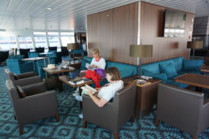
My wife, Jean, and friend Carolyn Torma relax in the lounge on the MS Nordnorge.

Boarding a cruise ship is more like joining a small, floating city. Once aboard, you can wander the decks for fresh air, you can chat with hundreds of people, converse with crew members, and take in sights both near and far away. You can break out that camera you just bought. And you can visit coastal cities for a few minutes or a few hours, depending on the itinerary.

Welcome to my final blog post on our trip to Norway in July 2017. I have promised and teased, but I am delivering after three prior installments about our flight to Norway; our time in Oslo; and most recently, our train trip to Bergen and our visit to its intriguing and highly edfying art museums.

When the day visit of our gang of five to the center of Bergen ended, we gathered our bags at the Clarion Hotel Admiral and boarded a shuttle bus to the dock where we checked our bags with Hurtigruten, a wonderful cruise line dedicated to sustainable practices, watched an instructional video on cruise safety, and boarded the ship. Perhaps I am a bit romantic but crossing the gangplank into a ship stirs more ancient memories of human experience than flying ever will. Humans have been sailing for thousands of years, traversing seas and oceans, and the only serious difference is that the ships have grown larger and more mechanized and, these days, electronic as well. But you are still floating close to the water and the weather and nature.

You also know that you will be aboard this behemoth for several days. That makes accommodations important. In our case, in order to join the same cruise as our friends, my wife and I had to lose our inner cheapskate and splurge on a state room because the lower decks were sold out. Our friends were on Deck 3, but we were on Deck 6, in a room that had a nice television screen and a bed for two, plus a decent bathroom. Admittedly, things still seemed a little cramped, but how much time do you want to spend in your room? Especially as the ship moves north and the summer nights grow long above the Arctic Circle, the idea of sitting in a room seems almost absurd.

Wander the decks! There is a whole world of Norwegian fjords to see out there. There was a promenade on Deck 5, one level below us, and the stairs with their gold-colored railings seemed like a grand way to get there, far more inviting than the elevator. There was the entire lounge on Deck 7, with an outdoor viewing area at the front of the ship, where you could sit outside and monitor the ship’s progress through passages that offered stunning scenery on every side. More than once, I sat there in a deck chair with the movie function turned on for a new Sony camera I had bought in anticipation of this trip. At lower latitudes near the beginning of the trip, this was often great fun. Later, as temperatures grew cooler farther north, it sometimes became less comfortable—but no less impressive.

Inside, we soon also discovered an entire world of Scandinavian cuisine that was previously not part of our daily experience. It’s not that my wife and I have not tried a wide range of international food. We simply had not visited Norway, nor spent nearly a week investigating buffet options for breakfast and lunch in the remarkable dining room on Deck 4, which offered a range of Norwegian pastries, dark breads with savory cheeses, herring, salmon, ham and beef, and all manner of vegetable dishes and soups. Dinner was served at assigned tables and times but allowed us to get to know an interesting and intellectually curious family of educators from Seattle. The food was one of the bigger surprises for me because I had not previously learned to regard Norwegian cuisine highly. Never mind all the stories you may have heard about lutefisk. After this trip, I stand corrected. The best of Norwegian cuisine is a salivating safari for sophisticated palates.
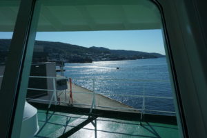
View out the front window of the lounge.

Amidst it all, relaxing in the lounge with a view of the shore in the distance or nearby, I plowed through my tome. On a long vacation, I like to take a long book I have wanted to read but never found the spare time to immerse myself in. For this trip, I tackled Doris Kearns Goodwin’s magisterial Team of Rivals, a 750-page exploration of Abraham Lincoln’s political genius in managing a team of strong wills and egos through the shoals of the Civil War. It filled the hours when I wanted to take a break from sightseeing and just enter another world and time. I chose well.

Viewing the Fjords

It is difficult to do justice to the scenery in words alone, but the beauty of the blog is that I can insert photographs to enrich the story. I had a small, aging Fuji digital camera; my iPhone; and a newly acquired Sony digital with zoom lens enhancements and movie features, all of which I was still trying to master on the fly. It often offered more options than I intelligently knew how to manipulate or had time to learn, as breath-taking scenery was often just around the next bend in the fjord.

There is nothing subtle about the Norwegian coast, but there is much that is sublime. It is not hard to imagine the awe of nature and the gods that must have filled the hearts of Vikings sailing along the coast or returning from their overseas explorations. Islands dot the sea lanes; some are inhabited, and many are not, usually because the terrain does not offer much solace. Shoreline communities occupy modest niches of flat land below hills and towering cliffs.

No two fjords are ever the same. Each has its own unique topography, its own paths to sheltered ports, its own dramatic waterfalls crashing off mountainsides into the seas, its own snow-capped peaks above the humble human intrusions below. Norwegians at times are remarkable engineers, but there must still be a sense of our own puniness in the face of such lofty natural beauty. We could never replicate the work of millions of years of geological transformations of earth’s landscape. It is better to sit back, gaze in admiration, and appreciate it.

What is remarkable, nonetheless, is the mastery of coastal navigation, even if modern ships benefit from a range of electronic wizardry to avoid danger. In a part of the coast known as the Trollfjord in the Lofoten Islands, it is my recollection that we were told we were crossing a passage with only 450 meters between rocky outcrops hundreds of meters high. On a cruise ship housing nearly 500 passengers and crew members, that does not leave much room for error, but the passage, admittedly in calm seas, seemed effortless and very precise. Our ship approached the passage in the evening; I was captivated by the scenery for the entire time and filmed it for 12 minutes. I cannot recall anything I have seen that compares.
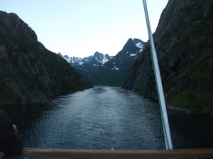
Passing through the Trollfjord.

Trondheim

Ports of call are a routine feature of cruises. In Norway, these are port cities along the coast, often away from the ocean itself within fjords, the long arms of the sea that often shelter such cities. On our second full day of the cruise, the MS Nordnorge docked in Trondheim for a 3 ½ hour visit. We disembarked and began a journey on foot to find Nidaros Cathedral, the oldest cathedral in Norway and the northernmost cathedral of its size in Europe. Trondheim was also at one time the capital; moving the capital south to Oslo, formerly known as Christiania, was a modern innovation. Nidaros Cathedral remains the scene of coronations for the nation’s constitutional monarchy.

The walk to Nidaros, which was under a half-hour, took us along the Nidelva River, lined by some colorful apartments on the far side, with some interesting urban architecture on our side as we moved into the heart of the city. The site of the cathedral became apparent as we drew near because the building is surrounded by impressive grounds and fencing. The soaring worship space was completed in 1300 but begun around 1070, with much of the construction occurring after 1190. Tours require tickets at a modest price, which visitors can obtain in the nearby gift shop, whose sales help support maintenance of this massive space. The cathedral sits above the grave of St. Olav, the nation’s patron saint, a tenth-century Viking king who converted his subjects—and himself—to Christianity after learning about the faith in England, which experienced numerous Norse raids in the Middle Ages. One must marvel at its height and size given the lack of modern tools, but a tour guide informed us that masons were in the habit of leaving their initials on the bricks that formed the foundation and walls. The building has both the sense of inner darkness typical of buildings lacking modern Illumination and a sense of spaciousness emanating from its massive ceilings and the size of its sanctuary. Originally, it was the seat of the archdiocese, but suffered a demotion to a huge parish church for Trondheim following Norway’s turn toward the Reformation, when Lutheranism became the state church.

Between its history and majestic architecture, my own judgment would be that, if one had time to visit only one thing in Trondheim, this would necessarily be the default choice. That said, we had a little time left after our tour. Jean and I, in touch with our friends by cell phone, wandered through a large, modern urban mall back toward the ship but stopped for a few minutes at a serendipitous discovery, a flowery pocket park inhabited by birds, where we simply imbibed the relaxing atmosphere in the middle of Norway’s third-largest city. Then we bought a couple of souvenirs at a shop atop the bridge we crossed as we made our way back to rejoin the cruise late in the afternoon. We still had a couple of hours to relax with our friends over drinks in the bar before dinner and another evening of scenery consumption.

Bodø

The next day, our long stop was at Bodø, a smaller city whose second syllable is pronounced somewhat like the “oo” sound in the English word “foot.” (Pronouncing that will give English speakers a vague sense of that distinctive sound of Scandinavian languages.) A slightly longer stay in a smaller city gave us ample opportunity to explore, but without the obvious choice of anything like Nidaros. One intriguing aspect of the day was passing beneath a tall bridge lined with spectators observing the passing of our ship beneath. Norway has plenty of bridges, no surprise, but this sort of welcome was a pleasant surprise.

In Bodø, one indicator of the changing cosmopolitan nature of Norwegian cities was the sign that greeted us not long after we became urban pedestrians again—Istanbul Kebab. Like other European nations, Norway has acquired its share of Middle Eastern immigrants, and restaurant options have diversified. No doubt, these newer options have also thrived as Norwegians seek a change of pace, just as Americans, Brits, and others have done. Still, even the shopping district near the shore affords an unhurried, uncrowded atmosphere that let us soak up the afternoon sun in peace and quiet.

Tromsø
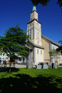
Tromso Cathedral

Our fourth full day took us ever farther north with a four-hour stop at Tromsø. This is the last major city on the journey north, and not hard to wander. With my interest piqued by Nidaros, I sought out the Tromsø Cathedral, just a few blocks from the shore, only to find that it was closed and undergoing renovations—signs of which abounded with construction equipment parked just outside on the somewhat spacious Kirkeparken that surrounds the building itself. Reduced to simply looking at the building from the street, we instead joined our friends in a visit to the nearby Tromsø Gift and Souvenir shop, which sported a stuffed bear outside that was a magnet for tourist selfies. It was a great place to look at gifts that someone back home might want, as well as those souvenir mugs and hot pads that line one’s cupboards.

Once that novelty had worn off, however, we quickly discovered the Northern Norway Art Museum, which had a wonderful display of indigenous Sami clothing and handicrafts, with some explanation of the Sami culture that produced them. Here, I should note that one of the more moving lectures aboard ship, amid other daily offerings, was a presentation by a young Sami woman who was part of the Nordnorge crew. She shared stories of the discrimination suffered by Sami people at the hands of Norwegians, including herself in school and elsewhere. Things are looking up, and the king and queen offered an apology to the Sami on behalf of the nation, but racial and ethnic prejudice takes many forms and is not easily or quickly rooted out from any society.

The Sami number perhaps a modest 50,000 in modern Norway, a number larger than in any other Scandinavian nation or in Russia, where a small number also live. One of their traditional occupations has been herding reindeer, which are produced for their lean and nutritious meat, a result of consuming native grasses and herbs. The Sami, however, faced a serious public health crisis after the 1986 Chernobyl nuclear power accident in what is now Ukraine, as the released radiation dispersed westward over northern Scandinavia and contaminated the ground and the reindeer who roamed it. Many Sami, including the speaker, suffered some degree of radiation poisoning, which in her case produced red blotches across her back and shoulders. Her story offered a dramatic example of the environmental jeopardy facing indigenous populations around the world. To call it sobering is to understate the case. She indicated that, over three decades, those radiation levels have receded significantly but were not always regarded as a matter of concern by the Norwegian government. The Sami relied on their reindeer and suffered with them. Not everything in Norway involves love and kisses, and history must be accounted for. I had to respect Hurtigruten for offering such a heart-felt, sobering presentation amid a cruise meant largely for entertainment. If people did not hear this story here, when might they ever hear it?
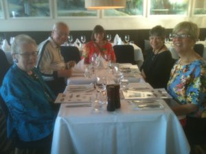
Jean’s birthday dinner, complete with reindeer steak entree and cloudberry dessert.

On the last night of our voyage, our gang of five enjoyed a complimentary upgrade to a private three-course meal on Jean’s birthday. One of the entrée options was reindeer steak, which Jean and I chose. It is a dark red, very lean meat, but very tasty and tender. I may never have it again, the supply in places like Chicago being almost nonexistent. But it was well worth finding out. I also recall that Jean tried a dessert involving cloudberries, a species unique to northern Norway, mostly grown above the Arctic Circle. Hurtigruten is very good at local sourcing of agricultural produce for passenger consumption. They have identified small, sustainable producers along their route from whom they can obtain these products during the numerous short stops at ports of call, a practice that also supports the many small, struggling farmers in rural Norway.

Honningsvag

Our last full day involved a stop at Honningsvag, a small city in the North Cape area above the Arctic Circle as the shoreline bends east along the Arctic Ocean toward the Russian border. Honningsvag is at the southeastern edge of Nordkapp, translated as North Cape in English, actually a rugged island off the northern coast of Norway. By now, I was getting used to the possibility of waking up at 3 a.m. and peeking out our cabin window to see sunlight diffused across the seascape. Summer above the Arctic Circle can be disconcerting in that respect. It upsets your normal biological rhythms.

We visited the North Cape Museum, a small but key attraction in the city that sits at the water’s edge near the Hurtigruten dock.
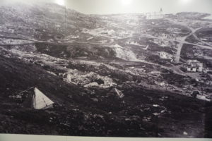
Honningsvag destroyed by German troops in the autumn of 1944. Photo taken in the museum exhibit.

There is one extremely sobering exhibit in the museum. To understand it, one must realize that all of Norway was occupied by the German army during World War II, after the country was betrayed by its own Vidkun Quisling, whose surname has become a synonym for “traitor.” Hundreds of thousands of German troops were pinned down in Norway because of fears of an Allied counterinvasion. As the war neared its end, Adolf Hitler also feared an invasion across the northern end of Scandinavia by the Red Army moving from Russia. Russia and Norway share the Arctic Ocean coast; Sweden and Finland reach only to the southern bounds of those two countries above the Article Circle. Hitler, to prevent such an incursion, ordered a scorched-earth policy for the German army in retreat.
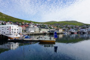
Honningsvag in 2017.

Several hundred soldiers had been stationed in Honningsvag. Very late in the war, they were ordered to torch the city, which they did. More than 20,000 citizens were evacuated to the mainland before that happened. When the war was over, and the residents of Honningsvag wanted to return home, a small contingent was sent to evaluate the state of their city. The museum’s photographs document the heartbreak they saw. With one notable exception, which was Kirkegata, the main Lutheran church south of the bay where the museum is located, everything in the city had been burned to the ground. My guess is that the church survived not because the Nazis spared it, but because the flames simply did not leap across the surrounding cemetery to the building. That church became the temporary home for the initial volunteers who helped rebuild until, step by step, the people of Honningsvag were able, with support from the national government, to rebuild their city and provide new, modern homes for thousands of displaced persons. It is a stunning reminder of the high cost of war and hatred but also offered insights into the heroism of the persistent and courageous Norwegian resistance, to which several museums throughout the nation have been dedicated.

Going Home

The next morning, at 9 a.m., our ship docked in Kirkenes, a small town that abuts the Russian border to the east. It was the end of our cruise, punctuated with a short bus ride to the local airport for a flight later that day to Oslo. On that flight, we had the chance to converse with a retired Norwegian airline pilot and his wife, who told us about an occasion on which the Russian government, seeking to dispose of Syrian refugees, had put them all on bicycles and sent them across the border into Kirkenes to let the Norwegian government deal with them. With a hint of sarcasm, he noted that the bicycles had to be destroyed once the refugees were taken into custody because the Russian vehicles did not meet Norwegian bicycle safety standards. I will let the reader make of this curious story what you will. I have no reason to doubt its veracity, but if true it certainly smacks of cynicism on the part of Russian officials.

Our three friends caught an earlier flight back to Bergen, where they chose to spend two more days. Jean and I stayed overnight at the Radisson Blu Airport Hotel, awoke for an early breakfast the next morning, and walked back across the pathway for a flight to London’s Heathrow Airport. There, with only a 75-minute layover to dash through the long halls of a monstrous facility, we made our way to a United flight back to Chicago. Our lives were about to return to normal.

Jim Schwab

Still Room for Improvement in the “Friendly Skies”

It has been almost a month since my last blog post, for a reason. I spent most of the remainder of July at a conference in Colorado, for four days, and then overseas, for nearly two weeks. My wife and I traveled to Norway for a vacation, and I chose to separate myself from my laptop for the duration. In coming weeks, I will produce some travelogue posts about that trip, as I have often done in the past. Norway has a great deal to offer for curious travelers.

But first, I want to describe some issues from an experience I am sure many other travelers have shared. Some aspects of this experience, I am sure, are an inevitable part of travel, which always involves the possibility of delays, whether from weather, traffic accidents, or equipment malfunctions, on highways, in the air, or on water. Other aspects are a function of corporate culture and the way in which airlines or other transportation providers choose to communicate with and respond to their customers.

Our flight from Chicago on July 15 began with United Airlines, on which I had used award miles to book both of us to Frankfurt, Germany, with connection on Lufthansa (a Star Alliance partner of United) to Oslo. United Airlines suffered earlier this year from a tsunami of negative publicity for its ill-considered removal of Dr. David Dao from a flight to Louisville, Kentucky, from O’Hare International Airport. The brutal dragging of this paying customer from his seat to make room for airline staff also besmirched the reputation of the Chicago Department of Aviation’s airport police, whose desire to become armed police suffered a long-term setback because of the incident. Followed by some inadequate corporate explanations before CEO Oscar Munoz finally issued a full apology, the incident made no one look good.

I mention this only because, in my opinion, the situation that evolved on our trip shows that United Airlines still has considerable room to improve in learning how to inform and serve its customers when problems arise. Our flight was scheduled to depart at 2:35 p.m., arriving at Frankfurt at 5:55 a.m., with a 7:05 a.m. connecting flight to Oslo. About one hour before that, I began to notice that no one was arriving to staff the original gate assignment, and the number of people present seemed modest for an international flight. Naturally suspicious, I rechecked the monitor in the hallway to discover that the flight had been moved to another gate. That happens, but I did politely ask at the new gate why I had not gotten a text from United, which routinely happens with all updates.

“You always have to check on gate assignments,” she said. I was aware of that—I have traveled a great deal over the years—but she did not really answer the question of why a routine update had not occurred via text. Instead, I got a reply that implied that I did not know any better. Thanks for the condescension, United.

It went downhill from there, as the United personnel learned that something was apparently awry with the engine on the aircraft and needed inspection. What followed was a slow drip of information that materialized in eight separate text messages that ultimately resulted in a departure at 5:30 p.m. In the absence of more definitive information in place of the assortment of 15- and 30-minute delay announcements, it was impossible to know at what point one’s connections would become impossible or, for that matter, which subsequent rebooked connection would be viable. Predictably, the lines for rebooking at both the gate and the United service center became long. At one point, one of the gate attendants checked on later flights and told me, “I’ve backed you up for 10:00.” What I learned later was that the phrase “backed up,” which I’d never heard before, effectively meant nothing. A new boarding pass in Frankfurt might have been useful. In the confusion and amid the crowd of frustrated passengers, getting better answers proved challenging, to put it mildly. Suddenly, in the end, before any of us knew what connections we would have in Frankfurt, airline personnel announced that boarding would commence. We were in the unenviable position of waiting until we got to Frankfurt to find out how we would get to Oslo. The only advice in Chicago was to go to the Lufthansa desk in Frankfurt (a huge airport) to find out. Our flight finally arrived in Frankfurt around 8:30, as best I recall. By then, I was more interested in facilitating the next leg of our journey than in recording the precise time.

Aboard the plane, those needing to rebook connections were told which gate to go to, but as we deplaned, a woman with a sign was telling the same passengers a slightly different gate. Where to go? Many of us ended up at the gate we were told as we got off, only to find that the Lufthansa attendants seemed even more preoccupied with serving passengers from a flight from Washington, D.C. One challenge in these situations is knowing precisely which line will best expedite your request without being able to just cut to the front to find out. When we did reach the desk, an attendant printed out something other than a boarding pass—I have by now tossed it and can’t remember what useless information it contained—and directed us down the hall to the “gate with the yellow signs.” I soon wondered if she was just getting rid of us because “down the hall” meant nothing. Every Lufthansa desk has yellow logos because that is their corporate color. We began to ask again, but we learned that the 10:00 a.m. flight that had been promised was at A52, which we could reach after going through Passport Control, which went quickly enough. But at A52, we were informed by a somewhat sympathetic Lufthansa agent that the flight in question already had a “wait list” of 30 people. So much for being “backed up” on the 10:00 a.m. flight. Soon, she made clear that she simply could not get both of us on the flight, and we made clear we did not want to fly separately, which would only mean Jean would wait in Oslo for my arrival, adding confusion to an already difficult journey.

When we made clear we would stay together, she directed us to A12 for rebooking. That became another interesting feature of communication involving signage. We reached a hall where signs to the right indicated A11 and below, while Gates 13 and above were to the left. Where was A12? We asked one middle-aged airport employee, who sounded like an American, about the gate and he pointed us to the left. Wrong—when we did not see it and asked at a gate, we were pointed back just behind where he had been. In fact, there was no sign for A12, but it was the Lufthansa service desk, not an actual gate. Why not tell us that to begin with? In any case, one friendly worker there tried to get us new boarding passes from one of the kiosks, but that did not work. We had to take a number (A3108) and wait for the electronic sign to tell us which of five desks would handle our problem. Fortunately, about ten minutes later, we were directed to a lady at the end of the wall. After shaking her head at one point, asking me at another if we had been booked with award miles, and discussing the matter by telephone in German with someone, she finally said, “You’re lucky. These are the last two seats on the 1:15 flight.” I thanked her; she had at least accomplished something for us. As for being lucky, I had mixed feelings. After so much non-direction and misdirection, and some other Lufthansa personnel adding to our growing feeling that customer service was not a high priority, I was no longer sure what “lucky” meant. But at least we knew when we would connect to Oslo.

Exhausted by then, Jean took a short hike down the hall from our new gate while I watched our belongings. We were getting hungry, so she bought hot dogs for both of us. That may have helped revive us a bit. We reached Oslo at about 3:10 p.m., got our luggage by 4 p.m., and caught a shuttle to the downtown Radisson Blu Hotel, and checked in by 5 p.m. We had lost an entire Sunday afternoon of sight-seeing that we may otherwise have enjoyed. Once we had stored everything in our room, we crossed the street to a Spanish restaurant, our only activity for the evening, and enjoyed tapas and Sangria and chatted with the waiter. Upon discovering that the trip was in part a celebration of my retirement, he arranged for a complimentary dessert of delicious flan with caramel sauce.

At least someone still knows what good customer service still looks like. The place is called La Sangria Restaurante Espanol. If you’re ever in Oslo, pay them a visit and tell them I sent you.


Jim Schwab

Riverwalk: A New Chicago Magnet

DSCF3110IMG_0239

Chicago is already quite rich in parks and tourist attractions. What can it add downtown?

In the past, I have written about the 606 Trail in Chicago, which is experiencing its first anniversary after opening a year ago. Despite some of its well-known challenges and problems, Chicago remains a city of quality destinations. Navy Pier, now a century old, just unveiled its redesign last month, including a new 200-foot Ferris wheel, and has been the top tourist attraction in Illinois. Millennium Park has few peers among downtown urban parks and has also been a second magnet for visitors since opening in 2004, ranking only behind Navy Pier.

But below the bridges and viaducts, down near the water’s edge, another jewel is nearing completion along the Chicago River—the Riverwalk. On June 2, I joined a tour sponsored by both the American Planning Association Illinois Chapter and the American Society of Landscape Architects Illinois Chapter and listened to an explanation of both completed and upcoming changes.

Chicago has no shortage of websites and museums devoted to its own urban history, which I won’t even try to summarize here. Suffice it to say that, when Haitian-French explorer-trader Jean Baptiste du Sable first encountered Potawatomi Indians (one of whom he married) at the shore of Lake Michigan in 1790, the Chicago River was still an indolent waterway barely crossing the sandbars to empty into the lake. In a little over 200 years, it has become home to one of the world’s largest cities, with all the pollution and navigation over two centuries that one might expect. In the 1890s, amid the city’s rapid industrial expansion, engineering reversed its flow away from the lake to the Mississippi River watershed, in large part to spare Chicagoans the pollution of their beaches and water supply that came with using the river as an open sewer. The river itself was not a place where you wanted to spend time unless you were in a boat, and even that was questionable. More than 800 picnickers died when the Eastland tipped over at the water’s edge in 1915. At street level on Wacker Drive, a plaque memorializes that notorious incident.

But times change, and in the 21st century, the Chicago River is once again a civic asset to which significant attention—and investment—are being paid. Over the last ten years, the first two phases of a rebuilding project have come to fruition, producing a Riverwalk that now extends on the south side of the main branch from Michigan Avenue west to LaSalle St. A third phase will extend the Riverwalk further west to the juncture of the North and South Branches. Even the term “main branch” may seem a little puzzling to non-natives because it extends only about one mile. Most of the length of the Chicago River is in the two branches, but the whole river in either direction is less than 20 miles. The Lake Michigan watershed in this instance barely reaches beyond the city and rises only about 20 feet above the lakeshore. Beyond that, you are in one of the sub-watersheds of the vast Mississippi River valley. Most people would never notice they had crossed this boundary if a sign did not tell them. The Continental Divide, this is not.

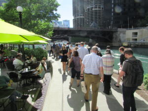
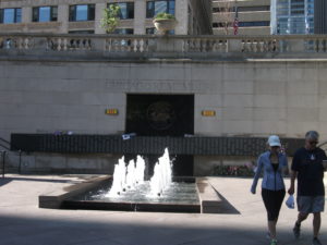
However, the controlled nature of the river and the short reach of the main branch make the creation of a downtown Riverwalk far more manageable and the experience of walking it thoroughly enjoyable. The firms of Jacobs/Ryan Associates, Sasaki Associates (with whom I have collaborated on disaster recovery issues), and Ross Barney Architects, involved in the design and engineering, have produced an experience that unfolds in “rooms” as one moves in either direction along the river, bringing users close to the water while allowing the occasional flood to muddy some steps without much damage beyond washing down the mud the next day. Phase 1redesigned and rebuilt an existing path between Michigan Avenue and the lake, an area popular with tourists as a loading zone below the stairs from Michigan Avenue down to the riverfront for tour boats. It then extended that two blocks westward to State DSCF3126Street and includes the Chicago Veterans’ Memorial Plaza, opened in 2006. One of its nice touches is a series of concrete stairs more suitable for lunch or relaxation than for climbing. It is a dignified but welcoming setting in keeping with its purpose. In Phase I, the idea began to emerge of adding river-level sidewalks that allow visitors to move from block to block without going up to street level and back down again, although some of these obviously had to intrude from the existing river’s edge into the waterway, and thus involved some negotiation among agencies responsible for navigation and safety, given the mix of water traffic still traversing the Chicago River. Congress also had to act to provide permission to allow building 25 feet into the river to create the necessary width for the new Riverwalk.

IMG_0242What has emerged in Phase II is the creation of the rooms: Marina, Cove, and River Theater, extending from State Street west. The first is opposite Marina City, occasionally nicknamed the “Corncob Towers” because of their design, and permits docking by river boats and lounging by pedestrians. The Cove, in contrast, is a favorite stopping point for kayaks and canoes, which provide a rich source of aquatic exercise for sports enthusiasts. The River Theater changes the nature of the experience yet again with the appearance of a riverside amphitheater, using a low-slope path woven into climbing stairs that can also double as points of relaxation for hikers. The theater, for the most part, is the activity on the river itself, although one can imagine a waterborne performance someday floating before the viewers. Most of this opened for public use just a year ago.

Phase III is adding a water plaza at the river’s edge; the Jetty, which places a series of floating gardens along the river edge that allow people to learn about river ecology and native plants, and the Boardwalk, providing an accessible walkway connecting to Lake Street. Although currently inaccessible at river level, one can view the construction on the final phase from street level. We were told the project will be completed by this fall.

O'Brien's is one of the existing restaurants, along with City Winery, that provide refreshment along the route.

O’Brien’s is one of the existing restaurants, along with City Winery, that provide refreshment along the route.

It is one thing to traverse this path with a crowd from a mobile workshop in the late afternoon. Not only does a crowd make a difference, so does timing. I returned the following morning, since my CTA Blue Line commute takes me to the Clark & Lake station. Instead of remaining on Lake Street, I walked to Wacker Drive and descended the stairway again, this time walking in the cool of the morning by myself at 8 a.m. Not that I was alone. The path was already being filled with pedestrians like me, and joggers, and even an occasional bicyclist, so I had to pay attention to those around me as I repeatedly set my camera to shoot many of the photos included here. Heat varies, of course, throughout the summer day, but one pleasant, enduring feature is the cool breeze off the water. In the morning, as well, the restaurants are not yet open, making for a slightly more solitary experience, which even a confirmed extrovert like me can enjoy in contrast to the crowds that by late afternoon are now finding their way to the

The collection of bars and restaurants on the Riverwalk is still growing.

The collection of bars and restaurants on the Riverwalk is still growing.

new bars and restaurants that are now exploiting the popularity of the Riverwalk, as intended, with more coming as the project moves along. The opportunity to sit outdoors at river level and enjoy snacks or dinner and drinks can be very pleasant, and very different from the usual experience high above on the city streets. I expect that most of these establishments will do quite well. I intend to enjoy some of them myself, with friends in tow.

Jim Schwab

Fix the Little Things

I am writing this story about a week after the fact that triggered the idea for this blog post because I have pretty much been on the road (or in the air) ever since, and will complete the two-week stretch of travel tomorrow with a flight to Tulsa. On Monday, September 14, I will give the opening speech there for the Disaster Risk Reduction Ambassadors Pilot Workshop of the Natural Hazard Mitigation Association. It is not the biggest assignment in the world, but an important one.

The fact that I am on the move to that degree, however, has a great deal to do with the point of this story. To the extent that they can do so, frequent travelers appreciate the willingness and ability of airlines, rental car companies, and others whose clientele we are to make our journeys just a little bit easier instead of more challenging. In that context, sometimes a little bit of common sense goes a long way. I am not writing to pick on Budget Rental specifically, nor on the Sacramento International Airport, but I certainly am using them as an example of a problem because they provide a case in point.

I was in Sacramento September 3 to help deliver a pilot workshop, and then, because the rates were so much cheaper, chose to take a 6:00 a.m. flight on US Airways to Phoenix the next morning, followed by a connection from there back to Chicago, where I live. I might have liked a later flight with a shorter layover in Phoenix, but I also wanted to get home at a decent hour, it’s a long trip, and the alternatives were more expensive. Projects have budgets, and flights between Sacramento and Chicago seem to be rather costly these days. The workshop was almost 20 miles from the airport, so renting a car made sense. Budget had the best deal.

So on that Friday morning, I set my alarm for 3:00 a.m., got up and dressed, and packed, and was on the road back to the airport by 4:00 a.m. Traffic at that hour, even in California, is not much of a problem, so that went smoothly, and the GPS kept me painlessly on track. The problem arose only as I got near the rental return station, on McNair Circle, which is almost literally a circular area within which all the rental car facilities are located.

Then things went haywire. It is dark at 4:30 or 4:40 a.m., when I approached. I eventually saw a small sign along the side of the road listing all the rental firms for returns, but did not see an entrance behind that sign. I found myself circling McNair Circle, and coming in for a landing on a second try. Again, I saw the sign, but could not identify the entrance, although I had noticed an employee-only parking lot. On my third try, I pulled into that lot so that I could get off the street and call Budget to clarify the location of the entrance for rental car returns. I discovered that the envelope containing my contract had only an 800, not a local, number, but I tried it. I was soon launched into meaningless waits for no one in particular, and began to get nervous as I watched the time slip away toward 5:00 a.m., knowing that, even after I turned in the car, I would still need to board a shuttle into the terminal.

In the midst of my frustration, I saw a car enter and park, so I left my car and approached the gentleman, who was wearing a Budget shirt, and asked for directions to return my car. He told me to leave the parking lot, turn right, follow the circle, and turn right at the next entrance. I found myself skeptical but willing to try, having passed the same area twice already. But sure enough, before the sign I had seen earlier, I discovered a small entrance, somewhat shrouded in the dark by roadside foliage, and turned right. I drove back a small distance and discovered the return location and the same employee to whom I had spoken, but he did not handle the returns. In a minute, a young lady came out of the hut, relieving my anxiety because it was 5:00 by now and I was getting anxious to move on. I had carry-on luggage but still needed to go through security. One never knows how long that line will be.

As she checked the car and gave me a receipt, I hurriedly told her that the entrance was very poorly marked and hard to see in the dark.

“I hear that all the time,” she said, rather matter-of-factly. I did not argue the point, but in my mind, I thought, “And no one does anything about it?”

But my first priority by then was not to make an issue of it, but to catch the shuttle and get to the airport. I suspect most other patrons have done much the same thing. Fortunately, a shuttle was waiting in front of the main building, and I boarded. I mentioned my experience to a man sitting across the aisle from me as we departed.

“I agree,” he said. “I missed that entrance once myself.”

Now, I will confess that I have not checked further at either Budget or the Sacramento International Airport to find out who is actually responsible for the signage on McNair Circle or the visibility of the entrance for rental car returns. I have not had time, and having made myself clear at the time I returned the vehicle, I don’t feel I have to make it my responsibility. Nor did I have time to get out my camera and take photos of the entrance to make my point. My objective was to board my flight on time.

If Budget employees in fact hear this complaint as often as the young lady admitted, the problem should be obvious anyway. Whether it is ultimately the responsibility of the various rental car firms that share the space in McNair Circle, or that of the airport authority, does not matter to me. The firms and the airport officials undoubtedly talk to each other once in a while, or can. If well aware of a problem, they can put it on their agenda to fix it. But it is apparent that it may not be on any agenda if the lady at Budget hears this complaint “all the time.”

One might think that a company trying to make travel easier in order to attract customers would want to ensure that they do not leave in frustration because a problem like this goes unaddressed. I don’t care whose job it is. As I said, if they know people have experienced a problem repeatedly, they can talk to each other and find a way to resolve it.

Failure to respond is the real failure in customer service. Little things often matter in big ways. Fixing them shows that an agency or company cares. Enough said.


Jim Schwab

Give It Up, Rahm

As any urban planner, lawyer, or intelligent elected official knows, public safety is a powerful argument in support of measures undertaken by any level of government. This is particularly true of local government, which in the U.S. is responsible for most law enforcement, traffic management, and response to emergencies and disasters.

The city of Chicago in recent years has wielded this argument as the primary justification for a program using red light cameras to monitor traffic at various intersections in the absence of direct management by police officers, who cannot be everywhere. The tradeoff is simple: Violators who drive through red lights or make right turns where not allowed are cited and fined, but those violations do not appear on their driving record. That can only happen if they are cited by a police officer. Violators receive the photographic evidence of their actions in the mail with a notice to pay the fine. The assumption is that the deterrent effect of having to pay the hefty fines will reduce such behavior and make the streets safer, especially in areas near school zones. Most citizens logically assume that the premise is sound, even if the possibility of being ensnared by the law in this fashion can be annoying and deflate one’s wallet.

In the bargain, the city also increases its revenue by the amount of the fines collected, minus the cost of the contract to the vendor operating the system. In a city pinched for cash, as most are, the lure of that revenue can be pretty powerful. The city of Chicago has reportedly collected more than $500 million since the program began ten years ago. It can be hard to part with that money.

All that would probably be acceptable to most people if the premise held water. But the Chicago Tribune paid for a study by the Texas A&M University Transportation Institute to examine the safety benefits of the program and found that it essentially laid a goose egg. Mind you, this program was started under Mayor Rahm Emanuel’s predecessor, Richard M. Daley, more than a decade ago. Emanuel fired the initial contractor, Redflex Traffic Systems Inc., when it became clear that the company had bribed city officials. Now it appears that federal prosecutors have a “bagman” witness who can testify that the company offered city transportation officials incentives of $1,500 per camera to install additional cameras to enlarge the program, which now includes 350 intersections. In short, a program intended to benefit public safety and generate some municipal revenue through fines became mired in corruption. Knowledgeable voters in Chicago would like to be surprised by all this, but, well, you know. We’ve seen this kind of thing before.

What Texas A&M found out undermines the rationale for the program. The city could easily afford to pay for a similar study if it had wanted an honest evaluation of the efficacy of the program, but it has not done so. Basically, in a series that began on Sunday, December 21, the Tribune revealed that the Texas A&M study determined that, while the cameras produced an overall 15 percent reduction in right-angle “T-bone” crashes due to red light violations, it had also produced a 22 percent increase in rear-end crashes. There is a reason for this, one that many drivers in Chicago have instinctively sensed even without statistical data to verify their hunches. The city is using yellow lights that change to red in three seconds, sometimes even just a fraction less. Many of us in the city have had the unnerving experience of slamming on the brakes in the face of quickly changing yellow lights, so it is not hard intuitively to understand how the rear-end crashes would result. The city claims that this complies with a formula developed by the Institute of Traffic Engineers, but the Tribune reports that other cities, like Washington, D.C., and St. Louis, use an ITE deceleration rate that results in a yellow light time of 3.2 seconds in 30-mph zones. Maryland and Michigan use 3.5 seconds, and California and Florida 3.7 seconds where there are red light cameras. Of course, there is discretionary judgment involved, but the more conservative timing is intended to reduce the likelihood of accidents. Chicago uses timing based on posted speed limits and insists that using actual driving speeds, or providing a cushion, the basis for the longer yellow lights, effectively serves to encourage speeding.

But, of course, longer yellows might also result in fewer violations, resulting in fewer fines being imposed. That said, to the extent that shorter yellow lights are inducing, rather than reducing, accidents, the city’s rationale that the program improves public safety becomes a more questionable argument. The city finds itself in the position of possibly causing accidents in order to increase revenue.

The alternative, of course, is to argue to the contrary. The Tribune notes that Chicago Department of Transportation Commissioner Rebekah Scheinfeld defended the program before the city council with a simple before-and-after comparison, showing that accidents had been reduced by 47 percent between 2005 and 2013. But there were flaws in this argument. Even those with a moderately sophisticated knowledge of statistics are aware that picking two years for such a comparison can be very simplistic and subject to manipulation by failing to control for a number of confounding variables. Among those variables, the state of Illinois, during the interim, changed its minimum damage level for required accident reports from $500 to $1,500. That single change accounts for a substantial share of the difference, but is not the only factor complicating the analysis. Nonetheless, the city continues to maintain that the program benefits public safety.

One can excuse Mayor Emanuel with regard to the initial corruption scandal that tarnished the program. That happened on Daley’s watch. But after four years in office, as Emanuel prepares to run for reelection, his support of the Chicago Department of Transportation’s public safety logic makes the program his, even with a new contractor operating it.

The decision to either abandon or fix the program–to produce logical explanations for the locations of cameras, to remedy the positioning of numerous cameras at low-traffic intersections where they may well be causing more accidents than they are preventing–can also be his. Public safety is a powerful argument for municipal traffic management until it falls apart under close examination.

Fix it or give it up, Rahm. Public safety is an awesome responsibility and ought to be taken seriously, no matter how much the city cherishes all that revenue.


Jim Schwab