 Last Wednesday, December 2, the U.S. Senate passed the Digital Coast Act in a final vote that sent the legislation to President Trump for his signature. If that happens, it may provide a very useful gift to thousands of coastal communities wrestling with a wide variety of coastal zone management challenges.
For more than a decade, the National Oceanic and Atmospheric Administration (NOAA) has sponsored through its Office of Coastal Management a program that has racked up stellar achievements while awaiting congressional blessing of its existence. Digital Coast began as an effort, in collaboration with five nongovernmental partners, to share federal geospatial data and tools with communities in ways that did not require a Ph.D. scientist to interpret them for local government uses.
Geospatial technology, not a familiar term for the average American, refers to “modern tools contributing to the geographic mapping and analysis of the Earth and human societies,” according to the American Association for the Advancement of Science (AAAS). In a coastal context, that includes tools for measuring, projecting, and visualizing sea level rise, as well as monitoring land uses and land cover in coastal areas, and mapping offshore areas as well. The mission of Digital Coast was to make these tools ever more useful for local government planners, resource managers, economic development agencies, and others with some sort of meaningful engagement with coastal issues and data.
Why is that important? For starters, because more than half of the U.S. population now lives in counties along either an oceanic or Great Lakes coast, and that percentage is growing. It matters greatly where these counties, and their cities, allow new development, how they court economic growth, and how they manage coastal resources, including marine life, tidal wetlands, and offshore resources, as well as ports and near-shore transportation. These coastal areas are huge drivers of the overall U.S. economy, and better data, and better access to data, will deeply affect the American future.
Improving that access and making tools easier to use, and data more understandable, has been the mission of the Digital Coast Partnership that was assembled from 2008 on, initially with five organizations: Association of State Floodplain Managers (ASFPM); The Nature Conservancy (TNC); National Association of Counties (NACo); National States Geographic Information Council (NSGIC); and Coastal States Organization (CSO). In the summer of 2010, the American Planning Association joined the partnership, an initiative I led as manager of APA’s Hazards Planning Center. Allison Hardin, a planner for the city of Myrtle Beach, South Carolina, and immediate past chair of APA’s Hazard Mitigation and Disaster Recovery Planning Division (which I now chair), reports that in 2009, she vigorously advocated for the addition of APA. At the time, Allison, a certified floodplain manager, was helping to represent ASFPM in the partnership. Today, there are eight nongovernmental partners, all of which serve as links to professional user communities to ensure widespread uptake of the data, tools, and resources available from Digital Coast. The two additions have been the Urban Land Institute and National Estuarine Research Reserve Association.
So, what difference does statutory authorization of Digital Coast make? According to John Palatiello, president of John M. Palatiello & Associates, Inc., a government relations and association management firm representing the surveying, mapping, GIS, and geospatial community, which helped lead the effort to get the act passed: “The Digital Coast Act will enable NOAA to partner with other government entities and the private sector to help protect and promote America’s coasts and shorelines. This legislation creates a program to utilize the extensive capabilities, competence, and qualifications of private sector geospatial professionals to provide the surveying, charting, remote sensing, and geospatial data of America’s coasts, harbors, ports, shorelines and ocean resources for economic growth, recreational activities, conservation, and resilience of our fragile coastal environment.” Put more simply, the new law stabilizes the authorization and budgetary support for Digital Coast within NOAA. There were times in the past when this was less than a sure thing. Now, its codification makes its program status official.
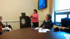
Digital Coast Act briefing, with NOAA Digital Coast staff Miki Schmidt (left) and Josh Murphy (right), standing near door.
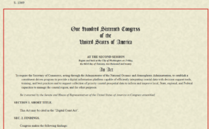
But Digital Coast, I can attest from personal experience, has a remarkably astute and dedicated professional staff in love with public service. The Act itself begins with this finding: “The Digital Coast is a model approach for effective Federal partnership with State and local government, nongovernmental organizations, and the private sector.” It goes on to note, a few paragraphs later, some of the needs that Digital Coast can help address, including flood and coastal storm surge prediction, hazard risk and vulnerability assessment, and community resilience, as well as ecosystem health. I applauded the program more than six years ago on this blog.
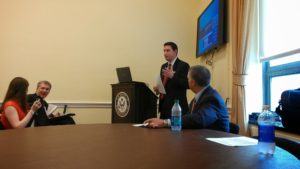
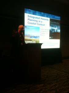
Briefing at the Capitol: APA Policy Director Jason Jordan at the mike; ASFPM Executive Director Chad Berginnis to his right.
It is important to note that this legislation is not the product of some recent brainstorm, but of a slow, steady process of building support, starting with a handful of legislators from both parties who saw its value. Perhaps most notable was Sen. Tammy Baldwin (D-WI), accompanied in the House by Rep. Dutch Ruppersberger (D-MD), who noted in a press release that he had been advocating such action for nearly a decade. But Republican support came from Rep. Don Young (R-AK) and Sens. Lisa Murkowski and Dan Sullivan, both of Alaska, the state with by far the longest coastline. All of them, along with the Digital Coast partners, plus the indefatigable John Byrd of MAPPS, pushed relentlessly, year after year, to find the support necessary to move the bill across the legislative goal line. They have at last succeeded.
Jim Schwab

