Bounce Forward? But, of Course!

In recent years, there has been growing interest in and activity around the concept of resilience. For many people long involved in trying to make the world’s communities safer from disasters, the interest has been heartwarming. The underlying idea is that a community should be better positioned to “bounce back” from a disaster, recovering more efficiently and quickly. A major natural disaster—tornado, hurricane, earthquake—need not be a death sentence or leave a community flat on its back for years. There are numerous ways in which we can do better. We can prepare better, mitigate better, plan better—but to what end?

Some resilience advocates are almost scared by the current interest. After all, look at what happened to the concept of sustainability, subjected by now to years of corporate whitewash and a relentless watering down of the essential message, as originally framed, that we have a moral obligation to future generations to leave them with the same opportunities to enjoy prosperity by reducing our ecological footprint, taking better care of the earth’s resources. Sustainability by its very nature ought to be challenging, yet too many things are too easily labeled sustainable, and the word loses its moral authority in the process.

Could the message of resilience be watered down in the same way?

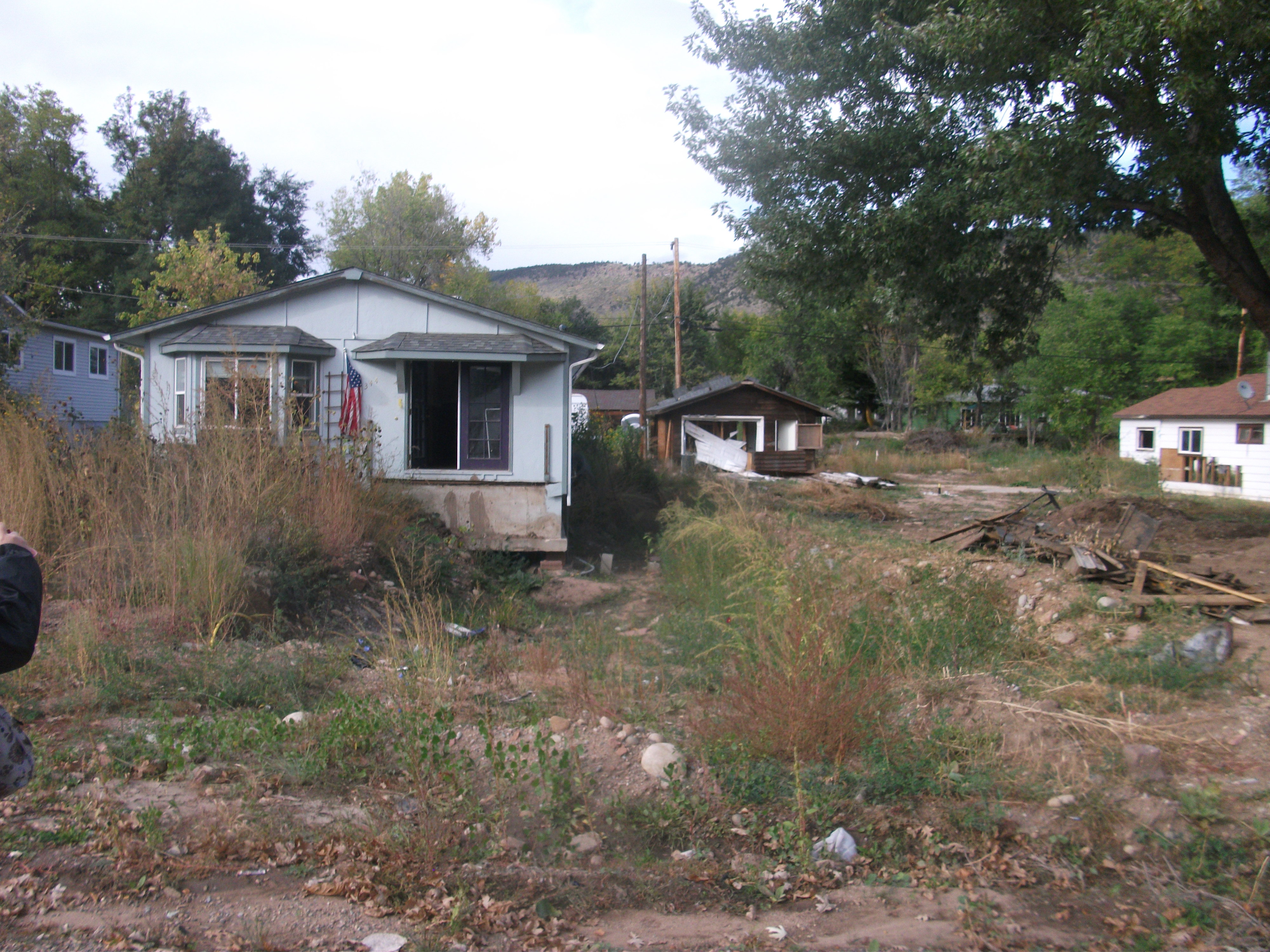
For a long time, federal and state policies with regard to disaster assistance focused on supporting no more than the replacement of what existed before disaster struck. We’ll help you build back, but we won’t help you build a Cadillac. As federal policy, particularly within the Federal Emergency Management Agency (FEMA), increasingly emphasized hazard mitigation in order to minimize losses in future disasters, however, the idea behind such thinking became increasingly suspect. If you could make a community more resistant to future disasters, if you could reduce that community’s future reliance on outside assistance in managing recovery, why would you not want to make that investment? In the 1993 Midwest floods, in particular, the use of federal Hazard Mitigation Grant Program money to buy out flood-prone properties and create public open space in floodplains at least meant removing some development from harm’s way. That opened the door to even more forward thinking. Some relocated communities, like Valmeyer, Illinois, went much farther and adopted green building codes. The “green rebuild” of Greensburg, Kansas, after its 2007 tornado built on this idea.

DSCF1844Indeed, is there really anything wrong with leaving a community better off than it was before? By the time the Hurricane Sandy Rebuilding Task Force issued its report in 2013, this bridge appears to have been crossed. The task force answer was clearly that we want very much to rebuild communities that would be more resilient in the face of future disasters. Ideally, that would not mean that such communities would merely regain their pre-disaster status quo more quickly, although that seems to have been the goal for more than a few communities after Sandy. The bigger vision just never materialized. At the same time, however, the U.S. Department of Housing and Urban Development has been seeking ways, most recently through the National Disaster Resilience Competition, to encourage states and communities to think about improvements that, in particular, instill greater resilience among their most vulnerable populations.

The question won’t go away, and fortunately, there are plenty of people, particularly within the growing community of climate change adaptation professionals, who remain engaged. This is a very good thing because, in the face of phenomena like climate change and sea level rise, hazard mitigation faces the prospect of running hard merely to stay in place, a la Alice in Wonderland. Elevate homes, retreat from the seashore, and you find in another generation that you have gained little or nothing because average temperatures are rising and the sea is following you to higher ground. This is precisely why the latest guidance from FEMA on hazard mitigation assistance insists that states and communities must begin to account for climate change in the hazard mitigation plans that qualify them for federal grants. There is little sense in spending federal money to mitigate the same problem repeatedly when you can do it once with more foresight.

At the risk of oversimplifying the underlying questions, which can and do fill volumes of scholarly and professional analysis these days, I lay this out as the background for introducing a remarkable new document unleashed into this debate by The Kresge Foundation. Bounce Forward, a strategy paper from Island Press and the foundation, which funded the project, raises the question of what constitutes “urban resilience in the era of climate change.” At the outset, it confronts the fear I cited at the beginning of this blog post—that of losing the essential poignancy of the message of resilience. It states:

But the transformative potential of resilience is far from assured. There are several potential pitfalls. Notably, if resilience is conceived simply as “bouncing back” from disaster, it could prove harmful, by reinforcing systems that compound the risks our cities face. More insidiously, the concept of resilience could be co-opted by opponents of meaningful reform. And if efforts to build resilience do not also mitigate climate change, they will be of limited use.

I sense an echo here. For some years, at the American Planning Association and some allied organizations, we have talked of “building back better” as the real goal of disaster recovery. (See Planning for Post-Disaster Recovery: Next Generation.)* But resilience is about much more than effective recovery from disasters. It is also about positioning a community’s human and institutional resources to respond to all manner of setbacks, whether stemming from chronic decline and social pressures, or from the impact of nature on the built environment, to deal more creatively with those problems so as to evolve a society that can help its least advantaged sectors in responding to those threats and to become more prosperous and confident. A commitment to social justice must be inherent in the formula. A society that imposes unfair environmental burdens upon, and denies opportunities to, its most economically challenged elements cannot be resilient in any meaningful way. Such a society is merely perpetuating its vulnerabilities. A community is only as strong as its weakest link. In an “era of rapid change,” the Kresge report says, in effect, that weakest link is getting weaker, inequalities are growing and will be magnified by the impacts of climate change, and the concept of resilience means nothing or worse if it does not address these issues.

The aim of Bounce Forward is to create a framework for doing so. Stronger social cohesion and more inclusive community decision making are among the ingredients essential to this transformation. What’s more, as such reports go, this one is a very good read.

Jim Schwab

*I wish to note that, at the invitation of The Kresge Foundation, I have participated over the past year as a member of its Project Advisory Committee for a study of community resilience being prepared by Stratus Consultants, which is still being completed. I also represented APA at a Kresge Foundation symposium on resilience at the Garrison Institute, held last June in Garrison, NY. Because of our common agendas, APA has had an active interest in supporting the Kresge initiatives on this subject.

The Challenge of Creating Resilient Communities

A scene from the Jersey shore after Hurricane Sandy.

A scene from the Jersey shore after Hurricane Sandy.

Resilience has typically been defined as an ability to bounce back from, and to withstand, shocks and crises. These can include natural disasters but also terrorist strikes, sudden economic downturns, or major industrial accidents. The term was borrowed from the field of ecology, but it has taken root in community planning and has important implications for how and where we build and for the kinds of human capital we develop. It is inherently a complex topic.

That complexity raises the question of how entities outside communities can encourage or foster greater resilience within them. Is it all up to local planners and elected officials, or is there a role for state and federal governance and perhaps private philanthropy? If so, what is that role?

Last fall, the U.S. Department of Housing and Urban Development (HUD), followed up on its Rebuild by Design initiative that followed Hurricane Sandy by unveiling the National Disaster Resilience Competition (NDRC). The new effort makes nearly $1 billion in grants available to eligible jurisdictions. Details about the HUD Notice of Funding Availability (NOFA) and the overall competition are available elsewhere on the APA website, on the HUD website, and on several other sites allied to or supportive of the competition (also listed on the APA page linked above), most notably including the Rockefeller Foundation. The idea was to encourage communities to develop proposals that would address community resilience needs in a holistic fashion. At the same time, because the money was tied to the Sandy supplemental appropriations for HUD’s Community Development Block Grant-Disaster Recovery program, the proposals needed to tie those needs back to a presidential disaster declaration between 2011 and 2013, and meet other CDBG requirements relating to vulnerable and disadvantaged sectors of the community. Those requirements establish a threshold of eligibility for states and communities that can be challenging to meet while setting their sights even higher. In all, the NOFA listed 67 eligible jurisdictions. These included 48 states (only South Carolina and Nevada had no declarations during the relevant period), and 19 other counties and municipalities, plus Puerto Rico. Louisiana and Illinois had adjacent local jurisdictions eligible in both the Chicago and New Orleans metropolitan areas.

Because only HUD can legally explain the NOFA but is unable to directly help jurisdictions develop their applications, the Rockefeller Foundation, already supporting other resilience initiatives, chose to support the competition by providing such technical assistance. It did this with extensive help from HR&A Advisors, a consulting firm, by organizing five regional “resilience academies,” in Atlanta, Seattle, Kansas City, Boston, and Chicago. These provided an excellent vehicle for using the talents of at least some of the APA members who volunteered their time for our Planners Resilience Network, whose names we shared with both HUD and Rockefeller. The Rockefeller consultants enlisted dozens of design professionals as subject matter experts (SMEs) and facilitators to staff the workshops. I participated as an SME in the Chicago academy, which was held January 29-30 at the James Hotel. Both groups were assigned during the events to specific applicant teams as they worked through their ideas, but also participated in critiques of presentations by other applicants. HUD personnel were on hand to answer questions about the NOFA, and Enterprise Community Partners representatives held counseling sessions with each applicant team.

The overall idea was to help the teams refine their ideas and broaden their thinking about resilience, overcome siloes and boundaries, and collaborate with neighbors. Judging from my own experience, I would say that in most cases the applicant teams moved quite far from their initial concepts in just two days. There is a tendency in local and state government to tailor proposals narrowly to fit the needs of highly stovepiped funding sources at the federal level, which can be notoriously limiting with regard to the range of acceptable options. Even HUD in its FAQs has broadened its interpretation of its own NOFA in recent weeks.

One challenge in particular that I noted in Chicago was that many of the issues states and other jurisdictions face do not stop at their boundaries. In the Midwest, for instance, major river systems—the Missouri, Mississippi, and Ohio, in particular—form those boundaries, but the floodplain management issues clearly involve both sides, whether it be Wisconsin/Minnesota or Ohio/Kentucky, to name just two examples. There can be little doubt that similar issues prevail across the country. What the academy organizers—and HUD—hoped to convey was that collaboration across such boundaries not only would be rewarded but is absolutely vital to long-term regional success in creating disaster resilience.

The formula worked in part because it minimized set presentations in order to maximize team discussions and feedback. There were basic presentations about the concept of resilience, defining risks, and how to apply innovative thinking to resilience problems. More importantly, however, the academies focused their efforts on a well-considered progression of exercises throughout the two days. These exercises led participants through the identification of resilience opportunities in their target communities, to understanding the risks they face, then to expanding their approach, before the first critique, which forced each team to decide on the “elevator speech” that would communicate the key elements of their proposal in about five minutes, subject to feedback from the SMEs and facilitators. Mastering the art of identifying a handful of key bullet points about a complex proposal to increase community or regional resilience for a particular area in reference to particular hazards and disaster events is not as easy as it may sound, and it probably does not even sound easy.  It is fair to say that some master this challenge better than others, but what is important is that all went home with the experience of having to defend and rethink their ideas and how they could be tied together into a coherent strategy that met also met the threshold requirements for the HUD grants. That is no small request to make of these teams, but many were game to at least try to rise to the occasion. That is progress.

The second, slightly shorter day allowed these teams to refine their approach through a leverage and consultation exercise, followed by a post-lunch second critique, closing out with an opportunity to finalize their approach before going home. The morning also offered five topic area breakout sessions where applicants could choose to learn more about particular hazard types or about leverage and creative financing.

Although the more conceptual Phase I proposals are due March 16, allowing HUD to winnow the list for the Phase II proposals that will nail down specific projects, it is virtually a certainty that nearly every team will be meeting with its counterparts at home to take their ideas farther and respond to the challenges posed during the academies. No one ever said planning is easy. Planning with the goal of achieving community resilience is even tougher. Representatives for the Rockefeller Foundation repeatedly emphasized that, even for communities that do not make the cut, the process of participating in these academies may still enrich their approaches to such issues for the future. No one should have gone home empty-handed.

Jim Schwab

The Next Generation of Disaster Recovery Guidance

It is always an honor to be able to lead an effort that advances the state of practice with regard to a subject as critical to the nation, and the world, as planning for post-disaster recovery. As readers will have noted from this blog and website, for the last four years or so I was in that position as both the manager of the APA Hazards Planning Center and project manager for Planning for Post-Disaster Recovery: Next Generation, a project that has included the production of an APA Planning Advisory Service Report (No. 576) of the same name. We wish to acknowledge the support of the Federal Emergency Management Agency through an agreement with APA, which made the project possible. I personally wish to thank the members of the project team who contributed to the report and the project overall, who are noted in the acknowledgments page of the report. Particularly, these include my co-authors: Laurie A. Johnson, Kenneth C. Topping, Allison Boyd, and J. Barry Hokanson.

The report came off the press at the end of last year, and became available online last week on the APA website. With it have come some other resources we were able to create:

  • A model pre-event recovery ordinance to help communities guide the recovery process
  • A new resource list of federal programs for assistance with local disaster recovery needs
  • Still to come, a series of briefing papers on subtopics of disaster recovery (stay tuned)

The purpose of this posting is simply to link interested readers to these resources, which include a free PDF download of the 200-page report, which we believe will set the standard in coming years for best practices in the arena of preparing communities beforehand for potential disasters and for planning afterwards for effective recovery. Please use the link above to access all of these resources.


Jim Schwab

Interview with Boulder, Colorado, Mayor

This is one of those short posts that takes you to a different blog, but one for which I have direct responsibilities–the Recovery News blog at the American Planning Association website. We posted last Friday a video interview with Matthew Appelbaum, the mayor of Boulder, Colorado, exploring the lessons the city learned from the floods that afflicted the city in September 2013. Appelbaum discusses the road to recovery, the unique circumstances of the flood, and the fact that “resilience is the watchword.” I hope you enjoy listening. Click here.

Jim Schwab

Living in an Integrated World

Little more than a week ago (October 28-29), I was participating in a conference in Broomfield, Colorado, north of Denver, sponsored by the Association of State Floodplain Managers, a national organization of 16,000 members dedicated to better floodplain management in the U.S. The conference was the Sixth Triennial Flood Mitigation and Floodproofing Workshop. Along with Julie Baxter, a former staff member of the Federal Emergency Management Agency’s Region VIII office in Denver, who recently left to join the new consulting firm, Risk Prepared, as a planner, I presented a mini-workshop on “Mitigation Planning Integration with Comprehensive Planning.”

Julie Baxter's opening slide, borrowing a cartoon from the Natural Hazards Observer

Julie Baxter’s opening slide, borrowing a cartoon from the Natural Hazards Observer

The first thing I am aware of is the need to explain what that actually means. It sounds like technical jargon, right? Or at least like a typical Germanic-language habit of stacking up nouns atop each other, most of which actually function as modifiers for the words that follow. Which is to say that technical English tends to use nouns as adjectives, but the end result sounds like gobbledygook. I know.

So here’s the story for those not already immersed in disaster lingo: In 2000, the U.S. Congress passed the Disaster Mitigation Act. Troubled by the rising costs of post-disaster rebuilding, Congress wanted to make states and communities more accountable for how they used federal disaster assistance. The law, in essence, stated that, henceforth, states and communities would receive no federal grants for hazard mitigation projects unless those states and communities had prepared a plan that won FEMA approval for meeting the standards of the statute (and FEMA’s implementing regulations) and was subsequently approved by the governing body, for example, a city council. Fourteen years later, FEMA can count the law a substantial success in that it has induced more than 20,000 local jurisdictions to prepare or adopt such plans. (Communities can choose to participate in a multijurisdictional plan instead of preparing one that is uniquely their own.)

That sounds wonderful, but there has been a problem, and it is only slowly going away. FEMA’s middle initials, after all, are “Emergency Management,” and the agency’s innate tendency is to stovepipe its programs through the state level with its equivalent agencies—state-level emergency management agencies or departments. They, in turn, work with their local partners. All of that is wonderful with regard to disaster response, which defines the core programs of emergency management—evacuation, search and rescue, restoring utility services, etc. Hazard mitigation, however, deals with permanent or long-term ways of reducing the probabilities of a community suffering loss of lives and property in disasters. Much hazard mitigation necessarily implicates issues of land-use planning and regulatory controls, such as zoning and subdivision regulations, which are largely the expertise of urban planners. The issue is both how and where we build. Success in this realm depends heavily on getting urban planners and emergency managers to collaborate, but often it has not happened. The emergency managers prepare the local hazard mitigation plan to comply with DMA, and the planners are either uninterested or on the outside of the process, looking in.  None of that expedites the efficient implementation of cost-effective hazard mitigation measures in our communities, and the losses from natural disasters continue to mount, while development in hazardous areas is not always questioned in a timely or effective manner.

The solution is to bake hazard mitigation into all aspects of the local planning process, from visioning and goal setting through comprehensive planning and on to financing and implementing the plan’s vision with regard to creating a more disaster-resilient community (presuming such a vision exists within the plan). One solution is to make the local hazard mitigation plan required by DMA for funding eligibility either part of, referenced by, or an element in, the local comprehensive plan that guides development in the community. That was, in effect, the underlying vision of a Planning Advisory Service Report we produced (and I edited and co-authored) at the American Planning Association in 2010.

In Broomfield on October 28, I took the matter one step further. I strongly suggested it was now time not only to include hazard mitigation in the local comprehensive plan, but some type of pre-event planning for post-disaster recovery as well. I announced that APA in December is due to release our newest effort, funded by FEMA like the hazard mitigation study, titled Planning for Post-Disaster Recovery: Next Generation, a complete overhaul of an earlier study we produced in 1998, Planning for Post-Disaster Recovery and Reconstruction. There are certain things we can do before we know what specific kind of disaster will strike our communities, and when, I told the assembled planners, and some things that must await knowledge of a specific pattern of damage resulting from a disaster. Those we can address beforehand, in order to give our communities a leg up in kick-starting their recovery, are the organization of a recovery management structure and certain policy goals guiding the recovery effort. With those two key points already settled, a community can regain crucial weeks and months that might otherwise be wasted after a disaster in establishing an effective strategy for planning and implementing recovery. In fact, as part of the new report, APA just released our new Model Recovery Ordinance, prepared by Kenneth C. Topping, a veteran California planner who, among other experience, was once the planning director for the city of Los Angeles. He has worked on and studied this question for a number of years and developed incomparable expertise. I have enjoyed working with him for the past two decades.

None of this should surprise anyone, even outside the field of disaster preparedness, who has thought more broadly about the need for more integrated approaches to managing the problems of business and government in the modern world. The old ways of compartmentalizing and bureaucratizing our responses to social and business problems is still with us, of course, but it is a dying breed. The path to creative solutions and business and community resilience lies with those who can think about and pursue integrated, collaborative solutions.


Jim Schwab

Resilience in the Rockies

Our visiting delegation arrives in Lyons on the slightly chilly afternoon of October 1.

Our visiting delegation arrives in Lyons on the slightly chilly afternoon of October 1.

Back on July 28, I told the story in “The Fatal Attraction” of a gourmet restaurant in Gold Hill, Colorado, that somehow produced great food with the help of a fantastically dedicated staff in a small town nestled in the mountains. I also noted that the surrounding communities had suffered both wildfires in the past and torrential floods in September 2013, from which they are still recovering.  I recounted a few details of some presentations by the mayors of both Boulder and Lyons, and their city manager and town administrator, during the annual Natural Hazards Workshop in nearby Broomfield, Colorado.

Victoria Simonsen explains the flood maps at the visitor center in downtown Lyons.

Victoria Simonsen explains the flood maps at the visitor center in downtown Lyons.

I had the opportunity just last week to spend three days in Boulder at the Third International Conference on Urban Disaster Reduction (ICUDR), which attracted sponsoring delegations from Taiwan, Japan, and New Zealand, and other attendees from nations like Algeria. I will discuss later some of what transpired at the conference, but here I wish to note that the conference provided the opportunity to join a field tour to Lyons, where we were joined by Mayor John O’Brien and Town Administrator Victoria Simonsen, both of whom seem to personify resilience in their approach to rebuilding a town that, at the height of the flood, was divided by the rampaging water into six islands and saw a 400-foot gouge cut through the heart of the town. We were joined on the bus by Professor Andrew Rumbach of the University of Colorado-Denver College of Architecture and Planning, whose students have been assisting the town with plan development; details and the plan itself are available at their website, resilientcolorado.org.

This aerial photo on the wall of the visitor center shows the damage inflicted by the flood on a major local bridge.

This aerial photo on the wall of the visitor center shows the damage inflicted by the flood on a major local bridge.

It is less my intent here to reiterate the flood statistics that were shared (for those see the box below), but to provide a photographic rendering of the condition of Lyons one year later, after thousands of hours of volunteer and paid work have been expended to restore homes, utility services, and some semblance of normal life to a town that was on the verge of destruction just a year ago. The town also received some planning

The St. Vrain watershed under more normal conditions during our visit.

The St. Vrain watershed under more normal conditions during our visit.

assistance from the American Planning Association through the pro bono visit of an APA Community Planning Assistance Team earlier this year. One thing that is very clear is that the town’s leadership is very gracious about acknowledging the extent of such outside help. Without it, Lyons would most likely never have mustered the resources to stage its comeback.

During the flood, water overtopped this bridge in the Confluence neighborhood.

During the flood, water overtopped this bridge in the Confluence neighborhood.


Lyons: The Numbers

  • Normal stream flow: 120 to 200 cubic feet per second (cfs)
  • Stream flow at height of flood: 30,000 cfs
  • Streams involved: North and South St. Vrain Creek, which meet to form confluence in Lyons
  • Size of gash cut through center of town by flood waters: 400 feet
  • Deaths: 1
  • People evacuated: ~2,000
  • Population of Lyons: 2,035
  • Homes damaged: 211
  • Homes substantially damaged: 84
  • Trees lost in flood: ~10,000

Jim Schwab

Views of damage in Lyons’s Confluence neighborhood, so called because it is near where the North and South St. Vrain Creeks merge:

DSCF2506DSCF2504


Here lie the remains of a mobile home caught in the swirling waters of the deluge.

Here lie the remains of a mobile home caught in the swirling waters of the deluge.

The Fatal Attraction

At first, it looks like something straight out of the Old West, and perhaps it is. The Gold Hill Inn is now 52 years old, which plants its origins in the 1960s, but the building was originally the dining hall for the adjacent but now closed Bluebird Lodge, built in 1873. The Gold Hill Inn, actually a restaurant, was built in 1926. In either case, Colorado was a decidedly different place back then. The historic district that remains carries forward the heritage of the old frontier.

The shuttered Bluebird Lodge, next to the Gold Hill Inn.

The shuttered Bluebird Lodge, next to the Gold Hill Inn.

What is remarkable is finding a restaurant of such gourmet and fine dining predilections, for the Gold Hill Inn is no typical small town diner. It boasts some of the finest menus in Colorado, but I will return to all that later. What I want to discuss first is the journey to this lofty establishment, whose website says it is open from May through December. Sitting high in the mountains above 8,000 feet, one reasonable explanation might be that cold and snow discourage the journey at other times of the year. But I am guessing, as a Midwesterner accustomed to cold but not to the altitude, and I could be wrong. Maybe they just like to take a break for four months.

The Gold Hill Inn awaits. From the left, my friends Barry Hokanson, of Greyslake, Illinois, and Ed Thomas, of Boston.

The Gold Hill Inn awaits. From the left, my friends Barry Hokanson, of Greyslake, Illinois, and Ed Thomas, of Boston.

On the evening of June 22, I was in the company of three other gentlemen, all attending the annual Natural Hazards Workshop in Broomfield, Colorado, who were already familiar with the Gold Hill Inn and had made plans to visit one of their favorite restaurants. Well—two of them were. Ed Thomas, president of the Natural Hazard Mitigation Association, also a land-use attorney and former FEMA employee from Boston, had talked to me a month before about the Gold Hill Inn, and Jim Murphy, a planner working with URS Corporation, knew the way because of prior work on hazard mitigation in the area. The journey was worth every bit as much, in professional education, as the restaurant itself was in oral gratification and nutrition, so I will offer that story first.

One never follows a straight path up into the Rockies. Everything is a long and winding road that clings to the sides of cliffs and creeks, and Jim, the driver, chose his path to let us see the impacts of the September 2013 floods along Four Mile Creek, which descends precipitously from the mountain ridges. We also saw the impacts of prior wildfires. Some of those wildfires were severe enough to char the soils beneath the forests, producing a phenomenon known as hydrophobic soils, which accelerate and exacerbate flash flooding because they are incapable of absorbing the rainfall when a storm hits. That forces the water to rush downstream as if it were simply pouring off a concrete pavement. One of the many functions of healthier soils, especially if covered with healthy tree canopy, is to delay the movement of that rainfall and absorb it into the ground, eventually recharging groundwater. Hydrophobic soils lose that function and contribute to the resulting flood disaster.

Up close, Four Mile Creek tumbling through the mountains.

Up close, Four Mile Creek tumbling through the mountains.

Last fall, Colorado suffered what amounted to a mountain monsoon that dumped nearly 18 inches of rain in parts of the mountains north of Boulder, producing record flooding in many of the communities along the creek path and below the mountains. In flatter areas, flooded rivers can move at frightening speeds, but never approaching those of mountain streams whose descent can sometimes be measured in thousands of feet over just a relatively few miles, particularly along the Front Range in Colorado.

Hillsides denuded of forest by wildfires become more vulnerable to stormwater runoff, exacerbating downstream flooding.

Hillsides denuded of forest by wildfires become more vulnerable to stormwater runoff, exacerbating downstream flooding.

But you don’t have to be at the bottom of the mountain to get the worst of it. Many people in Colorado have chosen home sites that amount to what I like to call the “fatal attraction.” I define such locations as alluring sites that often have stunning views, provide proximity to wildlife for those who treasure their communion with nature, but which also suffer from often dangerous exposures to natural hazards like wildfires and flooding. The fatal attraction is not limited to the Rocky Mountains, or even to the mountains, but plays out in seaside resorts in New Jersey and North Carolina’s Outer Banks, and in many other challenging choices all over the world. We humans are emotional as well as rational creatures, and we often choose places to live based on their tug on our hearts and eyeballs while ignoring the possible long-term consequences of living in locations exposed to hurricanes, floods, wildfires, volcanoes, and whatever else you can name.

And, in truth, those choices are not always as clear-cut as some would suggest. All hazards are ultimately matters of probabilities, how often something happens over what period of time, and of the magnitude of a likely event, and there is no place where those probabilities are zero. They may be zero for a particular hazard, but not for every possible hazard. In early July, lightning in a thunderstorm zapped our living room television and garage door opener. I live in Chicago. I may not be in a floodplain, but things happen. And as some of us like to say, it is not just where you build, but how you build. Yet few of us can afford to build a fortress, and most of us might not like the result if we did.

That said, there can be no doubt that those who choose to live on the side of the mountain can expect swift retribution from nature on occasion, and last fall nature doled it out in abundance. At the Natural Hazards Workshop, which assembles about 400 experts from numerous disciplines every year to discuss these very questions, we heard from local officials and scientists precisely what happened last September.

Robert Henson, a meteorologist at the University Corporation for Atmospheric Research in Boulder, noted that Boulder’s worst flooding was along small waterways and that the city received the equivalent of more than half of a year’s rain in one week. But there were problems with accurate measurements because some rain gauges were too close to buildings or under trees, others accidentally spilled, and others overflowed because the rain exceeded their capacity. Henson outlined some common misconceptions about such storms, including the idea that our climate is stationary. It is not. It is constantly changing, and today it is changing faster because of the impact of human activities that inject greenhouse gases into the atmosphere.

Getting agreement on the latter point is not a problem in Boulder, according to Mayor Matthew Appelbaum. He noted that a survey showed 99 percent agreement among local residents that climate change is real. That somewhat simplifies the task of getting consensus on the needed measures to mitigate against future disasters, but Boulder also benefits from some far-sighted policies of the past, although most were not specifically undertaken with such issues in mind. But over time, the city has created a wide swath of protected reserves with a lot of open space. It has used that open space to create recreational and physical activity benefits for residents by building bicycle and hiking paths along Boulder Creek, notably, but other smaller creeks as well. Thus, the public gets positive amenities in addition to flood mitigation. Much of that open space plan has prevented development in the more hazardous areas of Boulder and prevented unsightly mountainside development. But, according to City Administrator Jane Brautigan, that open space was not acquired in a day, or even a year, but over decades. Boulder’s high-hazard property acquisition program dedicates about a half million dollars every year to acquiring such properties and demolishing the homes. Boulder also reserves 10 percent of its budget for emergencies. It turns out this famously liberal town is fiscally conservative in confronting its vulnerabilities.

What Boulder did not expect was the damage from rising water tables as a result of the sheer quantity of rain, which flooded basements, an outcome that had not been considered possible—until it happened. The flood knocked out one of Boulder’s two water treatment plants, according to Appelbaum. Sewers that normally run 12 million gallons of water per day were running 50 million gallons daily for three weeks straight. Brautigan invited researchers seeking data on rainfall and groundwater to visit Boulder.

But suppose you are merely a town of 2,000, rather than the 100,000-plus residents of Boulder? Even massive reserves relative to your annual budget may not be enough in a case like that of Lyons, about 15 miles north of Boulder, but much smaller and considerably more vulnerable. Lyons sits at the confluence of the North and South St. Vrain Creeks. Every one of its citizens was forced to evacuate, and every one of its businesses closed, almost all of them independently owned.

Victoria Simonsen, the town administrator, noted that this town with a $1 million annual budget had $4.4 million in reserves, which still are nowhere near enough in the face of $50 million in damages. Outside assistance has been essential. The normal creek flow is 1,200 cubic feet per second (cfs); the storm produced a flood flow of 26,000 cfs, ripping a 400-foot gash through the center of town that runs three to 18 feet deep. The severe storm tore apart the water distribution system, pulled gas and electric lines out of the ground, and destroyed communications. Effectively, the community became a series of six islands surrounded by water, isolated from the outside world for 36 hours before the National Guard could arrive with high-water vehicles capable of entering the scene and evacuating those who remained. Miraculously, perhaps, only one person died.

There is a great deal of work to be done in Lyons, and some other towns like it, as a result of last year’s flood. Simonsen provided a laundry list of actions spread across the short-, mid-, and long-term recovery that lies ahead. But the town has help. Oskar Blues, a home-grown brewery, set up a nonprofit foundation to raise money, Oskar Blues CAN’d Aid, named after the company’s famous canned microbrew designed for mountain climbers who cannot afford to carry bottled beer in their sacks. Plans are underway to restart businesses, replace lost housing, and restore parks, open space, and trails. The summer festivals that attracted people in the past will go on, albeit with some adjustments. One has to admire such the sense of community that is on exhibit in places like Lyons.

That brings us back to the Gold Hill Inn. Unique entertainment and eating establishments, and the small town feel that they produce, are what keep many of these small Colorado towns alive today. The Gold Hill Inn serves special food in order to attract the special people who find their way up mountain roads to try the unique cuisine. The menu changes from day to day, so it is posted on the blackboard. You can get the three-course meal for about $25, as I recall, or the six-course for $35, and though it seemed indulgent, we all opted for six. I can personally attest that the Ukrainian borscht, flavored with bacon, made a fabulous side dish and was far better than anything like it I can recall. The ono salad was a treat, but the entrée I ordered, the roast pork cooked in apricot sauce, was a dream. All that is before we get to the dessert (a truly unique apple pie in my case that I cannot recall how to describe if I ever figured out how to do so in the first place), followed by cheeses that ultimately seemed decadent after everything that preceded them. The service was both outstanding and enthusiastic, and it was explained that the staff works as a team and responds to its clientele as a team. No want or concern among customers went unanswered. It is clear they want you to love the place and come back.

And that is because, for all its challenges, the people in these small towns seem to love the place themselves. There are, after all, many reasons not to be there. They focus on the reasons that make the place special.


Jim Schwab

Trees in the Disaster Recovery Equation

For the last two or three years, if not longer, I have been engaged in an ongoing discussion with people from the U.S. Forest Service and the International Society of Arboriculture (ISA) about the role of trees in post-disaster recovery. Phillip Rodbell, an urban and community forestry program manager with the Forest Service’s Northeast office in Philadelphia, has been particularly diligent in pursuing the question of how we can better protect trees in urban areas from storms and other major disasters as well as how to reduce the loss of trees in the process of removing debris after disasters. Too often, in the absence of qualified arborists or other forestry professionals, the existing incentives for debris removal cause more, rather than fewer, trees to be cut down and hauled away than is truly necessary. The question is how to change that.

The fact that some trees, sometimes many trees, do in fact get blown down in storms, crushing cars and occasionally people, snapping utility lines, and blocking roads, fosters the false perception in some minds that trees are inevitably hazards in themselves. In fact, inadequate maintenance of the urban forest, including inadequate attention to those trees that really do pose hazards, creates problems that can be prevented with better municipal tree pruning cycles and pre-planning for more appropriate vegetative debris removal after big storms. However, local resources, including professional expertise, can be overwhelmed in a more catastrophic disaster such as a severe tornado or hurricane. The sheer number of trees blown down by Hurricane Katrina, for instance, was staggering, well into the millions.

Phil and I ultimately decided that, if the Forest Service could provide a modicum of money to help sponsor what we decided to call a scoping session, and if ISA and the American Planning Association (APA) could contribute more modestly to support the project, we could perhaps bring together a team of subject matter experts, representatives of relevant local, state, and federal agencies, and people from interested nonprofit associations, and we could foster a meaningful discussion of how to address this problem. In the process, we might help save federal, state, and local governments millions of dollars annually in avoidable debris removal costs.

This spring, we succeeded in bringing that package together and initiating a contract between the Forest Service and APA. The result was a two-day discussion held June 16-17 in APA’s Washington, D.C., offices, involving more than two dozen people, mostly in-person, but with a handful joining by conference call from remote locations in New York and Mississippi. A summary of that discussion, and the issues it addressed, is now available on the APA website, along with a bibliography of resources on the topic, and a series of briefing papers prepared by the invited experts. I invite my readers to check it out. To learn more, click here.


Jim Schwab

Interview with HUD’s Scott Davis

I won’t go into great detail, just enough to entice you to click the link below to watch the interview I conducted with Scott Davis, formerly director of the U.S. Department of Housing and Urban Development’s Office of Recovery regarding Sandy recovery operations and programs and the role of planning in creating more resilient communities. The video, taped during the American Planning Association’s National Planning Conference in Atlanta, is on APA’s Recovery News blog, which features multimedia discussions and features on issues of planning for disaster recovery. To watch the video, click here.


Jim Schwab