Recovery in North Carolina One Year Later

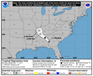
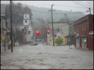
Amid the whirlwind of disasters this fall—three major hurricanes hitting the U.S., earthquakes and another hurricane hitting Mexico, wildfires in northern California—it is easy to forget that people hit by other disasters as recently as a year ago are still laboring toward long-term community recovery from the damages those events left behind. One of those places is North Carolina, which suffered flooding in several small communities in its eastern Coastal Plain from Hurricane Matthew. The Federal Emergency Management Agency (FEMA), of necessity, may shift its energy and resources to new places, but the communities and states trying to recover cannot escape the realities of rebuilding their own futures.

I was in North Carolina just two weeks ago for the annual conference of the North Carolina chapter of the American Planning Association, in Greenville. This city of about 90,000 is just an hour west of the Outer Banks, depending on which roads are open. (Hurricane Maria was kicking up waves as it moved north out in the Atlantic Ocean while I was there.) Much of the surrounding area consists of farm country and small towns nestled in river valleys subject to flooding in major storms including tropical storms and hurricanes. In the 1990s, the area was visited by Hurricanes Floyd and Fran, both of which left their marks. I had hoped to travel the towns affected by Matthew with a colleague, but it did not work out. But I did listen to a keynote presentation by Gavin Smith, a research professor at the University of North Carolina (UNC) in Chapel Hill and director of the U.S. Department of Homeland Security’s Coastal Resilience Center of Excellence, located at UNC. I was there because I had been invited to speak at two sessions, one on September 26 on community resilience and another the next day on flood hazards and subdivision design.

Smith has worked with the North Carolina Department of Emergency Management on recovery planning in the past, and as a consultant following Hurricane Katrina, led recovery in Mississippi under Gov. Haley Barbour. He later returned to North Carolina to join the UNC faculty, but clearly is an experienced hand in this field. He has also written extensively on disaster recovery, including an Island Press book, Planning for Post-Disaster Recovery: A Review of the United States Disaster Assistance Framework.

What Smith served up was a primer in planning for climate change and disaster recovery with a side order of North Carolina case studies. I don’t say that to be cute, but because I have discussed at length the issues associated with the former, so here, I will concentrate on the latter. I will note first, however, that he highlighted some issues connected with disaster recovery that are worth considering:

  • Disasters tend to bring to the forefront of community planning existing conditions that may have been less obvious beforehand, but which are not new.
  • Disaster involves opportunity, a unique situation in which good planning can effect positive change. Because planners are generally interested in advancing equity, this is important, as developers are often dictating growth even when it negatively affects some economically marginalized people in the community.
  • This post-disaster environment provides an opportunity to engage in alternative dispute resolution, with planners using negotiation to help resolve difficult issues.
  • The reality of disaster recovery is time compression, the need to move quickly even though better planning may demand stepping back and investing more time in deliberation before making decisions. We can alleviate some of that pressure by developing plans for recovery before disaster strikes.

That is, in a way, all background to the simple fact that one role for planning is to help change the rules governing recovery through serious engagement between local officials, who generally better understand local needs, and those at state and federal levels of government, who generally control more of the resources needed for successful recovery. In other words, planners need to help solve the disconnect between means and understanding. Communities that passively await rescue by higher levels of government without undertaking the task of owning their own recovery may well face consequences in the misallocation of the resources provided.

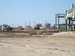
The Hurricane Matthew Disaster Recovery and Resilience Initiative (HMDRRI) has specifically worked with eight communities in eastern North Carolina under the auspices of the North Carolina Policy Collaboratory. Smith is the project director. It began with a research period that ran from February through June of this year. The project included intake interviews with people in the affected areas who were willing to pursue buyouts of their properties, which would then be maintained in perpetual open space under rules of FEMA’s Hazard Mitigation Grant Program, and discussed with them where they were willing to relocate. The program developed housing prototypes for affordable homes in the $90,000 range that would allow buyers to stay in their communities without remaining in the floodplain. One major question was whether they could endure as a community after such relocation, which is affected by area geography and topography and the ability to identify and develop suitable alternatives. It should also be noted that eastern North Carolina has been through much of this before. Following Hurricane Floyd in 1999, the state undertook buyouts of more than 5,000 homes and assisted in elevating another 1,000.

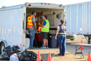
Camp shelter in Windsor, NC, one of the communities assisted by HMDRRI. Photo by Gavin Smith

The HMDRRI research product is a 580-page report that outlines project objectives and documents economic, housing, and other conditions in both the region and the communities specifically targeted by the project: Kinston, Fair Bluff, Windsor, Princeville, Lumberton, and Seven Springs. This documentation is critical to an accurate assessment of the challenges facing the region. For instance, the standard determinant of housing affordability is the ability to limit spending on housing to 30 percent of income. People in lower-income brackets often struggle to find such housing, and often it requires subsidies or some sort of intervention in the housing market. Within the coastal counties studied, however, the reasons for shortages of affordable housing can vary widely, as can its quality. The resilience of affordable housing in an area subject to coastal storms and flooding is important, yet the abundance of mobile and modular housing in the region offers little resilience in the face of disaster, and septic systems associated with much modular housing often make those homes even more susceptible to flooding. Thus, solutions must address both resilience and affordability to provide some semblance of social equity in disaster recovery.

The intriguing model offered by HMDRRI, however, is the systematic engagement of the academic community in what is simultaneously a practical learning experience for students and faculty, an opportunity for introducing the skills of practicing design professionals to the area, and a direct connection to state and federal officials, for instance, by allowing student and faculty teams to work in the FEMA Joint Field Office (JFO) and thus access data that might not otherwise be readily available. This included interaction with FEMA’s Community Planning and Capacity Building team, part of the larger federal Disaster Recovery Framework. The report, more readable than its length might suggest, includes a substantial section called Home Place that helps facilitate the transfer of design practices to the community level to empower better local recovery planning.

An example of this occurred in Princeville, which Smith described as the oldest African-American community founded by freed slaves. In August, HMDRRI hosted a five-day charrette with visiting architects, three-quarters of them African-American, who worked directly with the community on land-use and design solutions for relocating homes from the floodplain to a higher, 52-acre site still within the city limits. Helping the community to understand and come to terms with the land-use changes resulting from the recovery from Hurricane Matthew is critical to long-term success. The verdict is necessarily still pending in this case, but it may provide a solid case study for future efforts elsewhere. Smith also noted one other important aspect of the charrette experience: Participants were asked to check in daily to document the time they spent. Creative people that they were, the initial reaction was some resentment at being subjected to this bureaucratic procedure until it was explained that documenting their contribution of time was essential to showing a local match for federal funds supporting the project. Approximately 100 people were credentialed for the purpose. At that point, they complied enthusiastically because they understood the purpose as something more than mere bookkeeping. They were helping the community marshal badly needed resources.

It is worth noting that the report recommends that the North Carolina Governor’s Office form a standing committee to provide recommendations for policy, programming, and funding strategies for development of adequate housing in eastern North Carolina. The report also notes interest from Texas and Rice University in the model for state/academic collaboration that HMDRRI offers. This is part of the silver lining of disasters: the emergence and dissemination of positive and innovative solutions to common problems.

Jim Schwab

Flood of Events in Just Two Weeks

Life can produce very sudden turns of events. The turmoil and destruction dished out by Hurricanes Harvey and Irma may have been predictable in the abstract, that is, events that could occur at some point someday, but that means little when the day arrives that a hurricane is bearing down on your shores.

More than three months ago, I retired from the American Planning Association to move into a combination of activities I had tailored to my own skills and interests, which I have previously announced and discussed. Over the summer, I began setting the stage for introducing these new enterprises, but my wife and I also took time for a long-awaited excursion to Norway to celebrate this new phase of our lives. I began to share that story in August with blogs about our journey.

Meanwhile, I began work on the creation of Jim Schwab Consulting LLC, my solo planning practice. Just two weeks ago, with the help of a web designer, Luke Renn, I unveiled a business website that is a companion to this one. You can find it at the link above. But when we began to construct the site in mid-August, I had no idea what would ensue. By the time we had completed the new website, Harvey was making landfall on the Texas coast and dumping unimaginable amounts of rain in the Houston metropolitan area, and then on Port Arthur and Beaumont, Texas.

As Harvey was losing steam and moving inland, Irma, initially a Category 5 hurricane, devastated the small island of Barbuda, the smaller part of the tiny Caribbean nation of Antigua and Barbuda. Officials estimate that 95 percent of the island’s buildings were damaged or destroyed, and residents have been evacuated to the larger island of Antigua, partly in advance of an anticipated second attack by Hurricane Jose, following in Irma’s wake, that mercifully did not come to pass. That would have been bad enough, but the storm also badly rocked St. Thomas and St. John in the U.S. Virgin Islands, sideswiped Puerto Rico and the northern coast of Cuba, and finally passed through the Florida Keys, demolishing much of the community there, and sped up the western coast of Florida through places like Naples and Tampa. Irma was so huge that its waves and winds also buffeted numerous coastal communities in eastern Florida, no doubt shaking many people in Miami Beach to their core.

I will soon complete the tour of Norway on this blog, but it seemed more important to offer some insights, in some small way, into what is happening and will be needed in the recovery in Texas. Irma has been too large an event for me yet to absorb its totality and even begin to understand how I can possibly enhance what people know from the daily news barrage that has accompanied it. I am sure emergency management personnel at all levels are already weary but patriotically staffing their posts.

Planners like me must prepare for the much longer endurance test known as long-term recovery planning. While it is far too easy to say what, if any, role I may be asked to play in this drama, there have been conversations. Recovery, unlike emergency response, will take months to unfold. I will do my best to share what I learn. It is important because long-term recovery provides the opportunity to hash out major questions of the future and the resilience of the surviving communities. It has always been possible to learn from experience and to improve so that we lose fewer lives, suffer fewer losses, and rebound more quickly in future disasters. But possible is not certain. It is up to all of us to decide that we will rebuild with a resilient future in mind.

Jim Schwab

Map of Irma as of 9/12/17 from NOAA website.

Hurricane Harvey Interview on CBC

For those who have been reading the posts I have recently done since Hurricane Harvey made landfall, I thought it might be of interest to see this video clip of an interview I did with Canadian Broadcasting Corp. two days ago: https://youtu.be/UFslrKPd04s 

Jim Schwab

The People Affected by Harvey

A few days ago, in my last post, I wrote that Hurricane Harvey would last a few days, but the recovery would last years. However agonizingly long Harvey appears to be taking to inflict its misery on the Texas Gulf Coast, and now parts of southern Louisiana, it will go away. And then the real marathon will begin. People will have to face the necessity of reconstruction, both as individuals and as whole communities.

In writing about this now, I am crediting readers with a longer attention span than seems to be assumed of most Americans on social media today. I truly hope, however, that the news media does not forget about Harvey or the Gulf Coast as the recovery process grinds on over coming months and years. Certainly, most residents of the Texas coast will have little choice but to bear with the process, and ideally, they will participate. Recovery needs to be as participatory as possible to succeed fully.

FEMA teams managing the distribution of water, and meals for hundreds of semi-trucks at an incident Support Base in Seguin, Texas. Photo by Dominick Del Vecchio – Aug 29, 2017 (from FEMA website) 

It will not always be a pretty picture. The news media in recent days have been full of photographic and video evidence of the best aspects of humanity—people in boats rescuing neighbors and strangers alike, public safety personnel risking personal safety as they save people from flooded homes and transport them to shelters, and other heroic acts away from cameras and too numerous to count. People from other states and nations will contribute to disaster-related charities to help people they have never known and may never meet. Politics and race and religion will all take a back seat to saving lives and reducing suffering. For just a brief moment in history, we can stop shouting at each other long enough to care for each other and be proud of one another.

Several years ago, Rebecca Solnit produced an intriguing book, A Paradise Built in Hell, that explored many of the positive community-building relationships that emerge when people are challenged by adverse circumstances such as major natural disasters. It is a journalistic journey through the informal alliances and communities created by people under what seemingly are the worst possible conditions, but which challenge our humanity and force us to consider how we value those around us. It is an optimistic book that forces readers to rethink what it means to live through a disaster. I have always hoped that it would spark similar efforts among academic researchers, particularly in the social sciences, to study this phenomenon more closely. I think that is happening to some extent, but perhaps not nearly enough.

The Texas Gulf Coast communities stricken by Harvey will need as much of that spirit as they can muster to produce successful long-term recovery. Recovery takes years because, while no one wants to delay rebuilding unnecessarily, hasty rebuilding that fails to consider the failure points that allowed destruction to occur is even more undesirable. Under considerable time pressures, which researchers Robert Olshansky and Laurie Johnson, both wonderful friends of mine, have notably referred to as the problem of “time compression” in disaster recovery, planners and local and state officials will need to meet with constituents, hear their concerns, explain both the obstacles and opportunities involved in reconstruction, and ideally, inform the public process to help lead to a better outcome. During this time, minor and modest repairs may go forward while the bigger decisions, like where to buy out damaged properties, how to rebuild infrastructure and to what new standards, and how to produce a stronger, more resilient community to handle future disasters may need to undergo vigorous debate.

I point this out because, inevitably, and despite Solnit’s rosy scenarios in the context of community building, tempers will rise and people will need to iron out significant differences and widely varying perceptions of the causes of, and solutions to, the damage that occurred. There will surely be some debate about Houston’s sprawling development patterns and relative lack of development controls. There may be debates about strengthening building or zoning codes or, in Houston, the absence of zoning. If there is any echo of Hurricane Sandy, there may be discussion of a greater role for green infrastructure in mitigating hazards, though that alone would have made only modest difference in the flooding from Harvey, but it might have helped.

More importantly, people will have undergone trauma that will make them deeply and justifiably emotional about the disruption of their lives. They will bring that trauma, and a need to vent and share their fears and anger, to public meetings. Public officials will need to exhibit patience because, as Christine Butterfield, another good friend who served as community development director in Cedar Rapids, Iowa, during and after the 2008 floods, has noted, those public gatherings will be therapeutic. People may cry, they may yell, they may accuse. Most of all, they need to know that someone else wants to hear and share their pain. They want to know that someone cares. Once most have achieved that comfort level, they may be ready to move forward and discuss options for recovery. But first, community leaders must build trust.

Some people may never trust, and the rest of the community may need to move on. Life is not perfect. Human beings are not perfect. Recovery cannot wait forever, but it must demonstrate compassion and a commitment to social equity.

In a few weeks, the entire process will begin, and people will decide what role they want to play. Leaders will arise in unexpected places. Just last week, my students at the University of Iowa School or Urban and Regional Planning, during a field trip with which I launch my course on “Planning for Disaster Mitigation and Recovery” every year, heard from United Methodist pastor Clint Twedt-Ball, a co-founder and executive director of Matthew 25, a community organization that arose from almost nothing after the 2008 floods in Cedar Rapids to help rebuild 25 blocks of downtrodden neighborhoods in the city, raising money but also making tough decisions about what would work and what would not. Nine years later, his organization is still working to make a difference. Before 2008, Clint would confess, he knew next to nothing about floods or community development. My guess is that now he could nearly write a book. Who knew?

Watch Houston, and Rockport, and Corpus Christi, and all the other cities on the Texas Gulf Coast for both surprises and struggles, and mostly for deep human engagement in solving massive redevelopment problems the likes of which most of us will never have to confront. And be ready to cheer them on when good things happen. They are likely to need the encouragement from time to time.

Jim Schwab

Initial Observations on Harvey

Map from National Weather Service. http://www.weather.gov/akq/Harvey

For the people of the Texas Gulf Coast, the rain and winds of Hurricane Harvey are just the beginning of a long journey. The storm will last a few days. The recovery will last years.

Destruction in the Bolivar Peninsula after Hurricane Ike in 2008

I am not there, so I can only surmise, based on the news coverage I have seen, the full extent of the damage and suffering that people are enduring in Corpus Christi, Houston, Galveston, and hundreds of other communities in a wide arc that has fallen under the impact of this storm. I do not even expect that people there will read this, certainly not right now. Nonetheless, it may be worthwhile to offer some insights to people elsewhere. I have never lived or worked in Texas, but I have been there numerous times and visited Louisiana more often than I can remember. I saw first-hand the devastation wrought in the Bolivar Peninsula and Galveston after Hurricane Ike. I have worked with people in Texas, including those at the Texas A&M Hazards Reduction and Recovery Center, over many years. They have educated me greatly on the vulnerabilities of their state.

With all due humility, therefore, but also with experience from other disasters over the past quarter-century, I offer some observations that may enhance what readers of this blog may learn from the news.

Photo from NOAA. The NOAA/NASA Suomi NPP satellite captured this infrared image of Hurricane Harvey just prior to making landfall along the Texas coast on August 25, 2017 at 18:55 UTC. NOAA’s National Hurricane Center has clocked Harvey’s maximum sustained winds at 110 miles per hour with higher gusts. Infrared images like this one can help meteorologists identify the areas of the greatest intensity within large storm systems, such as the areas with the most intense convection, known as overshooting cloud tops (dark orange), surrounding the eye and along the outer bands. https://www.nnvl.noaa.gov/MediaDetail2.php?MediaID=2086&MediaTypeID=1

First, this is apparently a somewhat unusual storm system. It approached the coast just northeast of Corpus Christi as a Category 4 hurricane, although it is now downgraded to a tropical storm. That does not make it less dangerous. The Saffir-Simpson scale that is used to rate hurricane strength deals only with wind speeds. Winds are certainly important, especially when they reach the 130 mile-per-hour range that was the peak for this event. Winds have, from all the visual evidence on the various news outlets I have watched, wreaked tremendous havoc along the coast, tearing apart buildings and overturning trailers and other vehicles. Moreover, hurricanes often spawn tornadoes, and some of the intermittent damage—that is, buildings ripped apart near others largely intact—suggests that this has occurred. In other words, if the more diffuse hurricane winds don’t get you, the tornado just might. It is no laughing matter. It is a wonder the death toll remains relatively low, although we almost surely don’t know the full tally just yet.

One specific impact that always accompanies coastal storms of this magnitude is storm surge, the waters pushed landward by the winds that in this case ranged from six  to twelve feet. These can do considerable damage in low-lying areas along the coast and may also exacerbate coastal erosion.

What makes the storm somewhat unusual also makes it dangerous even after being downgraded to a tropical storm. The storm system appears to have stalled a bit on Sunday and may even be backing out into the gulf for another landfall. At least two very serious consequences can flow from this. One is that the stagnant storm front will dump immense amounts of rain over consecutive days. The projected precipitation totals, even larger than what has fallen so far, mount up, so that projections for many communities range as high as 50 inches. Keep in mind that 30 inches is ample rainfall for an entire year in many parts of the country, and almost no city in the United States is prepared to absorb even half that amount in just a few days. The average yearly rainfall in Houston is just shy of 50 inches.

Moreover, as the storm moves back out over the Gulf of Mexico, it may regain strength that storms typically lose as they make landfall. Tropical storms draw their strength from the warmth of the water over which they pass until they make landfall, after which wind speeds begin to die down. The water of the Gulf right now is in the mid- to high 80s Fahrenheit, reportedly a full two to three degrees above average. That is the source of the strength of Harvey. Regaining any strength from the warm Gulf waters is not a good omen for the Texas coast, and as the storm moves slowly northeast, more of this will affect Houston than was originally the case. That is why we are seeing such intense scenes of flooding in Houston: The storm began with enormous amounts of moisture and has moved along the coast at a snail’s pace, at times just a mile an hour. As the week progresses, however, the storm is projected to move northeast over Louisiana and Arkansas, weakening along the way.

Of course, those warm waters raise questions about the influence of global warming, a topic that does not always receive a warm reception in Texas political circles. It is impossible to say that a specific storm like Harvey would not have happened but for climate change. It is also possible to say very credibly that warmer waters make stronger storms possible. Warmer waters can reflect seasonal and yearly variations, but over time they can also reflect climatic trends. For now, let’s leave it at that. People will have plenty of time later to debate this topic. In due course, as recovery proceeds, it should become a topic of reasonable, informed public discourse.

Other factors are at work as well. The sheer extent of flooding reflects the inexorable fact that the ground in any area has limited capacity to absorb rain. The hydrological cycle allows much rain under normal circumstances to drain into the ground, depending on the types of soil present in any given location. Sand absorbs very well but does not provide a very solid building foundation. Clay provides a better foundation but does not absorb water as quickly. Soil types matter, therefore, but in urban areas we have complicated matters greatly with large quantities of impervious surface that absorb little or no water by design. Impervious surface includes buildings (with the limited exception of green roofs), paved surfaces like roads, parking lots, and driveways, and other structural impediments to the movement and absorption of water. Houston is a very large metropolitan area with the fourth-largest population among major cities in the U.S. Although it is making strides, it is also far from the greenest city in America. Like most major cities, the percentage of impervious surface varies widely, depending on density levels in specific neighborhoods and corridors. Flooding is also influenced by the quality of the drainage systems; Houston is challenged in this respect by low-lying, flat terrain. It is criss-crossed with numerous bayous and canals that provide paths for the movement of water but also have serious limits to the water they can absorb before spilling over onto streets and highways. Those water-filled streets are the main obstacle to evacuation for those who stayed behind. There comes a point where people are better off remaining in place than trying to move, which is why Houston Mayor Sylvester Turner chose not to recommend evacuation.

Some dangers of mass evacuation for 6.5 million people are self-evident: clogged highways that are rapidly filling with water, producing death traps for people in stranded vehicles. Pedestrians cannot see steep drop-offs in elevation as they wade through high waters and can trip and drown. In Houston, the bayous may also contain alligators, water moccasins, and other wildlife hazards that are more easily avoided in dry weather. Moreover, the sheer volume of water can produce eddies and swirls that catch people off guard, and not everyone will be strong enough to regain their footing. Finally, flood water is always dirty water, sometimes just plain filthy, posing a potentially serious threat to public health.

All that said, many other major cities suffer from similar problems. I can think of no city that is prepared for the sheer volume of water currently falling along the Texas coast.

The Texas Gulf Coast communities, therefore, will emerge from this storm with a widespread pattern of both wind- and flood-related damage that will vary significantly from one area to the next, but collectively the costs will probably skyrocket into tens of billions of dollars. It is impossible to know the full costs just yet, but this will almost surely rank as one of the most expensive disasters in U.S. history. The recovery will take years of planning and implementation. If done well, it will involve a great deal of reassessment of patterns of development along the Gulf Coast and of the quality and importance of building codes. Social equity considerations will demand a new examination of the location and quality of low-income housing and the adequacy of affordable housing. Development regulations have seldom been politically popular in Texas, a state that still has never empowered counties to enact zoning codes. Some coastal communities may also wish to look more closely at the prospect of undergrounding utility lines to protect them from hurricane winds.

Events can push public attitudes in new directions. Part of that may depend on new lines of thought gaining traction in the discussion of rebuilding after the disaster. That may require some degree of courageous political leadership. Some very significant changes occurred in Louisiana after Hurricane Katrina, including consolidation of levee district management, adoption of a statewide building code, and a charter amendment in New Orleans that gave a new master plan more control over development regulations. We should not make perverse assumptions about outcomes, just as we also should not be naïve about the obstacles. But in my time at the helm of the Hazards Planning Center of the American Planning Association, we certainly worked hard to create a thorough blueprint for those willing to advocate better planning in response to major and catastrophic disasters, and I assume APA remains prepared to further that discussion and provide technical assistance where it can.

There will also be plenty of help available from the federal government, including the Federal Emergency Management Agency, the U.S. Department of Housing and Urban Development, and other agencies. We can only hope that Congress will sidestep much of its partisan bickering to ensure rapid allocation of the necessary resources. And we can hope that those resources and personnel are managed well to advance the recovery process, which is complicated and daunting.

One encouraging factor in the response has been the emergence of both willing volunteers and the effective use of social media to expedite search and rescue operations. The number of boats driven by volunteers rescuing people from rooftops and the interiors of flooded homes reminded me of the so-called Cajun Navy that operated throughout New Orleans in the desperate days that followed Hurricane Katrina. Disasters have a fortunate tendency in most cases to bring out the best in people, but we are also at a point in history where our new technologies facilitate the ability of willing heroes to find the people who most need help. Even the elderly and disabled are largely capable of dialing 911, or tweeting, or posting photos of their situation on Facebook, sharing their location, and pleading for help—and then finding their guardian angel at the front door with a motor boat. That is a huge advance from only a decade ago because it enables the willing volunteers to become effective heroes. If those civic and humanitarian instincts carry over into the slower grind of recovery, perhaps a stronger, more resilient Gulf Coast can yet rise from the mud, the grime, and the shattered buildings we see now.

Jim Schwab

Hurricane Irene: Examining Resilience in Vermont

Earlier this year, the American Planning Association’s Hazard Mitigation and Disaster Recovery Planning Division, in cooperation with Texas A&M University, sponsored a student paper contest for students in urban planning programs across the country. The papers would need to deal with some aspect of natural hazards and planning. The contest involved a $2,500 prize and presentation of the award at APA’s National Planning Conference, which just occurred in New York City May 6-9. The award was announced at a joint reception of the hazard division and APA’s Sustainable Communities Division on May 8. As might be expected, numerous papers were submitted by students in graduate planning schools across the U.S..

To my surprise and great pleasure, the winner of this first-ever contest was one of my own students from a course I teach at the University of Iowa School of Urban and Regional Planning. Emily Seiple, of Mahomet, Illinois, was in my Fall 2016 class, “Planning for Disaster Mitigation and Recovery.” She was one of three students who sought my endorsement to submit their papers, but there were undoubtedly dozens of others, if not hundreds, from other schools. I have not inquired as to the total submitted.


Courtesy of NOAA, National Weather Service

Emily’s paper is very deserving of the recognition she has now received. In her paper, written as an assignment for my class, she expertly dissected the dynamics of a challenging recovery situation for the town of Waterbury, Vermont, following Hurricane Irene in the fall of 2011. Many readers may recall seeing television footage of glutted streams rushing downhill from the mountains, inundating one Vermont community after another. The flood itself was but the prelude, however, for then followed the arduous work of organizing recovery committees, managing recovery funds, working with state and federal agencies, and finding and implementing the silver lining in an otherwise bleak situation. Resilience involves a community’s ability both to respond well to such challenges and to build back better and stronger. Emily examined that story with a remarkably clear and perceptive eye to both details and the big picture, as you will learn by reading her paper, linked here. I present it because I believe her recpaper will allow blog readers to gain a greater understanding of the many nuances involved in disaster recovery planning, which has never been a simple subject.

I took the extra step, during the APA National Planning Conference, of arranging to videotape an interview with Emily Seiple about her paper, with the help of Michael Johnson of the APA staff. It may be two or three weeks before that video is posted, but you will ultimately be able to find it on the APA website, at www.planning.org. We will also arrange to post the paper on that site. I invite reader comments on both the paper and its subject matter.

Finally, I apologize to my readers for the relative shortage of postings in recent weeks. The final months of my tenure at APA, leading to my working independently as a writer, consultant, and speaker as of June 1, have been surprisingly hectic, and I want to be sure that I leave the APA Hazards Planning Center in good hands and in excellent shape. That has taken priority, but the end is near, after which I hope to give this blog considerably closer attention well into the future.


Jim Schwab

Shoot the Messenger (Even When the News Is Positive)

The people of Iowa are about to get a new governor. Lt. Gov. Kim Reynolds will be sworn in as soon as Terry Branstad wins confirmation to his new post of U.S. ambassador to China and he resigns his position as governor. President Trump nominated him because of the business ties he has cultivated between Iowa and China, a state that makes ample use of Iowa agricultural products. Branstad faces little controversy in his nomination hearings in the U.S. Senate, so his confirmation is only a matter of time. Meanwhile, the people of Iowa who retain some common sense are hoping that he completes his long legacy as governor by vetoing a particularly asinine piece of legislation that recently passed both houses of the General Assembly. Senate File 510 defunds the Aldo Leopold Center for Sustainable Agriculture at Iowa State University and mandates its closure by July 1.

Branstad, a Republican, was first governor from 1983 to 1999, when he stepped down and Tom Vilsack, later to become President Obama’s Secretary of Agriculture, won the office. Branstad returned when he defeated one-term Governor Chet Culver. But he was governor in 1987 when the Iowa legislature passed the Iowa Groundwater Protection Act, which used fees on nitrogen fertilizer and pesticides to fund the creation of the Leopold Center. That act was passed because of widespread concerns about pollution from agriculture and industry that diminished the quality of the state’s groundwater. Branstad signed that act into law. A subsequent campaign by the chemical industry against the bill’s supporters backfired in the 1988 elections, a result I wrote about the following year in The Nation (“Farmers and Environmentalists: The Attraction Is Chemical, October 16, 1989).

Apparently, the current Republican-dominated legislature fears no such backlash because Senate File 510 directly targets the Leopold Center, whose total annual budget is only $1.3 million, yet somehow is unaffordable according to the legislature. What Iowa loses is much greater:

  • It loses the status of a national leader in practical research on sustainable agriculture. Bryce Oates, writing for the Daily Yonder, described the center as “sustainable agriculture loyalty,” and “a hub for information.”
  • Last summer I wrote here about Iowa State’s crucial research on the value of filter and buffer strips in reducing runoff in waterways and mitigating flooding in the process. That kind of research would likely not be happening without the Leopold Center. The filter strips also play a role in reducing nitrate pollution.
  • The center has supported research and cost-benefit analysis of hoop house and deep-bedding livestock production methods used by meat companies that supply natural food stores and restaurants like Chipotle, Whole Foods, and many independent outlets. The center also helped launch “Agriculture of the Middle,” connecting family farmers with value chains that provide better prices for farming operations.


The entire focus on more sustainable, less environmentally damaging agriculture must have been too much for the commodity groups and agricultural giants and their water carriers in the legislature. They apparently see this modestly funded program as too great a threat to agricultural business as usual, which says a great deal about their own their own sense of vulnerability. So there is but one effective solution: Even when the messenger is producing good news about alternative, less polluting forms of agricultural production, shoot the messenger. It is a message that is all too common in the current political climate.

Jim Schwab

Climate Resilience on the High Plains

For those who think only in terms of the politics of red and blue states, the conference I attended March 30-31 in Lincoln, Nebraska, may seem like a paradox, if not an oxymoron. It is neither. It is a matter of looking beyond labels to facts and common sense, and ultimately toward solutions to shared problems. The problem with climate change is that the subject has been politicized into federal policy paralysis. But the scope for local and even state action is wider than it seems.

The University of Nebraska-Lincoln (UNL) Public Policy Center with support from the High Plains Regional Climate Center (HPRCC) sponsored the conference on “Utilizing Climate Science to Inform Local Planning and Enhance Resilience.” I spoke first on the opening panel. The sponsors have been working with communities across Iowa, Missouri, Kansas, and Nebraska. Planners, floodplain managers, and civil engineers from eleven municipalities in those states participated, along with UNL staff, climatologists, the Nebraska emergency manager, and myself.

My job was to provide a national perspective on the subject from a national professional organization, representing the Hazards Planning Center at the American Planning Association. I talked about two projects we are conducting with funding from the National Oceanic and Atmospheric Administration: “Building Coastal Resilience through Capital Improvements Planning” and “Incorporating Local Climate Science to Help Communities Plan for Climate Extremes.” I made light of the fact that there was not a single coastal community among the four states of the region, but I added that the lessons from the first project are still relevant because every community plans for capital improvements, which generally constitute the biggest investments they make in their future. Capital improvements cover long-term expenditures for transportation and waste and wastewater infrastructure as well as other facilities potentially affected by climate change. In the Midwest and High Plains, instead of sea level rise, communities are watching a rise in the number and severity of extreme events on both ends of the precipitation curve—in other words, both prolonged drought and more intense rainfall. Drought taxes water supply while heavy rainstorms tax local capacity to manage stormwater. Both may require costly improvements to address vulnerabilities.

This park is part of the new urban amenity created for Lincoln residents.

I simply set the stage, however, for an increasingly deep dive over two days into the realities facing the communities represented at the workshop. Such input was an essential point of the conference. Different professionals speak differently about the problem; if planners or local elected officials are to interpret climate data in a way that makes sense politically and makes for better local policy, it is important for, say, climate scientists to understand how their data are being understood. There must also be effective information conduits to the general public, which is often confused by overly technical presentations. Moreover, what matters most is not the same for every group of listeners.

Glenn Johnson explains some of the planning of Antelope Valley.

Some of the challenges, as well as the successes, were clear from presentations by two speakers who followed me to talk about the situation in Lincoln. Glenn Johnson is retired from the Lower South Platte Natural Resources District. Steve Owen is with the city’s Public Works and Utilities Department and spoke about the challenges related to water supply and quality, as well as flooding. At the end of the conference, we spent three hours touring Lincoln’s Antelope Valley project, an interesting combination of using a weir (small dam) and landscaping tools to create adequate water storage to reduce flooding in the downtown area. This had the interesting impact of removing some land from the floodplain and sparking redevelopment in what are now some of Lincoln’s most up-and-coming neighborhoods. At the same time, the project through creative urban

Now you know what a weir looks like (if you didn’t already). Photo courtesy of UNL.

design has allowed the city to create new urban park space and trails that enhance the urban experience for residents. Responding to climate and flooding challenges need not subtract from a city’s overall prospects; it can help enhance its attractiveness to both citizens and developers. The result is that good planning has helped make Lincoln a more interesting city than it might otherwise have been. That is a message worth considering amid all the political hubbub over climate change. We can create opportunity, but we must also embrace the reality. My guess is that this is why the other ten cities were present.

Jim Schwab

Step Forward on Water Hazards Resilience

Satellite photo of Great Lakes and St. Lawrence Seaway. Image from NOAA Great Lakes Environmental Research Laboratory (CC BY-SA 2.0).

It is time to make America resilient. The trends have been moving us in the wrong direction for a long time, but we know how to reverse them.

Planners — and elected officials — have to embrace the science that will inform us best on how to achieve that goal, and we have to develop the political will to decide that public safety in the face of natural hazards is central both to fiscal prudence and the kind of nation we want to be. America will not become great by being short-sighted.

Damage from natural disasters is taking an increasing toll on our society and our economy. The National Oceanic and Atmospheric Administration (NOAA), currently the target for serious budget cuts by the Trump administration, operates the National Centers for Environmental Information (NCEI), a vital national resource center for data. It has long tracked the number and costs of the nation’s weather and climate-related disasters, and the conclusion is unavoidable: The number of billion-dollar disasters is growing and getting worse.

APA’s Hazards Planning Center has long studied and highlighted best planning practices for addressing the vulnerabilities that lead to such disaster losses. However, the uptake into community planning systems varies, and it is often a long process challenged by resource shortages.

In recognition of Water Week, I offer the following recommendations to Congress for ways in which federal partners and planners can work together to create stronger, more resilient communities:

Maintain funding levels

Maintaining the necessary funding support for agencies like NOAA is critical for providing us with the baseline information the nation needs to track data. It’s only through the ongoing coordination, maintence, and strengthening of national data resources that federal partners will truly be able to support local planning efforts. More data — not less — is the key to creating hazards policy that prepares communities for the future.

Translate science into good public policy

It is important to find new and better ways to translate science into good public policy. This is one of the objectives for NOAA’s Regional Coastal Resilience program — just one of the many important grants in danger of being defunded in FY 2018.

Support America’s coastal communities by ensuring that they benefit from projects directing the nation’s scientific and technical ingenuity to solve problems related to coastal hazards. The price tag is a tiny fraction of what the nation spent on recovery from Hurricane Sandy. The program is clearly a wise investment in our coastal future.

Reauthorize the National Flood Insurance Program

The National Flood Insurance Program expires this year. Reauthorization must include continued support for the flood mapping program so communities have essential baseline information on the parameters of their flooding challenges.

Municipalities and counties need accurate and current flood mapping and data in order to make more informed judgments on both how and where to build. Only then will the nation begin to dial back the volume of annual flood damages.

Pass the Digital Coast Act

Passing the Digital Coast Act means authorizing and enabling NOAA to provide the suite of tools, data, and resources under the Digital Coast program that have proved useful to local planners, coastal resource managers, public works departments, and water agencies in better managing coastal zones and the natural systems that keep them healthy.

Through the Digital Coast Partnership, APA has been a strong advocate for formalizing NOAA’s Digital Coast project through legislation and providing adequate federal appropriations for robust funding.

This legislation already has bipartisan support because the program shows government at its best in providing cost-effective support to scientifically informed public policy and decision making.

As APA Past President Carol Rhea, FAICP, has noted, “This legislation will directly improve local disaster response and hazard mitigation planning. This bill will help local communities minimize potential loss of life and damage to infrastructure, private property, and conservation areas. The Digital Coast Act is an important step for effective coastal management.”

Continue funding for the Great Lakes Restoration Initiative

The U.S. Environmental Protection Agency was created partly in response to the sorry condition of the Great Lakes and major tributaries like the Cuyahoga and Maumee Rivers. We have come a long way since then. The lakes and rivers are healthier, and the communities around them are, too. Yet the administration’s budget would zero out such programs despite their megaregional and even international impacts.

Recognize the progress we have made and renew America’s commitment to further improve these major bodies of water. Support coastal resilience along the Great Lakes.

These are not dramatic requests. Mostly, they recognize the slow but steady progress — and the persistent creativity — that has resulted from past commitments. They are, however, critical to successful water policy and to our national future as a resilient nation.

Jim Schwab

This post is reprinted from the APA Blog with permission from the American Planning Association, for which it was produced.

Natural Solutions for Natural Hazards

Boulder Creek, Boulder, Colorado

Boulder Creek, Boulder, Colorado

It has taken a long while in our modern society for the notion to take hold that some of the best solutions to reduce the impact of natural hazards can be found in nature itself. Perhaps it is the high cost of continuing to use highly engineered solutions to protect development that has often been sited unwisely in the first place that has finally gotten our attention. Particularly after Hurricane Sandy, however, the notion of using green infrastructure as part of the hazard mitigation strategy for post-disaster recovery began to gain traction; green infrastructure was highlighted in the federal Hurricane Sandy Rebuilding Strategy. These approaches are also known as natural or nature-based designs. They involve understanding the role natural systems play in reducing damages and in using that knowledge to deploy such solutions as part of an intelligent game plan for improving community resilience.

But where should community planners and local officials get reliable information on the best and most proven strategies for implementing green infrastructure solutions?

About a year and a half ago, researchers from The Nature Conservancy (TNC) approached me about involving the American Planning Association (APA) Hazards Planning Center in a project they were undertaking with support from the Kresge Foundation to prepare such information in the form of a green infrastructure siting guide. In the end, they also involved the Association of State Floodplain Managers (ASFPM), the National Association of Counties (NACo), the American Society of Civil Engineers, and the Boston-based design firm Sasaki Associates to assist with this effort. Over the past year or more, we have all met regularly to discuss what needed to be done and our progress in making it happen. We produced case studies, strategy briefs, and other material to populate the project’s web-based resources.

Bioswale in a subdivision development in Boulder County, Colorado.

Bioswale in a subdivision development in Boulder County, Colorado.

Last month, after all that teamwork, TNC unveiled its new website for the project, called Naturally Resilient Communities. For those interested in knowing how trees, living shorelines, dunes, coastal marshes, and oyster reefs, among other types of natural infrastructure, can help mitigate natural hazards like coastal storms and urban flooding, the website provides a serious and interactive introduction to the subject matter, backed up by numerous resources.

What is especially valuable about the website design is that it allows users multiple avenues into the specific types of information they need. Not all natural infrastructure solutions are born equal. Some are more appropriate in certain settings than others. Some work best in inland river valleys, some along coastlines, and others in mountains or high plains. Some coastal solutions work well in the rocky coastlines of California or Oregon, while others work better along Atlantic or Gulf Coast shorelines. Applying such solutions is largely a matter of learning what works best in a specific natural environment in the face of specific hazards—riverine flooding, hurricanes, thunderstorms, or other threats that communities face. It is critical to adapt the solution to the problem.

Accordingly, the website, largely the work of Sasaki Associates with vetting from the other project partners, allows users to approach the information by deciding which strategies they wish to investigate or which part of the United States is relevant. They can also look at considerations such as cost, the geographic scale of the solution (neighborhood, municipal, regional), and the type of community in question. These are precisely the frames of reference familiar to most urban planners and civil engineers who are most likely to be involved in implementing natural infrastructure projects. The emphasis throughout is on the practical, not the ideal or the ideological. A particular approach either works or does not work, but it does so in very specific settings, such as a neighborhood in a city along one of the Great Lakes or in the Southwestern desert. Context is the central question.

This memorial to Gilbert White, the pioneer of modern floodplain management, marks the high point of flooding along Boulder Creek.

This memorial to Gilbert White, the pioneer of modern floodplain management, marks the high point of flooding along Boulder Creek.

Establishing context is why the project put considerable emphasis on case studies, which cover a variety of communities around the nation. Specify, for example, Rocky Mountain West as a region and riverine flooding as a problem, and the site gives you a case study from Boulder, Colorado, that examines the alternatives considered and solutions adopted for flooding along Boulder Creek and discusses the involvement of the city and the Denver-based Urban Drainage and Flood Control District to implement a stream restoration master plan. One can also find case studies from Florida, Ohio, and numerous other locations. One can also, however, explore sections of the website devoted to additional resources and funding

sources to support green infrastructure projects. These allow the user to connect to other websites and some PDFs for additional information.

Go explore. I admit to taking pride in our involvement in this effort. It is, I think, a welcome resource and great learning tool for planners, engineers, local officials, and the interested public.


Jim Schwab