Making Natural Infrastructure Solutions Happen

From time to time, I contribute to the APA Blog, which consists of a variety of news and perspectives the American Planning Association provides to its members on its own website. Recently, I composed an article about an effort APA undertook in concert with several organizational partners to explore issues related to permitting of wetlands restoration projects and some of the obstacles such projects may face. For those interested, just follow the link: https://www.planning.org/blog/blogpost/9118459/.

Jim Schwab

Deepwater Horizon

I have just returned tonight from seeing Deepwater Horizon at the movie theater. It has been a while since I used this blog to review a movie, but I feel compelled. This one, I am willing to say, is well worth your time and money. Peter Berg, as director, has done an outstanding job in using special effects to recreate a realistic sense of the disastrous chaos that ensued when BP’s Deepwater Horizon drilling platform exploded in the Gulf of Mexico, ultimately spilling more than 5 million barrels of oil over 86 days before the leak was plugged. Mark Wahlberg stars as Mike Williams, a leading member of the crew, along with Kurt Russell as Jimmy Harrell.

I will not dwell here on the details of what happened, which are well documented and readily available on numerous websites about the worst oil industry accident in American history. On the evening of April 20, 2010, the rig, owned by Transocean, exploded and burned as a result of a blowout deep below the water’s surface. BP owned the drilling rights in the area, known as the Macondo Prospect. Eleven men died, and numerous other workers were seriously injured. Billions of dollars of damage to the Gulf Coast environment ensued, resulting in a huge political backlash that ultimately entailed pressure from the White House on BP to establish a $20 billion fund to compensate victims including the states and communities affected by the oil pollution that spread across the Gulf.

The entire environmental and political story might make a good movie and certainly is great material for a documentary, but that is not the focus of the movie. Nor does it have much to do with my recommendation. Instead, the movie calls our attention to the intense human cost of the event among the workers themselves and their families. The value of the stunning special effects is not to make the event surreal, as in most Hollywood productions, but to make it all too real. For most of us, the events of the Deepwater Horizon spill are abstractions, and most of the television news coverage featured polluted shorelines and bayous, tarred and dying birds, and similar scenes that typified the larger impacts of the accident.

In contrast, Deepwater Horizon the movie draws our attention to the traumatic experience of actually working on the rig and exposes us to the tensions between Transocean workers and BP officials. The high human cost among the crew, involving not only physical suffering but traumatic escapes from the burning platform, are the less well understood aspects of the entire event, but the movie makes you feel those impacts at a very intense and personal level. I will admit it forthrightly: the movie left me with tears in my eyes as I began to absorb the horror that unfolded and almost surely left most of these people scarred in the deep recesses of their souls. Several, the movie indicates, never returned to sea or the oil industry again, but moved away from Louisiana and moved on to other things in their lives. It is worth remembering the high price they paid for the shortcomings of BP management.


Jim Schwab

Hold That Soil, Please

Photo by Suzan Erem

Photo by Suzan Erem


Ours has often been a profligate society in using the vast natural resources with which it was originally endowed. We’ve improved our attitudes about conservation, but we have a long way to go. Among those resources we have been prone to waste in the interest of short-term gain has been the deep topsoil that made the Midwest superbly productive. Less than 200 years ago, according to Rick Cruse, an Iowa State University researcher, Iowa had an average of 14 inches of topsoil in which grew thousands of square miles of prairie. Now that soil is about six inches deep, less than half what we inherited—or more accurately, mostly took—from the Native Americans who first lived here.

Those estimates come from an August 12 article in the Chicago Tribune that I shall credit as the inspiration for my addressing this topic. However, those familiar with my first book, Raising Less Corn and More Hell, will be well aware that the topic is not new to me. In 1985, farmer Gary Lamb and I wrote an op-ed for the Des Moines Register decrying the lack of conservation and what it might do in the long term to the fabled productivity of Iowa farmland. In essence, we were saying, nothing lasts forever if we insist on killing the goose that lays the golden egg.

Farmers mostly tore up the prairie to plant the corn, soybeans, wheat, and other agricultural products that now grow on the vast majority of the land in states like Iowa, Illinois, Missouri, and Kansas. Prairie plants had deep roots that held topsoil in place and nurtured it. With prairie grasses removed, loose soil began to erode, clogging streams and rivers that feed the Mississippi River, which dumps its overload into the Gulf of Mexico, producing what has become known as a “dead zone.” This is an area suffering from hypoxia—a shortage of oxygen in the sea that chokes out life. This comes at the additional cost of stripping Midwestern farms of much of the topsoil with which they were originally blessed. We have unhinged that layer of topsoil by depriving it of the prairie root systems that once anchored it. In fact, we continue to do so.

But the problem is more serious and immediate than simply undermining the long-term productivity of the soil. Current practices also threaten the public health and welfare of people in states like Iowa. Not long ago, the Des Moines Water Works filed suit against three upstream counties for failing to control the nonpoint source runoff that is contaminating the capital city’s water supply. That suit is being met with a good deal of anger and skepticism, but it is symptomatic of a larger conflict. That conflict pits the priorities of agriculture versus public welfare, a dispute playing out in other forms in even larger venues like California. But there the issue often has more to do with drought and the protection of adequate water supplies than with polluted runoff. In Iowa, floods have been a more persistent danger in recent memory.

Lawsuits, however, are not the only rational response to such a major public policy problem. It is critical that public universities support research aimed at viable solutions, and at least some research at Iowa State University is pointing to an answer that should seem remarkably obvious: restore the prairie. The imperatives of modern food production may make it clear that we are not going to restore all the farmland in the Midwest to pre-modern conditions. But the prairie provides demonstrable ecological benefits that we can ignore only at the cost of prolonging current problems with flooding and water quality. In a sense, what we are learning about the value of restoring some prairie for the purpose of reducing runoff and improving downstream water quality is similar to what we are learning in more urban contexts about the value of green infrastructure—the urban forest, the green roofs, the living shorelines, and other nature-based features that enhance the environmental quality of our communities.

But green infrastructure is not a concept that need be limited to our urban areas. Nature provides vast ecological functions for human benefit in all sorts of settings if we are wise enough to investigate them and learn to use them.

In that sense, I think that Iowa State University is on to something. Researchers there have been demonstrating the value of prairie restoration with a project called Science-based Trials of Rowcrops Integrated with Prairie Strips (STRIPS). Test sites have shown not only that these prairie strips can capture much of the polluted runoff from farms and enrich the soil, but that they provide valuable habitat for birds and other wildlife, restoring some of the richness of the land in the process. For instance, one research project by Lisa Schulte and others showed that such treatments doubled or tripled the presence of bird species, both in overall abundance and variety. Other research has found that wider strips of prairie serve to trap greater levels of sediment that would otherwise clog streams and reduce water quality. It is as if, having been blind to the free benefits of natural systems for so long, we have at last begun to learn to sing nature’s tune anew.

But it will take time to change attitudes and perspectives in a farm sector that has often been rather conservative about adopting such techniques. There is still likely to be a lively debate between environmentalists and dominant sectors of the agricultural industry, with varying levels of resonance in different states, but results speak volumes and gradually help to change minds. There may be more lawsuits like the one that originated in Des Moines, and there may ultimately be some meaningful legislative debates about incentives and regulations. We can at least hope that the steady infusion of research-based information on the benefits of prairie restoration will make a difference soon enough to matter. There is certainly a great deal at stake.

Jim Schwab

In the Valley of the Crooked River

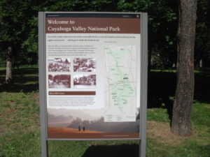
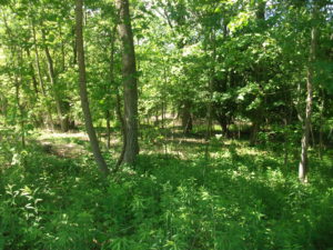
DSCF3156Two weeks ago, I wrote about Cleveland’s Flats Entertainment District, where restaurants and bars now line the sides of the once filthy Cuyahoga River that now hosts boats and rowers. The Flats is but the last reach of a river that extends south into the Akron area. What has often been far less well known to outsiders than the more notorious industrial past of the river is the beautiful, forested valley that surrounds it upstream. In fact, about the time the Cuyahoga River was making environmental history by becoming a driving force behind passage of the Clean Water Act in 1972, U.S. Rep. John Seiberling, an antiwar Democrat from Akron, was leading an effort to designate a new national park. By 1974, he had won authorization for the creation of what is now the Cuyahoga Valley National Park, which remains a hidden treasure for many. I have personally discovered from discussing our trip that many people outside Ohio do not even know that the park exists.

For some interesting background on the politics and commitment behind the drive to create the park, I recommend a book I read several years ago about the life of John Seiberling, A Passion for the Land: John F. Seiberling and the Environmental Movement, by University of Akron emeritus history professor Daniel Nelson.

As for the Cuyahoga Valley National Park: Yosemite or Yellowstone it is not. Ohio, which became a state in 1803 and rapidly urbanized and industrialized afterwards, does not offer such massive public spaces for preservation. But it does contain gorgeous smaller valleys such as the Cuyahoga where protection of the landscape was still possible in the 1970s, and land was assembled from numerous small landowners and public spaces, woven in some cases into the fabric of the existing Metroparks system. In the area that contains the park, certain places seem to take one back in time to the 19th century, when Ohio built a canal to connect the Ohio River and Lake Erie and move agricultural and other products to markets a generation before the railroads began to dominate. Towns such as Peninsula and Boston, in the heart of the upper Cuyahoga Valley, still have the small town feel of that era in many ways, and many older homes have been preserved.

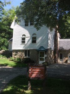
DSCF3157One, in fact, now hosts the Conservancy of the park, along Hines Hill Road just east of Boston, where one finds the visitor center. When we arrived, staffers were erecting a tent for an outdoor wedding that weekend. Curiously, we were also in town for an outdoor wedding for one of my nephews, but his was at Thorn Creek Winery in Aurora, several miles to the northeast. Although we merely stopped to investigate the scenery, and we were totally unexpected arrivals in the Conservancy office, the staff in the office treated us like honored guests, plying us with materials about the park and answering questions. Their friendliness is a tribute to the attitudes and sense of mission of both the Conservancy and the National Park Service itself.

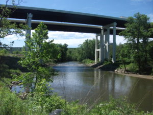
DSCF3164The park itself is a fantastic playground for hikers, bikers, backpackers, and even skiers and sledders. This is the north, after all. Near the Boston Visitor Center is the Boston Mills ski resort, offering some modest hills but great accessibility for people in the metropolitan area. But we arrived in June, and we began to wander the Towpath trail that leads away from the visitor center back into the forest, south beyond the massive bridge that carries Ohio Turnpike travelers past the Cuyahoga River below. From the height of the turnpike, one might never realize that what lies below is a national park, although it is certainly an impressive expanse of forested greenery. Down below, however, we were treated not to nature’s silence but to its music. For one thing, it was cicada season, so the buzz was all about the woods, but so were the birds, some of whom may have been feasting on cicadas. We surely could have seen other wildlife, had we come around dawn or dusk, but we were hiking in the late morning, when the deer and the rabbits and coyotes were well hidden. It is remarkable how easy it is to get away from everything, although the trails are popular enough to keep you in touch with other passing humans. The trails seemed to attract both young and elderly, providing a great excuse to all ages to stay in shape and in touch with nature. I began to wish I had tree and bird guides with me to better understand parts of my experience. If I still lived in the area, I might revisit with those guides, but it may be a while before I return.

DSCF3169Our hiking visit occurred on a Thursday. Jean and I made a return visit on Friday, but of a different nature, and one that accommodated my sister, Carol, who lives nearby in North Royalton. She joined us at the parking lot on Rockside Road in Independence at 9 a.m. for the Cuyahoga Valley Scenic Railroad, a fine way for first-time visitors (and others) to see the park and its valley from a different perspective. The CVSR is a passenger train that uses tracks that largely run along the edge of the river. It is mostly run by volunteers who simply love the job of educating people about the local environment and its history. Audio is available that allows you to hear some of that history along with what one crew member jokingly referred to as “some pretty bad music,” most of it evoking a sense of bluegrass and Civil War and the early frontier with the use of banjos and bass fiddles. Call it “mood music.” The train ride takes about an hour and a half to get to Akron before turning around and bringing you back to where it started. Along the way, there are several stops that allow riders to get off and explore and then wait for the next train coming through. Explorers may want to get the schedule before they wander off. The price is only $15; as senior citizens we got tickets for $13. The money supports the train and is well worth it for the scenery along the way.

Because the park is interwoven among small towns and private property, the park leases some land for sustainable farming of vegetables and sheep, goats, and chickens, with some of the products finding their way to the Countryside Farmers’ Markets. The Conservancy staff also noted for us that there is now a visitor home in the park called Stanford House, built in 1843. It is not a bed and breakfast because visitors are on their own in sharing the use of a kitchen, but rooms can be rented starting at $50 per night, and the home provides immediate access to the Towpath Trail and the railroad, among other attractions.

Ultimately, the Cuyahoga Valley National Park is a study in adaptation, fitting a park into the scenery of a river valley that is also at the center of the large Cleveland-Akron metropolitan area. The park has been evolving since its advent in the 1980s and will continue to evolve as conditions change. But one major contribution it has already made is to stymie the urban sprawl that has so adversely affected much of the Cleveland area and allow residents to enjoy an expanse of refreshing greenery.

One reason it has taken two weeks to return to this blog and tell the story, since we returned to Chicago on June 12, is that I left again on June 19 for Grand Rapids, Michigan, to participate in the 40th annual conference of the Association of State Floodplain Managers, which was founded about the same time the national park was being organized. Today it is a growing organization of more than 17,000 floodplain managers, about 1,000 of whom attended the conference at the DeVos Convention Center, which sits along the Grand River opposite the Gerald R. Ford Presidential Museum, to which it is connected by a stone pedestrian bridge. ASFPM members have always been familiar with nature-based strategies for reducing flood damages and preserving the quality of rivers and streams, and the conference contained numerous discussions of such approaches. It occurred to me that what I had seen in the Cuyahoga Valley was one of the best possible approaches to floodplain management, the prevention of the encroachment of development to allow nature its due, preserving a natural setting that nonetheless endows humans with wonderful opportunities for outdoor recreation and exercise in an age when public health authorities worry about an epidemic of obesity. We have to make our cities attractive places for people to get the exercise they need. Many factors in the Cleveland metropolitan area, frankly, work against that goal, but the park exemplifies it. It is modern floodplain management at its best with a healthy dose of environmental protection in the bargain. The fact that the park is sprinkled with outdoor attractions like the Blossom Music Festival only serves to enhance that goal by acquainting people with what the park has to offer.

John Seiberling was clearly a visionary in fighting for the creation of the park in Congress. But every city has its environmental champions. It is the job of the rest of us to make it politically possible for them to survive and to achieve their objectives. We all benefit from a better quality of life when they do.

As for the title of this blog post: The Cuyahoga River derived its name from the local nomenclature of the Mohawk Indians, an Iroquois nation, who referred to the river as “crooked” because of the way it winds through the landscape, hence “crooked river.” (The Seneca, also Iroquois, used a similar name.) Meandering is nature’s way of diffusing the force of flood waters while distributing silt into the rich agricultural soils along the banks. Ohio grew up on such wealth. Now it is preserving some of it.


Jim Schwab

Keeping It Sharp in the Flats

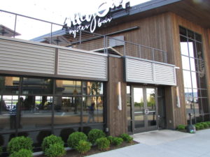
Let’s start with the fact, obvious mostly in retrospect, that I should have printed out a map of the Flats Entertainment District in Cleveland rather than relying on Onstar, the GM dial-in navigation system in our Saturn, for directions. (I could also have used my iPhone for guidance, but I hate looking at such a small screen while driving.) On this one occasion, Onstar stumbled somewhat, but a quick call to Alley Cat Oyster Bar, our choice of location for an anniversary dinner, got us to our destination a mere two blocks away. My point is that the Flats can be mildly confusing if you have not been there before. Onstar told me to go to a traffic circle but failed to detect that another traffic circle preceded the one in front of Alley Cat, but nonetheless insisted “you are near your destination.” Well, sort of.IMG_0258

That said, Onstar has generally served us very well for several years. But in certain anomalous settings like the Flats, it can fall short. The city could also improve its street signage in the area.

The Flats are somewhat anomalous in any event. Here is an area now known for high-end restaurants and entertainment venues along a river that in 1969 caught fire from a train spark and burned. When I was in junior high school in Brecksville, Ohio, in the early 1960s, our class took a field trip on the Goodtime Cruise down the Cuyahoga River and into Lake Erie. One of my classmates asked the tour guide what would happen if someone fell overboard into industrial filth that filled the river. The guide answered rather calmly that the person “would probably get pneumonia and die.” That answer haunted me into my college days, when I emerged as an environmental activist and founded the first student environmental organization at Cleveland State University.

The movement that grew out of shocking events like the burning river helped trigger the creation of the U.S. Environmental Protection Agency and the passage of the Clean Water Act, which in turn steadily advanced cleanup of the Cuyahoga River, among many others. In the meantime, foreign competition hammered the once-dominant steel industry, and other industries either died or evolved. It was a classic Rust Belt story. Over ensuring decades, the Cuyahoga River changed dramatically, and the current version of the Flats grew up where industrial sewers used to reign. It is a long story that has been told many times and deserves to be understood in the current political environment because it shows that this nation can succeed in improving its quality of life and the environment when it musters the political will to do so.

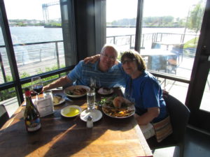
IMG_0256But back to dinner at the Flats. With a sense of history that is not yet lost in Cleveland, I sat in Alley Cat with my wife, watching out the window at the nearby river, this time watching a team of kayakers row up and down, a pleasure boat docked at the Alley Cat and another across the water at Shooters, on a sunny June evening in Cleveland, just two hours before Game 3 of the NBA Finals would take place downtown at Quicken Loans Arena, where the Cleveland Cavaliers were facing off against the Golden State Warriors in a rematch of the 2015 series. The city’s attention was riveted to the fate of its beloved Cavs.

There are today about a dozen restaurants in the general area of the Flats, but I chose Alley Cat based on its online reviews, which had been stellar. My wife, not a Cleveland native (she grew up in Nebraska), left that decision to me. But we both love seafood, which is Alley Cat’s strong suit, so she was happy. I can happily recommend Alley Cat on several counts.

IMG_0253First, the food is excellent. I enjoyed a Faroe Island salmon entrée, which is draped in Vauduvan curry sauce, accompanied by black rice and yellow squash. I enjoyed it all. My wife opted for the less expensive and more predictable fish sandwich (cod), with pickles and fries, but we cross-fertilized each other’s dinner a bit. The spirits list is impressive, although predictably pricey.  The bottom line is that neither of us was disappointed. Jean, generally a Merlot fan, loved the Syrah that I picked out.

But second, and very important, the wait staff was uniformly gracious and friendly. This is a feature of Cleveland more generally that many outsiders do not appreciate until they experience it, but this is a town that has had good reason at times for a chip on its shoulder yet retains a very welcoming, congenial atmosphere. It is fun to interact with people in the Cleveland metropolitan area. They seem to prefer to enjoy life. At times, they almost made me wonder what I was doing in Chicago. Just the night before, we had met over dinner in Shaker Heights with a former co-worker of mine, now working as a planner with the Northeast Ohio Areawide Coordinating Agency, who seemed very happy with his move here from Washington, D.C. As for the staff at the Alley Cat Oyster Bar, they were extremely accommodating with our every request.

IMG_0255The final point deals with the scenery. What was once a stinking, unhealthy cesspool a half-century ago is now a remarkably pleasant setting. Our table was right by a window facing west to the river, where we could watch the rippling water pass by along with the kayakers and other floating transportation, in the shadow of highway bridges high overhead, but with a sidewalk that allows one to experience the marine milieu in a refreshing way. There is outdoor seating, but this day had been rather cool for early summer, so we settled for inside dining.

This all served to remind me that the Flats are at the mouth of the Cuyahoga River. It is a relatively short reach of a river that stretches upstream to Akron along a beautiful valley that is now preserved, for the most part, in the Cuyahoga Valley National Park, the subject of my next blog post.


Jim Schwab

Regional Green Infrastructure

The subtitle to this headline for many people might be: Who Cares? As a term of art, green infrastructure may be popular with landscape architects, civil engineers, and urban planners, among a few other allied professions, but it does not often mean much to the average person. Many people may struggle to define infrastructure even without the word green in front of it.

Infrastructure generally refers to those modern systems, such as roads, bridges, and utility grids that allow our cities and regions to function effectively. Recognizing that the value of infrastructure lies in the services it provides, green infrastructure has been distinguished from traditional gray infrastructure by focusing on the use of natural systems, such as wetlands and urban forests, to protect or enhance environmental quality by filtering air pollution, mitigating stormwater runoff, and reducing flooding. It stands to reason that such natural systems are most likely to provide such “ecosystem services” well when we respect and preserve their natural integrity. It also stands to reason that, to the degree that such systems face threats from urban sprawl and urbanization, their ability to perform those services for human populations is diminished. To say that development has often helped to kill the goose that laid the environmental golden egg is to state the obvious, no matter how many people want to avoid that truth. That does not mean that our cities cannot or should not grow and develop. It does mean that, using the best available natural science, we need to get much smarter about how it happens if we want to live in healthy communities.

Fiscalini Ranch Preserve in Cambria, California.

Fiscalini Ranch Preserve in Cambria, California.

I mention this because, as part of the American Planning Association staff pursuing such issues, I spent three days in Washington, D.C., last week at a symposium we hosted with U.S. Forest Service sponsorship on “Regional Green Infrastructure at the Landscape Scale.” We were joined by about two dozen seasoned experts not only from the Forest Service and APA, but from the U.S. Environmental Protection Agency, several national nonprofits, and others to sort through the issues impeding better planning for green infrastructure. We explored major hazard-related issues such as wildfires, flooding, and coastal storms and how green infrastructure can or should function in relation to them.

This matters because there are huge costs associated with the way we choose to develop. There can also be huge benefits. Whether the ultimate ledger in any particular region is positive or negative is largely dependent on the approach we choose, and that is heavily dependent on how broadly or narrowly we view our responsibilities. Historically, in America, we have been rather myopic about the damage we have done to our environment, but our perspective has become more comprehensive over time, starting with the conservation movement in the late 1800s. But today, as always, there are undercurrents of more myopic attitudes and impatience with the more deliberate and thoughtful calculations a more long-term view requires. There is also the simple fact that understanding issues like climate change requires some degree of scientific literacy, something that is missing too often even in some presidential candidates.

But it helps to drill down to specific situations to get a firm sense of consequences. For instance, the Forest Service budget is literally (and figuratively) being burned away by the steadily and rapidly increasing costs of fighting wildfires. That is in large part because the average annual number of acres burned has essentially tripled since 1990, from under 2 million then to about 6 million now. As recently as 1995, 16 percent of the agency’s budget went to suppressing wildfires. Every dollar spent on wildfires is a dollar removed from more long-term programs like conservation and forest management. By 2015, this figure has risen to 52 percent, and is projected to consume two-thirds of the agency’s budget by 2025. Clearly, something has to give in this situation, and in the present political situation, it is unlikely to be an expansion of the Forest Service budget. At some point, a reckoning with the causes of this problem will have to occur.

What are those causes? Quite simply, one is a huge expansion in the number of homes built in what is known as the wildland-urban interface (WUI), defined as those areas where development is either mixed into, interfaces with, or surrounds forest areas that are vulnerable to wildfire. The problem with this is that every new home in the WUI complicates the firefighters’ task, putting growing numbers of these brave professionals at risk. Every year, a number of them lose their lives trying to protect people and property. In an area without such development, wildfires can do what they have done for millennia prior to human settlement—burn themselves out. Instead, a century of aggressive fire suppression has allowed western forests, in particular, to become denser and thus prone to more intense fires than used to occur. The homes themselves actually represent far greater densities of combustible material than the forest itself; thus fires burning homes are exacerbated by increased fuel loads. In addition, prescribed fire, a technique used to reduce underbrush in order to reduce fire intensity, becomes more difficult in proximity to extensive residential development. A prescribed fire that spun out of control was the cause of the infamous Los Alamos, New Mexico, wildfire in 2000. The entire situation becomes highly problematic without strong political leadership toward solutions.

At the same time, denial of climate change or even reluctance to broach the subject does not help, either. It compounds the difficulty of conducting an informed dialogue at a time when increased heat and drought are likely to fuel even more wildfires of greater intensity. The recent major wildfire around Fort McMurray, Alberta, displacing thousands of people, may be a harbinger of things to come.

That is just one sample of the issues we need to confront through a larger lens on the value of large-scale green infrastructure and regional cooperation to achieve positive environmental results that also affect issues like water quality and downstream flooding. Because we could produce an entire book on this issue—and the suggestion has in fact been made that we do so—I will not even attempt here to lay out the entire thesis. Rather, it may be useful to point readers to some resources that I have found useful in recent weeks in the context of writing for another project on green infrastructure strategies. Most of these are relatively brief reports rather than full-length books, enough to give most readers access to the basics, as well as references to longer works for those so inclined.

On the subject of water and development in private forests, a Forests on the Edge report, Private Forests, Housing Growth, and Water Supply is a good starting point for discussion. Because planning to achieve effective conservation at a landscape scale requires collaboration among numerous partners, an older (2006) Forest Service report, Cooperating Across Boundaries: Partnerships to Conserve Open Space in Rural America, may also be useful. With regard to wildfires, a recent presentation at a White House event by Ray Rasker, executive director of Headwaters Economics, a firm that has specialized in this area, may also be useful for its laser focus on trends and solutions with regard to development in the wildland-urban interface and the need for effective, knowledgeable local planning in areas affected by the problem. But I would be remiss if I did not bring readers’ attention back to a 2005 APA product of which I was co-author with Stuart Meck: Planning for Wildfires. It could probably use some updating by now, but every one of our central points, I believe, remains valid.

Happy reading to all!


Jim Schwab


Symbolic Journey

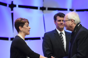
Sylvia Vargas and Ben Carlisle present FAICP medallion and certificate in Phoenix.

Sylvia Vargas and Ben Carlisle present FAICP medallion and certificate in Phoenix. Photo by Joe Szurszewski; copyright by American Planning Association.

Sometimes we find ourselves on a journey whose significance is bigger than the meaning for our own lives alone. In fact, if we are lucky, we come to realize that we can make at least some part of our lives much bigger than ourselves. Two weeks ago, while in Phoenix, being inducted into the College of Fellows of the American Institute of Certified Planners (AICP), one of the highest honors in the profession of urban planning, it became very apparent to me that I was not accepting this honor just for myself. I was also doing it for hundreds of other planners, if not thousands, who have incorporated disaster recovery and hazard mitigation priorities into their careers as essential parts of the ethical duty of planners to help promote public safety. Collectively, our work saves lives, reduces property damage, and reduces many of the negative impacts of human activities on the planetary environment.

Before I go farther in discussing those impacts, let me provide some context for the majority of readers who are not professional planners. AICP is a designation currently held by at least 15,000 professionals who have taken a certification exam, eligibility for which is based on a combination of education and experience. Most common these days as a starting point is a Master’s degree in urban planning, but there are other entry points, and there are undergraduate degrees in planning as well. AICP members, who are also members of the American Planning Association (APA), which has about 38,000 members, must maintain their status through a minimum of 32 hours of continuing education every two years, including 1.5 hours each of legal and ethical training. Only after a minimum of 15 years in AICP are planners eligible for consideration, through a rigorous review of their accomplishments and biography, for acceptance as fellows (FAICP). Only about 500 people have ever been inducted as fellows, including 61 in this year’s biennial ceremony, the largest group to date. I had the honor of being included in the class of 2016.

The very formal ceremony introduces each new fellow individually in alphabetical order while a member of the AICP review committee reads a 100-word summary of his or her achievements, during which the fellow receives a pin, a bemedaled ribbon, and certificate. Mine described my work as “pivotal” in incorporating natural hazards into the routine work of urban planners. That pivotal work is the point of my discussion that follows.

I did not start my work in urban planning with any focus on disasters, except perhaps the industrial variety. I did have an intense focus 30 years ago on environmental planning and wrote about issues like farmland preservation, Superfund, waste disposal, and other aspects of environmental protection. My first two books focused, in order, on the farm credit crisis of the 1980s and the environmental justice movement, the latter published by Sierra Club Books. I have joked in recent years, sometimes in public presentations, that even with that environmental focus in my academic training at the University of Iowa in urban and regional planning, I don’t recall ever hearing the words “flood,” “hazard,” or “disaster” once in all my classes. But I did hear about wetlands, air quality, water quality, and similar concerns. Frankly, in the early 1980s, natural hazards were simply not on the radar screen as a primary professional concern for any but a mere handful of planners. Even the Federal Emergency Management Agency (FEMA) came into being only in 1979, and these issues were seen largely as the purview of emergency managers. There certainly was no significant subdiscipline within planning devoted to hazards.

It was 1992 when Bill Klein, then the research director for APA, asked me to take over project management for an upcoming cooperative agreement with FEMA to examine planning for post-disaster recovery. As a preliminary step to this work, he sent me on a trip to south Florida for the APA Florida Chapter conference in October 1992 in Miami following Hurricane Andrew. Two aspects of that trip made a lasting impression. First was the keynote delivered by Bob Sheets, then the director of the National Hurricane Center. At one point, he showed a slide on the huge screen at the front end of the ballroom. It was an aerial photo of damage on two sides of a highway, with one side showing only modest damage and the other massive damage with roofs torn off and homes destroyed. There was no differential in wind patterns, he said, that could explain such differences at such small distances. The only plausible explanation, he insisted, lay in differences in the quality of enforcement of building codes. Florida then had stricter building codes than the rest of the nation for wind resistance, but they only mattered if code enforcement was consistent. Here, it was clear to me, was a problem directly related to development regulations. The second involved a field trip aboard several buses for interested planners to south Dade County. At one point I saw that the roof of a shopping center had been peeled off by the winds. It nearly took my breath away. Then our buses got caught in a traffic jam at the end of the afternoon. The cause was a long line of trucks hauling storm debris to landfills. This was already two months after Andrew.

Under the agreement, we didn’t start work on the project until October 1, 1993. In the meantime, floods had swept the Upper Midwest, making parts or all of nine states presidential disaster declaration zones. I decided to jump the gun on our start date and visit Iowa while it still was under water. Local planning departments in Iowa City and Des Moines cooperated in showing me their cities and sharing what had happened. It turned out that I was undertaking this project, in which I engaged several veteran planners to help write case studies and other material, at the beginning of America’s first big decade of disasters. (The next was even bigger.) In 1994, the Northridge earthquake struck the Los Angeles area. In 1996, Hurricane Fran struck North Carolina, followed by Hurricane Floyd in 1999. In the meantime, not only had our report, Planning for Post-Disaster Recovery and Reconstruction, been published in 1998, but so was another report of which I was the sole author: Planning and Zoning for Concentrated Animal Feeding Operations. Floyd left much of eastern North Carolina, liberally sprinkled with poultry and hog feedlots as a result of regulatory exemptions, devastated, with hundreds of thousands of animal carcasses floating downstream. Eventually, they were burned in mobile incinerators introduced by the U.S. Environmental Protection Agency. Suddenly, it became apparent to me that the environmental concerns aroused by such operations and the impacts of natural disasters were thoroughly intermingled. Bad public policy was exacerbating the impact of disasters like hurricanes and floods.

At this point, I need to make clear how low the level of engagement was back then between professional planners and disaster issues. In 1995, the APA National Planning Conference, which in recent years has typically attracted about 5,000 registrants, included two sessions related to disasters, at which the total attendance was 73 people. Disasters were anything but the topic du jour. Yet the events of that decade made clear, at least to me, that something had to change in that regard.

What I did not anticipate, based on past experience, was how quickly that would happen. For one thing, the Planning Advisory Service (PAS) Report grew on people and became a classic in the planning field. By 2005, after Hurricane Katrina, APA published a new edition, and FEMA made boxes of them readily available in the Gulf Coast, with planners like Stephen Villavaso, then the president of APA’s Louisiana chapter, voluntarily driving through stricken towns and passing out copies to local officials. In the meantime, I had worked on several other hazard-related projects addressing planning for landslides and wildfires and providing training on local hazard mitigation planning, among other efforts. After the APA conference in New Orleans in 2001, a group formed and continued to meet over dinner at every subsequent conference that billed itself as the “Disaster Planners Dinner,” an event that has become the subject of some legends among its veterans. The growing contingent of planners taking hazards seriously as a focus of their professional responsibilities was growing quickly and steadily.

Hurricane Katrina, more than any other event, added a powerful new element to the public discussion. It made crystal clear to the national news media that planning mattered in relation to disasters, and because of that perception, they called APA. Paul Farmer, then the CEO and executive director, and I shared those calls, and I logged no fewer than 40 major interviews in the two months following the event in late August 2005. I stressed that disasters involve the collision of the built environment with utterly natural events, and the resulting damage is not an “act of God” but the outcome of human decisions on what we build, where we build it, and how we build it. Planners have the responsibility to explain the consequences of those choices to communities and their elected officials during the development process, and those choices sometimes have huge social justice impacts. Katrina cost more than 1,800 lives on the Gulf Coast, most of them involving the poor and the physically disadvantaged. Better planning thus became a moral imperative. Making that perception stick produced a sea change in public understanding of the high stakes involved.

That afforded me considerable leverage to win funding for new projects with FEMA and other entities, most notably including the 2010 publication of Hazard Mitigation: Integrating Best Practices into Planning, a PAS Report that argued strongly for making hazard mitigation an essential element of all aspects of local planning practice, from visioning to comprehensive planning to policy implementation tools like zoning and subdivision regulations. Now the focus of a growing amount of federal and state guidance in this arena, that report was followed in 2014 with a massive update and revision of the post-disaster report, Planning for Post-Disaster Recovery: Next Generation, which dissected the whole process of long-term community recovery from disasters and argued fervently for pre-disaster planning to set the stage for effective recovery and resilience after an event. Those efforts came under the umbrella of the Hazards Planning Center (HPC), created by APA in 2008 along with two other centers as part of the National Centers for Planning. I have been the manager since HPC’s inception, and I was happy. We had succeeded in institutionalizing within the profession what had once been treated as a marginal concern of planners.

Along the way, that dinner group grew, attracting dozens of attendees by the end of the decade, and becoming large enough and attracting enough petition signatures to become APA’s newest membership division in 2015, the Hazard Mitigation and Disaster Recovery Planning Division. They now meet as such during the APA conferences. They are no longer an informal group. They are official and at last count had at least 250 paid members. But the interest is far larger. Remember those numbers from the 1995 APA conference? In Seattle at the 2015 APA conference, almost 3,000 people attended 23 different sessions related to climate change and natural hazards. I was the opening speaker for the very first session in the climate track, and the room was full. There was an overflow crowd in the hall outside. Hazards and climate change adaptation had arrived as a primary concern of planners. A growing number of graduate schools of planning, including the University of Iowa, where I have been adjunct faculty since 2008, now include curricula on such topics.
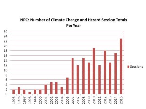
This bar graph and the one below were developed last year for a presentation I did in July 2015 at the opening plenary of the 40th annual Natural Hazards Workshop, in Broomfield, Colorado.
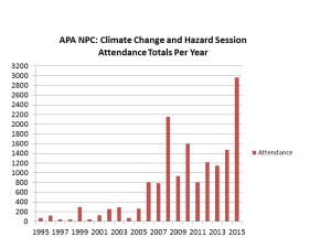
This bar graph and the one below were developed last year for a presentation I did in July 2015 at the opening plenary of the 40th annual Natural Hazards Workshop, in Broomfield, Colorado.

Slide1

I want to state that, although I often had only one intern working with me at APA, I have never been a one-man show. On most of those projects, I involved colleagues outside the APA staff as expert contributors and invited many more to symposia to help define issues. Those APA sessions attract numerous speakers with all sorts of valuable experience and expertise to share. This is a movement, and I have simply been lucky to have the opportunity to drive the train within the APA framework as the head of the Center.
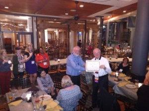
The night after the FAICP induction, at their division reception, members of the new APA division jokingly award me an "F" to go with my AICP. Alongside me is Barry Hokanson, HMDR chairman.

The night after the FAICP induction, at their division reception, members of the new APA division jokingly award me an “F” to go with my AICP. Alongside me is Barry Hokanson, HMDR chairman.

So let me take this story back to that moment two weeks ago when I walked on stage and accepted induction into FAICP. Before, during, and after that event, I received congratulations from many colleagues intensely interested in hazards planning, and I realized I was not simply accepting this honor for myself. My achievement was theirs too, and was literally impossible without them.

“You’ve gone from fringe to mainstream,” my colleague Jason Jordan told me the opening night of the Phoenix conference. He ought to know. Jason is the experienced governmental affairs director for APA and has a keen sense of the trends in planning and of government policy toward planning. But in order for his statement to be true, one important thing had to happen: Lots of other planners had to climb aboard that train for the journey. My success in winning this honor was symbolic for them, in that it served to validate the value of their commitment. I did not get there alone. A growing army of planners who care about public safety and community resilience helped make it happen, and I shall always be grateful—for them as well as for myself.


Jim Schwab


Greening Greater Racine

How often do any of us look around our communities closely enough to fully understand the extent of the greening activity that is taking place? My guess would be that the vast majority of us—and I include myself—have no idea of the sheer volume of hours and effort that is expended, particularly on a volunteer basis, to keep our cities green and healthy.

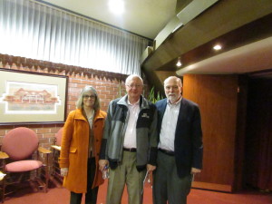
With Sandy and David Rhoads in the lobby of the Golden Rondelle Theater

With Sandy and David Rhoads in the lobby of the Golden Rondelle Theater

I had the opportunity this weekend to get a glimpse of all that effort in a city of about 80,000 just an hour and a half north of Chicago, in Racine, Wisconsin, a lakefront community about 20 miles south of Milwaukee. The gift to me was an invitation from David Rhoads to be the featured guest speaker for an event on Friday evening, March 18, which set the stage for an Eco-Fest the following day at Gateway Technical College. The evening event took place at the SC Johnson Golden Rondelle Theater, a building with a flying saucer appearance on the grounds of the SC Johnson Co. in downtown Racine. I should note that this company has for years sponsored environmental programs in and around Racine and provided backing through its Johnson Foundation for the famous Wingspread conference center, often used for important policy discussions related to environmental and resilience issues.

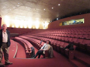
Inside the Golden Rondelle

Inside the Golden Rondelle

My theme was “Green and Healthy: The Future of Cities,” but I did not speak about Racine because, frankly, I did not know nearly enough about it, but also because my mission was to introduce the audience to the wider range of urban forestry and green energy activities around the nation. In the bargain, I discussed the role of hazard mitigation and disaster recovery planning in creating resilient communities that minimize the waste of destruction from natural hazards, concluding with the examples of Joplin, Missouri, which included major reforestation efforts in its recovery from a major 2011 tornado, and Greensburg, Kansas, which engineered a green recovery that has made the town 100 percent reliant on renewable energy. In short, my mission was to paint a holistic impression of what it takes to create green and healthy communities.

But David does know very well what has been happening in Racine, which was one reason he was introducing me that evening. We have known each other for nearly 25 years since he was a professor of New Testament at the Lutheran School of Theology in Chicago, and I was chairing the Environmental Concerns Working Group for the Metro Chicago Synod of the Evangelical Lutheran Church in America. David has always been intensely interested in the theology of creation and environmental stewardship. The Working Group mission became, and remains, financing and enabling energy efficiency and renewable energy retrofits for Lutheran churches in the synod, which covers four counties and roughly 200 congregations. David and his wife, Sandy, also a pastor, have made Racine their home and are actively engaged in environmental activism on the local scene, including faith-based environmental awareness efforts. I was thus more than pleased to honor David’s invitation.

Because the intent of my own presentation was to “set the table,” in David’s words, for discussing the greening of Racine, I was followed by a panel of four local professionals: Julie Kinzleman of the Racine City Health Department, who spoke on healthy beaches and water supply; Nan Calvert, on environmental education centers in the area; Matt Koepnick, on urban forestry; and the Rev. Bill Thompkins, an African-American church leader, on neighborhood beautification. Without detracting from the other three in any way, I must say I was particularly taken by Thompkins’s approach. After stating that his inner-city church had asked the question “you don’t necessarily want to ask,” namely, what would happen if your church were no longer present in the neighborhood, he and his parishioners and neighbors undertook to reclaim a city park that had become a gang battleground and began to distribute and plant thousands of plants and trees. What difference does that make? As Thompkins explained, people are more likely to treasure an attractive neighborhood than a neglected one, and to begin to take responsibility for their local environment. Greening the neighborhood, in effect, was a way of restoring the social health of the people in the neighborhood. That echoed a theme I had introduced earlier, citing our APA work in Planning the Urban Forest, that trees have actual mental health benefits that have been documented in social scientific studies. A city that is green is also a city that is healthy for its people.

But what also struck me was the diversity of the efforts underway, including not one but several environmental education centers in the area, and an ongoing expansion of tree-planting efforts in Racine. David asked me for a one-minute closing observation on the program, and that was the one point I chose to make. Look around. See how much is going on around you that you did not know was happening.

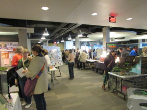
Activity at Eco-Fest Racine, at Gateway Technical College

Activity at Eco-Fest Racine, at Gateway Technical College

The entire program set the stage for a much better attended event the following morning at Gateway Technical College, a school on the lakefront that provides training in environmental technologies. Eco-Fest Racine featured more than 50 displays by groups large and small, activist and educational, including children’s activities, which attracted the immediate interest of my wife, a retired elementary school teacher. Display topics ranged from garbage disposal to recycling to energy audits to urban gardening and forestry to environmental education and advocacy. It included secular groups and Racine Green Congregations, where a woman named Margie informed me ruefully that Wisconsin, under Gov. Scott Walker, an ideological conservative, has been losing its best scientists from agencies like the Department of Natural Resources because of anti-scientific bias from the administration. In the space of just a few hours, neither my wife nor I could absorb all that was offered in this cornucopia of information, but I came to realize one thing: Such events serve a critical purpose in exposing all of us to the breadth of activity that is present in our communities. I do not think Racine is unique, though it is blessed. I think other communities might contemplate the model of this program, the first of its kind in Racine, according to David, as a way of connecting people.  We need to be more aware of the ways in which we support each other so that those at work improving their communities can feel less alone. Networking, after all, is an important form of empowerment.


Jim Schwab

That Burning Smell Out West

IMG_0224Although plenty of other issues have competed for our attention in recent weeks, astute observers of the news, in the U.S. at least, have probably noticed that wildfires have been charring much of the landscape in western states, most notably along the Pacific Coast. Both California and Washington are struggling under the burden of numerous fires triggered or helped along by prolonged drought and a hot summer. While some may jump to the conclusion that this is another harbinger of climate change, and it may well have some connections to climate change, it is important to know there are other historical factors that are even more significant. We have seen them coming but not done nearly enough to forestall the outcome, which may grow worse in coming years.

Ten years ago, in Planning for Wildfires (PAS Report No. 529/530), Stuart Meck and I noted that, in the 2000 census, the five fastest-growing states all had a high propensity for wildfires. Not much has changed. Texas, which suffered significantly from wildfires during its drought in 2011, made the largest numerical gain in the 2010 census, though it was fifth in percentage gain, behind Nevada (35.1), Arizona (24.6), Utah (23.8), and Idaho (21.1). Of course, many of those people move into larger cities like Las Vegas and Phoenix. More to the point, many people continue to move specifically into more rural areas with weaker development restrictions and building codes. As their numbers rise in what fire experts call the wildland-urban interface, the area where the built environment interfaces with fire-prone wildlands, so does human and structural vulnerability to wildfires. Why do people choose to live there? Social scientists, including some who work for the U.S. Forest Service, have been examining this question for at least two decades. We noted that the reasons include a desire for proximity to wildlife, privacy, nature, and the love of a rugged lifestyle.

These desires spawn problems, however, if not accompanied by considerable prudence in both how and where homes are built, as well as in landscape maintenance once a subdivision exists. Firewise Communities, a program of the National Fire Protection Association, has since the late 1990s sought to educate communities and homeowner associations on the realities of life in the wildland-urban interface, including the need for noncombustible roofing materials, eliminating a wildfire pathway to homes and other structures by maintaining a perimeter of “defensible space,” whose radius largely depends on terrain and forest conditions, and other best practices to reduce the impact of wildfires on homes. Still, we live with the legacy of prior development in many areas, and one result is that firefighters are increasingly exposed to lethal risks in trying to protect these homes when wildfire approaches. Every year some lose their lives, 163 over the past 10 years. There is a point where some homeowners must be told that more lives cannot be risked in protecting every remote structure at any cost.

And those costs are rapidly growing. Just 20 years ago, in 1995, the Forest Service spent 16 percent of its annual budget on fire management. That has climbed to 52 percent today, and the trend is ever upward, squeezing a largely static $5 billion budget of funds for other functions. About 90 percent of the firefighting expenses involve protecting houses. It would be a far simpler matter to let some fires burn, or to use prescribed burns to reduce flammable underbrush to prevent or mitigate future fires, if fewer of those houses were in the wildland-urban interface. But part of that fire management expense is for thinning the forest to scale back a problem the Forest Service itself created over the past century, and which modern fire managers have effectively inherited. Put simply, most of the western wildland forest is much denser than it was prior to the 20th century. Not just a little bit denser, but several times denser in many cases. The result is more intensive, longer-burning wildfires in those cases where the Forest Service is unable to suppress the fire at an early stage.

Full-scale suppression, however, is what brought us to this pass. Toward the end of an era Stephen J. Pyne has called the “Great Barbecue” (1870-1920), which saw some of the deadliest wildfires in U.S. history starting with the nearly simultaneous ignitions of Peshtigo, Wisconsin, which killed about 1,500 people, and the Great Chicago Fire, which had more to do with hot weather and conditions in the lumberyards that processed the products of the upper Midwest forests than with Mrs. O’Leary’s cow, the Forest Service secured its role as the nation’s wildland firefighting service. One can learn more about the Peshtigo firestorm in a great book, Firestorm in Peshtigo, by Denise Gess and William Lutz. That era was drifting toward an end in 1910, when the Big Burn killed 78 people and scarred 3 million acres and a pitched effort to fight them put the Forest Service in the limelight and won it this new role. Timothy Egan tells that story in The Big Burn. But the collective works of Pyne, an Arizona State University environmental historian who has specialized in the history of fire, can deliver more depth than you may ever desire and fill in the blanks between those two episodes and beyond into recent times.

What we have learned is that over time, as the policy of all-out suppression of wildfires took hold in the federal government, the smaller fires that historically and naturally had served to thin the forest were no longer allowed to do their job. The gradual result was a denser, thicker forest that, when it did catch fire, produces far more dangerous fires than ever before. When drought and bark beetle infestations begin to kill some of that dense forest, the result is that there is simply far more kindling than would otherwise be there. Yet, as Forest Service Chief Tim Tidwell notes, the Forest Service currently simply does not have the resources to undertake more than a fraction of the forest restoration work needed to achieve healthier, less fire-prone forests. The problem will only grow worse with a warming climate, of course, but did not arise primarily because of it, but because of past firefighting practices and a more recent history of development in wildland areas. But climate change can be counted on to produce increasing average temperatures that will vary depending on location, but possibly 4 to 6 degrees Fahrenheit by 2100. California’s Cal-Adapt has been tracking these changes and producing a stream of research and temperature maps that provide significant perspective on the extent of the problem we face moving into the future. It’s a sobering picture we would all do well to consider.


Jim Schwab

Financing Environmental Infrastructure

DSC00626For a number of years, the American Society of Civil Engineers has been issuing an annual report card on the condition of the nation’s infrastructure. Generally speaking, those grades have not been good: In 2013, the nation’s grade point average was a D+. It is not my intent in this short post to review all the deficiencies that ASCE describes, although I will note that part of the problem is a penny-wise, pound-foolish national politics that is so concerned about lowering taxes that it has lost sight of the value of investing wisely in the nation’s future. National, state, and local economic development all depend crucially on well-functioning infrastructure. The fear of raising taxes to pay for important infrastructure repair is short-sighted and ultimately unpatriotic.

Essential pieces of the national infrastructure are and should be environmentally related: water and wastewater treatment plants, sewer and water delivery pipes, green infrastructure that helps to mitigate stormwater runoff, and so on. Much of that environmental infrastructure also serves to mitigate natural hazards and thus reduce damages from major storms and other disasters. Regions affected by prolonged drought have learned the hard way, in many cases, that water-conserving infrastructure is critical to drought resilience.

How do we find new ways to pay for all this? The real point of this short blog post is simply to link the reader to a video interview by me with Dr. Jack Kartez, a long-time professor of urban planning at the University of Southern Maine. Dr. Kartez also serves as director of the U.S. Environmental Protection Agency’s Region 1 Environmental Finance Center, which is hosted at the university but serves all of New England. This is the second of two interviews we conducted during the July 20-22 Natural Hazards Workshop in Broomfield, Colorado, this summer under the auspices of the American Planning Association’s Hazards Planning Center. I think he offers some valuable insights into solving some of our problems in this arena.


Jim Schwab