Riverwalk: A New Chicago Magnet

DSCF3110IMG_0239

Chicago is already quite rich in parks and tourist attractions. What can it add downtown?

In the past, I have written about the 606 Trail in Chicago, which is experiencing its first anniversary after opening a year ago. Despite some of its well-known challenges and problems, Chicago remains a city of quality destinations. Navy Pier, now a century old, just unveiled its redesign last month, including a new 200-foot Ferris wheel, and has been the top tourist attraction in Illinois. Millennium Park has few peers among downtown urban parks and has also been a second magnet for visitors since opening in 2004, ranking only behind Navy Pier.

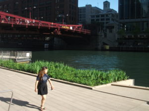
But below the bridges and viaducts, down near the water’s edge, another jewel is nearing completion along the Chicago River—the Riverwalk. On June 2, I joined a tour sponsored by both the American Planning Association Illinois Chapter and the American Society of Landscape Architects Illinois Chapter and listened to an explanation of both completed and upcoming changes.

Chicago has no shortage of websites and museums devoted to its own urban history, which I won’t even try to summarize here. Suffice it to say that, when Haitian-French explorer-trader Jean Baptiste du Sable first encountered Potawatomi Indians (one of whom he married) at the shore of Lake Michigan in 1790, the Chicago River was still an indolent waterway barely crossing the sandbars to empty into the lake. In a little over 200 years, it has become home to one of the world’s largest cities, with all the pollution and navigation over two centuries that one might expect. In the 1890s, amid the city’s rapid industrial expansion, engineering reversed its flow away from the lake to the Mississippi River watershed, in large part to spare Chicagoans the pollution of their beaches and water supply that came with using the river as an open sewer. The river itself was not a place where you wanted to spend time unless you were in a boat, and even that was questionable. More than 800 picnickers died when the Eastland tipped over at the water’s edge in 1915. At street level on Wacker Drive, a plaque memorializes that notorious incident.

But times change, and in the 21st century, the Chicago River is once again a civic asset to which significant attention—and investment—are being paid. Over the last ten years, the first two phases of a rebuilding project have come to fruition, producing a Riverwalk that now extends on the south side of the main branch from Michigan Avenue west to LaSalle St. A third phase will extend the Riverwalk further west to the juncture of the North and South Branches. Even the term “main branch” may seem a little puzzling to non-natives because it extends only about one mile. Most of the length of the Chicago River is in the two branches, but the whole river in either direction is less than 20 miles. The Lake Michigan watershed in this instance barely reaches beyond the city and rises only about 20 feet above the lakeshore. Beyond that, you are in one of the sub-watersheds of the vast Mississippi River valley. Most people would never notice they had crossed this boundary if a sign did not tell them. The Continental Divide, this is not.

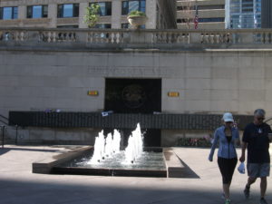
However, the controlled nature of the river and the short reach of the main branch make the creation of a downtown Riverwalk far more manageable and the experience of walking it thoroughly enjoyable. The firms of Jacobs/Ryan Associates, Sasaki Associates (with whom I have collaborated on disaster recovery issues), and Ross Barney Architects, involved in the design and engineering, have produced an experience that unfolds in “rooms” as one moves in either direction along the river, bringing users close to the water while allowing the occasional flood to muddy some steps without much damage beyond washing down the mud the next day. Phase 1redesigned and rebuilt an existing path between Michigan Avenue and the lake, an area popular with tourists as a loading zone below the stairs from Michigan Avenue down to the riverfront for tour boats. It then extended that two blocks westward to State DSCF3126Street and includes the Chicago Veterans’ Memorial Plaza, opened in 2006. One of its nice touches is a series of concrete stairs more suitable for lunch or relaxation than for climbing. It is a dignified but welcoming setting in keeping with its purpose. In Phase I, the idea began to emerge of adding river-level sidewalks that allow visitors to move from block to block without going up to street level and back down again, although some of these obviously had to intrude from the existing river’s edge into the waterway, and thus involved some negotiation among agencies responsible for navigation and safety, given the mix of water traffic still traversing the Chicago River. Congress also had to act to provide permission to allow building 25 feet into the river to create the necessary width for the new Riverwalk.
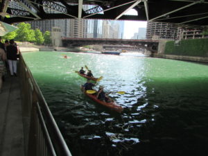
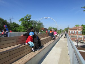
IMG_0242What has emerged in Phase II is the creation of the rooms: Marina, Cove, and River Theater, extending from State Street west. The first is opposite Marina City, occasionally nicknamed the “Corncob Towers” because of their design, and permits docking by river boats and lounging by pedestrians. The Cove, in contrast, is a favorite stopping point for kayaks and canoes, which provide a rich source of aquatic exercise for sports enthusiasts. The River Theater changes the nature of the experience yet again with the appearance of a riverside amphitheater, using a low-slope path woven into climbing stairs that can also double as points of relaxation for hikers. The theater, for the most part, is the activity on the river itself, although one can imagine a waterborne performance someday floating before the viewers. Most of this opened for public use just a year ago.

Phase III is adding a water plaza at the river’s edge; the Jetty, which places a series of floating gardens along the river edge that allow people to learn about river ecology and native plants, and the Boardwalk, providing an accessible walkway connecting to Lake Street. Although currently inaccessible at river level, one can view the construction on the final phase from street level. We were told the project will be completed by this fall.
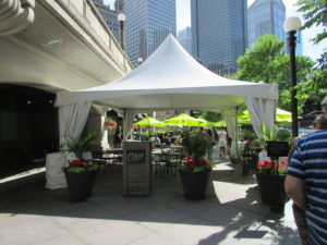
O'Brien's is one of the existing restaurants, along with City Winery, that provide refreshment along the route.

O’Brien’s is one of the existing restaurants, along with City Winery, that provide refreshment along the route.

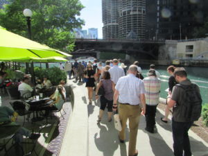
It is one thing to traverse this path with a crowd from a mobile workshop in the late afternoon. Not only does a crowd make a difference, so does timing. I returned the following morning, since my CTA Blue Line commute takes me to the Clark & Lake station. Instead of remaining on Lake Street, I walked to Wacker Drive and descended the stairway again, this time walking in the cool of the morning by myself at 8 a.m. Not that I was alone. The path was already being filled with pedestrians like me, and joggers, and even an occasional bicyclist, so I had to pay attention to those around me as I repeatedly set my camera to shoot many of the photos included here. Heat varies, of course, throughout the summer day, but one pleasant, enduring feature is the cool breeze off the water. In the morning, as well, the restaurants are not yet open, making for a slightly more solitary experience, which even a confirmed extrovert like me can enjoy in contrast to the crowds that by late afternoon are now finding their way to the

The collection of bars and restaurants on the Riverwalk is still growing.

The collection of bars and restaurants on the Riverwalk is still growing.

new bars and restaurants that are now exploiting the popularity of the Riverwalk, as intended, with more coming as the project moves along. The opportunity to sit outdoors at river level and enjoy snacks or dinner and drinks can be very pleasant, and very different from the usual experience high above on the city streets. I expect that most of these establishments will do quite well. I intend to enjoy some of them myself, with friends in tow.

Jim Schwab

Cubs Win! Holy Cow!

Okay, all you 8,000 blog readers out there, listen up. I deal with a lot of serious subjects on this blog, but I also like to have fun. And I’m also a big baseball fan. In Chicago. Right now that combination adds up to something slightly dangerous, as Chicago fans are entering uncharted waters.

They may well have a winner in the Chicago Cubs, who last won the World Series in 1908. At the risk of my nonexistent reputation for sports prognostication, I say they are going all the way.

There are times in the affairs of men and women when all the stars line up, and the omens all point in one direction. Consider the following:

  • The Cubs, who had a mediocre first half of the season, came roaring out of their obscurity after the All-Star game to secure a wild card spot, just three games behind the St. Louis Cardinals, the team with the best record in Major League Baseball this year.
  • They did this in large part with the help of a pitcher who was not even in the All Star game, Jake Arrieta, who was 11-1 after the break with a 0.75 ERA. I mean, who does that?
  • They used Arrieta in the one-game wild card playoff against the Pittsburgh Pirates in Pittsburgh, where he iced the team that was just two games behind the Cardinals in the National League Central Division with a four-hit shutout. The Cubs then moved on to St. Louis.
  • The Cubs lost game one in St. Louis, roared back to take game two, then finished off the Cardinals in two games in Wrigley Field, the first time in a century they have clinched a playoff series in their own stadium.
  • Despite the fact that Jake Arrieta finally had an off night, his first since July, his teammates picked up the slack and hit six home runs to carry him to an 8-6 victory. Those home runs broke an MLB record for the most by any team in a playoff game. Ever. Granted, it was a windy night on the lakefront, but it was just as windy for St. Louis.
  • And then—and then . . . . this is the topper, the one clue that marks a team of destiny. Late in game four, with the Cubs already ahead but happy to take out some insurance, Kyle Schwarber swatted a four-bagger that appeared to top the towering Budweiser sign in right field. But what happened to the ball? No one saw it land on Sheffield Avenue behind the stadium. No one claimed to have caught it. But photos revealed a ball sitting on the platform supporting the sign, and a Cubs worker indeed found it there, with the distinctive markings of a postseason ball.

Indeed, the Schwarbomb, as it is now known, a 419-foot monster launch, managed to fall onto the platform and stay there. The Cubs have encased it in a glass box to protect it from the elements and plan to leave it there until the playoffs are over. Think of it as a potent of good luck. Our time has come.

Now, I am going to upset half of Chicago with my unorthodoxy. I can root for the White Sox or the Cubs, and as the White Sox are not in the playoffs—in fact, they had a very mediocre season—I am perfectly happy to cheer on the Cubs. They are the best thing happening in Chicago, at the very time when the former Chicago Public Schools CEO has pleaded guilty in a bribery case for steering a no-bid contract.

You see, I grew up in Cleveland, where we had to suffer with the long-suffering Cleveland Indians, stuck with a name and logo that still brings discomfort to many Native Americans, a team that took a 41-year break in World Series appearances after 1954, when the winningest team in Major League history lost four straight to the New York Giants, who included in their ranks one Willy Mays, who made what is perhaps the most famous catch in Major League history of a Vic Wertz would-be home run ball. Events sometimes foretell destiny. Mays produced one in 1954; Schwarber may well have produced one in 2015.

Coming to a city with two teams, I failed to do what native Chicagoans do between the Cubs and White Sox: pick sides. Instead, I thought, double the chances, double the fun, what a blessing to have two teams in contention. Until I found out that, most years, neither one was in contention. And then there was that foul ball caught by fan Steve Bartman in the 2003 playoffs. He was blamed for the Cubs’ collapse, but really, a team so easily rattled did not deserve to move on. The 2015 Cubs are poised, not rattled, confident, not jittery. They are going to win.

Besides, I am a fan who never had any dreams of being on that field myself. As a child in Little League, I had about a .100 batting average after getting glasses for myopia and astigmatism. I didn’t learn how to compensate for all that until I was an adult and occasionally played intramural softball. One night, laying into a pitch that was just too good to be true, I drove one deep into left field, so far that I was crossing home plate before the other team got the ball back into the infield.

Damn, it felt good. Ever since, I have understood what it feels like to really park one. Even if mine came from an amateur against other amateurs. And I know when a really big home run is an omen of things to come.

And if my sixth sense about the Cubs turns out to be in error? I can always go back to writing about urban planning and disaster recovery. Lord knows, the Cubs have provided some lessons on the latter topic over the years. But not this year. They’re taking the World Series.


Jim Schwab

Chicago’s 606: Transformation of an Urban Space

IMG_0037

More than a century ago, the City of Chicago settled a neighborhood dispute by forcing the elevation of a railroad bed for a 2.7-mile spur line that served a variety of small factories on its North Side that provided jobs for a string of neighborhoods in or near Bloomingdale Avenue. The Burlington Northern Railroad had first built the line in the 1870s, but by 1910 it was on a collision course with the surrounding residential areas as auto and pedestrian traffic met freight cars at street grade. Within a few years, the rail cars were running about 16 feet above street level, with 37 viaducts providing overpasses above uninterrupted street traffic below. By the end of the century, however, many of the factories were gone, or were converted to condominiums, and trucks served whatever shipping needs remained. The rail spur had become an anachronism, and eventually the right-of-way reverted to the city.

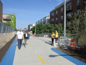
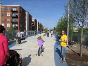
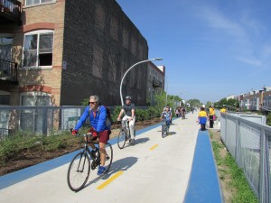
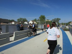
Dog walkers, children on tricycles and in strollers, all along the length of the Trail. Volunteers in yellow shirts were plentiful along the route.

Dog walkers, children on tricycles and in strollers, all along the length of the Trail. Volunteers in yellow shirts were plentiful along the route.

During that time, a vision developed of a different kind of urban space, a linear park that would become the nation’s second elevated rail-trail, following the High Line in Manhattan. Funded largely with federal transportation enhancement funds,

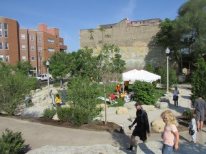
Winding, ADA-compliant access ramps connect pocket parks, such as Park 567 here, to the trail above.

Winding, ADA-compliant access ramps connect pocket parks, such as Park 567 here, to the trail above.

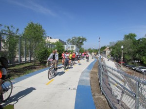
supplemented by some city money and millions in local fundraising, the Bloomingdale Trail moved from dream to concept to an actual plan by 2013, and finally, on Saturday, June 6, a reality as the trail opened, complete with 17 access ramps and Mayor Rahm Emanuel surveying its length as the leader of a small bicycle troupe accompanied by a handful of police. Thousands of Chicagoans moved onto the trail, on foot, on bicycles and tricycles, and in strollers, taking in the newest amenity in town amid street celebrations and music on Humboldt Avenue and with children’s activities in pocket parks along the way. A host of volunteers in yellow shirts welcomed the visitors and directed them to the day’s festivities. Residents had waited a long time for this day. They finally realized the imaginative transformation of an urban space that long had seemed neglected. The 606 Project, originally known as the Bloomingdale Trail, became a new source of healthy recreation.

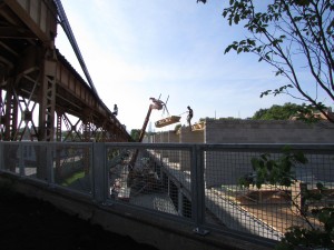
New construction is a common site along the trail. This site is near Milwaukee Avenue and parallel to the CTA Blue Line, which crosses the trail.

New construction is a common site along the trail. This site is near Milwaukee Avenue and parallel to the CTA Blue Line, which crosses the trail.

And, for some, an abiding fear of displacement. That was almost surely to be expected. Development of the trail followed the 2008 recession, with its sudden decline in housing prices, followed by a more recent uptick. For Chicago, that uptick has been nearly citywide, but there are disparities, and it has been noted repeatedly that the trail links disparate neighborhoods. To the east, starting around Ashland Avenue, neighborhoods within a mile of the trail were gentrified at least a decade ago. As one approaches the western terminus, at Ridgeway, household incomes and property values have been remarkably lower, and the percentage of renters much higher. Renters, of course, have much less control over rising housing costs than homeowners, on two counts—one, that rents can go up, but two, that affordable rental units can be torn down or rehabbed and converted into more expensive units, resulting in potential displacement in favor of newcomers with more income.

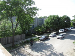
A view of my own street, North Campbell Avenue, from the trail crossing above.

A view of my own street, North Campbell Avenue, from the trail crossing above.

The trail is almost certainly accelerating those trends, but as a resident of eastern Humboldt Park since building a new home on an infill lot in 1994, at a location about one-third of the way from the eastern end, I can attest that it is not the sole source of such gentrification, which was already well underway to the east, in Wicker Park and Bucktown, even then, when the mere idea of the trail was barely a glimmer in the minds of the biggest visionaries in town. It has inexorably marched west. The question is not the direction in which trends are moving, but the pace.

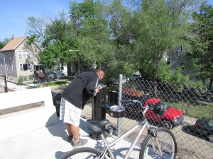
No need to leave the trail if you're thirsty. Water fountains appear at decent intervals.

No need to leave the trail if you’re thirsty. Water fountains appear at decent intervals.

The question is also not whether residents of the area want such an amenity. Now that the 606 Trail and Park is open, it is unquestionably a beautiful space that offers great recreational and physical activity value to a substantial chunk of Chicago. Nearly 100,000 Chicagoans are within walking distance of the trail, depending on how you calculate that distance. (Speaking for myself, one mile is no big deal, but for others it could be insurmountable, depending on age and physical condition.) The views from the trail are stupendous and varied. What is at issue for those concerned about being priced out is whether working and low-income people of modest income and resources can enjoy the park they have so long awaited. It is a volatile equity issue the city needs to address.

IMG_0079

In any event, there was always the opposite question: What if we did not develop such a trail? The abandoned rail line, left unattended, would eventually become a serious liability for the city, yet the cost of tearing it down, ending up with nothing, might well have been comparable to the $95 million ultimately invested in creating something, something noteworthy and positive.  Doing nothing with this obsolete space was never a viable option. It would have become an eyesore or worse.

IMG_0089One issue that a few have feared almost certainly will not come to pass: increased crime and vandalism. On opening day, despite teeming crowds, some running, some walking, some cycling, and some with dogs and baby strollers, along the entire length as I rode my own bicycle, stopped, shot photographs, and talked with volunteers, I saw absolutely no accidents and no incidents. People on wheels respected the pace and space of those around them. The trail seemed to bring out the best in everyone; Jane Jacobs’s long-ago observation about the value of “eyes on the street” never seemed so true. People with homes adjoining the trail seemed to enjoy the presence of the passersby, some sitting on decks and in backyards waving at trail users, including the occasional marching band participating in the celebration.

IMG_0094

There will be time to engage in more deliberative debate about the impacts of the 606. For today, on this blog at least, I prefer to take time to offer a visual celebration by sharing some of more than 130 photos I shot that opening morning. Enjoy the views.


Want to just watch the traffic go by? Sit on a bench.

Want to just watch the traffic go by? Sit on a bench.

Jim Schwab


Or watch the street fair below on Humboldt Avenue on opening day, June 6.

Or watch the street fair below on Humboldt Avenue on opening day, June 6.