Climate Resilience on the High Plains

For those who think only in terms of the politics of red and blue states, the conference I attended March 30-31 in Lincoln, Nebraska, may seem like a paradox, if not an oxymoron. It is neither. It is a matter of looking beyond labels to facts and common sense, and ultimately toward solutions to shared problems. The problem with climate change is that the subject has been politicized into federal policy paralysis. But the scope for local and even state action is wider than it seems.

The University of Nebraska-Lincoln (UNL) Public Policy Center with support from the High Plains Regional Climate Center (HPRCC) sponsored the conference on “Utilizing Climate Science to Inform Local Planning and Enhance Resilience.” I spoke first on the opening panel. The sponsors have been working with communities across Iowa, Missouri, Kansas, and Nebraska. Planners, floodplain managers, and civil engineers from eleven municipalities in those states participated, along with UNL staff, climatologists, the Nebraska emergency manager, and myself.

My job was to provide a national perspective on the subject from a national professional organization, representing the Hazards Planning Center at the American Planning Association. I talked about two projects we are conducting with funding from the National Oceanic and Atmospheric Administration: “Building Coastal Resilience through Capital Improvements Planning” and “Incorporating Local Climate Science to Help Communities Plan for Climate Extremes.” I made light of the fact that there was not a single coastal community among the four states of the region, but I added that the lessons from the first project are still relevant because every community plans for capital improvements, which generally constitute the biggest investments they make in their future. Capital improvements cover long-term expenditures for transportation and waste and wastewater infrastructure as well as other facilities potentially affected by climate change. In the Midwest and High Plains, instead of sea level rise, communities are watching a rise in the number and severity of extreme events on both ends of the precipitation curve—in other words, both prolonged drought and more intense rainfall. Drought taxes water supply while heavy rainstorms tax local capacity to manage stormwater. Both may require costly improvements to address vulnerabilities.

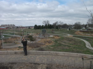
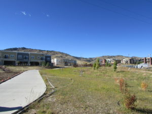
This park is part of the new urban amenity created for Lincoln residents.

I simply set the stage, however, for an increasingly deep dive over two days into the realities facing the communities represented at the workshop. Such input was an essential point of the conference. Different professionals speak differently about the problem; if planners or local elected officials are to interpret climate data in a way that makes sense politically and makes for better local policy, it is important for, say, climate scientists to understand how their data are being understood. There must also be effective information conduits to the general public, which is often confused by overly technical presentations. Moreover, what matters most is not the same for every group of listeners.

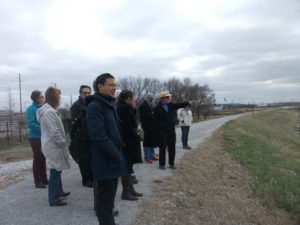
Glenn Johnson explains some of the planning of Antelope Valley.

Some of the challenges, as well as the successes, were clear from presentations by two speakers who followed me to talk about the situation in Lincoln. Glenn Johnson is retired from the Lower South Platte Natural Resources District. Steve Owen is with the city’s Public Works and Utilities Department and spoke about the challenges related to water supply and quality, as well as flooding. At the end of the conference, we spent three hours touring Lincoln’s Antelope Valley project, an interesting combination of using a weir (small dam) and landscaping tools to create adequate water storage to reduce flooding in the downtown area. This had the interesting impact of removing some land from the floodplain and sparking redevelopment in what are now some of Lincoln’s most up-and-coming neighborhoods. At the same time, the project through creative urban

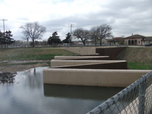
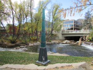
Now you know what a weir looks like (if you didn’t already). Photo courtesy of UNL.

design has allowed the city to create new urban park space and trails that enhance the urban experience for residents. Responding to climate and flooding challenges need not subtract from a city’s overall prospects; it can help enhance its attractiveness to both citizens and developers. The result is that good planning has helped make Lincoln a more interesting city than it might otherwise have been. That is a message worth considering amid all the political hubbub over climate change. We can create opportunity, but we must also embrace the reality. My guess is that this is why the other ten cities were present.

Jim Schwab

Make Community Planning Great Again

The American Planning Association (APA), the organization that employs me as the manager of its Hazards Planning Center, made me proud last week. It took a rare step: It announced its opposition to President Donald Trump’s 2018 budget proposal.

It is not that APA has never taken a position on a budgetary issue before, or never DSC00244spoken for or against new or existing programs or regulatory regimes. In representing nearly 37,000 members of the planning community in the United States, most of whom work as professional planners in local or regional government, APA has a responsibility to promote the best ways in which planning can help create healthy, prosperous, more resilient communities and has long done so. It’s just that seldom has a new administration in the White House produced a budget document that so obviously undercuts that mission. APA would be doing a serious disservice to its members by not speaking up on behalf of their core values, which aim at creating a high quality of life in communities of lasting value. That quest leads APA to embrace diversity, educational quality, environmental protection, and economic opportunity. Making all that happen, of course, is a very complex task and the reason that young planners are now largely emerging from graduate programs with complex skill sets that include the use of geographic information systems, demographic and statistical knowledge, public finance, and, increasingly, awareness of the environmental and hazard reduction needs of the communities they will serve. They understand what their communities need and what makes them prosper.

The Fiscal Year 2018 White House budget proposal, somewhat ironically titled America First: A Budget Blueprint to Make America Great Again, is in essential ways very short-sighted about just what will sustain America’s communities and make them great. Making America great seems in this document to center on a military buildup and resources to pursue illegal immigrants while eliminating resources for planning and community development. The proposal would eliminate funding for the U.S. Department of Housing and Urban Development’s Community Development Block Grant program, the HOME Investment Partnerships program, and the Choice Neighborhoods Initiative. It also eliminates the Low-Income Heating Energy Assistance Program, which was created under President Ronald Reagan, as well as the Department of Energy’s weatherization assistance program.

It also eliminates the Appalachian Regional Commission, which supports job training in the very areas where Trump irresponsibly promised to restore mining jobs. There is no doubt that hard-hit areas like West Virginia and eastern Kentucky are in serious need of economic development support. Trump’s promise, however, was hollow and reflected a lack of study of the real issues because environmental regulation, which the budget proposal also targets, is not the primary reason for the loss of mining jobs. The mines of a century ago were dangerous places supported by heavy manual labor, but automation reduced many of those jobs long before environmental protection became a factor. Competition from cheap natural gas, a byproduct of the hydraulic fracturing (or fracking) revolution in that industry, has further weakened the coal industry.

No rollback of clean air or climate programs will change all that. What is clearly needed is a shift in the focus of education and job training programs, and in the focus of economic development, to move the entire region in new directions. To come to terms with the complexity of the region’s socioeconomic challenges, I would suggest that the President read J.D. Vance’s Hillbilly Elegy, which deals compassionately but firmly with the deterioration of the social fabric in Appalachian communities. If anything, it will take a beefed up Appalachian Regional Commission and similar efforts to help turn things around for these folks who placed so much faith in Trump’s largely empty promises.

The March 9 issue of USA Today carried a poignant example of the realities that must be faced in producing economic opportunity in the region. The headline story, “West Virginia Won’t Forget,” highlights the problem of uncompleted highways in an area where a lack of modern transportation access impedes growth, focusing specifically on McDowell County, one of the nation’s most impoverished areas. It is hard for outsiders to grasp the realities. In the Midwest, if one route is closed, there are often parallel routes crossing largely flat or rolling land that maintain access between communities. In much of West Virginia, narrow mountain passes pose serious obstacles when roads no longer meet modern needs. It is the difference between the life and death of struggling communities, with those left behind often mired in desperate poverty. When I see a budget and programs from any White House that address these questions, I will know that someone wants to make Appalachia great again.

I say that in the context of a much larger question that also seems to drive much of the Trump budget. You must read the budget blueprint in its entirety, with an eye to questions of community and coastal resilience and climate change, to absorb fully the fact that the Trump administration is at war with any efforts to recognize the realities of climate change or facilitate climate change adaptation. The proposal zeroes out the National Oceanic and Atmospheric Administration’s coastal mapping and resilience grant programs. I will grant in full disclosure that APA, in partnership with the Association of State Floodplain Managers, is the recipient of a Regional Coastal Resilience Grant. For good reason: Our three-year project works with pilot communities in Georgia and Ohio to test and implement means of incorporating the best climate science into planning for local capital improvements. Communities invest billions of dollars yearly in transportation and environmental infrastructure and related improvements, and in coastal areas, ensuring that those investments account for resilience in the face of future climate conditions will save far more money for this nation than the $705,00 investment (plus a 50% match from ASFPM and APA) that NOAA is making in the project. The problem is that you have to respect the voluminous climatological science that has demonstrated that the climate is changing and that a serious long-term problem exists. And it is not just the focus of our singular project that matters. Today’s Chicago Tribune contains an Associated Press article about the race by scientists to halt the death of coral reefs due to ocean warming. The article notes that the world has lost half of its coral reefs in the last 30 years and that those reefs produce some of the oxygen we breathe.

The damage on climate change, however, does not stop with the NOAA budget. The Trump budget also zeroes out U.S. contributions to international programs to address climate change and undermines existing U.S. commitments to international climate agreements.

There is also a failure to take seriously the role of the U.S. Environmental Protection Agency, which would suffer a 31% budget reduction and the loss of 3,200 jobs. Among the programs to be axed is the Great Lakes Restoration Initiative, ostensibly on grounds that, like the Chesapeake Bay programs, it is a regional and not a national priority and therefore undeserving of federal support. That ignores the fact that four of the five lakes are international waters shared with Canada. It also ignores the history of the agency and its 1970 creation under President Richard Nixon, largely as a result of the serious water pollution problems experienced at the time.

IMG_0256Younger readers may not even be aware of some of this. But I grew up before the EPA existed; I was a college student environmental activist when this came about. When I was in junior high school several years earlier, our class took a field trip aboard the Good Time cruise, which escorted people down the Cuyahoga River to the shores of Lake Erie in Cleveland. The river was such an unspeakable industrial cesspool that one classmate asked the tour guide what would happen if someone fell overboard into the river. Matter-of-factly, the guide responded, “They would probably get pneumonia and die.” We have come a long way, and for those of us who understand what a difference the EPA has made, there is no turning back. I am sure that White House staffers would say that is not the point, but to me it is.

I am sure that, as with other agencies, one can find duplicative programs to eliminate, and ways to tweak the budget for greater efficiencies. That should be a goal of any administration. But in the broad sweep of the damage this budget proposes, I find it impossible to discern that motive in the butcher cuts the White House embraces. It is time to contact your Senators and U.S. Representatives. Ultimately, the budget is up to Congress, which must decide whether the new priorities make sense. My personal opinion is that they are short-sighted and ill-informed.


Jim Schwab

Natural Solutions for Natural Hazards

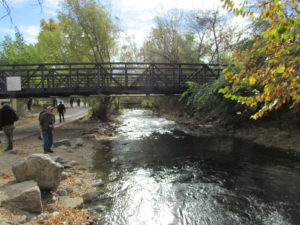
Boulder Creek, Boulder, Colorado

Boulder Creek, Boulder, Colorado

It has taken a long while in our modern society for the notion to take hold that some of the best solutions to reduce the impact of natural hazards can be found in nature itself. Perhaps it is the high cost of continuing to use highly engineered solutions to protect development that has often been sited unwisely in the first place that has finally gotten our attention. Particularly after Hurricane Sandy, however, the notion of using green infrastructure as part of the hazard mitigation strategy for post-disaster recovery began to gain traction; green infrastructure was highlighted in the federal Hurricane Sandy Rebuilding Strategy. These approaches are also known as natural or nature-based designs. They involve understanding the role natural systems play in reducing damages and in using that knowledge to deploy such solutions as part of an intelligent game plan for improving community resilience.

But where should community planners and local officials get reliable information on the best and most proven strategies for implementing green infrastructure solutions?

About a year and a half ago, researchers from The Nature Conservancy (TNC) approached me about involving the American Planning Association (APA) Hazards Planning Center in a project they were undertaking with support from the Kresge Foundation to prepare such information in the form of a green infrastructure siting guide. In the end, they also involved the Association of State Floodplain Managers (ASFPM), the National Association of Counties (NACo), the American Society of Civil Engineers, and the Boston-based design firm Sasaki Associates to assist with this effort. Over the past year or more, we have all met regularly to discuss what needed to be done and our progress in making it happen. We produced case studies, strategy briefs, and other material to populate the project’s web-based resources.

Bioswale in a subdivision development in Boulder County, Colorado.

Bioswale in a subdivision development in Boulder County, Colorado.

Last month, after all that teamwork, TNC unveiled its new website for the project, called Naturally Resilient Communities. For those interested in knowing how trees, living shorelines, dunes, coastal marshes, and oyster reefs, among other types of natural infrastructure, can help mitigate natural hazards like coastal storms and urban flooding, the website provides a serious and interactive introduction to the subject matter, backed up by numerous resources.

What is especially valuable about the website design is that it allows users multiple avenues into the specific types of information they need. Not all natural infrastructure solutions are born equal. Some are more appropriate in certain settings than others. Some work best in inland river valleys, some along coastlines, and others in mountains or high plains. Some coastal solutions work well in the rocky coastlines of California or Oregon, while others work better along Atlantic or Gulf Coast shorelines. Applying such solutions is largely a matter of learning what works best in a specific natural environment in the face of specific hazards—riverine flooding, hurricanes, thunderstorms, or other threats that communities face. It is critical to adapt the solution to the problem.

Accordingly, the website, largely the work of Sasaki Associates with vetting from the other project partners, allows users to approach the information by deciding which strategies they wish to investigate or which part of the United States is relevant. They can also look at considerations such as cost, the geographic scale of the solution (neighborhood, municipal, regional), and the type of community in question. These are precisely the frames of reference familiar to most urban planners and civil engineers who are most likely to be involved in implementing natural infrastructure projects. The emphasis throughout is on the practical, not the ideal or the ideological. A particular approach either works or does not work, but it does so in very specific settings, such as a neighborhood in a city along one of the Great Lakes or in the Southwestern desert. Context is the central question.

This memorial to Gilbert White, the pioneer of modern floodplain management, marks the high point of flooding along Boulder Creek.

This memorial to Gilbert White, the pioneer of modern floodplain management, marks the high point of flooding along Boulder Creek.

Establishing context is why the project put considerable emphasis on case studies, which cover a variety of communities around the nation. Specify, for example, Rocky Mountain West as a region and riverine flooding as a problem, and the site gives you a case study from Boulder, Colorado, that examines the alternatives considered and solutions adopted for flooding along Boulder Creek and discusses the involvement of the city and the Denver-based Urban Drainage and Flood Control District to implement a stream restoration master plan. One can also find case studies from Florida, Ohio, and numerous other locations. One can also, however, explore sections of the website devoted to additional resources and funding

sources to support green infrastructure projects. These allow the user to connect to other websites and some PDFs for additional information.

Go explore. I admit to taking pride in our involvement in this effort. It is, I think, a welcome resource and great learning tool for planners, engineers, local officials, and the interested public.


Jim Schwab

Making Natural Infrastructure Solutions Happen

From time to time, I contribute to the APA Blog, which consists of a variety of news and perspectives the American Planning Association provides to its members on its own website. Recently, I composed an article about an effort APA undertook in concert with several organizational partners to explore issues related to permitting of wetlands restoration projects and some of the obstacles such projects may face. For those interested, just follow the link: https://www.planning.org/blog/blogpost/9118459/.

Jim Schwab

Riverwalk: A New Chicago Magnet

DSCF3110IMG_0239

Chicago is already quite rich in parks and tourist attractions. What can it add downtown?

In the past, I have written about the 606 Trail in Chicago, which is experiencing its first anniversary after opening a year ago. Despite some of its well-known challenges and problems, Chicago remains a city of quality destinations. Navy Pier, now a century old, just unveiled its redesign last month, including a new 200-foot Ferris wheel, and has been the top tourist attraction in Illinois. Millennium Park has few peers among downtown urban parks and has also been a second magnet for visitors since opening in 2004, ranking only behind Navy Pier.

But below the bridges and viaducts, down near the water’s edge, another jewel is nearing completion along the Chicago River—the Riverwalk. On June 2, I joined a tour sponsored by both the American Planning Association Illinois Chapter and the American Society of Landscape Architects Illinois Chapter and listened to an explanation of both completed and upcoming changes.

Chicago has no shortage of websites and museums devoted to its own urban history, which I won’t even try to summarize here. Suffice it to say that, when Haitian-French explorer-trader Jean Baptiste du Sable first encountered Potawatomi Indians (one of whom he married) at the shore of Lake Michigan in 1790, the Chicago River was still an indolent waterway barely crossing the sandbars to empty into the lake. In a little over 200 years, it has become home to one of the world’s largest cities, with all the pollution and navigation over two centuries that one might expect. In the 1890s, amid the city’s rapid industrial expansion, engineering reversed its flow away from the lake to the Mississippi River watershed, in large part to spare Chicagoans the pollution of their beaches and water supply that came with using the river as an open sewer. The river itself was not a place where you wanted to spend time unless you were in a boat, and even that was questionable. More than 800 picnickers died when the Eastland tipped over at the water’s edge in 1915. At street level on Wacker Drive, a plaque memorializes that notorious incident.

But times change, and in the 21st century, the Chicago River is once again a civic asset to which significant attention—and investment—are being paid. Over the last ten years, the first two phases of a rebuilding project have come to fruition, producing a Riverwalk that now extends on the south side of the main branch from Michigan Avenue west to LaSalle St. A third phase will extend the Riverwalk further west to the juncture of the North and South Branches. Even the term “main branch” may seem a little puzzling to non-natives because it extends only about one mile. Most of the length of the Chicago River is in the two branches, but the whole river in either direction is less than 20 miles. The Lake Michigan watershed in this instance barely reaches beyond the city and rises only about 20 feet above the lakeshore. Beyond that, you are in one of the sub-watersheds of the vast Mississippi River valley. Most people would never notice they had crossed this boundary if a sign did not tell them. The Continental Divide, this is not.

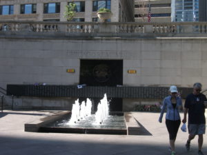
However, the controlled nature of the river and the short reach of the main branch make the creation of a downtown Riverwalk far more manageable and the experience of walking it thoroughly enjoyable. The firms of Jacobs/Ryan Associates, Sasaki Associates (with whom I have collaborated on disaster recovery issues), and Ross Barney Architects, involved in the design and engineering, have produced an experience that unfolds in “rooms” as one moves in either direction along the river, bringing users close to the water while allowing the occasional flood to muddy some steps without much damage beyond washing down the mud the next day. Phase 1redesigned and rebuilt an existing path between Michigan Avenue and the lake, an area popular with tourists as a loading zone below the stairs from Michigan Avenue down to the riverfront for tour boats. It then extended that two blocks westward to State DSCF3126Street and includes the Chicago Veterans’ Memorial Plaza, opened in 2006. One of its nice touches is a series of concrete stairs more suitable for lunch or relaxation than for climbing. It is a dignified but welcoming setting in keeping with its purpose. In Phase I, the idea began to emerge of adding river-level sidewalks that allow visitors to move from block to block without going up to street level and back down again, although some of these obviously had to intrude from the existing river’s edge into the waterway, and thus involved some negotiation among agencies responsible for navigation and safety, given the mix of water traffic still traversing the Chicago River. Congress also had to act to provide permission to allow building 25 feet into the river to create the necessary width for the new Riverwalk.

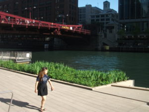
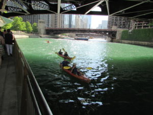
IMG_0242What has emerged in Phase II is the creation of the rooms: Marina, Cove, and River Theater, extending from State Street west. The first is opposite Marina City, occasionally nicknamed the “Corncob Towers” because of their design, and permits docking by river boats and lounging by pedestrians. The Cove, in contrast, is a favorite stopping point for kayaks and canoes, which provide a rich source of aquatic exercise for sports enthusiasts. The River Theater changes the nature of the experience yet again with the appearance of a riverside amphitheater, using a low-slope path woven into climbing stairs that can also double as points of relaxation for hikers. The theater, for the most part, is the activity on the river itself, although one can imagine a waterborne performance someday floating before the viewers. Most of this opened for public use just a year ago.

Phase III is adding a water plaza at the river’s edge; the Jetty, which places a series of floating gardens along the river edge that allow people to learn about river ecology and native plants, and the Boardwalk, providing an accessible walkway connecting to Lake Street. Although currently inaccessible at river level, one can view the construction on the final phase from street level. We were told the project will be completed by this fall.

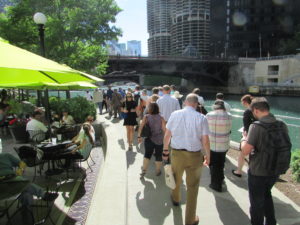
O'Brien's is one of the existing restaurants, along with City Winery, that provide refreshment along the route.

O’Brien’s is one of the existing restaurants, along with City Winery, that provide refreshment along the route.

It is one thing to traverse this path with a crowd from a mobile workshop in the late afternoon. Not only does a crowd make a difference, so does timing. I returned the following morning, since my CTA Blue Line commute takes me to the Clark & Lake station. Instead of remaining on Lake Street, I walked to Wacker Drive and descended the stairway again, this time walking in the cool of the morning by myself at 8 a.m. Not that I was alone. The path was already being filled with pedestrians like me, and joggers, and even an occasional bicyclist, so I had to pay attention to those around me as I repeatedly set my camera to shoot many of the photos included here. Heat varies, of course, throughout the summer day, but one pleasant, enduring feature is the cool breeze off the water. In the morning, as well, the restaurants are not yet open, making for a slightly more solitary experience, which even a confirmed extrovert like me can enjoy in contrast to the crowds that by late afternoon are now finding their way to the

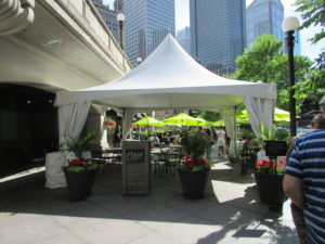
The collection of bars and restaurants on the Riverwalk is still growing.

The collection of bars and restaurants on the Riverwalk is still growing.

new bars and restaurants that are now exploiting the popularity of the Riverwalk, as intended, with more coming as the project moves along. The opportunity to sit outdoors at river level and enjoy snacks or dinner and drinks can be very pleasant, and very different from the usual experience high above on the city streets. I expect that most of these establishments will do quite well. I intend to enjoy some of them myself, with friends in tow.

Jim Schwab

Regional Green Infrastructure

The subtitle to this headline for many people might be: Who Cares? As a term of art, green infrastructure may be popular with landscape architects, civil engineers, and urban planners, among a few other allied professions, but it does not often mean much to the average person. Many people may struggle to define infrastructure even without the word green in front of it.

Infrastructure generally refers to those modern systems, such as roads, bridges, and utility grids that allow our cities and regions to function effectively. Recognizing that the value of infrastructure lies in the services it provides, green infrastructure has been distinguished from traditional gray infrastructure by focusing on the use of natural systems, such as wetlands and urban forests, to protect or enhance environmental quality by filtering air pollution, mitigating stormwater runoff, and reducing flooding. It stands to reason that such natural systems are most likely to provide such “ecosystem services” well when we respect and preserve their natural integrity. It also stands to reason that, to the degree that such systems face threats from urban sprawl and urbanization, their ability to perform those services for human populations is diminished. To say that development has often helped to kill the goose that laid the environmental golden egg is to state the obvious, no matter how many people want to avoid that truth. That does not mean that our cities cannot or should not grow and develop. It does mean that, using the best available natural science, we need to get much smarter about how it happens if we want to live in healthy communities.

Fiscalini Ranch Preserve in Cambria, California.

Fiscalini Ranch Preserve in Cambria, California.

I mention this because, as part of the American Planning Association staff pursuing such issues, I spent three days in Washington, D.C., last week at a symposium we hosted with U.S. Forest Service sponsorship on “Regional Green Infrastructure at the Landscape Scale.” We were joined by about two dozen seasoned experts not only from the Forest Service and APA, but from the U.S. Environmental Protection Agency, several national nonprofits, and others to sort through the issues impeding better planning for green infrastructure. We explored major hazard-related issues such as wildfires, flooding, and coastal storms and how green infrastructure can or should function in relation to them.

This matters because there are huge costs associated with the way we choose to develop. There can also be huge benefits. Whether the ultimate ledger in any particular region is positive or negative is largely dependent on the approach we choose, and that is heavily dependent on how broadly or narrowly we view our responsibilities. Historically, in America, we have been rather myopic about the damage we have done to our environment, but our perspective has become more comprehensive over time, starting with the conservation movement in the late 1800s. But today, as always, there are undercurrents of more myopic attitudes and impatience with the more deliberate and thoughtful calculations a more long-term view requires. There is also the simple fact that understanding issues like climate change requires some degree of scientific literacy, something that is missing too often even in some presidential candidates.

But it helps to drill down to specific situations to get a firm sense of consequences. For instance, the Forest Service budget is literally (and figuratively) being burned away by the steadily and rapidly increasing costs of fighting wildfires. That is in large part because the average annual number of acres burned has essentially tripled since 1990, from under 2 million then to about 6 million now. As recently as 1995, 16 percent of the agency’s budget went to suppressing wildfires. Every dollar spent on wildfires is a dollar removed from more long-term programs like conservation and forest management. By 2015, this figure has risen to 52 percent, and is projected to consume two-thirds of the agency’s budget by 2025. Clearly, something has to give in this situation, and in the present political situation, it is unlikely to be an expansion of the Forest Service budget. At some point, a reckoning with the causes of this problem will have to occur.

What are those causes? Quite simply, one is a huge expansion in the number of homes built in what is known as the wildland-urban interface (WUI), defined as those areas where development is either mixed into, interfaces with, or surrounds forest areas that are vulnerable to wildfire. The problem with this is that every new home in the WUI complicates the firefighters’ task, putting growing numbers of these brave professionals at risk. Every year, a number of them lose their lives trying to protect people and property. In an area without such development, wildfires can do what they have done for millennia prior to human settlement—burn themselves out. Instead, a century of aggressive fire suppression has allowed western forests, in particular, to become denser and thus prone to more intense fires than used to occur. The homes themselves actually represent far greater densities of combustible material than the forest itself; thus fires burning homes are exacerbated by increased fuel loads. In addition, prescribed fire, a technique used to reduce underbrush in order to reduce fire intensity, becomes more difficult in proximity to extensive residential development. A prescribed fire that spun out of control was the cause of the infamous Los Alamos, New Mexico, wildfire in 2000. The entire situation becomes highly problematic without strong political leadership toward solutions.

At the same time, denial of climate change or even reluctance to broach the subject does not help, either. It compounds the difficulty of conducting an informed dialogue at a time when increased heat and drought are likely to fuel even more wildfires of greater intensity. The recent major wildfire around Fort McMurray, Alberta, displacing thousands of people, may be a harbinger of things to come.

That is just one sample of the issues we need to confront through a larger lens on the value of large-scale green infrastructure and regional cooperation to achieve positive environmental results that also affect issues like water quality and downstream flooding. Because we could produce an entire book on this issue—and the suggestion has in fact been made that we do so—I will not even attempt here to lay out the entire thesis. Rather, it may be useful to point readers to some resources that I have found useful in recent weeks in the context of writing for another project on green infrastructure strategies. Most of these are relatively brief reports rather than full-length books, enough to give most readers access to the basics, as well as references to longer works for those so inclined.

On the subject of water and development in private forests, a Forests on the Edge report, Private Forests, Housing Growth, and Water Supply is a good starting point for discussion. Because planning to achieve effective conservation at a landscape scale requires collaboration among numerous partners, an older (2006) Forest Service report, Cooperating Across Boundaries: Partnerships to Conserve Open Space in Rural America, may also be useful. With regard to wildfires, a recent presentation at a White House event by Ray Rasker, executive director of Headwaters Economics, a firm that has specialized in this area, may also be useful for its laser focus on trends and solutions with regard to development in the wildland-urban interface and the need for effective, knowledgeable local planning in areas affected by the problem. But I would be remiss if I did not bring readers’ attention back to a 2005 APA product of which I was co-author with Stuart Meck: Planning for Wildfires. It could probably use some updating by now, but every one of our central points, I believe, remains valid.

Happy reading to all!


Jim Schwab


Building Coastal Resilience: A Podcast Discussion

Recently, the American Planning Association’s Hazards Planning Center, which I manage, and the Association of State Floodplain Managers, began work on a new project funded by the National Oceanic and Atmospheric Administration’s Office for Coastal Management (OCM), under a program called Regional Coastal Resilience. The project, “Building Coastal Resilience through Capital Improvements Planning: Guidance for Practitioners,” was one of six chosen under FY2015 in a competition involving well more than 100 proposals. The project will focus on building resilience and incorporating climate change data into the process of planning local capital improvements in order to make those public investments more resilient for the long term.

In a recent half-hour podcast, I interviewed Jeffrey Payne, director of the National Oceanic and Atmospheric Administration’s Office for Coastal Management (OCM), and Chad Berginnis, executive director of the Association of State Floodplain Managers (ASFPM), about this undertaking. Listen and learn!


Jim Schwab

Financing Environmental Infrastructure

DSC00626For a number of years, the American Society of Civil Engineers has been issuing an annual report card on the condition of the nation’s infrastructure. Generally speaking, those grades have not been good: In 2013, the nation’s grade point average was a D+. It is not my intent in this short post to review all the deficiencies that ASCE describes, although I will note that part of the problem is a penny-wise, pound-foolish national politics that is so concerned about lowering taxes that it has lost sight of the value of investing wisely in the nation’s future. National, state, and local economic development all depend crucially on well-functioning infrastructure. The fear of raising taxes to pay for important infrastructure repair is short-sighted and ultimately unpatriotic.

Essential pieces of the national infrastructure are and should be environmentally related: water and wastewater treatment plants, sewer and water delivery pipes, green infrastructure that helps to mitigate stormwater runoff, and so on. Much of that environmental infrastructure also serves to mitigate natural hazards and thus reduce damages from major storms and other disasters. Regions affected by prolonged drought have learned the hard way, in many cases, that water-conserving infrastructure is critical to drought resilience.

How do we find new ways to pay for all this? The real point of this short blog post is simply to link the reader to a video interview by me with Dr. Jack Kartez, a long-time professor of urban planning at the University of Southern Maine. Dr. Kartez also serves as director of the U.S. Environmental Protection Agency’s Region 1 Environmental Finance Center, which is hosted at the university but serves all of New England. This is the second of two interviews we conducted during the July 20-22 Natural Hazards Workshop in Broomfield, Colorado, this summer under the auspices of the American Planning Association’s Hazards Planning Center. I think he offers some valuable insights into solving some of our problems in this arena.


Jim Schwab