Life Lessons from Freezing Weather

We interrupt our regularly scheduled blog post . . . .

Tens of millions of Americans are accustomed to weather bulletins in winter months advising them of wintry conditions, whether they involve bitter cold or blowing snow. It is no great secret to anyone in recent days that even places as far south as Tallahassee, Florida, and Charleston, South Carolina, have been dealt an unexpected dose of the icy blast, while places like Boston and Maine, which have seen it all before, are being assaulted with both snow and icy storm surges from a northeaster.

Yes, I was a year old at one time. Thank God, photography has improved. Credit: Halle Studio

With friends who inquire about my background, I like to joke that I have spent my life moving back and forth along the 43rd parallel. Born in New York, I was moved at a year of age to a suburb of Cleveland, Ohio, in 1950, where I grew up. In January 1979, I moved to Iowa, first to lead a statewide public interest organization, later to attend graduate school at the University of Iowa. By 1985, I moved briefly to Omaha, where my wife and I were married; she was a lifelong Nebraskan. By Thanksgiving, I had a job in Chicago, and we have been here since then. That also means I have spent about six decades along the Great Lakes, experiencing various aspects of the famous “Lake Effect.” One aspect is that it can dump a ton of snow in your backyard—and everywhere else. You learn to deal with it.

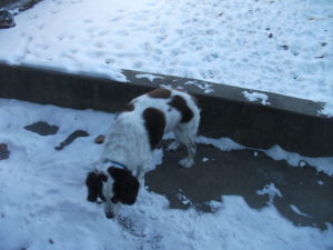
As you can see, Roscoe can barely contain his enthusiasm for being outside in the cold.

Chicago, by this weekend, is expected to complete a record-tying 12-day stretch in which the temperature has never reached 20°F. Overnight, it has often slipped below zero. I’d like to sound more poetic, but the simple fact is that it’s been cold out there. Our 14-year-old Springer Spaniel, Roscoe, doesn’t even want to partake in his usual long evening walks with my wife (or sometimes both of us). He prefers for now to take care of business in the snow in the backyard, then run to the kitchen door to be allowed back in. Dogs are very intelligent, practical animals.

When nature gets nasty outside, I tend to remember the first big test of my mettle in a blizzard. Unwittingly and unintentionally, I learned a great deal about myself from this incident. In February 1975, I bought a new Ford Maverick from a dealer in a Cleveland suburb. Radial tires were not yet in widespread use; drivers would use heavy-tread snow tires in the winter and lighter tires the rest of the year. With at most one month of winter left that year, I chose not to buy snow tires until the following fall.

However, in late April I drove this car with two friends to a small conference of progressive activists at Franconia Notch in New Hampshire, near Franconia College. At 25, I had never been to New England. For the first time, on the way up the purple mountainsides, I drove through fog that, when it broke, left us with clouds in the rear-view mirror. We drove past mountain lakes that were frozen on the shady side and rippling on the sunny side. Such scenery was exhilarating to an Ohio flatlander.

Don’t ask me what the conference was about. I no longer remember. All I recall is that, on the last afternoon, a Sunday, warnings began to circulate about an oncoming blizzard. It would be best for everyone to exit the mountain promptly to safer locations. The meetings were disbanded. It was the last weekend in April. I had never seen snow in April in Cleveland, so the thought that snow tires would be useful for this trip never occurred to me.

I soon learned otherwise. As we began our descent down the mountain, the wind whipped snow across the road, making visibility tough and traction even tougher. One thing I recall clearly is that I never panicked. Despite the nervous tension of my passengers, who had to watch me navigate with no control over their fate, I somehow summoned deep reserves of patience, kept my foot firmly but softly on the brake, and focused my eyes on the road ahead, cognizant of the deep chasms to the side. For perhaps the first time in my life, I became acutely aware that losing my nerve was not an option. Muscles taut, I steered the car downhill for what seemed like hours but was probably a mere 20 minutes. Eventually, my two friends were greatly relieved when we reached the base of the hill, which then led to an entrance to I-93, and then to I-91 and south to Hartford, and on through New York back to Cleveland. Where we stayed that night, and what path we subsequently followed home, is all a blur. The only truly emblazoned memory is that of driving down that slippery hillside amid a flurry of white precipitation.

What I learned was something akin to the famous British slogan, “Keep calm and carry on.” I learned that, in a crisis, I could call upon nerves of steel. Freaking out would have resulted in a wrecked car and possibly three dead passengers. Instead, we all got home safely a day later.

In later years, having been forged in that snowy ordeal, those traits reasserted themselves almost instinctively when new challenges arose. In January 1982, my old Plymouth died amid a bigger blizzard near Michigan City on the Indiana Turnpike, in what is ominously known as the snow belt (think “lake effect”), as I was returning after the holidays from Cleveland to Iowa City, where I would start graduate school later that month. Although I did not know the cause immediately, I learned later that the timing chain had snapped. Under such circumstances, the only option is to steer the limping car under its own momentum to the side of the road. I must note for younger readers that cell phones did not exist at the time. Some people, particularly truckers, had CB radios. The rest of us just had to wait for help. I retrieved a white emergency flag from the trunk and tied it to the antenna, noting sardonically to myself that this was of marginal value with the snow blowing and drifting in every direction.

For two hours, I sat patiently in the car, unable even to turn on the heater, and trying to stay as warm as possible under multiple layers of clothing. Finally, an Indiana DOT truck pulled up behind me and approached to find out what the problem was. He called a tow truck for me, whose driver then dropped off my car at a repair shop and took me to a nearby motel for the night. There may never be another motel room that will feel warmer. Whether and how I got some food for the evening, I don’t even remember.

The next day, I took a cab to the South Shore commuter rail station, rode to Union Station in downtown Chicago, and then caught a Greyhound bus for the five-hour ride to Iowa City, where I was greeted by 27 inches of snow but made it to a duplex I shared with roommates. I still can hear their voices when they greeted me at the front door: “He made it!” Later, when the snow was gone and the repairs to my car were complete, I took a day off from my new position as a graduate research assistant to make the reverse Greyhound-South Shore trip to Michigan City to retrieve my car and bring it home.

In between, I had a conversation outdoors with the same roommate, Paul, who first greeted me at the door. We were discussing the difference with weather in California. “This is great!” he exclaimed. “It keeps out the lightweights.” Californians, beware of Midwestern attitudes. We may not want your wildfires, but we can deal with the snow and the cold. We like to think we’re tough.

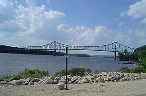
Sabula, Iowa, and Mississippi River bridge. From Wikipedia

Of course, snow is hardly the only challenge nature can provide. On one occasion about two years earlier, I had been in Dubuque, Iowa, before heading south to another meeting. As I was following U.S. Rte. 52, aka the Great River Road, a thunderstorm erupted. At points, following the river bluffs, the highway is steep and the hillsides even steeper, but rain mostly requires careful driving. Unfortunately, as I watched in alarm, the rubber windshield wiper on my side of the car worked its way loose, and bare metal was scraping the glass, making a screeching noise that was about as unsettling as finger nails on a chalk board. I had to turn off the wipers while continuing downhill because there was no shoulder and I could not block traffic. This time, those steady nerves forced me to lean forward and watch with utmost care for the yellow stripes down the middle of the road, and stay just to the right of them until I made it to the bottom of the hill.

My ordeal ended in Sabula, the only Mississippi River island community in Iowa, which sits at the end of a causeway that leads to a bridge across the river to Savanna, Illinois. Although it was not a big deal in the larger picture, I also recall that the one service station in town charged what I thought was an outrageous price for a wiper replacement—sort of an ultra-miniature version of the small-town Arizona ripoff garage scene in National Lampoon’s Vacation. At the time, I just paid the price and gladly installed the new wiper. My car, at least, did not have to limp away. It drove away very smoothly.

That situation may have prepared me well for Louisiana a dozen years later. Researching for my book about the environmental justice movement, Deeper Shades of Green, I had driven one morning from Baton Rouge to meet two women activists in Lake Charles. I had spent the day with them touring the area and interviewing people before returning in the evening. The one and only obvious path for this trip is I-10, which crosses the Atchafalaya Swamp for about 50 miles, in many areas on a two-lane strip of concrete in each direction above water, interspersed with cypress trees, snakes, alligators, and mud. None of this, of course, is at all foreign to the numerous Cajun residents of small towns in southern Louisiana, but it was new and interesting to me. In the evening, however, an intense thunderstorm swept the area. While there are guardrails on the sides of the interstate highway, I was not interested in sliding into them at 70 mph. I drove carefully, but visibility at times was little more than 100 feet amid torrents of descending water. My patience was rewarded when I finally found an exit into a small town where I bought coffee at a Burger King and waited out the storm. I noted with amusement that no one needed to worry about being cited for speeding (if they were even foolish enough to do so) because the police were also hanging out at Burger King. Eventually, when it seemed the storm had passed, I drove back to the highway, only to catch up with the storm further on my route back to Baton Rouge. Perhaps I had not been patient enough. But I made it back safely, with yet another story to tell.

Nasty weather can teach us patience and perspective, if we are willing listeners. I am grateful that my lessons came at a young age when such impressions matter most. I must admit they don’t make me patient about everything. Computer software glitches can still sometimes send me up a wall. But there is a difference. I just pack up my laptop on a sunny day and take it to the Geek Squad. They make money doing what they do best, I vent some frustration, and nobody gets hurt. Who can question such a sublime outcome?

Jim Schwab

Touching Sky and Sea in Norway

For three months, I have been intermittently aware that, back in August, I shared two phases of a trip to Norway that my wife and I took in July—and that I promised to complete the story with two more. At the same time, I was laying the groundwork for an entirely new phase of my career. Having left the American Planning Association (APA) at the end of May, I was planning book projects, establishing a one-person consulting firm, preparing to teach my fall course at the University of Iowa, and undertaking periodic speaking engagements. This was all part of my “five-point retirement plan,” of which the remaining piece is this blog.

Soon enough, however, given my professional focus on planning for disasters, real life overwhelmed my intentions. Even as I was laying the groundwork for Jim Schwab Consulting LLC, my consulting operation, Hurricane Harvey was blasting the Texas coast. Harvey was soon followed by Irma in Florida, then Maria in Puerto Rico, then wildfires in California. Though I have not been involved in recovery from Irma and Maria, people in Texas solicited my attention, and later I spoke at conferences in North Carolina and Utah. I am participating in a planning group for Harvey recovery, and I have undertaken some other work as well. Before I realized it, the semester was over, the holidays were upon us, and I had utterly failed to write about the rest of the Norway venture. And I do like to inject some travelogues into this blog. All disasters and policy disquisitions and no fun can make for a dull blog. (Some readers may disagree, but my mixture of subject matter seems to have broad appeal.)

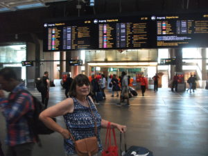
Railway station in Oslo (Jean in foreground)

So. About four months ago, I left our story in Oslo after a busy Monday. Jean and I stayed overnight, packed our bags again, and got ready to travel to Bergen. The trip between those two cities is one I would recommend to anyone with the slightest appetite for dramatic scenery. But first we had to move from our hotel, the Radisson Blu Scandinavia, to the railway station. One truly neat feature of Oslo is the tram, which was included in our Oslo Pass, as was all other public transit including the subway system. The tram stopped right behind the hotel, and the railway station was only a few stops away. We had a pleasant early morning ride down the middle of the street, then crossed the street with our luggage and entered a very modern-looking station that would put us on our train to Bergen. It all seemed very convenient and well organized.

The train from Oslo to Bergen, however, is more than just well organized. Norway in a Nutshell notes that the Bergen Railway is “Northern Europe’s highest-altitude railway line.” The passenger cars indicate the altitude at each stop, so you can track your progress upward as well as across the country and downward again to the sea. The highest reading I recall was 1,224 meters, roughly 4,000 feet, but a glance out the window made clear the mountains around us touched the clouds at a slightly more rarefied level.

Once the train departs the urban environment of Oslo, the scenery changes rapidly, passing lakes and rivers and entering the interior of Norway to reveal small lowland farms in the shadows of green, often forested hills. Over a 6 ½ hour journey, the train finds its way into numerous small communities along winding valleys and into the mountains until you begin to witness snow on the peaks, even in July, where the combination of altitude and latitude make clear that Norway is never entirely green. Knowing the long history of this nation, one can only imagine how the challenges of traversing this landscape influenced first the Viking, then the medieval, Reformation, and even Enlightenment Norwegian mindset, and why the law of primogeniture combined with meager prospects for agricultural prosperity to send waves of young people to America in search of a better life. Of course, in modern times, Norwegians have found prosperity through other means, including energy development and a highly educated work force, but for many centuries most people endured a hardscrabble life in a relatively unyielding environment. That gorgeous landscape did not make life easy for those trying to survive by breeding livestock and growing crops. Even though we did not leave the train until we reached Bergen, one could feel the chilly air when the doors opened at small town stations, and knowing it was July made one wonder how cold it might be in January.

And yet there was no question that the views were strikingly beautiful–unless you were passing through one of several tunnels beneath the mountains. We were not there in the right season to attest to this, but I have read repeatedly that winds and snow in the winter make this mountainous terrain a challenging environment in which to maintain year-round train service. The Norwegians, however, are as prepared for such challenges as anyone. They keep the train moving.

In due course, of course, one reaches the peak of the journey, and the downhill ride begins, ending near the sea in Bergen, the second-largest city in Norway behind Oslo. Because of prior arrangements by Bill Mitchell at Conlin Travel, we were greeted upon our exit from the train by a local driver who turned out to be a retired police officer, a fact he revealed in the process of insisting that we buckle up before he took us to our hotel, about 15 minutes away along the harbor. From him, we learned that Bergen is a city of nearly 300,000 people, with half as many more living in the entire metropolitan area. As first-time visitors, we were about to learn just how much Bergen has to offer.

Our modest but well-appointed Clarion Hotel Admiral offered a marvelously serene waterfront setting, supported by a flotilla of sail boats, fishing boats, and larger commercial craft. Somewhere further along the coast were the large cruise ships, such as the Nordnorge, on which we would be sailing by the next evening. Bergen is largely defined by its status as a seaport on a fjord near the Atlantic Ocean, but that location makes it as scenic as any city would want to be. From a crowded waterfront, homes and other buildings seem to radiate up the slopes until they thin out and the insistent lush forest takes over. We were also lucky. We were told it had been raining for most of the month before our arrival, but that, with the emergent sunshine after some initial misty cloudiness, we had “won the weather lottery.” We were grateful for the photogenic result.

For Jean and me, after checking in and relaxing in our room, our first order of business was to meet up with personal friends who would join us on the cruise. Two of my colleagues at APA had also retired within the last few months. Carolyn Torma, formerly education director, left at the end of November 2016 and had already been traveling on her own since then. Deene Alongi, the meetings and conferences director, retired on July 12, just a few days before our trip. She and I had met over dinner about some business matters back in January, and in discussing our plans, discovered we both intended to cruise the fjords of Norway during the summer. She and Carolyn had already been making arrangements for a cruise with Hurtigruten, a Norwegian cruise company, through Mitchell, an acquaintance of Carolyn’s cousin, Carol Wargelin. Why not join forces, we decided, and book the same cruise? Using the same travel agent allowed us to connect at the same hotel, even though our three friends were arriving separately after flying straight to Bergen, letting us visit Oslo first on our own, something I wanted to do so that Jean and I could ride the train to Bergen.

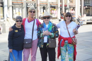
In front of the downtown mall in Bergen. From left, Deene, Carolyn, Carol, and Jean.

By late afternoon, I met Deene in the lobby as she entered the hotel. Later we met Carolyn and Carol, and the five of us enjoyed dinner in Admiral’s very pleasant restaurant. Our conversation revolved around plans for the following day, for we would have until 4 p.m. to wander the city before boarding a bus to the dock to enter the cruise ship.

Although our plans evolved, Bergen made it easy to enjoy the day. We discovered the Kode museums, which line one edge of a charmingly picturesque public park anchored by a pond with a fountain but also including a gazebo and lush lawns. Using a single pass, we visited all four museums by late afternoon, punctuated by lunch at a reasonably classy diner adjoining one of them. The museums offer five daily tours in English, in addition to Norwegian. Kode 1 offers the Singer collection, a combination of Chinese porcelain, period furniture from the 16th and 17th centuries, and classic paintings, among other art, plus a splendid display of silver and gold artifacts created in the city over the past half-millennium, and the H.M. Queen Sonja “Underway,” displaying graphic and ceramic artworks sponsored by a royal who seemed to relish the chance to sponsor sculpture and craft works.


The silverwork section of Kode 1.

Kode 2 was not then open, preparing a new exhibition that opened in October. Kode 3 featured the Rasmus Meyer collection, an assortment of Norwegian paintings from 1880-1905, which is surely the golden age, with works from landscape and other

Part of the Rasmus Meyer collection.

painters like J.C. Dahl, Harriet Backer, and Theodor Kittelsen. I will not claim to be any sort of expert on the subject; in fact, I learned about some of the artists for the first time in this visit. But viewing these works up close filled me with admiration for their skills and the cultural perspectives they conveyed. There can be little doubt that Norway experienced a remarkable flowering of artistic talent in the late 19th century. And that is before we even mention the substantial display of work by Edvard Munch. The iconic The Scream, for which he is best known (and of which there are four versions), is only the beginning of Munch’s lifetime of productivity, punctuated by some tragic interludes that no doubt profoundly influenced some of his artistic idiosyncrasies. However, it would be a mistake to think that all, or even most, of his work is affected by the mental illness that ran through the family, including his father, or was dark and depressed. Indeed, there is an entire strain of cheerful nature painting within his oeuvre. Munch was clearly Norway’s artistic genius.

Finally, Kode 4 branches out beyond Norway to include numerous modern European and other artists, including Pablo Picasso, Paul Klee, Diego Rivera, and Joan Miró. But as one might expect, time ran out, and we all had to stroll back to the Admiral Hotel, retrieve our stored luggage, and await transport to the Hurtigruten dock to embark on our cruise, which will be the focus of the final installment in this series.

Jim Schwab

New York City, Water, and Resilience

I was never a New York native, but I did not feel entirely alien, either, when I returned for the first of four visits to the area in January 2013, following Superstorm Sandy. My father lived in Queens most of his life and left only when my mother, who was from Cleveland, insisted on moving. New York City was not to her liking, and she wanted to go home. But my paternal grandparents remained on Long Island until they died in the 1960s, and we often visited. I was born in Bayshore Hospital, one of seven that were evacuated during the storm. My father had told me about living through the “Long Island Express,” the famous 1938 hurricane that also swamped much of New England. I was not a total stranger. I was certainly aware of many of the cultural traits that make New Yorkers famous (or infamous), though I think some consist more of popular stereotype than reality. But there is a certain toughness that comes from living in the Big Apple, even if it’s different from the toughness I have learned from my eventual attachment to Chicago, the alleged “City of Big Shoulders.”

Hence, despite all the vulnerabilities connected with a city of eight million people that is nearly surrounded by water, I instinctively understood the connection of the city with the concept of resilience. The city has withstood more than Sandy—this was the site of the worst 9/11 attacks, after all—and responds well to challenges. There are no feet of clay; the foundation of Manhattan is bedrock. But any map of the city makes clear that every borough but the Bronx is an island, and even that is a peninsula surrounded by water on three sides.

What brought me to New York after Sandy was a decision by the American Planning Association to assist our New York Metro and New Jersey chapters in preparing their members and communities for the arduous task of post-disaster recovery. To be honest, ours was a contribution more of solidarity and expertise than of resources, which had to come from the massive allocations of federal funds used or distributed by federal agencies, led mostly by the Federal Emergency Management Agency (FEMA) and the U.S. Department of Housing and Urban Development (HUD). What mattered to our members was our presence, our ideas, and the time we spent preparing and delivering a series of training workshops in April 2013 on planning for post-disaster recovery. It is fair to say that, as manager of APA’s Hazards Planning Center and the ringleader of that training effort, Sandy recovery dominated my life for the first half of 2013. And this is all context for my observations in reviewing a relatively new book from Island Press, Prospects for Resilience: Insights from New York City’s Jamaica Bay, edited by Eric W. Sanderson, William D. Solecki, John R. Waldman, and Adam S. Parris. Contributors include biologists, geographers, and engineers, among others with a wide range of expertise that contributes to the book’s comprehensive approach. its utility is clearly greater for professional practitioners in planning, civil engineering, public administration, and allied fields, as well as for academic researchers, than for purely casual readers.

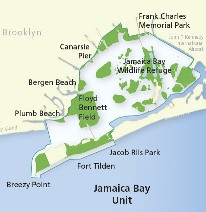
Map from Gateway National Park, National Park Service, website. https://www.nps.gov/gate/planyourvisit/map_jbu.htm

The book focuses specifically on Jamaica Bay, although New York City matters greatly as the municipal government making critical decisions that affect the bay’s resilience. Jamaica Bay, however, is an interesting case study of the intersection of geographic, ecological, industrial, and urban planning factors in both weakening and enhancing the overall resilience of a highly stressed water body and the urban neighborhoods that line its shores. The book’s most noteworthy feature is not any one approach to the subject of resilience for Jamaica Bay, but the way in which it seeks to cross disciplinary lines to undertake a thorough analysis of the prospects for building resilience in an area like Jamaica Bay. Researchers there may have much to share with those examining other ecologically challenged urban water bodies across the nation.

It is important to understand the geographic context of Jamaica Bay, an area familiar to most people (including many New Yorkers) primarily as the scenery below the airplane as it makes its descent into John F. Kennedy International Airport (JFK). The airport, in fact, has a significant impact on Jamaica Bay because it sits at the eastern end of the bay in Queens, the linchpin between the rest of Long Island and the Rockaways, a long, densely populated peninsula that stretches west from JFK and forms the southern boundary of the bay. That, in turn, means that the Rockaways, home to 180,000 people, is extremely vulnerable in a major storm like

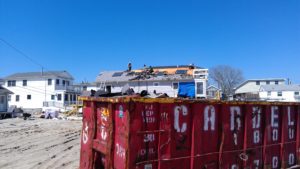
Fire devastated Breezy Point during Hurricane Sandy in 2012. Cleanup lasted for months. Photos courtesy of James Rausse.

Sandy. The Rockaways suffered some of the worst damages from the storm, including a fire that tore through Breezy Point, destroying 130 homes. Because of its isolation at the end of the peninsula, and the storm surge that inundated it, it was impossible for fire trucks to respond to the conflagration. For those curious about the origins of a fire in the midst of a flood or hurricane, it is worth remembering that a surge of salt water can easily corrode and short out electrical wires, triggering sparks. Much of New York’s subway system, well designed to pump out normal stormwater, was shut down during Sandy for the same reason.

What makes Jamaica Bay matter enough to devote nearly 300 pages to the subject? It is a great laboratory for resilience. The dense urban development that surrounds the bay stresses the natural ecosystems of the bay, whose biological composition has changed radically over time. The late 19th century witnessed the growth of a viable fishing industry, including oyster harvests, but pollution from sewage disposal and industry brought that to a sudden halt by the 1920s. The same factors reduced the bay’s recreational potential as well. Only in the last few years have there been efforts to restore the oyster beds, but like most such efforts, they will require ongoing research and attention to succeed.

Just as importantly, human communities need to become more resilient as part of a larger social-ecological system because the city is not about to disappear. There simply will be no return to pre-urban conditions. Urban stormwater drainage, sewage disposal, industrial activity, and transportation all have impacts that good urban planning must mitigate or prevent in trying to maintain a healthy urban relationship with the natural environment. Serious scientific inquiry may provide some answers. Greater levels of awareness and connectedness by area residents to the marine environment can also help, but that has often not been the case. An entire chapter explores neighborhood and community perspectives on resilience around Jamaica Bay. Few seasoned urban experts and planners will be surprised to learn that New York generally, and the Jamaica Bay watershed, feature remarkably diverse neighborhoods in terms of density, ethnicity and race, and income level, all of which influence those perspectives and influence community goals. New York is also a remarkably complex city in which residents of some areas in Queens can feel isolated from the center city in Manhattan, but may also feel more secure in their isolation. It is noteworthy that some areas at the western end of the peninsula were heavily populated by public safety personnel. All this influences people’s perspectives on proximity to, and connection with, the waterfront and public understanding of the relationship between human settlement and the ecological health of the bay, which is not always straightforward in any event. People can exert both positive and negative influences on that relationship. The good news is that the authors found that Sandy and the recovery process that followed had some useful impact on the perceptions that underlie those actions.

Given all that complexity, it will also be small surprise that the resilience of Jamaica Bay and its surrounding development is affected by a complex network of overlapping jurisdictional responsibilities that are sometimes in conflict. In addition to the city and its boroughs, a variety of federal and state agencies with varying agendas and authorities, including the New York-New Jersey Port Authority (responsible for airports including JFK), the National Park Service (Gateway National Park), and the National Oceanic and Atmospheric Administration (climate and coastal zones), overlay the influence of numerous private organizations and academic institutions. Add the flood mitigation and post-disaster recovery responsibilities of FEMA, and one is suddenly confronted with a multicolored collage that for some people can become bewildering.

The case of NOAA is interesting in that climate change is likely to affect the frequency of extreme weather events, which may further test the resilience of an already dynamic social-ecological system. As a scientific agency with significant meteorological and climatological expertise, NOAA has contributed to the array of modeling tools helping to analyze resilience in Jamaica Bay, although academic and other institutions have added to that toolbox. What is important ultimately is to bring together the various strands of research in cooperative efforts for integrative management. The good news, well described toward the end of this book, is that such cooperative efforts have produced the Science and Resilience Institute at Jamaica Bay for that purpose, with participation by decision makers from local, state, and federal agencies to help resolve those conflicting missions and adopt a comprehensive systems approach to the challenges facing the area. Let us hope that those decision makers, and the public officials controlling their resources, have the wisdom to maintain hard-won progress. As is true of many other areas in the U.S., those responsible for the health of Jamaica Bay have much work to do. The rest of us have much to learn from what they are doing and a stake in that progress.


Jim Schwab

Natural Solutions for Natural Hazards

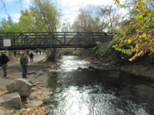
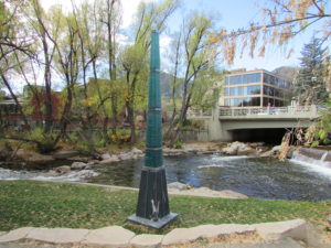
Boulder Creek, Boulder, Colorado

Boulder Creek, Boulder, Colorado

It has taken a long while in our modern society for the notion to take hold that some of the best solutions to reduce the impact of natural hazards can be found in nature itself. Perhaps it is the high cost of continuing to use highly engineered solutions to protect development that has often been sited unwisely in the first place that has finally gotten our attention. Particularly after Hurricane Sandy, however, the notion of using green infrastructure as part of the hazard mitigation strategy for post-disaster recovery began to gain traction; green infrastructure was highlighted in the federal Hurricane Sandy Rebuilding Strategy. These approaches are also known as natural or nature-based designs. They involve understanding the role natural systems play in reducing damages and in using that knowledge to deploy such solutions as part of an intelligent game plan for improving community resilience.

But where should community planners and local officials get reliable information on the best and most proven strategies for implementing green infrastructure solutions?

About a year and a half ago, researchers from The Nature Conservancy (TNC) approached me about involving the American Planning Association (APA) Hazards Planning Center in a project they were undertaking with support from the Kresge Foundation to prepare such information in the form of a green infrastructure siting guide. In the end, they also involved the Association of State Floodplain Managers (ASFPM), the National Association of Counties (NACo), the American Society of Civil Engineers, and the Boston-based design firm Sasaki Associates to assist with this effort. Over the past year or more, we have all met regularly to discuss what needed to be done and our progress in making it happen. We produced case studies, strategy briefs, and other material to populate the project’s web-based resources.

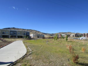
Bioswale in a subdivision development in Boulder County, Colorado.

Bioswale in a subdivision development in Boulder County, Colorado.

Last month, after all that teamwork, TNC unveiled its new website for the project, called Naturally Resilient Communities. For those interested in knowing how trees, living shorelines, dunes, coastal marshes, and oyster reefs, among other types of natural infrastructure, can help mitigate natural hazards like coastal storms and urban flooding, the website provides a serious and interactive introduction to the subject matter, backed up by numerous resources.

What is especially valuable about the website design is that it allows users multiple avenues into the specific types of information they need. Not all natural infrastructure solutions are born equal. Some are more appropriate in certain settings than others. Some work best in inland river valleys, some along coastlines, and others in mountains or high plains. Some coastal solutions work well in the rocky coastlines of California or Oregon, while others work better along Atlantic or Gulf Coast shorelines. Applying such solutions is largely a matter of learning what works best in a specific natural environment in the face of specific hazards—riverine flooding, hurricanes, thunderstorms, or other threats that communities face. It is critical to adapt the solution to the problem.

Accordingly, the website, largely the work of Sasaki Associates with vetting from the other project partners, allows users to approach the information by deciding which strategies they wish to investigate or which part of the United States is relevant. They can also look at considerations such as cost, the geographic scale of the solution (neighborhood, municipal, regional), and the type of community in question. These are precisely the frames of reference familiar to most urban planners and civil engineers who are most likely to be involved in implementing natural infrastructure projects. The emphasis throughout is on the practical, not the ideal or the ideological. A particular approach either works or does not work, but it does so in very specific settings, such as a neighborhood in a city along one of the Great Lakes or in the Southwestern desert. Context is the central question.

This memorial to Gilbert White, the pioneer of modern floodplain management, marks the high point of flooding along Boulder Creek.

This memorial to Gilbert White, the pioneer of modern floodplain management, marks the high point of flooding along Boulder Creek.

Establishing context is why the project put considerable emphasis on case studies, which cover a variety of communities around the nation. Specify, for example, Rocky Mountain West as a region and riverine flooding as a problem, and the site gives you a case study from Boulder, Colorado, that examines the alternatives considered and solutions adopted for flooding along Boulder Creek and discusses the involvement of the city and the Denver-based Urban Drainage and Flood Control District to implement a stream restoration master plan. One can also find case studies from Florida, Ohio, and numerous other locations. One can also, however, explore sections of the website devoted to additional resources and funding

sources to support green infrastructure projects. These allow the user to connect to other websites and some PDFs for additional information.

Go explore. I admit to taking pride in our involvement in this effort. It is, I think, a welcome resource and great learning tool for planners, engineers, local officials, and the interested public.


Jim Schwab

Beyond Tradition and Empire

Image

The Republic of Botswana, a paragon of progress in today’s Africa, did not start life with any apparent advantages. In fact, the former British protectorate of Bechuanaland, which became independent Botswana, appeared in the 1950s to have bleak prospects, in no small part because of archaic British colonial policy. Nearly surrounded in the post-World War II period by South Africa, which was in the process of establishing its notorious apartheid policy, the colonial backwater of South-West Africa that later became independent Namibia, and the white-run Rhodesia that morphed into modern Zimbabwe, Bechuanaland was a sparsely populated land of desert and scrub that seemed fated to be swallowed by more powerful neighbors. Yet today it is both one of the most prosperous of African nations and a functioning democracy, although like any nation it has its flaws and shortcomings. But it has maintained an uninterrupted series of democratic elections since independence, a claim few African nations can make.

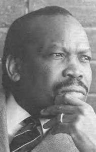
Seretse Khama. Image from Wikipedia

Seretse Khama. Image from Wikipedia

A curious and stunning piece of personal history lies behind the story of Botswana’s independence, which occurred in 1966. The heir to the chieftainship of the Batswana people, the nation’s predominant ethnic group, was in London in the years after World War II to study law while his uncle ruled the nation as a regent. The British had established their protectorate in 1885 after King Khama III had appealed to them in the face of rising threats from South Africa and other neighbors. With a population at the time of little more than 100,000 (now 2 million), Botswana would have been helpless in the face of invasion. Moreover, Botswana had mineral resources, including diamonds, that made the country a potentially attractive target. In the midst of all this, Seretse Khama (David Oyelowo), heir to the throne of this fragile country, managed to fall in love with an English working woman, Ruth Williams (Rosamund Pike), a typist.

A United Kingdom, a movie based on the book Colour Bar by Susan Williams, tells the story that followed from this unlikely romantic adventure. It is a little difficult at first to fathom exactly how these two become so strongly attracted to each other, but the story is based on real life, so we know they did. It’s just that it would be nice if the movie did a somewhat better job of making clear how that happened. It is clear enough that in post-war England, prejudice against black Africans remained widespread. Knowing this makes it important to better understand how Ruth Williams found the courage to face down family disapproval and societal racism to decide that, when Khama proposed to her on a London bridge, she was prepared both to move to a poor rural African nation and to assume the role of an African queen.

The disapproval occurred on both sides. Khama’s uncle, Tshekedi Khama, wanted him to divorce Willliams, and failing that, wanted to send him into exile to spare the country division over the issue. Khama refused to do either and insisted, against the advice of the British officials, most notably Alastair Canning (Jack Davenport), the condescending British liaison to Bechuanaland, that the case be presented to an assembly of the people, then all male. (It should be noted that Canning never existed. In the film he is a fictitious composite of various British colonial officials.) But in this format, we can already see the seeds of modern democracy in Batswana culture, an open forum in which people could hear and judge for themselves. Following the uncle’s denunciation of the marriage, Khama passionately makes his own case for remaining both king and the husband of his English mate, and after some tense moments of thought, the men side with him. Uncle Tshekedi moves on to form a new settlement where they no longer need to live together.

But then the machinations begin. British diplomats, worried about South African ambitions and opposition to interracial marriage, work behind the scenes to oust Khama anyway. Khama turns out to be no one’s fool; he notices that mining explorers are on Batswana land without permission and quietly enlists a British journalist to investigate, and it becomes clear that his nation may both be resource-rich and the target of those who would exploit it before Khama can assert the nation’s right to control those resources, which ultimately turn out to be diamonds. Meanwhile, the British are using the dispute between uncle and nephew to manipulate the situation for their own geopolitical advantage.

The story that follows shows both the workings of democratic dissent in the United Kingdom (the movie title is clearly a play on that name with reference to Botswana) and the dishonest nature of imperialism. Labor Prime Minister Clement Attlee seems bent on catering to South African wishes despite opposition within his own party. British officials lure Khama to Britain to negotiate a settlement, then ban him from returning for five years. Amid all this, the king and his wife must endure the burden of prolonged separation while she is pregnant and gives birth in Bechuanaland to their first child, a daughter. We watch her convictions and commitment grow as she blends in with the people she comes to love despite the skepticism many first felt about her.

Back in England, meanwhile, Winston Churchill, in a bid to return to power as prime minister, promises publicly to return the young king to his throne. Once his Conservatives regain a narrow majority in Parliament, however, he reverses course and declares a lifetime exile for Khama. Despite widespread adulation of his role in the fight against Hitler, there was a dark side to Churchill that wanted to cling to the glory of the declining British Empire. Increasingly desperate both to reunite with his wife and to save his country from these designs, Khama finally manages to get permission to return for one week to meet with his uncle and settle family affairs. Khama uses that opportunity brilliantly by convincing his uncle of the need for national unity. Overcoming the weight of tradition, they agree to forsake the traditional monarchy and seek independence with free elections, upending the British ban on Khama’s rule and setting the stage for eventual separation from the UK within the Commonwealth. In due course, by 1966 Khama was elected the first president but honored democratic principles and set the stage for a much better history than most other African nations have experienced. Moreover, the nation has largely lifted itself out of poverty, with average annual income rising from about $70 per year to nearly $20,000 today. A Texas-sized nation in southern Africa, two-thirds of which is Kalahari desert, has grown a substantial middle class and educated its citizens. Somewhere, there is a moral in this story. It strikes me that the moral centers on courage and leadership and vision, which are often in short supply in this world.

And all that means this movie deserves more attention than it will likely get, but I’d like to hope that it will get that attention anyway. It is a powerful antidote to much of what we still see happening in the world today. It reminds us that one can stand for dignity in politics and make change accordingly. And while you’re watching A United Kingdom, enjoy the dramatic South African scenery, the lively romantic plot, and the brilliant acting. It is a movie, after all.


Jim Schwab

Connecting Hazard Science and Planning Down Under

Much of New Zealand is a land of striking natural beauty riddled with natural hazards.

Much of New Zealand is a land of striking natural beauty riddled with natural hazards.

Nearly nine years ago, when I was invited to accept a three-week visiting fellowship in New Zealand with the Centre for Advanced Engineering in New Zealand (CAENZ) at the University of Canterbury, people began to ask me why the New Zealanders were so interested in me or the work of our Hazards Planning Center at the American Planning Association. My response was to ask another question: “Have you seen Lord of the Rings?”

The overwhelming majority of inquirers would say yes, and I would follow up by asking whether they were aware that the entire trilogy was filmed in New Zealand. Most were, though not all. “Look at the landscape in those films,” I would say, adding that “it ought to come to you” after doing so. Later, I wrote an article for Planning, APA’s monthly magazine, about the experience, titling it “A Landscape of Hazards.” New Zealand almost literally has it all: earthquake faults, active volcanoes, coastal storms, landslides, flash floods, and even occasional wildfires. One day, back in the states, I even learned that a small tornado had struck in Auckland. There were very good reasons CAENZ spent enough money to bring me there to consult on national hazards policy and land use.

Damage following a coastal storm on the North Island in August 2008.

Damage following a coastal storm on the North Island in August 2008.

One serious consequence of the visit, which included my doing seven lectures and seminars around the country during that time, was that I established a number of valuable and lasting professional relationships, some of which are occasionally rekindled by meeting Kiwi researchers at conferences in the U.S. since then. One was a young researcher, Wendy Saunders, at GNS Science, who recently sent me a copy of a new report she co-authored for this crown research center, released in November. “The Role of Science in Land Use Planning: Exploring the Challenges and Opportunities to Improve Practice” made me realize that a common problem in U.S. planning, the introduction of scientific information related to natural hazards, is not much different halfway around the world, even under a rather different planning framework than ours.

Indeed, one other benefit of the trip was that, not only did they learn from me about the complexities and idiosyncrasies of land-use planning in the United States, but I learned a great deal about their system as well, and it broadened my perspective on how planning is practiced around the world. Things are somewhat simpler in this small nation of 4.2 million people on two islands that together are somewhat smaller than California. That led to an interesting comment from one gentleman to another in the front row of a modest crowd at the Christchurch regional council following one of my presentations. “We’re about the size of a small state over there,” he mused. Yes, I thought, we are two sovereign nations, but vastly different in size, with systems calibrated to very different needs as a result.

In the New Zealand context, the result is a system, based on 1989 reforms, in which there is no “state” layer of government between the national government in Wellington and local government at the municipal level. Under the nation’s Resource Management Act, however, a series of regional councils does provide oversight of environmental policy and reviews local decisions for compliance. Those regions are basically based on watershed boundaries, which may seem like nirvana to some bioregionalists in the U.S., but they entail their own political challenges. No system is perfect.

The challenge the GNS Science report addresses, in fact, is that of properly introducing natural hazards science into land-use policy at the local level, which is not an easy task even in New Zealand, where such hazards seem abundant and omnipresent. The report includes a case study of GNS’s own experience in intervening in a plan change in Hutt City, near Wellington on the North Island, where a major earthquake fault straddles and affects much urban development. The problem of how to introduce issues like climate and hazard mitigation into the planning process is one we have pondered repeatedly at the Hazards Planning Center at APA, precisely because that is our mission. As the GNS report notes, while local planners may complain that science is often presented In ways that lack translation into a local context, with no straightforward means of resolving conflicts between experts, scientists nonetheless “are often frustrated by the lack of uptake of their science in land use planning decisions.” Maybe Kiwis and Yankees, at least in this respect, have far more in common than we realize.

Inevitably, because there are no simple solutions that fit all cases, the report concludes that incorporating natural hazards science in land-use decision making is a “complex process influenced by numerous social levers and networks.” In the Hutt City case, economic development was paramount, but natural hazards took their place on the stage in part as a result of GNS Science’s intervention, a lesson to scientific researchers that it is important for them to find their voice even if local elected officials and policy makers may not absorb all the subtleties of scientific conclusions. It is not always a matter of scientists being poor communicators. Sometimes public officials must be better listeners. Scientists must be willing to learn more about the planning process, but planners must learn more about the nuances of scientific assessments. Public safety with regard to natural hazards risks is not a matter of stopping all development, but of using scientific knowledge wisely to make development better. We must all become better at reaching across disciplinary boundaries to reduce misunderstanding and misinformation and to receive information vital to making better decisions. The importance of this became very clear to me less than three years after my visit, when Christchurch, the home of CAENZ, was shaken by significant earthquakes from which the city is still recovering.


Jim Schwab

The Past and Future of Disaster Research and Practice

Interdisciplinary disaster studies are still relatively new, compared to long-standing fields like geology or even psychology. I spent last week (July 19-23) in Broomfield, Colorado, first at the Natural Hazards Workshop, sponsored by the University of Colorado’s Natural Hazards Center, and then at the one-day add-on conference of the Natural Hazard Mitigation Association (NHMA). The International Research Committee on Disasters Researchers Meeting took place at the same time as the NHMA gathering. The main event marked the 40th year of the Natural Hazards Workshop, launched in 1976, with support from the National Science Foundation (NSF), by the Natural Hazards Center’s renowned founder, Gilbert F. White, who virtually pioneered studies of flooding in the 1930s as a geographer who served in the New Deal under President Franklin Roosevelt, later taught at the University of Chicago, and finally found his home in Boulder, where he died in 2006 at age 94. You can read a full biography of White, a true scientific pioneer, in Robert E. Hinshaw’s Living with Nature’s Extremes, published shortly after White’s death.

To mark this milestone, current NHC director Kathleen Tierney invited several of us to join a panel for the opening plenary on July 20 to discuss both retrospective and prospective views of disaster research and practice within four disciplines. I spoke about urban planning; Howard Kunreuther spoke by video on economics; Tricia Wachtendorf of the University of Delaware on sociology; and Ken Mitchell of Rutgers University on geography. In the end, of course, we all use and benefit from each other’s insights, so it was intriguing to hear the comparisons in how our fields have approached problems of hazard mitigation and disaster recovery. The forum was moderated by long-time NSF program director Dennis Wenger, who previously served at Texas A&M University, where he was Founding Director and Senior Scholar of the Hazard Reduction & Recovery Center.

Wenger himself had a story to tell before introducing his panel, one involving more than 800 projects funded by NSF for more than $200 million over the years his program, Infrastructure Systems Management and Extreme Events, has been in place to fund research on hazards. It has not always had that name; as Wenger humorously noted, however, its four name changes over some four decades is “not bad for NSF.” The ballroom of 500 disaster practitioners and researchers from multiple disciplines contained more than a few people whose research has benefited from those NSF grants, which have moved the field forward in numerous and remarkable ways.

The American Planning Association taped the opening plenary and has made it available on its multimedia Recovery News blog at http://blogs.planning.org/postdisaster/2015/07/28/what-next-the-past-and-future-of-disaster-practice-and-research/. The blog post includes the PowerPoint accompanying my presentation.


Jim Schwab