Climate Resilience on the High Plains

For those who think only in terms of the politics of red and blue states, the conference I attended March 30-31 in Lincoln, Nebraska, may seem like a paradox, if not an oxymoron. It is neither. It is a matter of looking beyond labels to facts and common sense, and ultimately toward solutions to shared problems. The problem with climate change is that the subject has been politicized into federal policy paralysis. But the scope for local and even state action is wider than it seems.

The University of Nebraska-Lincoln (UNL) Public Policy Center with support from the High Plains Regional Climate Center (HPRCC) sponsored the conference on “Utilizing Climate Science to Inform Local Planning and Enhance Resilience.” I spoke first on the opening panel. The sponsors have been working with communities across Iowa, Missouri, Kansas, and Nebraska. Planners, floodplain managers, and civil engineers from eleven municipalities in those states participated, along with UNL staff, climatologists, the Nebraska emergency manager, and myself.

My job was to provide a national perspective on the subject from a national professional organization, representing the Hazards Planning Center at the American Planning Association. I talked about two projects we are conducting with funding from the National Oceanic and Atmospheric Administration: “Building Coastal Resilience through Capital Improvements Planning” and “Incorporating Local Climate Science to Help Communities Plan for Climate Extremes.” I made light of the fact that there was not a single coastal community among the four states of the region, but I added that the lessons from the first project are still relevant because every community plans for capital improvements, which generally constitute the biggest investments they make in their future. Capital improvements cover long-term expenditures for transportation and waste and wastewater infrastructure as well as other facilities potentially affected by climate change. In the Midwest and High Plains, instead of sea level rise, communities are watching a rise in the number and severity of extreme events on both ends of the precipitation curve—in other words, both prolonged drought and more intense rainfall. Drought taxes water supply while heavy rainstorms tax local capacity to manage stormwater. Both may require costly improvements to address vulnerabilities.

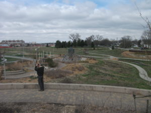
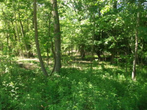
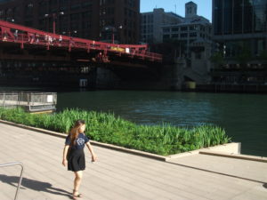
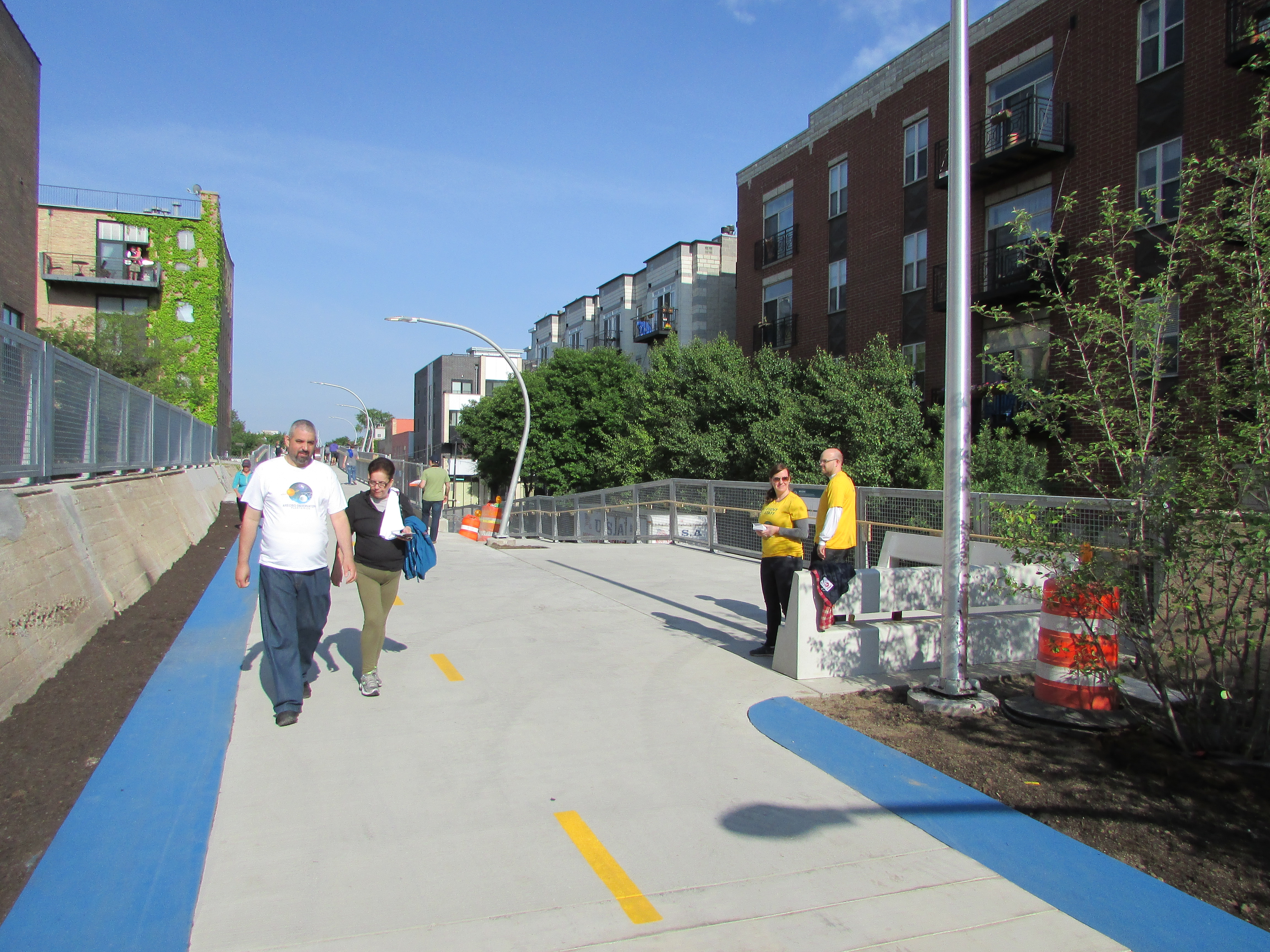
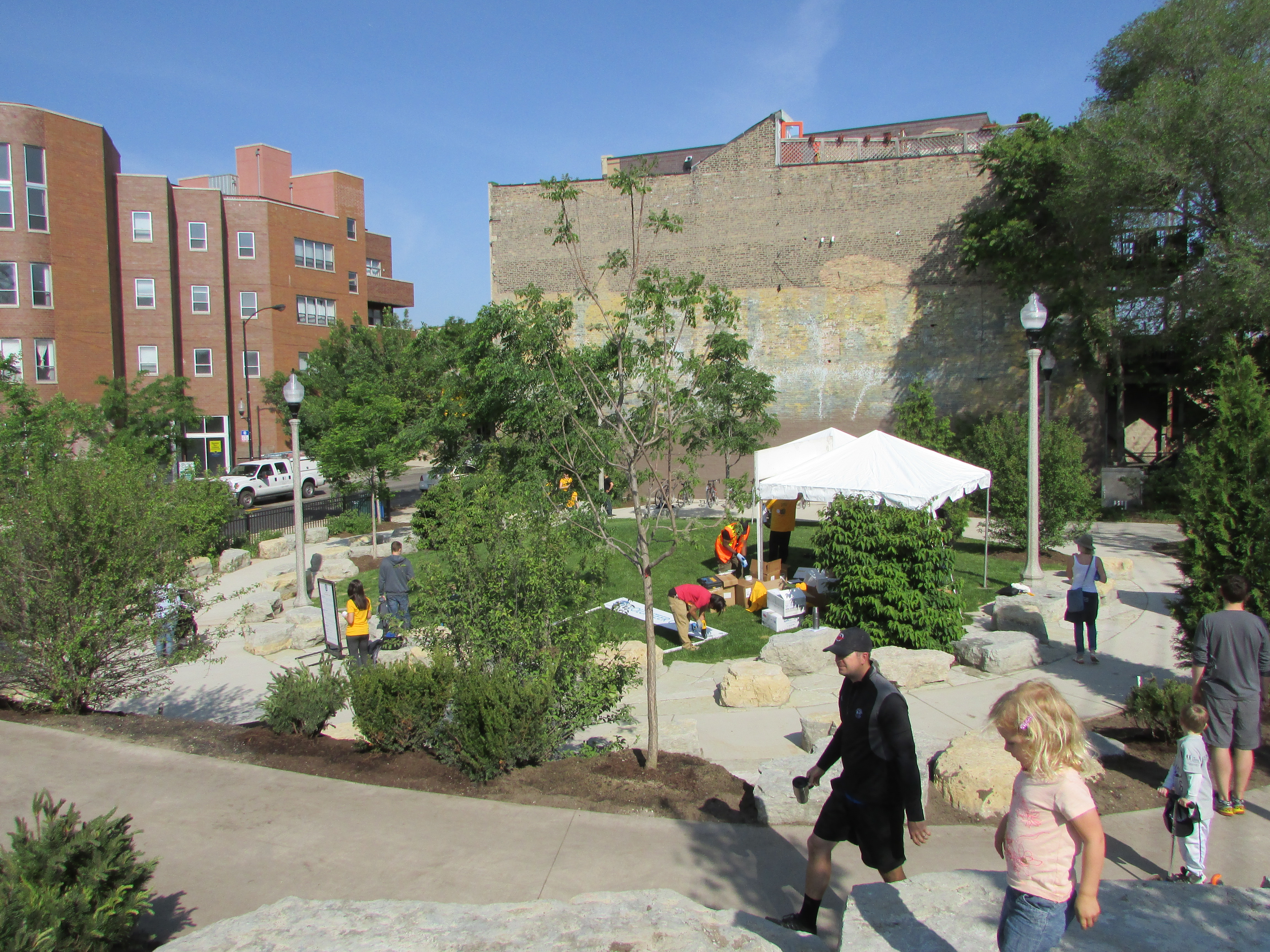
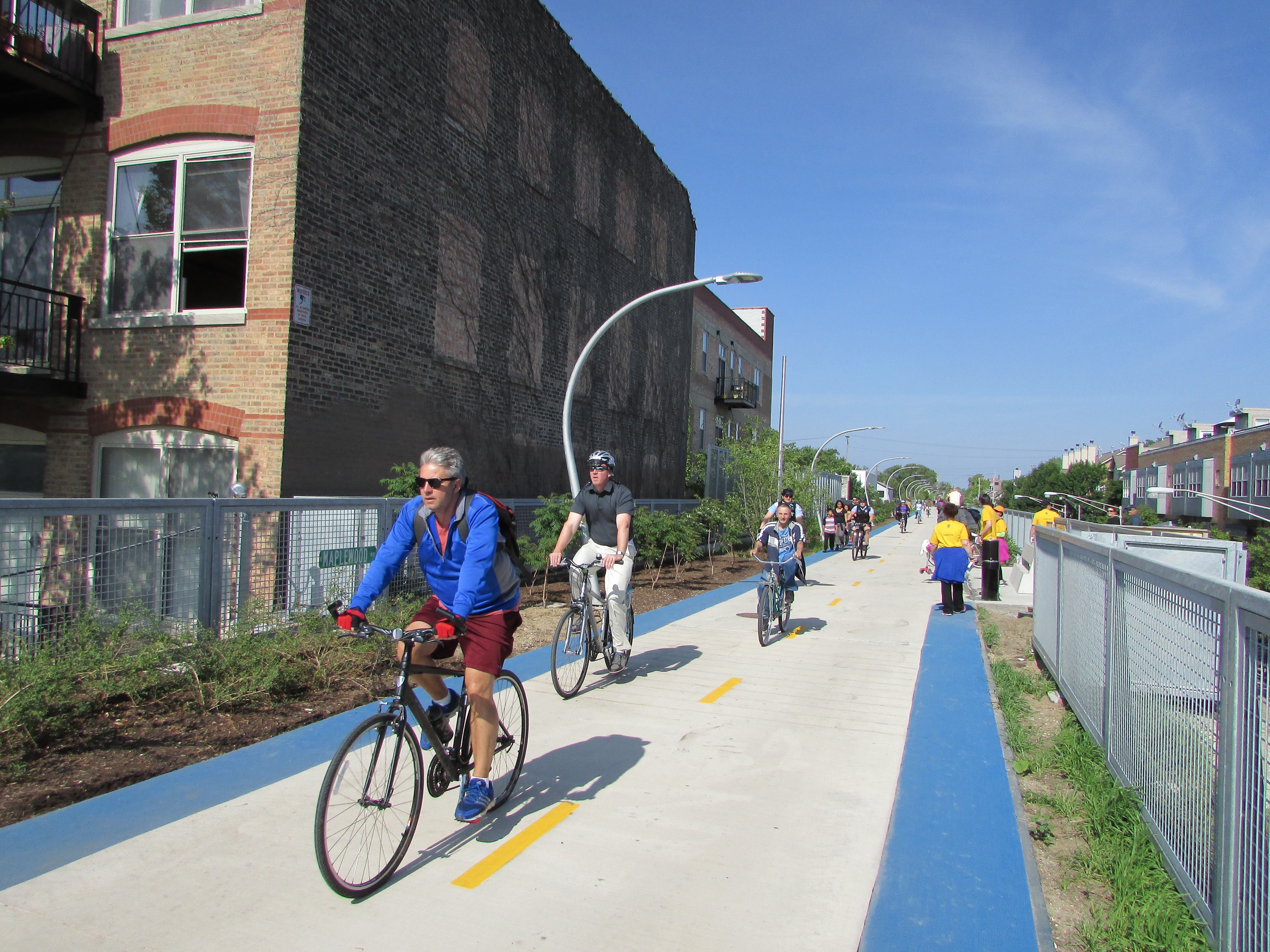
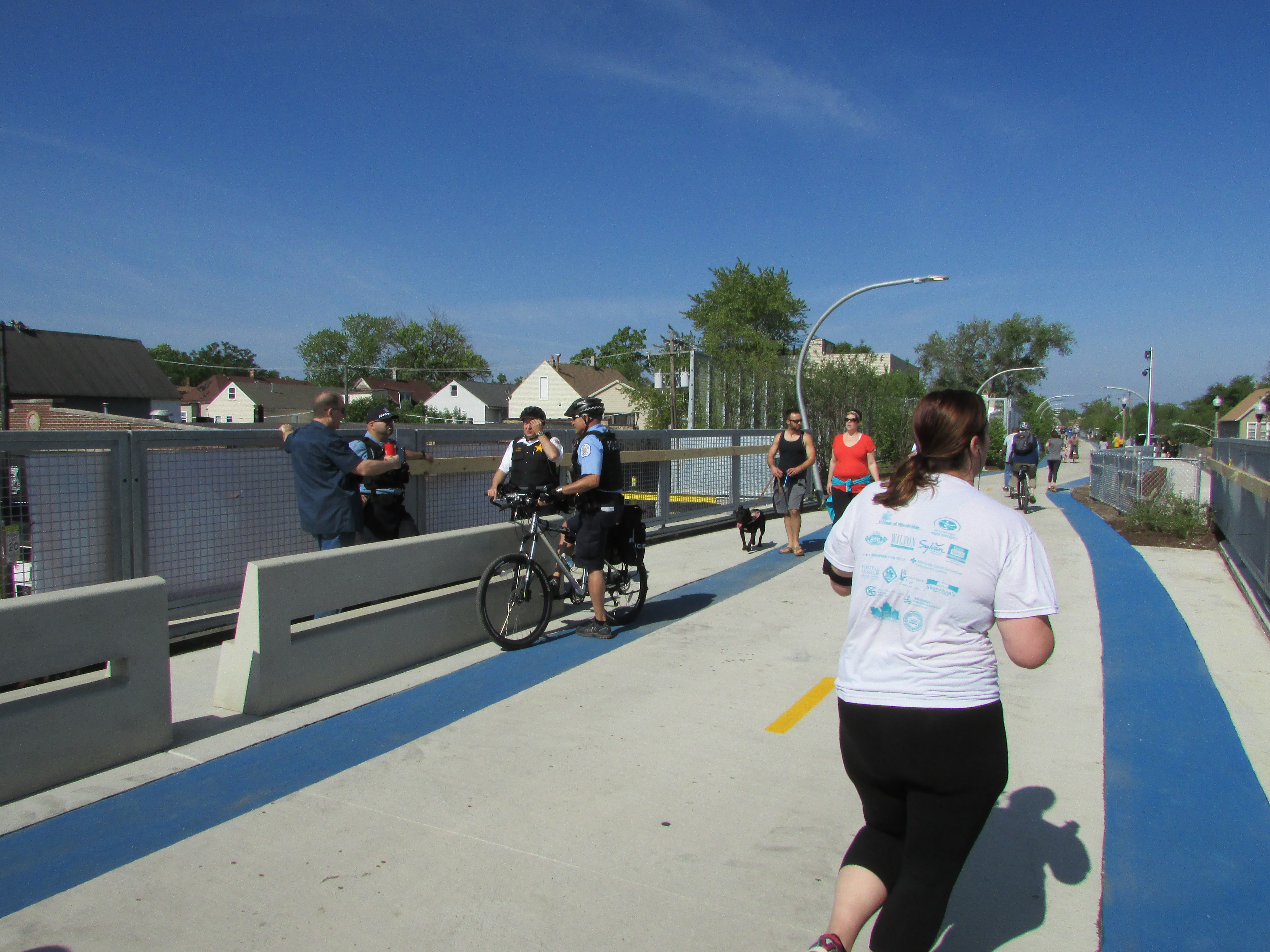
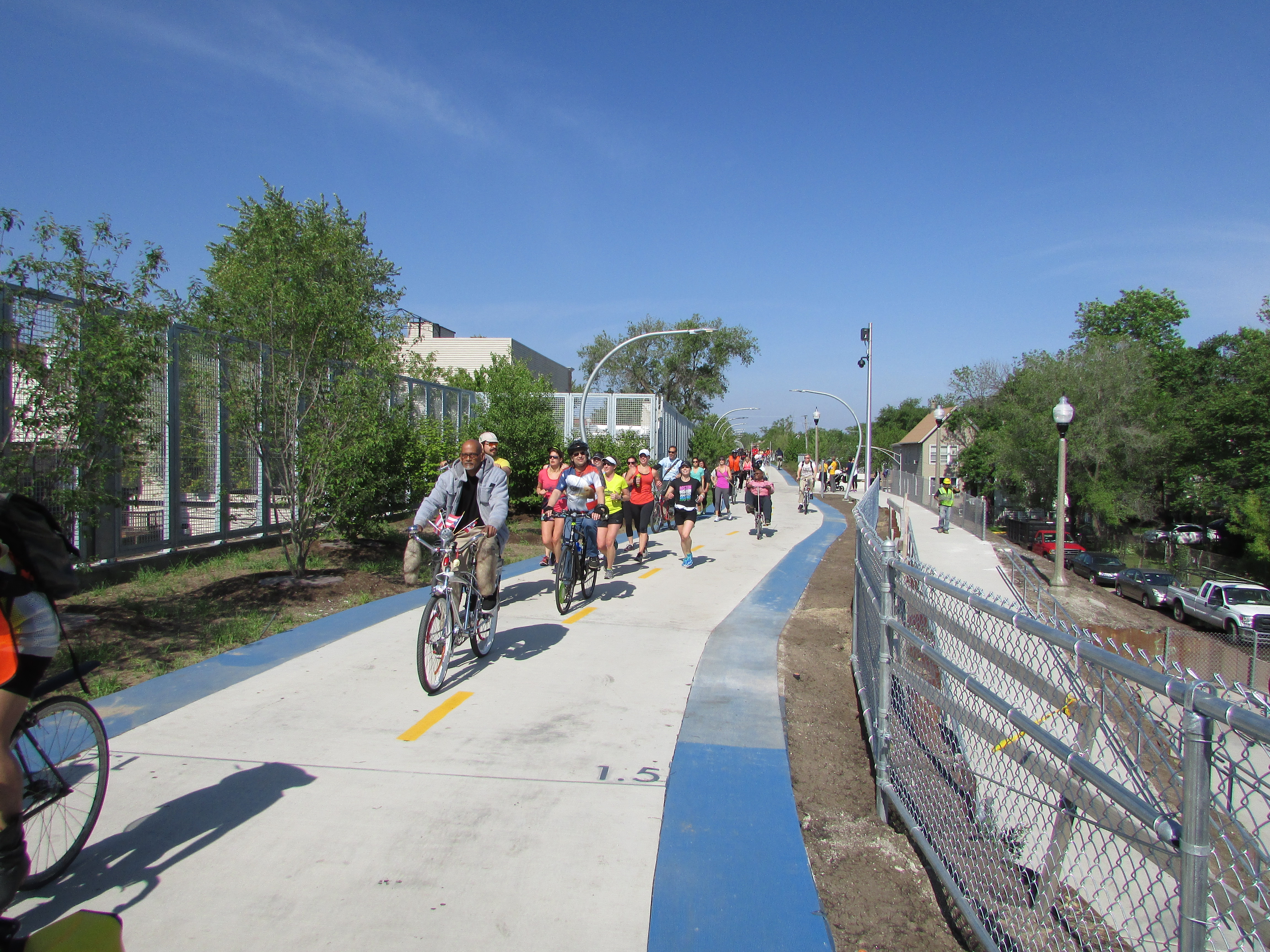
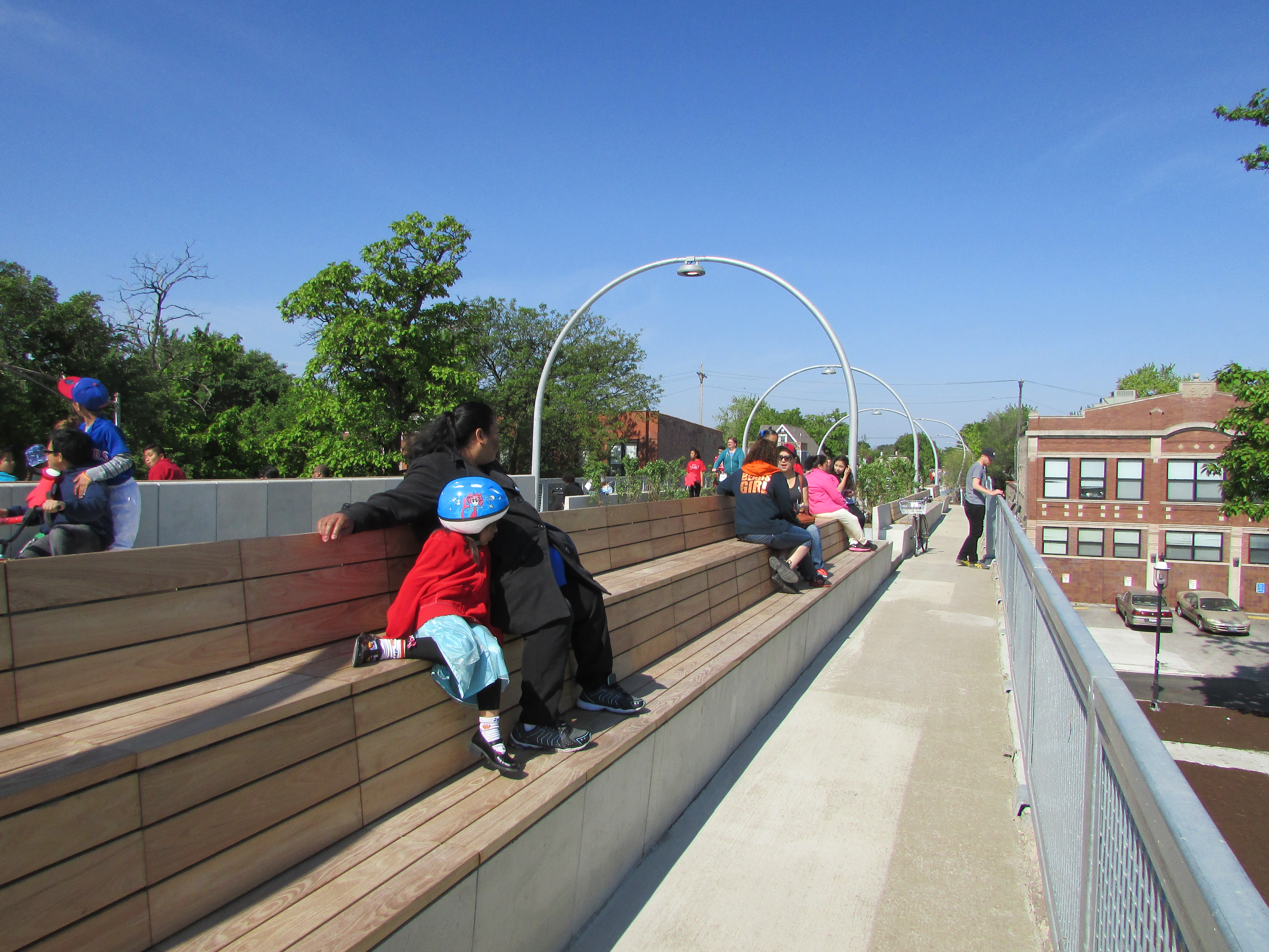
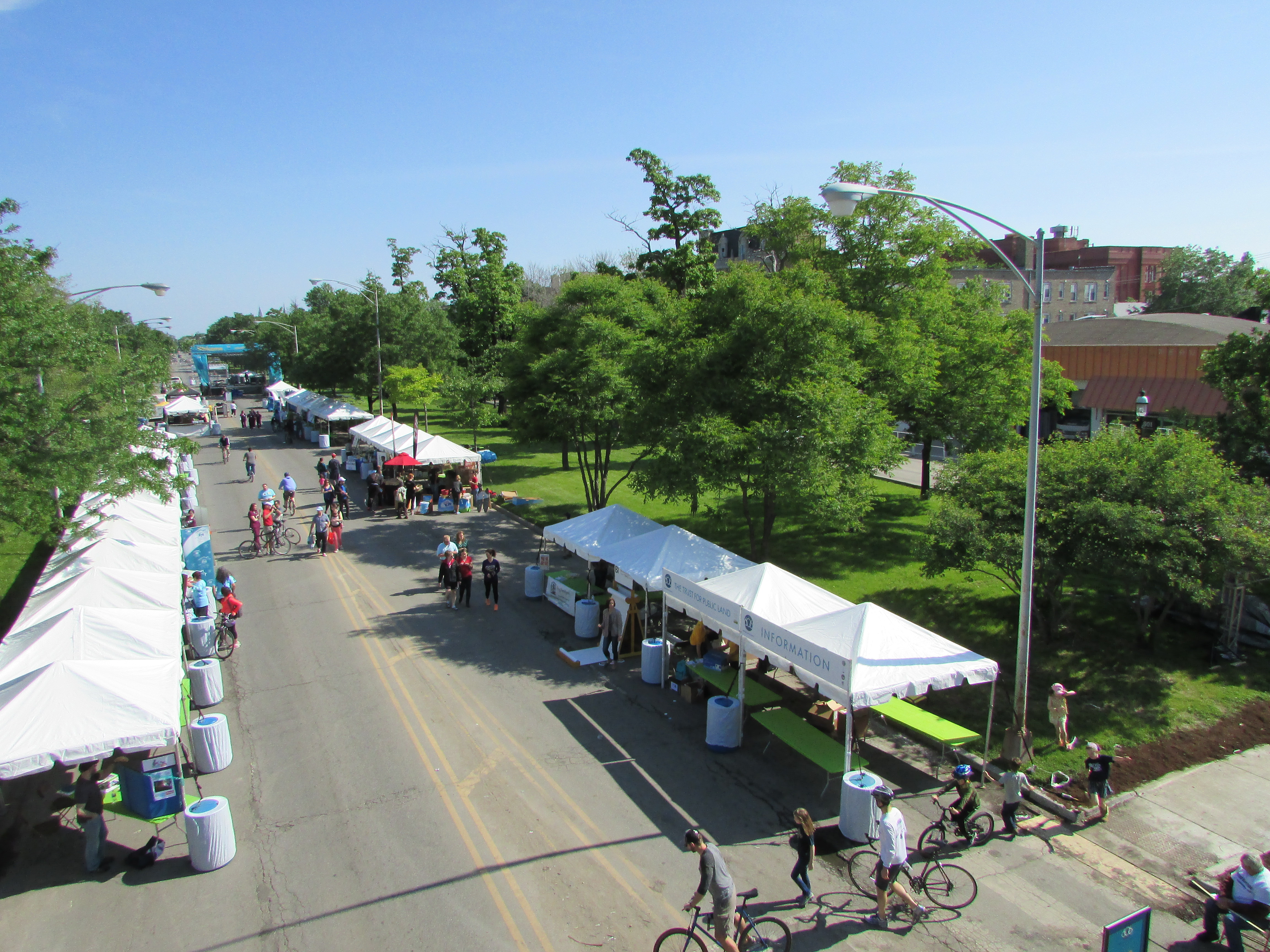
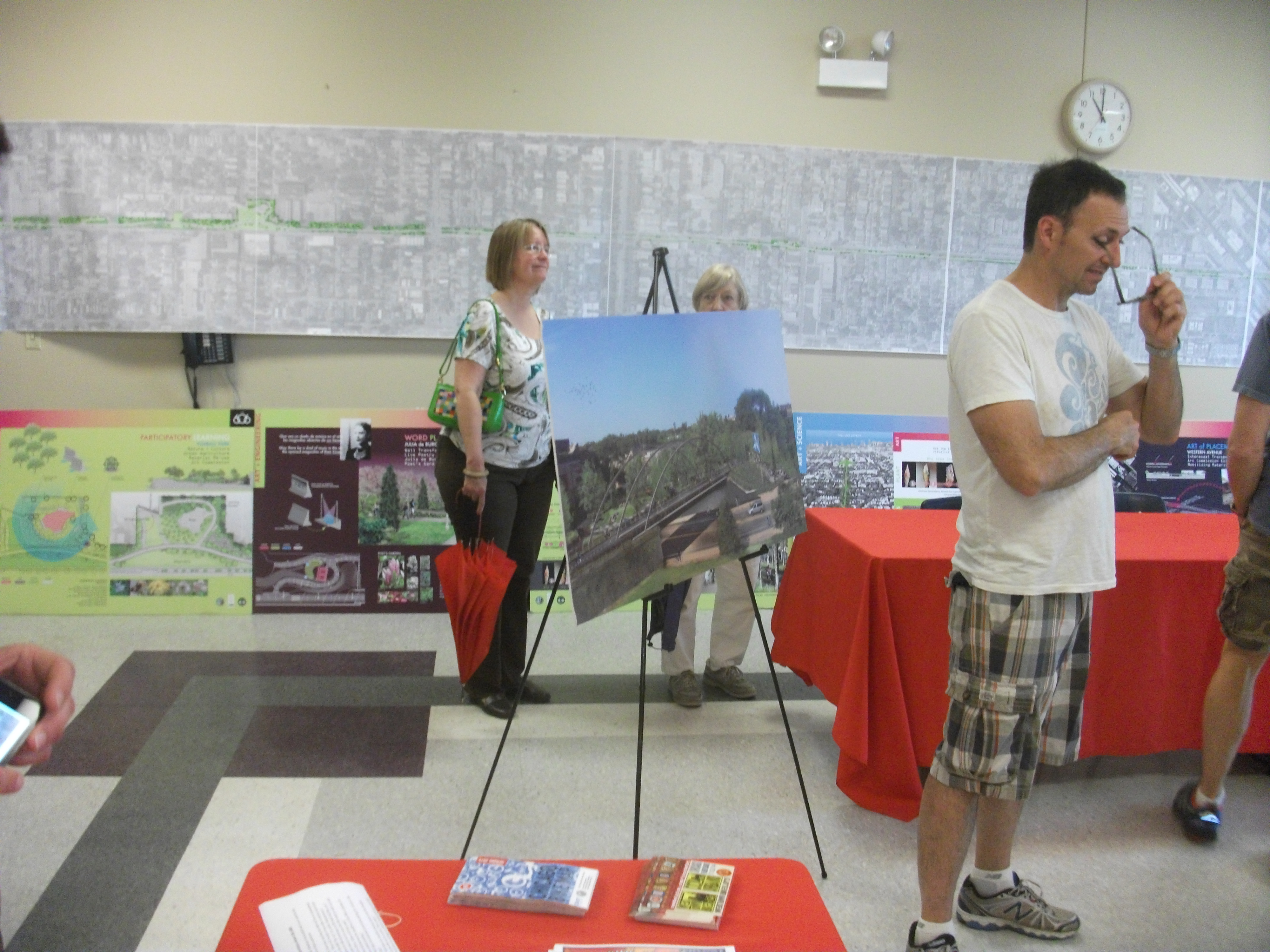
This park is part of the new urban amenity created for Lincoln residents.

I simply set the stage, however, for an increasingly deep dive over two days into the realities facing the communities represented at the workshop. Such input was an essential point of the conference. Different professionals speak differently about the problem; if planners or local elected officials are to interpret climate data in a way that makes sense politically and makes for better local policy, it is important for, say, climate scientists to understand how their data are being understood. There must also be effective information conduits to the general public, which is often confused by overly technical presentations. Moreover, what matters most is not the same for every group of listeners.

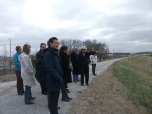
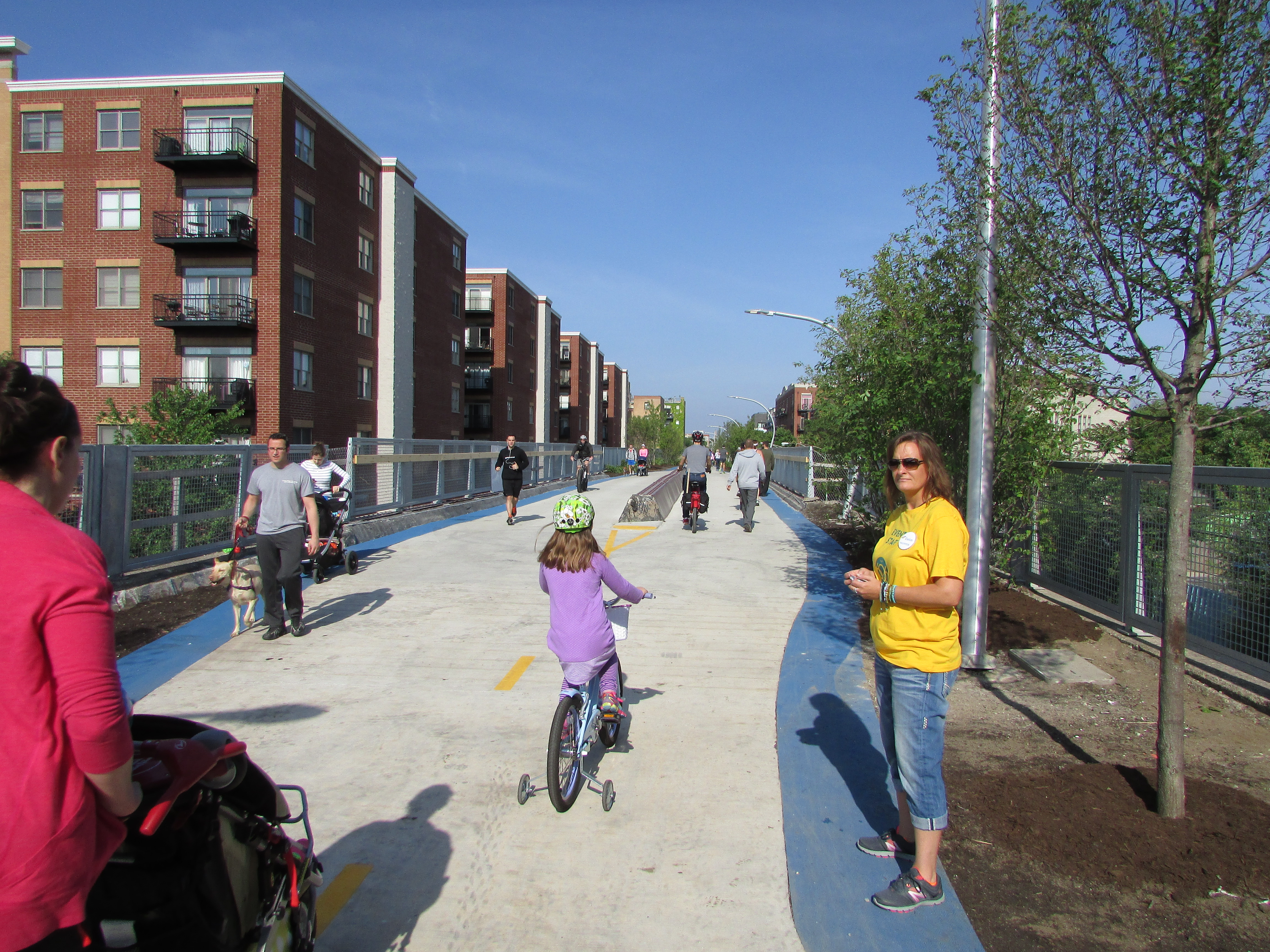
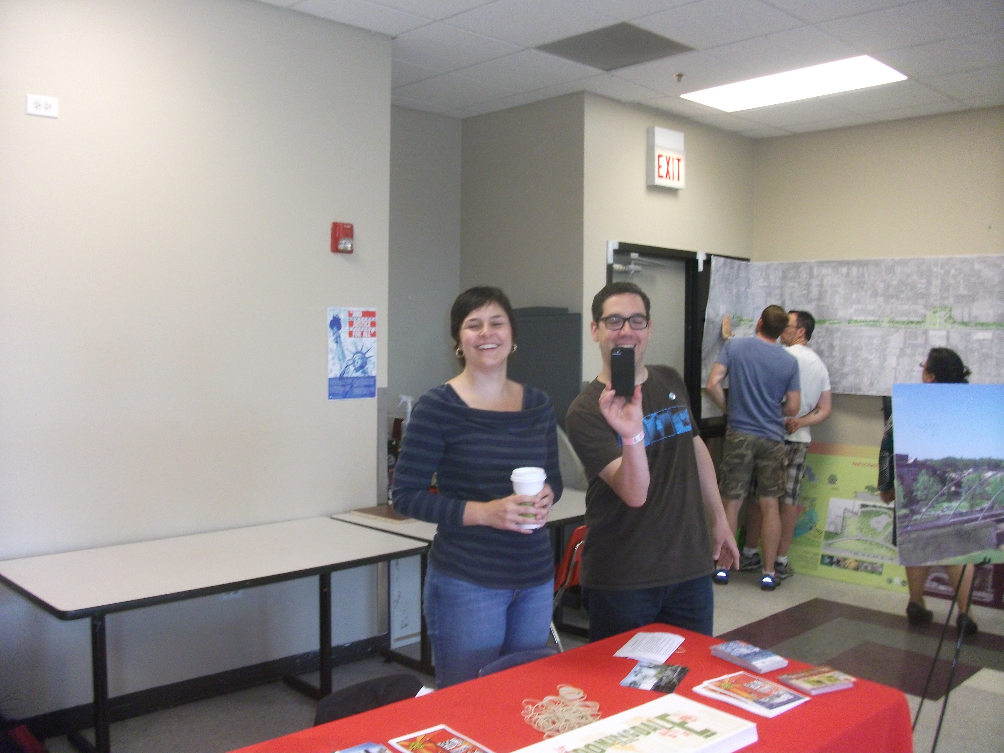
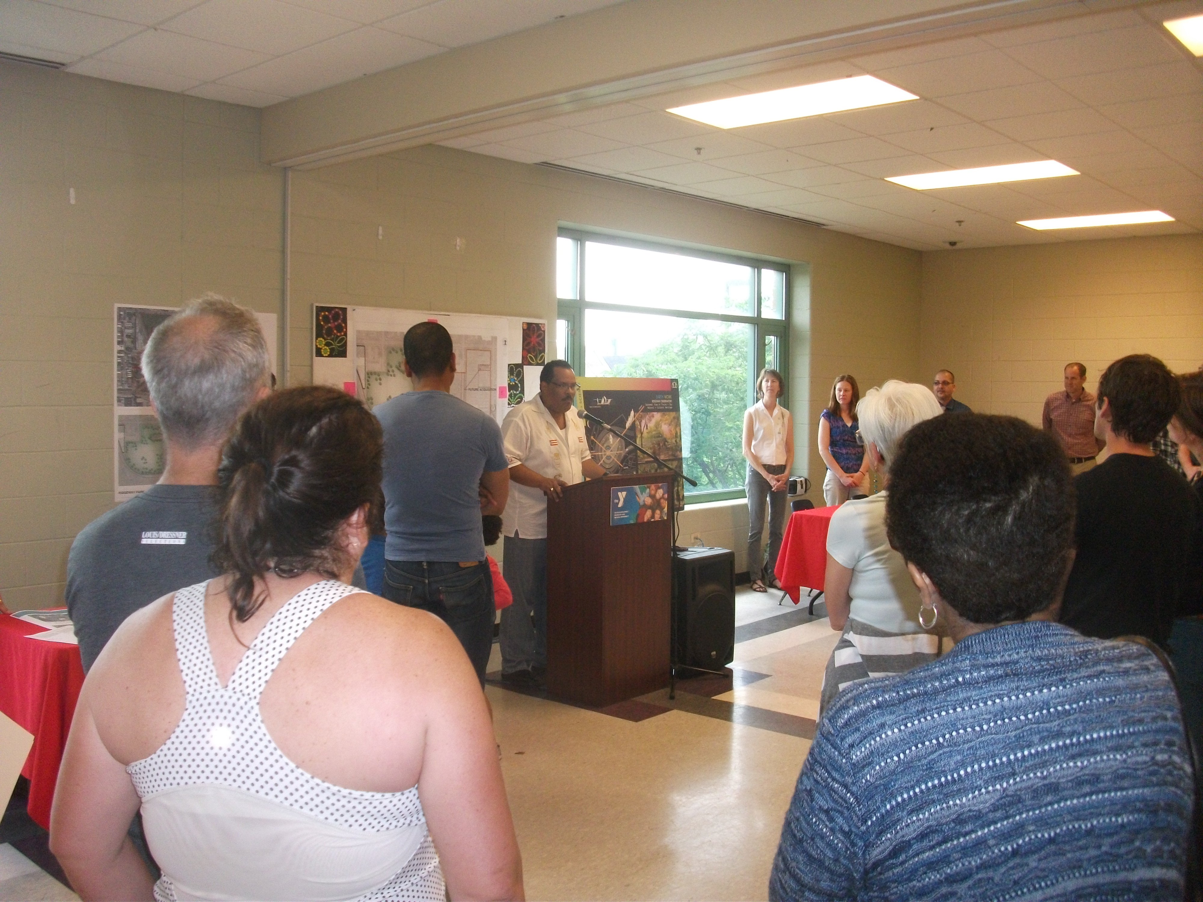
Glenn Johnson explains some of the planning of Antelope Valley.

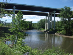
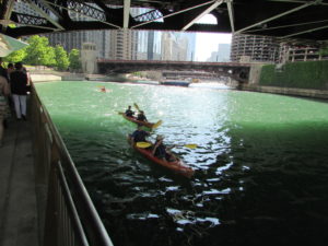
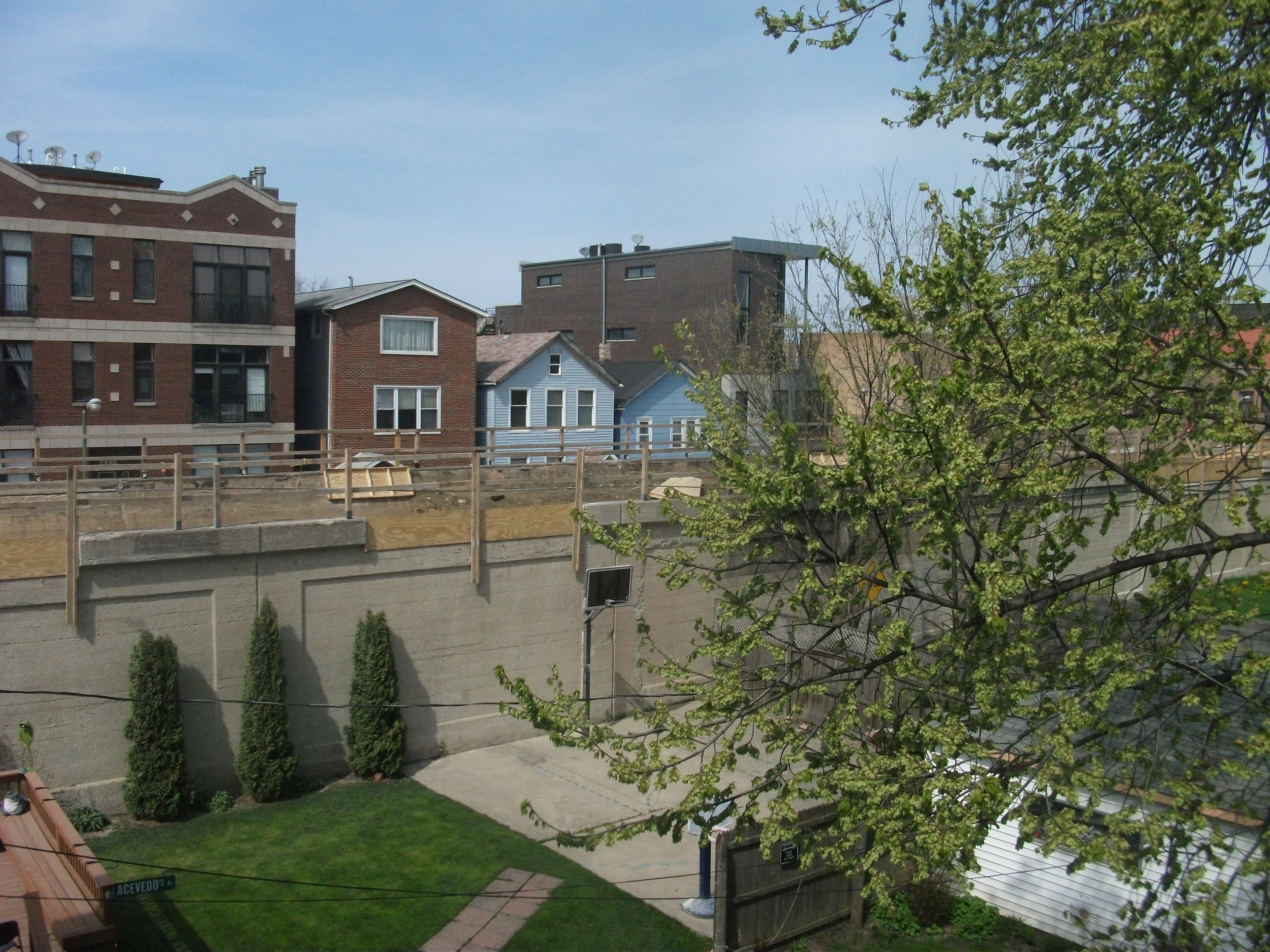
Some of the challenges, as well as the successes, were clear from presentations by two speakers who followed me to talk about the situation in Lincoln. Glenn Johnson is retired from the Lower South Platte Natural Resources District. Steve Owen is with the city’s Public Works and Utilities Department and spoke about the challenges related to water supply and quality, as well as flooding. At the end of the conference, we spent three hours touring Lincoln’s Antelope Valley project, an interesting combination of using a weir (small dam) and landscaping tools to create adequate water storage to reduce flooding in the downtown area. This had the interesting impact of removing some land from the floodplain and sparking redevelopment in what are now some of Lincoln’s most up-and-coming neighborhoods. At the same time, the project through creative urban

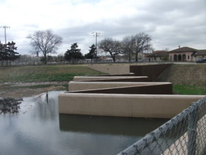
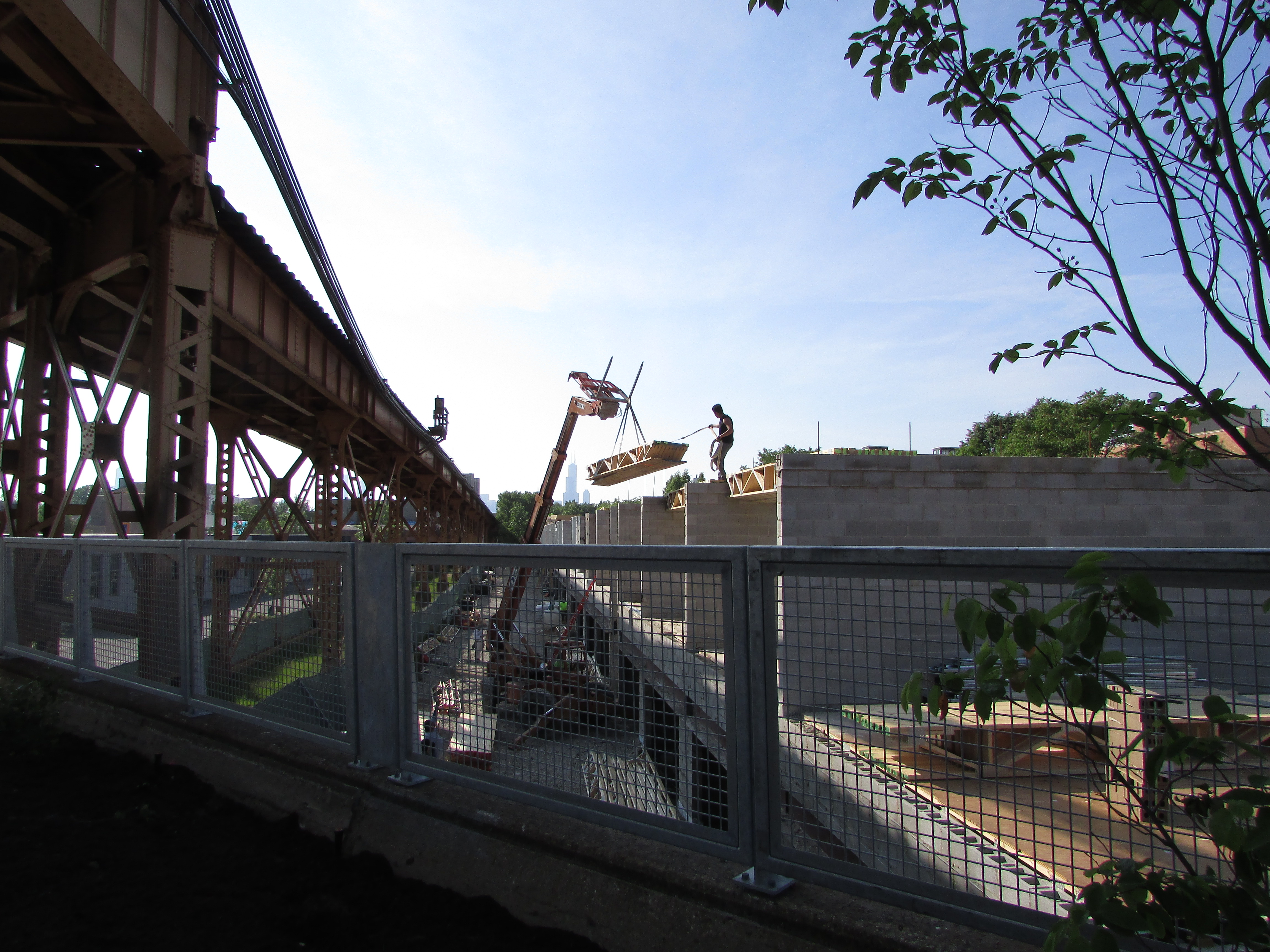
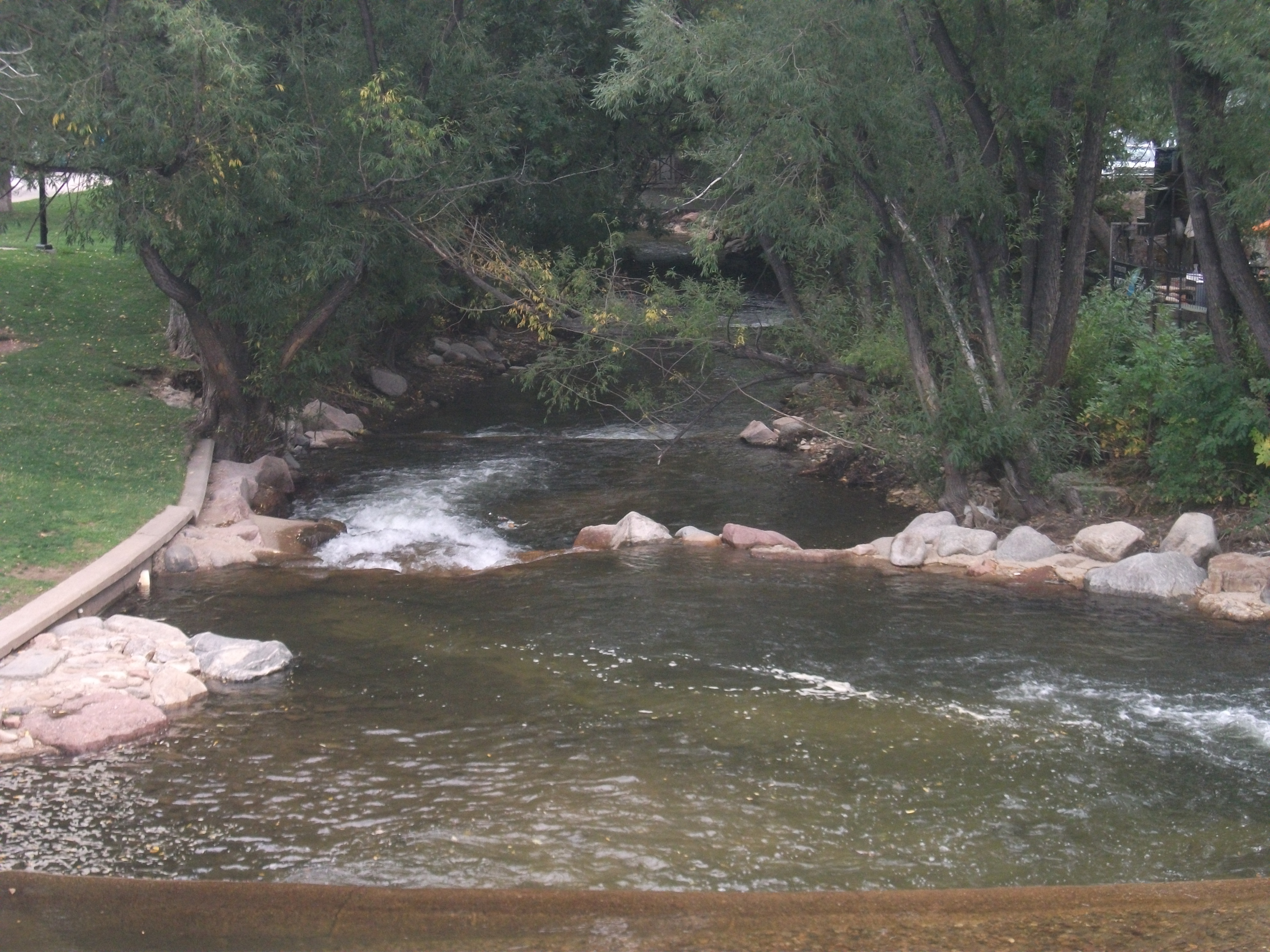
Now you know what a weir looks like (if you didn’t already). Photo courtesy of UNL.

design has allowed the city to create new urban park space and trails that enhance the urban experience for residents. Responding to climate and flooding challenges need not subtract from a city’s overall prospects; it can help enhance its attractiveness to both citizens and developers. The result is that good planning has helped make Lincoln a more interesting city than it might otherwise have been. That is a message worth considering amid all the political hubbub over climate change. We can create opportunity, but we must also embrace the reality. My guess is that this is why the other ten cities were present.

Jim Schwab

In the Valley of the Crooked River

DSCF3156Two weeks ago, I wrote about Cleveland’s Flats Entertainment District, where restaurants and bars now line the sides of the once filthy Cuyahoga River that now hosts boats and rowers. The Flats is but the last reach of a river that extends south into the Akron area. What has often been far less well known to outsiders than the more notorious industrial past of the river is the beautiful, forested valley that surrounds it upstream. In fact, about the time the Cuyahoga River was making environmental history by becoming a driving force behind passage of the Clean Water Act in 1972, U.S. Rep. John Seiberling, an antiwar Democrat from Akron, was leading an effort to designate a new national park. By 1974, he had won authorization for the creation of what is now the Cuyahoga Valley National Park, which remains a hidden treasure for many. I have personally discovered from discussing our trip that many people outside Ohio do not even know that the park exists.

For some interesting background on the politics and commitment behind the drive to create the park, I recommend a book I read several years ago about the life of John Seiberling, A Passion for the Land: John F. Seiberling and the Environmental Movement, by University of Akron emeritus history professor Daniel Nelson.

As for the Cuyahoga Valley National Park: Yosemite or Yellowstone it is not. Ohio, which became a state in 1803 and rapidly urbanized and industrialized afterwards, does not offer such massive public spaces for preservation. But it does contain gorgeous smaller valleys such as the Cuyahoga where protection of the landscape was still possible in the 1970s, and land was assembled from numerous small landowners and public spaces, woven in some cases into the fabric of the existing Metroparks system. In the area that contains the park, certain places seem to take one back in time to the 19th century, when Ohio built a canal to connect the Ohio River and Lake Erie and move agricultural and other products to markets a generation before the railroads began to dominate. Towns such as Peninsula and Boston, in the heart of the upper Cuyahoga Valley, still have the small town feel of that era in many ways, and many older homes have been preserved.

DSCF3157One, in fact, now hosts the Conservancy of the park, along Hines Hill Road just east of Boston, where one finds the visitor center. When we arrived, staffers were erecting a tent for an outdoor wedding that weekend. Curiously, we were also in town for an outdoor wedding for one of my nephews, but his was at Thorn Creek Winery in Aurora, several miles to the northeast. Although we merely stopped to investigate the scenery, and we were totally unexpected arrivals in the Conservancy office, the staff in the office treated us like honored guests, plying us with materials about the park and answering questions. Their friendliness is a tribute to the attitudes and sense of mission of both the Conservancy and the National Park Service itself.

DSCF3164The park itself is a fantastic playground for hikers, bikers, backpackers, and even skiers and sledders. This is the north, after all. Near the Boston Visitor Center is the Boston Mills ski resort, offering some modest hills but great accessibility for people in the metropolitan area. But we arrived in June, and we began to wander the Towpath trail that leads away from the visitor center back into the forest, south beyond the massive bridge that carries Ohio Turnpike travelers past the Cuyahoga River below. From the height of the turnpike, one might never realize that what lies below is a national park, although it is certainly an impressive expanse of forested greenery. Down below, however, we were treated not to nature’s silence but to its music. For one thing, it was cicada season, so the buzz was all about the woods, but so were the birds, some of whom may have been feasting on cicadas. We surely could have seen other wildlife, had we come around dawn or dusk, but we were hiking in the late morning, when the deer and the rabbits and coyotes were well hidden. It is remarkable how easy it is to get away from everything, although the trails are popular enough to keep you in touch with other passing humans. The trails seemed to attract both young and elderly, providing a great excuse to all ages to stay in shape and in touch with nature. I began to wish I had tree and bird guides with me to better understand parts of my experience. If I still lived in the area, I might revisit with those guides, but it may be a while before I return.

DSCF3169Our hiking visit occurred on a Thursday. Jean and I made a return visit on Friday, but of a different nature, and one that accommodated my sister, Carol, who lives nearby in North Royalton. She joined us at the parking lot on Rockside Road in Independence at 9 a.m. for the Cuyahoga Valley Scenic Railroad, a fine way for first-time visitors (and others) to see the park and its valley from a different perspective. The CVSR is a passenger train that uses tracks that largely run along the edge of the river. It is mostly run by volunteers who simply love the job of educating people about the local environment and its history. Audio is available that allows you to hear some of that history along with what one crew member jokingly referred to as “some pretty bad music,” most of it evoking a sense of bluegrass and Civil War and the early frontier with the use of banjos and bass fiddles. Call it “mood music.” The train ride takes about an hour and a half to get to Akron before turning around and bringing you back to where it started. Along the way, there are several stops that allow riders to get off and explore and then wait for the next train coming through. Explorers may want to get the schedule before they wander off. The price is only $15; as senior citizens we got tickets for $13. The money supports the train and is well worth it for the scenery along the way.

Because the park is interwoven among small towns and private property, the park leases some land for sustainable farming of vegetables and sheep, goats, and chickens, with some of the products finding their way to the Countryside Farmers’ Markets. The Conservancy staff also noted for us that there is now a visitor home in the park called Stanford House, built in 1843. It is not a bed and breakfast because visitors are on their own in sharing the use of a kitchen, but rooms can be rented starting at $50 per night, and the home provides immediate access to the Towpath Trail and the railroad, among other attractions.

Ultimately, the Cuyahoga Valley National Park is a study in adaptation, fitting a park into the scenery of a river valley that is also at the center of the large Cleveland-Akron metropolitan area. The park has been evolving since its advent in the 1980s and will continue to evolve as conditions change. But one major contribution it has already made is to stymie the urban sprawl that has so adversely affected much of the Cleveland area and allow residents to enjoy an expanse of refreshing greenery.

One reason it has taken two weeks to return to this blog and tell the story, since we returned to Chicago on June 12, is that I left again on June 19 for Grand Rapids, Michigan, to participate in the 40th annual conference of the Association of State Floodplain Managers, which was founded about the same time the national park was being organized. Today it is a growing organization of more than 17,000 floodplain managers, about 1,000 of whom attended the conference at the DeVos Convention Center, which sits along the Grand River opposite the Gerald R. Ford Presidential Museum, to which it is connected by a stone pedestrian bridge. ASFPM members have always been familiar with nature-based strategies for reducing flood damages and preserving the quality of rivers and streams, and the conference contained numerous discussions of such approaches. It occurred to me that what I had seen in the Cuyahoga Valley was one of the best possible approaches to floodplain management, the prevention of the encroachment of development to allow nature its due, preserving a natural setting that nonetheless endows humans with wonderful opportunities for outdoor recreation and exercise in an age when public health authorities worry about an epidemic of obesity. We have to make our cities attractive places for people to get the exercise they need. Many factors in the Cleveland metropolitan area, frankly, work against that goal, but the park exemplifies it. It is modern floodplain management at its best with a healthy dose of environmental protection in the bargain. The fact that the park is sprinkled with outdoor attractions like the Blossom Music Festival only serves to enhance that goal by acquainting people with what the park has to offer.

John Seiberling was clearly a visionary in fighting for the creation of the park in Congress. But every city has its environmental champions. It is the job of the rest of us to make it politically possible for them to survive and to achieve their objectives. We all benefit from a better quality of life when they do.

As for the title of this blog post: The Cuyahoga River derived its name from the local nomenclature of the Mohawk Indians, an Iroquois nation, who referred to the river as “crooked” because of the way it winds through the landscape, hence “crooked river.” (The Seneca, also Iroquois, used a similar name.) Meandering is nature’s way of diffusing the force of flood waters while distributing silt into the rich agricultural soils along the banks. Ohio grew up on such wealth. Now it is preserving some of it.


Jim Schwab

Riverwalk: A New Chicago Magnet

DSCF3110IMG_0239

Chicago is already quite rich in parks and tourist attractions. What can it add downtown?

In the past, I have written about the 606 Trail in Chicago, which is experiencing its first anniversary after opening a year ago. Despite some of its well-known challenges and problems, Chicago remains a city of quality destinations. Navy Pier, now a century old, just unveiled its redesign last month, including a new 200-foot Ferris wheel, and has been the top tourist attraction in Illinois. Millennium Park has few peers among downtown urban parks and has also been a second magnet for visitors since opening in 2004, ranking only behind Navy Pier.

But below the bridges and viaducts, down near the water’s edge, another jewel is nearing completion along the Chicago River—the Riverwalk. On June 2, I joined a tour sponsored by both the American Planning Association Illinois Chapter and the American Society of Landscape Architects Illinois Chapter and listened to an explanation of both completed and upcoming changes.

Chicago has no shortage of websites and museums devoted to its own urban history, which I won’t even try to summarize here. Suffice it to say that, when Haitian-French explorer-trader Jean Baptiste du Sable first encountered Potawatomi Indians (one of whom he married) at the shore of Lake Michigan in 1790, the Chicago River was still an indolent waterway barely crossing the sandbars to empty into the lake. In a little over 200 years, it has become home to one of the world’s largest cities, with all the pollution and navigation over two centuries that one might expect. In the 1890s, amid the city’s rapid industrial expansion, engineering reversed its flow away from the lake to the Mississippi River watershed, in large part to spare Chicagoans the pollution of their beaches and water supply that came with using the river as an open sewer. The river itself was not a place where you wanted to spend time unless you were in a boat, and even that was questionable. More than 800 picnickers died when the Eastland tipped over at the water’s edge in 1915. At street level on Wacker Drive, a plaque memorializes that notorious incident.

But times change, and in the 21st century, the Chicago River is once again a civic asset to which significant attention—and investment—are being paid. Over the last ten years, the first two phases of a rebuilding project have come to fruition, producing a Riverwalk that now extends on the south side of the main branch from Michigan Avenue west to LaSalle St. A third phase will extend the Riverwalk further west to the juncture of the North and South Branches. Even the term “main branch” may seem a little puzzling to non-natives because it extends only about one mile. Most of the length of the Chicago River is in the two branches, but the whole river in either direction is less than 20 miles. The Lake Michigan watershed in this instance barely reaches beyond the city and rises only about 20 feet above the lakeshore. Beyond that, you are in one of the sub-watersheds of the vast Mississippi River valley. Most people would never notice they had crossed this boundary if a sign did not tell them. The Continental Divide, this is not.

However, the controlled nature of the river and the short reach of the main branch make the creation of a downtown Riverwalk far more manageable and the experience of walking it thoroughly enjoyable. The firms of Jacobs/Ryan Associates, Sasaki Associates (with whom I have collaborated on disaster recovery issues), and Ross Barney Architects, involved in the design and engineering, have produced an experience that unfolds in “rooms” as one moves in either direction along the river, bringing users close to the water while allowing the occasional flood to muddy some steps without much damage beyond washing down the mud the next day. Phase 1redesigned and rebuilt an existing path between Michigan Avenue and the lake, an area popular with tourists as a loading zone below the stairs from Michigan Avenue down to the riverfront for tour boats. It then extended that two blocks westward to State DSCF3126Street and includes the Chicago Veterans’ Memorial Plaza, opened in 2006. One of its nice touches is a series of concrete stairs more suitable for lunch or relaxation than for climbing. It is a dignified but welcoming setting in keeping with its purpose. In Phase I, the idea began to emerge of adding river-level sidewalks that allow visitors to move from block to block without going up to street level and back down again, although some of these obviously had to intrude from the existing river’s edge into the waterway, and thus involved some negotiation among agencies responsible for navigation and safety, given the mix of water traffic still traversing the Chicago River. Congress also had to act to provide permission to allow building 25 feet into the river to create the necessary width for the new Riverwalk.

IMG_0242What has emerged in Phase II is the creation of the rooms: Marina, Cove, and River Theater, extending from State Street west. The first is opposite Marina City, occasionally nicknamed the “Corncob Towers” because of their design, and permits docking by river boats and lounging by pedestrians. The Cove, in contrast, is a favorite stopping point for kayaks and canoes, which provide a rich source of aquatic exercise for sports enthusiasts. The River Theater changes the nature of the experience yet again with the appearance of a riverside amphitheater, using a low-slope path woven into climbing stairs that can also double as points of relaxation for hikers. The theater, for the most part, is the activity on the river itself, although one can imagine a waterborne performance someday floating before the viewers. Most of this opened for public use just a year ago.

Phase III is adding a water plaza at the river’s edge; the Jetty, which places a series of floating gardens along the river edge that allow people to learn about river ecology and native plants, and the Boardwalk, providing an accessible walkway connecting to Lake Street. Although currently inaccessible at river level, one can view the construction on the final phase from street level. We were told the project will be completed by this fall.

O'Brien's is one of the existing restaurants, along with City Winery, that provide refreshment along the route.

O’Brien’s is one of the existing restaurants, along with City Winery, that provide refreshment along the route.

It is one thing to traverse this path with a crowd from a mobile workshop in the late afternoon. Not only does a crowd make a difference, so does timing. I returned the following morning, since my CTA Blue Line commute takes me to the Clark & Lake station. Instead of remaining on Lake Street, I walked to Wacker Drive and descended the stairway again, this time walking in the cool of the morning by myself at 8 a.m. Not that I was alone. The path was already being filled with pedestrians like me, and joggers, and even an occasional bicyclist, so I had to pay attention to those around me as I repeatedly set my camera to shoot many of the photos included here. Heat varies, of course, throughout the summer day, but one pleasant, enduring feature is the cool breeze off the water. In the morning, as well, the restaurants are not yet open, making for a slightly more solitary experience, which even a confirmed extrovert like me can enjoy in contrast to the crowds that by late afternoon are now finding their way to the

The collection of bars and restaurants on the Riverwalk is still growing.

The collection of bars and restaurants on the Riverwalk is still growing.

new bars and restaurants that are now exploiting the popularity of the Riverwalk, as intended, with more coming as the project moves along. The opportunity to sit outdoors at river level and enjoy snacks or dinner and drinks can be very pleasant, and very different from the usual experience high above on the city streets. I expect that most of these establishments will do quite well. I intend to enjoy some of them myself, with friends in tow.

Jim Schwab

Incident below the 606

The 606 is, if anything, ordinarily a very safe, quiet space full of people enjoying the outdoors. This photo is from opening day in June 2015.

The 606 is, if anything, ordinarily a very safe, quiet space full of people enjoying the outdoors. This photo is from opening day in June 2015.

One of the more disquieting aspects of urban life is an occasional confrontation with the irrational. I have debated telling this story, but I decided that enough other people either have had or will share such experiences that sharing it may have great value. One must be prepared somehow to handle these unexpected situations.

In my very last post a week ago, I noted my workouts with a trainer at XSport Fitness. One of those occurred yesterday, Saturday morning, at 8 a.m., after which I walked home with my gym bag, stopping for a snack and coffee at McDonald’s, after which I crossed Western Avenue by going up the ramp on one side to the 606 Trail, about which I have written more than once, and crossing to the other side. It is when I came down I encountered trouble, in broad daylight in the middle of a sunny, beautiful morning.

I was heading down the sidewalk to my home when a young man stood in front of me and demanded to know where I was going. “I’m going home,” I said in a matter-of-fact voice that was intended to suggest that the rest was no one else’s business. Nothing about his manner suggested that this was a friendly question.

“This is my neighborhood,” he asserted, “and I don’t know you.”

“It doesn’t matter,” I said, and began to move down the sidewalk. But he moved to block my path. I moved out toward the street to pass him, and he moved again. He reasserted that he did not know who I was, and I made clear that was irrelevant to my right to continue on my way home. But he would not get out of the way, prompting me to ask, with increasing exasperation, “What is your problem?”

I had both the gym bag and a mostly full cup of coffee in my hands. Before I could truly absorb just how determined he was, I saw his punch coming toward my jaw. I moved back just as quickly, so that his swing only barely connected with my cheek, but now he had really angered me. I threw the coffee at him, and it splattered across his shirt. But I lost my footing and fell backwards, landing on my rump on the planter strip below the trail 16 feet above. He picked up the gym bag and threw it at me while I was down. I quickly got back up, but it was clear this confrontation was not over, and I might just have to throw a few punches of my own if he continued.

But by then, something else happened that I think is one of the redeeming glories of the 606. A small crowd of witnesses to the scuffle had gathered above, and it was very clear to all of them that he was the aggressor. Some began to try to talk him down, threatening to dial 911 for the police. I would have done that myself, except that it was a rare trip in which I had not brought my cell phone. “Do it,” I yelled to them, signaling, I suppose, that I did not have a phone with me. At that moment, I would have liked nothing better than to see a squad car show up. But it did not happen.

What did happen is that one of the men on the trail had made his way down the ramp to usher me away from the confrontation while the young man watched. Amazingly, considering all the witnesses to what had happened, he loudly protested that I had thrown my coffee at him, to which I replied, “Yes, after you took a damned swing at me!” In effect, I retreated at the other man’s urging, continuing further down the trail and then circling back to my home. Equally interesting, though, someone came out of the nearby building and ushered the young man inside. It was over; no one was hurt.

I subsequently made a police report at the station, cycling there after I got home. As soon as I told my story, the officer behind the desk indicated they knew who it probably was, showed me a picture, and I verified him as the individual who had assaulted me. They told me he was mentally ill. I know his name but will not share it. I know where he lives and will not share it. I have learned from detectives shortly after originally posting this that they are still looking for him. This was not the first time he had accosted someone. Moreover, they said it was consistent with his “M.O.”

One important feature of this story is that it highlights a problem we all know exists, but that our society does a remarkably poor job of confronting: the management of the mentally ill, including, in his case, the apparently violent mentally ill. I do not profess to be an expert in this area. There are social workers and psychologists who are much more conversant with all the issues and bureaucratic complications of a system that copes poorly, in part because most of us do not want to spend much time thinking about such people, let alone funding programs to treat them. Our jails and prisons are full of them. Many of the homeless are victims of mental illness. Yet, in Illinois, we have a governor more focused on union-busting than on funding needed social services, despite persistent pleadings from churches and social service agencies, and a legislature that is more focused on re-election than on finding solutions to our fiscal mess. We are at a standstill.

I am not saying, of course, that there is any foolproof solution that would prevent encounters such as mine. Mental illness is a fact of human life that may never disappear no matter how many medicines we invent. There will always be the problem of someone who needs those medicines not being willing to take them. There will always be those who slip between the cracks. It will fall to those of us with enough poise, enough mental stability, and enough judgment to try to defuse these situations. In this particular case, I am enormously grateful to all those people on the trail because, in their absence, I am not sure what else might have transpired. It was a somewhat unnerving incident in part because, rational creature that I am, it took a minute or two for me to grasp that this individual was simply not operating with the same set of perceptions that were part of my universe. In my universe, the street belongs to anyone who wants to use it, and other people’s rights end at the beginning of my nose, as they say, or in this case at the edge of my jaw. In his universe, I constituted some sort of threat merely by trying to walk past him.

If I had been more elderly than my 66 years, less physically fit, or a mother with a child, the incident could have been terrifying, and I suspect it has happened and may yet happen again. And in the process sometimes, we end up with even more of the walking wounded among us. It is a sobering thought on an otherwise sunny Sunday morning.


Jim Schwab

Chicago’s 606: Transformation of an Urban Space

IMG_0037

More than a century ago, the City of Chicago settled a neighborhood dispute by forcing the elevation of a railroad bed for a 2.7-mile spur line that served a variety of small factories on its North Side that provided jobs for a string of neighborhoods in or near Bloomingdale Avenue. The Burlington Northern Railroad had first built the line in the 1870s, but by 1910 it was on a collision course with the surrounding residential areas as auto and pedestrian traffic met freight cars at street grade. Within a few years, the rail cars were running about 16 feet above street level, with 37 viaducts providing overpasses above uninterrupted street traffic below. By the end of the century, however, many of the factories were gone, or were converted to condominiums, and trucks served whatever shipping needs remained. The rail spur had become an anachronism, and eventually the right-of-way reverted to the city.

Dog walkers, children on tricycles and in strollers, all along the length of the Trail. Volunteers in yellow shirts were plentiful along the route.

Dog walkers, children on tricycles and in strollers, all along the length of the Trail. Volunteers in yellow shirts were plentiful along the route.

During that time, a vision developed of a different kind of urban space, a linear park that would become the nation’s second elevated rail-trail, following the High Line in Manhattan. Funded largely with federal transportation enhancement funds,

Winding, ADA-compliant access ramps connect pocket parks, such as Park 567 here, to the trail above.

Winding, ADA-compliant access ramps connect pocket parks, such as Park 567 here, to the trail above.

supplemented by some city money and millions in local fundraising, the Bloomingdale Trail moved from dream to concept to an actual plan by 2013, and finally, on Saturday, June 6, a reality as the trail opened, complete with 17 access ramps and Mayor Rahm Emanuel surveying its length as the leader of a small bicycle troupe accompanied by a handful of police. Thousands of Chicagoans moved onto the trail, on foot, on bicycles and tricycles, and in strollers, taking in the newest amenity in town amid street celebrations and music on Humboldt Avenue and with children’s activities in pocket parks along the way. A host of volunteers in yellow shirts welcomed the visitors and directed them to the day’s festivities. Residents had waited a long time for this day. They finally realized the imaginative transformation of an urban space that long had seemed neglected. The 606 Project, originally known as the Bloomingdale Trail, became a new source of healthy recreation.

New construction is a common site along the trail. This site is near Milwaukee Avenue and parallel to the CTA Blue Line, which crosses the trail.

New construction is a common site along the trail. This site is near Milwaukee Avenue and parallel to the CTA Blue Line, which crosses the trail.

And, for some, an abiding fear of displacement. That was almost surely to be expected. Development of the trail followed the 2008 recession, with its sudden decline in housing prices, followed by a more recent uptick. For Chicago, that uptick has been nearly citywide, but there are disparities, and it has been noted repeatedly that the trail links disparate neighborhoods. To the east, starting around Ashland Avenue, neighborhoods within a mile of the trail were gentrified at least a decade ago. As one approaches the western terminus, at Ridgeway, household incomes and property values have been remarkably lower, and the percentage of renters much higher. Renters, of course, have much less control over rising housing costs than homeowners, on two counts—one, that rents can go up, but two, that affordable rental units can be torn down or rehabbed and converted into more expensive units, resulting in potential displacement in favor of newcomers with more income.

A view of my own street, North Campbell Avenue, from the trail crossing above.

A view of my own street, North Campbell Avenue, from the trail crossing above.

The trail is almost certainly accelerating those trends, but as a resident of eastern Humboldt Park since building a new home on an infill lot in 1994, at a location about one-third of the way from the eastern end, I can attest that it is not the sole source of such gentrification, which was already well underway to the east, in Wicker Park and Bucktown, even then, when the mere idea of the trail was barely a glimmer in the minds of the biggest visionaries in town. It has inexorably marched west. The question is not the direction in which trends are moving, but the pace.

No need to leave the trail if you're thirsty. Water fountains appear at decent intervals.

No need to leave the trail if you’re thirsty. Water fountains appear at decent intervals.

The question is also not whether residents of the area want such an amenity. Now that the 606 Trail and Park is open, it is unquestionably a beautiful space that offers great recreational and physical activity value to a substantial chunk of Chicago. Nearly 100,000 Chicagoans are within walking distance of the trail, depending on how you calculate that distance. (Speaking for myself, one mile is no big deal, but for others it could be insurmountable, depending on age and physical condition.) The views from the trail are stupendous and varied. What is at issue for those concerned about being priced out is whether working and low-income people of modest income and resources can enjoy the park they have so long awaited. It is a volatile equity issue the city needs to address.

IMG_0079

In any event, there was always the opposite question: What if we did not develop such a trail? The abandoned rail line, left unattended, would eventually become a serious liability for the city, yet the cost of tearing it down, ending up with nothing, might well have been comparable to the $95 million ultimately invested in creating something, something noteworthy and positive.  Doing nothing with this obsolete space was never a viable option. It would have become an eyesore or worse.

IMG_0089One issue that a few have feared almost certainly will not come to pass: increased crime and vandalism. On opening day, despite teeming crowds, some running, some walking, some cycling, and some with dogs and baby strollers, along the entire length as I rode my own bicycle, stopped, shot photographs, and talked with volunteers, I saw absolutely no accidents and no incidents. People on wheels respected the pace and space of those around them. The trail seemed to bring out the best in everyone; Jane Jacobs’s long-ago observation about the value of “eyes on the street” never seemed so true. People with homes adjoining the trail seemed to enjoy the presence of the passersby, some sitting on decks and in backyards waving at trail users, including the occasional marching band participating in the celebration.

IMG_0094

There will be time to engage in more deliberative debate about the impacts of the 606. For today, on this blog at least, I prefer to take time to offer a visual celebration by sharing some of more than 130 photos I shot that opening morning. Enjoy the views.


Want to just watch the traffic go by? Sit on a bench.

Want to just watch the traffic go by? Sit on a bench.

Jim Schwab


Or watch the street fair below on Humboldt Avenue on opening day, June 6.

Or watch the street fair below on Humboldt Avenue on opening day, June 6.


Food at the Riverside: Review

Restaurants can and often do feature curious logos, and one would expect no less from any independent restaurant in Boulder, Colorado, but an image of an upward-pointing fork with a upside-down goat sitting on top? Well, let’s just accept that. I didn’t see any goat on the menu anyway, just . . . .

Never judge a restaurant by its entrance. :)

Never judge a restaurant by its entrance. 🙂

goat cheese, unless I am missing something, which I doubt, although buffalo does make an appearance. This is the new West, after all.

And I can always appreciate an entrepreneurial sense of humor. I am a strong believer that a healthy sense of humor extends our life span, and I certainly hope to extend mine with a positive attitude and a disposition toward laughter as good medicine.

In a state where the sign inside “Food at the Riverside,” pointing to a separate downstairs facility, welcomed the now legal “Colorado Cannabis Industry Meetup” that evening, I might note that my own personal disposition is that humor and laughter beat drugs as a source of spiritual and psychological nourishment. But people will find solace where they will, and while I do not personally find any use for marijuana, I certainly favor decriminalization and taxation over wasting money and human resources on jail time for such activities. Our society has better things to do, just as it had better things to do than Prohibition nearly a century ago.

DSCF2469

But that is all apart from my comments on Food at the Riverside, a small restaurant nestled alongside—and mercifully above—the sometimes mercurial Boulder Creek, as it ripples downstream after spilling out of the nearby Rocky Mountains. It is part of a larger complex known simply as The Riverside that includes an outdoor café and facilities for private events, in a building that began its existence long ago as a candy store.

I was part of an unexpected, reservationless group of 14 customers, all attendees of the 3rd International Conference on Urban Disaster Reduction at the nearby Hotel Boulderado. The hotel, by the way, is a wonderfully historic building that dates to Colorado’s nineteenth century and features a look that bridges the years between. It has its challenges, if you want all the modern conveniences of a newly built hotel. The elevator requires the operation of a hotel staffer, but you can ascend and descend five stories of stairs, as I did for three days, and get some aerobic exercise while moving around. In a state with more physical fitness per capita than perhaps any other in the U.S., and one of the lowest obesity rates, this is perhaps not a bad thing, although it is not necessarily the best for people with physical disabilities.

Despite our large group’s unexpected arrival early in the evening, Food at the Riverside quickly made accommodations. An adjacent room hosted a blues band for the evening, but we were able to hear each other and enjoy our conversation, and the evening was nice enough to allow the open window to filter the burbling sound of the creek below. In fact, at one point, that sound was loud enough to cause some of us to wonder if it was raining outside, but it was not.

Our delegation included only three Americans, the rest being from Taiwan and Japan. The size of our group allowed us to combine our orders in certain categories for discounted prices. The menu allows you to choose three items from salads, cold plates, warm plates, or grilled plates for discounts; the salads were all in high single digits, with three for $19; the grilled plates, the most expensive, still were only $10 to $12, or all three for $27. The latter options included duck breast (with butternut squash, granny smith apple, hazelnuts, and tarragon butter), lamb rib (spiced with cardamom brown sugar, plus pear, pomegranate, pistachio, arugula, and gryree), and New York strip steak (with whipped potatoes, grilled asparagus, and horseradish demi). I chose the last of the three, and I must say it was succulent and well prepared, and capped off an evening that began with a quality wine and beer list.

The salads were also all excellent; my choice was arugula, augmented with pears, Maytag blue cheese, toasted walnuts, and red wine vinaigrette. But others featuring romaine hearts, spinach, and golden beets were also available. They were all well worth their modest price.

DSCF2473

I should also note that the manager, as we left, hastened to hand me the breakfast and lunch menu as well once he learned of my blog, and it does look interesting, featuring omelets, benedicts, paninis, and quiches, in addition to more classic fare. I may well be tempted to try either meal on a subsequent visit to Boulder, which for me is almost inevitable, given the local presence of the Natural Hazards Center.

When I do, if the season is appropriate, it may be nice to try the outdoor seating above the creek, where one can watch the joggers, bicyclists, and strollers, as well as the water, pass by. I can think of worse ways to spend a summer evening, especially if another band is playing inside.


Jim Schwab

The Bridge to Success

Bridges come in many forms. There are 37 viaducts along the Bloomingdale Trail, the centerpiece of The 606 Project. It’s a northwest side Chicago project whose progress I have featured on this blog more than once in the past. Those viaducts are physical bridges that link the trail (and formerly the railroad) across underpasses that facilitate traffic below. More than a century ago, the city and the railroad agreed that elevating the spur line would alleviate traffic conflicts on the streets below.

Today the work on the trail also features more metaphorical bridges: those between people. Making the planning process and its implementation run more smoothly as the trail is constructed involves the judicious use of public-private partnerships, allowing both the public and private sectors to perform separate functions more efficiently and effectively. For that purpose, at the beginning of the project, the Chicago Park District hired the national organization, Trust for Public Land, as its representative in both organizing and managing public involvement in the project. The Trust for Public Land also helps manages the Park District’s relationships with the other city agencies involved, most notably the Chicago Department of Transportation (CDOT). CDOT is leading the construction because federal transportation enhancement funds provide the bulk of the funding for the $95 million project. As part of the public/private nature of the project, The Trust for Public Land is also leading the charge to raise money from private sources.

I took time recently to meet with Jamie Simone, who ten years ago worked for me as a research intern on an American Planning Association project on Planning for Wildfires. Jamie was enthusiastic and curious then, as she remains now that she is performing her dream job with The Trust for Public Land as program director for the Chicago Urban Parks Program. We discussed both what The Trust for Public Land actually does and how it does it.

Jamie, left, at a June 21, 2014, open house for the Bloomingdale Trail project at the Tribune-McCormick YMCA in Chicago.

Jamie, left, at a June 21, 2014, open house for the Bloomingdale Trail project at the Tribune-McCormick YMCA in Chicago.

The Trust for Public Land has a formal agreement with the Park District, Jamie noted, in which it serves as the district’s project coordinator and an “owner’s representative.” What this means in practical terms is that The Trust for Public Land provides an interface with other city agencies on behalf of the park district “to keep things moving forward.” What is important about this arrangement is that, for Jamie, this is her main project; for many of the people in city agencies, the park and trail system development is one of several projects among which they must divide their time. In short, The Trust for Public Land staff can give the trail a “different level of attention.” But, in addition, The Trust for Public Land can bring private fundraising to bear on the project, something inherently more difficult for the city itself to do.

Particularly in a big city like Chicago, however, the effective management of opportunities for citizen engagement with the project is critical. The failure to provide such opportunities has derailed more than a few big urban projects across the country over the years. People want to provide input, and when it comes to a project as intimately related to the quality of life in their neighborhoods as the Bloomingdale Trail, they want such input very much. Hundreds of neighborhood residents attended meetings over a period of months in the last two years that allowed them to see and comment on design options for not only the trail itself but the access ramps and their connections to nearby pocket parks and residential streets.  I know that the input was real and sometimes fervent because I attended two of the bigger meetings. People had strong opinions, but they also clearly wanted the project to succeed.

Chicago Alderman Rey Colon addresses the open house audience.

Chicago Alderman Rey Colon addresses the open house audience.

Numerous maps and posters at the open house help explain both the vision and progress of The 606 Project.

Numerous maps and posters at the open house help explain both the vision and progress of The 606 Project.

When the park and trail system open, residents will end up with some sort of access within one quarter-mile of any point along the trail, and the access points will all be compliant with the Americans with Disabilities Act (a requirement in any case). This trail is an exceedingly rare opportunity in urban life, and it was important that it meet people’s perceived and actual needs.

With that in mind, The Trust for Public Land continues to manage monthly public outreach meetings as the trail progresses, with a variety of neighborhoods and organizations involved. But the focus has shifted, as it has with the weekly staff meetings in which city staff and The Trust for Public Land review progress. The design phase is over, and construction has been underway for some months. The emphasis now is on managing a project the likes of which the city has never tackled before. This is, after all, only the second elevated rail-trail in the United States, after the High Line in Manhattan, which is much shorter. The challenge lies in learning how to maintain such infrastructure, with running trails and access parks. It is a different kind of maintenance than the park district has ever done, and there will be a learning curve. The Trust for Public Land helps as a more limber, more flexible organism than the city. Neither is better; they are simply complementary, with notably different assignments and strengths. That is the beauty of a well-executed public-private partnership.


One final note is that, as the whole project moves forward, The Trust for Public Land has also been able to use the services of Exelon Fellow, Jean Linsner, to develop the trail as an urban educational tool, reaching out to 25 schools within a half-mile of the trail, which can become a visible lesson in urban history for thousands of young people. Perhaps including my own grandchildren.


Jim Schwab


Moving Forward on the Trail

Spring has sprung in Chicago, and along with it, construction progress on the Bloomingdale Trail. I can hear the hammers pounding as I write, installing guard rails at the edges of the trail. Other equipment is tearing out old rail debris and erecting access ramps.

View of the trail under development from third floor of our home.

View of the trail under development from third floor of our home.

Last summer I reported on the plans for the trail, which would become the second elevated rail trail in the nation, but also the longest. Work began in spots, but now it is obvious all the way up and down the 2.7-mile stretch that sits 16 feet above street level. Work crews have been repairing the concrete walls, replacing bridges, fixing viaducts, and preparing the landscape for improvements. In mid-April, they removed an old bridge over Western Avenue, the busiest north-south arterial passing beneath the trail, and installed a new one, that is actually an old one from Ashland Avenue, in its place. The old bridge needed replacement regardless of the trail project because its low ceiling had long been a hazard for the occasional truck that found itself just a tad too tall to pass beneath. That is no longer a problem.

The new trail bridge over Western Avenue.

The new trail bridge over Western Avenue.

No place along the trail will be more than a quarter-mile from an access ramp. Every access ramp will be ADA-compliant to ensure that those with disabilities can enjoy the linear park like all the rest of us. Bicyclists and pedestrians will all be able to enjoy the quiet vistas and street furniture of the elevated design. New public art will also be part of the equation. The rollout of most of this is expected as early as this fall, so those who live nearby—my house is little more than 50 feet south of the trail—can expect a busy, perhaps at times noisy summer as the progress continues. That is okay, at least from my point of view. What we gain in the end is far greater, a wonderful public amenity that will be a showcase of the best ways to repurpose otherwise obsolete pieces of infrastructure. What once belonged to the railroad will now belong to the people of the city of Chicago.

Access ramp under construction from Rockwell Avenue.

Access ramp under construction from Rockwell Avenue.

Jim Schwab

The High View of Chicago

The Bloomingdale Trail (awaiting improvements) viewed from our backyard

In my last blog post, I extolled some of the virtues of staying put, at least for a vacation, as opposed to roaming the world, a charge to which I plead guilty on a regular basis, though more in connection with work than pleasure. That was a teaser to my real goal of introducing readers to one of the most intriguing projects in Chicago in recent years. The wonderful thing is that my wife and I live just 50 feet from the Bloomingdale Trail. I can even overcome my dislike for the name the larger project surrounding the trail has acquired: The 606. Intended to convey the idea that this is everyone’s project in Chicago by using the first three digits of the city’s many ZIP codes, I find it as unappealing as most things numerical when a real name using words could have been found. But this decision has been made, and it does not necessarily harm anything. The idea seems to have been that the simple name, “Bloomingdale Trail,” which we started out with, and which simply parallels the name of the narrow street beneath it, would confuse people. There are towns named Bloomingdale, after all, and somehow we would not understand, or people elsewhere in the city would think the trail is not theirs because it is ours. I don’t follow all that, but I’ll live with it. The project is still worthwhile. And Bloomingdale remains the name of the trail itself.

What we are discussing here is a public amenity born of an old railroad spur line. Beginning in 1873, the Chicago and Pacific Railroad operated this 2.7-mile span through some dense neighborhoods, serving  various small factories. Despite these economic merits, the line caused a good deal of consternation when its trains tied up traffic, blocked fire trucks, and otherwise displeased the neighbors in Logan Square, West Town, and Humboldt Park, the three North Side neighborhoods in Chicago that it traversed. The residents pleaded and demanded with City Hall that the tracks be raised above street level to minimize conflict, and over several years, beginning in 1910, the city did just that. Instead of the railroad continuing to run down the center of Bloomingdale Avenue, it was raised 20 feet with the construction of two concrete triangles into which dirt was poured, with the tracks laid on top. A total of 38 viaducts then allowed street traffic to cross beneath the railroad. However, by 1994, when we built our house on Campbell Avenue, the railroad was barely operational, and the question was what would become of it. Tearing it down would have been very expensive.

The Campbell Avenue viaduct.

So the question arose: Why not turn it into linear public open space?

And so the Bloomingdale Trail began to emerge as a conceivable alternative. By 2004, the Friends of the Bloomingdale Trail had emerged as leading advocates in the community for such a course. Plans began to be laid, and by the time Rahm Emanuel became mayor in 2011, efforts were underway through the city to use federal transportation enhancement funds to develop such a park, including bicycle and pedestrian trails as well as street furniture and trees, all within a design that would allow people in this elevated space to enjoy magnificent views of the city below while finding peace and quiet, and maybe even some wildlife, in a high place.

Of course, as with any such project, there were issues to be addressed, problems to be solved. How would the city protect the privacy of homeowners and condominium dwellers adjacent to the trail? How would it provide adequate access to the trail not only for the physically fit, including bicyclists, but for the disabled? A system of winding ramps emerging from existing public park spaces throughout the span of the trail showed up on diagrams and maps at public meetings. Chicago responded as Chicago does, and hundreds of us showed up at neighborhood sessions to discuss, debate, suggest alternatives, and ask questions of the Chicago Department of Transportation, the lead agency in the project, the Chicago Park District, and the staff of the Trust for Public Land, which was representing the Park District in the process of acquiring public input. This transpired throughout the last two years, and finally, the 606 Project, which includes all the accessory amenities to the trail, was inaugurated, and work on the trail began this summer. The mayor wants to be able to ride the trail by the end of next year; certainly, it is likely to be finished before the next municipal elections in the spring of 2015, however ambitious that schedule may seem. This is, after all, the City of Broad Shoulders. Things get done. One of those broad shoulders is about to become a trail—and only the second elevated rail-trail in the U.S., after the High Line in Manhattan.


Work underway on access point at Milwaukee Ave.


It is also likely to become a source of joy, exercise, and exposure to urban nature for thousands of nearby residents and those throughout the city who are willing to find their way to this combination of concrete, dirt, trails, and trees that towers just beyond our property line.


Jim Schwab