Resilience in Utah

Amid all the necessary attention to current disasters, small community conferences across the country are steadily training and educating local government staff, emergency volunteers, and local stakeholders in hazard-related issues to become more resilient. Because hazards vary widely with geography and climate, the specific focus of these meetings varies widely as well. The quiet but important fact is that they are happening, and people are learning. This is one particularly salient reason why, in my new post-APA career, I have made myself available as a public speaker. These conferences provide an excellent opportunity to feel the pulse of America regarding hazard mitigation and disaster recovery.

All is far from perfect, as one might expect, but the progress can be encouraging. My latest presentation was on December 6 in Salt Lake City, at the Resilient Salt Lake County Conference in the Salt Palace Convention Center. About 240 people had registered, I was told, for this one-day event.

While, for many people outside Utah, the word “Mormon” comes to mind quickly in connection with the state, one important fact to know is that the Church of Jesus Christ of Latter-Day Saints (LDS) is itself active in encouraging members, congregations, and communities to become more resilient and aware of the disaster threats around them. One interesting feature of the conference was that it focused as much on individual attitudes and resilience as it did on community planning. Given my background, I tend to focus on the latter as a public speaker, but I do not underestimate the value of personal emotions and outlook in handling stressful situations. In fact, for me, the most valuable takeaways from my visit dealt with those issues, even though many people attending may have felt the opposite after listening to me. Sometimes, the issue is simply what you need to learn at a given moment. But communities are composed of individuals, and whole-community resilience depends on the sum of its parts.

My own after-lunch presentation certainly started with a personal element, as I walked people through what I called “an emotional journey” through Sri Lanka and New Orleans in 2005, and events beyond, to regain a human perspective on why our community-level planning for hazard mitigation and disaster recovery remains important. I then highlighted many of the tools we had developed during my tenure at the American Planning Association to advance such planning, and concluded with a primer on the most practical aspects of adaptation for climate change. But I want to focus instead on what others said that I found important.

Utah’s Threatscape

First, I might note that a presentation early in the day by Matt Beaudry, from the Utah Division of Emergency Management, provided an effective handle on the state’s approach to resilience, which seems to involve a serious effort to take a holistic approach. Beaudry used the term “threatscape,” not one I have heard much before, to talk about the comprehensive array of hazards facing Utah communities. This threatscape, he noted, is “evolving daily,’ and that we are “planning daily for things unimaginable 10 or 20 years ago.” Most of these new threats are not natural but involve the critical infrastructure we have built in our communities and include cybercrime as well as active violence such as vehicle rammings.

Nonetheless, the natural hazards remain. Utah has fault zones and is subject to seismic disturbances, but are communities prepared for earthquakes? It is easy enough to understand when the wildfire season starts, but earthquakes provide no warning. The best preparation is seismically resistant construction, but what about older buildings? Beaudry discussed numerous acronym-laden state programs to address these needs, many of which can be found on the Utah Department of Public Safety website, but one was refreshingly non-acronymic and easy to understand—“Fix the Bricks,” a Salt Lake City program offering grants for seismic retrofitting of older buildings.

Utah has also experienced floods, wildfires, and landslides. Beaudry noted that catastrophic disruptions to water supplies threaten life itself. Hospitals cannot stay open without water. What happens when that lifeline is cut off?

Michael Barrett, resilience program manager for Salt Lake County Emergency Services, followed up by noting that Salt Lake County wants “to ensure that all plans include resilience.”

The ComeBACK Formula

The last morning speaker, Sandra Millers Younger, whom I had never met before this trip, provided the most powerful perspective of the day on individual resilience. Her story began from personal experience, which is not surprising, nor is the fact that she converted that personal experience into a book, The Fire Outside My Window. That fire, the largest in modern California history and known as the Cedar Fire, consumed 280,000 acres near San Diego in 2003.

It also destroyed the house she and her husband had built on a hill they called Terra Nova, which, she says, afforded lofty views “all the way to Mexico.” I must confess that I might have hesitated to build in that location, but what matters for her story is what happened after she awoke to see fire outside, “grabbed our pets and belongings,” including many of her photographer husband’s images, and jammed everything into an Acura Coupe. They headed downhill along a steep route, lost visibility amid the smoke, and feared going off the road and over a cliff until a bobcat leaped in front of her headlights. She followed the bobcat into the smoke to safety. But twelve neighbors died. It was Younger’s struggle with the aftermath that ultimately yielded her story and her approach, which she now calls the ComeBACK formula. At the core of that approach is a quote she uses from Victor Frankl, a Holocaust survivor who wrote a highly regarded book, Man’s Search for Meaning, in which he writes, “Everything can be taken from a man but one thing: the last of the human freedoms—to choose one’s attitude in any given set of circumstances, to choose one’s own way.”

That underlay the simple statement that, confronted with crisis or disaster, we can choose to be victims or survivors. Younger noted that a current subset of psychological research deals with “post-traumatic growth,” ways in which we grow our personal resilience as a result of our experience with disaster. This is not to gainsay the reality of post-traumatic stress, which has gained far more attention, but to acknowledge that we do have choices about the ways in which we respond. To give reality to her approach, Younger stepped the audience through an exercise, pairing up at their tables to share answers to questions based on her approach.

Younger’s five points in the ComeBACK Formula are straightforward enough, but not always easy for people to internalize:

  1. Come to a place of gratitude.
  2. Be patient; believe you can.
  3. Accept help; be tough enough to ask.
  4. Choose your story.
  5. Keep moving forward.

I found it interesting that a female speaker and counselor would use the phrase, “be tough enough to ask,” in reference to accepting help from others. As a man, I wonder how many men would even think of framing the question of accepting help in those terms; yet it feels instinctively true. Asking for help, especially when you are a professional helper, means having the courage to expose your own vulnerability, but also your willingness to learn and grow by doing so. As she notes, it is “hard to call 911 when you are 911.” On the other hand, it is hard to be a hero without understanding what it means to be rescued. To become a better giver, learn how to receive.

The Extreme Example

All this may well have set the stage for the closing keynote, 93-year-old Edgar Harrell, a World War II Marine Corps veteran who survived the sinking of the USS Indianapolis on July 30, 1945, as it was returning to the Philippines from Guam. A lurking Japanese submarine had spotted the ship and launched six torpedoes, two of which struck and literally cut the vessel in half.

Unbeknownst to its crew, the ship had delivered to Tinian Island the atomic bomb that destroyed Hiroshima a few days later. Most of the crew, 880 men, perished while a shrinking contingent that included Harrell, then 21, struggled in tropical seas for five days to survive without food and drinkable water. Finally, a U.S. airplane spotted them, and a seaplane rescue was underway. Here was an example in which the only route to survival was to accept help because no one would have lived otherwise. Harrell lived and retold his story in Out of the Depths.

Younger had earlier noted that she met a man who had lost only his garage in the wildfire, yet was bitter about the outcome, while others who had lost relatives or suffered grievous burns had far more positive attitudes about the future. When any of us think we have seen the worst, it is these stories that remind us of the truth of Victor Frankl’s observation. We do indeed choose how to respond.

Jim Schwab

Think Globally, Adapt Locally

In times of political hostility to scientific truth, knowledgeable people sometimes wonder how we can progress without federal support for important initiatives such as adaptation to climate change. The answer, in a vibrant democracy, is that the truth often bubbles up from the bottom instead of being disseminated from the top. When the top is dysfunctional, as it currently seems to be, it is the creativity of local officials and their communities that often saves America from itself. For me, part of the joy of a career in urban planning has been watching and sometimes abetting the great local experiments that pave the way for an eventual federal and international response to pressing urban and environmental problems. The struggle to adapt successfully to climate change is one of those urgent problems. We may indeed confront a wave of scientific ignorance among some leaders in the Trump administration for a few years, but they should be aware that they cannot halt the wave of innovation as communities work to solve real problems.

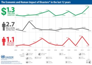
Denying that humans have contributed significantly to climate change through the Industrial Revolution and transportation driven by fossil fuel consumption will do nothing to stop sea level rise, nor will it prevent the bifurcation of extreme weather events that flattens the bell curve with fewer normal events and more high-precipitation storms and prolonged drought, which sometimes also feeds a longer and more intense wildfire season. Disasters happen, and the numbers don’t lie.

UNISDRAs a result, I was very happy a couple of years ago to be invited to join a Project Advisory Committee for the Kresge Foundation, which had hired Abt Associates to produce a report on climate adaptation at the community level. The foundation has supported a good deal of work related to community resilience and social equity in addition to making serious investments in the resuscitation of Detroit as a functioning urban community. Kresge wants to know what makes communities tick in responding to resilience challenges like climate change, and the study by Abt was intended to establish a sort of baseline for understanding the best practices in local planning related to climate adaptation.

I was thus involved in a series of all-day or multiday meetings of 16 project advisors from around the United States who reviewed and commented on the progress of the study for the consultants. Our meetings involved some serious debates about what constituted climate adaptation and resilience, and the degree to which communities needed to use such labels for what they were doing, or conversely, the degree to which we needed to recognize what they were doing as climate adaptation. Sometimes, we learned, adaptation may quack like a duck without being called a duck by local citizens and officials. What matters is what is accomplished.

Climate Adaptation: The State of Practice in U.S. Communities was officially released by Kresge Foundation in December; I will confess to being a little late in sharing the news, but at the time I was trying to recover from pneumonia. It took me a while longer to find time to read the report in its 260-page entirety, but I thought it important to do so to report intelligently on the final product. There is a difference between reviewing case studies in bits and pieces before committee meetings and seeing the full report between two covers.

I am happy to tell you that I think the nine authors who contributed to the report hit a home run. The bulk of its wisdom lies in 17 case studies spread across the nation, including some surprising places like Cleveland, Ohio, and the Southwestern Crown of Montana. I applaud Abt Associates for its work in even identifying many places that may not have been on the standard maps of leadership in climate resilience. Some of that can be attributed to maintaining an open mind about what they were looking for and what constituted innovation and success in adaptation. One thing that is utterly clear is that no two communities are the same, nor do they face the same problems. Ours is a very diverse country in spite of all that binds us together. Ours is also a nation of creative citizens who confront local problems based on local circumstances rather than “one size fits all” solutions. Perhaps that is why support from Washington does not always matter as much as we think, except in the international arena, where it is critical.

The example of Cleveland may be enlightening in this regard. While issues of social equity may not always seem like a logical starting point for engagement on climate adaptation, Cleveland is a city that was utterly battered by economic change from the 1970s into the early 21st century. The result is a community that is noticeably IMG_0256less prosperous than its surrounding metropolitan area, and has some of the lowest socioeconomic rankings among major cities nationwide. It is also a city that has lost more than half of its 1950s population, which peaked around 900,000. It is a city that may well say, in evaluating its place on the prosperity scale, “Thank God for Detroit.” That also means that no discussion of climate adaptation will move forward without a solid anchor in efforts to confront these inequities because it is hard to imagine how a community can become resilient in the face of climate challenges without also rebuilding economic opportunity for a badly battered working class. I know. I may have decamped for Iowa in 1979, but I grew up in the Cleveland area and worked my way through college in a chemical plant. Rebuilding prosperity in Cleveland has been tough sledding.

By the same token, climate change has had a direct impact on Montana, and the Southwestern Crown, a rural area of mountains and forests, has suffered the loss of timber industry jobs, which has in much of the Pacific Northwest resulted in some bitterness toward environmentalists. At the same time, nature takes a serious toll in increased wildfire damage, and at some point, if people of different perspectives can sit down for some serious discussions of reality, they can also imagine new futures for a region at risk. That has been the job of the Southwestern Crown Collaborative.

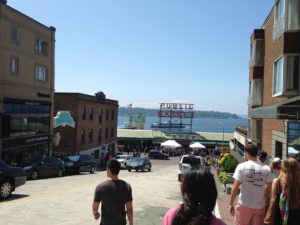
Pike Street MarketMentioning every case study here would not make sense. But it is worth noting that communities generally seen as not only prosperous but on the cutting edge of the new high-tech economy, such as Seattle, face other challenges that nonetheless tax local resources and resourcefulness. Seattle Public Utilities (SPU) became another Kresge case study, in large part, it seems, because its management needed to find ways to bring its staff and customers into the difficult realm of defining the threat and deciding how it could best be handled. SPU is responsible for managing Seattle’s water supply. When one confronts a future that portends potential water shortages as a result of decreased winter snow pack, leading to reduced snow melt that combined with drought can leave a huge metropolitan area high and dry, the need to recalibrate the system can be daunting. This case study is not important for providing precise answers to such questions, for there are none. Instead, it emphasizes the challenge of accustoming utility engineers and managers to an uncertain future, and helping them find comfort levels with uncertainty. What needs to change to make Seattle’s water supply resilient in the face of natural hazards? How does a city on Puget Sound cope with sea level rise? What plans will be adequate for protecting water supplies two or three decades into the future? In the end, the answers revolve around changing the culture of decision making within the organization as well as communicating those challenges clearly to the public. One product of SPU’s efforts, however, is a path forward for other communities facing similar long-term challenges.

Bottom line: This report is a great resource for those who want to descend from the heights of overarching theory on climate change to the realities of confronting the problem on the ground. Use this link, download it, and read it. Few resources in recent years have been so thorough in documenting the state of practice in climate adaptation at the local level. I am proud to have been involved even in an advisory capacity. I have learned a great deal from the process.

Jim Schwab


Regional Green Infrastructure

The subtitle to this headline for many people might be: Who Cares? As a term of art, green infrastructure may be popular with landscape architects, civil engineers, and urban planners, among a few other allied professions, but it does not often mean much to the average person. Many people may struggle to define infrastructure even without the word green in front of it.

Infrastructure generally refers to those modern systems, such as roads, bridges, and utility grids that allow our cities and regions to function effectively. Recognizing that the value of infrastructure lies in the services it provides, green infrastructure has been distinguished from traditional gray infrastructure by focusing on the use of natural systems, such as wetlands and urban forests, to protect or enhance environmental quality by filtering air pollution, mitigating stormwater runoff, and reducing flooding. It stands to reason that such natural systems are most likely to provide such “ecosystem services” well when we respect and preserve their natural integrity. It also stands to reason that, to the degree that such systems face threats from urban sprawl and urbanization, their ability to perform those services for human populations is diminished. To say that development has often helped to kill the goose that laid the environmental golden egg is to state the obvious, no matter how many people want to avoid that truth. That does not mean that our cities cannot or should not grow and develop. It does mean that, using the best available natural science, we need to get much smarter about how it happens if we want to live in healthy communities.

Fiscalini Ranch Preserve in Cambria, California.

Fiscalini Ranch Preserve in Cambria, California.

I mention this because, as part of the American Planning Association staff pursuing such issues, I spent three days in Washington, D.C., last week at a symposium we hosted with U.S. Forest Service sponsorship on “Regional Green Infrastructure at the Landscape Scale.” We were joined by about two dozen seasoned experts not only from the Forest Service and APA, but from the U.S. Environmental Protection Agency, several national nonprofits, and others to sort through the issues impeding better planning for green infrastructure. We explored major hazard-related issues such as wildfires, flooding, and coastal storms and how green infrastructure can or should function in relation to them.

This matters because there are huge costs associated with the way we choose to develop. There can also be huge benefits. Whether the ultimate ledger in any particular region is positive or negative is largely dependent on the approach we choose, and that is heavily dependent on how broadly or narrowly we view our responsibilities. Historically, in America, we have been rather myopic about the damage we have done to our environment, but our perspective has become more comprehensive over time, starting with the conservation movement in the late 1800s. But today, as always, there are undercurrents of more myopic attitudes and impatience with the more deliberate and thoughtful calculations a more long-term view requires. There is also the simple fact that understanding issues like climate change requires some degree of scientific literacy, something that is missing too often even in some presidential candidates.

But it helps to drill down to specific situations to get a firm sense of consequences. For instance, the Forest Service budget is literally (and figuratively) being burned away by the steadily and rapidly increasing costs of fighting wildfires. That is in large part because the average annual number of acres burned has essentially tripled since 1990, from under 2 million then to about 6 million now. As recently as 1995, 16 percent of the agency’s budget went to suppressing wildfires. Every dollar spent on wildfires is a dollar removed from more long-term programs like conservation and forest management. By 2015, this figure has risen to 52 percent, and is projected to consume two-thirds of the agency’s budget by 2025. Clearly, something has to give in this situation, and in the present political situation, it is unlikely to be an expansion of the Forest Service budget. At some point, a reckoning with the causes of this problem will have to occur.

What are those causes? Quite simply, one is a huge expansion in the number of homes built in what is known as the wildland-urban interface (WUI), defined as those areas where development is either mixed into, interfaces with, or surrounds forest areas that are vulnerable to wildfire. The problem with this is that every new home in the WUI complicates the firefighters’ task, putting growing numbers of these brave professionals at risk. Every year, a number of them lose their lives trying to protect people and property. In an area without such development, wildfires can do what they have done for millennia prior to human settlement—burn themselves out. Instead, a century of aggressive fire suppression has allowed western forests, in particular, to become denser and thus prone to more intense fires than used to occur. The homes themselves actually represent far greater densities of combustible material than the forest itself; thus fires burning homes are exacerbated by increased fuel loads. In addition, prescribed fire, a technique used to reduce underbrush in order to reduce fire intensity, becomes more difficult in proximity to extensive residential development. A prescribed fire that spun out of control was the cause of the infamous Los Alamos, New Mexico, wildfire in 2000. The entire situation becomes highly problematic without strong political leadership toward solutions.

At the same time, denial of climate change or even reluctance to broach the subject does not help, either. It compounds the difficulty of conducting an informed dialogue at a time when increased heat and drought are likely to fuel even more wildfires of greater intensity. The recent major wildfire around Fort McMurray, Alberta, displacing thousands of people, may be a harbinger of things to come.

That is just one sample of the issues we need to confront through a larger lens on the value of large-scale green infrastructure and regional cooperation to achieve positive environmental results that also affect issues like water quality and downstream flooding. Because we could produce an entire book on this issue—and the suggestion has in fact been made that we do so—I will not even attempt here to lay out the entire thesis. Rather, it may be useful to point readers to some resources that I have found useful in recent weeks in the context of writing for another project on green infrastructure strategies. Most of these are relatively brief reports rather than full-length books, enough to give most readers access to the basics, as well as references to longer works for those so inclined.

On the subject of water and development in private forests, a Forests on the Edge report, Private Forests, Housing Growth, and Water Supply is a good starting point for discussion. Because planning to achieve effective conservation at a landscape scale requires collaboration among numerous partners, an older (2006) Forest Service report, Cooperating Across Boundaries: Partnerships to Conserve Open Space in Rural America, may also be useful. With regard to wildfires, a recent presentation at a White House event by Ray Rasker, executive director of Headwaters Economics, a firm that has specialized in this area, may also be useful for its laser focus on trends and solutions with regard to development in the wildland-urban interface and the need for effective, knowledgeable local planning in areas affected by the problem. But I would be remiss if I did not bring readers’ attention back to a 2005 APA product of which I was co-author with Stuart Meck: Planning for Wildfires. It could probably use some updating by now, but every one of our central points, I believe, remains valid.

Happy reading to all!


Jim Schwab


NOAA Provides Online Resources on Water

Watershed Assessment, Tracking and Environmental Results

Occasionally, I have used this blog to link to American Planning Association blog posts that I think some readers may find important. That is the case here: At the APA blog, I provide a brief introduction to a wonderful new resource for communities on a variety of water-related issues, ranging from not enough (drought), to too much (flooding), to not good enough (water quality), and other aspects and manifestations of the numerous ways in which water influences our lives and the way we build and move around. I am pleased to have played a role on behalf of APA in helping vet and shape this new resource.

What is it? The National Oceanic and Atmospheric Administration has created a Water Resources Dashboard for those needing timely information on water from a number of perspectives. Check it out. It is a great example of how a user-friendly federal agency can provide a great service to citizens and communities and raise the level of scientific awareness generally.

Photo from NOAA Water Resources Dashboard site

Jim Schwab

Drifting into Disaster

Scene from the Sacramento-San Joaquin Delta

Scene from the Sacramento-San Joaquin Delta

Across the United States of America, about one in five people live under the rules and structures of some sort of private association that governs common property interests. These can be condominium associations, homeowners associations, or similar entities that are somehow responsible for levying fees and maintaining communal property. To degrees they often may not realize, the residents are thus controlled and constrained by the decisions these associations make, which often may concern themselves with details that a local government would not even consider, such as the color of aluminum siding, allowable holiday decorations, and other matters with minor impacts on the quality of life. Many homeowners associations are established by developers at the time they get permits to create a new subdivision. In some states, local governments are happy to offload responsibility for infrastructure maintenance, such as private roads, onto these associations while coveting the property taxes they will still pay.

The implications of all this were brought to my attention in the past week or two by Chad Berginnis, the executive director of the Association of State Floodplain Managers (ASFPM). He has been working with me on material for a future report we plan to publish at the American Planning Association on subdivision design as it relates to areas with flood hazards. The issue that concerned him as he wrote a chapter on subdivision standards for local governments, which have the primary responsibility for permitting new development, is how well these private owner associations can sustain over time the financial responsibilities for infrastructure designed to protect their properties from disaster, most notably but not exclusively, flooding.

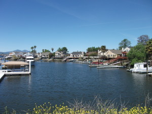
Among the items that have come to my attention is a paper by two California attorneys, Tyler P. Berding and Steven S. Weil, disturbingly titled, “Disaster! No Reserves. No Insurance. What’s Left if a Natural Disaster Destroys a Community Association?” They begin with a cautionary tale about the Bethel Island Municipal Improvement District, actually a California special district, not a homeowners association. Its mission is to maintain and improve the levees that surround the Sacramento Delta island of 2,500 residents, where the interior is seven to 15 feet below sea level. To say that their survival depends on well-maintained levees is no exaggeration. Moreover, in that part of California, the levees are subject to collapse from earthquake shaking as well as from overtopping in a flood. I have some idea of their peril because four years ago, a representative of the California Department of Water Resources (DWR) took me on a six-hour guided tour of the levee system in the delta area, plying me with a number of the background studies by DWR of the overall situation. There are hundreds of such islands throughout the Sacramento-San Joaquin Delta, many used for agriculture, and some developed. In their 2012 article, produced about the time of that tour, Berding and Weil note, “But the district is broke.” Voters “soundly” rejected a 2010 parcel tax measure to fund improvements, and much of the district staff was laid off. The levees were deteriorating, to some extent “suffering damage by beavers and rodents.”

It is disturbingly easy for homeowners association or other private association board members to take their eyes off the ball of maintaining adequate reserves and resources to address dangers that seem less than imminent, and even to forget why they are responsible for collecting assessments in the first place. And it is even easier for residents who must approve some of those assessments to lack meaningful knowledge of the consequences of either depleting or failing to maintain adequate reserves for unfortunate natural events like floods, earthquakes, or other disasters. Once they begin sliding down that slippery slope of amnesia and unawareness, it is not long before they have put a good deal of common and individual property at risk. The few who may be aware of the long-term consequences often may lack the ability to make their case to less concerned neighbors.

This issue is one of concern in the field of urban planning because new subdivisions, in particular, often arise at the edge of metropolitan areas in unincorporated county lands or small towns, where governance capacity may be limited and resistance to government regulation particularly high. The result is that oversight is weakest, and the desire for new development highest, precisely where the need for that oversight may be greatest. In regulatory terms, it is the theory of the weakest link. One of our motives for the new report (underwritten by the Federal Emergency Management Agency) is to help shore up those weak links with stronger guidance about sound practices in reviewing plans for new subdivisions. Berding and Weil were serving a similar purpose, at least in the California context, by describing sound practices for community associations, particularly in sustaining adequate reserves for contingencies such as disasters.

But finances are only part of the problem. Sometimes, the leadership of such associations can become so focused on issues like aesthetics and conformity that they lose sight of larger issues like public safety. In the past, the National Fire Protection Association, which supports the Firewise Communities initiative, has trained its attention on the question of covenants that run counter to public safety, for example, by inhibiting well-researched methods for containing wildfire threats. Many of these techniques involve either landscaping or building design, yet some associations have rules limiting tree trimming or landscaping that would aid in wildfire mitigation. In Safer from the Start, NFPA’s 2009 study of the issues involved in building and maintaining “firewise-friendly developments,” a sidebar notes that the state of Colorado’s recently passed “Colorado Common Interest Ownership Act,” among other measures, basically invalidated a number of types of association covenants and restrictions that inhibited defensible space around private dwellings in order to advance wildfire safety statewide. In effect, the state was saying, with regard to rules that made wildfire safety more difficult to enforce, “enough.” At the same time, the publication overall provided a significant amount of sound advice about best practices in wildfire protection in rural subdivisions and new developments.

That seven-year-old NFPA advice recently got a new boost from an interesting direction: Green Builder Media just recently issued its own e-brochure, “Design with Fire in Mind: Three Steps to a Safer New Home,” in cooperation with NFPA. Green Builder Media has more of a direct avenue to influence those developers who want to build safe, resilient, energy-efficient communities.

The fact that these resources have continued to materialize on a regular basis over the past decade or two indicates, to me, that the subject of good design and homeowner association responsibility is not going away any time soon. It is the job of planners, floodplain managers, and local and state officials to ensure that those responsibilities remain on their radar screens and are taken seriously. One-fifth of the American population depends to a significant degree on the quality of their oversight.


Jim Schwab

That Burning Smell Out West

IMG_0224Although plenty of other issues have competed for our attention in recent weeks, astute observers of the news, in the U.S. at least, have probably noticed that wildfires have been charring much of the landscape in western states, most notably along the Pacific Coast. Both California and Washington are struggling under the burden of numerous fires triggered or helped along by prolonged drought and a hot summer. While some may jump to the conclusion that this is another harbinger of climate change, and it may well have some connections to climate change, it is important to know there are other historical factors that are even more significant. We have seen them coming but not done nearly enough to forestall the outcome, which may grow worse in coming years.

Ten years ago, in Planning for Wildfires (PAS Report No. 529/530), Stuart Meck and I noted that, in the 2000 census, the five fastest-growing states all had a high propensity for wildfires. Not much has changed. Texas, which suffered significantly from wildfires during its drought in 2011, made the largest numerical gain in the 2010 census, though it was fifth in percentage gain, behind Nevada (35.1), Arizona (24.6), Utah (23.8), and Idaho (21.1). Of course, many of those people move into larger cities like Las Vegas and Phoenix. More to the point, many people continue to move specifically into more rural areas with weaker development restrictions and building codes. As their numbers rise in what fire experts call the wildland-urban interface, the area where the built environment interfaces with fire-prone wildlands, so does human and structural vulnerability to wildfires. Why do people choose to live there? Social scientists, including some who work for the U.S. Forest Service, have been examining this question for at least two decades. We noted that the reasons include a desire for proximity to wildlife, privacy, nature, and the love of a rugged lifestyle.

These desires spawn problems, however, if not accompanied by considerable prudence in both how and where homes are built, as well as in landscape maintenance once a subdivision exists. Firewise Communities, a program of the National Fire Protection Association, has since the late 1990s sought to educate communities and homeowner associations on the realities of life in the wildland-urban interface, including the need for noncombustible roofing materials, eliminating a wildfire pathway to homes and other structures by maintaining a perimeter of “defensible space,” whose radius largely depends on terrain and forest conditions, and other best practices to reduce the impact of wildfires on homes. Still, we live with the legacy of prior development in many areas, and one result is that firefighters are increasingly exposed to lethal risks in trying to protect these homes when wildfire approaches. Every year some lose their lives, 163 over the past 10 years. There is a point where some homeowners must be told that more lives cannot be risked in protecting every remote structure at any cost.

And those costs are rapidly growing. Just 20 years ago, in 1995, the Forest Service spent 16 percent of its annual budget on fire management. That has climbed to 52 percent today, and the trend is ever upward, squeezing a largely static $5 billion budget of funds for other functions. About 90 percent of the firefighting expenses involve protecting houses. It would be a far simpler matter to let some fires burn, or to use prescribed burns to reduce flammable underbrush to prevent or mitigate future fires, if fewer of those houses were in the wildland-urban interface. But part of that fire management expense is for thinning the forest to scale back a problem the Forest Service itself created over the past century, and which modern fire managers have effectively inherited. Put simply, most of the western wildland forest is much denser than it was prior to the 20th century. Not just a little bit denser, but several times denser in many cases. The result is more intensive, longer-burning wildfires in those cases where the Forest Service is unable to suppress the fire at an early stage.

Full-scale suppression, however, is what brought us to this pass. Toward the end of an era Stephen J. Pyne has called the “Great Barbecue” (1870-1920), which saw some of the deadliest wildfires in U.S. history starting with the nearly simultaneous ignitions of Peshtigo, Wisconsin, which killed about 1,500 people, and the Great Chicago Fire, which had more to do with hot weather and conditions in the lumberyards that processed the products of the upper Midwest forests than with Mrs. O’Leary’s cow, the Forest Service secured its role as the nation’s wildland firefighting service. One can learn more about the Peshtigo firestorm in a great book, Firestorm in Peshtigo, by Denise Gess and William Lutz. That era was drifting toward an end in 1910, when the Big Burn killed 78 people and scarred 3 million acres and a pitched effort to fight them put the Forest Service in the limelight and won it this new role. Timothy Egan tells that story in The Big Burn. But the collective works of Pyne, an Arizona State University environmental historian who has specialized in the history of fire, can deliver more depth than you may ever desire and fill in the blanks between those two episodes and beyond into recent times.

What we have learned is that over time, as the policy of all-out suppression of wildfires took hold in the federal government, the smaller fires that historically and naturally had served to thin the forest were no longer allowed to do their job. The gradual result was a denser, thicker forest that, when it did catch fire, produces far more dangerous fires than ever before. When drought and bark beetle infestations begin to kill some of that dense forest, the result is that there is simply far more kindling than would otherwise be there. Yet, as Forest Service Chief Tim Tidwell notes, the Forest Service currently simply does not have the resources to undertake more than a fraction of the forest restoration work needed to achieve healthier, less fire-prone forests. The problem will only grow worse with a warming climate, of course, but did not arise primarily because of it, but because of past firefighting practices and a more recent history of development in wildland areas. But climate change can be counted on to produce increasing average temperatures that will vary depending on location, but possibly 4 to 6 degrees Fahrenheit by 2100. California’s Cal-Adapt has been tracking these changes and producing a stream of research and temperature maps that provide significant perspective on the extent of the problem we face moving into the future. It’s a sobering picture we would all do well to consider.


Jim Schwab

Restoring the Chicago Area Landscape

Outside the Thornhill Education Center, a view of the gorgeous grounds of the Morton Arboretum.

Outside the Thornhill Education Center, a view of the gorgeous grounds of the Morton Arboretum.

Chicago is not terribly old, as world-class cities go. It was incorporated only in 1837. The area was essentially devoid of European settlers until the 19th century. In the preceding centuries, the resident Indians, including the Potawatomi, had created a landscape dominated by oak ecosystems as a result of actively managing the landscape through the use of prairie fires. On the open lands of the Upper Midwest, there were few meaningful fire breaks, and the fires drifted east over vast grasslands. This North American fire regime changed the land by preventing the establishment of woody species, allowing oaks to dominate because of their thick, fire-resistant barks. The oaks in turn allowed more sunlight through their canopy and provided a thriving ecosystem for numerous species, including more than 800 species of birds and moths that eat their leaves.

The settlers who arrived in the 19th century, however, whether wittingly or otherwise, made quick work of the landscape they inherited from the natives they largely pushed out. They suppressed the wildfires in favor of plowing the prairie soils and savannas to create farm fields. Natural wildfires are few in northern Illinois; the wildfires that preceded European settlement were almost entirely a native artifact, which served the purpose of clearing hunting grounds but also served natural purposes of preparing the land for the sprouting of prairie plants. As the oaks receded, other trees moved into the void where fields did not prevent them, and in time maples and basswood took over, followed later by the invasive buckthorn, an introduced species. Today only 17 percent as much oak coverage survives as was present in the 1830s, and the landscape is highly fragmented. By the 1930s, only one oak-dominated parcel of more than 1,000 acres remained; today none remain. The numbers of various smaller chunks of oak land have also shrunk, just as steadily.

Chicago Wilderness, an alliance of organizations dedicated to open space, and the Morton Arboretum believe the metropolitan area needs to reverse the trend soon. Last August, I wrote about the Chicago Region Trees Initiative (CRTI) being led by the Morton Arboretum. On April 7, I attended a pair of meetings at the arboretum’s Thornhill Education Center that aimed at advancing the initiative. CRTI, which benefited for a period of time starting in the 1990s from federal support for some of its environmental projects, is now seeking new sources of funds as federal grants have waned, and is sharpening its focus into six areas of interest in order to clarify its mission for potential funders. Restoring oak ecosystems is one of those six focus areas. Another is landowners; most of the land that could be used to restore the fragmented oak ecosystems is private, and its owners must not only be willing to cooperate with the larger effort, but understand the reasons for it and its potential ecological, economic, and social benefits.

Economic and social? Yes. That is part of the appeal, one we laid out several years ago at the American Planning Association with the publication of Planning the Urban Forest: Ecology, Economy and Community Development, which began with an exposition of the documented benefits of the urban forest across dimensions of human health, pollution reduction, stormwater management, energy conservation, economic development, and other factors. Michael Leff, a research urban forester at the Davey Institute, has been developing a guidance document that stresses how good urban forestry needs to take a three-part approach that is as aware of the social and economic aspects as it is of the environment. Humans are essential to the success of any ecological plan, particularly in an urban setting. Public areas of nature or forest preserves contribute only a partial solution to a much larger problem, and solving that problem contributes significantly to human quality of life. It takes considerable scientific and social awareness to make the urban forest work in a highly developed setting where ecosystem fragmentation has become the norm.

Hence the social mission of CRTI: the need to share the story of the oak ecosystem with a wide variety of audiences throughout the area in an engaging manner that motivates them to take part in the initiative and participate in coordinated stewardship efforts. In addition, CRTI is reaching out to municipal public officials and staff, including planners, to provide training around the issues of municipal tree management and a model tree ordinance that CRTI is still developing for use by communities to advance the goals of urban forestry, including the oak ecosystem restoration efforts. There is also a role for the nurseries that grow trees and a need to keep them aware and involved so that they can be supportive of the overall effort, as well as for landscaping professionals, arborists, and others. I will return to this subject as the initiative progresses and evolves.

Meanwhile, I learned at the meetings of one valuable resource of which I was previously unaware: Bringing Nature Home, by Douglas W. Tallamy, published by Timber Press. So I looked it up, and it draws rave reviews for explaining the value of native plants and ecosystems, just as people at the meeting had said. It’s probably worth a download.


Jim Schwab

One Thing Leads to Another

I have been to my fair share of presentations on disaster-related issues. When I hear a particularly good presentation, I know it is good because I have a lot of others to which I can compare it. Sometimes local planners, emergency managers, and engineers, among others, can bring a certain parochial flavor to their presentations. I think this is usually the result of not having either the experience or the inclination to think beyond the set of problems and challenges immediately before them.

But there are also those who have thought bigger thoughts, figured out larger patterns, and validated them through observation and experience. Last week, at a conference in Broomfield, Colorado, north of Denver, I heard one such presentation that I thought gave listeners something serious to think about.

The Association of State Floodplain Managers, which is based in Madison, Wisconsin, was holding its Sixth Triennial Flood Mitigation and Floodproofing Workshop. I was invited to help present a 90-minute workshop on the integration of hazard mitigation into comprehensive planning, a subject I will address in a forthcoming blog. Before I do that, however, I thought it more important to discuss what Brian Varrella, an engineer and certified floodplain manager for the city of Fort Collins, Colorado, discussed in a plenary presentation based in part on his city’s experience with serious floods in September 2013.

Varrella did not settle for merely telling us about the extent of the flood and resulting damages in Fort Collins, and how the city is rebuilding again. He took the audience back to some neglected basics. In teaching graduate urban planning students about hazard mitigation and disaster recovery at the University of Iowa, I often try to do the same thing early in the course. I stress that all hazard events involve some very basic equation rooted in physics. Want a wildfire? Combine oxygen, fuel, and heat. Want to predict the direction of a flood? Think about gravity, and you will find the water, which inevitably flows downhill. Of course, the specific circumstances of any disaster require some knowledge of the local conditions, particularly topography, to make that understanding useful. But the basic equations never go away.

What differentiates a disaster from a natural event—what, for instance, turns a hurricane into a disaster—is the presence of the built environment and humans in the path of that event. A hurricane (typhoon) passing over an uninhabited island in the Pacific Ocean does not produce a disaster. The same storm assaulting Miami becomes a disaster. The difference is what we have built in harm’s way.

What if the conditions exist for several hazards simultaneously? That is the Colorado challenge that Varrella addressed. Wildfire, he noted, creates other problems from one disaster, in part by baking the soil when it is particularly intense. Subsequent thunderstorms cannot penetrate the now hardened soil, and instead carry vegetative and muddy debris downhill into the watershed, producing “muddy material that is opaque,” water that is heavy with silt. The result is a more intense flood. Colorado, Varrella noted, lost 10 people in last year’s floods; that was fortunately not even close to the record of 140 lives lost in the Big Thompson flood of the 1970s.

Yet some solutions commonly used to mitigate future damages elsewhere cannot always work because of Colorado’s steep terrain. Elevation, for instance, is commonly used in riverine and coastal floodplains to place the living area of a home above projected elevations of future floods, as determined by National Flood Insurance Program maps. But in mountainous terrain, watersheds can rapidly migrate in flash floods, washing out the toe of ledges beneath houses on hillsides. Elevation does nothing to restore the underlying stability of the soil, but significant setbacks from such ledges may help. Varrella suggested that Colorado borrow standards for such situations from other states with similar experiences, citing Vermont, New Mexico, and Washington. He noted that flood insurance rate maps (known as FIRMs) do not show all hazards. “We must find a new way of doing business,” he said. Maps that are static in time are not prone to show or predict such dynamic erosion.

It is always helpful when such a speaker has a set of recommendations for moving forward with a dynamic, complex problem, and Varrella did, so here goes:

• Create a framework for understanding wildfire and flood as cascading, related events.

• Reduce the human side of the disaster equation, for example, by requiring setbacks in the cases cited above.

• Treat wildfires as a prelude to the sequence of floods followed by erosion and debris.

• Change our hydraulic and hydrological practices to think in the fourth dimension of time; advocate for unsteady hydraulic models that reflect dynamic realities.

• Collaborate as a watershed among local governments. The watershed is the most efficient level at which to mitigate damages from wildfire and flooding; combine resources, stakeholders, and solutions.

• Communicate all natural hazards to the public. Establish flood warning systems before wildfires ever happen.

• Break the fire-flood-erosion cycle by managing forests as assets, not just resources.

• More helicopters, please; get eyes above the ground to see what’s happening on the ground in a timely fashion in order to save lives.

It’s a tall agenda, but a sensible one that is manageable if we focus on the problem. I think he’s clearly on the right track.

Jim Schwab

Random Thoughts on the People’s Climate March

Reportedly, about 400,000 people attended the People’s Climate March in New York City last weekend. I was not one of them, but that is not because I don’t support their objectives. I had planned to be in Iowa City, and will discuss that visit in an upcoming blog to follow this one, and I learned long ago that I cannot be everywhere that I think it might even be important to be. As I jokingly tell those who wish I could attend some event that I have declined, “I have utterly failed to clone myself.”

I am, however, glad that others were there, including those scientists, particularly climate scientists, who felt a need to speak out on this issue. I won’t even try to duplicate all the news already reported through numerous outlets like Huffington Post and the New York Times. There are plenty of places on the Internet and in print to find such reportage. Instead, briefly, I want to offer a different observation.

There are two groups of people who really need to speak at such events, beyond the citizen activists who turned out in such numbers, not only in New York but in dozens of other nations throughout the world. One group consists of the public officials and policy makers, and they were certainly represented by the likes of former Vice President Al Gore and New York Mayor Bill de Blasio. It is their job to translate credible science into public policy. For mayors, that job has often turned into a challenge to plan both for adaptation to and mitigation of climate change at the local level. For New York City, the adaptation means crafting strategies to protect the city from the impact of natural hazards, such as Hurricane Sandy, and the increasing impacts of storm surge combined with sea level rise. In other places, it may mean planning for prolonged drought, increased wildfire intensity, or flooding from high-precipitation events. Mitigation means finding ways to reduce the degree to which a community adds greenhouse gases to the atmosphere that feed these changes, and can include strategies for reduced consumption of fossil fuels that produce carbon dioxide emissions. All this is important, but it is sad that much of this must take place in the face of inaction from Congress, where climate change skeptics abound in the face of an abundance of scientific evidence.

That brings me to the role of the scientists. Historically, many if not most scientists have been reluctant to be drawn into public policy debates, which often remove them from their comfort zone within the research community. They understand better than anyone how complex these issues can be, and often wince at oversimplifications of the underlying science. While environmental activists are perfectly capable of uttering their own oversimplifications at times, the megaphone for distortions has rested squarely with the skeptics, particularly those associated with industries that have benefited from undermining public acceptance of the science. These distortions are intentional and play upon the fact that it is human nature to seek simpler solutions than to spend the time and effort to try to understand complex problems. The campaign of distortion was highlighted several years ago in Merchants of Doubt, an excellent book on the public relations of issues like the health impacts of smoking, for which the science was settled some time ago, and climate change, a more recent entrant into the public lexicon. Their exposure of the techniques behind this campaign is troubling, to say the least. The authors are scientists who felt a compelling need to combat such distortions.

The bottom line is that very few climate scientists, or others qualified to discuss the subject, have any doubt remaining that human industrial and transportation activities, among other factors connected with modern civilization, are inducing changes in global climate patterns, for the most part producing an overall warming trend. Yet there is scientific debate about this issue because it remains and always will be complex. As Laurence Smith noted in The World in 2050, climate change involves global warming in most places most of the time, but also involves disruption of climate patterns elsewhere that result in particularly noticeable climate changes in certain places, most notably the polar extremes. The results overall are uneven. The skeptics cherry-pick selected outcomes and statistics without wrestling with the more inconvenient and nuanced overall changes that constitute the reality of climate change. Even so, there are clear trends to which honest policy makers must pay heed.

What was encouraging about the People’s Climate March was that, among those 400,000 voices, were some belonging to the very people who understand this science the best. They must continue to speak out and share what they know, lest the merchants of doubt win the day with misleading assertions based on cherry-picked data. We can no longer afford to be misled.


Jim Schwab

The Fatal Attraction

At first, it looks like something straight out of the Old West, and perhaps it is. The Gold Hill Inn is now 52 years old, which plants its origins in the 1960s, but the building was originally the dining hall for the adjacent but now closed Bluebird Lodge, built in 1873. The Gold Hill Inn, actually a restaurant, was built in 1926. In either case, Colorado was a decidedly different place back then. The historic district that remains carries forward the heritage of the old frontier.

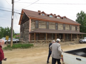
The shuttered Bluebird Lodge, next to the Gold Hill Inn.

The shuttered Bluebird Lodge, next to the Gold Hill Inn.

What is remarkable is finding a restaurant of such gourmet and fine dining predilections, for the Gold Hill Inn is no typical small town diner. It boasts some of the finest menus in Colorado, but I will return to all that later. What I want to discuss first is the journey to this lofty establishment, whose website says it is open from May through December. Sitting high in the mountains above 8,000 feet, one reasonable explanation might be that cold and snow discourage the journey at other times of the year. But I am guessing, as a Midwesterner accustomed to cold but not to the altitude, and I could be wrong. Maybe they just like to take a break for four months.

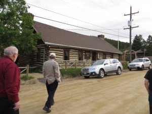
The Gold Hill Inn awaits. From the left, my friends Barry Hokanson, of Greyslake, Illinois, and Ed Thomas, of Boston.

The Gold Hill Inn awaits. From the left, my friends Barry Hokanson, of Greyslake, Illinois, and Ed Thomas, of Boston.

On the evening of June 22, I was in the company of three other gentlemen, all attending the annual Natural Hazards Workshop in Broomfield, Colorado, who were already familiar with the Gold Hill Inn and had made plans to visit one of their favorite restaurants. Well—two of them were. Ed Thomas, president of the Natural Hazard Mitigation Association, also a land-use attorney and former FEMA employee from Boston, had talked to me a month before about the Gold Hill Inn, and Jim Murphy, a planner working with URS Corporation, knew the way because of prior work on hazard mitigation in the area. The journey was worth every bit as much, in professional education, as the restaurant itself was in oral gratification and nutrition, so I will offer that story first.

One never follows a straight path up into the Rockies. Everything is a long and winding road that clings to the sides of cliffs and creeks, and Jim, the driver, chose his path to let us see the impacts of the September 2013 floods along Four Mile Creek, which descends precipitously from the mountain ridges. We also saw the impacts of prior wildfires. Some of those wildfires were severe enough to char the soils beneath the forests, producing a phenomenon known as hydrophobic soils, which accelerate and exacerbate flash flooding because they are incapable of absorbing the rainfall when a storm hits. That forces the water to rush downstream as if it were simply pouring off a concrete pavement. One of the many functions of healthier soils, especially if covered with healthy tree canopy, is to delay the movement of that rainfall and absorb it into the ground, eventually recharging groundwater. Hydrophobic soils lose that function and contribute to the resulting flood disaster.

Up close, Four Mile Creek tumbling through the mountains.

Up close, Four Mile Creek tumbling through the mountains.

Last fall, Colorado suffered what amounted to a mountain monsoon that dumped nearly 18 inches of rain in parts of the mountains north of Boulder, producing record flooding in many of the communities along the creek path and below the mountains. In flatter areas, flooded rivers can move at frightening speeds, but never approaching those of mountain streams whose descent can sometimes be measured in thousands of feet over just a relatively few miles, particularly along the Front Range in Colorado.

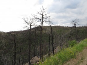
Hillsides denuded of forest by wildfires become more vulnerable to stormwater runoff, exacerbating downstream flooding.

Hillsides denuded of forest by wildfires become more vulnerable to stormwater runoff, exacerbating downstream flooding.

But you don’t have to be at the bottom of the mountain to get the worst of it. Many people in Colorado have chosen home sites that amount to what I like to call the “fatal attraction.” I define such locations as alluring sites that often have stunning views, provide proximity to wildlife for those who treasure their communion with nature, but which also suffer from often dangerous exposures to natural hazards like wildfires and flooding. The fatal attraction is not limited to the Rocky Mountains, or even to the mountains, but plays out in seaside resorts in New Jersey and North Carolina’s Outer Banks, and in many other challenging choices all over the world. We humans are emotional as well as rational creatures, and we often choose places to live based on their tug on our hearts and eyeballs while ignoring the possible long-term consequences of living in locations exposed to hurricanes, floods, wildfires, volcanoes, and whatever else you can name.

And, in truth, those choices are not always as clear-cut as some would suggest. All hazards are ultimately matters of probabilities, how often something happens over what period of time, and of the magnitude of a likely event, and there is no place where those probabilities are zero. They may be zero for a particular hazard, but not for every possible hazard. In early July, lightning in a thunderstorm zapped our living room television and garage door opener. I live in Chicago. I may not be in a floodplain, but things happen. And as some of us like to say, it is not just where you build, but how you build. Yet few of us can afford to build a fortress, and most of us might not like the result if we did.

That said, there can be no doubt that those who choose to live on the side of the mountain can expect swift retribution from nature on occasion, and last fall nature doled it out in abundance. At the Natural Hazards Workshop, which assembles about 400 experts from numerous disciplines every year to discuss these very questions, we heard from local officials and scientists precisely what happened last September.

Robert Henson, a meteorologist at the University Corporation for Atmospheric Research in Boulder, noted that Boulder’s worst flooding was along small waterways and that the city received the equivalent of more than half of a year’s rain in one week. But there were problems with accurate measurements because some rain gauges were too close to buildings or under trees, others accidentally spilled, and others overflowed because the rain exceeded their capacity. Henson outlined some common misconceptions about such storms, including the idea that our climate is stationary. It is not. It is constantly changing, and today it is changing faster because of the impact of human activities that inject greenhouse gases into the atmosphere.

Getting agreement on the latter point is not a problem in Boulder, according to Mayor Matthew Appelbaum. He noted that a survey showed 99 percent agreement among local residents that climate change is real. That somewhat simplifies the task of getting consensus on the needed measures to mitigate against future disasters, but Boulder also benefits from some far-sighted policies of the past, although most were not specifically undertaken with such issues in mind. But over time, the city has created a wide swath of protected reserves with a lot of open space. It has used that open space to create recreational and physical activity benefits for residents by building bicycle and hiking paths along Boulder Creek, notably, but other smaller creeks as well. Thus, the public gets positive amenities in addition to flood mitigation. Much of that open space plan has prevented development in the more hazardous areas of Boulder and prevented unsightly mountainside development. But, according to City Administrator Jane Brautigan, that open space was not acquired in a day, or even a year, but over decades. Boulder’s high-hazard property acquisition program dedicates about a half million dollars every year to acquiring such properties and demolishing the homes. Boulder also reserves 10 percent of its budget for emergencies. It turns out this famously liberal town is fiscally conservative in confronting its vulnerabilities.

What Boulder did not expect was the damage from rising water tables as a result of the sheer quantity of rain, which flooded basements, an outcome that had not been considered possible—until it happened. The flood knocked out one of Boulder’s two water treatment plants, according to Appelbaum. Sewers that normally run 12 million gallons of water per day were running 50 million gallons daily for three weeks straight. Brautigan invited researchers seeking data on rainfall and groundwater to visit Boulder.

But suppose you are merely a town of 2,000, rather than the 100,000-plus residents of Boulder? Even massive reserves relative to your annual budget may not be enough in a case like that of Lyons, about 15 miles north of Boulder, but much smaller and considerably more vulnerable. Lyons sits at the confluence of the North and South St. Vrain Creeks. Every one of its citizens was forced to evacuate, and every one of its businesses closed, almost all of them independently owned.

Victoria Simonsen, the town administrator, noted that this town with a $1 million annual budget had $4.4 million in reserves, which still are nowhere near enough in the face of $50 million in damages. Outside assistance has been essential. The normal creek flow is 1,200 cubic feet per second (cfs); the storm produced a flood flow of 26,000 cfs, ripping a 400-foot gash through the center of town that runs three to 18 feet deep. The severe storm tore apart the water distribution system, pulled gas and electric lines out of the ground, and destroyed communications. Effectively, the community became a series of six islands surrounded by water, isolated from the outside world for 36 hours before the National Guard could arrive with high-water vehicles capable of entering the scene and evacuating those who remained. Miraculously, perhaps, only one person died.

There is a great deal of work to be done in Lyons, and some other towns like it, as a result of last year’s flood. Simonsen provided a laundry list of actions spread across the short-, mid-, and long-term recovery that lies ahead. But the town has help. Oskar Blues, a home-grown brewery, set up a nonprofit foundation to raise money, Oskar Blues CAN’d Aid, named after the company’s famous canned microbrew designed for mountain climbers who cannot afford to carry bottled beer in their sacks. Plans are underway to restart businesses, replace lost housing, and restore parks, open space, and trails. The summer festivals that attracted people in the past will go on, albeit with some adjustments. One has to admire such the sense of community that is on exhibit in places like Lyons.

That brings us back to the Gold Hill Inn. Unique entertainment and eating establishments, and the small town feel that they produce, are what keep many of these small Colorado towns alive today. The Gold Hill Inn serves special food in order to attract the special people who find their way up mountain roads to try the unique cuisine. The menu changes from day to day, so it is posted on the blackboard. You can get the three-course meal for about $25, as I recall, or the six-course for $35, and though it seemed indulgent, we all opted for six. I can personally attest that the Ukrainian borscht, flavored with bacon, made a fabulous side dish and was far better than anything like it I can recall. The ono salad was a treat, but the entrée I ordered, the roast pork cooked in apricot sauce, was a dream. All that is before we get to the dessert (a truly unique apple pie in my case that I cannot recall how to describe if I ever figured out how to do so in the first place), followed by cheeses that ultimately seemed decadent after everything that preceded them. The service was both outstanding and enthusiastic, and it was explained that the staff works as a team and responds to its clientele as a team. No want or concern among customers went unanswered. It is clear they want you to love the place and come back.

And that is because, for all its challenges, the people in these small towns seem to love the place themselves. There are, after all, many reasons not to be there. They focus on the reasons that make the place special.


Jim Schwab