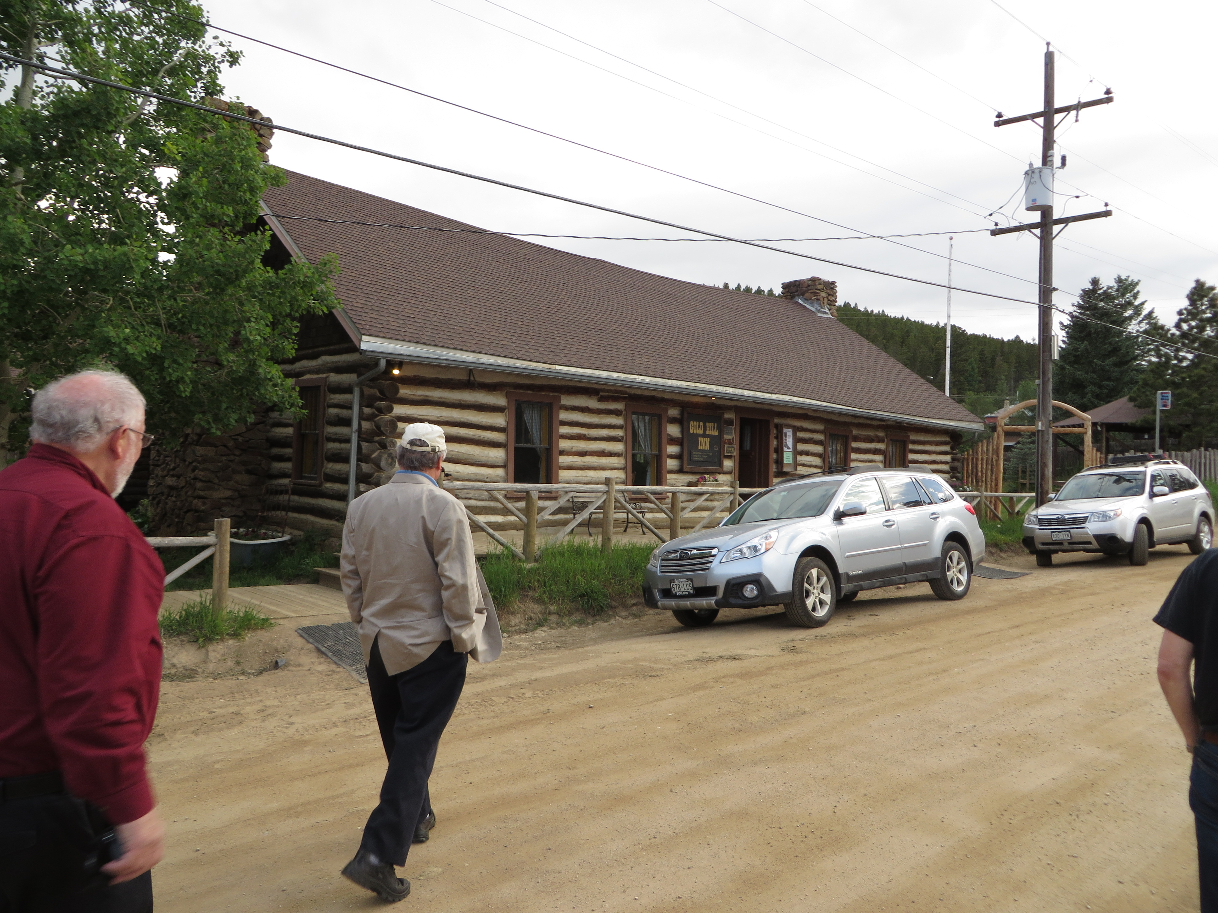
At first, it looks like something straight out of the Old West, and perhaps it is. The Gold Hill Inn is now 52 years old, which plants its origins in the 1960s, but the building was originally the dining hall for the adjacent but now closed Bluebird Lodge, built in 1873. The Gold Hill Inn, actually a restaurant, was built in 1926. In either case, Colorado was a decidedly different place back then. The historic district that remains carries forward the heritage of the old frontier.
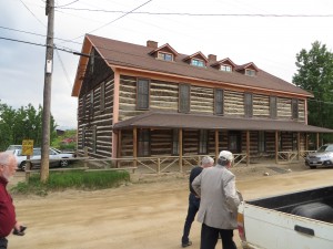
The shuttered Bluebird Lodge, next to the Gold Hill Inn.
What is remarkable is finding a restaurant of such gourmet and fine dining predilections, for the Gold Hill Inn is no typical small town diner. It boasts some of the finest menus in Colorado, but I will return to all that later. What I want to discuss first is the journey to this lofty establishment, whose website says it is open from May through December. Sitting high in the mountains above 8,000 feet, one reasonable explanation might be that cold and snow discourage the journey at other times of the year. But I am guessing, as a Midwesterner accustomed to cold but not to the altitude, and I could be wrong. Maybe they just like to take a break for four months.

The Gold Hill Inn awaits. From the left, my friends Barry Hokanson, of Greyslake, Illinois, and Ed Thomas, of Boston.
On the evening of June 22, I was in the company of three other gentlemen, all attending the annual Natural Hazards Workshop in Broomfield, Colorado, who were already familiar with the Gold Hill Inn and had made plans to visit one of their favorite restaurants. Well—two of them were. Ed Thomas, president of the Natural Hazard Mitigation Association, also a land-use attorney and former FEMA employee from Boston, had talked to me a month before about the Gold Hill Inn, and Jim Murphy, a planner working with URS Corporation, knew the way because of prior work on hazard mitigation in the area. The journey was worth every bit as much, in professional education, as the restaurant itself was in oral gratification and nutrition, so I will offer that story first.
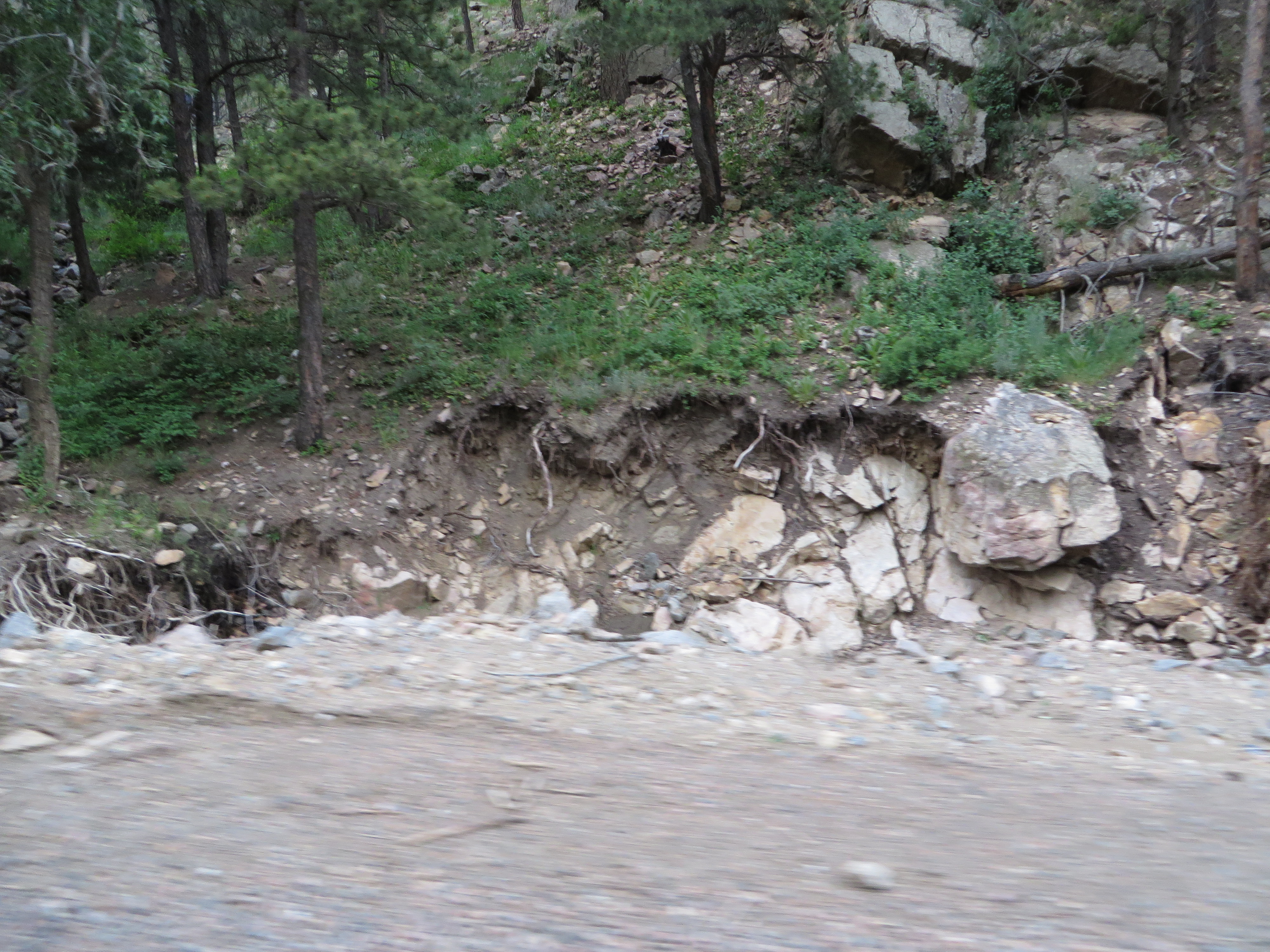
One never follows a straight path up into the Rockies. Everything is a long and winding road that clings to the sides of cliffs and creeks, and Jim, the driver, chose his path to let us see the impacts of the September 2013 floods along Four Mile Creek, which descends precipitously from the mountain ridges. We also saw the impacts of prior wildfires. Some of those wildfires were severe enough to char the soils beneath the forests, producing a phenomenon known as hydrophobic soils, which accelerate and exacerbate flash flooding because they are incapable of absorbing the rainfall when a storm hits. That forces the water to rush downstream as if it were simply pouring off a concrete pavement. One of the many functions of healthier soils, especially if covered with healthy tree canopy, is to delay the movement of that rainfall and absorb it into the ground, eventually recharging groundwater. Hydrophobic soils lose that function and contribute to the resulting flood disaster.

- Up close, Four Mile Creek tumbling through the mountains.
Last fall, Colorado suffered what amounted to a mountain monsoon that dumped nearly 18 inches of rain in parts of the mountains north of Boulder, producing record flooding in many of the communities along the creek path and below the mountains. In flatter areas, flooded rivers can move at frightening speeds, but never approaching those of mountain streams whose descent can sometimes be measured in thousands of feet over just a relatively few miles, particularly along the Front Range in Colorado.
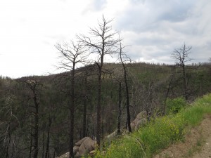
Hillsides denuded of forest by wildfires become more vulnerable to stormwater runoff, exacerbating downstream flooding.
But you don’t have to be at the bottom of the mountain to get the worst of it. Many people in Colorado have chosen home sites that amount to what I like to call the “fatal attraction.” I define such locations as alluring sites that often have stunning views, provide proximity to wildlife for those who treasure their communion with nature, but which also suffer from often dangerous exposures to natural hazards like wildfires and flooding. The fatal attraction is not limited to the Rocky Mountains, or even to the mountains, but plays out in seaside resorts in New Jersey and North Carolina’s Outer Banks, and in many other challenging choices all over the world. We humans are emotional as well as rational creatures, and we often choose places to live based on their tug on our hearts and eyeballs while ignoring the possible long-term consequences of living in locations exposed to hurricanes, floods, wildfires, volcanoes, and whatever else you can name.
And, in truth, those choices are not always as clear-cut as some would suggest. All hazards are ultimately matters of probabilities, how often something happens over what period of time, and of the magnitude of a likely event, and there is no place where those probabilities are zero. They may be zero for a particular hazard, but not for every possible hazard. In early July, lightning in a thunderstorm zapped our living room television and garage door opener. I live in Chicago. I may not be in a floodplain, but things happen. And as some of us like to say, it is not just where you build, but how you build. Yet few of us can afford to build a fortress, and most of us might not like the result if we did.
That said, there can be no doubt that those who choose to live on the side of the mountain can expect swift retribution from nature on occasion, and last fall nature doled it out in abundance. At the Natural Hazards Workshop, which assembles about 400 experts from numerous disciplines every year to discuss these very questions, we heard from local officials and scientists precisely what happened last September.
Robert Henson, a meteorologist at the University Corporation for Atmospheric Research in Boulder, noted that Boulder’s worst flooding was along small waterways and that the city received the equivalent of more than half of a year’s rain in one week. But there were problems with accurate measurements because some rain gauges were too close to buildings or under trees, others accidentally spilled, and others overflowed because the rain exceeded their capacity. Henson outlined some common misconceptions about such storms, including the idea that our climate is stationary. It is not. It is constantly changing, and today it is changing faster because of the impact of human activities that inject greenhouse gases into the atmosphere.
Getting agreement on the latter point is not a problem in Boulder, according to Mayor Matthew Appelbaum. He noted that a survey showed 99 percent agreement among local residents that climate change is real. That somewhat simplifies the task of getting consensus on the needed measures to mitigate against future disasters, but Boulder also benefits from some far-sighted policies of the past, although most were not specifically undertaken with such issues in mind. But over time, the city has created a wide swath of protected reserves with a lot of open space. It has used that open space to create recreational and physical activity benefits for residents by building bicycle and hiking paths along Boulder Creek, notably, but other smaller creeks as well. Thus, the public gets positive amenities in addition to flood mitigation. Much of that open space plan has prevented development in the more hazardous areas of Boulder and prevented unsightly mountainside development. But, according to City Administrator Jane Brautigan, that open space was not acquired in a day, or even a year, but over decades. Boulder’s high-hazard property acquisition program dedicates about a half million dollars every year to acquiring such properties and demolishing the homes. Boulder also reserves 10 percent of its budget for emergencies. It turns out this famously liberal town is fiscally conservative in confronting its vulnerabilities.
What Boulder did not expect was the damage from rising water tables as a result of the sheer quantity of rain, which flooded basements, an outcome that had not been considered possible—until it happened. The flood knocked out one of Boulder’s two water treatment plants, according to Appelbaum. Sewers that normally run 12 million gallons of water per day were running 50 million gallons daily for three weeks straight. Brautigan invited researchers seeking data on rainfall and groundwater to visit Boulder.
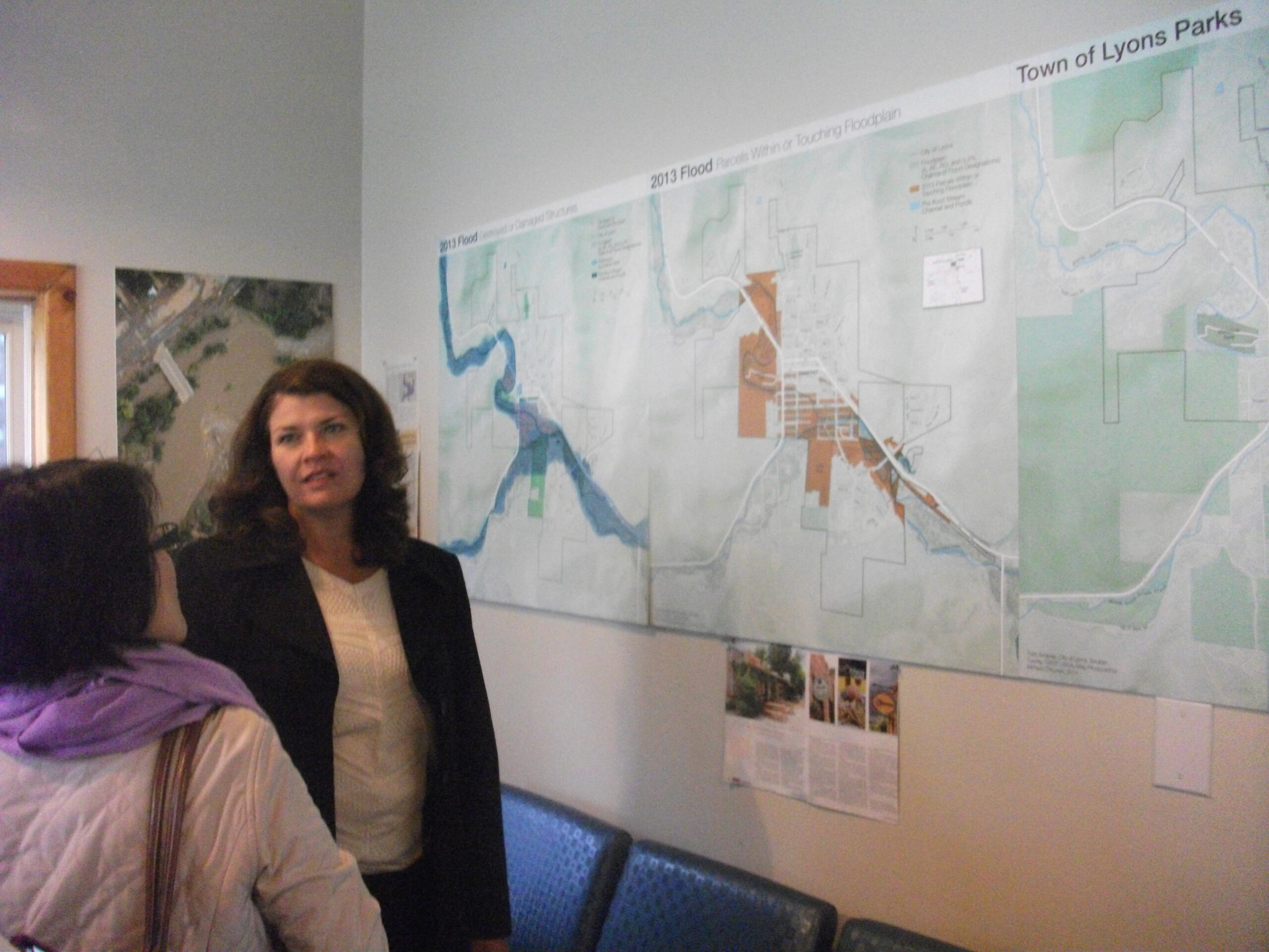
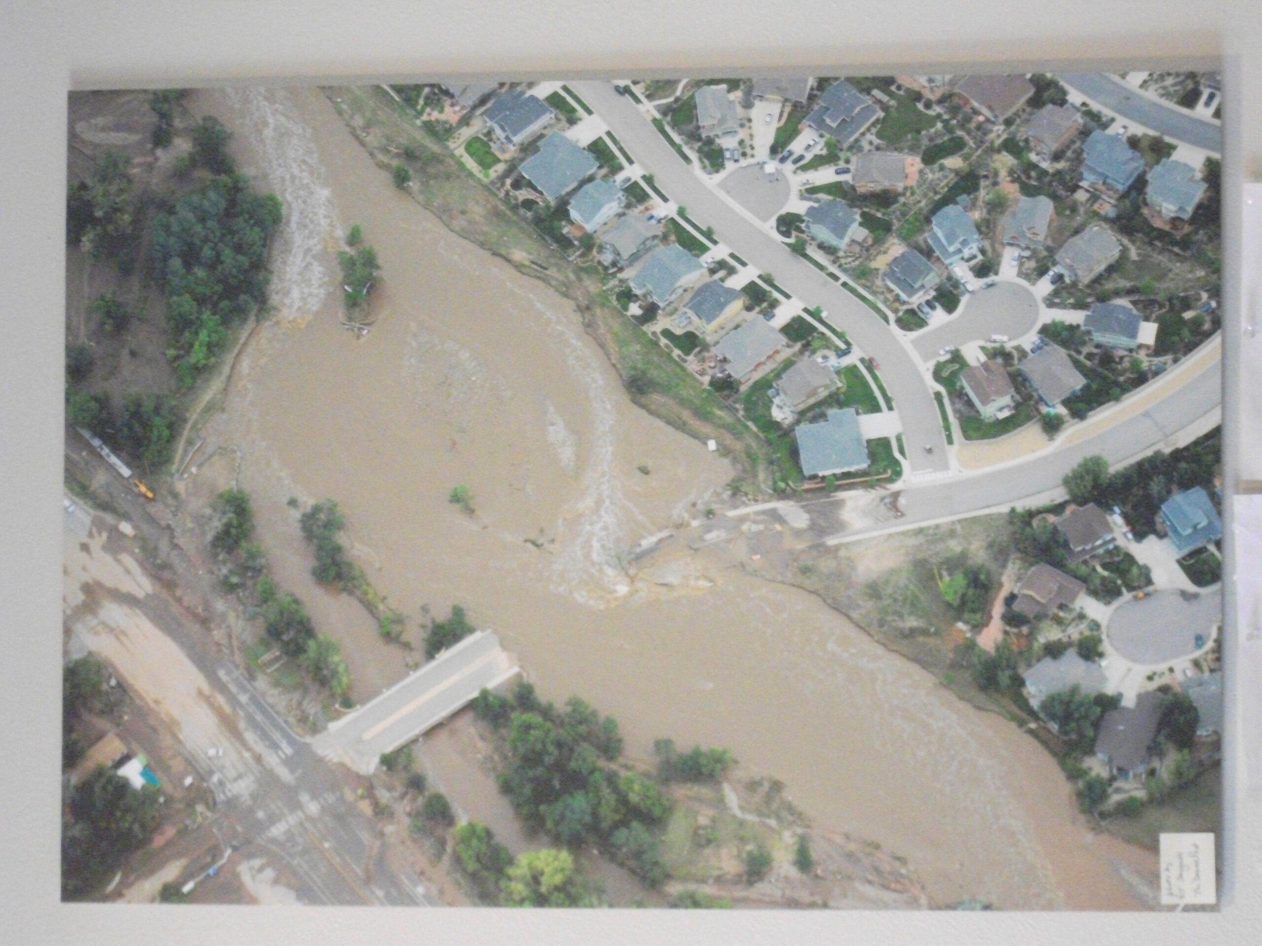
But suppose you are merely a town of 2,000, rather than the 100,000-plus residents of Boulder? Even massive reserves relative to your annual budget may not be enough in a case like that of Lyons, about 15 miles north of Boulder, but much smaller and considerably more vulnerable. Lyons sits at the confluence of the North and South St. Vrain Creeks. Every one of its citizens was forced to evacuate, and every one of its businesses closed, almost all of them independently owned.
Victoria Simonsen, the town administrator, noted that this town with a $1 million annual budget had $4.4 million in reserves, which still are nowhere near enough in the face of $50 million in damages. Outside assistance has been essential. The normal creek flow is 1,200 cubic feet per second (cfs); the storm produced a flood flow of 26,000 cfs, ripping a 400-foot gash through the center of town that runs three to 18 feet deep. The severe storm tore apart the water distribution system, pulled gas and electric lines out of the ground, and destroyed communications. Effectively, the community became a series of six islands surrounded by water, isolated from the outside world for 36 hours before the National Guard could arrive with high-water vehicles capable of entering the scene and evacuating those who remained. Miraculously, perhaps, only one person died.
There is a great deal of work to be done in Lyons, and some other towns like it, as a result of last year’s flood. Simonsen provided a laundry list of actions spread across the short-, mid-, and long-term recovery that lies ahead. But the town has help. Oskar Blues, a home-grown brewery, set up a nonprofit foundation to raise money, Oskar Blues CAN’d Aid, named after the company’s famous canned microbrew designed for mountain climbers who cannot afford to carry bottled beer in their sacks. Plans are underway to restart businesses, replace lost housing, and restore parks, open space, and trails. The summer festivals that attracted people in the past will go on, albeit with some adjustments. One has to admire such the sense of community that is on exhibit in places like Lyons.
That brings us back to the Gold Hill Inn. Unique entertainment and eating establishments, and the small town feel that they produce, are what keep many of these small Colorado towns alive today. The Gold Hill Inn serves special food in order to attract the special people who find their way up mountain roads to try the unique cuisine. The menu changes from day to day, so it is posted on the blackboard. You can get the three-course meal for about $25, as I recall, or the six-course for $35, and though it seemed indulgent, we all opted for six. I can personally attest that the Ukrainian borscht, flavored with bacon, made a fabulous side dish and was far better than anything like it I can recall. The ono salad was a treat, but the entrée I ordered, the roast pork cooked in apricot sauce, was a dream. All that is before we get to the dessert (a truly unique apple pie in my case that I cannot recall how to describe if I ever figured out how to do so in the first place), followed by cheeses that ultimately seemed decadent after everything that preceded them. The service was both outstanding and enthusiastic, and it was explained that the staff works as a team and responds to its clientele as a team. No want or concern among customers went unanswered. It is clear they want you to love the place and come back.
And that is because, for all its challenges, the people in these small towns seem to love the place themselves. There are, after all, many reasons not to be there. They focus on the reasons that make the place special.
Jim Schwab