Envisioning a More Resilient Future

One reason I have long loved being an urban planner is that, ultimately, planning is about imagining a better future. Or should be, anyway. Although I was in my early thirties before I returned to school for a pair of graduate degrees in Urban and Regional Planning and Journalism (a very unusual combination, I soon learned), I was intrigued with the creative process as early as high school. At the time, I applied it mostly to writing, but I learned in college that creativity was valuable for just about any endeavor. Much later, I was enthralled when I read University of Chicago psychology professor Mihaly Csikszentmihalyi’s path-breaking 1990 book, Flow, a study of the creative process. By then, I was already in the throes of writing my own books and learning where my planning credentials could take me.

While most planners never write or publish books, we all are quite accustomed to producing plans, reports, and other documents for consumption by the public, public officials, and other decision makers. We learn how to present these materials and visualizations in public at meetings and hearings. Visual depictions, for example, of what a neighborhood not only is, but could become, are standard fare. Many of us learn to work with various kinds of visualization and design software that create renderings of future versions of boulevards and parks and other public spaces. What architects do for individual buildings, we try to do for entire neighborhoods and cities. In the process, we try to feed and amplify the public imagination for what could be, hoping to find options for improvement that will appeal to a public that may be looking for alternatives to an unsatisfactory or uninspiring status quo. Whole books and software programs, such as CommunityViz, have been devoted to sharing strategies with planners for accomplishing these visionary goals.

The written word and visualizations are two ways, often combined, for helping people see new possibilities or change the way they see the familiar. I have used them for decades, in evolving ways, to help people better understand my own planning specializations, hazard mitigation and disaster recovery. When a natural disaster such as a hurricane or earthquake has shaken a community’s assumptions about its own future, it can be time to think about rebuilding in a way that makes that community more resilient in the face of future events. I helped advance the idea of pre-disaster planning for post-disaster recovery, that is, thinking before a disaster even happens about what would expedite the recovery process and allow the community to emerge stronger and more prosperous than before. This has become known as finding the “silver lining” in the dark cloud of disaster recovery, building hope during a process that can take years or even decades in the most drastic situations.

Left to right, crew members Jim Schwab, David Taylor, and Kim Taylor Galway toast the film project at Royal Peacock, Sarasota, FL, June 18, 2023

Even when I left the American Planning Association (APA) at the end of May 2017, I largely envisioned a continuation of my hybrid journalistic and planning career in the form of books and teaching, for the most part, augmented by various consulting jobs. It was only after conversations with high school classmate David Taylor at the 50th reunion of our Brecksville, Ohio, Class of 1968 in June 2018 that another idea took shape. David, a Purple Heart Vietnam Veteran, had taken a very different path in life after recovering from war wounds, by becoming first a photographer, and later a videographer. After retiring from a marketing position with the U.S. Postal Service, he opened his own studio and has done film and photography work for veterans and environmental groups, as well as traditional assignments like weddings.

Dave had followed my career for decades, starting with the publication of my first book, Raising Less Corn and More Hell (University of Illinois Press), in 1988. As I grew into my role as a leader in hazards planning, he became fascinated with what planners do in that realm, regarding them as “unsung heroes” of the recovery process. Further conversations led to a visit to his home in Sarasota, Florida, in February 2019, which included a presentation at a Florida Atlantic University symposium in West Palm Beach, and eventually that fall into the idea of producing a video documentary about the role of planning in helping communities address threats from natural disasters and climate change. As chair-elect at the time of the APA Hazard Mitigation and Disaster Recovery Planning Division (HMDR), I took that idea to the executive committee, and they chose to sponsor the project.

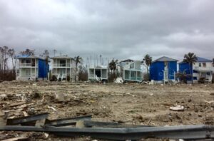
Devastation from Hurricane Michael, October 2018. Photo by David Taylor

Thus began, for me, a new way of thinking about how to engage the public on these issues. I had no experience with film as a vehicle for this process, except as a viewer, but the idea captured my imagination. What can one do with film that would be different from the written word? As the script writer, how would I think about the narrative differently? Moving out of my comfort zone forced me to think even more creatively than usual, but I welcomed the experience because I sensed that it might give us a new way to capture people’s emotions and imagination around an idea whose time was overdue. The United States, and the world, were suffering ever more massive losses from natural disasters, in part as a result of climate change, and needed new ways to approach the problem. Maybe the kinetic visual impact of a film could help affect that, if crafted with the right forward-looking perspectives in mind.

It would not be easy, and I readily understood that. Moreover, the first question was how to pay for the project. Movies are inherently more expensive to produce than books, and involve at least as much work in most ways. But if we could pull this off . . . .

Fortunately, incoming chair-elect Stacy Wright was able to arrange a $5,000 donation from Atkins, a consulting firm, to start the ball rolling in the fall of 2019. I became chair of HMDR on January 1, 2020, but the COVID pandemic intervened within weeks and by March 2020, we had to shut the project down and wait for the best. It was the fall of 2021 before we were again able to move forward. We created a Video Project Advisory Committee to provide guidance on the project. It consists of leading voices in the hazards planning subfield. We also began to assemble teams of regional volunteers who could assist us with logistics and recommend leading planners for interviews and advice.

We chose to name the film Planning to Turn the Tide because of the metaphorical implications of seeking to reverse the growing tide of losses of life and property from natural and other disasters. Well aware of the impacts and trends of climate change, we know that the number and costs of America’s billion-dollar disasters has risen rapidly in recent decades. We also know that planning can make a difference.
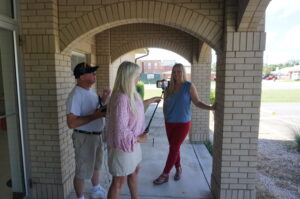
Outdoor interview with Julie Dennis, owner of OVID Solutions (also a member of Video Project Advisory Committee) in Blountstown, Florida, July 2022. Holding camera is Kim Taylor Galway; to her left is videographer David Taylor.

In the meantime, we raised additional donations from other consulting firms* and won two small grants from the APA Divisions Council to help us get started. We announced our project in May 2022 at the APA National Planning Conference in San Diego and recorded interviews with leading hazards professionals at the Association of State Floodplain Managers annual conference two weeks later in Orlando. By mid-July, we had recorded 14 more interviews in the Florida Panhandle, mostly in Panama City, following the area’s recovery four years after Hurricane Michael struck as the first Category 5 storm to reach the U.S. mainland since Hurricane Andrew in 1992. In that visit, we had extensive support from both City Hall in Panama City and the Bay County Chamber of Commerce, which provided its board room for a recording studio for an entire day.
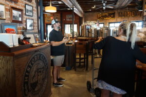
Local entrepreneur Allan Branch explains his restoration efforts at History Class Brewing in downtown Panama City, July 2022

By then, our main problem was that we needed an easy way for people interested in supporting the project to make donations. Fundraising can be hard work, but there is little reason these days to make it harder than it needs to be. APA worked with us over subsequent months to create a dedicated donations page where people could donate online. Because we were the first division in APA’s history to attempt a project like this, we were also the first to need such a mechanism, but by late March of this year, it was ready. The donations page, which you can also reach with the QR code below, channels donations directly to HMDR and tracks the donor information for us, so that we can recognize our supporters appropriately (unless they choose to be anonymous). You can help keep this project moving ahead by donating now, and I sincerely hope you choose to do so. You will be helping us sell the concept of resilient communities to America.

If you need more information on the project itself, visit our project information page. I will be adding new posts regularly as we continue our work, including short blog videos summarizing what we are doing along the way. Please stay in touch.

Jim Schwab

*Early Supporters:

Atkins

APA Divisions Council

Michael Baker International

JEO Consulting

Association of State Floodplain Managers (in-kind donation)

Jim Schwab Consulting LLC

OVID Solutions

Richard Roths, AICP

Clarion Associates

Punchard Consulting


Fatal Attraction

Explaining the frustrations of first responders in searching Mexico Beach, Florida, for survivors after Hurricane Michael, Brock Long, administrator of the Federal Emergency Management Agency, told Associated Press, “Very few people live to tell what it’s like to experience storm surge, and unfortunately in this country we seem not to learn the lesson.” Mexico Beach was ground zero for landfall of the hurricane a few days ago.

But then Long was much more direct: “When state and local officials tell you to get out, dang it, do it. Get out.”

The desire or willingness to “ride it out” among people who think the storm will never be as bad as they are told is unquestionably one of the most troubling facets of disaster response, especially when there is adequate warning.

There are disasters, of course, where adequate warning is either extremely difficult or nearly impossible. I still vividly recall one evening in 1979, when, living in Ames, Iowa, I was awakened from a second-story bedroom at about 3 a.m. by the loudest roar I had ever heard. I turned to the window to see total darkness, and aside from the howling winds, no clue of what was unfolding. When it finally passed, I went back to sleep. The next morning, I learned from the newspaper that a small tornado had struck about a mile away, lifting the roofs from seven homes before skipping off into the sky again. On the other hand, we had no cell phones and no reverse 911 in 1979.

Wildfires often give but a few minutes of warning, and earthquakes generally none at all. Hurricanes are different, at least today. In 1900, when more than 6,000 residents of Galveston were swept to sea in the deadliest storm in American history, they had no meaningful warning. In 2018, we have the best satellites the federal government and private money can buy, and we typically know at least 48 hours in advance that a coastal storm is coming, although its strength can change quickly. What we surely know in any case is that, if you live on the Gulf Coast or the Atlantic Coast in the U.S., you can expect hurricanes. Only the frequency and severity vary, and they are not always predictable. But people generally have plenty of time to learn what to do when the time comes. The rest is a matter of cooperation.

There is, of course, the question of why people choose to live in the most vulnerable locations. Early in my quarter-century of involvement in hazards planning, I borrowed

No question about it. The seashore can be a profoundly attractive place in calm weather. The question is both how we build and where we build, and, in the process, what burdens we place on first responders.

the title of a 1987 mystery thriller, The Fatal Attraction, to describe the psychology of our very human attraction to seashores, wooded mountains, and beautiful sunrises. Living on the seashore can be indescribably beautiful under blue skies and balmy breezes. There is nothing wrong with enjoying all that under the right circumstances, but it is critical that we begin to learn our own limitations in adapting to such environments, the need to build appropriately in such locations, and when it is time to simply “get out,” as Long suggested. If we don’t do these things, we are often placing inexcusable burdens on first responders who must dig our dead or injured bodies from the wreckage or save our homes from raging wildfires.

In short, there are times in life when we must be willing to think about more than ourselves. Saving our own skin in the face of oncoming natural disaster is not only not selfish; it is downright thoughtful with regard to the burdens otherwise placed on police, firefighters, and emergency medical personnel.

I am aware that the issue is bigger than I have just described. In another month, I will be speaking about post-disaster recovery to an audience of long-term care health professionals. As a society, we also have obligations to ensure that the elderly live in homes that are removed from floodplains and other hazards, that children attend schools that are as safely located as possible, and that we do not force the poor and disadvantaged into neighborhoods that are at risk and where no one else would wish to live. In New Orleans during Hurricane Katrina, the system failed thousands of poor people who did not own cars by failing to provide means for carless evacuation. The sheer number of such people was never a secret to officials in Louisiana, but good planning never happened before it was too late. All that said, those who have the means should have the willingness to consider both where they choose to live or build and to evacuate when told to do so.

We can all hope that the body count from Hurricane Michael remains low. As of the moment I am writing this, authorities have counted 17 deaths, but it may rise.

Long-term recovery awaits communities affected by either Florence or Michael. As always, serious questions can be posed about where and how to rebuild, whether we can make communities more resilient against future disasters, and what vision states and communities should have as they move forward. In its Influencers series, the Charlotte Observer asked what leaders thought North Carolina could do for coastal and inland communities affected by flooding from coastal storms. Interestingly, many cited setbacks from the coast, accounting for climate change (something the Republican-dominated legislature has explicitly chosen not to do), and keeping new development out of floodplains. All these efforts would make it easier to plan evacuations in the first place. The issue is whether North Carolina, or any other state in the path of such storms, can muster the political will to do what is right.

And whether people who live in highly vulnerable locations can heed the call when told to evacuate.

Jim Schwab


Taking Stock of Recent Disasters

Photo by Jeff Clevenger

We learn from disasters as we recover from them, but each disaster teaches slightly different things. Sometimes the lessons are significant and historic; in others, one community is learning what others already know or should have learned from their own past events. Some years are relatively quiescent, as 2018 so far seems to be. And some become relentless slogs, like 2017.

Adam Smith, lead scientist for the National Oceanic and Atmospheric Administration’s National Centers for Environmental Information, noted in a plenary panel in July for the 2018 Natural Hazards Workshop, in Broomfield, Colorado, that the tally for 2017 disasters had exceeded $200 billion. This is more than 40 percent of the tally so far of billion-dollar disasters for the entire decade beginning in 2010. Simply put, with three major hurricanes—Harvey, Irma, and Maria—striking parts of the southern U.S., followed in short order by some of the most expensive wildfires in California history, it was a wild, taxing year in the world of emergency management.

But our attention fades quickly. Right now, there are no equivalent disasters seizing our attention, but in time there will be. The people who remain painfully aware that recovery is a long, slow process are those directly affected, and even many of them will not fully grasp the ways in which past location choices and patterns of development have brought them to this pass. Many had no choice anyway. Our communities are frequently full of social inequities that compromise the life choices of the poor and disabled. In other cases, the losses inflicted on neighborhoods are the result of hubris on the part of developers, city officials, and homeowners themselves. It does not hurt, approximately one year after these combined events, to look at what we know so far about the recovery following them.

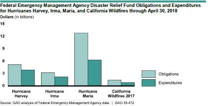
Apparently, the U.S. General Accountability Office (GAO), an arm of Congress, agreed that the time was ripe for review because it has released a study, 2017 Hurricanes and Wildfires: Initial Observations on the Federal Response and Key Recovery Challenges. Because of the severity of challenges in Puerto Rico, one may note from the graph below, reproduced from the report, that Hurricane Maria by far entailed the largest federal expenditures.

In spite of that level of effort, Puerto Rico has engendered the most significant criticism of the performance of the Federal Emergency Management Agency (FEMA). Maria struck Puerto Rico and the U.S. Virgin Islands (USVI) after Harvey had already drenched and flooded coastal Texas, and Irma had swept through much of Florida.

FEMA teams managing the distribution of water, and meals for hundreds of semi-trucks at an incident Support Base in Seguin, Texas. Photo by Dominick Del Vecchio – Aug 29, 2017

The report notes that, as a result, FEMA resources were severely stretched by then, only to have wildfires in California add to the pressure, though the personnel assigned in the last case were small compared to the hurricanes (as is typically the case). Adding to the challenge, Puerto Rico and USVI are offshore and were also poorly prepared for a Category 4 hurricane. Puerto Rico had already suffered years of neglect of crucial infrastructure, was burdened with oppressive debts, and was by far the least prosperous target of the 2017 storms. All this, combined with some incredibly inept public relations from the White House, led to a perfect storm in which nearly 3,000 people have died directly or indirectly as a result of the disaster. To my knowledge, that is a number exceeded in U.S. history only by the 1900 hurricane in Galveston, which killed more than twice as many people. The difference is that, in Puerto Rico, most people died because of blocked transportation, loss of electricity, and similar problems with critical facilities that prevented adequate transportation or medical attention in many isolated communities in the interior of the mountainous island.

Exactly what we learn from Puerto Rico remains to be seen. It is worth noting, in my view, that far more prosperous Hawaii has coped well with admittedly less-challenging disasters in recent years, in large part because state government has practiced response and committed resources to the problem. I say this despite being aware of gaps in Hawaii recovery planning that merit further attention. But if Puerto Rico is a logistical challenge for mainland responders, Hawaii is even more remote but better prepared. The difference in economic circumstances, however, is a dramatic and powerful variable in this comparison, as is Hawaii’s statehood. It is also worth noting that Hawaii is a long chain of islands, and storms (or volcanoes) never affect all at the same time. Effectively, that has always meant that emergency resources in Hawaii have been able to be moved from one or more islands to another that has been hit by a storm. All of Puerto Rico was devastated almost on the same day, with internal transportation, communications, and electric power nearly brought to a standstill, making access to many villages nearly impossible.

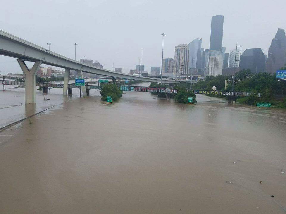
If Puerto Rico, followed closely by USVI, is the direst case for long-term recovery, there nonetheless remain serious challenges in Texas, not only in Houston but in dozens of other counties along the Gulf Coast. A recent Washington Post article used the term “Harvey homeless” to describe thousands of Texas families living in whatever parts of their flooded homes they have salvaged while struggling to accumulate the resources to repair the rest. They live with mold, dust, and any other environmental contaminants that endure in essentially unusable parts of their homes. In all, according to the Texas Department of Public Safety, at least 175,000 Texas homes were “badly damaged” by Hurricane Harvey, and 80 percent lacked flood insurance, thus relying on much smaller federal disaster payments (averaging $4,203) than flood insurance would have afforded. If there is one powerful lesson in Texas, it concerns public education on the value of flood insurance, particularly in the many areas outside the 100-year floodplain. Unfortunately, much of the public retains the illusion that flood insurance is either unnecessary or unavailable outside the legally defined floodplain. Yet Harvey’s 60 inches of rain in some parts of metropolitan Houston left vast areas beyond the regulatory flood boundaries under water because water does not care about such artificial boundaries. It goes where gravity compels it to go. Moreover, years of loose land-use regulation over the past half-century of rapid growth have expanded the floodplain and put numerous neighborhoods in greater danger than they faced in the past.

Moreover, as John Henneberger, executive director of the nonprofit advocacy group Texas Housers, noted in his keynote at the Natural Hazards Workshop, Texas does not have a noteworthy history of attention to social equity in disaster recovery. Henneberger called for a new model of disaster recovery in which we seek to use recovery planning to overcome racial and economic inequities, stating that “the legal framework already exists” in federal programs like Community Development Block Grant—Disaster Recovery (CDBG-DR) to “overcome inequalities,” but the rules are not always followed. Thus, his top recommendation for reform was simply to “obey the law” regarding the conditions that apply to state and local use of CDBG-DR funds.

Finally, Bloomberg Business Week chose recently to examine the questions surrounding rebuilding after the California wildfires. With a population already approaching 40 million, the state is under intense pressure to build adequate housing amid rising housing costs. California has repeatedly toughened its building codes in response to wildfire threats but faces a legacy problem of homes built under earlier standards. Not often known outside wildfire research circles is the fact that the average home contains seven to eight times the density of combustible materials as the surrounding forest in the wildland-urban interface. That means that every home that catches fire or explodes is a huge matchstick endangering every other home in its immediate vicinity. When one considers that California is unquestionably the most progressive state in tackling wildfire problems, one understands that the problem of retrofitting older homes built to lower building code standards—or none at all in some other western states—is a lingering and potentially very expensive problem. The dilemma serves to illuminate the value of pre-planning for recovery, learning how to seize the “teachable moment” for reform, to reduce the scope of the problem. The article also notes that, if California is to reduce pressure to build in the forest, its cities must be prepared to allow greater density to relieve the housing crisis in a state where a shortage of affordable housing has yielded a concomitant problem of growing homelessness. And so, we see why urban planning needs both to be holistic in its approach to social problems and guided by wise state policy with supporting resources. We all still have a long way to go.

This blog post can never be long enough to explore all these issues in depth. But in coming weeks and months, I hope to delve into specific issues more deeply, share interviews with individual experts, and explore what needs to be done. I am also watching intently for new books that will shed light on new solutions. One just arrived today. Stay tuned.

Jim Schwab

FEMA Needs to Think about This One

Flooded property in Lyons, Colorado, after the St. Vrain River flooded in September 2013.

There is that old saying that, if it ain’t broke, don’t fix it. To that, one might add that, if you’re thinking about fixing it anyway, you may want to clarify exactly how you wish to improve things and why you think the improvement will be better.

In a February 27 notice in the Federal Register, the Federal Emergency Management Agency (FEMA) proposed a major change in long-standing hazard mitigation rules regarding grants for acquisitions of flooded properties that made almost no effort to meet that test. I wish I had noticed it earlier because the deadline for comments was April 30. I submitted a brief comment on that date and tried to rally others on Facebook, but the truth is that this one got away from me. I was busy on other fronts. I have subsequently spent a few days gathering background information.

I am very glad that a few national organizations like the Association of State Floodplain Managers (ASFPM), American Rivers, and the Natural Resources Defense Council (NRDC) found time to file substantial objections to FEMA’s notice on Property Acquisitions and Relocation for Open Space (Docket ID: FEMA-2018-0006). Their objections raise profound questions about both the process and the substance of FEMA’s proposed changes. Others have also submitted comments.

Here’s the bottom line: For 30 years since the passage of the Stafford Act, which provides the basic framework of most federal disaster law, federal hazard mitigation grant programs have required that lands being acquired from property owners whose homes have been flooded must be placed into perpetual open space following demolition of the structures. The clear intent is to reduce the ongoing exposure of the federal government and the National Flood Insurance Program to repeated losses by precluding further development in those flood-prone areas. By and large, those grants go through state and local governments, which then maintain those open spaces and must periodically certify to FEMA that the lands remain in that status. Today, those grant programs include not only the Hazard Mitigation Grant Program (HMGP), a sometimes-substantial source of mitigation funding that is available after a presidentially declared disaster; the Pre-Disaster Mitigation (PDM) program, created as part of the Disaster Mitigation Act of 2000, which amended the Stafford Act; and Flood Mitigation Assistance (FMA), part of which deals with Severe Repetitive Loss properties, which make up a disproportionate share of overall flood claims.

In the notice, FEMA has announced a new option to allow owners of flooded properties to retain the underlying land while being paid to demolish the structures, thereby permitting them to eventually rebuild on that same flood-prone land. Because mitigation grants have gone from FEMA through states to local governments, those governments have been responsible for the open space programs that result. This new approach would allow the property owner the option of taking the grant directly from FEMA. In its comments on the proposal, ASFPM noted that, in the 2004 NFIP reform legislation, it supported providing FEMA the option to deal directly with property owners, mostly because some local governments have lacked the capacity to monitor the open space requirements, but it still expected that FEMA would consult with those governments before using that option as a means of maintaining consistency with state and local hazard mitigation policy. The current notice makes no mention of such coordination.

Elevation of flooded properties remains a viable option in many cases.

It is not as if these owners do not have other options for mitigating future flood damage, including elevation of residential structures above the 100-year base flood elevation established on FEMA flood insurance rate maps, or floodproofing the structure. But, the thinking seems to be, some owners will be more willing to demolish if they can retain the land. One possibility for some might be to retain the land, rebuild in due course, and flip the improved property while leaving the NFIP with continued flood loss exposures. How that helps federal taxpayers or other flood insurance rate payers is not especially clear.

The Federal Register announcement does nothing to make that clear. If you follow the link and read the notice, you are likely to experience my reaction, which was that I felt left in the dark regarding the rationale for making this move, which is not explained. Nor does FEMA provide any data to support the idea that this initiative would do anything to reduce flood losses. The opposite could easily prove true.

In an April 26 article in Insurance Journal, former FEMA administrator Craig Fugate offers some support for the new option by noting that placing land in permanent open space through a buyout is often a “hard sell.” That may well be, but it is partly because the solution is meant to be effective and lasting. It is also not as if the approach has lacked success. As NRDC notes in its comments, citing ASFPM case studies, more than 30,000 floodplain properties have been removed from development since 1993, many of them following major cataclysms such as the 1993 and 2008 Midwest floods and various hurricanes.

Perhaps more telling is the question of homeowners’ motivation in making the difficult decision to sell and relocate. The idea that people would necessarily prefer to be able to rebuild in the same location is not as clear or straightforward as some might assume, though there are, no doubt, advocates of property rights who would prefer to create the new option. But this emotional decision contains some factors that should not be ignored. Perhaps straight to the point is this comment from American Rivers:

Our experience working with floodplain managers has taught us that convincing property owners to accept a buyout is an emotional and difficult decision, and many are only willing to accept the buyout offer after they are assured that the property will be preserved as open space for the good of the public. Offering direct grants that allow new construction where a structure was demolished could be at odds with local hazard mitigation plans and efforts to acquire flood prone properties for open space. FEMA should instead be working to support the implementation of open space goals in local and state hazard mitigation grants.

In other words, many of those choosing a buyout, having suffered the damages of severe and repetitive losses from flooding, and aware of the larger issues concerning the public good in these situations, would rather ensure that nothing like this happens again, at least in their community. But what happens to the motivation undergirding their willingness to sell if they become acutely aware that their neighbors now have the option of prolonging the pain by not placing the land in permanent open space? Will they still feel that they are accomplishing anything by pursuing the traditional option? In any event, are these not the people whose choices we most want to honor for the greater good of the community?

City-acquired open space in Cedar Falls, Iowa, near the Cedar River.

The essential reason all this is important is that we have learned much over the years about the natural and beneficial functions of floodplains, which include soil enrichment, wildlife habitat, reduced flood severity, and reductions in erosion and stormwater runoff, to name a few, in addition to the potential recreational functions of waterfront parks and open space. All this is in addition to the fiscal benefits of reducing future floodplain losses in the areas affected. If all that is not reason enough for FEMA to pause, rethink the question, and at least offer some solid scientific and economic documentation of the benefits of the proposed new approach, then I am not sure what is. Otherwise, count me a serious skeptic.

Jim Schwab

The Past and Future of Disaster Research and Practice

Interdisciplinary disaster studies are still relatively new, compared to long-standing fields like geology or even psychology. I spent last week (July 19-23) in Broomfield, Colorado, first at the Natural Hazards Workshop, sponsored by the University of Colorado’s Natural Hazards Center, and then at the one-day add-on conference of the Natural Hazard Mitigation Association (NHMA). The International Research Committee on Disasters Researchers Meeting took place at the same time as the NHMA gathering. The main event marked the 40th year of the Natural Hazards Workshop, launched in 1976, with support from the National Science Foundation (NSF), by the Natural Hazards Center’s renowned founder, Gilbert F. White, who virtually pioneered studies of flooding in the 1930s as a geographer who served in the New Deal under President Franklin Roosevelt, later taught at the University of Chicago, and finally found his home in Boulder, where he died in 2006 at age 94. You can read a full biography of White, a true scientific pioneer, in Robert E. Hinshaw’s Living with Nature’s Extremes, published shortly after White’s death.

To mark this milestone, current NHC director Kathleen Tierney invited several of us to join a panel for the opening plenary on July 20 to discuss both retrospective and prospective views of disaster research and practice within four disciplines. I spoke about urban planning; Howard Kunreuther spoke by video on economics; Tricia Wachtendorf of the University of Delaware on sociology; and Ken Mitchell of Rutgers University on geography. In the end, of course, we all use and benefit from each other’s insights, so it was intriguing to hear the comparisons in how our fields have approached problems of hazard mitigation and disaster recovery. The forum was moderated by long-time NSF program director Dennis Wenger, who previously served at Texas A&M University, where he was Founding Director and Senior Scholar of the Hazard Reduction & Recovery Center.

Wenger himself had a story to tell before introducing his panel, one involving more than 800 projects funded by NSF for more than $200 million over the years his program, Infrastructure Systems Management and Extreme Events, has been in place to fund research on hazards. It has not always had that name; as Wenger humorously noted, however, its four name changes over some four decades is “not bad for NSF.” The ballroom of 500 disaster practitioners and researchers from multiple disciplines contained more than a few people whose research has benefited from those NSF grants, which have moved the field forward in numerous and remarkable ways.

The American Planning Association taped the opening plenary and has made it available on its multimedia Recovery News blog at http://blogs.planning.org/postdisaster/2015/07/28/what-next-the-past-and-future-of-disaster-practice-and-research/. The blog post includes the PowerPoint accompanying my presentation.


Jim Schwab

Did We Learn from Sandy?

Two years ago, in June 2013, I participated in a day-long meeting in New York hosted by the Regional Plan Association (RPA) and the Lincoln Institute of Land Policy, helping explore the coastal policy implications of Hurricane Sandy. These two organizations were hardly the only ones pursuing such questions, but they were certainly among the most prominent. RPA has been a long-time presence in the New York Metro area, and the Lincoln Institute is a highly reputed research organization located at Harvard University. Both clearly had a stake in the region’s recovery from the Superstorm, and together they had access to some of the best planning minds familiar with disaster issues.

Last year, in part as a result of that and other research sessions and forums, the Lincoln Institute produced Lessons from Sandy: Federal Policies to Build Climate-Resilient Coastal Regions. Though many of their prescriptions will look familiar to those who have followed the trajectory of post-Sandy redevelopment, this report is both worth reading and very readable. It concentrates on issues of disaster relief, insurance and flood risk management, and urban infrastructure. Its recommendations are clear and strong, starting with a series of specific ideas for addressing future climate impacts during the recovery and rebuilding process, talking about how to make programs such as the Federal Emergency Management Agency’s Public Assistance Program, which funds the rebuilding of public infrastructure, more flexible in this regard, improving the coordination of planning before and after disasters, and development of new financing and insurance mechanisms to support investments in mitigation and resilience. It also discusses realigning federal programs to reduce risk and restore the health of coastal resources, and better data sharing to aid decision making.


Jim Schwab

Resources for Planners to Address Hazards

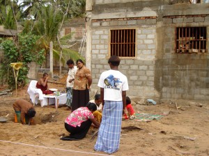
Sri Lankans dedicate new housing built in 2005, after the Indian Ocean tsunami, in a Buddhist ceremony.

Sri Lankans dedicate new housing built in 2005, after the Indian Ocean tsunami, in a Buddhist ceremony.

One benefit of increased attention to hazards and climate change within the planning profession is a growing array of valuable literature that can benefit practicing planners and widen the scope of thinking on the subject among academics. This review of books published within the past year or so is intended to highlight some of this new literature and offer some comparisons on the focus and practical value the authors provide.

Because urban planning is ultimately about people and the built environment, it may make sense to start this survey with two books that examine the context within which risk happens. Kathleen Tierney, a professor of sociology at the University of Colorado in Boulder and director of the Natural Hazards Center there, sets out in The Social Roots of Risk: Producing Disasters, Promoting Resilience (Stanford University Press, 2014) to reorient our thinking away from the idea that individual natural phenomena—earthquakes, hurricanes, floods, etc.—“cause” the death and destruction that we often associate with them. In fact, she says, the death and destruction, particularly in the modern world, is an artifact of the social decisions that produce and, equally important, distribute risk differentially among populations, often producing widely varying impacts. In the opening chapter, she states, “the organizing idea for this book is that disasters and their impacts are socially produced, and that the forces driving the production of disaster are embedded in the social order itself.”

By itself, the idea that disaster losses result from the collision of natural forces with the built environment should not surprise any planners with a modicum of intelligence. And the built environment is inevitably the result of both individual and community decisions. The devil of Tierney’s thesis lies in the details: paying attention not only to all the social, institutional, and political decisions that either enhance or mitigate risk but to how those decisions get made and for what reasons. It is clear that those impacts are anything but randomly distributed and that most are avoidable, yet the litany of losses marches on. Tierney notes that a great deal of professional attention in recent decades has focused on how people perceive risk, a legitimate area of inquiry, but not nearly as much has focused on the origins of risk and how it was socially constructed. There are reasons, after all, why a 7.0 magnitude earthquake in Haiti kills an estimated 300,000 (but who really knows?) yet only dozens at most in California, and why the 1,800 who died during Hurricane Katrina included overwhelmingly disproportionate numbers of the economically disadvantaged.

Most planners work in local or regional government, and they serve power structures that must make the decisions, even when they choose to do nothing, that affect these outcomes. In that sense, some of Tierney’s theories and conclusions may challenge our comfort zones because they imply (or state directly) a need to challenge power with regard to these issues. For precisely that reason, I recommend reading it. Most social progress results from stepping outside traditional comfort zones. For planners, it is also within our ethical and legal responsibilities to help protect public health, safety, and welfare.

Those who wish to examine more closely how differential risk affects more vulnerable subsections of community populations can follow up with a case in point provided by Michael R. Greenberg, professor at the Edward J. Bloustein School of Planning and Public Policy at Rutgers in New Jersey, where he had a front-row seat to observe Superstorm Sandy in 2012. As a baby boomer with aging parents, he says, the event inspired him to examine the issues such events pose for seniors. Protecting Seniors Against Environmental Disasters: From Hazards and Vulnerability to Prevention and Resilience (Routledge, 2014) closely dissects the vulnerabilities of the rising generation of seniors among baby boomers. It exposes the resulting collision of demographics with natural hazards and often inadequate public policy in considering the reduced resilience that may result. At the same time, he notes that many seniors in good mental and physical health can become assets in using their to help build the very resilience many communities will need in coming decades, if only their communities learn to focus these social resources to address and help solve such problems. My only regret after reading this thoughtful book is that the publisher chose to make it so expensive ($145 hardcover), but perhaps a library or electronic copy can make it more accessible.

Six authors, mostly at Texas A&M University (TAMU) have addressed the question of resilience head-on in Planning for Community Resilience: A Handbook for Reducing Vulnerability to Disasters (Island Press, 2014). Jamie Hicks Masterson, program director of Texas Target Communities (TAMU); Walter Gillis Peacock, professor in the Department of Landscape Architecture and Urban Planning and director of the Hazards Reduction & Recovery Center (TAMU); Shannon S. Van Zandt, associate professor in the department and director of the Center for Housing and Urban Development (TAMU); Himanshu Grover, assistant professor in the Department of Urban Planning and Regional Planning at the University of Buffalo; Lori Feild Schwarz, comprehensive planning manager for the City of Plano, Texas (and formerly in Galveston); and John T. Cooper, Jr., associate professor of practice in the same department at TAMU, have combined somehow to produce an almost seamless document that lays out a very practical approach to understanding and developing resilience within communities. The book is littered with tables, checklists, and exercises to walk planners and city officials through the necessary analysis to grasp the impacts of everyday planning decisions in connection with natural hazards. The book tends to rely heavily on the Texas and Gulf Coast experiences of the authors, but as they note with a wry sense of humor, “We like to say that if you can plan in Texas, you can plan anywhere.” For the practicing planner, this may well be the most useful of the five books reviewed here.

Two other books represent the rising level of interest among planners in addressing the impacts of climate change, a subject implicit, and sometimes explicitly expressed, in the three books noted above. One of these, Local Climate Action Planning (Island Press, 2012), by Michael R. Boswell, Adrienne I. Greve, and Tammy L. Seale, is actually three years old but still a very useful and well-informed primer for those planners and city officials undertaking to address climate change. The primary focus is actually not hazards but climate action plans, which focus on mitigating climate change by using public policy and planning to reduce greenhouse gas emissions. For climate change skeptics, it is worth noting that many of the resulting strategies have local environmental and economic benefits that add to the allure of effective climate action plans. While much of the book addresses techniques like inventorying local greenhouse gas emissions and developing reduction strategies, nonetheless, the authors devote one chapter to climate adaptation and outline means of assessing community sectors for vulnerability to climate change impacts.

Finally, Adapting to Climate Change: Lessons from Natural Hazards Planning (Springer, 2014), assembled from a variety of contributions by editors Bruce C. Glavovic, of New Zealand’s Massey University, and Gavin P. Smith, of the University of North Carolina at Chapel Hill, brings together the subjects of climate and natural hazards in a way that points to future successes in addressing the increased vulnerabilities associated with climate change. Unlike the other books, it is less a single narrative than an anthology using examples of climate change adaptation from around the world. It is unquestionably the most cosmopolitan and far-reaching of the five books in its aspirations for global relevance, using case studies from South Africa, Peru, New Zealand, and the South Pacific, among other locations, in addition to the United States. The two editors first met while working in different capacities along the Gulf Coast after Hurricane Katrina and have collaborated periodically ever since. Both have been anxious to explore and explain the critical roles of planning and governance in managing exposure to natural disasters, especially as “practitioners from diverse backgrounds  . . . are faced with the grand challenge of adapting to climate change. Planners who like to mine the experience of other cities and regions in case studies will find plenty to contemplate as they review the mixed international track record of community resilience in facing floods, coastal storms, and other weather-related phenomena influenced by a changing global climate with its wide-ranging variations in specific local settings. It may take a while to digest this substantial book, but it is probably well worth the effort.


Jim Schwab

The Next Generation of Disaster Recovery Guidance

It is always an honor to be able to lead an effort that advances the state of practice with regard to a subject as critical to the nation, and the world, as planning for post-disaster recovery. As readers will have noted from this blog and website, for the last four years or so I was in that position as both the manager of the APA Hazards Planning Center and project manager for Planning for Post-Disaster Recovery: Next Generation, a project that has included the production of an APA Planning Advisory Service Report (No. 576) of the same name. We wish to acknowledge the support of the Federal Emergency Management Agency through an agreement with APA, which made the project possible. I personally wish to thank the members of the project team who contributed to the report and the project overall, who are noted in the acknowledgments page of the report. Particularly, these include my co-authors: Laurie A. Johnson, Kenneth C. Topping, Allison Boyd, and J. Barry Hokanson.

The report came off the press at the end of last year, and became available online last week on the APA website. With it have come some other resources we were able to create:

  • A model pre-event recovery ordinance to help communities guide the recovery process
  • A new resource list of federal programs for assistance with local disaster recovery needs
  • Still to come, a series of briefing papers on subtopics of disaster recovery (stay tuned)

The purpose of this posting is simply to link interested readers to these resources, which include a free PDF download of the 200-page report, which we believe will set the standard in coming years for best practices in the arena of preparing communities beforehand for potential disasters and for planning afterwards for effective recovery. Please use the link above to access all of these resources.


Jim Schwab

Drone Coverage in Napa

Readers may well be waiting for me to post something substantial soon, and I plan to compose a significant article this Labor Day weekend. It’s been very hectic for me the last two weeks, and I am currently in Washington on a round of ten meetings in two days, pursuing business new and old.

But while all that is happening, Mike Johnson from our IT department at the American Planning Association latched onto something very interesting, I think, and added it to our Recovery News blog. Amid all the debate about the proper and allowable uses of drones, Evan Kilkus in California has found one use that gives us handy new insights into the nature of damage from the recent earthquake in Napa, California. Use the link above to see his drone-filmed video of the damaged buildings from a perspective you won’t get from the street.

Recovery News is a vehicle we created to deliver news and resources pertaining to post-disaster recovery in connection with our project, nearing completion, with FEMA to prepare the Next Generation guidance on planning for post-disaster recovery. Kudos to Mike for turning up the latest innovation in this area, and to Evan Kilkus for getting it done.

Jim Schwab