Costly Coastal Arrogance

In the days shortly after World War II, writes Gilbert M. Gaul in The Geography of Risk, Morris Shapiro and his family were busy building their own version of Levittown, the famed suburban tract housing development of Long Island, on a barrier island in southern New Jersey known as Long Beach Island. The place had largely been the preserve of fishing villages in earlier years, but Shapiro had a vision, one he passed along to his son, Herbert, in due time.

Shapiro drained and built on what we now call wetlands, but in the 1940s, environmental values were a weak reed for resisting the onslaught of developers who believed in the next big real estate trend and the willingness of small villages to grow with them. And so, Morris persuaded Herbert to buy land around Barnegat Bay, and the few hunters and watermen who understood the value of salt marsh in preserving wildlife habitat were pushed aside. The suburbanization of the Jersey Shore soon took hold.

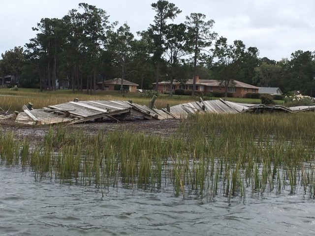
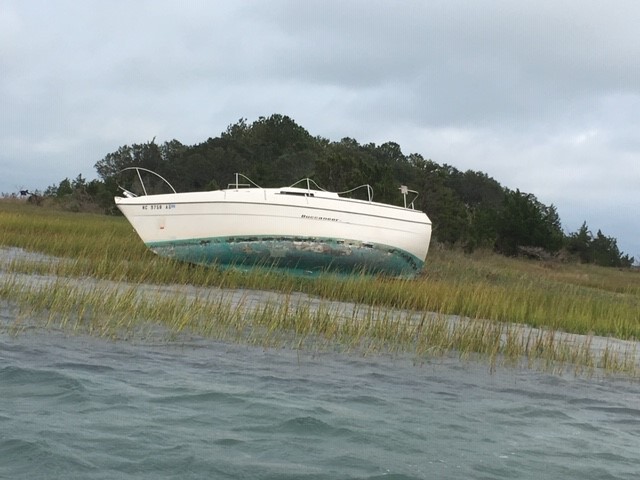
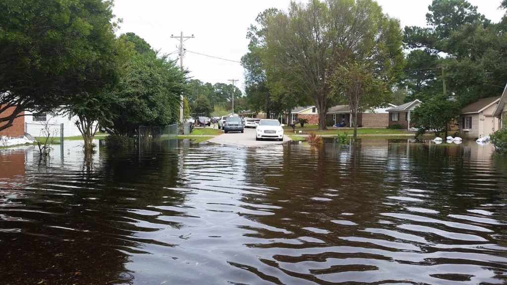
Nature heals its own wounds when the landscape is healthy, but damage to the built environment can be another matter altogether. Gaul details the impacts of the Ash Wednesday storm that struck the New Jersey coast in the spring of 1962, providing the nation with its first television-era glimpse of disasters yet to come and the high costs of having compromised the protective dunes and wetlands and installed thousands of bungalows on a narrow, highly vulnerable strip of land along the sea. “Nearly all the 5,361 homes on Long Beach Island . . . were damaged,” Gaul tells us, “including 1,000 that were severely impaired and 600 that were destroyed.”

As always, the immediate focus was on rebuilding, with urgent reminders from legislators and others of the economic value of shoreline development (but not its costs). In the face of that Category 5 juggernaut, Gov. Richard Hughes bravely proposed a six-month moratorium on new development, supported by the U.S. Army Corps of Engineers, and a ban on rebuilding along a 100-foot buffer along the beach. Looking back, it seems visionary for its time in anticipating the problems that would otherwise follow, and it attracted precisely the blowback we have come to expect. Federal support for rebuilding came from the Kennedy administration, and the long drift toward increased federal responsibility for recovery was underway.

Gaul goes on to detail the long tale of Jim Mancini, both developer and mayor of Long Beach Island, and cheerleader in chief for the coastal towns and what they saw as their inevitable growth. Still, governors and environmental officials in New Jersey were periodically game for a new try at restraining a situation where local officials controlled building and zoning while state taxpayers provided millions of dollars to repair storm damage and infrastructure. Gov. Brendan Byrne was next in 1979, starting with a conference on the future of the New Jersey shore, followed by initiatives from the state Department of Environmental Protection and the introduction of the Dune and Shorefront Protection Act in the legislature.

Predictably, the mayors rebelled, led by Mancini, who organized 1,500 protesters to attend a July 1980 hearing at the St. Francis Community Center in Brant Beach. Robert Hollenbeck, chairman of the Senate Energy and Natural Resources Committee, essentially presided over an ambush in which he was repeatedly shouted down by angry homeowners. Once again, the opportunity to take a creative regulatory approach to controlling shoreline damage was driven into wholesale political retreat. By the time Superstorm Sandy delivered its legendary hit in October 2012, it was all over but the shouting. The administration of Gov. Chris Christie was not about to seriously challenge the home rule prerogatives that dominate the politically fragmented landscape of New Jersey township government. The tough questions would have to wait.

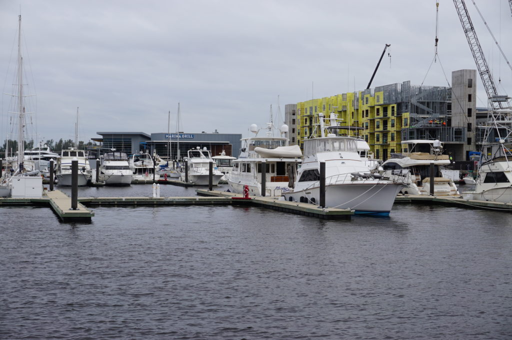
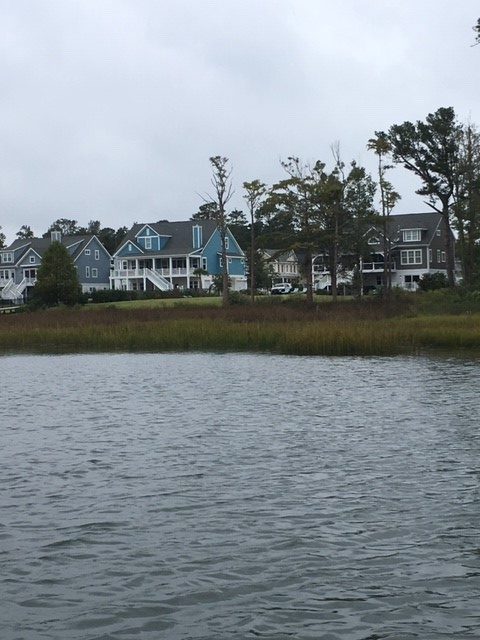
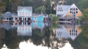
What Gaul outlines in New Jersey, of course, has occurred in other forms in other places from the Carolinas to Florida to Texas over the subsequent decades. Gaul takes us to all these locations as the book progresses. What we have seen, time and again, are the costly consequences of a pattern of coastal development that has placed increasing quantities of homes and properties in harm’s way, then begged or even demanded that states and the federal government rescue the storm-damaged communities even as they fight bitterly against regulatory measures aimed at reducing future costs by restricting unwise development.

Of course, by now there are many residents caught in the middle. But surely, it is not impossible to sympathize with their plight and be willing to assist those who seek alternatives, while refusing to continue subsidizing unwise new development or bailing out those who refuse to accept the reality of the risks they have assumed. What is clear is that tough decisions await, and the public does not have endless resources. Wiser development and rebuilding decisions are imperative.

Not surprisingly, Gaul, a veteran Pulitzer Prize-winning author and reporter, is a New Jersey native. But he is also an astute historian and researcher who writes with a well-informed passion that brings us, in the end, to the fateful season of 2017—the year of Hurricanes Harvey, Irma, and Maria—and then 2018, when all looked calm on the meteorological front until Florence took its toll in North Carolina, followed by Category 5 Michael in the Florida Panhandle. Climate change, inducing hurricanes that become slow-moving rain bombs that flood cities like Houston, is still “not a thing” in the Trump White House. Neither, for the most part, are buyouts of repetitively flooded homes, even as the nation desperately needs to find ways to live more resiliently in the face of the risks it has embedded on its coastal landscapes.

But the costs keep climbing, and it is not impossible to imagine a serious political reckoning under a different administration with a more realistic handle on the stakes involved, which run into the trillions of dollars. It is not impossible, for instance, to imagine a $250 billion disaster if a catastrophic hurricane took direct aim at one of Florida’s major cities. For that reason alone, Gaul’s book may be worth a read. We need to improve the quality and depth of the conversation around issues with such drastic fiscal impact.

Jim Schwab

Facing Waterfront Hazards in Wilmington

Wilmington, a charming city of just over 100,000 on the far southern edge of the North Carolina coast, has taken some hits from coastal storms in recent years, most notably Hurricane Florence in 2018. Hurricane Dorian this year posed a minor threat but mostly left a trail of 14 identified tornadoes in its wake, a phenomenon familiar in the Southeast, though their association with hurricanes may be less well known elsewhere.

Wilmington Planning Director Glenn Harbeck, who I was told was one of the most knowledgeable people in town for the purpose, on October 8 took me on a boat tour of much of the city’s interior waterfront to let me see and photograph the area along Hewletts Creek, a stream feeding into the Atlantic Ocean behind the barrier island that includes the Masonboro Island Estuarine Reserve. Glenn and his wife have lived in Wilmington for 40 years, during which, he says, they have experienced a succession of hurricanes: Diana (1984), Bertha (1996), Fran (1996), Bonnie (1998), Floyd (1999), Matthew (2016), Florence (2018), and Dorian (2019).

Why it has taken me this long to write about it is another matter related entirely to my own obligations and distractions. At the time, however, I was in Wilmington as the invited keynote speaker for the annual conference of the North Carolina chapter of the American Planning Association. That event was at the city’s convention center, which sits along the Cape Fear River, which basically serves as the city’s western edge, with suburban or unincorporated New Hanover County on the other side. Along with the adjoining Embassy Suites, the complex boasts a boardwalk that allows people to walk to restaurants and other venues in more historic quarters of the city. I joined a party of a dozen at a nearby seafood restaurant, The George on the River, and got to see much of it. Some of the boardwalk appears to need work, but I was not clear on whether that was due to hurricane damage of work in progress. But I can give The George five stars. The food was wonderful and a credit to southern coastal cuisine. (I enjoyed crab-topped salmon with garlic mashed potatoes and spicy collards. I gladly recommend it.) Added appeal derived from the outdoor seating that made for a pleasant evening setting.

But all that followed the boat tour, which came in the late afternoon after a delayed arrival in Wilmington following a long layover in Atlanta on the way from Chicago. The weather had been uncertain, and Glenn was a bit concerned about concluding the trip before it turned rainy or inhospitable, although it never did. It was simply a bit chilly, but my photos have that overcast, gray-sky look as a result.

Compared to some prior tours I have taken of disaster sites, this one was relatively brief with modest expectations. Nonetheless, there are always learning opportunities, and I had never visited Wilmington before. Touring by boat allowed a different perspective than by land. Certain factors became readily apparent, with Glenn supplying ample explanation.

One, to be expected, was that, despite the clear dangers and mitigation challenges associated with a waterfront near the ocean in a region frequently affected by coastal storms and hurricanes, housing along Hewletts Creek remains attractive to its owners and has gained value as a result. These are people who love their boats and their access to the water, and the storms are simply part of the environment, much like a snowstorm in Chicago. Whether everyone takes all the appropriate precautions to protect those properties may be another matter, but most are at least aware of the challenges they face when hurricanes move toward North Carolina.

Because access to the water is a prized asset, most properties include piers, although shared piers are becoming more common, according to Glenn, presumably because of reduced costs and environmental impact. Those piers, however, have typically taken a beating in big storms, and Hurricane Florence contained some solid punches. One problem, he informed me, is that the buoyancy of the wood is the enemy of the piers’ survival because, as the storm surge rises and the piers rise with it, they are bent and twisted and collapse. In other words, the buoyancy of wood works against them. The photos provide ample evidence, but Glenn also told me that some had been repaired in recent months; if I had come three months earlier, the destruction would have been more evident. Past adaptation in some places was to rebuild the piers higher than before to move them above likely wave levels, but frequent storms and high storm surges have sometimes obviated the effectiveness of this approach. Instead, some pier owners are adapting with the use of Titan decking, which uses polypropylene plastic to stabilize the piers during future storms.

There were also, a year after Florence, remaining indications of the damages suffered to the boats themselves, which can easily be tossed about by winds and waves. We encountered one of those (below) toward the end of the tour.  

It should be noted that, although it is inside Wilmington, Hewletts Creek has a much more rural or suburban feel than the Cape Fear River waterfront, which is near the urban heart of the city and its downtown. The riverfront is not primarily residential but encompasses a variety of commercial uses, including hotels and a large marina. In contrast, the waterfront along Hewletts Creek consisted predominantly of private residential property.

I do not wish to leave the impression from this glimpse of Hewletts Creek that what happened there is the extent of the impact of Florence. Although I did not have time on this trip to get a thorough tour of the city, I did receive other information from Glenn and from Christine Hughes, a senior planner with the city for Comprehensive Planning, Design, and Community Engagement. From her, I learned that Wilmington’s working and low-income populations sustained a large hit on their affordable housing stock with the loss of approximately 1,200 apartment units. In September, the Wilmington City Council approved $27 million worth of bond issuances for the Wilmington Housing Authority. A big part of that involved the closure of Market North Apartments on Darlington Avenue, which will be rebuilt. That closure forced evacuation by more than 1,000 residents. Wilmington will be recovering from Florence for some time to come. The cost and numbers of people affected in this housing redevelopment underscore the solemn fact that often low-income and minority populations suffer the greatest impacts of natural disasters. Our communities are not whole unless and until we give them high priority in recovery planning.

It is also worth knowing that the quest for coastal resilience is not new to Wilmington, which has engaged with federal and state agencies for some time, as illustrated in a 2013 report on a U.S. Environmental Protection Agency pilot project on community resilience. Glenn Harbeck has been in his current position for more than seven years after a long period of consulting and knows well the direction the city needs to take, but it is a long road. Residents can learn a great deal about the progress of infrastructure recovery projects from the city’s online map tracking such efforts, which include street and sidewalk repairs and stormwater management. Recovery is a complex process, as Wilmington knows well, and future storms, climate change, and sea level rise will all surely add to the challenges that lie ahead.

Jim Schwab

The Predictable Impact of Florence

Flooding in Rosewood in Horry County, SC, September 24, 2018 (All photos by Allison Hardin with exceptions of FEMA photo from Hurricane Floyd and Charlotte image.)

It has been a few weeks of drought on this blog, but just the opposite in North Carolina, where Hurricane Florence dropped up to 30 inches of rain in some locations, and floods migrated downstream via numerous rivers to swamp cities both inland and near the coast. Now, Hurricane Michael threatens to compound the damage as it migrates northeast from its powerful Category 4 assault on the Florida Panhandle, with storm surges up to 14 feet in areas just east of the eye, which made landfall near Panama City.

The blog drought was the result of both a bit of writer’s block, mostly induced by a busy schedule that included two conference trips over the past three weeks, combined with a bit of fatigue and a few significant diversions of my personal time. But that may be okay. My intent was to write about the recent hurricane along the East Coast, and sometimes letting the subject ferment in the mind results in a more thorough and insightful perspective. I hope that is the result here.

Storms never happen in a vacuum. In a world with relatively few uninhabited places, their impact is the result more of patterns of human development and the legacy of past choices in land use and building practices than of the storm itself, which is, after all, simply a natural and very predictable event. Hurricanes were part of the natural cycle on this earth long before humans took over the planet (or thought they did).

Hurricane wind warning at bridge in Socastee, South Carolina

But they appear to be getting worse, and climate change, most of it almost surely attributable to human activity, is an increasingly evident factor. Meteorologist Ken Kunkel, affiliated both with the National Oceanic and Atmospheric Administration and North Carolina State University, stated that Florence produced more rain than any other storm in the last 70 years except for Hurricane Harvey last year. According to Kunkel, five weather stations over an area of 14,000 square miles in the Carolinas recorded an average of 17.5 inches. Harvey’s average was 25.6 inches. By comparison, Chicago averages about 37 inches for an entire year. Such heightened precipitation levels are in line with expected impacts of climate change.

What became obvious to me early on was that Florence would rehash a certain amount of unfortunate North Carolina history regarding feedlot agriculture. I am familiar with that history because 20 years ago I authored a Planning Advisory Service Report (#482) for the American Planning Association, titled Planning and Zoning for Concentrated Animal Feeding Operations. (In that same year, APA also published PAS 483/484, Planning for Post-Disaster Recovery and Reconstruction, for which I was the lead author and project manager.) I want to emphasize that what happened in North Carolina was not unusual. Nationwide, many states have laws dating to the 1950s that exempt all or most agricultural operations from county zoning ordinances. Most of these were intended to create a friendly regulatory environment for family farms, and they were often followed by other “right-to-farm” laws designed to shield farmers using conventional farming methods from nuisance lawsuits. Only later, as the large feedlots known also by the acronym “CAFO” became widespread, did it become clear that such exemptions, by then fiercely defended by industry groups, became giant loopholes for the detrimental environmental impacts of such operations. This story has been repeated in Iowa, Missouri, Utah, and numerous other states.

In North Carolina in 1991, State Senator Wendell Murphy, who owned a direct interest in the growing Murphy Family Farms, engineered passage of a law widening the state’s exemptions to include CAFOs. Within two years, as I noted in the report, North Carolina’s hog population shot up from 2.8 million to 4.6 million. Today, the number is at least 9 million. A public backlash at the impacts of CAFOs resulted in a new law in 1997 that included a moratorium on new waste lagoons, but by then, although the hogs were firmly ensconced in a growing number of feedlots, the figurative horse was out of the barn. Many counties in eastern North Carolina, where the industry was concentrated, were slow or reluctant to use their newly regained powers. In any case, various large operators were effectively already grandfathered into continued existence. Today, consolidation within the industry has left Smithfield Foods in possession of most of the business in North Carolina, yet Smithfield itself was acquired by the Chinese-owned WH Group several years ago.

Grenville, NC, September 24, 1999 — The livestock loss and potential health hazard to Eastern North Carolina is huge. Here volunteers have towed in dead and floating cattle from a nearby ranch at Pactolus, NC (just North of Greenville), trying to remove them as fast as possible to lower the potential health hazards associated.
Photo by Dave Gatley/ FEMA News Photo

Along came Hurricane Floyd in 1999. The low-lying plains of eastern North Carolina, always vulnerable to flooding, were deeply awash, but worse, filled with millions of pigs and poultry and their excrement in manure lagoons. Hurricane Dennis just weeks earlier had dumped 15 inches of rain on the region, and Floyd dumped even more in some areas. The Tar and Neuse Rivers, among others, badly overflowed their banks and inundated numerous farms. More than 110,000 hog carcasses, and more than 1 million chicken and turkey carcasses, floated downriver while waste lagoons were breached, creating a stench-filled public health disaster only partly solved when the U.S. Environmental Protection Agency brought in huge incinerators to burn carcasses, though most animals were buried. It was a fiasco that did not have to happen at the scale on which it occurred.

Fast forward to this year and Hurricane Florence, presuming a surfeit of lessons to be learned from the 1999 disaster as well as later storms. As Emily Moon notes in the Pacific Standard, North Carolina has had opportunities over the past 20 years to introduce serious regulatory change, but various factors foiled those chances, and North Carolina remains the nation’s second-largest hog producer, having pushed aside every state but Iowa. The industry has evolved, but the problem remains. The state has bought out 46 operations since 1999 and shut down their lagoons, but the vast majority remain in operation. The numbers changed in Florence—more than 3 million chickens and 5,500 hogs dead and afloat in the flood waters—but the devastation rooted in CAFO practices continued. Coal ash landfills associated with power stations added to the environmental impacts. And the beat goes on, in a part of the state heavily populated by African-Americans, many too poor and powerless to challenge the system effectively without outside help.

I mention all this aside from the obvious human tragedies of lost lives, ruined homes, and prolonged power outages affecting some 740,000 homes and businesses.

Flooding at Arrowhead Development in Myrtle Beach, SC, September 26, 2018

Still, there are significant lessons available from Hurricane Florence outside the realm of mass production of poultry and hogs, and I want to offer a positive note. One is that, while only about 35 percent of properties at risk of flooding in North Carolina have flood insurance, which is available from the National Flood Insurance Program, neighboring South Carolina ranked second in the nation with 65 percent coverage. While I do not know all the details behind that sizable difference, it seems to me there is surely something to be learned from a comparison of these results and how they were achieved. They come in the context of a “moonshot” by the Federal Emergency Management Agency to double flood insurance coverage nationally by 2022. That will happen when South Carolina becomes the norm rather than the exception. Sometimes we can use these events to push in the right direction. Texas, for instance, has added 145,000 new flood insurance policies in effect since Hurricane Harvey; the question will be whether the new awareness wears off as memory of Harvey fades, or whether the state can solidify those gains. For that matter, can the states in the Southeast—the Carolinas, Georgia, and Florida—leverage the lessons of Florence and Michael to push in the same direction?

Hidden Valley drainage restoration project, Charlotte, NC. Image courtesy of Tim Trautman.

Recently, Bloomberg Business News offered an example within North Carolina of how differently floodplains could be managed by highlighting the case of Charlotte and Mecklenburg County. I worked for several years in a series of training workshops on flood resilience with Tim Trautman, the manager for the engineering and mitigation program for Mecklenburg Storm Water Services, so I am familiar with their intriguing story. The county for many years has used a stormwater utility fee on property owners to fund its own hazard mitigation program, using the money to buy out flood-prone properties and increase open space in its floodplains. The result has been a significant reduction in flood-prone land and buildings. The question is not whether Charlotte is successful, but what state and federal programs and authorities can do to encourage and support such efforts and make them more commonplace.

Every serious disaster offers lessons and opportunities, and I am not attempting here to pick on North Carolina alone. Other states face their own challenges; Iowa, for one, is undergoing a somewhat muted debate about the impact of its own farm practices on downstream flooding and water quality, in part as an outgrowth of the 2008 floods. What is important is that we use these windows of opportunity, the “teachable moments,” as they are sometimes known, to initiate the changes that are surely needed for the long term in creating more resilient, environmentally healthy communities. What we do not need is a natural disaster version of Groundhog Day.

Jim Schwab

Recovery in North Carolina One Year Later

Amid the whirlwind of disasters this fall—three major hurricanes hitting the U.S., earthquakes and another hurricane hitting Mexico, wildfires in northern California—it is easy to forget that people hit by other disasters as recently as a year ago are still laboring toward long-term community recovery from the damages those events left behind. One of those places is North Carolina, which suffered flooding in several small communities in its eastern Coastal Plain from Hurricane Matthew. The Federal Emergency Management Agency (FEMA), of necessity, may shift its energy and resources to new places, but the communities and states trying to recover cannot escape the realities of rebuilding their own futures.

I was in North Carolina just two weeks ago for the annual conference of the North Carolina chapter of the American Planning Association, in Greenville. This city of about 90,000 is just an hour west of the Outer Banks, depending on which roads are open. (Hurricane Maria was kicking up waves as it moved north out in the Atlantic Ocean while I was there.) Much of the surrounding area consists of farm country and small towns nestled in river valleys subject to flooding in major storms including tropical storms and hurricanes. In the 1990s, the area was visited by Hurricanes Floyd and Fran, both of which left their marks. I had hoped to travel the towns affected by Matthew with a colleague, but it did not work out. But I did listen to a keynote presentation by Gavin Smith, a research professor at the University of North Carolina (UNC) in Chapel Hill and director of the U.S. Department of Homeland Security’s Coastal Resilience Center of Excellence, located at UNC. I was there because I had been invited to speak at two sessions, one on September 26 on community resilience and another the next day on flood hazards and subdivision design.

Smith has worked with the North Carolina Department of Emergency Management on recovery planning in the past, and as a consultant following Hurricane Katrina, led recovery in Mississippi under Gov. Haley Barbour. He later returned to North Carolina to join the UNC faculty, but clearly is an experienced hand in this field. He has also written extensively on disaster recovery, including an Island Press book, Planning for Post-Disaster Recovery: A Review of the United States Disaster Assistance Framework.

What Smith served up was a primer in planning for climate change and disaster recovery with a side order of North Carolina case studies. I don’t say that to be cute, but because I have discussed at length the issues associated with the former, so here, I will concentrate on the latter. I will note first, however, that he highlighted some issues connected with disaster recovery that are worth considering:

  • Disasters tend to bring to the forefront of community planning existing conditions that may have been less obvious beforehand, but which are not new.
  • Disaster involves opportunity, a unique situation in which good planning can effect positive change. Because planners are generally interested in advancing equity, this is important, as developers are often dictating growth even when it negatively affects some economically marginalized people in the community.
  • This post-disaster environment provides an opportunity to engage in alternative dispute resolution, with planners using negotiation to help resolve difficult issues.
  • The reality of disaster recovery is time compression, the need to move quickly even though better planning may demand stepping back and investing more time in deliberation before making decisions. We can alleviate some of that pressure by developing plans for recovery before disaster strikes.

That is, in a way, all background to the simple fact that one role for planning is to help change the rules governing recovery through serious engagement between local officials, who generally better understand local needs, and those at state and federal levels of government, who generally control more of the resources needed for successful recovery. In other words, planners need to help solve the disconnect between means and understanding. Communities that passively await rescue by higher levels of government without undertaking the task of owning their own recovery may well face consequences in the misallocation of the resources provided.

The Hurricane Matthew Disaster Recovery and Resilience Initiative (HMDRRI) has specifically worked with eight communities in eastern North Carolina under the auspices of the North Carolina Policy Collaboratory. Smith is the project director. It began with a research period that ran from February through June of this year. The project included intake interviews with people in the affected areas who were willing to pursue buyouts of their properties, which would then be maintained in perpetual open space under rules of FEMA’s Hazard Mitigation Grant Program, and discussed with them where they were willing to relocate. The program developed housing prototypes for affordable homes in the $90,000 range that would allow buyers to stay in their communities without remaining in the floodplain. One major question was whether they could endure as a community after such relocation, which is affected by area geography and topography and the ability to identify and develop suitable alternatives. It should also be noted that eastern North Carolina has been through much of this before. Following Hurricane Floyd in 1999, the state undertook buyouts of more than 5,000 homes and assisted in elevating another 1,000.

Camp shelter in Windsor, NC, one of the communities assisted by HMDRRI. Photo by Gavin Smith

The HMDRRI research product is a 580-page report that outlines project objectives and documents economic, housing, and other conditions in both the region and the communities specifically targeted by the project: Kinston, Fair Bluff, Windsor, Princeville, Lumberton, and Seven Springs. This documentation is critical to an accurate assessment of the challenges facing the region. For instance, the standard determinant of housing affordability is the ability to limit spending on housing to 30 percent of income. People in lower-income brackets often struggle to find such housing, and often it requires subsidies or some sort of intervention in the housing market. Within the coastal counties studied, however, the reasons for shortages of affordable housing can vary widely, as can its quality. The resilience of affordable housing in an area subject to coastal storms and flooding is important, yet the abundance of mobile and modular housing in the region offers little resilience in the face of disaster, and septic systems associated with much modular housing often make those homes even more susceptible to flooding. Thus, solutions must address both resilience and affordability to provide some semblance of social equity in disaster recovery.

The intriguing model offered by HMDRRI, however, is the systematic engagement of the academic community in what is simultaneously a practical learning experience for students and faculty, an opportunity for introducing the skills of practicing design professionals to the area, and a direct connection to state and federal officials, for instance, by allowing student and faculty teams to work in the FEMA Joint Field Office (JFO) and thus access data that might not otherwise be readily available. This included interaction with FEMA’s Community Planning and Capacity Building team, part of the larger federal Disaster Recovery Framework. The report, more readable than its length might suggest, includes a substantial section called Home Place that helps facilitate the transfer of design practices to the community level to empower better local recovery planning.

An example of this occurred in Princeville, which Smith described as the oldest African-American community founded by freed slaves. In August, HMDRRI hosted a five-day charrette with visiting architects, three-quarters of them African-American, who worked directly with the community on land-use and design solutions for relocating homes from the floodplain to a higher, 52-acre site still within the city limits. Helping the community to understand and come to terms with the land-use changes resulting from the recovery from Hurricane Matthew is critical to long-term success. The verdict is necessarily still pending in this case, but it may provide a solid case study for future efforts elsewhere. Smith also noted one other important aspect of the charrette experience: Participants were asked to check in daily to document the time they spent. Creative people that they were, the initial reaction was some resentment at being subjected to this bureaucratic procedure until it was explained that documenting their contribution of time was essential to showing a local match for federal funds supporting the project. Approximately 100 people were credentialed for the purpose. At that point, they complied enthusiastically because they understood the purpose as something more than mere bookkeeping. They were helping the community marshal badly needed resources.

It is worth noting that the report recommends that the North Carolina Governor’s Office form a standing committee to provide recommendations for policy, programming, and funding strategies for development of adequate housing in eastern North Carolina. The report also notes interest from Texas and Rice University in the model for state/academic collaboration that HMDRRI offers. This is part of the silver lining of disasters: the emergence and dissemination of positive and innovative solutions to common problems.

Jim Schwab