Envisioning a More Resilient Future

One reason I have long loved being an urban planner is that, ultimately, planning is about imagining a better future. Or should be, anyway. Although I was in my early thirties before I returned to school for a pair of graduate degrees in Urban and Regional Planning and Journalism (a very unusual combination, I soon learned), I was intrigued with the creative process as early as high school. At the time, I applied it mostly to writing, but I learned in college that creativity was valuable for just about any endeavor. Much later, I was enthralled when I read University of Chicago psychology professor Mihaly Csikszentmihalyi’s path-breaking 1990 book, Flow, a study of the creative process. By then, I was already in the throes of writing my own books and learning where my planning credentials could take me.

While most planners never write or publish books, we all are quite accustomed to producing plans, reports, and other documents for consumption by the public, public officials, and other decision makers. We learn how to present these materials and visualizations in public at meetings and hearings. Visual depictions, for example, of what a neighborhood not only is, but could become, are standard fare. Many of us learn to work with various kinds of visualization and design software that create renderings of future versions of boulevards and parks and other public spaces. What architects do for individual buildings, we try to do for entire neighborhoods and cities. In the process, we try to feed and amplify the public imagination for what could be, hoping to find options for improvement that will appeal to a public that may be looking for alternatives to an unsatisfactory or uninspiring status quo. Whole books and software programs, such as CommunityViz, have been devoted to sharing strategies with planners for accomplishing these visionary goals.

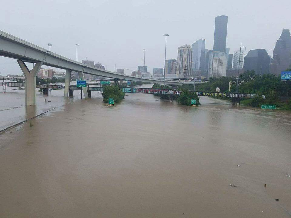
The written word and visualizations are two ways, often combined, for helping people see new possibilities or change the way they see the familiar. I have used them for decades, in evolving ways, to help people better understand my own planning specializations, hazard mitigation and disaster recovery. When a natural disaster such as a hurricane or earthquake has shaken a community’s assumptions about its own future, it can be time to think about rebuilding in a way that makes that community more resilient in the face of future events. I helped advance the idea of pre-disaster planning for post-disaster recovery, that is, thinking before a disaster even happens about what would expedite the recovery process and allow the community to emerge stronger and more prosperous than before. This has become known as finding the “silver lining” in the dark cloud of disaster recovery, building hope during a process that can take years or even decades in the most drastic situations.

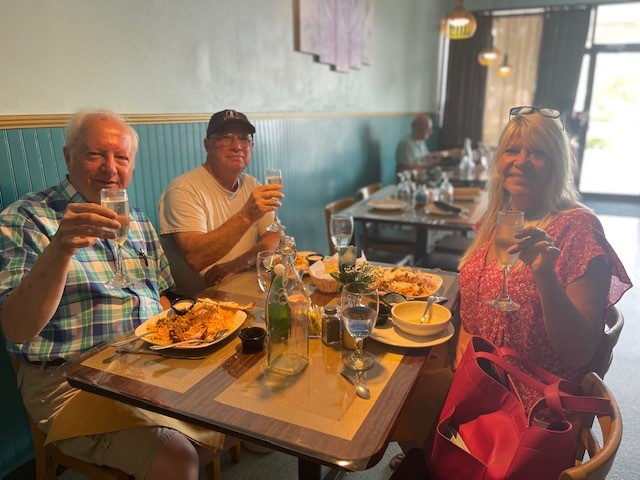
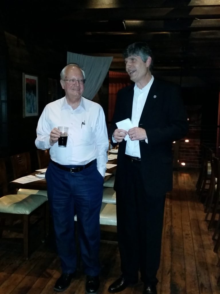
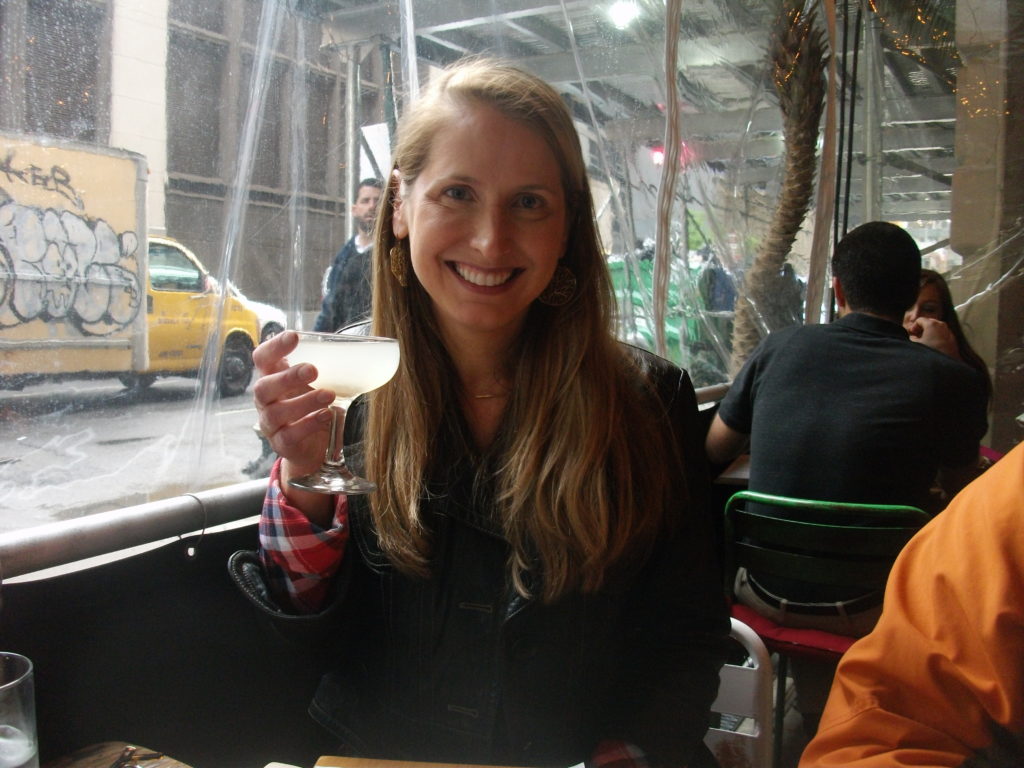
Left to right, crew members Jim Schwab, David Taylor, and Kim Taylor Galway toast the film project at Royal Peacock, Sarasota, FL, June 18, 2023

Even when I left the American Planning Association (APA) at the end of May 2017, I largely envisioned a continuation of my hybrid journalistic and planning career in the form of books and teaching, for the most part, augmented by various consulting jobs. It was only after conversations with high school classmate David Taylor at the 50th reunion of our Brecksville, Ohio, Class of 1968 in June 2018 that another idea took shape. David, a Purple Heart Vietnam Veteran, had taken a very different path in life after recovering from war wounds, by becoming first a photographer, and later a videographer. After retiring from a marketing position with the U.S. Postal Service, he opened his own studio and has done film and photography work for veterans and environmental groups, as well as traditional assignments like weddings.

Dave had followed my career for decades, starting with the publication of my first book, Raising Less Corn and More Hell (University of Illinois Press), in 1988. As I grew into my role as a leader in hazards planning, he became fascinated with what planners do in that realm, regarding them as “unsung heroes” of the recovery process. Further conversations led to a visit to his home in Sarasota, Florida, in February 2019, which included a presentation at a Florida Atlantic University symposium in West Palm Beach, and eventually that fall into the idea of producing a video documentary about the role of planning in helping communities address threats from natural disasters and climate change. As chair-elect at the time of the APA Hazard Mitigation and Disaster Recovery Planning Division (HMDR), I took that idea to the executive committee, and they chose to sponsor the project.

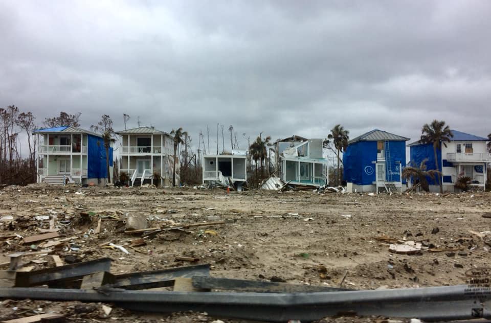
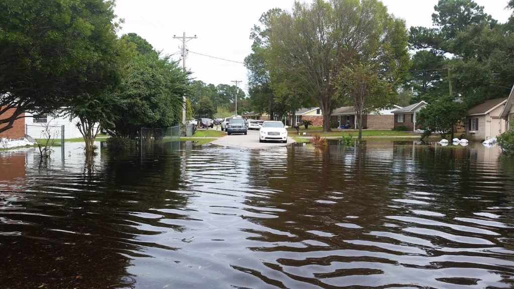
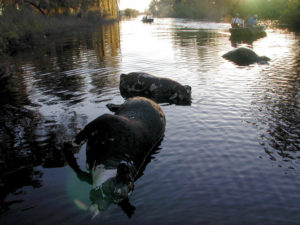
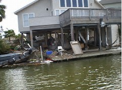
Devastation from Hurricane Michael, October 2018. Photo by David Taylor

Thus began, for me, a new way of thinking about how to engage the public on these issues. I had no experience with film as a vehicle for this process, except as a viewer, but the idea captured my imagination. What can one do with film that would be different from the written word? As the script writer, how would I think about the narrative differently? Moving out of my comfort zone forced me to think even more creatively than usual, but I welcomed the experience because I sensed that it might give us a new way to capture people’s emotions and imagination around an idea whose time was overdue. The United States, and the world, were suffering ever more massive losses from natural disasters, in part as a result of climate change, and needed new ways to approach the problem. Maybe the kinetic visual impact of a film could help affect that, if crafted with the right forward-looking perspectives in mind.

It would not be easy, and I readily understood that. Moreover, the first question was how to pay for the project. Movies are inherently more expensive to produce than books, and involve at least as much work in most ways. But if we could pull this off . . . .

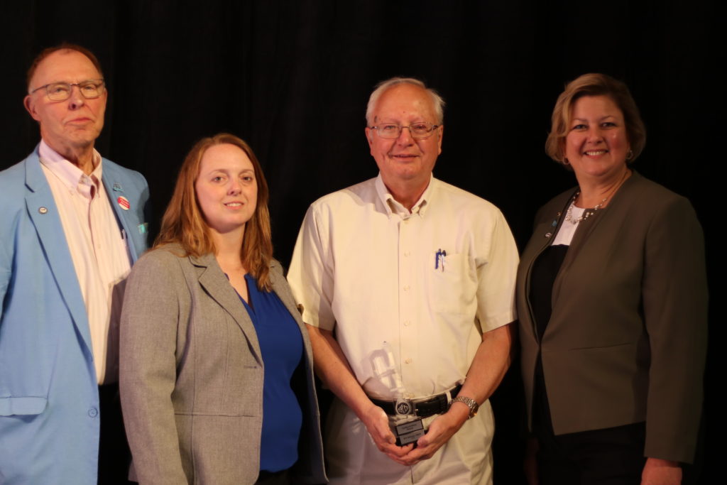
Fortunately, incoming chair-elect Stacy Wright was able to arrange a $5,000 donation from Atkins, a consulting firm, to start the ball rolling in the fall of 2019. I became chair of HMDR on January 1, 2020, but the COVID pandemic intervened within weeks and by March 2020, we had to shut the project down and wait for the best. It was the fall of 2021 before we were again able to move forward. We created a Video Project Advisory Committee to provide guidance on the project. It consists of leading voices in the hazards planning subfield. We also began to assemble teams of regional volunteers who could assist us with logistics and recommend leading planners for interviews and advice.

We chose to name the film Planning to Turn the Tide because of the metaphorical implications of seeking to reverse the growing tide of losses of life and property from natural and other disasters. Well aware of the impacts and trends of climate change, we know that the number and costs of America’s billion-dollar disasters has risen rapidly in recent decades. We also know that planning can make a difference.

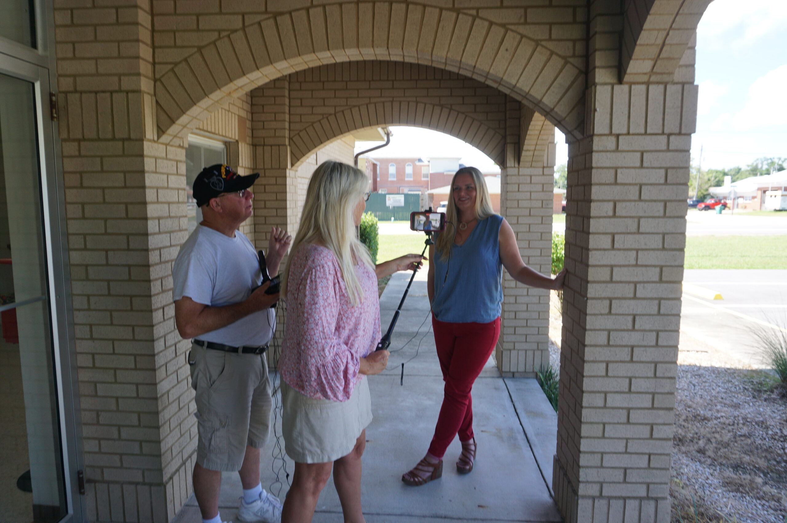
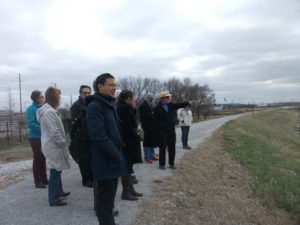
Outdoor interview with Julie Dennis, owner of OVID Solutions (also a member of Video Project Advisory Committee) in Blountstown, Florida, July 2022. Holding camera is Kim Taylor Galway; to her left is videographer David Taylor.

In the meantime, we raised additional donations from other consulting firms* and won two small grants from the APA Divisions Council to help us get started. We announced our project in May 2022 at the APA National Planning Conference in San Diego and recorded interviews with leading hazards professionals at the Association of State Floodplain Managers annual conference two weeks later in Orlando. By mid-July, we had recorded 14 more interviews in the Florida Panhandle, mostly in Panama City, following the area’s recovery four years after Hurricane Michael struck as the first Category 5 storm to reach the U.S. mainland since Hurricane Andrew in 1992. In that visit, we had extensive support from both City Hall in Panama City and the Bay County Chamber of Commerce, which provided its board room for a recording studio for an entire day.

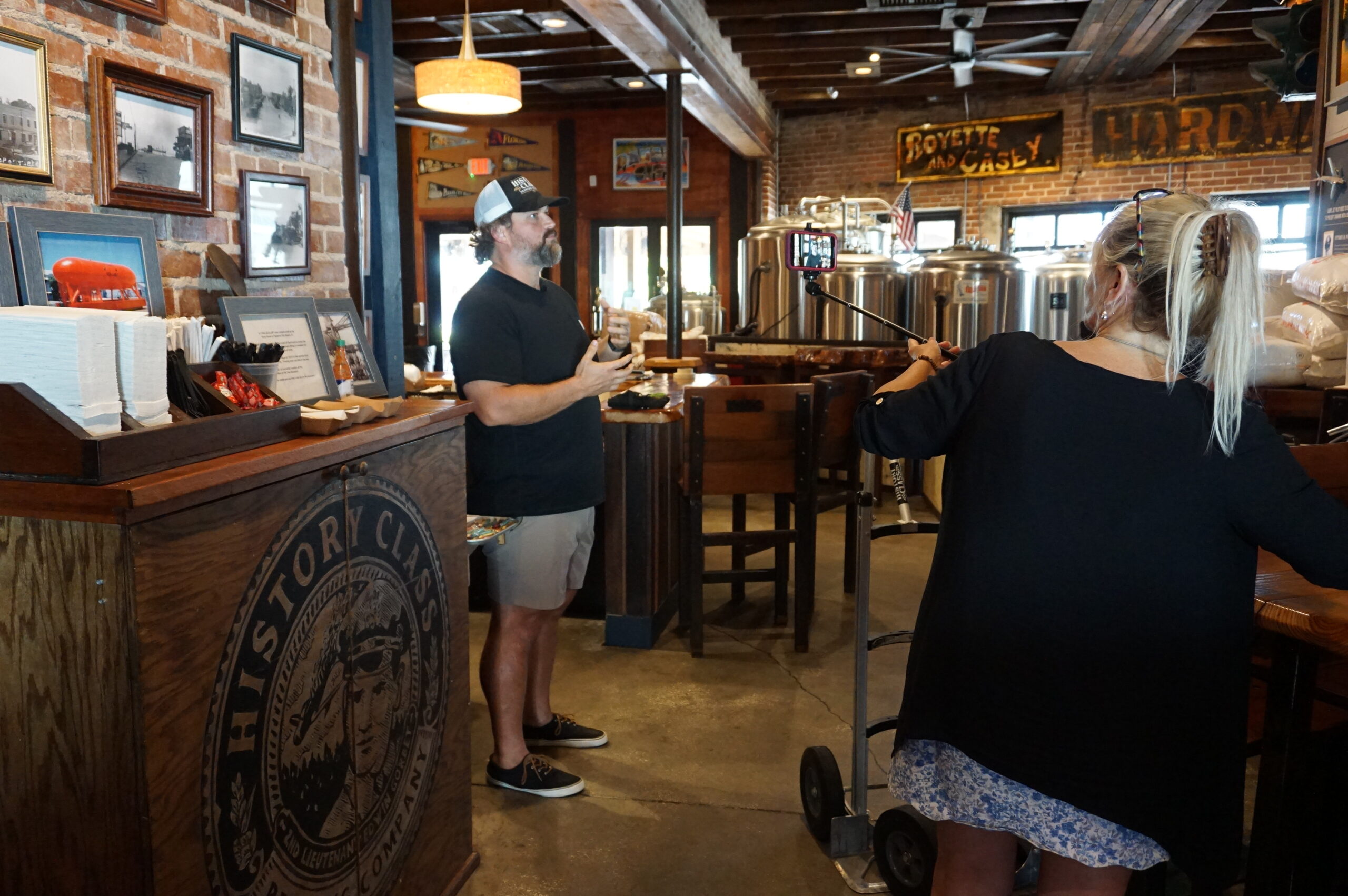
Local entrepreneur Allan Branch explains his restoration efforts at History Class Brewing in downtown Panama City, July 2022

By then, our main problem was that we needed an easy way for people interested in supporting the project to make donations. Fundraising can be hard work, but there is little reason these days to make it harder than it needs to be. APA worked with us over subsequent months to create a dedicated donations page where people could donate online. Because we were the first division in APA’s history to attempt a project like this, we were also the first to need such a mechanism, but by late March of this year, it was ready. The donations page, which you can also reach with the QR code below, channels donations directly to HMDR and tracks the donor information for us, so that we can recognize our supporters appropriately (unless they choose to be anonymous). You can help keep this project moving ahead by donating now, and I sincerely hope you choose to do so. You will be helping us sell the concept of resilient communities to America.

If you need more information on the project itself, visit our project information page. I will be adding new posts regularly as we continue our work, including short blog videos summarizing what we are doing along the way. Please stay in touch.

Jim Schwab

*Early Supporters:

Atkins

APA Divisions Council

Michael Baker International

JEO Consulting

Association of State Floodplain Managers (in-kind donation)

Jim Schwab Consulting LLC

OVID Solutions

Richard Roths, AICP

Clarion Associates

Punchard Consulting


Digital Coast Act Becomes Real

Last Wednesday, December 2, the U.S. Senate passed the Digital Coast Act in a final vote that sent the legislation to President Trump for his signature. If that happens, it may provide a very useful gift to thousands of coastal communities wrestling with a wide variety of coastal zone management challenges.

For more than a decade, the National Oceanic and Atmospheric Administration (NOAA) has sponsored through its Office of Coastal Management a program that has racked up stellar achievements while awaiting congressional blessing of its existence. Digital Coast began as an effort, in collaboration with five nongovernmental partners, to share federal geospatial data and tools with communities in ways that did not require a Ph.D. scientist to interpret them for local government uses.

Geospatial technology, not a familiar term for the average American, refers to “modern tools contributing to the geographic mapping and analysis of the Earth and human societies,” according to the American Association for the Advancement of Science (AAAS). In a coastal context, that includes tools for measuring, projecting, and visualizing sea level rise, as well as monitoring land uses and land cover in coastal areas, and mapping offshore areas as well. The mission of Digital Coast was to make these tools ever more useful for local government planners, resource managers, economic development agencies, and others with some sort of meaningful engagement with coastal issues and data.

Why is that important? For starters, because more than half of the U.S. population now lives in counties along either an oceanic or Great Lakes coast, and that percentage is growing. It matters greatly where these counties, and their cities, allow new development, how they court economic growth, and how they manage coastal resources, including marine life, tidal wetlands, and offshore resources, as well as ports and near-shore transportation. These coastal areas are huge drivers of the overall U.S. economy, and better data, and better access to data, will deeply affect the American future.

Digital Coast partners and staff at a 2015 meeting. I am at front row, right. 

Improving that access and making tools easier to use, and data more understandable, has been the mission of the Digital Coast Partnership that was assembled from 2008 on, initially with five organizations: Association of State Floodplain Managers (ASFPM); The Nature Conservancy (TNC); National Association of Counties (NACo); National States Geographic Information Council (NSGIC); and Coastal States Organization (CSO). In the summer of 2010, the American Planning Association joined the partnership, an initiative I led as manager of APA’s Hazards Planning Center. Allison Hardin, a planner for the city of Myrtle Beach, South Carolina, and immediate past chair of APA’s Hazard Mitigation and Disaster Recovery Planning Division (which I now chair), reports that in 2009, she vigorously advocated for the addition of APA. At the time, Allison, a certified floodplain manager, was helping to represent ASFPM in the partnership. Today, there are eight nongovernmental partners, all of which serve as links to professional user communities to ensure widespread uptake of the data, tools, and resources available from Digital Coast. The two additions have been the Urban Land Institute and National Estuarine Research Reserve Association.

Allison Hardin speaking at Capitol briefing. 

So, what difference does statutory authorization of Digital Coast make? According to John Palatiello, president of John M. Palatiello & Associates, Inc., a government relations and association management firm representing the surveying, mapping, GIS, and geospatial community, which helped lead the effort to get the act passed: “The Digital Coast Act will enable NOAA to partner with other government entities and the private sector to help protect and promote America’s coasts and shorelines. This legislation creates a program to utilize the extensive capabilities, competence, and qualifications of private sector geospatial professionals to provide the surveying, charting, remote sensing, and geospatial data of America’s coasts, harbors, ports, shorelines and ocean resources for economic growth, recreational activities, conservation, and resilience of our fragile coastal environment.” Put more simply, the new law stabilizes the authorization and budgetary support for Digital Coast within NOAA. There were times in the past when this was less than a sure thing. Now, its codification makes its program status official.

Digital Coast Act briefing, with NOAA Digital Coast staff Miki Schmidt (left) and Josh Murphy (right), standing near door.

But Digital Coast, I can attest from personal experience, has a remarkably astute and dedicated professional staff in love with public service. The Act itself begins with this finding: “The Digital Coast is a model approach for effective Federal partnership with State and local government, nongovernmental organizations, and the private sector.” It goes on to note, a few paragraphs later, some of the needs that Digital Coast can help address, including flood and coastal storm surge prediction, hazard risk and vulnerability assessment, and community resilience, as well as ecosystem health. I applauded the program more than six years ago on this blog.

Briefing at the Capitol: APA Policy Director Jason Jordan at the mike; ASFPM Executive Director Chad Berginnis to his right.

It is important to note that this legislation is not the product of some recent brainstorm, but of a slow, steady process of building support, starting with a handful of legislators from both parties who saw its value. Perhaps most notable was Sen. Tammy Baldwin (D-WI), accompanied in the House by Rep. Dutch Ruppersberger (D-MD), who noted in a press release that he had been advocating such action for nearly a decade. But Republican support came from Rep. Don Young (R-AK) and Sens. Lisa Murkowski and Dan Sullivan, both of Alaska, the state with by far the longest coastline. All of them, along with the Digital Coast partners, plus the indefatigable John Byrd of MAPPS, pushed relentlessly, year after year, to find the support necessary to move the bill across the legislative goal line. They have at last succeeded.

Jim Schwab

Great Lakes Merit Protection

I grew up near the shores of Lake Erie, in suburban Cleveland. After a seven-year stint in Iowa and Nebraska, I ended up in Chicago, where I have lived since 1985. The Great Lakes have been part of my ecological and geographic consciousness for essentially 90 percent of my lifetime. As an urban planner, that means I am deeply aware of their significance on many levels.

It will surprise no one, then, that as a planner who has focused heavily on environmental and natural hazards issues, I have been involved in projects aimed at protecting that natural heritage. As manager of the Hazards Planning Center at the American Planning Association (APA), I involved APA as a partner with the Association of State Floodplain Managers (ASFPM) as ASFPM developed its Great Lakes Coastal Resilience website with National Oceanic and Atmospheric Administration (NOAA) support. Later, I prepared a successful grant for support from NOAA’s Sectoral Applications Research Program for a project on integrating climate change data into local comprehensive and capital improvements planning. In that project, APA collaborated with the Chicago Metropolitan Agency for Planning and the University of Illinois. That project, which involved work with five pilot communities in the Chicago metropolitan area, was (and still is) ongoing when I left APA at the end of May 2017. The aim was to develop applicable models for such planning for other communities throughout the Great Lakes region.

It is thus always encouraging to see others pick up the same mantle. It was hardly surprising that the Environmental Law & Policy Center (ELPC), a long-time Chicago-based staple of the public interest community, would see fit to do so. On March 20, in concert with the Chicago Council on Global Affairs, ELPC released “An Assessment of the Impact of Climate Change on the Great Lakes,” with 18 scientists contributing to the 74-page report. I spoke two weeks later with Howard Learner, the long-time president and executive director of ELPC, about the rationale and hopes for the report.

The impact of adding one more report to the parade is cumulative but important. Learner explained that national studies, particularly the National Climate Assessment, mention regional impacts of climate change, but that drilling down to the impacts on a specific region and making local and state decision makers aware of the issues at those levels was the point. Thus, he asked Don Wuebbles, an atmospheric scientist at the University of Illinois and a science adviser to ELPC, to assemble a team of experts for the purpose. Wuebbles recruited most of the team, with the goal not only of identifying problems but of developing or pinpointing solutions. Repeatedly, Learner emphasized the public policy role of ELPC as a “problem-solving” institution. The intended audience was governors, provincial ministers, congressional delegations from Great Lakes states, and other public officials, providing them with an assessment of the state of the science concerning the Great Lakes.

I won’t even attempt to review all the data in the report, but certain points are essential to an adequate public understanding. For one, the Great Lakes are simply huge and constitute a very complex ecosystem in a heavily populated region of more than 34 million people in the U.S. and Canada, the vast majority of whom repeatedly express support for protection of the Great Lakes in public opinion polls. It is the largest freshwater group of lakes on the planet, and second largest in volume. It is a binational ecosystem that demands cooperation across state, provincial, and national boundaries. It is home to 170 species of fish and a $7 billion fisheries industry. It has long been home to one of the most significant industrial regions of both nations. What happens here matters.

The term “lake effect” is most often associated with the Great Lakes because their sheer mass has a measurable impact on local and regional weather patterns. Winds pick up considerable moisture that often lands downwind in the form of snowstorms and precipitation. For instance, any frequent visitor of farmers’ markets along the Great Lakes is likely to be aware of western Michigan’s “fruit belt” offerings of apples, cherries, pears, and other crops dependent on the lake effect.

Figure 3. Observed changes in annually-averaged temperature (°F) for the U.S. states bordering the Great Lakes for present-day (1986–2016) relative to 1901–1960. Derived from the NOAA nClimDiv dataset (Vose et al., 2014). Figure source: NOAA/NCEI (Both images reprinted from report courtesy ELPC.

Figure 4. Projected change in annually-averaged temperature (°F) for U.S. states bordering the Great Lakes from the (a) higher (RCP8.5) and (b) lower (RCP4.5) scenarios for the 2085 (2070-2099) time period relative to 1976-2005. Figure source: NOAA/NCEI

The lake effect, of course, is a part of the natural system in a region carved out of the landscape by melting glaciers at the end of the last Ice Age. Recent climate change is another matter. The region has already experienced a 1.6° F. increase in average daily temperatures in the 1985-2016 period as compared to the 1901-1960 average. Those increases are expected to accelerate over the remainder of this century. It is not just temperatures that change, however, because changing weather patterns as a result of long-term climate change result in altered precipitation patterns. Summer precipitation is predicted to decline by 5 to 15 percent, suggesting some increased propensity for drought, while winter and spring precipitation will increase, producing an increased regional propensity for spring flooding. Increased intensity of major thunderstorm events will exacerbate the vulnerability of urban areas to stormwater runoff, resulting in increased “urban flooding,” often a result of inadequate stormwater drainage systems in highly developed urban areas. That, in turn, has huge implications for municipal and regional investments in stormwater and sewage treatment infrastructure. In addition, heat waves can threaten lives and public health. Public decision makers ignore these implications at the fiscal and physical peril of their affected communities.

Among those impacts highlighted in the report is the increased danger of algal blooms in the Great Lakes as a result of changing biological conditions. The report notes that the largest algal bloom in Lake Erie history occurred in 2011, offshore from Toledo, Ohio, affecting drinking water for a metropolitan area of 500,000 people.

There is also danger to the stability of some shoreline bluffs, an issue highlighted on the Great Lakes Coastal Resilience website, as a result of reduced days of ice cover during the winter. While less ice cover may seem a minor problem to some, in fact it means changes in water density and seasonal mixing patterns in water columns, but it also means the loss of protection from winter waves from storm patterns because the ice cover prevents those waves from reaching the shore until the spring melt. The result is increased shoreline erosion.

All of that harks back to the central question of my interview with Learner: What do you hope to achieve? “The time for climate action is now,” he insisted, noting that the Trump presidency has been “a step back,” making it important for cities and states to “step up with their own climate solutions.” Learner hopes the report at least provides a “road map” for governors and Canadian premiers to focus their actions on the impact of climate change on the Great Lakes, such as “extreme weather events.”

Curiously, one arena in which new action may be possible is the city of Chicago itself, which on April 2 elected a new mayor, Lori Lightfoot. Media attention has focused on the fact that she is both the first gay mayor and the first African-American female mayor in the city’s history, but equally significant is her history as a former federal prosecutor who campaigned against corruption. Learner notes that outgoing Mayor Rahm Emanuel convened a Chicago Climate Summit in November 2017, and that ELPC is now “looking to Mayor Lightfoot to step up Chicago’s game” to benefit both the local economy and environment with a stronger approach to climate change.

The same can be said, of course, for numerous other municipalities choosing new leadership and for the new governors of the region, including J.B. Pritzker in Illinois. They all have much work to do, but an increasing amount of research and guidance with which to do it.

Jim Schwab

Gratitude on Parade #3

GRATITUDE ON PARADE
#gratitudeonparade
[Partners of] the National Oceanic and Atmospheric Administration‘s Digital Coast program are hosting a meeting in Washington, D.C., today of the Digital Coast Partnership, an assortment of eight national nonprofit organizations willing to support geotechnical services to coastal communities across the U.S. The Digital Coast staff have been leading this effort for more than a decade, and the result is better decision making on coastal land use and resource management among the communities using Digital Coast tools and resources.

I attended these meetings and participated in Digital Coast projects until I left the American Planning Association, one of those partners, in 2017. But as of 2010, when APA joined the partnership, I found the entire enterprise a magnificent example of positive federal engagement with local governments and user communities in need of better data and easier ways to access data. And I made some fast friends because of the quality of the staff.

Leading that effort was one remarkable human being, Miki Schmidt, who has been with NOAA that entire time. Miki has a positive, can-do attitude, and helped me learn a great deal about what positive federal outreach could look like. We had numerous valuable conversations about how to move forward, and Miki repeatedly expressed his gratitude to APA for becoming part of the entire effort. But he deserves recognition for doing a top-notch job year after year, and empowering a staff that couldn’t be better. Near the end of my era, also, as depicted in the photo below, he organized a retirement “roast” at a restaurant during a NOAA Coastal GeoTools Conference. I could not have asked for a nicer tribute.

James Schwab CORRECTION: I did not realize that NOAA was caught up in the federal government shutdown and NOAA staff are not present at the meeting mentioned in the first sentence. it is a tribute to the success of the partnership, however, that the National Association of Counties, one of the partners, is hosting and the partners are proceeding with the meeting on their own. I just did not realize that was the case. Let us all hope that, one day, these shutdowns will be a thing of the past that is no longer an acceptable practice.

Miki, at right, prior to dinner that included a retirement roast.

Posted on Facebook 1/15/2019

GRATITUDE ON PARADE
#gratitudeonparade
I am not done singing the praises of Digital Coast nor of expressing my gratitude to outstanding staff of that program. If I had an opportunity to nominate someone for Liaison of the Year, someone with an outstanding sense of customer relations, it would surely be Susan Fox, who actually works with the Baldwin Group on behalf of NOAA, and has served for several years as a Digital Coast liaison with the American Planning Association. I had the honor to work with her while managing APA’s Hazards Planning Center into 2017. She is enthusiastic, positive, very well-organized, and incredibly supportive. Just like Miki Schmidt, about whom I wrote yesterday, she is a pillar of the Digital Coast program. Thank you, Susan, for all you do.

Susan in Manhattan for dinner during APA National Planning Conference, 2017.

Posted on Facebook 1/16/2019

GRATITUDE ON PARADE

#gratitudeonparade

Continuing with my tributes to Digital Coast staff, I must now know mention the invaluable Josh Murphy, who works from NOAA’s headquarters in Silver Spring, Maryland. Josh was the creative soul who helped negotiate a HUD-funded, NOAA-sponsored project led by AECOM but involving Digital Coast partners (APA, NACo, ASFPM) to work with two pilot communities (Brevard County, FL, and San Luis Obispo County, CA) to help operationalize concepts for integrating resilience and hazard mitigation priorities into the local planning process. This is rather advanced stuff and requires some real skill to manage, but we all did it together, advancing the frontiers of planning. And we had Josh to thank for making it all possible. He is one of NOAA’s truly valuable assets.

Courtesy of Shannon Burke

Posted on Facebook 1/17/2019

GRATITUDE ON PARADE
#gratitudeonparade
As I complete this round of gratitude to Digital Coast staff, I wish to make clear that there are many others at NOAA for whom we should all be grateful beyond those I have highlighted. But I do want to close by mentioning the remarkable Lori Cary-Kothera, whose consistent demonstrations of enthusiasm, high intelligence, and dedication have also helped the partners to succeed in their efforts both to support the Digital Coast program and to advance their own respective projects and services to coastal communities. Lori is one of those rare people you can count on for positive advice and support. She is also a welcome beacon of warmth and humanity.

Courtesy of Shannon Burke

Posted on Facebook 1/18/2019

Jim Schwab

The Predictable Impact of Florence

Flooding in Rosewood in Horry County, SC, September 24, 2018 (All photos by Allison Hardin with exceptions of FEMA photo from Hurricane Floyd and Charlotte image.)

It has been a few weeks of drought on this blog, but just the opposite in North Carolina, where Hurricane Florence dropped up to 30 inches of rain in some locations, and floods migrated downstream via numerous rivers to swamp cities both inland and near the coast. Now, Hurricane Michael threatens to compound the damage as it migrates northeast from its powerful Category 4 assault on the Florida Panhandle, with storm surges up to 14 feet in areas just east of the eye, which made landfall near Panama City.

The blog drought was the result of both a bit of writer’s block, mostly induced by a busy schedule that included two conference trips over the past three weeks, combined with a bit of fatigue and a few significant diversions of my personal time. But that may be okay. My intent was to write about the recent hurricane along the East Coast, and sometimes letting the subject ferment in the mind results in a more thorough and insightful perspective. I hope that is the result here.

Storms never happen in a vacuum. In a world with relatively few uninhabited places, their impact is the result more of patterns of human development and the legacy of past choices in land use and building practices than of the storm itself, which is, after all, simply a natural and very predictable event. Hurricanes were part of the natural cycle on this earth long before humans took over the planet (or thought they did).

Hurricane wind warning at bridge in Socastee, South Carolina

But they appear to be getting worse, and climate change, most of it almost surely attributable to human activity, is an increasingly evident factor. Meteorologist Ken Kunkel, affiliated both with the National Oceanic and Atmospheric Administration and North Carolina State University, stated that Florence produced more rain than any other storm in the last 70 years except for Hurricane Harvey last year. According to Kunkel, five weather stations over an area of 14,000 square miles in the Carolinas recorded an average of 17.5 inches. Harvey’s average was 25.6 inches. By comparison, Chicago averages about 37 inches for an entire year. Such heightened precipitation levels are in line with expected impacts of climate change.

What became obvious to me early on was that Florence would rehash a certain amount of unfortunate North Carolina history regarding feedlot agriculture. I am familiar with that history because 20 years ago I authored a Planning Advisory Service Report (#482) for the American Planning Association, titled Planning and Zoning for Concentrated Animal Feeding Operations. (In that same year, APA also published PAS 483/484, Planning for Post-Disaster Recovery and Reconstruction, for which I was the lead author and project manager.) I want to emphasize that what happened in North Carolina was not unusual. Nationwide, many states have laws dating to the 1950s that exempt all or most agricultural operations from county zoning ordinances. Most of these were intended to create a friendly regulatory environment for family farms, and they were often followed by other “right-to-farm” laws designed to shield farmers using conventional farming methods from nuisance lawsuits. Only later, as the large feedlots known also by the acronym “CAFO” became widespread, did it become clear that such exemptions, by then fiercely defended by industry groups, became giant loopholes for the detrimental environmental impacts of such operations. This story has been repeated in Iowa, Missouri, Utah, and numerous other states.

In North Carolina in 1991, State Senator Wendell Murphy, who owned a direct interest in the growing Murphy Family Farms, engineered passage of a law widening the state’s exemptions to include CAFOs. Within two years, as I noted in the report, North Carolina’s hog population shot up from 2.8 million to 4.6 million. Today, the number is at least 9 million. A public backlash at the impacts of CAFOs resulted in a new law in 1997 that included a moratorium on new waste lagoons, but by then, although the hogs were firmly ensconced in a growing number of feedlots, the figurative horse was out of the barn. Many counties in eastern North Carolina, where the industry was concentrated, were slow or reluctant to use their newly regained powers. In any case, various large operators were effectively already grandfathered into continued existence. Today, consolidation within the industry has left Smithfield Foods in possession of most of the business in North Carolina, yet Smithfield itself was acquired by the Chinese-owned WH Group several years ago.

Grenville, NC, September 24, 1999 — The livestock loss and potential health hazard to Eastern North Carolina is huge. Here volunteers have towed in dead and floating cattle from a nearby ranch at Pactolus, NC (just North of Greenville), trying to remove them as fast as possible to lower the potential health hazards associated.
Photo by Dave Gatley/ FEMA News Photo

Along came Hurricane Floyd in 1999. The low-lying plains of eastern North Carolina, always vulnerable to flooding, were deeply awash, but worse, filled with millions of pigs and poultry and their excrement in manure lagoons. Hurricane Dennis just weeks earlier had dumped 15 inches of rain on the region, and Floyd dumped even more in some areas. The Tar and Neuse Rivers, among others, badly overflowed their banks and inundated numerous farms. More than 110,000 hog carcasses, and more than 1 million chicken and turkey carcasses, floated downriver while waste lagoons were breached, creating a stench-filled public health disaster only partly solved when the U.S. Environmental Protection Agency brought in huge incinerators to burn carcasses, though most animals were buried. It was a fiasco that did not have to happen at the scale on which it occurred.

Fast forward to this year and Hurricane Florence, presuming a surfeit of lessons to be learned from the 1999 disaster as well as later storms. As Emily Moon notes in the Pacific Standard, North Carolina has had opportunities over the past 20 years to introduce serious regulatory change, but various factors foiled those chances, and North Carolina remains the nation’s second-largest hog producer, having pushed aside every state but Iowa. The industry has evolved, but the problem remains. The state has bought out 46 operations since 1999 and shut down their lagoons, but the vast majority remain in operation. The numbers changed in Florence—more than 3 million chickens and 5,500 hogs dead and afloat in the flood waters—but the devastation rooted in CAFO practices continued. Coal ash landfills associated with power stations added to the environmental impacts. And the beat goes on, in a part of the state heavily populated by African-Americans, many too poor and powerless to challenge the system effectively without outside help.

I mention all this aside from the obvious human tragedies of lost lives, ruined homes, and prolonged power outages affecting some 740,000 homes and businesses.

Flooding at Arrowhead Development in Myrtle Beach, SC, September 26, 2018

Still, there are significant lessons available from Hurricane Florence outside the realm of mass production of poultry and hogs, and I want to offer a positive note. One is that, while only about 35 percent of properties at risk of flooding in North Carolina have flood insurance, which is available from the National Flood Insurance Program, neighboring South Carolina ranked second in the nation with 65 percent coverage. While I do not know all the details behind that sizable difference, it seems to me there is surely something to be learned from a comparison of these results and how they were achieved. They come in the context of a “moonshot” by the Federal Emergency Management Agency to double flood insurance coverage nationally by 2022. That will happen when South Carolina becomes the norm rather than the exception. Sometimes we can use these events to push in the right direction. Texas, for instance, has added 145,000 new flood insurance policies in effect since Hurricane Harvey; the question will be whether the new awareness wears off as memory of Harvey fades, or whether the state can solidify those gains. For that matter, can the states in the Southeast—the Carolinas, Georgia, and Florida—leverage the lessons of Florence and Michael to push in the same direction?

Hidden Valley drainage restoration project, Charlotte, NC. Image courtesy of Tim Trautman.

Recently, Bloomberg Business News offered an example within North Carolina of how differently floodplains could be managed by highlighting the case of Charlotte and Mecklenburg County. I worked for several years in a series of training workshops on flood resilience with Tim Trautman, the manager for the engineering and mitigation program for Mecklenburg Storm Water Services, so I am familiar with their intriguing story. The county for many years has used a stormwater utility fee on property owners to fund its own hazard mitigation program, using the money to buy out flood-prone properties and increase open space in its floodplains. The result has been a significant reduction in flood-prone land and buildings. The question is not whether Charlotte is successful, but what state and federal programs and authorities can do to encourage and support such efforts and make them more commonplace.

Every serious disaster offers lessons and opportunities, and I am not attempting here to pick on North Carolina alone. Other states face their own challenges; Iowa, for one, is undergoing a somewhat muted debate about the impact of its own farm practices on downstream flooding and water quality, in part as an outgrowth of the 2008 floods. What is important is that we use these windows of opportunity, the “teachable moments,” as they are sometimes known, to initiate the changes that are surely needed for the long term in creating more resilient, environmentally healthy communities. What we do not need is a natural disaster version of Groundhog Day.

Jim Schwab

Taking Stock of Recent Disasters

Photo by Jeff Clevenger

We learn from disasters as we recover from them, but each disaster teaches slightly different things. Sometimes the lessons are significant and historic; in others, one community is learning what others already know or should have learned from their own past events. Some years are relatively quiescent, as 2018 so far seems to be. And some become relentless slogs, like 2017.

Adam Smith, lead scientist for the National Oceanic and Atmospheric Administration’s National Centers for Environmental Information, noted in a plenary panel in July for the 2018 Natural Hazards Workshop, in Broomfield, Colorado, that the tally for 2017 disasters had exceeded $200 billion. This is more than 40 percent of the tally so far of billion-dollar disasters for the entire decade beginning in 2010. Simply put, with three major hurricanes—Harvey, Irma, and Maria—striking parts of the southern U.S., followed in short order by some of the most expensive wildfires in California history, it was a wild, taxing year in the world of emergency management.

But our attention fades quickly. Right now, there are no equivalent disasters seizing our attention, but in time there will be. The people who remain painfully aware that recovery is a long, slow process are those directly affected, and even many of them will not fully grasp the ways in which past location choices and patterns of development have brought them to this pass. Many had no choice anyway. Our communities are frequently full of social inequities that compromise the life choices of the poor and disabled. In other cases, the losses inflicted on neighborhoods are the result of hubris on the part of developers, city officials, and homeowners themselves. It does not hurt, approximately one year after these combined events, to look at what we know so far about the recovery following them.

Apparently, the U.S. General Accountability Office (GAO), an arm of Congress, agreed that the time was ripe for review because it has released a study, 2017 Hurricanes and Wildfires: Initial Observations on the Federal Response and Key Recovery Challenges. Because of the severity of challenges in Puerto Rico, one may note from the graph below, reproduced from the report, that Hurricane Maria by far entailed the largest federal expenditures.

In spite of that level of effort, Puerto Rico has engendered the most significant criticism of the performance of the Federal Emergency Management Agency (FEMA). Maria struck Puerto Rico and the U.S. Virgin Islands (USVI) after Harvey had already drenched and flooded coastal Texas, and Irma had swept through much of Florida.

FEMA teams managing the distribution of water, and meals for hundreds of semi-trucks at an incident Support Base in Seguin, Texas. Photo by Dominick Del Vecchio – Aug 29, 2017

The report notes that, as a result, FEMA resources were severely stretched by then, only to have wildfires in California add to the pressure, though the personnel assigned in the last case were small compared to the hurricanes (as is typically the case). Adding to the challenge, Puerto Rico and USVI are offshore and were also poorly prepared for a Category 4 hurricane. Puerto Rico had already suffered years of neglect of crucial infrastructure, was burdened with oppressive debts, and was by far the least prosperous target of the 2017 storms. All this, combined with some incredibly inept public relations from the White House, led to a perfect storm in which nearly 3,000 people have died directly or indirectly as a result of the disaster. To my knowledge, that is a number exceeded in U.S. history only by the 1900 hurricane in Galveston, which killed more than twice as many people. The difference is that, in Puerto Rico, most people died because of blocked transportation, loss of electricity, and similar problems with critical facilities that prevented adequate transportation or medical attention in many isolated communities in the interior of the mountainous island.

Exactly what we learn from Puerto Rico remains to be seen. It is worth noting, in my view, that far more prosperous Hawaii has coped well with admittedly less-challenging disasters in recent years, in large part because state government has practiced response and committed resources to the problem. I say this despite being aware of gaps in Hawaii recovery planning that merit further attention. But if Puerto Rico is a logistical challenge for mainland responders, Hawaii is even more remote but better prepared. The difference in economic circumstances, however, is a dramatic and powerful variable in this comparison, as is Hawaii’s statehood. It is also worth noting that Hawaii is a long chain of islands, and storms (or volcanoes) never affect all at the same time. Effectively, that has always meant that emergency resources in Hawaii have been able to be moved from one or more islands to another that has been hit by a storm. All of Puerto Rico was devastated almost on the same day, with internal transportation, communications, and electric power nearly brought to a standstill, making access to many villages nearly impossible.

If Puerto Rico, followed closely by USVI, is the direst case for long-term recovery, there nonetheless remain serious challenges in Texas, not only in Houston but in dozens of other counties along the Gulf Coast. A recent Washington Post article used the term “Harvey homeless” to describe thousands of Texas families living in whatever parts of their flooded homes they have salvaged while struggling to accumulate the resources to repair the rest. They live with mold, dust, and any other environmental contaminants that endure in essentially unusable parts of their homes. In all, according to the Texas Department of Public Safety, at least 175,000 Texas homes were “badly damaged” by Hurricane Harvey, and 80 percent lacked flood insurance, thus relying on much smaller federal disaster payments (averaging $4,203) than flood insurance would have afforded. If there is one powerful lesson in Texas, it concerns public education on the value of flood insurance, particularly in the many areas outside the 100-year floodplain. Unfortunately, much of the public retains the illusion that flood insurance is either unnecessary or unavailable outside the legally defined floodplain. Yet Harvey’s 60 inches of rain in some parts of metropolitan Houston left vast areas beyond the regulatory flood boundaries under water because water does not care about such artificial boundaries. It goes where gravity compels it to go. Moreover, years of loose land-use regulation over the past half-century of rapid growth have expanded the floodplain and put numerous neighborhoods in greater danger than they faced in the past.

Moreover, as John Henneberger, executive director of the nonprofit advocacy group Texas Housers, noted in his keynote at the Natural Hazards Workshop, Texas does not have a noteworthy history of attention to social equity in disaster recovery. Henneberger called for a new model of disaster recovery in which we seek to use recovery planning to overcome racial and economic inequities, stating that “the legal framework already exists” in federal programs like Community Development Block Grant—Disaster Recovery (CDBG-DR) to “overcome inequalities,” but the rules are not always followed. Thus, his top recommendation for reform was simply to “obey the law” regarding the conditions that apply to state and local use of CDBG-DR funds.

Finally, Bloomberg Business Week chose recently to examine the questions surrounding rebuilding after the California wildfires. With a population already approaching 40 million, the state is under intense pressure to build adequate housing amid rising housing costs. California has repeatedly toughened its building codes in response to wildfire threats but faces a legacy problem of homes built under earlier standards. Not often known outside wildfire research circles is the fact that the average home contains seven to eight times the density of combustible materials as the surrounding forest in the wildland-urban interface. That means that every home that catches fire or explodes is a huge matchstick endangering every other home in its immediate vicinity. When one considers that California is unquestionably the most progressive state in tackling wildfire problems, one understands that the problem of retrofitting older homes built to lower building code standards—or none at all in some other western states—is a lingering and potentially very expensive problem. The dilemma serves to illuminate the value of pre-planning for recovery, learning how to seize the “teachable moment” for reform, to reduce the scope of the problem. The article also notes that, if California is to reduce pressure to build in the forest, its cities must be prepared to allow greater density to relieve the housing crisis in a state where a shortage of affordable housing has yielded a concomitant problem of growing homelessness. And so, we see why urban planning needs both to be holistic in its approach to social problems and guided by wise state policy with supporting resources. We all still have a long way to go.

This blog post can never be long enough to explore all these issues in depth. But in coming weeks and months, I hope to delve into specific issues more deeply, share interviews with individual experts, and explore what needs to be done. I am also watching intently for new books that will shed light on new solutions. One just arrived today. Stay tuned.

Jim Schwab

Knock Me Over

From left: Larry Larson; Maria Cox-Lamm, ASFPM Chair; myself; Ingrid Wadsworth, ASFPM Deputy Director

I confess: I was taken totally by surprise. Most of us, if we have a level head on our shoulders, do not do our work with the thought that we will some day be presented with a major award because of it. Especially those of us in the world of public service and nonprofits, where dedication to the greater good is a primary motive, even though we are not immune to thinking about raises and promotions, which, after all, may enable us to be more effective in what we do.

Consequently, when the Association of State Floodplain Managers (ASFPM) asked me to attend the annual ASFPM conference in Phoenix last week (June 17-21), I naively accepted the rationale that, since they had recently contracted with me as an independent consultant to lead the production of a Planning Advisory Service Report on climate resilience and capital improvements planning, under a Regional Coastal Resilience grant from the National Oceanic and Atmospheric Administration (NOAA), they needed me there to discuss the project. I had helped write the grant three years ago while still leading the Hazards Planning Center at the American Planning Association (APA), which became the major partner to ASFPM in conducting the three-year project. Although I retired from that position a little more than a year ago, there was a great deal of logic in bringing me back to see at least that part of the project to a successful conclusion.

There was only one problem in Phoenix. No one seemed all that concerned about spending time talking to me about the NOAA project. I was certainly learning a great deal by listening to presentations, and I certainly enjoyed networking with colleagues at receptions and in hallways at the Phoenix Convention Center, but the question was bugging me: Why did they really want me out here?

On Thursday morning, June 21, before the morning plenary began in the Ballroom, I approached David Conrad and Larry Larson at a front table after initially parking my belongings at another table further back. David Conrad was once with the National Wildlife Federation and wrote a path-breaking report following the 1993 Midwest floods. Larry is the former executive director of ASFPM and now a policy advisor working with current executive director Chad Berginnis. Both are prominent in the field of floodplain management.

I patted David on the shoulder and with self-effacing humor said, “I used to sit at the front table before I retired from APA, but now I’m nobody anymore.” They chuckled, and ASFPM’s public information officer, Michele Mihalovich, said from across the table, “Jim, you’ll never be nobody.” We all laughed, David invited me to join them, and I moved to the front table for the plenary. All good for a laugh. Afterwards, Larry made a point of asking me to find him at a front table, off to the side, for the awards luncheon at noon. Still clueless, I assumed he was simply being friendly but honored his request when the time came.

Lunch was served, and Doug Plasencia, president of the ASFPM Foundation, and Diane Brown, retiring from her post as outreach and events manager at ASFPM after 35 years of excellent service, introduced award recipients and their achievements one at a time, with images on the screen, and each winner stood with presenters for a photo. Interesting, I thought, in considering the various prizes, but routine. I was happy for the winners, some of whom I knew. Almost every national professional organization does such things. Meanwhile, I ate my salad, the roast beef entrée, and the dessert. In a little while, it would all be over, and we would move on to an afternoon of presentations and discussions in a variety of concurrent sessions. I flipped through the program to see what looked interesting.

Finally, Diane Brown began to describe the winner of the highest honor ASFPM bestows, the Goddard-White Award, described thus on the website:

“The Goddard-White Award is named in honor of the contributions made to floodplain management by Gilbert White (1911- 2006) and Jim Goddard (1906-1994). This award is given by ASFPM to individuals who have had a national impact carrying forward the goals and objectives of floodplain management. It is an indication of the level of esteem the association holds for the two namesakes as well as the recipients and is ASFPM’s highest award. It is not necessarily presented every year.”

I’m not sure because one does not time such things. I believe it took about 30 seconds of Diane’s narration of the story behind this year’s award before it suddenly dawned on me that I was the person they were talking about. I had never spent one minute before that contemplating this specific award or how I might have anything to do with it. The revelation that I was a recipient struck me like a lightning bolt. Larry was looking toward me, and I pointed to myself silently as if so say, “Moi?” He kept his Cheshire cat smile and waited for the emcees to invite me forward. Larry, by the way, was in 1985 the very first recipient of this honor. He had known all along precisely what was coming. Diane invited me to the podium to say a few words. A few tears started to run down my cheeks, so I struggled to get them under control. At the podium, Diane asked, “Are you okay to talk?” I nodded yes.

I cannot repeat verbatim what I said because it was all spontaneous, but I know that I began by saying that we in the hazards world are “supposed to be prepared. I am not. You caught me off guard.” I took the crowd on a two-minute tour of what we had achieved together in the partnership of recent years that I helped construct between ASFPM and APA, and said, “Eventually, you look back and ask, ‘Did we do all that?’” I then explained that it was not just me. I had learned a great deal over the years from many other people, that big achievements require collective effort. And I thanked everyone for this high honor before stepping over to the curtain for a photograph that you see above.

I checked later and found that only 24 people have received this award, including former NOAA Coastal Services Center administrator Margaret Davidson, a truly memorable individual, U.S. Rep. Earl Blumenauer of Oregon, a perennial warrior for better disaster legislation, and French Wetmore, who helped create the Federal Emergency Management Agency’s Community Rating System for the National Flood Insurance Program. All I can say is, Wow. What a band of high achievers and visionaries I have apparently joined.

It is hard to top such an honor, except in one way: It is important not to rest on these laurels, but to continue to contribute, to encourage others to find their passion, and to remain an effective voice for positive change. I hope I am doing that and can remain part of the action for many years to come. Thanks, ASFPM. I hope I can prove you right.

Jim Schwab

Engaging for Sustainability

I know. My very title for this blog post sounds to some like yet another naïve stab at kumbaya. Well, stay with me, anyway. We are talking about solving problems in our communities, and the more people who get behind the solution, the more successful it is likely to be.

Kristin Baja, right, with Dubuque Mayor Roy Buol before her presentation.

What I am really aiming to write about, in the narrowest sense, is a morning keynote presentation by Kristin Baja at the tenth annual Growing Sustainable Communities conference in Dubuque, Iowa, on October 4. The City of Dubuque has been hosting this event from the outset, and I rather like the riverside convention center where they host it. Hell, I rather like the mystique of the Mississippi River, the very reason Dubuque exists. I’m fascinated enough that I thought the conference a good venue for meeting people who might be useful to my pet project since leaving the American Planning Association (APA) at the end of May: a two-book series on the 1993 and 2008 Midwest floods. Dubuque is one of those communities that understands that environmentally healthy communities are a necessary path to the future.

That is why they engaged Kristin Baja, a former planner for the city of Baltimore who was instrumental in effecting significant changes in planning that recognized the fundamental problems that Baltimore needed to address, both socially and environmentally. She openly states that Baltimore was built on a legacy of racism that must be overcome through new approaches that must complement the city’s efforts to address climate change. The poor tend to be more vulnerable to natural hazards. Recently, Baja left her city position to become the Climate Resilience Officer for the Urban Sustainability Directors Network. In this new role, she is essentially bringing what she learned at the local level to the national stage.

What she seems to have learned most, and emphasized in her keynote, is the value of empathy, a quality often sorely lacking in national politics. I frankly think we are more likely to relearn its value at the community level, where we can engage directly and personally with our neighbors. Perhaps then we can reapply it to national policy discussions if we can get past the angry tweets and the noise of shouting talk show hosts.

Baja started with a display of many of the same points I have made in this blog before. The climate is changing, and we have plenty of evidence to make this point if we can get people to listen. We cannot afford to continue to confuse weather with climate, for instance, by using one snowstorm to ridicule the entire notion of global warming. “Weather is your mood, climate is your personality,” she suggested, and it is not a bad analogy for helping people to grasp the distinction between short-term and long-term trends. If we are to achieve resilience in our communities, it will be essential to understand that we must build community strength in the face of both shocks, which are sudden and unexpected changes, and stressors, those long-time problems that weaken a community’s social fabric, like high unemployment, poverty, racism, and distrust of authority. If community leaders want to overcome some of that malaise, it is critical that they foster and sustain mutual trust, be accountable, keep promises, share power, value people’s time, and focus on community cohesion. It may be a tall order, but I would add one other factor. When a community finds such leaders, it needs to honor them. Too often, the best intentions are drowned in a tidal wave of vitriol.

I will not reprise every aspect of Baja’s captivating presentation. What I want to share is the underlying logic of her approach. She first came to my attention when I learned about Baltimore’s now well-known DP3 project, which stands for Disaster Preparedness and Planning Project. DP3 resulted in the approval in 2013 of a combined local hazard mitigation plan and climate adaptation plan. Baja participated in a July 2016 webinar I organized for APA on the subject of merging climate adaptation and hazard mitigation plans.

Hazard mitigation plans have been produced by the thousands by state and local governments ever since the Disaster Mitigation Act of 2000 decreed that they would be ineligible for federal mitigation grants, which pay for many hazard mitigation projects after disasters, unless they adopted a FEMA-approved plan. All states now have such plans, and about 20,000 units of local government have adopted them, often participating in multijurisdictional efforts. But almost universally, until a few creative cities like Baltimore began to outline a new approach, these plans have been backward-looking in identifying local hazards. Why? Because the standard approach is to project future hazards based on historical patterns. The problem is that climate change is disrupting those expectations and exacerbating existing vulnerabilities. The path to resilience lies in using climate science data to anticipate the hazards of the future. Baltimore accomplished that by integrating data about climate trends into its hazard mitigation plan, thus elegantly addressing both existing and future hazards. Baja was at the center of this activity.

But her innovative style goes farther. She worked on the use of vacant lots in cities for development of green infrastructure to help remedy urban flooding. In March of this year, she attended the first of two day-long roundtables APA organized with the National Oceanic and Atmospheric Administration on ways to integrate climate science into the local planning process. She was feisty and persuasive as usual, and we all appreciated her contributions.

Ultimately, what Baja discussed with the audience was not merely the policy changes that are needed to produce climate-resilient communities, but the practices of community engagement that would undergird those policies and make them stick, embed them in municipal and regional civic culture. She unleashed her own flood of ideas about how to do this, including training staff, as she has done recently in Dubuque, with training games that make the undertaking fun, such as a “Game of Floods.” The laundry list that rolled from her tongue and flowed from the PowerPoint screen included these tips for engaging members of the community and removing barriers to participation in civic meetings:

  • Go to people
  • Partner with community leaders
  • Provide transportation
  • Provide food and beverages
  • Provide childcare or activities with children
  • Consider language barriers
  • Translate signs and data
  • Insure compliance with the Americans with Disabilities Act
  • Collect stories
  • Approach all stakeholders with empathy
  • Provide interactive and fun ways of engagement
  • Invite participation on advisory committees

One of her approaches, used in Baltimore to give life to these ideas, was to create a community ambassador network to empower the very people who often labor to advance these ideas through small neighborhood organizations with no financial support from the city. Recognizing the contribution these people make to their city goes a long way to strengthening the trust that supports progressive policy making.

There is a method to the madness of making this all work. Baja is not the only person who has discovered the value of empowering volunteers for good planning, but she herself is now a full-time ambassador through USDN. I’d say they found the right person.

Bike tour of Dubuque’s riverfront at the end of the conference.


Jim Schwab

Climate Resilience on the High Plains

For those who think only in terms of the politics of red and blue states, the conference I attended March 30-31 in Lincoln, Nebraska, may seem like a paradox, if not an oxymoron. It is neither. It is a matter of looking beyond labels to facts and common sense, and ultimately toward solutions to shared problems. The problem with climate change is that the subject has been politicized into federal policy paralysis. But the scope for local and even state action is wider than it seems.

The University of Nebraska-Lincoln (UNL) Public Policy Center with support from the High Plains Regional Climate Center (HPRCC) sponsored the conference on “Utilizing Climate Science to Inform Local Planning and Enhance Resilience.” I spoke first on the opening panel. The sponsors have been working with communities across Iowa, Missouri, Kansas, and Nebraska. Planners, floodplain managers, and civil engineers from eleven municipalities in those states participated, along with UNL staff, climatologists, the Nebraska emergency manager, and myself.

My job was to provide a national perspective on the subject from a national professional organization, representing the Hazards Planning Center at the American Planning Association. I talked about two projects we are conducting with funding from the National Oceanic and Atmospheric Administration: “Building Coastal Resilience through Capital Improvements Planning” and “Incorporating Local Climate Science to Help Communities Plan for Climate Extremes.” I made light of the fact that there was not a single coastal community among the four states of the region, but I added that the lessons from the first project are still relevant because every community plans for capital improvements, which generally constitute the biggest investments they make in their future. Capital improvements cover long-term expenditures for transportation and waste and wastewater infrastructure as well as other facilities potentially affected by climate change. In the Midwest and High Plains, instead of sea level rise, communities are watching a rise in the number and severity of extreme events on both ends of the precipitation curve—in other words, both prolonged drought and more intense rainfall. Drought taxes water supply while heavy rainstorms tax local capacity to manage stormwater. Both may require costly improvements to address vulnerabilities.

This park is part of the new urban amenity created for Lincoln residents.

I simply set the stage, however, for an increasingly deep dive over two days into the realities facing the communities represented at the workshop. Such input was an essential point of the conference. Different professionals speak differently about the problem; if planners or local elected officials are to interpret climate data in a way that makes sense politically and makes for better local policy, it is important for, say, climate scientists to understand how their data are being understood. There must also be effective information conduits to the general public, which is often confused by overly technical presentations. Moreover, what matters most is not the same for every group of listeners.

Glenn Johnson explains some of the planning of Antelope Valley.

Some of the challenges, as well as the successes, were clear from presentations by two speakers who followed me to talk about the situation in Lincoln. Glenn Johnson is retired from the Lower South Platte Natural Resources District. Steve Owen is with the city’s Public Works and Utilities Department and spoke about the challenges related to water supply and quality, as well as flooding. At the end of the conference, we spent three hours touring Lincoln’s Antelope Valley project, an interesting combination of using a weir (small dam) and landscaping tools to create adequate water storage to reduce flooding in the downtown area. This had the interesting impact of removing some land from the floodplain and sparking redevelopment in what are now some of Lincoln’s most up-and-coming neighborhoods. At the same time, the project through creative urban

Now you know what a weir looks like (if you didn’t already). Photo courtesy of UNL.

design has allowed the city to create new urban park space and trails that enhance the urban experience for residents. Responding to climate and flooding challenges need not subtract from a city’s overall prospects; it can help enhance its attractiveness to both citizens and developers. The result is that good planning has helped make Lincoln a more interesting city than it might otherwise have been. That is a message worth considering amid all the political hubbub over climate change. We can create opportunity, but we must also embrace the reality. My guess is that this is why the other ten cities were present.

Jim Schwab

Step Forward on Water Hazards Resilience

Satellite photo of Great Lakes and St. Lawrence Seaway. Image from NOAA Great Lakes Environmental Research Laboratory (CC BY-SA 2.0).

It is time to make America resilient. The trends have been moving us in the wrong direction for a long time, but we know how to reverse them.

Planners — and elected officials — have to embrace the science that will inform us best on how to achieve that goal, and we have to develop the political will to decide that public safety in the face of natural hazards is central both to fiscal prudence and the kind of nation we want to be. America will not become great by being short-sighted.

Damage from natural disasters is taking an increasing toll on our society and our economy. The National Oceanic and Atmospheric Administration (NOAA), currently the target for serious budget cuts by the Trump administration, operates the National Centers for Environmental Information (NCEI), a vital national resource center for data. It has long tracked the number and costs of the nation’s weather and climate-related disasters, and the conclusion is unavoidable: The number of billion-dollar disasters is growing and getting worse.

APA’s Hazards Planning Center has long studied and highlighted best planning practices for addressing the vulnerabilities that lead to such disaster losses. However, the uptake into community planning systems varies, and it is often a long process challenged by resource shortages.

In recognition of Water Week, I offer the following recommendations to Congress for ways in which federal partners and planners can work together to create stronger, more resilient communities:

Maintain funding levels

Maintaining the necessary funding support for agencies like NOAA is critical for providing us with the baseline information the nation needs to track data. It’s only through the ongoing coordination, maintence, and strengthening of national data resources that federal partners will truly be able to support local planning efforts. More data — not less — is the key to creating hazards policy that prepares communities for the future.

Translate science into good public policy

It is important to find new and better ways to translate science into good public policy. This is one of the objectives for NOAA’s Regional Coastal Resilience program — just one of the many important grants in danger of being defunded in FY 2018.

Support America’s coastal communities by ensuring that they benefit from projects directing the nation’s scientific and technical ingenuity to solve problems related to coastal hazards. The price tag is a tiny fraction of what the nation spent on recovery from Hurricane Sandy. The program is clearly a wise investment in our coastal future.

Reauthorize the National Flood Insurance Program

The National Flood Insurance Program expires this year. Reauthorization must include continued support for the flood mapping program so communities have essential baseline information on the parameters of their flooding challenges.

Municipalities and counties need accurate and current flood mapping and data in order to make more informed judgments on both how and where to build. Only then will the nation begin to dial back the volume of annual flood damages.

Pass the Digital Coast Act

Passing the Digital Coast Act means authorizing and enabling NOAA to provide the suite of tools, data, and resources under the Digital Coast program that have proved useful to local planners, coastal resource managers, public works departments, and water agencies in better managing coastal zones and the natural systems that keep them healthy.

Through the Digital Coast Partnership, APA has been a strong advocate for formalizing NOAA’s Digital Coast project through legislation and providing adequate federal appropriations for robust funding.

This legislation already has bipartisan support because the program shows government at its best in providing cost-effective support to scientifically informed public policy and decision making.

As APA Past President Carol Rhea, FAICP, has noted, “This legislation will directly improve local disaster response and hazard mitigation planning. This bill will help local communities minimize potential loss of life and damage to infrastructure, private property, and conservation areas. The Digital Coast Act is an important step for effective coastal management.”

Continue funding for the Great Lakes Restoration Initiative

The U.S. Environmental Protection Agency was created partly in response to the sorry condition of the Great Lakes and major tributaries like the Cuyahoga and Maumee Rivers. We have come a long way since then. The lakes and rivers are healthier, and the communities around them are, too. Yet the administration’s budget would zero out such programs despite their megaregional and even international impacts.

Recognize the progress we have made and renew America’s commitment to further improve these major bodies of water. Support coastal resilience along the Great Lakes.

These are not dramatic requests. Mostly, they recognize the slow but steady progress — and the persistent creativity — that has resulted from past commitments. They are, however, critical to successful water policy and to our national future as a resilient nation.

Jim Schwab

This post is reprinted from the APA Blog with permission from the American Planning Association, for which it was produced.