Decade of Recovery and Resilience in Colorado

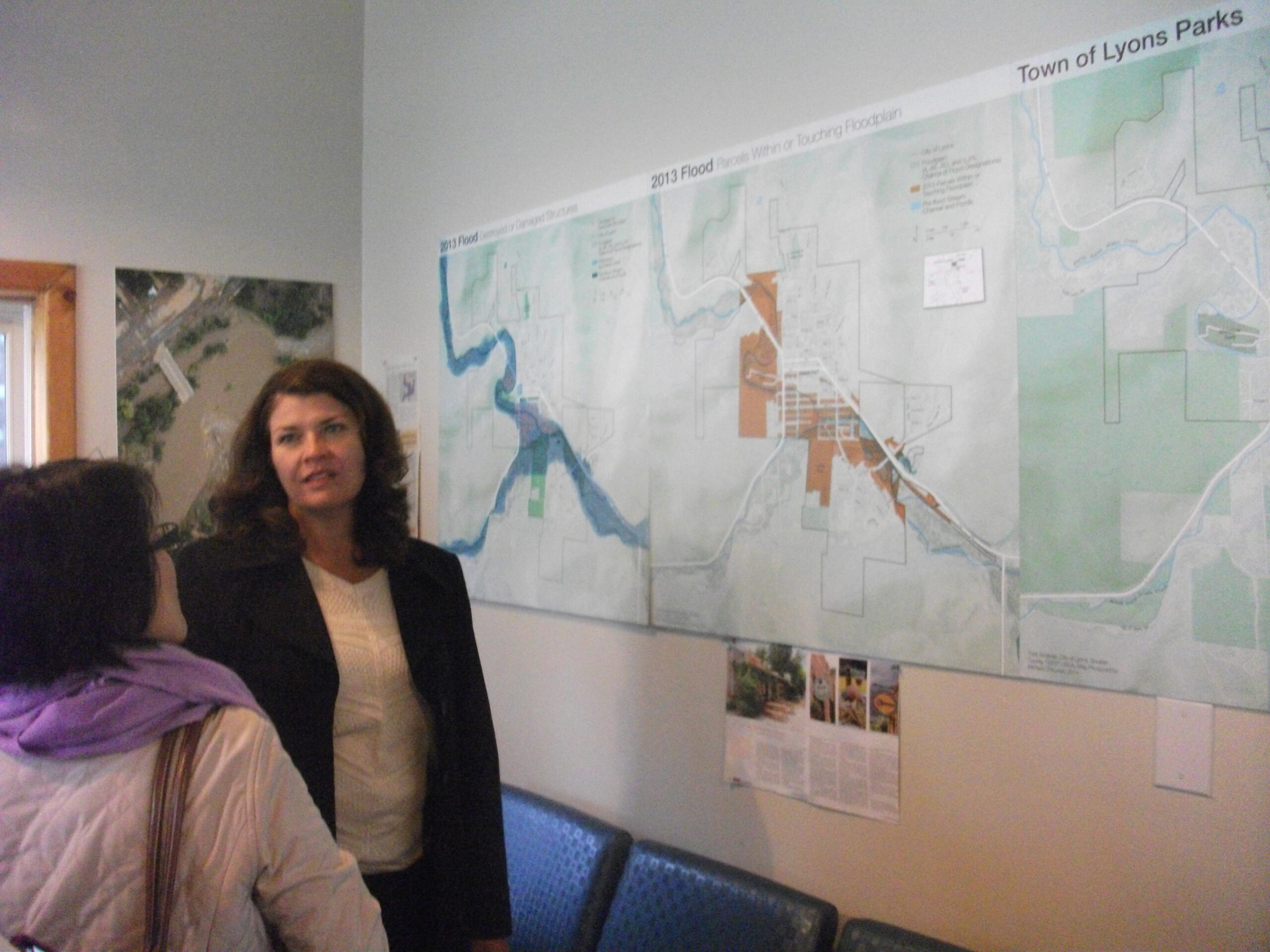
Victoria Simonsen discussing a map of the town’s flood damage with visitor, 2014

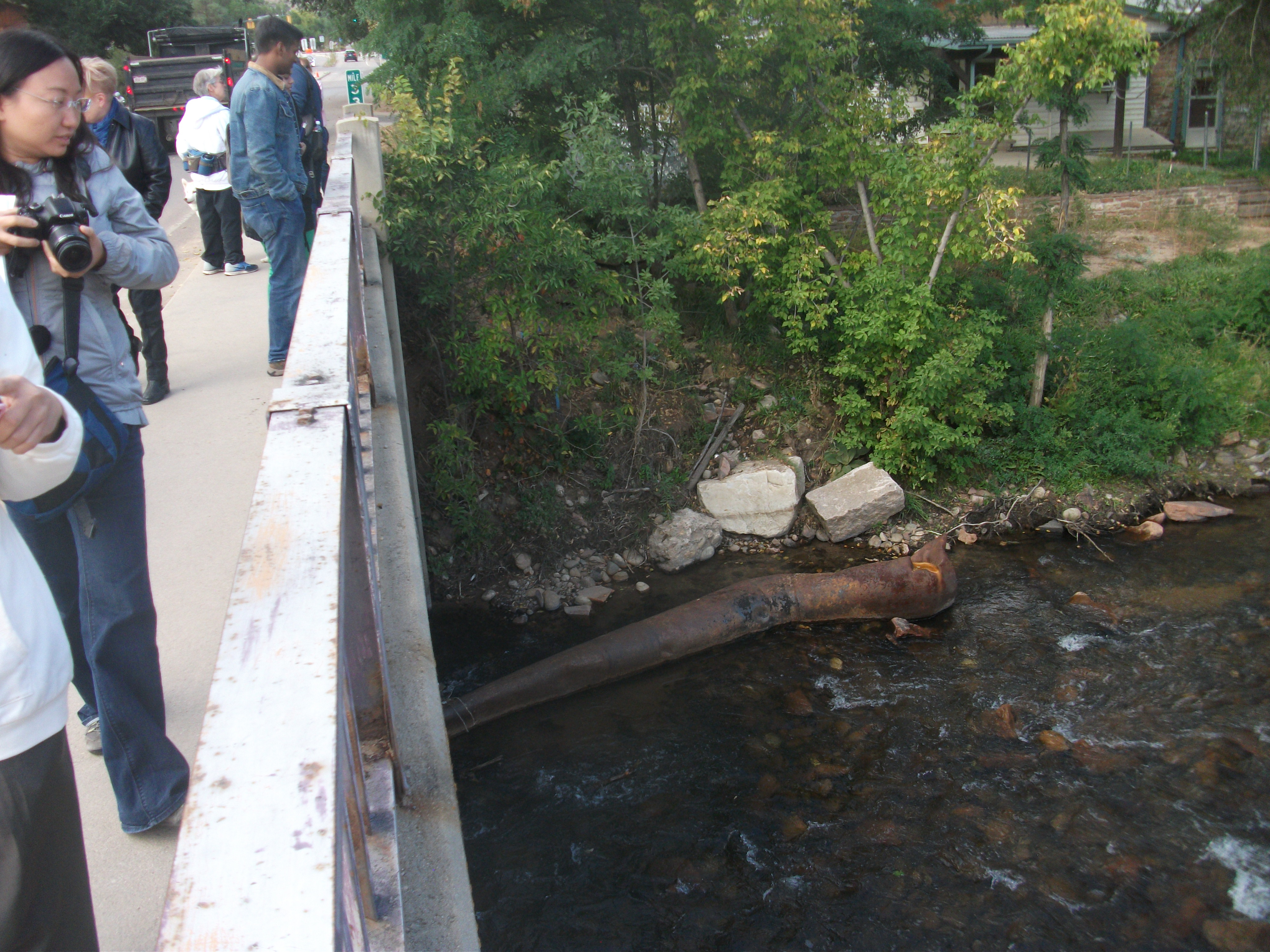
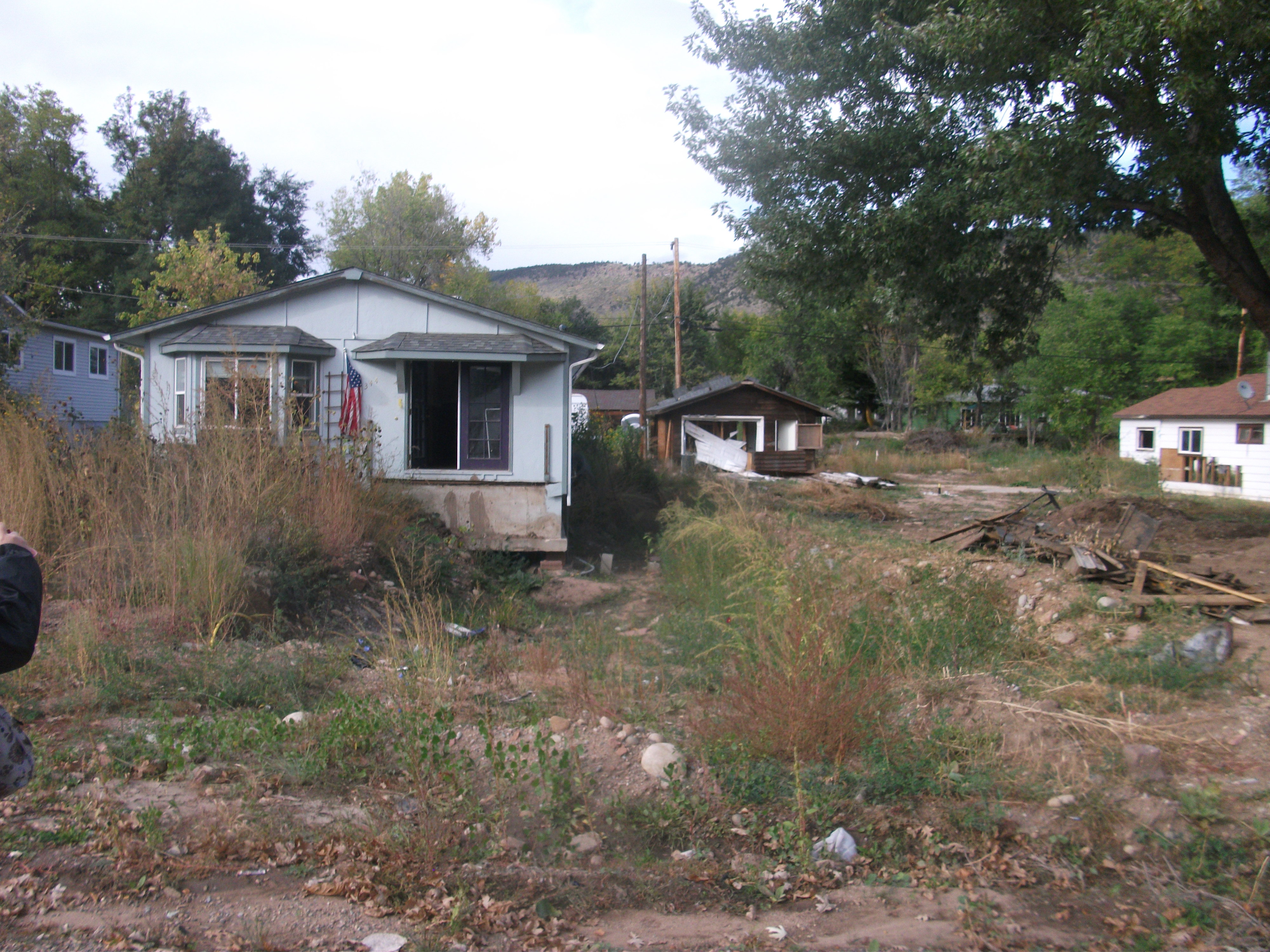
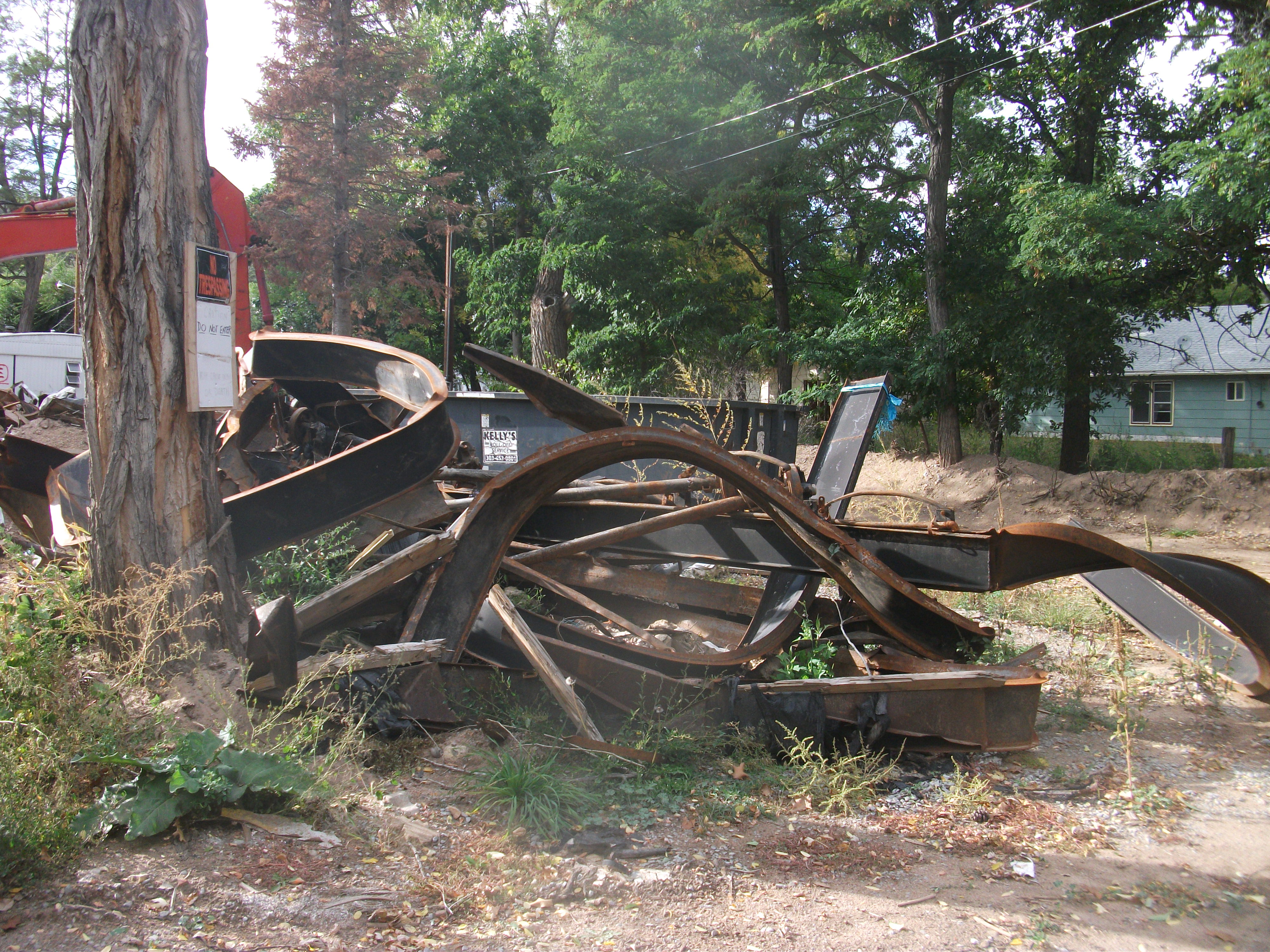
Ten years ago this month, Colorado faced a crisis. Following previous years of drought and wildfires, Rocky Mountain monsoon rains dumped a year’s worth of precipitation on the Front Range in a single day. Water poured down mountainsides that were sometimes so parched and scorched from previous high heat and fires that they could not absorb the rainfall, which then carried mud and debris downhill through the towns in its path. One of those towns was Lyons, which we visited on July 13 to interview Town Administrator Victoria Simonsen, who has remained on the job through thick and thin, helping to guide a remarkable recovery. But she also helped arrange for us to interview homeowner Priscilla Cohan, who is also a local artist, and Neil Sullivan, owner of the St. Vrain Market local grocery store. He has also served on the town’s planning commission, and his wife served two terms as mayor during the recovery.

Click here to watch the blog video recorded in Lyons.

I had previously visited Lyons twice in the early years after the flood, discussing some of the situation in an early blog post here. During the same time, a Community Planning Assistance Team (CPAT) from the American Planning Association spent several days visiting Lyons and producing a report with its own recommendations for moving forward. Lyons received other outside help too, from agencies like the Federal Emergency Management Agency, of course, but also from entities like the planning school at the University of Colorado at Denver.

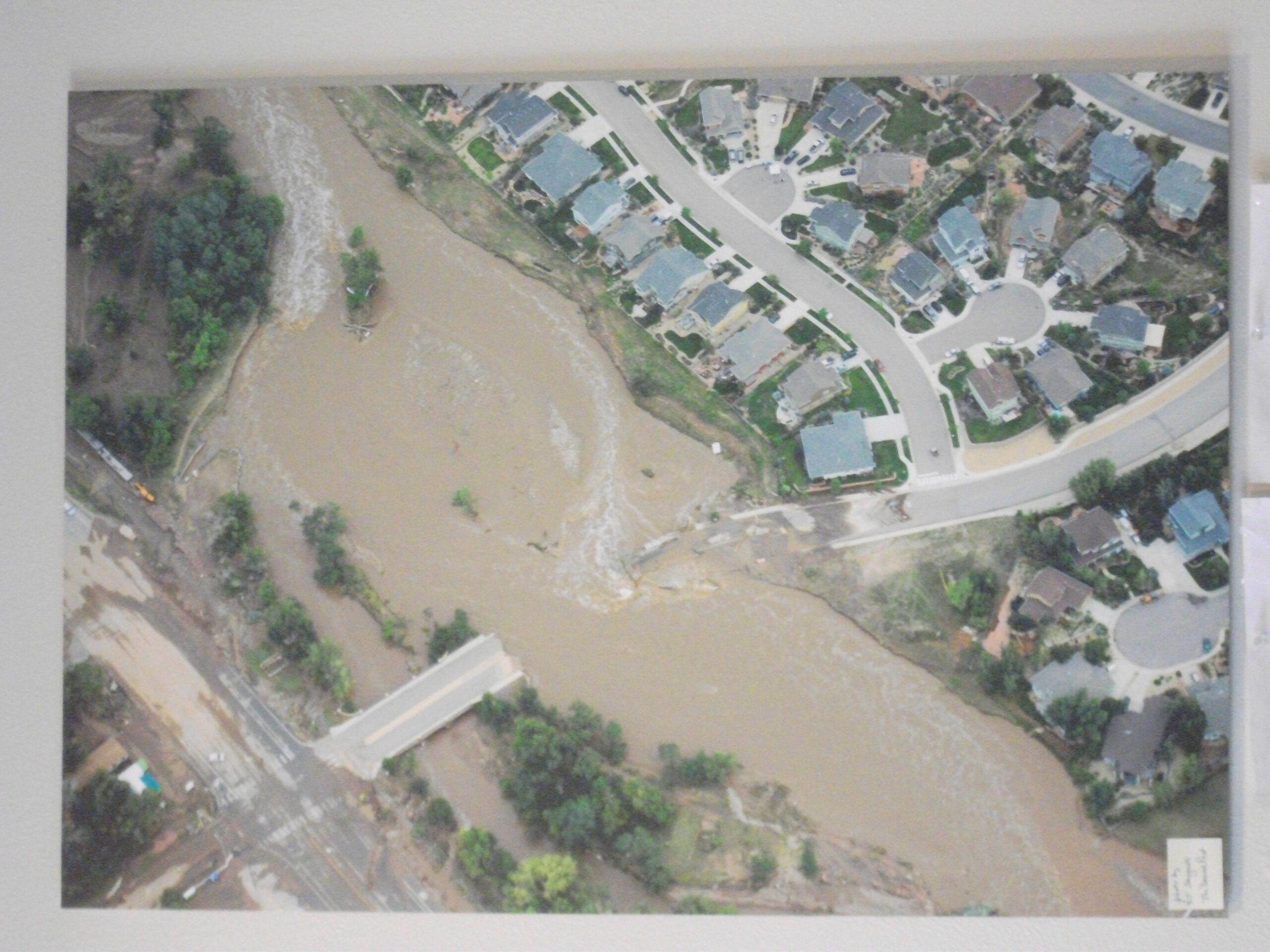
Aerial view of damage to bridge over St. Vrain River in September 2013

Now, the town is moving forward this month with a commemoration of that infamous flood that divided this Rocky Mountain hillside community into six islands divided by flood waters, compounding the difficulties of search and rescue until the flood waters receded. Why did we go there now? We wanted to capture this story and learn how it fit into a larger story of the State of Colorado building capacity for local governments to develop resilience in the face of cascading disasters like drought, wildfires, landslides, and flooding. We will integrate that story into the final film product for Planning to Turn the Tide, made possible by the assistance of people like Simonsen and numerous other volunteers from the Colorado APA Chapter and the Colorado planning community.

If you wish to support this endeavor, please use the QR code below or link here.

Jim Schwab

Resilience in the Rockies

Our visiting delegation arrives in Lyons on the slightly chilly afternoon of October 1.

Our visiting delegation arrives in Lyons on the slightly chilly afternoon of October 1.

Back on July 28, I told the story in “The Fatal Attraction” of a gourmet restaurant in Gold Hill, Colorado, that somehow produced great food with the help of a fantastically dedicated staff in a small town nestled in the mountains. I also noted that the surrounding communities had suffered both wildfires in the past and torrential floods in September 2013, from which they are still recovering.  I recounted a few details of some presentations by the mayors of both Boulder and Lyons, and their city manager and town administrator, during the annual Natural Hazards Workshop in nearby Broomfield, Colorado.

Victoria Simonsen explains the flood maps at the visitor center in downtown Lyons.

Victoria Simonsen explains the flood maps at the visitor center in downtown Lyons.

I had the opportunity just last week to spend three days in Boulder at the Third International Conference on Urban Disaster Reduction (ICUDR), which attracted sponsoring delegations from Taiwan, Japan, and New Zealand, and other attendees from nations like Algeria. I will discuss later some of what transpired at the conference, but here I wish to note that the conference provided the opportunity to join a field tour to Lyons, where we were joined by Mayor John O’Brien and Town Administrator Victoria Simonsen, both of whom seem to personify resilience in their approach to rebuilding a town that, at the height of the flood, was divided by the rampaging water into six islands and saw a 400-foot gouge cut through the heart of the town. We were joined on the bus by Professor Andrew Rumbach of the University of Colorado-Denver College of Architecture and Planning, whose students have been assisting the town with plan development; details and the plan itself are available at their website, resilientcolorado.org.

This aerial photo on the wall of the visitor center shows the damage inflicted by the flood on a major local bridge.

This aerial photo on the wall of the visitor center shows the damage inflicted by the flood on a major local bridge.

It is less my intent here to reiterate the flood statistics that were shared (for those see the box below), but to provide a photographic rendering of the condition of Lyons one year later, after thousands of hours of volunteer and paid work have been expended to restore homes, utility services, and some semblance of normal life to a town that was on the verge of destruction just a year ago. The town also received some planning

The St. Vrain watershed under more normal conditions during our visit.

The St. Vrain watershed under more normal conditions during our visit.

assistance from the American Planning Association through the pro bono visit of an APA Community Planning Assistance Team earlier this year. One thing that is very clear is that the town’s leadership is very gracious about acknowledging the extent of such outside help. Without it, Lyons would most likely never have mustered the resources to stage its comeback.

During the flood, water overtopped this bridge in the Confluence neighborhood.

During the flood, water overtopped this bridge in the Confluence neighborhood.


Lyons: The Numbers

  • Normal stream flow: 120 to 200 cubic feet per second (cfs)
  • Stream flow at height of flood: 30,000 cfs
  • Streams involved: North and South St. Vrain Creek, which meet to form confluence in Lyons
  • Size of gash cut through center of town by flood waters: 400 feet
  • Deaths: 1
  • People evacuated: ~2,000
  • Population of Lyons: 2,035
  • Homes damaged: 211
  • Homes substantially damaged: 84
  • Trees lost in flood: ~10,000

Jim Schwab

Views of damage in Lyons’s Confluence neighborhood, so called because it is near where the North and South St. Vrain Creeks merge:

DSCF2506DSCF2504


Here lie the remains of a mobile home caught in the swirling waters of the deluge.

Here lie the remains of a mobile home caught in the swirling waters of the deluge.