Lasting Lessons in Resilience

In the latter half of June 2008, it was hard to imagine Cedar Rapids as the city it had been just one month earlier. A massive flood along the Cedar River clobbered the city with a classic double whammy: About the time existing flood crests that had already swamped upstream Cedar Falls hit Cedar Rapids, a severe thunderstorm reached the city to compound the impact. The river, which runs through downtown in this city of 130,000 people, reached a flood level of 31.2 feet, besting the all-time previous record of 20 feet, reached in 1851 and 1929.

Downtown Cedar Rapids undergoing debris removal, late June 2008

Flood waters covered 14 percent of the city, more than 10 square miles. About 10 percent of the city’s population was evacuated from the deluge. Highway ramps became inaccessible, and at one point, a bus carrying prisoners from the county jail stayed just inches ahead of the rising waters to make its escape. City Hall, unfortunately situated on Mays Island in the middle of the river, was underwater, and governmental operations were moved to high ground elsewhere. In the end, nearly 1,300 flood-damaged homes were demolished, many making way for permanent open space as the city used federal hazard mitigation grants to acquire the properties with deed restrictions. Amazingly, as city officials have often said, there were no deaths due to the flood.

Relocated Czech & Slovak National Museum following June 2008 flood, Cedar Rapids

The avoidance of loss of life can be credited to the city and Linn County’s rapid response, which was not limited to emergency management. Within days, the Cedar Rapids City Council adopted a set of recovery goals that guided planning for long-term recovery for months and years afterwards. It shifted outside consulting contracts from riverfront planning to flood recovery. And it moved forward with a litany of creative approaches to business restoration, employment stabilization, and affordable housing development. Cedar Rapids became a living laboratory for community resilience.

For that reason, we made a special point during our Colorado to Iowa road tour for the film Planning to Turn the Tide, the documentary project of the APA Hazard Mitigation and Disaster Recovery Planning Division, to interview five essential city staff members on Tuesday, July 18, before closing out our trip by heading back to Chicago. These included City Manager Jeff Pomeranz and Community Development Director Jennifer Pratt.

Click here to hear two Cedar Rapids officials—Jennifer Pratt and Brenna Fall—discuss why they are supporting the HMDR film project.

These lessons have had lasting impacts in Cedar Rapids, which also suffered massive tree canopy devastation, as well as building damage, from an August 2020 derecho whose worst winds, exceeding 140 mph, swept through Linn County, including several suburbs. Taking climate change seriously, the city also last year adopted its own climate action plan. Cedar Rapids has quite probably done more to attack these problems in a forward-looking fashion than any other city in Iowa.

In coming weeks, this blog will feature new video clips from a four-day visit to the Florida APA conference in Jacksonville in early September. Meanwhile, plans are afoot for a November trip to Texas to capture additional content from the Texas APA conference in Corpus Christi, follow a mobile workshop exploring Hurricane Harvey recovery in Rockport, a Gulf Coast city where Harvey first made landfall in September 2017, and visit environmentally disadvantaged communities in the Houston area and record interviews with planners and activists there. Those posts will acknowledge the gracious support we are already receiving from several organizations and institutions in Texas.

To support the HMDR film-making effort, use either the donations link here or the QR code below. We will acknowledge all donors, whose help we greatly appreciate. Make this your film too as we move forward.

Jim Schwab

Striving for Flood Resilience in Iowa

Collapse of the CRANDIC railroad bridge during the 2008 floods in Cedar Rapids, Iowa

In 2008, much of Iowa experienced such massive floods that 10 percent of Cedar Rapids was evacuated, books were being rescued from the basement of the University of Iowa Library, and homes were under water in Cedar Falls. Dozens of other Iowa communities faced flood waters to varying degrees, all remembering that it was only 15 years earlier that they had dealt with another massive emergency in the Midwest floods of 1993. After billions of dollars of damage and thousands of lost homes, Iowans were forced to confront the fact that so-called 100-year floods might in fact be far more frequent events of the future and that climate change was a reality for the Midwest as well as coastal states.

It was in this environment of concern about how Iowa would cope with future flood emergencies and disasters that the Iowa Legislature decided in 2009 to establish the Iowa Flood Center (IFC). Born of cooperative discussions between IIHR—Hydroscience and Engineering at the University of Iowa and state leaders, the Iowa Flood Center became a leading model for state technical outreach to communities regarding flood mitigation, flood awareness, and warning systems, including an extensive system of stream gauges. Centered at the Stanley Hydraulics Laboratory along the Iowa River, the Center manages the Iowa Flood Information System, a platform that gives communities across the state easy access to inundation maps, alerts, and real-time data on stream conditions.

Over intervening years, I have occasionally worked with staff at the Iowa Flood Center. In addition to their collaborative work in one flood recovery consulting project for the Iowa Economic Development Authority in which I participated, I also have hosted Associate Director Nate Young as a guest speaker in my University of Iowa School of Planning and Public Affairs class, “Planning for Disaster Mitigation and Recovery.” In every instance I have seen, IFC has been a class act. Visitors from other states have been intrigued with the Center as a model for their own states.

It should be no surprise at this point that I decided early on that our film project, Planning to Turn the Tide, needed to include some content about the work of the Iowa Flood Center and the changes it has introduced to flood preparation and recovery in Iowa. On July 17, as David Taylor and I were making our way back east from Colorado, we stopped in Iowa City for the purpose of taping an interview with IFC Director Witold Krajewski, a veteran environmental engineer who has become intimately familiar with the hazard mitigation and planning needs of the hundreds of small communities, as well as larger cities, throughout a state that has seen more than its fair share of flood disasters. We also met with Kate Giannini, Iowa Watershed Approach Program Manager, about access for our film project to flood footage and other resources from the Iowa Flood Center that would help tell the story visually as well as in words.

Click here to watch the blog video about our visit to Iowa City.

As always, if you wish to support the Planning to Turn the Tide documentary film project, use this link or the QR code below to access our donations link on the APA website. We can use your help and will truly appreciate the support.

Jim Schwab

Heading Out on the Film Trail

The view from this week’s brief video blog is from Chicago’s 606 Trail, but David Taylor, our videographer for Planning to Turn the Tide, and I were actually headed out on a much longer trail for nearly two weeks. In a car containing his video equipment, we departed Chicago on Thursday, July 6, and drove across Illinois, Iowa, and Nebraska to arrive two days later in Broomfield, Colorado, the site of the 2023 annual Natural Hazards Workshop. We returned to Chicago on Tuesday evening, July 18.

Click here to view this new video blog installment in our ongoing series.

Why such a long road trip for this documentary film of the APA Hazard Mitigation and Disaster Recovery Planning Division? We had long hoped that we could combine travel to Colorado and Iowa in a single trip. This project, dependent on grants and individual and corporate donations, does not thrive on an expensive news media budget. It is driven by a great deal of volunteer support from planners and supporters of the planning community across the country, and specifically by ad hoc groups organized in the locations where we have chosen to film segments that we think will be of the greatest educational and inspirational value in the final product. Part of the answer, therefore, lies in a diligent frugality with our donors’ money.

Flying is inevitable to some locations. In this case, however, an extensive network of grassroots contacts let us bring several elements of the production together in a short, concentrated time scale. First, we are extremely grateful to the University of Colorado’s Natural Hazards Center, which welcomed our operation enthusiastically at its conference at the Omni Interlocken Hotel and Resort in Broomfield, which took place July 9-12. Their embrace allowed us to film interviews at the hotel throughout the conference.

At the same time, support from the Colorado Chapter of the American Planning Association, as well as other volunteers, made it possible to arrange meaningful visits to communities along the Front Range that have been affected over the past decade by drought, wildfire, and flooding, and to interview people who could share their knowledge and experience, which will be detailed in upcoming blog posts over the next few weeks. That filled out the first week.

Over the following weekend, we made our way back east again to Iowa, stopping in Iowa City and Cedar Rapids to discuss some meaningful Iowa planning innovations at both the state and local levels, dealing mostly with floods but also larger implications of climate change. I will note here that, while we stayed overnight in Lincoln on this return trip, we experienced what I had already seen in Chicago two weeks earlier: significant air pollution sweeping through Nebraska as a result of drifting smoke from raging wildfires in Canada.

Chad Nabity

Little more than a week earlier, on our way out to Colorado, we had stopped in Grand Island, Nebraska, to visit on a late Friday afternoon with Chad Nabity, AICP, the planning director for Hall County and Grand Island. Chad is the sort of remarkable professional who loves to give back to his profession. He currently serves the American Planning Association as Chair of the Divisions Council, of which HMDR is a member. In our chat at his office in City Hall, as well as at a nearby chocolate shop, he discussed Grand Island’s encounters with natural disasters, which included some flooding issues but also the Night of the Twisters in 1980, when seven tornadoes visited Grand Island in rapid succession, devastating parts of the community and triggering frantic emergency response efforts. Chad himself was entering high school that year in Grand Island. Although his parents’ house suffered little damage, he says, “not the same for close friends of mine.” Later, Chad went off to college, earned his planning degree, and eventually returned as a Grand Island native in the position he now holds. Not surprisingly, Chad is also a member of HMDR.

The evening became famous enough to draw Hollywood attention, resulting in the first Family Channel movie production, titled, you guessed it, Night of the Twisters. The movie itself drew from a 1984 young adult book of the same name by Ivy Ruckman. I guess we are not the first to think of making a movie about disasters, but I confess to viewing most such movies with a jaundiced eye because of their tendency to sensationalize such events.

We are producing an educational documentary because we are more interested in telling the story of how to prevent or mitigate such hazards, how to create resilient communities, and how to persist in the long road to recovery that inevitably follows. We want to build a community of interest for better planning for disaster resilience.

If you think that is a worthwhile enterprise, I will once again mention our need for financial support. Use the QR code below or this link to help us out. We will truly appreciate it.

Jim Schwab

Charting a Path to Sustainability

A presidential transition has always been a time to look forward in American history, anticipating change, contemplating new directions. Sometimes we like the new direction, sometimes we don’t; sometimes we think it just doesn’t go far enough to remedy the problems we face. But never have we faced the narcissistic spectacle of a president unwilling to release his grip on power. Every president before Donald Trump has been enough of a patriot to cooperate with a new president of the opposite party, and losing candidates who never ascended to the White House have been willing to concede. It is extremely unfortunate that some Americans are trying to deny others the right to focus on defining a more positive future.

But they are only trying because the right to map out an alternative future is still ours. The capacity to imagine a different future is one of the defining characteristics of a society that is capable of renewal, resilience, and sustainability. It is vitally important that civic leaders, academics, and authors help us clarify the truth of our past and map out paths to a better future. And, presidential transitions notwithstanding, it can and should happen below the national level, to help states and communities explore their unique history and their opportunities.

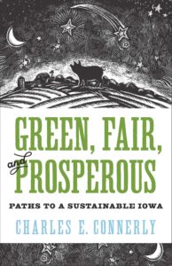
It is in that context that I wish to introduce readers to Green, Fair, and Prosperous: Paths to a Sustainable Iowa, the work of Charles E. Connerly, who by next summer will be retiring as professor and the director of the University of Iowa School of Urban and Regional Planning, recently renamed the School of Planning and Public Affairs after Connerly’s successful push to incorporate a Master’s in Public Affairs to the program’s offerings. Connerly has been at Iowa since 2008 since migrating back to his Midwestern roots after a long tenure at Florida State University in Tallahassee. As a matter of full disclosure, he was also responsible for hiring me as an adjunct assistant professor to teach one course each fall that has come to be known as Planning for Disaster Mitigation and Recovery. His many years at Florida State, working alongside Robert Deyle, a colleague who worked with me on disaster issues as far back as the 1990s, made him supremely aware of the importance of addressing hazards in the planning process. I was hired in the immediate aftermath of the massive 2008 floods in Iowa.

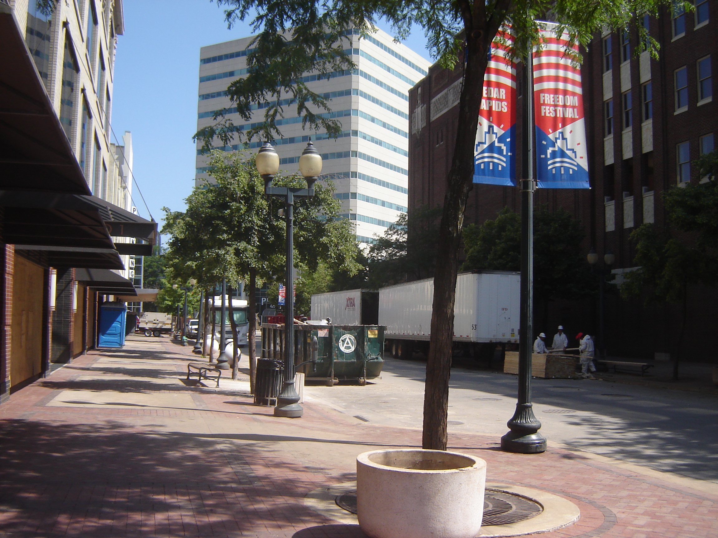
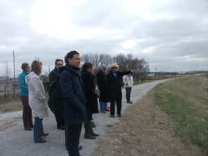
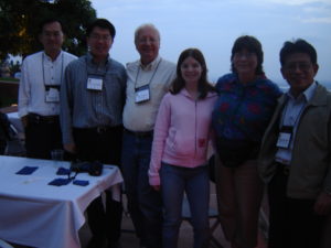
Connerly (in gray jacket) during a 2014 field trip of post-flood redevelopment in Cedar Rapids.

Connerly is truly a comprehensive thinker in the best planning tradition, and this book shows it. While I am certain, because of publishing schedules, that he had completed his manuscript before the death of George Floyd at the hands of Minneapolis police over the Memorial Day weekend, his book is incredibly timely in the fall of 2020 because of his focus on the history of racial and ethnic disparities in Iowa. In fact, Chapter 4 is simply titled, “Why Is Iowa So White?”

Indeed, that is a very good question. It is not just a matter of Iowa being farm country. After growing up in the Cleveland metro area in Ohio, then moving to Iowa in January 1979 before ultimately enrolling in graduate school at the University of Iowa, I remember being struck by the apparent lack of diversity, especially outside the handful of cities above, say, 50,000 people. There is, after all, industry in these cities, and industry has often attracted multiracial work forces. Unless, that is, political and social forces intervene to prevent such an outcome. Most people, however, never notice such forces at work and never learn about them in school. History can be very silent about such matters unless diligent researchers insist on exposing that legacy to sunshine, aka “the best disinfectant.”

Connerly digs deep on this topic, all the way back to antebellum Iowa politics. Sitting just north of Missouri, a slave-holding border state, Iowa was both a frontier of the Underground Railroad and a harbor of typical northern mixed feelings about African Americans. In 1850, Iowa was no less than 99.8 percent white, and did not dip below 99 percent, Connerly notes, until 1970. Since then, there has been a substantial growth in minority populations. But African Americans have historically been concentrated in just four urban counties. All that said, it was also the Iowa Democratic caucuses in 2008 that launched Barack Obama on a streaking path to the presidency. What accounts for this paradoxical history?

From the early days of statehood, Iowa suffered from a typical northern moral conflict between supporting emancipation and not particularly wanting too many blacks in the neighborhood. That is not putting too fine a point on the matter. Connerly notes that before the Civil War, Iowa had enacted laws banning blacks from the state. The territory avoided enacting such black codes to win statehood, but once that was achieved, Iowa legislators had no problem backtracking on the issue. The bottom line was that Iowans, overall, opposed slavery but did not necessarily favor civil rights for freed slaves.

That changed somewhat after the Civil War, with Radical Republicans pushing through changes that liberalized matters considerably, but it was only following World War II and through the Civil Rights movement of the 1960s that serious, permanent change began to occur. By that time, however, previous history had done its work in making African Americans largely feel unwelcome. Iowa stayed overwhelmingly white, but not entirely by accident. At the same time, the state has been receptive to refugees, for example, after the Vietnam war, and remarkably progressive on some other issues. Northwest Iowa elected the remarkably ignorant Steve King to Congress, but Republicans themselves dethroned him in this year’s June primary.

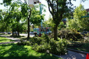
Prior to white settlement and the rise of modern agriculture, much of the Iowa landscape enjoyed by Indians consisted of prairie. Photo by Suzan Erem

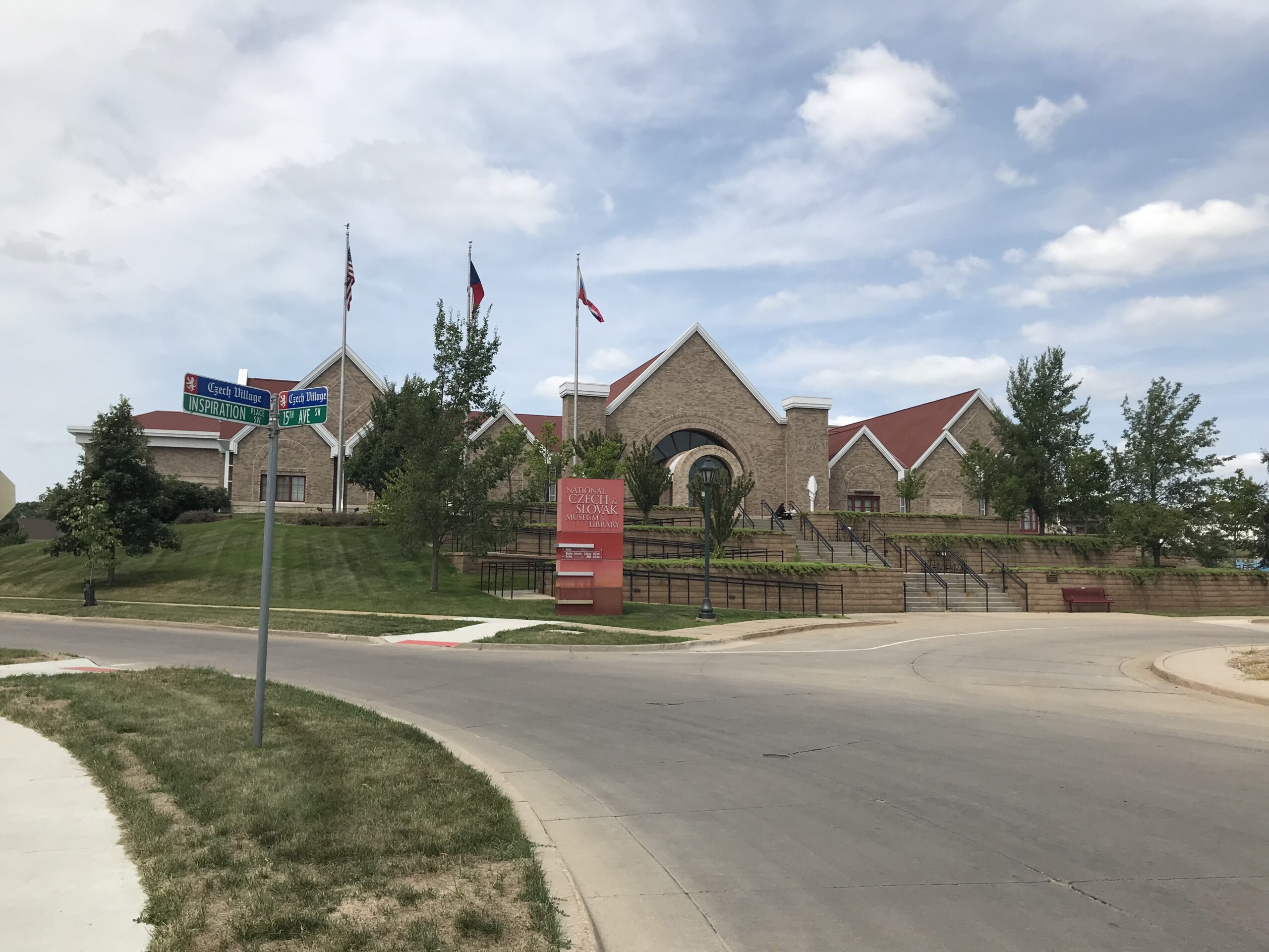
Connerly writes that African Americans were not the only minorities to feel the impact of 19th-century American racism. Before European settlement, which took place in earnest only after Iowa became part of the United States following the Louisiana Purchase, fourteen Native American nations had, over millennia, occupied some part of what became Iowa. Before the 1800s, their interaction with Europeans was largely through trade, but eventually their land ended up in the hands of white settlers. The short answer as to how that happened is simple: “We took it from them.” Today, only the Mesquaki settlement in Tama remains as a reminder of the formerly dominant Native American presence.

The Hispanic presence, and that of various Asian minorities, is a product of more recent history, some of it involving the evolution of labor relations, particularly in agriculture and meat processing plants, but today there is a distinct, but distinctly disadvantaged, Hispanic presence. It is no accident that earlier this year, some of the most intense controversy over coronavirus spread in states like Iowa, Nebraska, and South Dakota involved minority workers in the meat-packing industry and deficiencies in safety protocols among the companies involved. In a whole chapter dealing with labor issues over time in both the food and agricultural equipment industries, one can see the steady decline of leverage among white-dominated labor unions and the rise of cheap labor and mass production within the industry as it is today. It is hardly a stretch to suggest that these social and economic changes have had profound impacts on, and implications for, the future of Iowa’s economy and society. Iowa did not shift from supporting Obama in 2008 and 2012 to Trump in 2016 and 2020 without some massive strains within the body politic. How those tensions are resolved will go a long way toward determining whether Iowa can chart a successful path to a sustainable future, as Connerly’s book suggests. Iowans will have serious work ahead in improving social equity while adjusting to a changing demographic makeup across the state.

But I do not wish to create the impression that the book is strictly focused on such demographic issues, as important and critical as they are. It is important to notice that Connerly has tied together the issues of environmental health, fairness, and prosperity in his title. His larger point is that all these questions are inextricably related. To quote some planners I have known, “Everything is connected to everything else.”

Connerly takes us on a detailed, well-documented tour not only of Iowa’s demographic history, but of its environmental and economic history as well. Iowa clearly entered statehood as a predominantly rural, agricultural state, though not necessarily producing the corn and soybeans that predominate now. Originally, in fact, it grew more wheat, but trends shifted to corn and hogs. But the state is still heavily dependent on agriculture, with 43 percent of its 2015 manufacturing centered on either food processing or machinery used in agricultural production. These two gave rise in the twentieth century to some powerful unions representing workers who were largely able to achieve a blue-collar version of middle-class prosperity. Hogs, supported by state laws exempting agriculture from county zoning laws, gave rise to the growth of concentrated animal feeding operations (CAFOs) in the past 40 years, and the meat-packing industry itself became more concentrated and able to mechanize increasingly and replace high-wage jobs with lower-wage mass production and weaker unions. The people working in the newer factories are definitely more racially diverse but definitely not more empowered and definitely paid less. The growing inequities have resulted in a shrinking middle class.

One factor that distinguished the Iowa packing plants prior to the major, union-busting shifts of the 1970s and 1980s was that the plants were closer to the farms, and thus, unlike larger plants in Chicago and Kansas City, bought animals directly from farmers. Connerly maps out the consequences in urban development for Iowa, namely, that Iowa never developed the metropolitan magnets of neighboring states like Minnesota, Missouri, and Illinois because of the dominance of the Twin Cities, Chicago, and Kansas City, and instead has a number of smaller cities, the largest being Des Moines, which has about 215,000 people, though the entire metro area is about three times that size. Smaller cities have mostly grown around agriculture-related industries.

All this has had significant consequences not only for quality of life but the quality of the environment, with water quality problems arising from rural land use issues such as CAFOs, soil erosion, and nitrate concentrations in groundwater. Connerly’s final chapter asks whether Iowa truly is the “best state in the nation,” a title bestowed in 2018 by U.S. News and World Report. As a former Iowan, I do not offer this review as a way of trashing the state, nor does Connerly offer his book in that spirit, but the question is an opportunity to explore the complexity of a state that too many elsewhere see as simply white and rural. Iowa, with the right policies, the right incentives, and the right opportunities, has the potential to create a healthy environment and economy, but it must examine current trends and determine how to reverse those that are moving the state in the wrong direction. The last chapter is a succinct compendium of recommendations for moving Iowa toward a growing middle class, a healthier environment with better recreational opportunities, and a progressive approach toward making agriculture more ecologically sound and resilient in the face of natural hazards, most notably, floods.

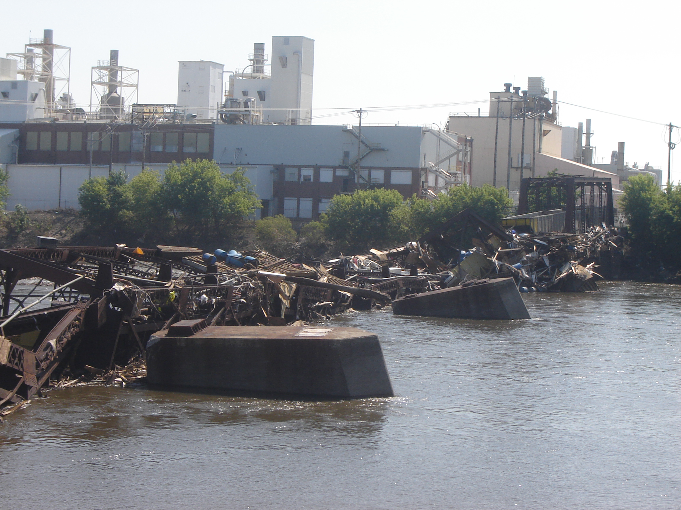
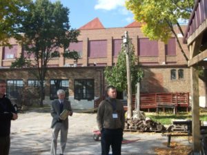
Testing facility of the Iowa Flood Center, 2019.

The state has created some interesting mechanisms for doing this, but has a stubborn habit in recent years of shooting itself in the foot. In 1987, the legislature wisely passed the Groundwater Protection Act, which created the Aldo Leopold Center for Sustainable Agriculture at Iowa State University, which has done remarkable research on establishing a balance between economic and environmental needs in agricultural practices. Yet, in recent years, the legislature has significantly limited state funding for the center at the behest of corporate agricultural interests. In 2010, following the devastating floods in 2008, the legislature funded creation of the Iowa Flood Center at the University of Iowa, which has become a model in advancing flood prediction and mitigation that other states are considering copying, yet some question the need for continued funding. It is almost as if Iowa wants to replicate the larger national battle between science and an increasingly poisonous distrust of “experts.” Would it not be better to marshal and support the best intellectual resources Iowa can muster for an assessment of the opportunities that lie ahead?

Connerly points out, in contrast, how Iowa could take the lead in solving problems like climate change and excessive nutrient runoff in the Mississippi River basin that leads to both groundwater contamination locally and hypoxia in the Gulf of Mexico. This last chapter is the biggest single reason to read the book, but its logic is only fully clear after reading the thorough research that precedes it.

My final comment is that it may seem that this is a book that is primarily or perhaps solely relevant to Iowans. I think that conclusion, however, would be short-sighted. While I am profoundly aware of the many books others have produced about other states, regions, and metropolitan areas across the U.S., I think it is vitally important that other scholars across the nation undertake similar efforts to assess the path to sustainability for their own states, regions, and cities. We could sorely use such a book in Illinois, and the same is probably true for every neighboring state. As I suggested at the outset, it is not enough to chart a new national path. We need these serious explorations at subnational levels as well. In that sense, I believe Connerly has done a major service for the Hawkeye state. I’d like to see more such books.

Jim Schwab

Truly Hard Wind

What in the U.S. Midwest would spur comparisons to a hurricane? What could spread damage over an equally wide area? It is a good bet that most people are unfamiliar with the word “derecho,” which comes from Spanish, meaning “straight,” but such a storm made itself felt just three weeks ago in Iowa, Illinois, and Indiana, as well as parts of Nebraska and Wisconsin. The Spanish word with an adopted meaning in English refers to such a storm’s powerful straight-line winds, as opposed to another adapted Spanish word, “tornado,” literally meaning “turned,” which, of course, refers to a cyclonic, or spinning, meteorological phenomenon.

The Event

On August 10, a derecho took shape in eastern Nebraska and the southeastern corner of South Dakota early in the morning. The city of Omaha suffered some of the initial damage, with an estimated 57,000 people losing power. But as it roared across the center of Iowa, the storm, as derechos often do, rapidly gained wind speed until estimated winds of 140 miles per hour struck Cedar Rapids and surrounding Linn County in eastern Iowa. Nearby Iowa City, home of the University of Iowa, also suffered extensive damage. Derechos can and typically do strike with little warning, unlike hurricanes, but even at speeds of 90 to 100 mph, in this case, it still takes hours to cross Iowa from west to east, and even longer to reach Illinois and Indiana.

Thus, my first warning of what was to come, sitting here in Chicago, was a telephone alert from the University of Iowa around noon that day. I get such alerts because I am on the faculty, although I now teach remotely as an adjunct. But our landline and my cell phone are on the system, so the alerts come automatically. Fortunately, that gave me most of the afternoon to prepare for what was coming, which arrived in our area around 3:45 p.m. Winds and rain pounded on our skylights for nearly 45 minutes, leaving numerous branches and twigs on the ground from our stately American elm, which towers above our house and garage and has probably withstood other storms for at least a century. It was already huge when we built our house in 1994, and we chose to make it sure it remained. Even this storm caused it only minor damage.

The same could not be said of many street trees in parts of Chicago. Trees often collapsed on top of parked cars, leaving many owners to bemoan what became of their vehicles—or, in some cases, the roofs of their homes.

Even the repose of the dead was not left undisturbed. Graceland Cemetery, one of the more famous in Chicago, faces months of repairs and replanting and is closed for six weeks. The storm uprooted about 40 trees and damaged numerous gravestones and monuments. It had become a popular place for peaceful strolls and contemplation during the months of coronavirus-induced shutdown. After the storm, it was a visual mess that will cost about $250,000 to repair.

Removing damaged trees in Chicago’s Rogers Park.

One lesser-known by-product of derechos is tornadoes, which can be spun off from the shelf cloud as it moves through an area. In Chicago, two tornadoes, one EF-1 in the Rogers Park neighborhood along Lake Michigan near the city line with Evanston, literally buzzsawed trees in an area of densely built multifamily housing and small

Insurance claims agents inspect building damage in Rogers Park.

businesses. A few days later, I visited the area to shoot photos that appear here. At first, driving up Greenwood Avenue, I wondered where the damage was. But as I drove further north and approached W. Jarvis Ave., the answer became starkly obvious. I could not drive beyond that corner because the street was blocked; Jarvis was one way going east, but Jarvis east of Greenwood was also blocked. City trucks were removing damaged trees. After finding a way to park without impeding traffic, I encountered insurance agents on the ground shooting outside photos of nearby buildings, presumably for damaged masonry. Any damaged cars had already been removed.

That tornado, and another that reportedly skipped across the Eisenhower Expressway (I-290) on the West Side, dramatically demolished for some an old urban myth that tornadoes don’t strike urban areas. People believe this for various reasons, including how they think tall buildings disrupt wind circulation, but trust me: I’ve been involved in disaster recovery long enough to know that tornadoes do not discriminate against smaller towns. Rogers Park is very urban. Tornadoes go where they please. This specific tornado eventually skipped out over the lake, becoming a waterspout. But it left its mark.

The storm, by the way, ultimately spun off at least 17 documented tornadoes, mostly in northern Illinois, but a few in Wisconsin and Indiana. All were either EF-1 or EF-0 on the Enhanced Fujita scale. But by far, most of the damage resulted from the straight-line winds themselves, which were often in the range of 90 to 100 mph, with a top measured speed of 126 mph in Atkins, Iowa, making them basically of tornado or hurricane strength. And they sped, over the course of a single afternoon, across all or parts of several states.

By 4:30, the storm had continued its march into northwest Indiana, where it finally petered out. But what happened along the way?

Iowans can attest that it functioned across much of their state like a Category 2, maybe even Category 3, hurricane. Lyz Lenz, a columnist for the Cedar Rapids Gazette, noted in a guest column for the Washington Post four days later that the winds had damaged “more than 10 million acres, or 43 percent, of the state’s corn and soybean crop.” The reduction in harvest in Iowa is likely to be between one-fourth and one-half. The heading on her column referred to the storm as an “inland hurricane” that most people had not heard about. The damage was massive enough to be visible in satellite images.

The damage was not just to crops on the ground, but to hundreds of millions of bushels in storage bins on farms and in commercial storage facilities, according to the Iowa Department of Agriculture. Toppled grain bins were a common site.

Damage to Chinese House roof in Grinnell. Photo by Rachel Bly.

Despite those staggering figures, that was only the beginning. Between Indiana and Iowa, four people died from either falling trees or electrocution, and, in one case, a mobile home tipped over by high winds. Losses of electric power affected approximately 585,000 Iowans, or roughly 20 percent, while 1.9 million lost power in neighboring Illinois. Tree damage in Linn County totaled in the hundreds of thousands, and most buildings suffered anywhere from mild to catastrophic damage. In small towns, like Grinnell, building damage and tree damage to cars was also extensive. Here, I wish to thank Rachel Bly, director of Conference Operations and Events for Grinnell College, for sending me dozens of photographs she shot after the event. Bly, I might note, has a certificate in emergency management from Park University in addition to her MPA from Drake University. The images she shared help convey some reality to the trauma that occurred. Hundreds of other small communities suffered similar impacts. Not surprisingly, Gov. Kim Reynolds issued a state disaster declaration by August 14 for 25 counties, and has sought a federal declaration from President Trump, citing an estimated $4 billion in damages. By August 19, Trump had signed a declaration for Public Assistance (PA) but not Individual Assistance (IA) for Iowa. PA provides aid for restoring public infrastructure, such as roads and bridges and community facilities, while IA provides direct aid to individuals for reasons such as loss of housing.

Power line damage in Grinnell. Photo by Rachel Bly.

Photo by Rachel Bly

Roof seen through the window. Photo by Rachel Bly.

Inside a damaged salon in Grinnell. Photo by Rachel Bly.


Derechos as a Natural Hazard

All this raises the question of what we know about derechos as a wind-related hazard. I will confess that I spent most of my life never having heard the word, let alone understanding what it meant. It is not the most common occurrence, but it certainly ranks among the most destructive. To my surprise, I learned from Wikipedia that the term was coined in 1888 by a German-American scientist, Gustavus Detlef Hinrichs, who had emigrated to St. Louis just before the Civil War. He wrote in the American Meteorological Journal about a storm that struck Iowa in 1877 and described its unique characteristics. Nonetheless, even in the Midwest today, many people are unfamiliar with the term—until they hear it on the news, as they did on August 10 amid storm warnings.  

The gust front “arcus” cloud on the leading edge of a derecho-producing storm system. The photo was taken on the evening of July 10, 2008 in Hampshire, Illinois. Credit: Brittney Misialek. From National Weather Service website.

There are several types of derechos, but the National Weather Service describes a derecho as a “widespread, long-lived windstorm that is associated with a band of rapidly moving showers as thunderstorms.” More specifically, it defines the phenomenon as a swath of damage that “extends more than 240 miles (about 400 kilometers) and includes wind gusts of at least 58 mph (93 km/h) or greater along most of its length.” In plain English, this is a huge, regional storm, not some localized thunderstorm. It exhibits straight-line winds that can be at least double the minimum in the definition, and the August 10 event involved winds far above 58 mph in most locations. Like all such storms, it is a product of unstable atmospheric systems, in this case typically involving a bow-shaped front in a large squall line.

The storms are typically a mid-latitude phenomenon, making North America and the Midwestern U.S. particularly susceptible, but they occur elsewhere in the world as well, including southern latitudes (southeastern Brazil and Argentina), South Africa, China, and even eastern Europe, where a derecho struck parts of Estonia in August 2010, and near Berlin in Germany in 2002. The August 10 event was not the first one I have witnessed in Chicago—another struck in July 2011 and disabled electric power for nearly a million people—but it was certainly the largest in a long time.

70% of all derechos occur between the months of May-August (the warm season). The other 30% occur during the cool season. From National Weather Service website.

As a mitigation planning response, almost no hazard mitigation plan (produced for FEMA approval as a condition of eligibility for federal hazard mitigation grants) for any state or community east of the Rockies (with the possible exception of Florida) should fail to identify derechos as a potential hazard. Moreover, especially in the Midwest, it may be time for states and communities to reexamine their building codes for wind resistance as a means of limiting future damages from derechos. Finally, it may also be time for many communities to examine more closely their urban forestry programs for adequate attention to hazardous tree management. That does not mean refusing to plant trees or removing them unnecessarily as a mindless precaution. It does mean engaging professional urban foresters in an assessment of the urban tree canopy with an eye to ensuring forest health and removing those trees that are most likely to fail under severe wind pressure. Already, the call has arisen for such reforms in Chicago. It is time for planners, environmentalists, disaster professionals, open space advocates, and concerned citizens to seize the moment while they have the public’s attention.

Jim Schwab

FEMA Needs to Think about This One

Flooded property in Lyons, Colorado, after the St. Vrain River flooded in September 2013.

There is that old saying that, if it ain’t broke, don’t fix it. To that, one might add that, if you’re thinking about fixing it anyway, you may want to clarify exactly how you wish to improve things and why you think the improvement will be better.

In a February 27 notice in the Federal Register, the Federal Emergency Management Agency (FEMA) proposed a major change in long-standing hazard mitigation rules regarding grants for acquisitions of flooded properties that made almost no effort to meet that test. I wish I had noticed it earlier because the deadline for comments was April 30. I submitted a brief comment on that date and tried to rally others on Facebook, but the truth is that this one got away from me. I was busy on other fronts. I have subsequently spent a few days gathering background information.

I am very glad that a few national organizations like the Association of State Floodplain Managers (ASFPM), American Rivers, and the Natural Resources Defense Council (NRDC) found time to file substantial objections to FEMA’s notice on Property Acquisitions and Relocation for Open Space (Docket ID: FEMA-2018-0006). Their objections raise profound questions about both the process and the substance of FEMA’s proposed changes. Others have also submitted comments.

Here’s the bottom line: For 30 years since the passage of the Stafford Act, which provides the basic framework of most federal disaster law, federal hazard mitigation grant programs have required that lands being acquired from property owners whose homes have been flooded must be placed into perpetual open space following demolition of the structures. The clear intent is to reduce the ongoing exposure of the federal government and the National Flood Insurance Program to repeated losses by precluding further development in those flood-prone areas. By and large, those grants go through state and local governments, which then maintain those open spaces and must periodically certify to FEMA that the lands remain in that status. Today, those grant programs include not only the Hazard Mitigation Grant Program (HMGP), a sometimes-substantial source of mitigation funding that is available after a presidentially declared disaster; the Pre-Disaster Mitigation (PDM) program, created as part of the Disaster Mitigation Act of 2000, which amended the Stafford Act; and Flood Mitigation Assistance (FMA), part of which deals with Severe Repetitive Loss properties, which make up a disproportionate share of overall flood claims.

In the notice, FEMA has announced a new option to allow owners of flooded properties to retain the underlying land while being paid to demolish the structures, thereby permitting them to eventually rebuild on that same flood-prone land. Because mitigation grants have gone from FEMA through states to local governments, those governments have been responsible for the open space programs that result. This new approach would allow the property owner the option of taking the grant directly from FEMA. In its comments on the proposal, ASFPM noted that, in the 2004 NFIP reform legislation, it supported providing FEMA the option to deal directly with property owners, mostly because some local governments have lacked the capacity to monitor the open space requirements, but it still expected that FEMA would consult with those governments before using that option as a means of maintaining consistency with state and local hazard mitigation policy. The current notice makes no mention of such coordination.

Elevation of flooded properties remains a viable option in many cases.

It is not as if these owners do not have other options for mitigating future flood damage, including elevation of residential structures above the 100-year base flood elevation established on FEMA flood insurance rate maps, or floodproofing the structure. But, the thinking seems to be, some owners will be more willing to demolish if they can retain the land. One possibility for some might be to retain the land, rebuild in due course, and flip the improved property while leaving the NFIP with continued flood loss exposures. How that helps federal taxpayers or other flood insurance rate payers is not especially clear.

The Federal Register announcement does nothing to make that clear. If you follow the link and read the notice, you are likely to experience my reaction, which was that I felt left in the dark regarding the rationale for making this move, which is not explained. Nor does FEMA provide any data to support the idea that this initiative would do anything to reduce flood losses. The opposite could easily prove true.

In an April 26 article in Insurance Journal, former FEMA administrator Craig Fugate offers some support for the new option by noting that placing land in permanent open space through a buyout is often a “hard sell.” That may well be, but it is partly because the solution is meant to be effective and lasting. It is also not as if the approach has lacked success. As NRDC notes in its comments, citing ASFPM case studies, more than 30,000 floodplain properties have been removed from development since 1993, many of them following major cataclysms such as the 1993 and 2008 Midwest floods and various hurricanes.

Perhaps more telling is the question of homeowners’ motivation in making the difficult decision to sell and relocate. The idea that people would necessarily prefer to be able to rebuild in the same location is not as clear or straightforward as some might assume, though there are, no doubt, advocates of property rights who would prefer to create the new option. But this emotional decision contains some factors that should not be ignored. Perhaps straight to the point is this comment from American Rivers:

Our experience working with floodplain managers has taught us that convincing property owners to accept a buyout is an emotional and difficult decision, and many are only willing to accept the buyout offer after they are assured that the property will be preserved as open space for the good of the public. Offering direct grants that allow new construction where a structure was demolished could be at odds with local hazard mitigation plans and efforts to acquire flood prone properties for open space. FEMA should instead be working to support the implementation of open space goals in local and state hazard mitigation grants.

In other words, many of those choosing a buyout, having suffered the damages of severe and repetitive losses from flooding, and aware of the larger issues concerning the public good in these situations, would rather ensure that nothing like this happens again, at least in their community. But what happens to the motivation undergirding their willingness to sell if they become acutely aware that their neighbors now have the option of prolonging the pain by not placing the land in permanent open space? Will they still feel that they are accomplishing anything by pursuing the traditional option? In any event, are these not the people whose choices we most want to honor for the greater good of the community?

City-acquired open space in Cedar Falls, Iowa, near the Cedar River.

The essential reason all this is important is that we have learned much over the years about the natural and beneficial functions of floodplains, which include soil enrichment, wildlife habitat, reduced flood severity, and reductions in erosion and stormwater runoff, to name a few, in addition to the potential recreational functions of waterfront parks and open space. All this is in addition to the fiscal benefits of reducing future floodplain losses in the areas affected. If all that is not reason enough for FEMA to pause, rethink the question, and at least offer some solid scientific and economic documentation of the benefits of the proposed new approach, then I am not sure what is. Otherwise, count me a serious skeptic.

Jim Schwab

Life Lessons from Freezing Weather

We interrupt our regularly scheduled blog post . . . .

Tens of millions of Americans are accustomed to weather bulletins in winter months advising them of wintry conditions, whether they involve bitter cold or blowing snow. It is no great secret to anyone in recent days that even places as far south as Tallahassee, Florida, and Charleston, South Carolina, have been dealt an unexpected dose of the icy blast, while places like Boston and Maine, which have seen it all before, are being assaulted with both snow and icy storm surges from a northeaster.

Yes, I was a year old at one time. Thank God, photography has improved. Credit: Halle Studio

With friends who inquire about my background, I like to joke that I have spent my life moving back and forth along the 43rd parallel. Born in New York, I was moved at a year of age to a suburb of Cleveland, Ohio, in 1950, where I grew up. In January 1979, I moved to Iowa, first to lead a statewide public interest organization, later to attend graduate school at the University of Iowa. By 1985, I moved briefly to Omaha, where my wife and I were married; she was a lifelong Nebraskan. By Thanksgiving, I had a job in Chicago, and we have been here since then. That also means I have spent about six decades along the Great Lakes, experiencing various aspects of the famous “Lake Effect.” One aspect is that it can dump a ton of snow in your backyard—and everywhere else. You learn to deal with it.

As you can see, Roscoe can barely contain his enthusiasm for being outside in the cold.

Chicago, by this weekend, is expected to complete a record-tying 12-day stretch in which the temperature has never reached 20°F. Overnight, it has often slipped below zero. I’d like to sound more poetic, but the simple fact is that it’s been cold out there. Our 14-year-old Springer Spaniel, Roscoe, doesn’t even want to partake in his usual long evening walks with my wife (or sometimes both of us). He prefers for now to take care of business in the snow in the backyard, then run to the kitchen door to be allowed back in. Dogs are very intelligent, practical animals.

When nature gets nasty outside, I tend to remember the first big test of my mettle in a blizzard. Unwittingly and unintentionally, I learned a great deal about myself from this incident. In February 1975, I bought a new Ford Maverick from a dealer in a Cleveland suburb. Radial tires were not yet in widespread use; drivers would use heavy-tread snow tires in the winter and lighter tires the rest of the year. With at most one month of winter left that year, I chose not to buy snow tires until the following fall.

However, in late April I drove this car with two friends to a small conference of progressive activists at Franconia Notch in New Hampshire, near Franconia College. At 25, I had never been to New England. For the first time, on the way up the purple mountainsides, I drove through fog that, when it broke, left us with clouds in the rear-view mirror. We drove past mountain lakes that were frozen on the shady side and rippling on the sunny side. Such scenery was exhilarating to an Ohio flatlander.

Don’t ask me what the conference was about. I no longer remember. All I recall is that, on the last afternoon, a Sunday, warnings began to circulate about an oncoming blizzard. It would be best for everyone to exit the mountain promptly to safer locations. The meetings were disbanded. It was the last weekend in April. I had never seen snow in April in Cleveland, so the thought that snow tires would be useful for this trip never occurred to me.

I soon learned otherwise. As we began our descent down the mountain, the wind whipped snow across the road, making visibility tough and traction even tougher. One thing I recall clearly is that I never panicked. Despite the nervous tension of my passengers, who had to watch me navigate with no control over their fate, I somehow summoned deep reserves of patience, kept my foot firmly but softly on the brake, and focused my eyes on the road ahead, cognizant of the deep chasms to the side. For perhaps the first time in my life, I became acutely aware that losing my nerve was not an option. Muscles taut, I steered the car downhill for what seemed like hours but was probably a mere 20 minutes. Eventually, my two friends were greatly relieved when we reached the base of the hill, which then led to an entrance to I-93, and then to I-91 and south to Hartford, and on through New York back to Cleveland. Where we stayed that night, and what path we subsequently followed home, is all a blur. The only truly emblazoned memory is that of driving down that slippery hillside amid a flurry of white precipitation.

What I learned was something akin to the famous British slogan, “Keep calm and carry on.” I learned that, in a crisis, I could call upon nerves of steel. Freaking out would have resulted in a wrecked car and possibly three dead passengers. Instead, we all got home safely a day later.

In later years, having been forged in that snowy ordeal, those traits reasserted themselves almost instinctively when new challenges arose. In January 1982, my old Plymouth died amid a bigger blizzard near Michigan City on the Indiana Turnpike, in what is ominously known as the snow belt (think “lake effect”), as I was returning after the holidays from Cleveland to Iowa City, where I would start graduate school later that month. Although I did not know the cause immediately, I learned later that the timing chain had snapped. Under such circumstances, the only option is to steer the limping car under its own momentum to the side of the road. I must note for younger readers that cell phones did not exist at the time. Some people, particularly truckers, had CB radios. The rest of us just had to wait for help. I retrieved a white emergency flag from the trunk and tied it to the antenna, noting sardonically to myself that this was of marginal value with the snow blowing and drifting in every direction.

For two hours, I sat patiently in the car, unable even to turn on the heater, and trying to stay as warm as possible under multiple layers of clothing. Finally, an Indiana DOT truck pulled up behind me and approached to find out what the problem was. He called a tow truck for me, whose driver then dropped off my car at a repair shop and took me to a nearby motel for the night. There may never be another motel room that will feel warmer. Whether and how I got some food for the evening, I don’t even remember.

The next day, I took a cab to the South Shore commuter rail station, rode to Union Station in downtown Chicago, and then caught a Greyhound bus for the five-hour ride to Iowa City, where I was greeted by 27 inches of snow but made it to a duplex I shared with roommates. I still can hear their voices when they greeted me at the front door: “He made it!” Later, when the snow was gone and the repairs to my car were complete, I took a day off from my new position as a graduate research assistant to make the reverse Greyhound-South Shore trip to Michigan City to retrieve my car and bring it home.

In between, I had a conversation outdoors with the same roommate, Paul, who first greeted me at the door. We were discussing the difference with weather in California. “This is great!” he exclaimed. “It keeps out the lightweights.” Californians, beware of Midwestern attitudes. We may not want your wildfires, but we can deal with the snow and the cold. We like to think we’re tough.

Sabula, Iowa, and Mississippi River bridge. From Wikipedia

Of course, snow is hardly the only challenge nature can provide. On one occasion about two years earlier, I had been in Dubuque, Iowa, before heading south to another meeting. As I was following U.S. Rte. 52, aka the Great River Road, a thunderstorm erupted. At points, following the river bluffs, the highway is steep and the hillsides even steeper, but rain mostly requires careful driving. Unfortunately, as I watched in alarm, the rubber windshield wiper on my side of the car worked its way loose, and bare metal was scraping the glass, making a screeching noise that was about as unsettling as finger nails on a chalk board. I had to turn off the wipers while continuing downhill because there was no shoulder and I could not block traffic. This time, those steady nerves forced me to lean forward and watch with utmost care for the yellow stripes down the middle of the road, and stay just to the right of them until I made it to the bottom of the hill.

My ordeal ended in Sabula, the only Mississippi River island community in Iowa, which sits at the end of a causeway that leads to a bridge across the river to Savanna, Illinois. Although it was not a big deal in the larger picture, I also recall that the one service station in town charged what I thought was an outrageous price for a wiper replacement—sort of an ultra-miniature version of the small-town Arizona ripoff garage scene in National Lampoon’s Vacation. At the time, I just paid the price and gladly installed the new wiper. My car, at least, did not have to limp away. It drove away very smoothly.

That situation may have prepared me well for Louisiana a dozen years later. Researching for my book about the environmental justice movement, Deeper Shades of Green, I had driven one morning from Baton Rouge to meet two women activists in Lake Charles. I had spent the day with them touring the area and interviewing people before returning in the evening. The one and only obvious path for this trip is I-10, which crosses the Atchafalaya Swamp for about 50 miles, in many areas on a two-lane strip of concrete in each direction above water, interspersed with cypress trees, snakes, alligators, and mud. None of this, of course, is at all foreign to the numerous Cajun residents of small towns in southern Louisiana, but it was new and interesting to me. In the evening, however, an intense thunderstorm swept the area. While there are guardrails on the sides of the interstate highway, I was not interested in sliding into them at 70 mph. I drove carefully, but visibility at times was little more than 100 feet amid torrents of descending water. My patience was rewarded when I finally found an exit into a small town where I bought coffee at a Burger King and waited out the storm. I noted with amusement that no one needed to worry about being cited for speeding (if they were even foolish enough to do so) because the police were also hanging out at Burger King. Eventually, when it seemed the storm had passed, I drove back to the highway, only to catch up with the storm further on my route back to Baton Rouge. Perhaps I had not been patient enough. But I made it back safely, with yet another story to tell.

Nasty weather can teach us patience and perspective, if we are willing listeners. I am grateful that my lessons came at a young age when such impressions matter most. I must admit they don’t make me patient about everything. Computer software glitches can still sometimes send me up a wall. But there is a difference. I just pack up my laptop on a sunny day and take it to the Geek Squad. They make money doing what they do best, I vent some frustration, and nobody gets hurt. Who can question such a sublime outcome?

Jim Schwab

Shoot the Messenger (Even When the News Is Positive)

The people of Iowa are about to get a new governor. Lt. Gov. Kim Reynolds will be sworn in as soon as Terry Branstad wins confirmation to his new post of U.S. ambassador to China and he resigns his position as governor. President Trump nominated him because of the business ties he has cultivated between Iowa and China, a state that makes ample use of Iowa agricultural products. Branstad faces little controversy in his nomination hearings in the U.S. Senate, so his confirmation is only a matter of time. Meanwhile, the people of Iowa who retain some common sense are hoping that he completes his long legacy as governor by vetoing a particularly asinine piece of legislation that recently passed both houses of the General Assembly. Senate File 510 defunds the Aldo Leopold Center for Sustainable Agriculture at Iowa State University and mandates its closure by July 1.

Branstad, a Republican, was first governor from 1983 to 1999, when he stepped down and Tom Vilsack, later to become President Obama’s Secretary of Agriculture, won the office. Branstad returned when he defeated one-term Governor Chet Culver. But he was governor in 1987 when the Iowa legislature passed the Iowa Groundwater Protection Act, which used fees on nitrogen fertilizer and pesticides to fund the creation of the Leopold Center. That act was passed because of widespread concerns about pollution from agriculture and industry that diminished the quality of the state’s groundwater. Branstad signed that act into law. A subsequent campaign by the chemical industry against the bill’s supporters backfired in the 1988 elections, a result I wrote about the following year in The Nation (“Farmers and Environmentalists: The Attraction Is Chemical, October 16, 1989).

Apparently, the current Republican-dominated legislature fears no such backlash because Senate File 510 directly targets the Leopold Center, whose total annual budget is only $1.3 million, yet somehow is unaffordable according to the legislature. What Iowa loses is much greater:

  • It loses the status of a national leader in practical research on sustainable agriculture. Bryce Oates, writing for the Daily Yonder, described the center as “sustainable agriculture loyalty,” and “a hub for information.”
  • Last summer I wrote here about Iowa State’s crucial research on the value of filter and buffer strips in reducing runoff in waterways and mitigating flooding in the process. That kind of research would likely not be happening without the Leopold Center. The filter strips also play a role in reducing nitrate pollution.
  • The center has supported research and cost-benefit analysis of hoop house and deep-bedding livestock production methods used by meat companies that supply natural food stores and restaurants like Chipotle, Whole Foods, and many independent outlets. The center also helped launch “Agriculture of the Middle,” connecting family farmers with value chains that provide better prices for farming operations.


The entire focus on more sustainable, less environmentally damaging agriculture must have been too much for the commodity groups and agricultural giants and their water carriers in the legislature. They apparently see this modestly funded program as too great a threat to agricultural business as usual, which says a great deal about their own their own sense of vulnerability. So there is but one effective solution: Even when the messenger is producing good news about alternative, less polluting forms of agricultural production, shoot the messenger. It is a message that is all too common in the current political climate.

Jim Schwab

Climate Resilience on the High Plains

For those who think only in terms of the politics of red and blue states, the conference I attended March 30-31 in Lincoln, Nebraska, may seem like a paradox, if not an oxymoron. It is neither. It is a matter of looking beyond labels to facts and common sense, and ultimately toward solutions to shared problems. The problem with climate change is that the subject has been politicized into federal policy paralysis. But the scope for local and even state action is wider than it seems.

The University of Nebraska-Lincoln (UNL) Public Policy Center with support from the High Plains Regional Climate Center (HPRCC) sponsored the conference on “Utilizing Climate Science to Inform Local Planning and Enhance Resilience.” I spoke first on the opening panel. The sponsors have been working with communities across Iowa, Missouri, Kansas, and Nebraska. Planners, floodplain managers, and civil engineers from eleven municipalities in those states participated, along with UNL staff, climatologists, the Nebraska emergency manager, and myself.

My job was to provide a national perspective on the subject from a national professional organization, representing the Hazards Planning Center at the American Planning Association. I talked about two projects we are conducting with funding from the National Oceanic and Atmospheric Administration: “Building Coastal Resilience through Capital Improvements Planning” and “Incorporating Local Climate Science to Help Communities Plan for Climate Extremes.” I made light of the fact that there was not a single coastal community among the four states of the region, but I added that the lessons from the first project are still relevant because every community plans for capital improvements, which generally constitute the biggest investments they make in their future. Capital improvements cover long-term expenditures for transportation and waste and wastewater infrastructure as well as other facilities potentially affected by climate change. In the Midwest and High Plains, instead of sea level rise, communities are watching a rise in the number and severity of extreme events on both ends of the precipitation curve—in other words, both prolonged drought and more intense rainfall. Drought taxes water supply while heavy rainstorms tax local capacity to manage stormwater. Both may require costly improvements to address vulnerabilities.

This park is part of the new urban amenity created for Lincoln residents.

I simply set the stage, however, for an increasingly deep dive over two days into the realities facing the communities represented at the workshop. Such input was an essential point of the conference. Different professionals speak differently about the problem; if planners or local elected officials are to interpret climate data in a way that makes sense politically and makes for better local policy, it is important for, say, climate scientists to understand how their data are being understood. There must also be effective information conduits to the general public, which is often confused by overly technical presentations. Moreover, what matters most is not the same for every group of listeners.

Glenn Johnson explains some of the planning of Antelope Valley.

Some of the challenges, as well as the successes, were clear from presentations by two speakers who followed me to talk about the situation in Lincoln. Glenn Johnson is retired from the Lower South Platte Natural Resources District. Steve Owen is with the city’s Public Works and Utilities Department and spoke about the challenges related to water supply and quality, as well as flooding. At the end of the conference, we spent three hours touring Lincoln’s Antelope Valley project, an interesting combination of using a weir (small dam) and landscaping tools to create adequate water storage to reduce flooding in the downtown area. This had the interesting impact of removing some land from the floodplain and sparking redevelopment in what are now some of Lincoln’s most up-and-coming neighborhoods. At the same time, the project through creative urban

Now you know what a weir looks like (if you didn’t already). Photo courtesy of UNL.

design has allowed the city to create new urban park space and trails that enhance the urban experience for residents. Responding to climate and flooding challenges need not subtract from a city’s overall prospects; it can help enhance its attractiveness to both citizens and developers. The result is that good planning has helped make Lincoln a more interesting city than it might otherwise have been. That is a message worth considering amid all the political hubbub over climate change. We can create opportunity, but we must also embrace the reality. My guess is that this is why the other ten cities were present.

Jim Schwab

The Fine Art of Stepping Down

“The cemeteries are full of indispensable people,” or variations thereof, is a quotation that has been attributed to many, including the late French President Charles de Gaulle, but according to Quote Investigator, actually belongs to an American writer Elbert Hubbard in 1907, using the phrase, “people the world cannot do without” and the word “graveyards.” But QI notes numerous sources over the years, many of which may well have borrowed from or built upon the other. The point is clear: None of us lives forever, and the world finds a way to move on without us. We can make an impact, but so can others. And we can come to terms with those facts long before we arrive at the cemetery.

Although it was not made public until January 9, I decided a few months ago that it was time to leave my post at the American Planning Association as manager of the Hazards Planning Center. There are two other such centers at APA—Green Communities, and Planning and Community Health—each of which has had at least three different managers since the National Centers for Planning were established in 2008 as a means of making clear APA’s commitment to certain leading-edge topics in planning. I have so far been the only manager for Hazards.  More importantly, I built that center’s portfolio atop an existing legacy of work in the field of planning for hazards dating back to 1993, when I agreed to manage a project funded by the Federal Emergency Management Agency (FEMA) that led to publication of the landmark report, Planning for Post-Disaster Recovery and Reconstruction. I did not at first foresee the ways in which that effort would forever alter the arc of my career in urban planning. Looking back, there was nothing inevitable about it. While I was http://www.statenislandusa.com/heavily involved until then in environmental planning, almost none of it involved disasters. Once I sank my teeth deeply into the subject matter, however, there was no letting go. The Blues Brothers would have said that I was on a mission from God. Increasingly, I became aware of the high stakes for our society in properly planning our communities to cope with natural hazards.

One of the special pleasures of my position was the opportunity every summer to attend the Natural Hazards Conference in Colorado. Here, along with my wife, Jean, and daughter, Anna, in 2007, are some visitors from Taiwan whom I had met during a conference there the year before.

One of the special pleasures of my position was the opportunity every summer to attend the Natural Hazards Conference in Colorado. Here, along with my wife, Jean, and daughter, Anna, in 2007, are some visitors from Taiwan whom I had met during a conference there the year before.

That quarter-century tenure in the driver’s seat of APA’s initiatives regarding disaster policy and practice made me, in some people’s minds at least, almost inseparable from the position I now hold. Perhaps in part because I was comfortable in working with the news media, I became the public face of APA in the realm of hazards planning. That may have been amplified to some extent by the fact that, until last year, the only APA employees working directly under me on a regular basis were interns, most of whom were graduate planning students. It’s not that I was a one-man show. I enlisted staff within the research department for specific projects with assigned hours. Given the expertise needed in this area, and my own willingness to listen to and learn from the best, most experienced people available, it was generally productive to contract with those people on a consulting basis or through partnerships with other organizations. Because APA is a professional organization with a membership of almost 40,000, those resources were readily available. I could marshal expertise far greater than any we could have hired for most of those years. Last year, however, we came to terms with growth and added research associate Joseph DeAngelis, who joined us after leaving the New York City Planning Department, where he had worked on Hurricane Sandy recovery on Staten Island. He has become a great asset to the organization.

His ability to span the transition to a new manager was one of several preconditions I had in mind over the last two or three years in contemplating my retirement from APA. More important, but a factor in adding him to our staff, was that I wanted to leave my successor with a center that was in good shape. This meant having projects underway, and funded by agreements with sponsors beyond the immediate few months after my departure. By late last year, we had won project grants from FEMA and the National Oceanic and Atmospheric Administration (NOAA) that will all end between July and December in 2018. That gives my successor, whoever he or she may be, more than adequate opportunity to complete those ongoing projects, maintain APA’s credibility in the realm of hazards, and explore new options and opportunities that will sustain the legacy that is already in place. I understand that people like me sometimes move quickly to another organization, firm, or government agency because a huge opportunity opens on short notice. With retirement, however, there is no need for such haste. We can take time to plan well.

That leads to another precondition in which I can say that I am greatly aided by the management philosophy of APA’s current executive director, James Drinan. He believes that, when possible, we should seek a managerial replacement who can join APA in the last two or three weeks of the tenure of their predecessor. This allows the opportunity for the outgoing person to share how things are done or even answer questions about how they might be done better or differently. I recognize, for one thing, that my own package of skills is unique and unlikely to be replicated. That is fine because someone new may well be much stronger in some other areas than I ever was. And if so, I am happy for them. It is a fool’s errand to seek replacement by a clone. Ultimately, the hiring choice will belong to APA’s research director, David Rouse, but my input on what credentials and experience are most useful is likely to have an impact. We hope to see resumes from some high-quality candidates in coming weeks.

So what is next for me as of June 1? I look forward to an opportunity to explore some new options that simply have not been feasible until now. Elsewhere on this website, I describe my intended work on some future book projects, most immediately focusing on the 1993 and 2008 Midwest floods, but there are other ideas waiting in the wings. APA would like to use my consulting services as needed to aid the transition beyond my retirement, and I have agreed, but there are and may be some other offers. I will certainly continue teaching at the University of Iowa School of Urban and Regional Planning, at least as long as they wish to continue that relationship, which has been very fruitful. And it should surprise no one if people find me on the speaking circuit from time to time. In fact, I may be much freer to accept such invitations if I am not managing a research program for APA. Finally, I shall have considerably greater free time to devote to this blog. In less than four years, its following has grown from virtually nothing to more than 14,000 subscribers as of this week. It has been a great pleasure to share what I learn through that forum.

The opportunity to spend part of an afternoon just reading a book on a 606 Trail bench beckons.

The opportunity to spend part of an afternoon just reading a book on a 606 Trail bench beckons.

But those are all activities that somehow involve work. I may well involve myself in some volunteer activities with APA divisions and its Illinois chapter, the Society of Midland Authors, and other outlets that I may discover. That too sometimes sounds like work, so let me try harder. I have written about the wonderful 606 Trail near my home; I expect to walk and bicycle there and in nearby Humboldt Park. I may well take a great novel to one of the trail’s benches (or to my front patio) and read in the middle of the day. My wife and I may travel, both as we choose and as we are invited. Anyone reading this blog must already know that I love to get around. Despite all its flaws, the world remains a fascinating place, and I want to explore it while I can. I may never get a gig (or want one) like that of Anthony Bourdain, but I will see enough. And, yes, like him, I love to explore different cuisines—in part so that, as an amateur gourmet chef with new time on his hands, I can try them out for guests at home or elsewhere. Like I said, the world is a fascinating place. Explore it while you can.

Jim Schwab