A bit more than a month ago, I introduced this blog audience to Planning to Turn the Tide, the film project being undertaken by the APA Hazard Mitigation and Disaster Recovery Planning Division. I noted that we would be rolling out a series of updates as we completed work on new trips around the country, but the first was in Southwest Florida in late June of this year. A week later, we shared the first blog video discussing our progress, focusing on a series of interviews with planners and others at the Tampa Bay Regional Planning Commission. Today, I am sharing the second blog video, which discusses our subsequent work in Sarasota County.
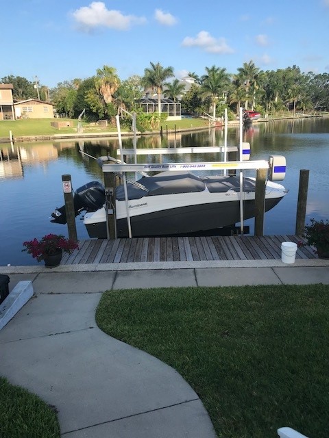
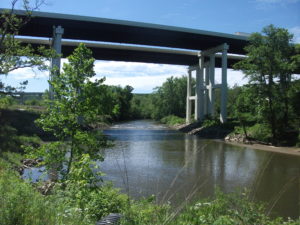
Phillippi Creek in southern Sarasota County
Click here to watch the summary video about the interviews we conducted in Sarasota County.
SW Florida, USGS map. Sarasota is midway along the central coast in this section.
One key point throughout the discussions was that Hurricane Ian at one point had been projected to move through Sarasota County before weather patterns in the Gulf of Mexico pushed it eastward into Lee County and Fort Myers instead. That near-miss still allows Sarasota County officials, like those further north in Tampa Bay, to make the point that preparation for a direct hit in a future storm is the entire region’s best bet.
Except for one unrelated post on July 4, it has been a while until now. David Taylor and I left Chicago on a road trip on July 6 to film in Colorado and Iowa, returning on July 18. The delay since then in putting this series back on track arose from both a short-term illness and a long to-do list of other tasks once I was back home, but here we are. We have much more to share now about Florida, Colorado, and Iowa to keep readers aware of our progress, so please keep tuning in every few days. We’ll be working to keep you updated.
If you wish to support the project, please use the QR code below for an online donation.
I wish to be clear about my purpose in writing this post. As an urban planner and researcher, I have doggedly sought to focus on known facts and accurate assessments of hazardous situations of any type. Sometimes, the truth is clear enough. In others, it is wise to withhold judgment while raising questions that deserve thoughtful answers. In this instance, there are so many aspects to the story of the condo building collapse that caution is the appropriate approach because new facts seem to emerge daily. One question—why the North Tower did not collapse while the South Tower did—may compel further inquiry on the role of condo boards in driving decisions about investing in maintenance before catastrophe strikes, but further investigation may reveal many nuances to that story as well. Complete answers are not always simple or obvious.
I have no intention of rushing to judgment on the tragedy in Surfside. But I do wish to focus on one issue that I know is endemic to housing development on a nationwide basis: the roles and responsibilities of homeowners associations (HOA) for managing and maintaining property. Condo boards are one specific subset of HOAs, based on the nature of the buildings. But the issues are not limited to such buildings; they can easily affect the management of townhouse developments and gated subdivisions as well.
Five years ago, when the American Planning Association (APA) and the Association of State Floodplain Managers (ASFPM) collaborated to produce a Planning Advisory Service Report, Subdivision Design and Flood Hazard Areas, we confronted one ticklish issue that concerned us greatly, albeit with regard to flood (and some other natural) hazards rather than structural integrity of tall buildings. The underlying issue, however, dealt with the capacity of privately governed homeowner associations to manage, finance, and maintain hazard mitigation infrastructure over time. Of course, one can easily broaden the definition of such infrastructure to include structural integrity repairs in a situation where buildings can potentially collapse, just as it might include the need to maintain the structural integrity of bridges to prevent such tragedies as the collapse of the I-35 bridge over the Mississippi River in the Twin Cities in 2007. There is considerable room for flexibility in defining the issue so long as the focus remains on public safety.
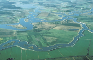
Our concern at the time was the potential for a financially challenged homeowners association or special district to fail to maintain critical infrastructure before a natural disaster leads to catastrophic failure, whether because of flood, landslide, earthquake, or wildfire, among other possibilities. Chad Berginnis, the executive director of ASFPM, alerted us to an article published by two lawyers involved in owner association litigation in California, Tyler Berding and Stephen Weil. They offered several examples of such situations including Bethel Island, which sits in the Sacramento Delta and includes about 2,500 residents whose homes are protected by more than 11 miles of levees that
USGS photo of Sacramento-San Joaquin Delta in California
circle the island, just 12 miles from the Greenville Fault. Throughout the Sacramento-San Joaquin Delta, the potential cascading impact of an earthquake triggering massive flooding with failed levees is a nightmare of major proportions. However, residents had defeated a proposed parcel tax to finance improvements through the Bethel Island Municipal Improvement District (BIMID), leaving the district broke and laying off staff. Berding and Weill offered a series of suggestions for better planning and management of these situations.
Whether the case involves a special district like BIMID or special assessments imposed by an owner association board, the issue is the local or private responsibility for financing and maintaining the protective infrastructure to avert such tragedies. Disasters are almost never solely a function of natural forces affecting human communities. They are also a function of the location, condition, and resilience of those communities, and the greater the exposure, the greater is likely to be the long-term cost of restoring that resilience over time to prevent catastrophic loss. In many cases involving floods, landslides, or earthquakes, insurance may be unavailable or financially problematic. The ultimate result can be a bankrupt association and property owners who cannot recover their losses, let alone rebuild, yielding a combination not only of loss of life and property, but of financial calamity as well.
Pad-mounted Transformer in a floodplain not elevated. Photo by Chad Berginnis from PAS Report, used with his permission.
In the report, we sought in several ways to address the issues posed by these dilemmas. We noted, for instance, that as of 2016, the Community Associations Institute reported that 66.7 million people, about 20 percent of the U.S. population, lived in some 333,600 common-interest communities, 55 percent of which were homeowners associations, the rest either condominium or other community associations. One result is the transfer of responsibility for infrastructure within a subdivision from the municipality permitting it to the HOA itself. The long-term problem is that association leadership not only changes over time but often lacks expertise pertaining to the significant risks and responsibilities involved. We suggested that local planning and other agencies extend technical assistance to overcome this gap. This gap, however, remains a serious problem in many communities. When disaster strikes, the idea of having shifted responsibility will become transparently short-sighted because the city or county will be providing emergency response and assistance, just as is happening in Surfside. It is impossible to ignore a disaster.
We noted that many such associations assume responsibility for stormwater infrastructure, such as detention ponds, seawalls, and levees, or even private dams. If they fall into disrepair, the flooding consequences can be severe, so provisions for inspection and maintenance are critical. It is vital for such association boards to understand, for instance, that levees are never totally flood-proof and failure can have various causes. Privately built and owned levees exist across the nation, many in poor condition, according to the American Society of Civil Engineers.
In short, these owner associations have assumed responsibility for some key areas of local flood risk management, including ponds, spillways, erosion and sediment control, flood control structural repairs, drainage improvements, managing vegetation that reduces flood risk, bridge maintenance, and open space management, among other possibilities. Given the potential financial and expertise limitations of these private associations, it may be incumbent upon local governments, in approving development, to assert some degree of control over the standards for approval, for which we offered several major recommendations for requirements related to maintenance costs and final plat approval.
There is, in the end, no perfect way to ensure adequate protection against disaster, but we were hoping to raise the level of concern and discussion, and attention to detail, in the relationships between local governments and owner associations as a way to avert tragedy and financial meltdown following disaster. It is not my intent here to explore the issue in depth but to introduce readers to the depth of the questions that these situations entail. Those wishing to learn more can follow the links to additional resources.
Hillsborough
County is a dense metropolitan area, anchored by the city of Tampa. Tampa and nearby
St. Petersburg, in
Pinellas County, sit on opposite
shores of Tampa Bay, a 400-square-mile
expanse of water connected to the Gulf of Mexico. Across
that gap sits the Sunshine
Skyway Bridge, a magnificent and scenic section of I-275. On a sunny day,
it displays coastal Florida in all its glory.
Eugene
Henry, like anyone else, enjoys those sunny days, but he also worries about
what may happen when the region suffers inclement weather. As Hillsborough
County’s Hazard Mitigation Program Manager, it is his job to think about how
well the area will fare under the impact of natural and other disasters, which
can include hurricanes, floods, tornadoes, sinkholes, and wildfires. At least
the first two are complicated by sea level rise, and one can easily argue that
climate change in a broader sense may well influence the damage from wildfires.
For those uninitiated in the particulars of Florida’s natural environment,
wildfires are a recurring feature. In what is ordinarily such a lush
environment fostered by rain and abundant sunshine, it takes only one drought
year amid high heat to turn dense vegetation into a tinderbox. It has happened
before, repeatedly.
But the biggest concern, by far, is the arrival of the Big
One, the high-intensity hurricane that the county readily admits it has escaped
in recent decades. In its Post-Disaster
Redevelopment Plan (PDRP), the county states forthrightly that this is
merely a matter of good fortune and that planners fully understand that the day
will surely come—and that they had best be ready for it. Disaster resilience in
the face of hurricanes is not a matter to be taken lightly with 158 miles of
shoreline along Tampa Bay, numerous rivers and streams, and numerous
vulnerable, low-lying areas. Absent serious attention to mitigation, damages
from a Category 4 or 5 hurricane, or one like Harvey that stalls and dumps
voluminous rain on an urban area, could become catastrophic.
But Tampa and Hillsborough County have been very fortunate.
The last Category 3 hurricane struck the area in 1921. What may have been a Category
4 struck in 1848, though wind speed measurements were primitive at the time,
and the U.S. had no official records yet. According to the county’s Local
Mitigation Strategy, that storm “reshaped parts of the coast and destroyed
much of what few human works and habitation were then in the Tampa Bay area.”
Tides rose 14 feet. Tampa was still a small city then, and Gene Henry wonders
about the staggering losses that might occur with a comparable event today.
I had long wanted to visit the area to see in person how
these issues are being addressed. I have known Gene for a long time, and I have
read the county’s PDRP, an extensive document laying out the county’s
preparations for recovery from disasters. But I had never been to Tampa. As the
result, however, of a personal invitation from a high school classmate, David Taylor, who now
lives in Sarasota,
my wife and I flew to Tampa February 20 and stayed with Dave and his wife,
Linda, for five days. Sarasota is about one hour’s drive south of Tampa. As
part of the trip, I arranged to meet with Gene the day after we arrived and
tour the county to see the hazard mitigation projects underway there. I also
delivered a one-hour lecture the following afternoon in West Palm Beach,
on behalf of Florida Atlantic University, as part
of a two-hour program that included a panel discussion following my talk on
“Recovery and Resilience: Facing the Disasters of the Future.” Not one to skip
a learning opportunity, Gene drove four hours from Tampa to attend the program.
But back to Hillsborough. My wife and I met Gene at the
county’s Emergency
Operations Center (EOC) around mid-morning, hopped in his county truck, and
took off. Our first stop was the Florida Center
for Design + Research, housed in the School of Architecture + Design at the
University of South Florida (USF),
Gene’s graduate alma mater. The school features an urban planning program where
he wanted us to meet Professor
Brian Cook. Planning students often take studio classes, which involve
design or research work on real-life community problems. Students learn to
define a community design or policy issue, work with clients, and try to
produce solutions that will be of some practical value to the community they
are serving. They typically work in teams. In this case, students were applying
geographic information system (GIS), or mapping, skills to determine areas of
high vulnerability to flooding and sea level rise in less affluent
neighborhoods. Gene’s county office collaborates with USF instructors to
identify areas of practical concern for the students’ work. The photos show
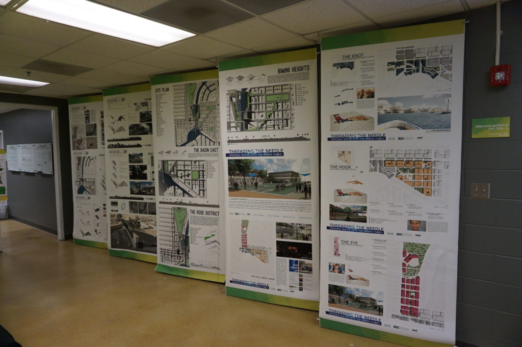
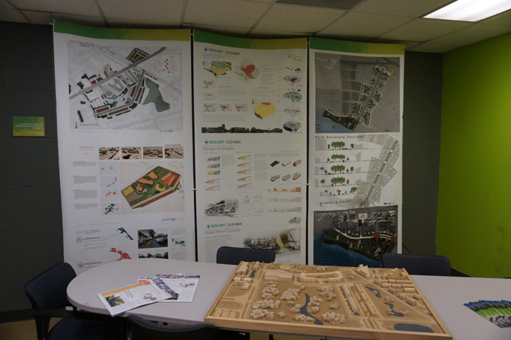
some of the design work the students have done, the best of which is often
displayed in poster sessions at state and national professional planning conferences.
Posters (above and below) from the USF design studio
The most encouraging aspect of that visit was, for me, the mere fact that the students are engaging with such a pressing problem. I have researched the issue of hazards and climate change in the planning curriculum for both undergraduate and graduate degree programs in urban planning, and most such programs are lacking in this respect, a situation that is disserving the planners of tomorrow who must be well trained to come to grips with these challenges in whatever communities they end up serving. But a growing number of students are getting such training—I have myself been teaching such a course at the University of Iowa since 2008—and southern Florida is as good a laboratory as they could wish for. To see collaboration between a county agency and USF graduate students and faculty is a most welcome note.
But Gene had other places to take us in the afternoon,
besides, that is, the Cuban-themed La Teresita restaurant
where we ate lunch—a place I am willing to recommend if you ever visit Tampa.
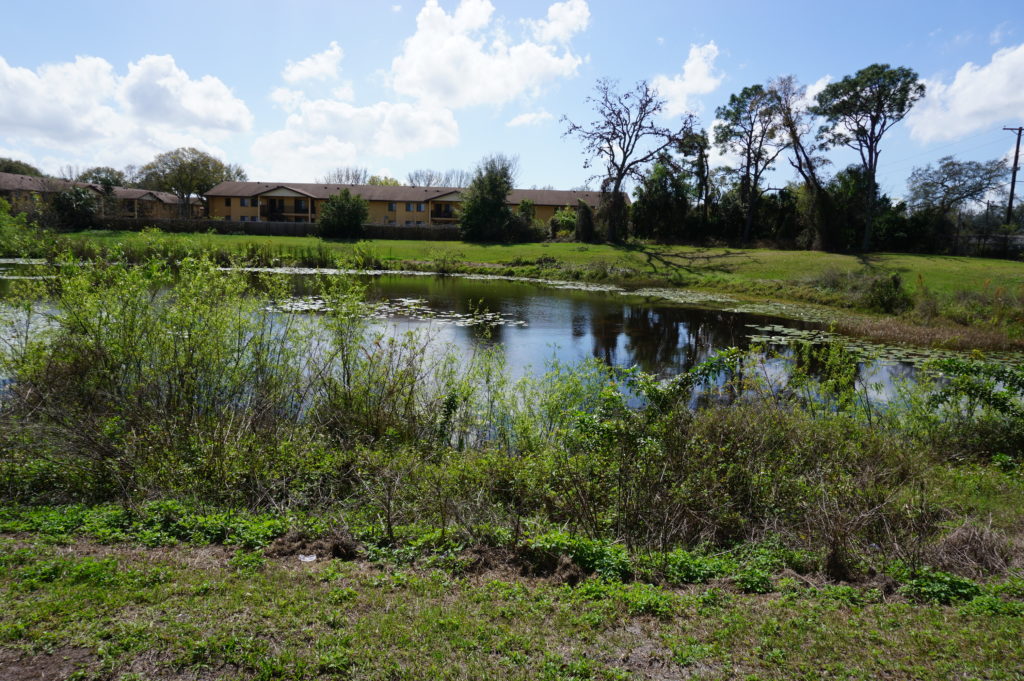
First up in the afternoon was the University
Mall area north of downtown Tampa and just east of I-275. This involves a
stormwater management and flood-mitigation project in an area subject to a
certain amount of repetitive loss, meaning that the same properties continue to
suffer periodic flood losses. The project removed structures while creating
additional areas for stormwater storage and reshaping a natural area known as
Duck Pond, thus creating a system for stormwater conveyance. This includes a
large stormwater pump that transfers slow-moving stormwater to areas further
downstream and, in due course, to a reservoir owned by the City of Tampa.
Before this project was initiated, storms used to inundate multifamily
apartment buildings, Gene says, as well as a nearby assisted living facility.
How does the county pay for all this? He credits a combination of local funds,
which is certainly not unusual, and federal money in the form of Hazard Mitigation
Grant Program (HMGP) funds. The latter are available as part of an overall
recovery package after a Presidential Disaster
Declaration, but require that purchased properties, once cleared, remain in
perpetual open space. The point is to ensure that a vulnerable area is not
redeveloped, thus perpetuating the problem.
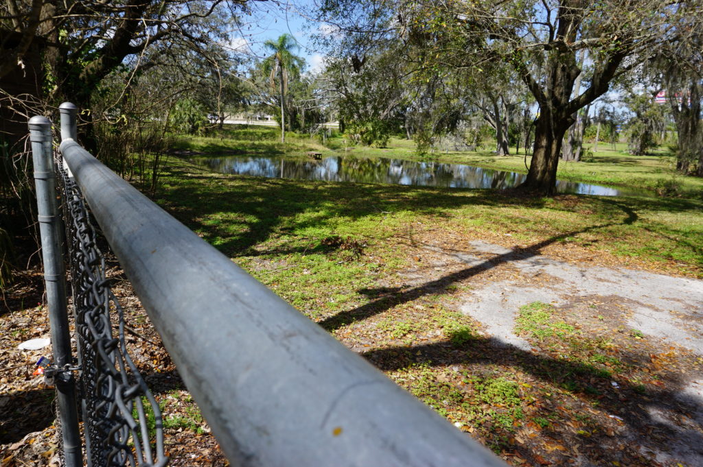
At 132nd Street, also in Tampa, another flood-mitigation
and stormwater management project presents a very different appearance. This
too was subject to repetitive loss and required protection from urban flooding,
which is typically the result of poor stormwater drainage in developed areas. The
problems can include poor water conveyance from one area to the next—the nearby
highway provided an impediment to drainage—and high levels of impervious
surface, meaning coverage with concrete and structures that limit percolation
of water into the soil. In this case, a small subdivision suffered repetitive
flooding even with small storms. Here also, the county acquired homes with HMGP
funds, which are dispensed by the Federal
Emergency Management Agency (FEMA). The streets were removed, and
stormwater ponds were added.
This was a location where the county’s partnership with USF
paid dividends. Researchers analyzed which plants were best at removing
nitrogen and other chemicals common in stormwater runoff in order to clean up
the water before it reaches Tampa Bay. Henry says this project was made
possible through a combination of local and HMGP funds in combination with
federal Community
Development Block Grant entitlement money.
I included the chain link in my photo to show that the solution may not be complete. After all, chain link fences are intended to limit access. What consideration, I asked, had been given to eventually converting this cleared area to some sort of public park and thus facilitating a public benefit? There can be challenges in part because of pollution cleanup and other public safety factors. Gene readily admitted he would love that solution, but it may take time. The adjoining neighborhood must be comfortable with that use, which can involve solving various site-related problems. A nearby church might be a potential ally, serving as a patron and watchdog, but reaching agreement about solutions and responsibilities, including ongoing maintenance and supervision, takes time. And only time will tell whether such a solution materializes with the support of local public officials.
Some projects assist a single homeowner with a stubborn
problem. This is often the case with homes that are elevated, a common site in
parts of the Southeast, where coastal and riverine flooding can wreak havoc
with homes in vulnerable locations that do not necessarily require buyouts and
relocation. That was the case near Rocky Creek,
where a homeowner rebuilt a structure elevated three feet above base flood
elevation (BFE) using a combination of private funds and a Flood
Mitigation Assistance (FMA) grant from FEMA. The result is living space
that is better protected when flood waters surround the lower level.
The same story occurred at a home near the Alafia River, where
another homeowner was elevated three feet above BFE, using the same combination
of funds.
Gene also shared with us an interesting strategy at a
frequently flooded and highly vulnerable modular home park, where an area had
been cleared of its former homes to allow repopulation with recreational
vehicles (RVs). The logic is that, when flood warnings arrive, RV owners will
be able, unlike those with more stationary modular homes, to simply drive off
the site to safer areas until the emergency subsides. The initiative, Gene
says, was taken by the park’s new owner (which owns other parks nationwide), which
identified no more permanent structures in the floodway as part of its
compliance strategy after the most recent flooding event in the area.
This area is slated for RV occupancy only.
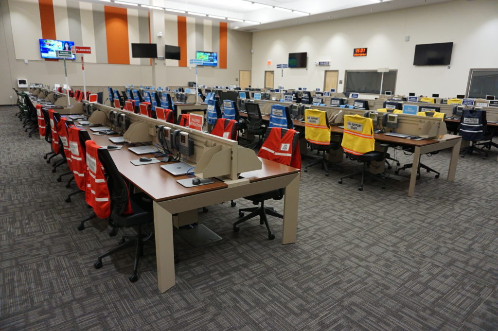
Finally, we returned to learn a little about the EOC. We
visited what is often known in such centers as the “war room,” where designated
officials meet to discuss and establish strategies for dealing with an
emergency of any sort that activates the emergency operations plan. In the
photo, each chair is designated for a specific official, with groups of people
with related tasks seated in color-coded sections of the room. Many such EOCs
are much smaller, but Hillsborough County is very urban and populated, and the
needs are complex and interrelated. It is expected that those involved will
arrive with authority to respond to the disaster, to indicate what they are and
are not capable of doing as part of the overall response to disaster. It is not
a place where one expresses a need to go back to another office and “find out.”
Hillsborough County Emergency Operations Center “war room”
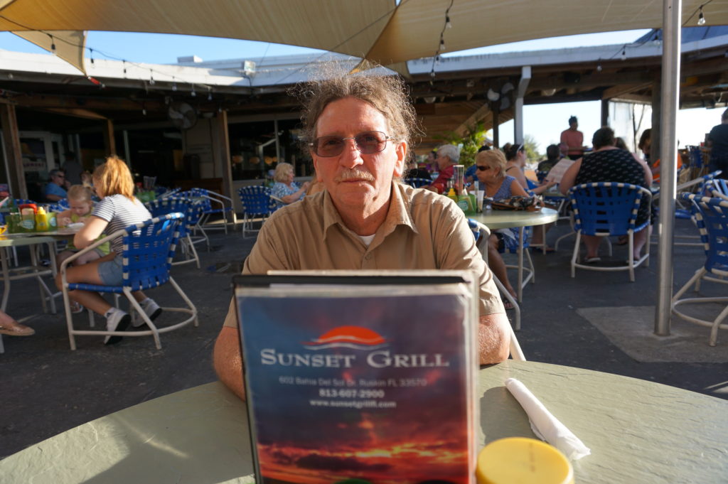
Ready to relax and enjoy a drink and a snack, we followed
Gene down the highway to the Sunset
Grill at Little Harbor, which has a beautiful view of the bay. At dusk,
numerous people followed a daily ritual of photographing the sunset over the
water. Tourist attraction it may be, as well as a local watering hole, but the
surrounding area has a significant mangrove forest and salt-bed areas that were
preserved as open space using Environmental Land Acquisition Funds from what
Gene describes as a “locally instigated preservation program.”
Hillsborough County’s Hazard Mitigation Program Manager, Eugene Henry, at rest at Sunset Grill at the end of our day-long tour.
And so, with the sun declining in the west, we sat at an
outdoor table and hashed over the world’s problems, and sometimes our own. One
point that seems clear to me is that Hillsborough County has a great deal to
offer to other jurisdictions, just as it has undoubtedly learned a great deal
as well—one reason both he and a resident scholar and Japanese graduate student
from the University of Illinois, Kensuke Otsuyama,
planned to drive to West Palm Beach the next day to hear my presentation. Although
there is sometimes a tendency for local governments to become more insular, to
allow fewer opportunities for employees like Gene to share and exchange
information in professional forums and conferences, this, I think, is always a
mistake. The growth in the value of what someone like Gene does lies in this
fruitful sharing of experience and perspectives that such opportunities allow,
and I hope that will continue, for certainly Gene made my day by sharing his
time to allow me to learn and to share with the growing readership that follows
this blog.
Supplemental Comment:
Although the hearing was held today, making live streaming a
moot point, significant written and recorded testimony on hazard mitigation and
climate resilience issues occurred before the U.S. House Appropriations
Subcommittee on Transportation, Housing, and Urban Development. Yesterday, the
following link was made available from several sources including the American Planning
Association (APA) to provide access to this testimony and information:
Representatives from APA, PEW, Houston Public Works,
Rutgers University, and the Town of Arlington, MA are delivering testimony to
the Transportation and Housing and Urban Development (THUD) congressional
subcommittee tomorrow, March 13th at 10:00 a.m. EST. THUD, a part of
the House Committee on Appropriations, writes laws that fund the federal
government’s important responsibilities. The testimony is available for
streaming here:
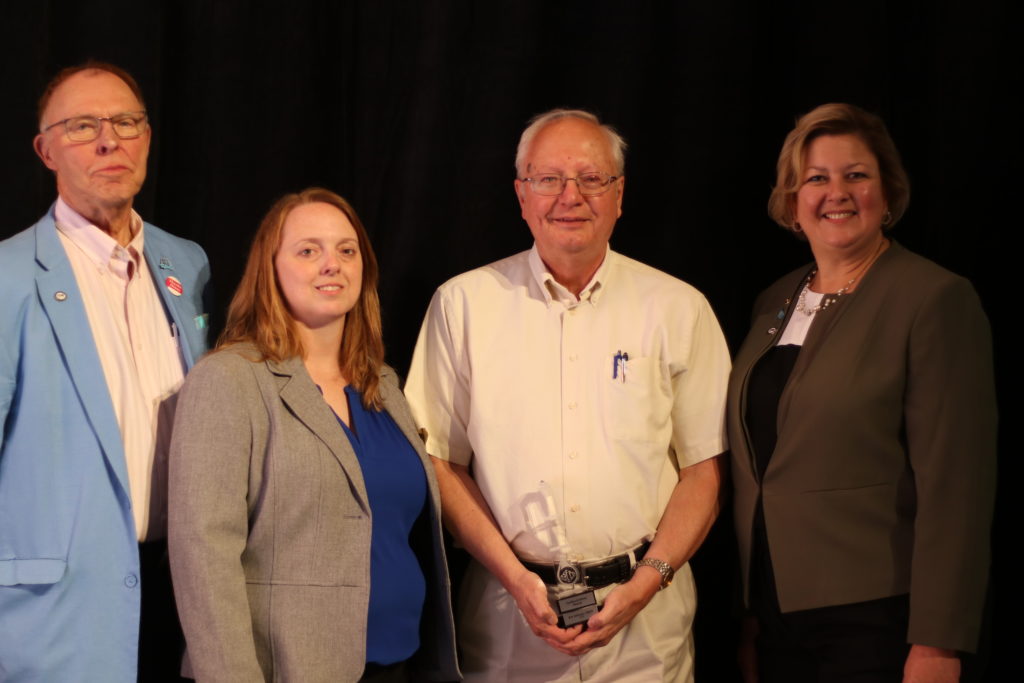
From left: Larry Larson; Maria Cox-Lamm, ASFPM Chair; myself; Ingrid Wadsworth, ASFPM Deputy Director
I confess: I was taken totally by surprise. Most of us, if we have a level head on our shoulders, do not do our work with the thought that we will some day be presented with a major award because of it. Especially those of us in the world of public service and nonprofits, where dedication to the greater good is a primary motive, even though we are not immune to thinking about raises and promotions, which, after all, may enable us to be more effective in what we do.
Consequently, when the Association of State Floodplain Managers (ASFPM) asked me to attend the annual ASFPM conference in Phoenix last week (June 17-21), I naively accepted the rationale that, since they had recently contracted with me as an independent consultant to lead the production of a Planning Advisory Service Report on climate resilience and capital improvements planning, under a Regional Coastal Resilience grant from the National Oceanic and Atmospheric Administration (NOAA), they needed me there to discuss the project. I had helped write the grant three years ago while still leading the Hazards Planning Center at the American Planning Association (APA), which became the major partner to ASFPM in conducting the three-year project. Although I retired from that position a little more than a year ago, there was a great deal of logic in bringing me back to see at least that part of the project to a successful conclusion.
There was only one problem in Phoenix. No one seemed all that concerned about spending time talking to me about the NOAA project. I was certainly learning a great deal by listening to presentations, and I certainly enjoyed networking with colleagues at receptions and in hallways at the Phoenix Convention Center, but the question was bugging me: Why did they really want me out here?
On Thursday morning, June 21, before the morning plenary began in the Ballroom, I approached David Conrad and Larry Larson at a front table after initially parking my belongings at another table further back. David Conrad was once with the National Wildlife Federation and wrote a path-breaking report following the 1993 Midwest floods. Larry is the former executive director of ASFPM and now a policy advisor working with current executive director Chad Berginnis. Both are prominent in the field of floodplain management.
I patted David on the shoulder and with self-effacing humor said, “I used to sit at the front table before I retired from APA, but now I’m nobody anymore.” They chuckled, and ASFPM’s public information officer, Michele Mihalovich, said from across the table, “Jim, you’ll never be nobody.” We all laughed, David invited me to join them, and I moved to the front table for the plenary. All good for a laugh. Afterwards, Larry made a point of asking me to find him at a front table, off to the side, for the awards luncheon at noon. Still clueless, I assumed he was simply being friendly but honored his request when the time came.
Lunch was served, and Doug Plasencia, president of the ASFPM Foundation, and Diane Brown, retiring from her post as outreach and events manager at ASFPM after 35 years of excellent service, introduced award recipients and their achievements one at a time, with images on the screen, and each winner stood with presenters for a photo. Interesting, I thought, in considering the various prizes, but routine. I was happy for the winners, some of whom I knew. Almost every national professional organization does such things. Meanwhile, I ate my salad, the roast beef entrée, and the dessert. In a little while, it would all be over, and we would move on to an afternoon of presentations and discussions in a variety of concurrent sessions. I flipped through the program to see what looked interesting.
Finally, Diane Brown began to describe the winner of the highest honor ASFPM bestows, the Goddard-White Award, described thus on the website:
“The Goddard-White Award is named in honor of the contributions made to floodplain management by Gilbert White (1911- 2006) and Jim Goddard (1906-1994). This award is given by ASFPM to individuals who have had a national impact carrying forward the goals and objectives of floodplain management. It is an indication of the level of esteem the association holds for the two namesakes as well as the recipients and is ASFPM’s highest award. It is not necessarily presented every year.”
I’m not sure because one does not time such things. I believe it took about 30 seconds of Diane’s narration of the story behind this year’s award before it suddenly dawned on me that I was the person they were talking about. I had never spent one minute before that contemplating this specific award or how I might have anything to do with it. The revelation that I was a recipient struck me like a lightning bolt. Larry was looking toward me, and I pointed to myself silently as if so say, “Moi?” He kept his Cheshire cat smile and waited for the emcees to invite me forward. Larry, by the way, was in 1985 the very first recipient of this honor. He had known all along precisely what was coming. Diane invited me to the podium to say a few words. A few tears started to run down my cheeks, so I struggled to get them under control. At the podium, Diane asked, “Are you okay to talk?” I nodded yes.
I cannot repeat verbatim what I said because it was all spontaneous, but I know that I began by saying that we in the hazards world are “supposed to be prepared. I am not. You caught me off guard.” I took the crowd on a two-minute tour of what we had achieved together in the partnership of recent years that I helped construct between ASFPM and APA, and said, “Eventually, you look back and ask, ‘Did we do all that?’” I then explained that it was not just me. I had learned a great deal over the years from many other people, that big achievements require collective effort. And I thanked everyone for this high honor before stepping over to the curtain for a photograph that you see above.
It is hard to top such an honor, except in one way: It is important not to rest on these laurels, but to continue to contribute, to encourage others to find their passion, and to remain an effective voice for positive change. I hope I am doing that and can remain part of the action for many years to come. Thanks, ASFPM. I hope I can prove you right.
Amid the whirlwind of disasters this fall—three major hurricanes hitting the U.S., earthquakes and another hurricane hitting Mexico, wildfires in northern California—it is easy to forget that people hit by other disasters as recently as a year ago are still laboring toward long-term community recovery from the damages those events left behind. One of those places is North Carolina, which suffered flooding in several small communities in its eastern Coastal Plain from Hurricane Matthew. The Federal Emergency Management Agency (FEMA), of necessity, may shift its energy and resources to new places, but the communities and states trying to recover cannot escape the realities of rebuilding their own futures.
I was in North Carolina just two weeks ago for the annual conference of the North Carolina chapter of the American Planning Association, in Greenville. This city of about 90,000 is just an hour west of the Outer Banks, depending on which roads are open. (Hurricane Maria was kicking up waves as it moved north out in the Atlantic Ocean while I was there.) Much of the surrounding area consists of farm country and small towns nestled in river valleys subject to flooding in major storms including tropical storms and hurricanes. In the 1990s, the area was visited by Hurricanes Floyd and Fran, both of which left their marks. I had hoped to travel the towns affected by Matthew with a colleague, but it did not work out. But I did listen to a keynote presentation by Gavin Smith, a research professor at the University of North Carolina (UNC) in Chapel Hill and director of the U.S. Department of Homeland Security’s Coastal Resilience Center of Excellence, located at UNC. I was there because I had been invited to speak at two sessions, one on September 26 on community resilience and another the next day on flood hazards and subdivision design.
What Smith served up was a primer in planning for climate change and disaster recovery with a side order of North Carolina case studies. I don’t say that to be cute, but because I have discussed at length the issues associated with the former, so here, I will concentrate on the latter. I will note first, however, that he highlighted some issues connected with disaster recovery that are worth considering:
Disasters tend to bring to the forefront of community planning existing conditions that may have been less obvious beforehand, but which are not new.
Disaster involves opportunity, a unique situation in which good planning can effect positive change. Because planners are generally interested in advancing equity, this is important, as developers are often dictating growth even when it negatively affects some economically marginalized people in the community.
This post-disaster environment provides an opportunity to engage in alternative dispute resolution, with planners using negotiation to help resolve difficult issues.
The reality of disaster recovery is time compression, the need to move quickly even though better planning may demand stepping back and investing more time in deliberation before making decisions. We can alleviate some of that pressure by developing plans for recovery before disaster strikes.
That is, in a way, all background to the simple fact that one role for planning is to help change the rules governing recovery through serious engagement between local officials, who generally better understand local needs, and those at state and federal levels of government, who generally control more of the resources needed for successful recovery. In other words, planners need to help solve the disconnect between means and understanding. Communities that passively await rescue by higher levels of government without undertaking the task of owning their own recovery may well face consequences in the misallocation of the resources provided.
The Hurricane Matthew Disaster Recovery and Resilience Initiative (HMDRRI) has specifically worked with eight communities in eastern North Carolina under the auspices of the North Carolina Policy Collaboratory. Smith is the project director. It began with a research period that ran from February through June of this year. The project included intake interviews with people in the affected areas who were willing to pursue buyouts of their properties, which would then be maintained in perpetual open space under rules of FEMA’s Hazard Mitigation Grant Program, and discussed with them where they were willing to relocate. The program developed housing prototypes for affordable homes in the $90,000 range that would allow buyers to stay in their communities without remaining in the floodplain. One major question was whether they could endure as a community after such relocation, which is affected by area geography and topography and the ability to identify and develop suitable alternatives. It should also be noted that eastern North Carolina has been through much of this before. Following Hurricane Floyd in 1999, the state undertook buyouts of more than 5,000 homes and assisted in elevating another 1,000.
Camp shelter in Windsor, NC, one of the communities assisted by HMDRRI. Photo by Gavin Smith
The HMDRRI research product is a 580-page report that outlines project objectives and documents economic, housing, and other conditions in both the region and the communities specifically targeted by the project: Kinston, Fair Bluff, Windsor, Princeville, Lumberton, and Seven Springs. This documentation is critical to an accurate assessment of the challenges facing the region. For instance, the standard determinant of housing affordability is the ability to limit spending on housing to 30 percent of income. People in lower-income brackets often struggle to find such housing, and often it requires subsidies or some sort of intervention in the housing market. Within the coastal counties studied, however, the reasons for shortages of affordable housing can vary widely, as can its quality. The resilience of affordable housing in an area subject to coastal storms and flooding is important, yet the abundance of mobile and modular housing in the region offers little resilience in the face of disaster, and septic systems associated with much modular housing often make those homes even more susceptible to flooding. Thus, solutions must address both resilience and affordability to provide some semblance of social equity in disaster recovery.
The intriguing model offered by HMDRRI, however, is the systematic engagement of the academic community in what is simultaneously a practical learning experience for students and faculty, an opportunity for introducing the skills of practicing design professionals to the area, and a direct connection to state and federal officials, for instance, by allowing student and faculty teams to work in the FEMA Joint Field Office (JFO) and thus access data that might not otherwise be readily available. This included interaction with FEMA’s Community Planning and Capacity Building team, part of the larger federal Disaster Recovery Framework. The report, more readable than its length might suggest, includes a substantial section called Home Place that helps facilitate the transfer of design practices to the community level to empower better local recovery planning.
An example of this occurred in Princeville, which Smith described as the oldest African-American community founded by freed slaves. In August, HMDRRI hosted a five-day charrette with visiting architects, three-quarters of them African-American, who worked directly with the community on land-use and design solutions for relocating homes from the floodplain to a higher, 52-acre site still within the city limits. Helping the community to understand and come to terms with the land-use changes resulting from the recovery from Hurricane Matthew is critical to long-term success. The verdict is necessarily still pending in this case, but it may provide a solid case study for future efforts elsewhere. Smith also noted one other important aspect of the charrette experience: Participants were asked to check in daily to document the time they spent. Creative people that they were, the initial reaction was some resentment at being subjected to this bureaucratic procedure until it was explained that documenting their contribution of time was essential to showing a local match for federal funds supporting the project. Approximately 100 people were credentialed for the purpose. At that point, they complied enthusiastically because they understood the purpose as something more than mere bookkeeping. They were helping the community marshal badly needed resources.
It is worth noting that the report recommends that the North Carolina Governor’s Office form a standing committee to provide recommendations for policy, programming, and funding strategies for development of adequate housing in eastern North Carolina. The report also notes interest from Texas and Rice University in the model for state/academic collaboration that HMDRRI offers. This is part of the silver lining of disasters: the emergence and dissemination of positive and innovative solutions to common problems.
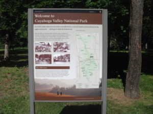
Two weeks ago, I wrote about Cleveland’s Flats Entertainment District, where restaurants and bars now line the sides of the once filthy Cuyahoga River that now hosts boats and rowers. The Flats is but the last reach of a river that extends south into the Akron area. What has often been far less well known to outsiders than the more notorious industrial past of the river is the beautiful, forested valley that surrounds it upstream. In fact, about the time the Cuyahoga River was making environmental history by becoming a driving force behind passage of the Clean Water Act in 1972, U.S. Rep. John Seiberling, an antiwar Democrat from Akron, was leading an effort to designate a new national park. By 1974, he had won authorization for the creation of what is now the Cuyahoga Valley National Park, which remains a hidden treasure for many. I have personally discovered from discussing our trip that many people outside Ohio do not even know that the park exists.
As for the Cuyahoga Valley National Park: Yosemite or Yellowstone it is not. Ohio, which became a state in 1803 and rapidly urbanized and industrialized afterwards, does not offer such massive public spaces for preservation. But it does contain gorgeous smaller valleys such as the Cuyahoga where protection of the landscape was still possible in the 1970s, and land was assembled from numerous small landowners and public spaces, woven in some cases into the fabric of the existing Metroparks system. In the area that contains the park, certain places seem to take one back in time to the 19th century, when Ohio built a canal to connect the Ohio River and Lake Erie and move agricultural and other products to markets a generation before the railroads began to dominate. Towns such as Peninsula and Boston, in the heart of the upper Cuyahoga Valley, still have the small town feel of that era in many ways, and many older homes have been preserved.
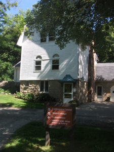
One, in fact, now hosts the Conservancy of the park, along Hines Hill Road just east of Boston, where one finds the visitor center. When we arrived, staffers were erecting a tent for an outdoor wedding that weekend. Curiously, we were also in town for an outdoor wedding for one of my nephews, but his was at Thorn Creek Winery in Aurora, several miles to the northeast. Although we merely stopped to investigate the scenery, and we were totally unexpected arrivals in the Conservancy office, the staff in the office treated us like honored guests, plying us with materials about the park and answering questions. Their friendliness is a tribute to the attitudes and sense of mission of both the Conservancy and the National Park Service itself.
The park itself is a fantastic playground for hikers, bikers, backpackers, and even skiers and sledders. This is the north, after all. Near the Boston Visitor Center is the Boston Mills ski resort, offering some modest hills but great accessibility for people in the metropolitan area. But we arrived in June, and we began to wander the Towpath trail that leads away from the visitor center back into the forest, south beyond the massive bridge that carries Ohio Turnpike travelers past the Cuyahoga River below. From the height of the turnpike, one might never realize that what lies below is a national park, although it is certainly an impressive expanse of forested greenery. Down below, however, we were treated not to nature’s silence but to its music. For one thing, it was cicada season, so the buzz was all about the woods, but so were the birds, some of whom may have been feasting on cicadas. We surely could have seen other wildlife, had we come around dawn or dusk, but we were hiking in the late morning, when the deer and the rabbits and coyotes were well hidden. It is remarkable how easy it is to get away from everything, although the trails are popular enough to keep you in touch with other passing humans. The trails seemed to attract both young and elderly, providing a great excuse to all ages to stay in shape and in touch with nature. I began to wish I had tree and bird guides with me to better understand parts of my experience. If I still lived in the area, I might revisit with those guides, but it may be a while before I return.
Our hiking visit occurred on a Thursday. Jean and I made a return visit on Friday, but of a different nature, and one that accommodated my sister, Carol, who lives nearby in North Royalton. She joined us at the parking lot on Rockside Road in Independence at 9 a.m. for the Cuyahoga Valley Scenic Railroad, a fine way for first-time visitors (and others) to see the park and its valley from a different perspective. The CVSR is a passenger train that uses tracks that largely run along the edge of the river. It is mostly run by volunteers who simply love the job of educating people about the local environment and its history. Audio is available that allows you to hear some of that history along with what one crew member jokingly referred to as “some pretty bad music,” most of it evoking a sense of bluegrass and Civil War and the early frontier with the use of banjos and bass fiddles. Call it “mood music.” The train ride takes about an hour and a half to get to Akron before turning around and bringing you back to where it started. Along the way, there are several stops that allow riders to get off and explore and then wait for the next train coming through. Explorers may want to get the schedule before they wander off. The price is only $15; as senior citizens we got tickets for $13. The money supports the train and is well worth it for the scenery along the way.
Because the park is interwoven among small towns and private property, the park leases some land for sustainable farming of vegetables and sheep, goats, and chickens, with some of the products finding their way to the Countryside Farmers’ Markets. The Conservancy staff also noted for us that there is now a visitor home in the park called Stanford House, built in 1843. It is not a bed and breakfast because visitors are on their own in sharing the use of a kitchen, but rooms can be rented starting at $50 per night, and the home provides immediate access to the Towpath Trail and the railroad, among other attractions.
Ultimately, the Cuyahoga Valley National Park is a study in adaptation, fitting a park into the scenery of a river valley that is also at the center of the large Cleveland-Akron metropolitan area. The park has been evolving since its advent in the 1980s and will continue to evolve as conditions change. But one major contribution it has already made is to stymie the urban sprawl that has so adversely affected much of the Cleveland area and allow residents to enjoy an expanse of refreshing greenery.
One reason it has taken two weeks to return to this blog and tell the story, since we returned to Chicago on June 12, is that I left again on June 19 for Grand Rapids, Michigan, to participate in the 40th annual conference of the Association of State Floodplain Managers, which was founded about the same time the national park was being organized. Today it is a growing organization of more than 17,000 floodplain managers, about 1,000 of whom attended the conference at the DeVos Convention Center, which sits along the Grand River opposite the Gerald R. Ford Presidential Museum, to which it is connected by a stone pedestrian bridge. ASFPM members have always been familiar with nature-based strategies for reducing flood damages and preserving the quality of rivers and streams, and the conference contained numerous discussions of such approaches. It occurred to me that what I had seen in the Cuyahoga Valley was one of the best possible approaches to floodplain management, the prevention of the encroachment of development to allow nature its due, preserving a natural setting that nonetheless endows humans with wonderful opportunities for outdoor recreation and exercise in an age when public health authorities worry about an epidemic of obesity. We have to make our cities attractive places for people to get the exercise they need. Many factors in the Cleveland metropolitan area, frankly, work against that goal, but the park exemplifies it. It is modern floodplain management at its best with a healthy dose of environmental protection in the bargain. The fact that the park is sprinkled with outdoor attractions like the Blossom Music Festival only serves to enhance that goal by acquainting people with what the park has to offer.
John Seiberling was clearly a visionary in fighting for the creation of the park in Congress. But every city has its environmental champions. It is the job of the rest of us to make it politically possible for them to survive and to achieve their objectives. We all benefit from a better quality of life when they do.
As for the title of this blog post: The Cuyahoga River derived its name from the local nomenclature of the Mohawk Indians, an Iroquois nation, who referred to the river as “crooked” because of the way it winds through the landscape, hence “crooked river.” (The Seneca, also Iroquois, used a similar name.) Meandering is nature’s way of diffusing the force of flood waters while distributing silt into the rich agricultural soils along the banks. Ohio grew up on such wealth. Now it is preserving some of it.