Fatal Attraction

Explaining the frustrations of first responders in searching Mexico Beach, Florida, for survivors after Hurricane Michael, Brock Long, administrator of the Federal Emergency Management Agency, told Associated Press, “Very few people live to tell what it’s like to experience storm surge, and unfortunately in this country we seem not to learn the lesson.” Mexico Beach was ground zero for landfall of the hurricane a few days ago.

But then Long was much more direct: “When state and local officials tell you to get out, dang it, do it. Get out.”

The desire or willingness to “ride it out” among people who think the storm will never be as bad as they are told is unquestionably one of the most troubling facets of disaster response, especially when there is adequate warning.

There are disasters, of course, where adequate warning is either extremely difficult or nearly impossible. I still vividly recall one evening in 1979, when, living in Ames, Iowa, I was awakened from a second-story bedroom at about 3 a.m. by the loudest roar I had ever heard. I turned to the window to see total darkness, and aside from the howling winds, no clue of what was unfolding. When it finally passed, I went back to sleep. The next morning, I learned from the newspaper that a small tornado had struck about a mile away, lifting the roofs from seven homes before skipping off into the sky again. On the other hand, we had no cell phones and no reverse 911 in 1979.

Wildfires often give but a few minutes of warning, and earthquakes generally none at all. Hurricanes are different, at least today. In 1900, when more than 6,000 residents of Galveston were swept to sea in the deadliest storm in American history, they had no meaningful warning. In 2018, we have the best satellites the federal government and private money can buy, and we typically know at least 48 hours in advance that a coastal storm is coming, although its strength can change quickly. What we surely know in any case is that, if you live on the Gulf Coast or the Atlantic Coast in the U.S., you can expect hurricanes. Only the frequency and severity vary, and they are not always predictable. But people generally have plenty of time to learn what to do when the time comes. The rest is a matter of cooperation.

There is, of course, the question of why people choose to live in the most vulnerable locations. Early in my quarter-century of involvement in hazards planning, I borrowed

No question about it. The seashore can be a profoundly attractive place in calm weather. The question is both how we build and where we build, and, in the process, what burdens we place on first responders.

the title of a 1987 mystery thriller, The Fatal Attraction, to describe the psychology of our very human attraction to seashores, wooded mountains, and beautiful sunrises. Living on the seashore can be indescribably beautiful under blue skies and balmy breezes. There is nothing wrong with enjoying all that under the right circumstances, but it is critical that we begin to learn our own limitations in adapting to such environments, the need to build appropriately in such locations, and when it is time to simply “get out,” as Long suggested. If we don’t do these things, we are often placing inexcusable burdens on first responders who must dig our dead or injured bodies from the wreckage or save our homes from raging wildfires.

In short, there are times in life when we must be willing to think about more than ourselves. Saving our own skin in the face of oncoming natural disaster is not only not selfish; it is downright thoughtful with regard to the burdens otherwise placed on police, firefighters, and emergency medical personnel.

I am aware that the issue is bigger than I have just described. In another month, I will be speaking about post-disaster recovery to an audience of long-term care health professionals. As a society, we also have obligations to ensure that the elderly live in homes that are removed from floodplains and other hazards, that children attend schools that are as safely located as possible, and that we do not force the poor and disadvantaged into neighborhoods that are at risk and where no one else would wish to live. In New Orleans during Hurricane Katrina, the system failed thousands of poor people who did not own cars by failing to provide means for carless evacuation. The sheer number of such people was never a secret to officials in Louisiana, but good planning never happened before it was too late. All that said, those who have the means should have the willingness to consider both where they choose to live or build and to evacuate when told to do so.

We can all hope that the body count from Hurricane Michael remains low. As of the moment I am writing this, authorities have counted 17 deaths, but it may rise.

Long-term recovery awaits communities affected by either Florence or Michael. As always, serious questions can be posed about where and how to rebuild, whether we can make communities more resilient against future disasters, and what vision states and communities should have as they move forward. In its Influencers series, the Charlotte Observer asked what leaders thought North Carolina could do for coastal and inland communities affected by flooding from coastal storms. Interestingly, many cited setbacks from the coast, accounting for climate change (something the Republican-dominated legislature has explicitly chosen not to do), and keeping new development out of floodplains. All these efforts would make it easier to plan evacuations in the first place. The issue is whether North Carolina, or any other state in the path of such storms, can muster the political will to do what is right.

And whether people who live in highly vulnerable locations can heed the call when told to evacuate.

Jim Schwab


The Predictable Impact of Florence

Flooding in Rosewood in Horry County, SC, September 24, 2018 (All photos by Allison Hardin with exceptions of FEMA photo from Hurricane Floyd and Charlotte image.)

It has been a few weeks of drought on this blog, but just the opposite in North Carolina, where Hurricane Florence dropped up to 30 inches of rain in some locations, and floods migrated downstream via numerous rivers to swamp cities both inland and near the coast. Now, Hurricane Michael threatens to compound the damage as it migrates northeast from its powerful Category 4 assault on the Florida Panhandle, with storm surges up to 14 feet in areas just east of the eye, which made landfall near Panama City.

The blog drought was the result of both a bit of writer’s block, mostly induced by a busy schedule that included two conference trips over the past three weeks, combined with a bit of fatigue and a few significant diversions of my personal time. But that may be okay. My intent was to write about the recent hurricane along the East Coast, and sometimes letting the subject ferment in the mind results in a more thorough and insightful perspective. I hope that is the result here.

Storms never happen in a vacuum. In a world with relatively few uninhabited places, their impact is the result more of patterns of human development and the legacy of past choices in land use and building practices than of the storm itself, which is, after all, simply a natural and very predictable event. Hurricanes were part of the natural cycle on this earth long before humans took over the planet (or thought they did).

Hurricane wind warning at bridge in Socastee, South Carolina

But they appear to be getting worse, and climate change, most of it almost surely attributable to human activity, is an increasingly evident factor. Meteorologist Ken Kunkel, affiliated both with the National Oceanic and Atmospheric Administration and North Carolina State University, stated that Florence produced more rain than any other storm in the last 70 years except for Hurricane Harvey last year. According to Kunkel, five weather stations over an area of 14,000 square miles in the Carolinas recorded an average of 17.5 inches. Harvey’s average was 25.6 inches. By comparison, Chicago averages about 37 inches for an entire year. Such heightened precipitation levels are in line with expected impacts of climate change.

What became obvious to me early on was that Florence would rehash a certain amount of unfortunate North Carolina history regarding feedlot agriculture. I am familiar with that history because 20 years ago I authored a Planning Advisory Service Report (#482) for the American Planning Association, titled Planning and Zoning for Concentrated Animal Feeding Operations. (In that same year, APA also published PAS 483/484, Planning for Post-Disaster Recovery and Reconstruction, for which I was the lead author and project manager.) I want to emphasize that what happened in North Carolina was not unusual. Nationwide, many states have laws dating to the 1950s that exempt all or most agricultural operations from county zoning ordinances. Most of these were intended to create a friendly regulatory environment for family farms, and they were often followed by other “right-to-farm” laws designed to shield farmers using conventional farming methods from nuisance lawsuits. Only later, as the large feedlots known also by the acronym “CAFO” became widespread, did it become clear that such exemptions, by then fiercely defended by industry groups, became giant loopholes for the detrimental environmental impacts of such operations. This story has been repeated in Iowa, Missouri, Utah, and numerous other states.

In North Carolina in 1991, State Senator Wendell Murphy, who owned a direct interest in the growing Murphy Family Farms, engineered passage of a law widening the state’s exemptions to include CAFOs. Within two years, as I noted in the report, North Carolina’s hog population shot up from 2.8 million to 4.6 million. Today, the number is at least 9 million. A public backlash at the impacts of CAFOs resulted in a new law in 1997 that included a moratorium on new waste lagoons, but by then, although the hogs were firmly ensconced in a growing number of feedlots, the figurative horse was out of the barn. Many counties in eastern North Carolina, where the industry was concentrated, were slow or reluctant to use their newly regained powers. In any case, various large operators were effectively already grandfathered into continued existence. Today, consolidation within the industry has left Smithfield Foods in possession of most of the business in North Carolina, yet Smithfield itself was acquired by the Chinese-owned WH Group several years ago.

Grenville, NC, September 24, 1999 — The livestock loss and potential health hazard to Eastern North Carolina is huge. Here volunteers have towed in dead and floating cattle from a nearby ranch at Pactolus, NC (just North of Greenville), trying to remove them as fast as possible to lower the potential health hazards associated.
Photo by Dave Gatley/ FEMA News Photo

Along came Hurricane Floyd in 1999. The low-lying plains of eastern North Carolina, always vulnerable to flooding, were deeply awash, but worse, filled with millions of pigs and poultry and their excrement in manure lagoons. Hurricane Dennis just weeks earlier had dumped 15 inches of rain on the region, and Floyd dumped even more in some areas. The Tar and Neuse Rivers, among others, badly overflowed their banks and inundated numerous farms. More than 110,000 hog carcasses, and more than 1 million chicken and turkey carcasses, floated downriver while waste lagoons were breached, creating a stench-filled public health disaster only partly solved when the U.S. Environmental Protection Agency brought in huge incinerators to burn carcasses, though most animals were buried. It was a fiasco that did not have to happen at the scale on which it occurred.

Fast forward to this year and Hurricane Florence, presuming a surfeit of lessons to be learned from the 1999 disaster as well as later storms. As Emily Moon notes in the Pacific Standard, North Carolina has had opportunities over the past 20 years to introduce serious regulatory change, but various factors foiled those chances, and North Carolina remains the nation’s second-largest hog producer, having pushed aside every state but Iowa. The industry has evolved, but the problem remains. The state has bought out 46 operations since 1999 and shut down their lagoons, but the vast majority remain in operation. The numbers changed in Florence—more than 3 million chickens and 5,500 hogs dead and afloat in the flood waters—but the devastation rooted in CAFO practices continued. Coal ash landfills associated with power stations added to the environmental impacts. And the beat goes on, in a part of the state heavily populated by African-Americans, many too poor and powerless to challenge the system effectively without outside help.

I mention all this aside from the obvious human tragedies of lost lives, ruined homes, and prolonged power outages affecting some 740,000 homes and businesses.

Flooding at Arrowhead Development in Myrtle Beach, SC, September 26, 2018

Still, there are significant lessons available from Hurricane Florence outside the realm of mass production of poultry and hogs, and I want to offer a positive note. One is that, while only about 35 percent of properties at risk of flooding in North Carolina have flood insurance, which is available from the National Flood Insurance Program, neighboring South Carolina ranked second in the nation with 65 percent coverage. While I do not know all the details behind that sizable difference, it seems to me there is surely something to be learned from a comparison of these results and how they were achieved. They come in the context of a “moonshot” by the Federal Emergency Management Agency to double flood insurance coverage nationally by 2022. That will happen when South Carolina becomes the norm rather than the exception. Sometimes we can use these events to push in the right direction. Texas, for instance, has added 145,000 new flood insurance policies in effect since Hurricane Harvey; the question will be whether the new awareness wears off as memory of Harvey fades, or whether the state can solidify those gains. For that matter, can the states in the Southeast—the Carolinas, Georgia, and Florida—leverage the lessons of Florence and Michael to push in the same direction?

Hidden Valley drainage restoration project, Charlotte, NC. Image courtesy of Tim Trautman.

Recently, Bloomberg Business News offered an example within North Carolina of how differently floodplains could be managed by highlighting the case of Charlotte and Mecklenburg County. I worked for several years in a series of training workshops on flood resilience with Tim Trautman, the manager for the engineering and mitigation program for Mecklenburg Storm Water Services, so I am familiar with their intriguing story. The county for many years has used a stormwater utility fee on property owners to fund its own hazard mitigation program, using the money to buy out flood-prone properties and increase open space in its floodplains. The result has been a significant reduction in flood-prone land and buildings. The question is not whether Charlotte is successful, but what state and federal programs and authorities can do to encourage and support such efforts and make them more commonplace.

Every serious disaster offers lessons and opportunities, and I am not attempting here to pick on North Carolina alone. Other states face their own challenges; Iowa, for one, is undergoing a somewhat muted debate about the impact of its own farm practices on downstream flooding and water quality, in part as an outgrowth of the 2008 floods. What is important is that we use these windows of opportunity, the “teachable moments,” as they are sometimes known, to initiate the changes that are surely needed for the long term in creating more resilient, environmentally healthy communities. What we do not need is a natural disaster version of Groundhog Day.

Jim Schwab

Taking Stock of Recent Disasters

Photo by Jeff Clevenger

We learn from disasters as we recover from them, but each disaster teaches slightly different things. Sometimes the lessons are significant and historic; in others, one community is learning what others already know or should have learned from their own past events. Some years are relatively quiescent, as 2018 so far seems to be. And some become relentless slogs, like 2017.

Adam Smith, lead scientist for the National Oceanic and Atmospheric Administration’s National Centers for Environmental Information, noted in a plenary panel in July for the 2018 Natural Hazards Workshop, in Broomfield, Colorado, that the tally for 2017 disasters had exceeded $200 billion. This is more than 40 percent of the tally so far of billion-dollar disasters for the entire decade beginning in 2010. Simply put, with three major hurricanes—Harvey, Irma, and Maria—striking parts of the southern U.S., followed in short order by some of the most expensive wildfires in California history, it was a wild, taxing year in the world of emergency management.

But our attention fades quickly. Right now, there are no equivalent disasters seizing our attention, but in time there will be. The people who remain painfully aware that recovery is a long, slow process are those directly affected, and even many of them will not fully grasp the ways in which past location choices and patterns of development have brought them to this pass. Many had no choice anyway. Our communities are frequently full of social inequities that compromise the life choices of the poor and disabled. In other cases, the losses inflicted on neighborhoods are the result of hubris on the part of developers, city officials, and homeowners themselves. It does not hurt, approximately one year after these combined events, to look at what we know so far about the recovery following them.

Apparently, the U.S. General Accountability Office (GAO), an arm of Congress, agreed that the time was ripe for review because it has released a study, 2017 Hurricanes and Wildfires: Initial Observations on the Federal Response and Key Recovery Challenges. Because of the severity of challenges in Puerto Rico, one may note from the graph below, reproduced from the report, that Hurricane Maria by far entailed the largest federal expenditures.

In spite of that level of effort, Puerto Rico has engendered the most significant criticism of the performance of the Federal Emergency Management Agency (FEMA). Maria struck Puerto Rico and the U.S. Virgin Islands (USVI) after Harvey had already drenched and flooded coastal Texas, and Irma had swept through much of Florida.

FEMA teams managing the distribution of water, and meals for hundreds of semi-trucks at an incident Support Base in Seguin, Texas. Photo by Dominick Del Vecchio – Aug 29, 2017

The report notes that, as a result, FEMA resources were severely stretched by then, only to have wildfires in California add to the pressure, though the personnel assigned in the last case were small compared to the hurricanes (as is typically the case). Adding to the challenge, Puerto Rico and USVI are offshore and were also poorly prepared for a Category 4 hurricane. Puerto Rico had already suffered years of neglect of crucial infrastructure, was burdened with oppressive debts, and was by far the least prosperous target of the 2017 storms. All this, combined with some incredibly inept public relations from the White House, led to a perfect storm in which nearly 3,000 people have died directly or indirectly as a result of the disaster. To my knowledge, that is a number exceeded in U.S. history only by the 1900 hurricane in Galveston, which killed more than twice as many people. The difference is that, in Puerto Rico, most people died because of blocked transportation, loss of electricity, and similar problems with critical facilities that prevented adequate transportation or medical attention in many isolated communities in the interior of the mountainous island.

Exactly what we learn from Puerto Rico remains to be seen. It is worth noting, in my view, that far more prosperous Hawaii has coped well with admittedly less-challenging disasters in recent years, in large part because state government has practiced response and committed resources to the problem. I say this despite being aware of gaps in Hawaii recovery planning that merit further attention. But if Puerto Rico is a logistical challenge for mainland responders, Hawaii is even more remote but better prepared. The difference in economic circumstances, however, is a dramatic and powerful variable in this comparison, as is Hawaii’s statehood. It is also worth noting that Hawaii is a long chain of islands, and storms (or volcanoes) never affect all at the same time. Effectively, that has always meant that emergency resources in Hawaii have been able to be moved from one or more islands to another that has been hit by a storm. All of Puerto Rico was devastated almost on the same day, with internal transportation, communications, and electric power nearly brought to a standstill, making access to many villages nearly impossible.

If Puerto Rico, followed closely by USVI, is the direst case for long-term recovery, there nonetheless remain serious challenges in Texas, not only in Houston but in dozens of other counties along the Gulf Coast. A recent Washington Post article used the term “Harvey homeless” to describe thousands of Texas families living in whatever parts of their flooded homes they have salvaged while struggling to accumulate the resources to repair the rest. They live with mold, dust, and any other environmental contaminants that endure in essentially unusable parts of their homes. In all, according to the Texas Department of Public Safety, at least 175,000 Texas homes were “badly damaged” by Hurricane Harvey, and 80 percent lacked flood insurance, thus relying on much smaller federal disaster payments (averaging $4,203) than flood insurance would have afforded. If there is one powerful lesson in Texas, it concerns public education on the value of flood insurance, particularly in the many areas outside the 100-year floodplain. Unfortunately, much of the public retains the illusion that flood insurance is either unnecessary or unavailable outside the legally defined floodplain. Yet Harvey’s 60 inches of rain in some parts of metropolitan Houston left vast areas beyond the regulatory flood boundaries under water because water does not care about such artificial boundaries. It goes where gravity compels it to go. Moreover, years of loose land-use regulation over the past half-century of rapid growth have expanded the floodplain and put numerous neighborhoods in greater danger than they faced in the past.

Moreover, as John Henneberger, executive director of the nonprofit advocacy group Texas Housers, noted in his keynote at the Natural Hazards Workshop, Texas does not have a noteworthy history of attention to social equity in disaster recovery. Henneberger called for a new model of disaster recovery in which we seek to use recovery planning to overcome racial and economic inequities, stating that “the legal framework already exists” in federal programs like Community Development Block Grant—Disaster Recovery (CDBG-DR) to “overcome inequalities,” but the rules are not always followed. Thus, his top recommendation for reform was simply to “obey the law” regarding the conditions that apply to state and local use of CDBG-DR funds.

Finally, Bloomberg Business Week chose recently to examine the questions surrounding rebuilding after the California wildfires. With a population already approaching 40 million, the state is under intense pressure to build adequate housing amid rising housing costs. California has repeatedly toughened its building codes in response to wildfire threats but faces a legacy problem of homes built under earlier standards. Not often known outside wildfire research circles is the fact that the average home contains seven to eight times the density of combustible materials as the surrounding forest in the wildland-urban interface. That means that every home that catches fire or explodes is a huge matchstick endangering every other home in its immediate vicinity. When one considers that California is unquestionably the most progressive state in tackling wildfire problems, one understands that the problem of retrofitting older homes built to lower building code standards—or none at all in some other western states—is a lingering and potentially very expensive problem. The dilemma serves to illuminate the value of pre-planning for recovery, learning how to seize the “teachable moment” for reform, to reduce the scope of the problem. The article also notes that, if California is to reduce pressure to build in the forest, its cities must be prepared to allow greater density to relieve the housing crisis in a state where a shortage of affordable housing has yielded a concomitant problem of growing homelessness. And so, we see why urban planning needs both to be holistic in its approach to social problems and guided by wise state policy with supporting resources. We all still have a long way to go.

This blog post can never be long enough to explore all these issues in depth. But in coming weeks and months, I hope to delve into specific issues more deeply, share interviews with individual experts, and explore what needs to be done. I am also watching intently for new books that will shed light on new solutions. One just arrived today. Stay tuned.

Jim Schwab

Why the Nation Should Invest in Mitigation

Cover of NIBS Interim Study from Marathon, Florida. “These modern, mitigated homes withstood Hurricane Irma. They are elevated to withstand high water and their roofs are constructed to withstand up to 220 mph winds. Good mitigation learns from mistakes to build more resilient communities.” Photo by Howard Greenblatt, FEMA,, November 22, 2017.

I should have written this blog post six months ago, but better late than never. Last December, the National Institute of Building Sciences (NIBS), Multihazard Mitigation Council, issued Natural Hazard Mitigation Saves: 2017 Interim Report, a welcome update of its highly regarded, widely quoted, 2004 report, Natural Hazard Mitigation Saves: An Independent Study to Assess the Future Savings from Mitigation Activities. Why is this new report still relevant for blog discussion eight months after its release? Because it is having a significant, if not yet profound, effect on public and congressional thinking about the investment of federal dollars in hazard mitigation. That shift is long overdue.

The original report was a landmark in hazard mitigation research in its own right, finding that the nation eventually saved $4 in costs from disaster losses for every dollar of federal money invested in hazard mitigation, a remarkable return on investment by any standard. That report also differentiated specific savings related to specific disaster types ranging from $1.50 per dollar for earthquake mitigation efforts to $9 for flood-related mitigation investments. In short, presuming that specific projects merited investment based on cost-benefit comparisons, the U.S. could prevent a world of pain with timely and effective investments in mitigation projects to reduce such losses.

Still, over the years, the federal government has provided far more money after disasters to support mitigation against future disasters by more generously funding post-disaster programs, primarily the Hazard Mitigation Grant Program (HMGP), than pre-disaster programs such as the Pre-Disaster Mitigation (PDM) program, authorized under the Disaster Mitigation Act (DMA) of 2000 (Sec. 203 of the Stafford Act, 42 U.S.C. 5133). Pilot funding actually began in 1997 under the Federal Emergency Management Agency’s (FEMA) Project Impact, which was terminated by the George W. Bush administration, but by then the DMA was law, and so was PDM. However, secure funding is another matter, and over the years, PDM has been subjected to a roller coaster ride of erratic congressional appropriations. Disregarding the Project Impact years through FY2002, appropriations have ranged from a peak of $150 million when the fund was established in FY2003, to $35.5 million in FY2012, to $25 million in FY2014 following an attempt by the U.S. Department of Homeland Security to zero out the fund and merge it into a single mitigation account, a ploy that did not succeed in Congress. Now the trend is in the opposite direction, with $90 million allocated in FY2017, and dramatically more under consideration for FY2019. In June, the Senate was looking at a proposed allocation of $246 million (House version), according to Meredith Inderfurth, Washington liaison of the Association of State Floodplain Managers. That is the same amount allocated the previous year, so one can hope PDM is stabilizing at a higher level. One must realize, also, that what is proposed from the administration of the moment is not necessarily what is disposed by Congress, where appropriations committees may act under significantly different influences from those affecting the White House.

What is the difference between PDM and HMGP? Most simply, PDM provides funding under a competitive grant system to communities for proposed projects to implement hazard mitigation before disaster strikes, under what some call “blue skies.” By contrast, HMGP funding is a percentage of overall disaster assistance following a presidentially declared disaster. That percentage has varied over time and among states; those with enhanced state hazard mitigation plans, which must meet higher standards and show a deeper state commitment to mitigation, receive a higher percentage of overall disaster assistance in HMGP funds. Currently, for states with enhanced plans, that amounts to 20 percent of overall assistance, in other words, $200 million in HMGP for every billion dollars of disaster aid. The amounts are smaller, beginning with 15 percent for the first $2 billion of aid, and shrinking as percentages of higher levels, for states without enhanced plans. The states then distribute this money to local jurisdictions for specific projects. But no HMGP money exists without a declared disaster.

However, at least the recent revived congressional interest in funding PDM suggests that the emphasis is changing, and it is no accident that this is happening after the release of the NIBS interim report. The $4 savings calculation from the 2004 report has been widely disseminated and quoted in disaster management circles. The new report accentuates that good news with increased savings estimates based on complex studies that have dug much more deeply into the logic of how those savings should be calculated. To be honest, I will not confess to following all the detail in 344 pages of text and appendices in the new report. Economics is not my field. My trust in the numbers, however, grows out of both admiration for the stellar collection of scholars involved in the study and an ability to at least follow the logic of their arguments, if not the details of every calculation. I can at least follow the logic of the methodology, which appears very sound.

What did they find? The report established a new, higher overall savings ratio of $6 for every federal dollar invested in hazard mitigation by “select federal agencies.” It did this by establishing methodology for including new but relevant factors into the cost-benefit calculations the study used. The new study goes farther by also examining investments “to exceed select provisions of the 2015 model building codes,” for which it found a 4-1 benefit-cost ratio. In the latter case, this meant that the analysis focused on those mitigation efforts that used stricter standards for building resilience than those in the model codes. It should be noted here that neither model codes, propagated by nonprofit code development organizations that research the effectiveness of various building standards and promulgate such codes for use by local governments, nor federal mitigation requirements, such as those in the National Flood Insurance Program, prohibit local governments from “going the extra mile” to strengthen protection against various potential disasters.

Like the 2004 study, this one also sought to establish more specific benefit-cost ratios for particular disaster types, for which the efficacy of mitigation investments can vary. Nevertheless, all proved positive to differing degrees. Flood mitigation led the pack, as it did in the earlier study, with a 7-1 ratio for federal investments and 5-1 for exceeding 2015 model code requirements. Investments for exceeding codes for hurricane storm surge bore a 5-1 benefit, but an inadequate sample for federal investments prevented the study from producing a ratio for federal investments. Wind mitigation was 5-1 for both analyses; earthquake and wildland-urban interface yielded 3-1 advantages for federal investments and 4-1 for code exceedance. Overall, however, the dominant area of U.S. losses in disasters has always come from flooding, generally by a very wide margin.

As I noted, a good deal of the refinement materialized from the study’s ability to quantify some aspects of future cost savings that were often left out of the equation in past analyses and in traditional benefit-cost analyses. Rather than paraphrase, I will simply offer the study’s own summary from page 9:

The Interim Study quantified a number of benefits from mitigation, including reductions in:

  • Future deaths, nonfatal injuries, and PTSD
  • Repair costs for damaged buildings and contents
  • Sheltering costs for displaced households
  • Loss of revenue and other business-interruption costs to businesses whose property is damaged
  • Loss of economic activity in the broader community
  • Loss of service to the community when fire stations, hospitals, and other public buildings are damaged
  • Insurance costs other than insurance claims
  • Costs for urban search and rescue

All these are important facets of the overall costs of disasters, many of which have been hard to quantify in the past. That is what makes this update so significant. What will make it more valuable is for advocates of effective hazard mitigation, whether experts or ordinary citizens, to learn the basic facts of these findings and share them with policy makers at local, state, and federal levels of government, so that it becomes clear that simply rebuilding the same structures in the same hazardous locations after each disaster constitutes a massive lost opportunity. The staggering losses last year from Hurricanes Harvey, Irma, and Maria, combined with the wildfires in California, should be a wake-up call. We can avoid a great deal of tragedy with smart investments in mitigation at all levels of government. Download or scan this study, at least read the summary, and be prepared to make the basic case. It is the fiscally conservative thing to do, in view of the hundreds of billions of dollars that have been poured into disaster recovery.

Jim Schwab

Knock Me Over

From left: Larry Larson; Maria Cox-Lamm, ASFPM Chair; myself; Ingrid Wadsworth, ASFPM Deputy Director

I confess: I was taken totally by surprise. Most of us, if we have a level head on our shoulders, do not do our work with the thought that we will some day be presented with a major award because of it. Especially those of us in the world of public service and nonprofits, where dedication to the greater good is a primary motive, even though we are not immune to thinking about raises and promotions, which, after all, may enable us to be more effective in what we do.

Consequently, when the Association of State Floodplain Managers (ASFPM) asked me to attend the annual ASFPM conference in Phoenix last week (June 17-21), I naively accepted the rationale that, since they had recently contracted with me as an independent consultant to lead the production of a Planning Advisory Service Report on climate resilience and capital improvements planning, under a Regional Coastal Resilience grant from the National Oceanic and Atmospheric Administration (NOAA), they needed me there to discuss the project. I had helped write the grant three years ago while still leading the Hazards Planning Center at the American Planning Association (APA), which became the major partner to ASFPM in conducting the three-year project. Although I retired from that position a little more than a year ago, there was a great deal of logic in bringing me back to see at least that part of the project to a successful conclusion.

There was only one problem in Phoenix. No one seemed all that concerned about spending time talking to me about the NOAA project. I was certainly learning a great deal by listening to presentations, and I certainly enjoyed networking with colleagues at receptions and in hallways at the Phoenix Convention Center, but the question was bugging me: Why did they really want me out here?

On Thursday morning, June 21, before the morning plenary began in the Ballroom, I approached David Conrad and Larry Larson at a front table after initially parking my belongings at another table further back. David Conrad was once with the National Wildlife Federation and wrote a path-breaking report following the 1993 Midwest floods. Larry is the former executive director of ASFPM and now a policy advisor working with current executive director Chad Berginnis. Both are prominent in the field of floodplain management.

I patted David on the shoulder and with self-effacing humor said, “I used to sit at the front table before I retired from APA, but now I’m nobody anymore.” They chuckled, and ASFPM’s public information officer, Michele Mihalovich, said from across the table, “Jim, you’ll never be nobody.” We all laughed, David invited me to join them, and I moved to the front table for the plenary. All good for a laugh. Afterwards, Larry made a point of asking me to find him at a front table, off to the side, for the awards luncheon at noon. Still clueless, I assumed he was simply being friendly but honored his request when the time came.

Lunch was served, and Doug Plasencia, president of the ASFPM Foundation, and Diane Brown, retiring from her post as outreach and events manager at ASFPM after 35 years of excellent service, introduced award recipients and their achievements one at a time, with images on the screen, and each winner stood with presenters for a photo. Interesting, I thought, in considering the various prizes, but routine. I was happy for the winners, some of whom I knew. Almost every national professional organization does such things. Meanwhile, I ate my salad, the roast beef entrée, and the dessert. In a little while, it would all be over, and we would move on to an afternoon of presentations and discussions in a variety of concurrent sessions. I flipped through the program to see what looked interesting.

Finally, Diane Brown began to describe the winner of the highest honor ASFPM bestows, the Goddard-White Award, described thus on the website:

“The Goddard-White Award is named in honor of the contributions made to floodplain management by Gilbert White (1911- 2006) and Jim Goddard (1906-1994). This award is given by ASFPM to individuals who have had a national impact carrying forward the goals and objectives of floodplain management. It is an indication of the level of esteem the association holds for the two namesakes as well as the recipients and is ASFPM’s highest award. It is not necessarily presented every year.”

I’m not sure because one does not time such things. I believe it took about 30 seconds of Diane’s narration of the story behind this year’s award before it suddenly dawned on me that I was the person they were talking about. I had never spent one minute before that contemplating this specific award or how I might have anything to do with it. The revelation that I was a recipient struck me like a lightning bolt. Larry was looking toward me, and I pointed to myself silently as if so say, “Moi?” He kept his Cheshire cat smile and waited for the emcees to invite me forward. Larry, by the way, was in 1985 the very first recipient of this honor. He had known all along precisely what was coming. Diane invited me to the podium to say a few words. A few tears started to run down my cheeks, so I struggled to get them under control. At the podium, Diane asked, “Are you okay to talk?” I nodded yes.

I cannot repeat verbatim what I said because it was all spontaneous, but I know that I began by saying that we in the hazards world are “supposed to be prepared. I am not. You caught me off guard.” I took the crowd on a two-minute tour of what we had achieved together in the partnership of recent years that I helped construct between ASFPM and APA, and said, “Eventually, you look back and ask, ‘Did we do all that?’” I then explained that it was not just me. I had learned a great deal over the years from many other people, that big achievements require collective effort. And I thanked everyone for this high honor before stepping over to the curtain for a photograph that you see above.

I checked later and found that only 24 people have received this award, including former NOAA Coastal Services Center administrator Margaret Davidson, a truly memorable individual, U.S. Rep. Earl Blumenauer of Oregon, a perennial warrior for better disaster legislation, and French Wetmore, who helped create the Federal Emergency Management Agency’s Community Rating System for the National Flood Insurance Program. All I can say is, Wow. What a band of high achievers and visionaries I have apparently joined.

It is hard to top such an honor, except in one way: It is important not to rest on these laurels, but to continue to contribute, to encourage others to find their passion, and to remain an effective voice for positive change. I hope I am doing that and can remain part of the action for many years to come. Thanks, ASFPM. I hope I can prove you right.

Jim Schwab

FEMA Needs to Think about This One

Flooded property in Lyons, Colorado, after the St. Vrain River flooded in September 2013.

There is that old saying that, if it ain’t broke, don’t fix it. To that, one might add that, if you’re thinking about fixing it anyway, you may want to clarify exactly how you wish to improve things and why you think the improvement will be better.

In a February 27 notice in the Federal Register, the Federal Emergency Management Agency (FEMA) proposed a major change in long-standing hazard mitigation rules regarding grants for acquisitions of flooded properties that made almost no effort to meet that test. I wish I had noticed it earlier because the deadline for comments was April 30. I submitted a brief comment on that date and tried to rally others on Facebook, but the truth is that this one got away from me. I was busy on other fronts. I have subsequently spent a few days gathering background information.

I am very glad that a few national organizations like the Association of State Floodplain Managers (ASFPM), American Rivers, and the Natural Resources Defense Council (NRDC) found time to file substantial objections to FEMA’s notice on Property Acquisitions and Relocation for Open Space (Docket ID: FEMA-2018-0006). Their objections raise profound questions about both the process and the substance of FEMA’s proposed changes. Others have also submitted comments.

Here’s the bottom line: For 30 years since the passage of the Stafford Act, which provides the basic framework of most federal disaster law, federal hazard mitigation grant programs have required that lands being acquired from property owners whose homes have been flooded must be placed into perpetual open space following demolition of the structures. The clear intent is to reduce the ongoing exposure of the federal government and the National Flood Insurance Program to repeated losses by precluding further development in those flood-prone areas. By and large, those grants go through state and local governments, which then maintain those open spaces and must periodically certify to FEMA that the lands remain in that status. Today, those grant programs include not only the Hazard Mitigation Grant Program (HMGP), a sometimes-substantial source of mitigation funding that is available after a presidentially declared disaster; the Pre-Disaster Mitigation (PDM) program, created as part of the Disaster Mitigation Act of 2000, which amended the Stafford Act; and Flood Mitigation Assistance (FMA), part of which deals with Severe Repetitive Loss properties, which make up a disproportionate share of overall flood claims.

In the notice, FEMA has announced a new option to allow owners of flooded properties to retain the underlying land while being paid to demolish the structures, thereby permitting them to eventually rebuild on that same flood-prone land. Because mitigation grants have gone from FEMA through states to local governments, those governments have been responsible for the open space programs that result. This new approach would allow the property owner the option of taking the grant directly from FEMA. In its comments on the proposal, ASFPM noted that, in the 2004 NFIP reform legislation, it supported providing FEMA the option to deal directly with property owners, mostly because some local governments have lacked the capacity to monitor the open space requirements, but it still expected that FEMA would consult with those governments before using that option as a means of maintaining consistency with state and local hazard mitigation policy. The current notice makes no mention of such coordination.

Elevation of flooded properties remains a viable option in many cases.

It is not as if these owners do not have other options for mitigating future flood damage, including elevation of residential structures above the 100-year base flood elevation established on FEMA flood insurance rate maps, or floodproofing the structure. But, the thinking seems to be, some owners will be more willing to demolish if they can retain the land. One possibility for some might be to retain the land, rebuild in due course, and flip the improved property while leaving the NFIP with continued flood loss exposures. How that helps federal taxpayers or other flood insurance rate payers is not especially clear.

The Federal Register announcement does nothing to make that clear. If you follow the link and read the notice, you are likely to experience my reaction, which was that I felt left in the dark regarding the rationale for making this move, which is not explained. Nor does FEMA provide any data to support the idea that this initiative would do anything to reduce flood losses. The opposite could easily prove true.

In an April 26 article in Insurance Journal, former FEMA administrator Craig Fugate offers some support for the new option by noting that placing land in permanent open space through a buyout is often a “hard sell.” That may well be, but it is partly because the solution is meant to be effective and lasting. It is also not as if the approach has lacked success. As NRDC notes in its comments, citing ASFPM case studies, more than 30,000 floodplain properties have been removed from development since 1993, many of them following major cataclysms such as the 1993 and 2008 Midwest floods and various hurricanes.

Perhaps more telling is the question of homeowners’ motivation in making the difficult decision to sell and relocate. The idea that people would necessarily prefer to be able to rebuild in the same location is not as clear or straightforward as some might assume, though there are, no doubt, advocates of property rights who would prefer to create the new option. But this emotional decision contains some factors that should not be ignored. Perhaps straight to the point is this comment from American Rivers:

Our experience working with floodplain managers has taught us that convincing property owners to accept a buyout is an emotional and difficult decision, and many are only willing to accept the buyout offer after they are assured that the property will be preserved as open space for the good of the public. Offering direct grants that allow new construction where a structure was demolished could be at odds with local hazard mitigation plans and efforts to acquire flood prone properties for open space. FEMA should instead be working to support the implementation of open space goals in local and state hazard mitigation grants.

In other words, many of those choosing a buyout, having suffered the damages of severe and repetitive losses from flooding, and aware of the larger issues concerning the public good in these situations, would rather ensure that nothing like this happens again, at least in their community. But what happens to the motivation undergirding their willingness to sell if they become acutely aware that their neighbors now have the option of prolonging the pain by not placing the land in permanent open space? Will they still feel that they are accomplishing anything by pursuing the traditional option? In any event, are these not the people whose choices we most want to honor for the greater good of the community?

City-acquired open space in Cedar Falls, Iowa, near the Cedar River.

The essential reason all this is important is that we have learned much over the years about the natural and beneficial functions of floodplains, which include soil enrichment, wildlife habitat, reduced flood severity, and reductions in erosion and stormwater runoff, to name a few, in addition to the potential recreational functions of waterfront parks and open space. All this is in addition to the fiscal benefits of reducing future floodplain losses in the areas affected. If all that is not reason enough for FEMA to pause, rethink the question, and at least offer some solid scientific and economic documentation of the benefits of the proposed new approach, then I am not sure what is. Otherwise, count me a serious skeptic.

Jim Schwab

Comparing Disaster Recovery Around the World

There was a time not long ago, in human history, when a faraway nation could experience a wrenching natural disaster that most of the rest of us would not know about for months, or even years, afterwards. The idea that anyone else should or could help the stricken cities or nations recover would have seemed foreign, if not utterly impractical. Help from the U.S. federal government for San Francisco following the 1906 earthquake was minimal and slow to arrive. American involvement in an earthquake at the time in China would have seemed preposterous and quixotic.

2002 planning meeting in Bhuj following the 2001 Gujarat earthquake. Photo by B.R. Balachandran, Environmental Planning Collaborative, Ahmedabad, obtained from Robert Olshansky.

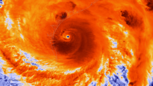
Modern transportation and communications have changed all that, and as we became more instantly aware of hurricanes in Florida, earthquakes in Japan, and volcanoes in the Philippines, we began to realize that there were ways to help—and much to learn. Governments became more aware of a responsibility to assist with planning for long-term recovery, and the field of urban planning, which for decades saw natural hazards as outside its purview, by the 1980s began to undertake systematic studies of how to make recovery more effective. As disasters became more expensive in light of widespread urbanization in recent decades, the stakes have risen dramatically. Researchers and practitioners over the past 40 or 50 years have exchanged data and ideas at major international and national conferences, and national and local policies on post-disaster recovery have evolved rapidly. One can now find a substantial literature on the topic.

One recent and noteworthy entry into this literature is After Great Disasters: An In-Depth Analysis of How Six Countries Managed Community Recovery (Lincoln Institute of Land Policy, 2017; 380 pp.). The authors, Laurie A. Johnson and Robert B. Olshansky, are both highly experienced in the international arena and, I will add, good colleagues of mine in this field. Johnson is an independent consultant based in northern California with past ties to various firms engaged in hazards work. She was a major contributor to Planning for Post-Disaster Recovery: Next Generation (2014), a project I led at the American Planning Association. Olshansky is a professor and head of the department of urban planning at the University of Illinois in Champaign-Urbana. The two previously co-authored Clear as Mud (Planners Press, 2010), a book that chronicled recovery planning in New Orleans after Hurricane Katrina.

They have worked in the countries whose disasters they describe in the book: India, Japan, China, New Zealand, Indonesia, and the U.S. These are, of course, vastly different nations in wealth, geography, size, and circumstance, and the question that the authors confront is devilishly simple: Are there lessons from these nations’ experiences in managing long-term community recovery that are transferable? What, pray tell, does flood recovery in Iowa have in common with tsunami recovery in Indonesia or earthquake recovery in India?

My own international experiences have largely been different from those they describe: I have been involved in the Dominican Republic (after Hurricane Georges), Sri Lanka (after the 2004 tsunami), Taiwan, and New Zealand, under varying circumstances, and that very question has grown in my own mind over time. Those experiences have also provided background for assessing the lessons that Johnson and Olshansky derive from the countries they study. I think they do a very solid job of assembling data, shaping the narratives, and drawing useful conclusions from their case studies. At the same time, they make clear what is unique in each country, and where nuances and differences in national frameworks for disaster policy shed light on larger issues.

One fact that is clear from this book is that those national policies are anything but static. Every nation they study is learning from each major disaster and implementing changes over time. Except for New Zealand, these six are large nations with events occurring frequently enough that many of the lessons multiply and reinforce each other. It is equally clear that political history has a major influence on how these nations organize disaster recovery and how it evolves. Teasing out the lessons that are generally transferable is thus devilishly simple. They emerge only after researchers immerse themselves in the details and compare them closely.

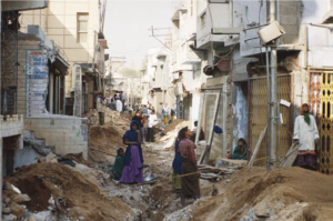
For instance, India, like the United States, has a federal system of government. Both nations thus tend to push down to state governments a number of responsibilities that more centralized China and Japan might reserve at the national level. Prior to the 2001 earthquake in Gujarat, a state in India’s northwest, India had only a very small disaster management division within its Ministry of Agriculture, a location within the national bureaucracy that itself speaks volumes about how India once perceived the nature of most disasters.

It is worth noting, however, that the U.S. did not consolidate its own disaster relief and recovery functions within the Federal Emergency Management Agency (FEMA) until 1979, when the agency was created under President Jimmy Carter. The U.S. did not have any federal statutory framework for systematic disaster response until 1950, and created the National Flood Insurance Program in 1968. As the authors explain, the terrorist attacks of September 11, 2001, then completely reshaped the administrative landscape of American disaster management as Congress reacted to those events by creating the Department of Homeland Security and placing FEMA under its umbrella.

The fact that India was at most a generation behind in assuming greater responsibility at the national level should not be surprising in light of its development, but rapid urbanization has also forced reassessment of many issues of federal ministerial structure. India is also a nation that, because of its relative poverty, has relied much more on international assistance, even as it has steadily expanded its home-grown expertise on natural hazards and urban planning.

A sewer line is laid in the old city of Bhuj in Gujarat, India, in 2004. Photo by B.R. Balachandran, Environmental Planning Collaborative, Ahmedabad. Reprinted from the book with permission from authors.

Two weeks after the 2001 earthquake, the state established the Gujarat State Disaster Management Authority, led by the chief minister. Like state and national agencies in every other country studied, GSDMA experimented at times, made mistakes and enjoyed successes, and helped rebuild homes and infrastructure. There is no perfect way to recover from disaster, and there are always disappointments. For housing reconstruction, Gujarat, the authors report, employed both an owner-driven plan and a public-private partnership plan. The owner-driven approach had no precedent in India on such a large scale; the earthquake had flattened almost 6,500 buildings and killed 7,000 people. This fact alone illustrates one highly transferable lesson from international experience—that disaster recovery provides a compelling laboratory for such innovation, providing that authorities are prepared to accept the prospect of some measure of failure and to learn from it. A more positive way of making that same point is the “silver lining” theory, which sees disaster recovery as a unique opportunity to advance positive change in a “teachable moment.”

Such lessons take shape in very different cauldrons, however. New Zealand, for instance, which suffered the 2010-2011 earthquakes in Christchurch, the major city of the South Island, has a smaller population than any Indian state or most states in the U.S. The nation is also comparatively prosperous. With only 4.7 million people in an area about 70 percent the size of California, New Zealand has no need to decentralize most government functions, except for rural districts and municipalities. The national government thus found it easy to take control of some recovery functions from the city, and there was no intermediary authority. China, with the world’s largest population, tends to concentrate power but nonetheless also finds some decentralization of recovery functions a practical necessity. In the U.S., however, such power sharing is integral to the system and enshrined in the Constitution. These issues of central authority versus state or provincial and local autonomy tend to set the terms within which the experiments in recovery operate. Moreover, as the chapter on Indonesia following the  2004 tsunami through subsequent lesser disasters illustrates, disaster management institutions are evolving rapidly in developing nations as well as in those with more developed economies such as the U.S. and Japan.

So, what can we learn? This book provides a wealth of detail in its case studies, but the authors note that a key leader of Indonesian recovery efforts stated to them his belief that there are no general lessons to learn because “all disasters are unique.” It is certainly true that each event has its own special context and contours, but that simply makes drawing lessons more challenging, not impossible. The authors conclude with seven recommendations.

The first is to “enhance existing structures and systems to promote information flow and collaboration.” Often it makes sense to retain new agencies or programs because they serve more purposes than simply advancing disaster recovery. Second, the authors emphasize the need for data management, transparency, and accountability. The availability of information is crucial for citizens and stakeholders to make good decisions as they rebuild.

A village meeting discusses details of the post-tsunami resettlement in Nagapattinam, Tamil Nadu, India, in 2008. Photo by Divya Chandresekhar, obtained from Robert Olshansky.

The third point is to “plan and act simultaneously.” The paradox here is that reconstruction can never happen fast enough, yet it is important at times to slow the process down in order to inject some thoughtful deliberation into the process. In short, planners and public officials must learn to work efficiently with limited time to make things happen. In some settings, that may necessitate at least some decentralized decision making to prevent bottlenecks. It becomes essential to learn on the run because not learning can be extremely detrimental.

It is also critical both to budget for the costs of communicating and planning, because these functions are critical to success, and to increase capacity in local governments to make recovery decisions. Effective communication aids empowerment, but so does the ability to hire adequate staff with adequate training. Pushing some of that power and capacity down to individual citizens also expedites decision making. That requires sharing information.

The 2004 Indian Ocean tsunami dramatically affected shoreline communities in Tamil Nadu, India, but fishing families were often reluctant to relocate. Photo by Robert Olshansky (from the book).

The authors also suggest avoiding “permanent relocation of residents and communities, except in rare instances, and then only with full participation of residents.” The risk of forced relocation is greater in more authoritarian and highly centralized systems like that in China, while the U.S. heavily relies on voluntary relocation, and total community relocation remains a rarity. But the consequences of such relocation can be devastating unless the community has bought into the idea and clearly understands how it will benefit—presuming it actually will.

Finally, the authors, again picking up on the theme of time compression after disasters, say, “Reconstruct quickly, but do not be hasty.” Exactly when undue speed becomes haste is, of course, very much a matter of judgment, and good judgment often relies on experience, all of which strongly suggests the value of pre-planning for disasters in order to create the opportunity to evaluate options beforehand and train staff for the eventuality. It might be added that expanding the literature available to them that will expand their familiarity with the issues before disaster strikes is also valuable. This book, in its own way, helps advance that mission.

Jim Schwab

Engaging for Sustainability

I know. My very title for this blog post sounds to some like yet another naïve stab at kumbaya. Well, stay with me, anyway. We are talking about solving problems in our communities, and the more people who get behind the solution, the more successful it is likely to be.

Kristin Baja, right, with Dubuque Mayor Roy Buol before her presentation.

What I am really aiming to write about, in the narrowest sense, is a morning keynote presentation by Kristin Baja at the tenth annual Growing Sustainable Communities conference in Dubuque, Iowa, on October 4. The City of Dubuque has been hosting this event from the outset, and I rather like the riverside convention center where they host it. Hell, I rather like the mystique of the Mississippi River, the very reason Dubuque exists. I’m fascinated enough that I thought the conference a good venue for meeting people who might be useful to my pet project since leaving the American Planning Association (APA) at the end of May: a two-book series on the 1993 and 2008 Midwest floods. Dubuque is one of those communities that understands that environmentally healthy communities are a necessary path to the future.

That is why they engaged Kristin Baja, a former planner for the city of Baltimore who was instrumental in effecting significant changes in planning that recognized the fundamental problems that Baltimore needed to address, both socially and environmentally. She openly states that Baltimore was built on a legacy of racism that must be overcome through new approaches that must complement the city’s efforts to address climate change. The poor tend to be more vulnerable to natural hazards. Recently, Baja left her city position to become the Climate Resilience Officer for the Urban Sustainability Directors Network. In this new role, she is essentially bringing what she learned at the local level to the national stage.

What she seems to have learned most, and emphasized in her keynote, is the value of empathy, a quality often sorely lacking in national politics. I frankly think we are more likely to relearn its value at the community level, where we can engage directly and personally with our neighbors. Perhaps then we can reapply it to national policy discussions if we can get past the angry tweets and the noise of shouting talk show hosts.

Baja started with a display of many of the same points I have made in this blog before. The climate is changing, and we have plenty of evidence to make this point if we can get people to listen. We cannot afford to continue to confuse weather with climate, for instance, by using one snowstorm to ridicule the entire notion of global warming. “Weather is your mood, climate is your personality,” she suggested, and it is not a bad analogy for helping people to grasp the distinction between short-term and long-term trends. If we are to achieve resilience in our communities, it will be essential to understand that we must build community strength in the face of both shocks, which are sudden and unexpected changes, and stressors, those long-time problems that weaken a community’s social fabric, like high unemployment, poverty, racism, and distrust of authority. If community leaders want to overcome some of that malaise, it is critical that they foster and sustain mutual trust, be accountable, keep promises, share power, value people’s time, and focus on community cohesion. It may be a tall order, but I would add one other factor. When a community finds such leaders, it needs to honor them. Too often, the best intentions are drowned in a tidal wave of vitriol.

I will not reprise every aspect of Baja’s captivating presentation. What I want to share is the underlying logic of her approach. She first came to my attention when I learned about Baltimore’s now well-known DP3 project, which stands for Disaster Preparedness and Planning Project. DP3 resulted in the approval in 2013 of a combined local hazard mitigation plan and climate adaptation plan. Baja participated in a July 2016 webinar I organized for APA on the subject of merging climate adaptation and hazard mitigation plans.

Hazard mitigation plans have been produced by the thousands by state and local governments ever since the Disaster Mitigation Act of 2000 decreed that they would be ineligible for federal mitigation grants, which pay for many hazard mitigation projects after disasters, unless they adopted a FEMA-approved plan. All states now have such plans, and about 20,000 units of local government have adopted them, often participating in multijurisdictional efforts. But almost universally, until a few creative cities like Baltimore began to outline a new approach, these plans have been backward-looking in identifying local hazards. Why? Because the standard approach is to project future hazards based on historical patterns. The problem is that climate change is disrupting those expectations and exacerbating existing vulnerabilities. The path to resilience lies in using climate science data to anticipate the hazards of the future. Baltimore accomplished that by integrating data about climate trends into its hazard mitigation plan, thus elegantly addressing both existing and future hazards. Baja was at the center of this activity.

But her innovative style goes farther. She worked on the use of vacant lots in cities for development of green infrastructure to help remedy urban flooding. In March of this year, she attended the first of two day-long roundtables APA organized with the National Oceanic and Atmospheric Administration on ways to integrate climate science into the local planning process. She was feisty and persuasive as usual, and we all appreciated her contributions.

Ultimately, what Baja discussed with the audience was not merely the policy changes that are needed to produce climate-resilient communities, but the practices of community engagement that would undergird those policies and make them stick, embed them in municipal and regional civic culture. She unleashed her own flood of ideas about how to do this, including training staff, as she has done recently in Dubuque, with training games that make the undertaking fun, such as a “Game of Floods.” The laundry list that rolled from her tongue and flowed from the PowerPoint screen included these tips for engaging members of the community and removing barriers to participation in civic meetings:

  • Go to people
  • Partner with community leaders
  • Provide transportation
  • Provide food and beverages
  • Provide childcare or activities with children
  • Consider language barriers
  • Translate signs and data
  • Insure compliance with the Americans with Disabilities Act
  • Collect stories
  • Approach all stakeholders with empathy
  • Provide interactive and fun ways of engagement
  • Invite participation on advisory committees

One of her approaches, used in Baltimore to give life to these ideas, was to create a community ambassador network to empower the very people who often labor to advance these ideas through small neighborhood organizations with no financial support from the city. Recognizing the contribution these people make to their city goes a long way to strengthening the trust that supports progressive policy making.

There is a method to the madness of making this all work. Baja is not the only person who has discovered the value of empowering volunteers for good planning, but she herself is now a full-time ambassador through USDN. I’d say they found the right person.

Bike tour of Dubuque’s riverfront at the end of the conference.


Jim Schwab

Recovery in North Carolina One Year Later

Amid the whirlwind of disasters this fall—three major hurricanes hitting the U.S., earthquakes and another hurricane hitting Mexico, wildfires in northern California—it is easy to forget that people hit by other disasters as recently as a year ago are still laboring toward long-term community recovery from the damages those events left behind. One of those places is North Carolina, which suffered flooding in several small communities in its eastern Coastal Plain from Hurricane Matthew. The Federal Emergency Management Agency (FEMA), of necessity, may shift its energy and resources to new places, but the communities and states trying to recover cannot escape the realities of rebuilding their own futures.

I was in North Carolina just two weeks ago for the annual conference of the North Carolina chapter of the American Planning Association, in Greenville. This city of about 90,000 is just an hour west of the Outer Banks, depending on which roads are open. (Hurricane Maria was kicking up waves as it moved north out in the Atlantic Ocean while I was there.) Much of the surrounding area consists of farm country and small towns nestled in river valleys subject to flooding in major storms including tropical storms and hurricanes. In the 1990s, the area was visited by Hurricanes Floyd and Fran, both of which left their marks. I had hoped to travel the towns affected by Matthew with a colleague, but it did not work out. But I did listen to a keynote presentation by Gavin Smith, a research professor at the University of North Carolina (UNC) in Chapel Hill and director of the U.S. Department of Homeland Security’s Coastal Resilience Center of Excellence, located at UNC. I was there because I had been invited to speak at two sessions, one on September 26 on community resilience and another the next day on flood hazards and subdivision design.

Smith has worked with the North Carolina Department of Emergency Management on recovery planning in the past, and as a consultant following Hurricane Katrina, led recovery in Mississippi under Gov. Haley Barbour. He later returned to North Carolina to join the UNC faculty, but clearly is an experienced hand in this field. He has also written extensively on disaster recovery, including an Island Press book, Planning for Post-Disaster Recovery: A Review of the United States Disaster Assistance Framework.

What Smith served up was a primer in planning for climate change and disaster recovery with a side order of North Carolina case studies. I don’t say that to be cute, but because I have discussed at length the issues associated with the former, so here, I will concentrate on the latter. I will note first, however, that he highlighted some issues connected with disaster recovery that are worth considering:

  • Disasters tend to bring to the forefront of community planning existing conditions that may have been less obvious beforehand, but which are not new.
  • Disaster involves opportunity, a unique situation in which good planning can effect positive change. Because planners are generally interested in advancing equity, this is important, as developers are often dictating growth even when it negatively affects some economically marginalized people in the community.
  • This post-disaster environment provides an opportunity to engage in alternative dispute resolution, with planners using negotiation to help resolve difficult issues.
  • The reality of disaster recovery is time compression, the need to move quickly even though better planning may demand stepping back and investing more time in deliberation before making decisions. We can alleviate some of that pressure by developing plans for recovery before disaster strikes.

That is, in a way, all background to the simple fact that one role for planning is to help change the rules governing recovery through serious engagement between local officials, who generally better understand local needs, and those at state and federal levels of government, who generally control more of the resources needed for successful recovery. In other words, planners need to help solve the disconnect between means and understanding. Communities that passively await rescue by higher levels of government without undertaking the task of owning their own recovery may well face consequences in the misallocation of the resources provided.

The Hurricane Matthew Disaster Recovery and Resilience Initiative (HMDRRI) has specifically worked with eight communities in eastern North Carolina under the auspices of the North Carolina Policy Collaboratory. Smith is the project director. It began with a research period that ran from February through June of this year. The project included intake interviews with people in the affected areas who were willing to pursue buyouts of their properties, which would then be maintained in perpetual open space under rules of FEMA’s Hazard Mitigation Grant Program, and discussed with them where they were willing to relocate. The program developed housing prototypes for affordable homes in the $90,000 range that would allow buyers to stay in their communities without remaining in the floodplain. One major question was whether they could endure as a community after such relocation, which is affected by area geography and topography and the ability to identify and develop suitable alternatives. It should also be noted that eastern North Carolina has been through much of this before. Following Hurricane Floyd in 1999, the state undertook buyouts of more than 5,000 homes and assisted in elevating another 1,000.

Camp shelter in Windsor, NC, one of the communities assisted by HMDRRI. Photo by Gavin Smith

The HMDRRI research product is a 580-page report that outlines project objectives and documents economic, housing, and other conditions in both the region and the communities specifically targeted by the project: Kinston, Fair Bluff, Windsor, Princeville, Lumberton, and Seven Springs. This documentation is critical to an accurate assessment of the challenges facing the region. For instance, the standard determinant of housing affordability is the ability to limit spending on housing to 30 percent of income. People in lower-income brackets often struggle to find such housing, and often it requires subsidies or some sort of intervention in the housing market. Within the coastal counties studied, however, the reasons for shortages of affordable housing can vary widely, as can its quality. The resilience of affordable housing in an area subject to coastal storms and flooding is important, yet the abundance of mobile and modular housing in the region offers little resilience in the face of disaster, and septic systems associated with much modular housing often make those homes even more susceptible to flooding. Thus, solutions must address both resilience and affordability to provide some semblance of social equity in disaster recovery.

The intriguing model offered by HMDRRI, however, is the systematic engagement of the academic community in what is simultaneously a practical learning experience for students and faculty, an opportunity for introducing the skills of practicing design professionals to the area, and a direct connection to state and federal officials, for instance, by allowing student and faculty teams to work in the FEMA Joint Field Office (JFO) and thus access data that might not otherwise be readily available. This included interaction with FEMA’s Community Planning and Capacity Building team, part of the larger federal Disaster Recovery Framework. The report, more readable than its length might suggest, includes a substantial section called Home Place that helps facilitate the transfer of design practices to the community level to empower better local recovery planning.

An example of this occurred in Princeville, which Smith described as the oldest African-American community founded by freed slaves. In August, HMDRRI hosted a five-day charrette with visiting architects, three-quarters of them African-American, who worked directly with the community on land-use and design solutions for relocating homes from the floodplain to a higher, 52-acre site still within the city limits. Helping the community to understand and come to terms with the land-use changes resulting from the recovery from Hurricane Matthew is critical to long-term success. The verdict is necessarily still pending in this case, but it may provide a solid case study for future efforts elsewhere. Smith also noted one other important aspect of the charrette experience: Participants were asked to check in daily to document the time they spent. Creative people that they were, the initial reaction was some resentment at being subjected to this bureaucratic procedure until it was explained that documenting their contribution of time was essential to showing a local match for federal funds supporting the project. Approximately 100 people were credentialed for the purpose. At that point, they complied enthusiastically because they understood the purpose as something more than mere bookkeeping. They were helping the community marshal badly needed resources.

It is worth noting that the report recommends that the North Carolina Governor’s Office form a standing committee to provide recommendations for policy, programming, and funding strategies for development of adequate housing in eastern North Carolina. The report also notes interest from Texas and Rice University in the model for state/academic collaboration that HMDRRI offers. This is part of the silver lining of disasters: the emergence and dissemination of positive and innovative solutions to common problems.

Jim Schwab

Initial Observations on Harvey

Map from National Weather Service. http://www.weather.gov/akq/Harvey

For the people of the Texas Gulf Coast, the rain and winds of Hurricane Harvey are just the beginning of a long journey. The storm will last a few days. The recovery will last years.

Destruction in the Bolivar Peninsula after Hurricane Ike in 2008

I am not there, so I can only surmise, based on the news coverage I have seen, the full extent of the damage and suffering that people are enduring in Corpus Christi, Houston, Galveston, and hundreds of other communities in a wide arc that has fallen under the impact of this storm. I do not even expect that people there will read this, certainly not right now. Nonetheless, it may be worthwhile to offer some insights to people elsewhere. I have never lived or worked in Texas, but I have been there numerous times and visited Louisiana more often than I can remember. I saw first-hand the devastation wrought in the Bolivar Peninsula and Galveston after Hurricane Ike. I have worked with people in Texas, including those at the Texas A&M Hazards Reduction and Recovery Center, over many years. They have educated me greatly on the vulnerabilities of their state.

With all due humility, therefore, but also with experience from other disasters over the past quarter-century, I offer some observations that may enhance what readers of this blog may learn from the news.

Photo from NOAA. The NOAA/NASA Suomi NPP satellite captured this infrared image of Hurricane Harvey just prior to making landfall along the Texas coast on August 25, 2017 at 18:55 UTC. NOAA’s National Hurricane Center has clocked Harvey’s maximum sustained winds at 110 miles per hour with higher gusts. Infrared images like this one can help meteorologists identify the areas of the greatest intensity within large storm systems, such as the areas with the most intense convection, known as overshooting cloud tops (dark orange), surrounding the eye and along the outer bands. https://www.nnvl.noaa.gov/MediaDetail2.php?MediaID=2086&MediaTypeID=1

First, this is apparently a somewhat unusual storm system. It approached the coast just northeast of Corpus Christi as a Category 4 hurricane, although it is now downgraded to a tropical storm. That does not make it less dangerous. The Saffir-Simpson scale that is used to rate hurricane strength deals only with wind speeds. Winds are certainly important, especially when they reach the 130 mile-per-hour range that was the peak for this event. Winds have, from all the visual evidence on the various news outlets I have watched, wreaked tremendous havoc along the coast, tearing apart buildings and overturning trailers and other vehicles. Moreover, hurricanes often spawn tornadoes, and some of the intermittent damage—that is, buildings ripped apart near others largely intact—suggests that this has occurred. In other words, if the more diffuse hurricane winds don’t get you, the tornado just might. It is no laughing matter. It is a wonder the death toll remains relatively low, although we almost surely don’t know the full tally just yet.

One specific impact that always accompanies coastal storms of this magnitude is storm surge, the waters pushed landward by the winds that in this case ranged from six  to twelve feet. These can do considerable damage in low-lying areas along the coast and may also exacerbate coastal erosion.

What makes the storm somewhat unusual also makes it dangerous even after being downgraded to a tropical storm. The storm system appears to have stalled a bit on Sunday and may even be backing out into the gulf for another landfall. At least two very serious consequences can flow from this. One is that the stagnant storm front will dump immense amounts of rain over consecutive days. The projected precipitation totals, even larger than what has fallen so far, mount up, so that projections for many communities range as high as 50 inches. Keep in mind that 30 inches is ample rainfall for an entire year in many parts of the country, and almost no city in the United States is prepared to absorb even half that amount in just a few days. The average yearly rainfall in Houston is just shy of 50 inches.

Moreover, as the storm moves back out over the Gulf of Mexico, it may regain strength that storms typically lose as they make landfall. Tropical storms draw their strength from the warmth of the water over which they pass until they make landfall, after which wind speeds begin to die down. The water of the Gulf right now is in the mid- to high 80s Fahrenheit, reportedly a full two to three degrees above average. That is the source of the strength of Harvey. Regaining any strength from the warm Gulf waters is not a good omen for the Texas coast, and as the storm moves slowly northeast, more of this will affect Houston than was originally the case. That is why we are seeing such intense scenes of flooding in Houston: The storm began with enormous amounts of moisture and has moved along the coast at a snail’s pace, at times just a mile an hour. As the week progresses, however, the storm is projected to move northeast over Louisiana and Arkansas, weakening along the way.

Of course, those warm waters raise questions about the influence of global warming, a topic that does not always receive a warm reception in Texas political circles. It is impossible to say that a specific storm like Harvey would not have happened but for climate change. It is also possible to say very credibly that warmer waters make stronger storms possible. Warmer waters can reflect seasonal and yearly variations, but over time they can also reflect climatic trends. For now, let’s leave it at that. People will have plenty of time later to debate this topic. In due course, as recovery proceeds, it should become a topic of reasonable, informed public discourse.

Other factors are at work as well. The sheer extent of flooding reflects the inexorable fact that the ground in any area has limited capacity to absorb rain. The hydrological cycle allows much rain under normal circumstances to drain into the ground, depending on the types of soil present in any given location. Sand absorbs very well but does not provide a very solid building foundation. Clay provides a better foundation but does not absorb water as quickly. Soil types matter, therefore, but in urban areas we have complicated matters greatly with large quantities of impervious surface that absorb little or no water by design. Impervious surface includes buildings (with the limited exception of green roofs), paved surfaces like roads, parking lots, and driveways, and other structural impediments to the movement and absorption of water. Houston is a very large metropolitan area with the fourth-largest population among major cities in the U.S. Although it is making strides, it is also far from the greenest city in America. Like most major cities, the percentage of impervious surface varies widely, depending on density levels in specific neighborhoods and corridors. Flooding is also influenced by the quality of the drainage systems; Houston is challenged in this respect by low-lying, flat terrain. It is criss-crossed with numerous bayous and canals that provide paths for the movement of water but also have serious limits to the water they can absorb before spilling over onto streets and highways. Those water-filled streets are the main obstacle to evacuation for those who stayed behind. There comes a point where people are better off remaining in place than trying to move, which is why Houston Mayor Sylvester Turner chose not to recommend evacuation.

Some dangers of mass evacuation for 6.5 million people are self-evident: clogged highways that are rapidly filling with water, producing death traps for people in stranded vehicles. Pedestrians cannot see steep drop-offs in elevation as they wade through high waters and can trip and drown. In Houston, the bayous may also contain alligators, water moccasins, and other wildlife hazards that are more easily avoided in dry weather. Moreover, the sheer volume of water can produce eddies and swirls that catch people off guard, and not everyone will be strong enough to regain their footing. Finally, flood water is always dirty water, sometimes just plain filthy, posing a potentially serious threat to public health.

All that said, many other major cities suffer from similar problems. I can think of no city that is prepared for the sheer volume of water currently falling along the Texas coast.

The Texas Gulf Coast communities, therefore, will emerge from this storm with a widespread pattern of both wind- and flood-related damage that will vary significantly from one area to the next, but collectively the costs will probably skyrocket into tens of billions of dollars. It is impossible to know the full costs just yet, but this will almost surely rank as one of the most expensive disasters in U.S. history. The recovery will take years of planning and implementation. If done well, it will involve a great deal of reassessment of patterns of development along the Gulf Coast and of the quality and importance of building codes. Social equity considerations will demand a new examination of the location and quality of low-income housing and the adequacy of affordable housing. Development regulations have seldom been politically popular in Texas, a state that still has never empowered counties to enact zoning codes. Some coastal communities may also wish to look more closely at the prospect of undergrounding utility lines to protect them from hurricane winds.

Events can push public attitudes in new directions. Part of that may depend on new lines of thought gaining traction in the discussion of rebuilding after the disaster. That may require some degree of courageous political leadership. Some very significant changes occurred in Louisiana after Hurricane Katrina, including consolidation of levee district management, adoption of a statewide building code, and a charter amendment in New Orleans that gave a new master plan more control over development regulations. We should not make perverse assumptions about outcomes, just as we also should not be naïve about the obstacles. But in my time at the helm of the Hazards Planning Center of the American Planning Association, we certainly worked hard to create a thorough blueprint for those willing to advocate better planning in response to major and catastrophic disasters, and I assume APA remains prepared to further that discussion and provide technical assistance where it can.

There will also be plenty of help available from the federal government, including the Federal Emergency Management Agency, the U.S. Department of Housing and Urban Development, and other agencies. We can only hope that Congress will sidestep much of its partisan bickering to ensure rapid allocation of the necessary resources. And we can hope that those resources and personnel are managed well to advance the recovery process, which is complicated and daunting.

One encouraging factor in the response has been the emergence of both willing volunteers and the effective use of social media to expedite search and rescue operations. The number of boats driven by volunteers rescuing people from rooftops and the interiors of flooded homes reminded me of the so-called Cajun Navy that operated throughout New Orleans in the desperate days that followed Hurricane Katrina. Disasters have a fortunate tendency in most cases to bring out the best in people, but we are also at a point in history where our new technologies facilitate the ability of willing heroes to find the people who most need help. Even the elderly and disabled are largely capable of dialing 911, or tweeting, or posting photos of their situation on Facebook, sharing their location, and pleading for help—and then finding their guardian angel at the front door with a motor boat. That is a huge advance from only a decade ago because it enables the willing volunteers to become effective heroes. If those civic and humanitarian instincts carry over into the slower grind of recovery, perhaps a stronger, more resilient Gulf Coast can yet rise from the mud, the grime, and the shattered buildings we see now.

Jim Schwab