Softly Persuasive Planning Pioneer

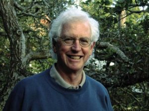
Photo from David Topping’s Facebook posting of his father’s passing.

I first met Ken Topping at the American Planning Association (APA) office in Chicago on a cold day in January 1994. Chicago was suffering one of its classic Arctic blasts at something like -20°F. Ken, a tall, very polite, and articulate gentleman, had his heavy winter coat for the ride back to O’Hare International Airport toward the end of the day. On January 17, just a day or so before he arrived in Chicago, the Northridge Earthquake struck Los Angeles, an area where he had worked for many years. Ken, who was already developing a significant history of advancing what was then the nascent role of urban planning in responding to disasters, became immediately involved. Exactly one year later, on January 17, 1995, the Great Hanshin earthquake leveled much of Kobe, a major city in Japan. With his extensive acquaintances there, Ken was again on the scene.

At the time, I gently needled him that trouble followed him wherever he traveled. But the reality was that Ken took the lead in planning solutions to some of the world’s most vexing environmental challenges: natural disasters. It took years for me to understand the degree to which that initial meeting with Ken changed my life and my perspectives on what I wanted to accomplish as a professional planner. Ken lured me into the world of disaster recovery and resilience planning in a way no one else did.

When we met, it was Bill Klein, then the research director at APA, who introduced us. Just a few months before, Bill, who had somehow negotiated a modest contract with the Federal Emergency Management Agency (FEMA) to produce a Planning Advisory Service (PAS) Report on planning for post-disaster recovery, offered me the opportunity to manage the project. This was not because I had any great expertise in the subject. It was because no one else at APA did, either, but I at least had a strong background in environmental planning, and disasters are, at least in part, an environmental problem. Actually, I learned, they are many problems rolled into one, and what I was about to undertake was a challenge well above any I had encountered before, even though I was already completing a book—my second—about environmental justice. But that left the question of why Ken Topping, with noteworthy contributions to the disaster field behind him, should be dealing with a greenhorn like me.

That’s not the way he saw it. Or ever saw it. If Bill had confidence in me, then for Ken it was a chance to mentor someone new to the field and help shape the project at its roots. Over the next few years, as the project grew and expanded from its original ambitions, Ken introduced me to numerous players in this then small arena of planning to reduce the impacts of natural hazards. I did not fully appreciate the significance of some of the people I met, a fact I still regret, but it was all such new territory that I did not always fully understand who was who.

Leaders of Tomorrow

My experience with Ken was far from unique. He mentored, nurtured, and influenced the professional development of people who became some of my best professional friends and colleagues in the growing subfield of hazards planning.
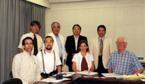
Ken and US-Japan team members meeting with community leaders of the Shin-Nagata North neighborhood that was heavily damaged in the 1995 Kobe earthquake. On the front row from left to right are: Robert Olshansky, Laurie Johnson, Kazuyoshi Ohnishi, and Ken Topping (U.S. team leader). Photo provided by Laurie Johnson.

Robert Olshansky, now professor emeritus at the University of Illinois and living in the Bay Area, met Topping and Laurie Johnson, then a young planner with a bachelor’s degree in geophysics, at a conference of the Central United States Earthquake Consortium in June 1994 in Louisville, Kentucky. The conference, which I also attended, drew mostly engineers, so these three planners “stayed up late in animated conversation,” Rob recalls. Frankly, I don’t remember much of what I did there, but I do recall meeting Laurie either there or a month later at the Natural Hazards Workshop in Boulder, Colorado. I was very much the newcomer to this business back then, in any case. But Rob, Laurie, and Ken engaged in a round of post-Northridge earthquake research meetings in California, which led to a proposal, led by Topping, to compare the Northridge and Kobe earthquake recovery experiences. Eventually funded by the National Science Foundation (NSF), their work began in 1998, but the important facet was that it involved extensive international collaboration between this American trio and four Japanese researchers. It was Ken who introduced Rob and Laurie to Japanese planning. Rob confesses he had never been to Asia before the Kobe earthquake, but he and Laurie developed close connections in Japan who remain good friends 25 years later. Rob says it was Ken who insisted on the close collaboration with the Japanese and helped select the neighborhoods they chose for comparative study.
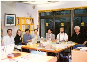
Ken with the US-Japan team conducting a long-term comparative study of rebuilding in Los Angeles and Kobe following the 1994 and 1995 earthquakes, respectively, during a team meeting in 2000 in Kobe. Left to right are: Robert Olshansky, Laurie Johnson, Ikuo Kobayashi, Hisako Koura, Yoshiteru Murosaki (Japan team leader), Kazuyoshi Ohnishi, and Ken Topping (U.S. team leader). Photo provided by Laurie Johnson.

The remarkable aspect of all this for Laurie Johnson, now a prominent hazard planning consultant based in San Rafael, California, was Ken’s acceptance and support though, she says, “I was barely in my 30s and had only a few years of relevant professional experience” when they first met. Their first contact, she says, came in 1990, when Ken spoke at the International Symposium on Rebuilding after Earthquakes, hosted at Stanford University by Spangle Associates, the firm for which she was then working. Spangle had produced a study that was among the first I studied in this emerging field, examining four case studies of post-disaster recovery. It profoundly influenced my view of what happens to communities in a disaster.

Ken, says Laurie, “wowed the group with his presentation on LA’s efforts to prepare a first-ever, pre-disaster recovery plan for the city before a major disaster like an earthquake struck.” Ken was then the planning director of Los Angeles. Fortunately, a draft of what became the Los Angeles Recovery and Reconstruction Plan had been completed when the Northridge earthquake occurred. The city formally adopted it a year later. Another NSF study led by Spangle Associates, in which Laurie was involved, found “that the plan was instrumental in contributing to the high level of staff performance” after the earthquake, helping most city departments to understand their responsibilities and prepare to perform them.

Innovations

By the mid-1990s, Ken was a tall, white-haired gentleman in his 50s, a strong intellect with a gentle voice. In coming years, in part working on the project I was leading, he made a significant impression on our colleagues at FEMA. Terry Baker, former National Team Leader for Hazard Mitigation Planning, recalled him as “always generous with his time and thoughts. A luminary in the field, although you wouldn’t know that from his kind and down-to-earth demeanor.” Similarly, Cecelia Rosenberg, who served as both project officer and grants manager at FEMA, recalls his “softly persuasive ways and quiet wisdom.” He was never a loud voice, but people knew they were speaking with someone who mattered.

He mattered because of a history of innovations, a willingness to try new things to solve emerging problems. He was well ahead of most planners in recognizing how planning could be used to reduce disaster risk. In a career that that was already well underway amid the environmental planning revolution of the 1970s, he consistently found ways to generate meaningful change. By 1973, he was planning director in San Bernardino County, California, where, as California Polytechnic State University-San Luis Obispo (Cal Poly) Professor William Siembieda notes, he “created one of the first wildfire mitigation programs and an overlay zone on 19,000 square miles of desert land for future regional conservation.”

Ken’s spirit of innovation was not limited to southern California. It was a hallmark of his career. Working with me and a team of contributors to Planning for Post-Disaster Recovery and Reconstruction (PAS 483/484, 1998), his singular contribution lay in crafting a model ordinance for post-disaster recovery that is still in use today. The model offers local governments a means of structuring governance of the recovery process after a major or catastrophic disaster, assigning responsibilities among city agencies and empowering them to handle such urgent tasks as post-disaster demolition and intergovernmental coordination. It helps them create order out of chaos with a management structure for long-term recovery that can be activated as soon as the city declares an emergency. It expedites recovery by saving precious time after disaster strikes. I can state with certainty that no more than a handful of jurisdictions had adopted any similar approach prior to the release of our report.

More than a dozen years later, after I had convinced FEMA to fund an overhaul of the original post-disaster study, adding a bevy of online resources to a new report (Planning for Post-Disaster Recovery: Next Generation, PAS 560, 2014), Ken sought to update the model ordinance as part of the project. When I directed his attention to what I considered an important innovation by the city of Cedar Rapids, Iowa, after its massive 2008 flood, he did not hesitate to contact former Community Development Director Christine Butterfield for details. The new model thus included language requiring municipal licensing of building repair contractors to prevent the sort of fraudulent repairs that had been rife in places like New Orleans after Hurricane Katrina. Ken knew a good idea when he saw one, and Cedar Rapids had done something important. A major contributor to the later PAS Report was Laurie Johnson, who produced two of the most important chapters, dealing with the recovery planning process and implementation of recovery plans. Like me, under Ken’s influence, Laurie had come a very long way in the planning field since first meeting Ken.

Bill Siembieda says this focus on innovation was also evident in Ken’s relationship with Cal Poly, which began in the spring of 2000 and lasted two decades. Ken was a part-time lecturer and George Hasslein Chair in the College of Architecture and Environmental Design, City and Regional Planning Department. His efforts included an international symposium on risk reduction, multidisciplinary courses focused on mitigation and risk reduction, and work with state agencies, most notably on the 2010 California Multi-Hazard Mitigation Plan, in which “he created a set of working groups within the state government” to discuss topics of mutual interest. He believed strongly in the value of cross-disciplinary discussions to achieve a more integrated approach to solving problems.

This focus on integration led to Ken’s involvement in what I regarded as my own signature project, which resulted in the PAS Report, Hazard Mitigation: Integrating Best Practices into Planning (PAS 560, 2010). For his accomplishments and leadership in city planning and management, environmental and hazard resilience planning, Ken was inducted into the College of Fellows of the American Institute of Certified Planners in 2000 and honored with a special session at the 2019 conference of the California chapter of APA.

Multiple Dimensions

Ken died on March 5 from complications of Parkinson’s Disease at 85. He and his wife, Phyllis, spent the last year or so in San Clemente Villas in a seacoast town in Southern California. I had a few last conversations by phone with him after that move from Cambria, California, where he had served at one point as the general manager for the Cambria Community Services District and later chaired the San Luis Obispo County Planning Commission, where he demonstrated his penchant for conservation by helping establish the Fiscalini Ranch as a Pacific Ocean coastal bluff park. Siembieda credits Ken’s “great persistence” and a “willingness to put time and energy into each work product” for his vision to support large solar farms in the county and his opposition to a “large petroleum industry oil train project.”

In one of those calls, he shared with me that he had recently fallen while trying to maneuver his walker in a parking lot. It was clear that time was taking its toll, but in a later call, ever cheerful, he gently told me how much he admired my own career path. He seldom missed an opportunity to encourage the people he had mentored.

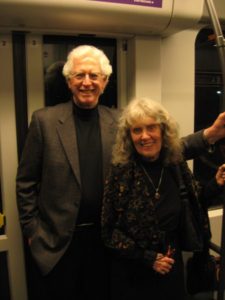
Ken with Phyllis, his wife. From David Topping’s Facebook notice about his father’s passing.

One of the more fascinating aspects of his own story, however, was his birth in 1935 in Kobe, Japan, to a pair of American Baptist missionaries. Before the outbreak of World War II, his family found it necessary to return to the United States, where he grew up in San Francisco and Boulder, Colorado, before the family returned to Japan after the war. He later returned to the U.S. for college at the University of Redlands in California, where he met Phyllis, with whom he had two sons, and earned a degree in sociology, followed by further studies at the University of North Carolina at Chapel Hill. They returned to California, where Ken began a career as a regional planner in Los Angeles but also earned a Masters in Public Administration in 1972 from California State University, Los Angeles. That led to his becoming planning director for San Bernardino County in 1973, and later the city of Los Angeles, appointed in 1986 by Mayor Tom Bradley. One of his achievements was Los Angeles’s first zoning update using geographic information systems (GIS), then a new technology.

The environment was clearly one of his high priorities, something readily apparent in April 2012, when he and Phyllis walked my wife, Jean, and me through the Fiscalini Ranch Preserve before treating us to lunch at a local Cambria restaurant. But he also had a deeply empathetic personal side. I had been in Los Angeles the prior week at the APA National Planning Conference (NPC), much of which became for me a daunting experience as I suffered an attack of prostatitis, though I did not know the diagnosis before visiting a local urgent care center. Exhibiting my stubborn streak, on a Saturday evening early in the conference, I showed up in a hotel meeting room after getting dressed, despite feeling drained and weak, to lead a meeting of the project team for the Next Generation project. Ken took one look at me and would have none of it. His personal touch was evident as he turned to Kathy Smith, our FEMA project officer, and said, “Look at him. He’s in no condition to run a meeting.” At Ken’s urging, It was rescheduled subsequently for a remote meeting from Cal Poly the day after our visit to Cambria.

Ken seated along with children and staff at the Morioka Kindergarten in 2013. Photo provided by Laurie Johnson.

Laurie Johnson believes many of Ken’s finer traits can be attributed to his exposure to Japan. She recalls “a beautiful tribute to Ken and his family’s ties to Japan organized by Professor [Haruo] Hayashi (Kyoto University) and colleagues” in March 2013. They were documenting recovery efforts in northern Japan following the 2011 Tohoku earthquake and tsunami, but the group visited a kindergarten founded in the city of Morioka by Ken’s grandmother more than a century earlier. “The kindergartners assembled and tried to sit patiently as the history was explained and Ken was honored,” she says. “They then sang a song, “Small Garden,” that his grandmother had taught her classes many years ago and which classes still sing today.”

From David Topping’s Facebook notice of his father’s passing.

Ken tapped a beat, she says, which reminded her that Ken had taught himself to play the bass and guitar and had played before for the joint research team at home in Cambria in 2002. Music was another element of his humanity and family life (including a family band), and that focus influenced his two sons to pursue careers in music. Ken went on that day at the school to remind the children to continue to learn as they grew up, how he was there himself to learn about the earthquake, and about the value of friends around the world. “So please be my friend, too,” he told them, “and keep learning all of your lives so that you can help make the world a better place.”

Connecting People

As that vignette illustrates, there was nothing more important for Ken Topping than connecting people, particularly people of talent and determination, with the resources and networks they needed to succeed at making the world a better place. And that mission spanned international boundaries.

Professor Norio Maki of Kyoto University was one of those who benefited. He describes Topping as “my mentor on planning.” In addition to working with Ken in Japan, he learned greatly from collaboration on a project in Marikina, a city in the Philippines. The goal was to develop an earthquake mitigation plan through workshops with city staff. In what he describes as “real on-the-job training,” Ken advised him on workshop presentations and the use of GIS. Despite his university degrees, he says, “I think I got my degree in planning from Ken.”

Rob also facilitated Rob Olshansky’s now permanent connection to Japan. Ken helped arrange for Rob to follow him in a one-year visiting fellowship at Kyoto University, with Professor Hayashi. The cultural shift could have been deeply challenging, but Rob brought his children along for “a life-changing year at school in Japan.” Ken advised him on “important Japanese etiquette do’s and don’ts, in addition to navigating the Japanese train system.” Eight years later, Rob was able to pay it forward by doing the same favor for another visiting professor, Jim Goltz. And so the waves of influence move forward. Rob also believes that a book he and Laurie co-authored, After Great Disasters (reviewed on this blog), “would never have happened without Ken’s influence.”

I could go on, and Rob, Laurie, Terry, Cecelia, Bill, and Norio submitted numerous and extensive comments for my use, but the overall point seems clear. Ken is gone, but as with all such special and creative people, the lesson for the rest of us is simple—to continue to extend that positive influence into future generations in our chosen field. And beyond, wherever possible. I hope we are still doing that, in our own ways.

Jim Schwab

Building Codes Matter

Ask Anchorage after last Friday’s 7.0 earthquake. Admittedly, this is not the biggest earthquake the area could have suffered. The famous 1964 earthquake registered at 9.2, triggered a tsunami, and killed an estimated 130 people. Still, by and large, things seemed to work as planned.

Ask the mayor. And the governor. Mayor Ethan Berkowitz says building codes and good preparation minimized structural damages. No one died. Berkowitz even stated to PBS that other cities would want to emulate Anchorage “because Anchorage did this right.” Alaska Governor Bill Walker admitted to sometimes grousing about strict building codes but conceded, “Building codes mean something,” stating that his own home suffered only minor water damage.

What worked? According to the same PBS report, “Sterling Strait, a member of the Alaska Seismic Hazards Safety Commission, said the states [Alaska and California] use the International Building Code,” which he deemed the “best available standard for seismic safety.”

This good news comes while some states and jurisdictions, in some parts of the country, still resist more stringent building codes, and when some voters still resent what they view as an imposition, sometimes even after the damage from a hurricane, flood, wildfire, or earthquake. But the higher standards matter in saving lives and preventing building collapse, which also prevents injuries. Tellingly, Anchorage hospitals reported a normal day, with no dramatic upsurge in injuries from the earthquake.

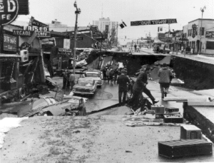
Collapse of Fourth Avenue near C Street in 1964 earthquake in Anchorage. USGS photo.

One factor working in Anchorage’s favor is its relative newness as a big city, now about 300,000 population. A city of only 3,000 as late as 1940, Anchorage grew rapidly during and after World War II, still claiming only about 100,000 at the time of the 1964 earthquake. The salient result is that, between its late start as an urban center and the destruction of many older buildings in 1964, Anchorage has far fewer legacy buildings predating modern seismic construction standards than some other cities in states like California. Many California cities, including Los Angeles and Berkeley, have spent considerable sums to subsidize seismic retrofits for older structures including highly vulnerable unreinforced masonry buildings.

As an urban planner, my own expertise lies with land use and not structural engineering, so I will not elaborate on the details of building codes as if I were an expert, but the evidence is compelling. I will note one handout I found on the Anchorage city website, however, on geotechnical investigations. It concerns a requirement for a report from a geotechnical expert and inspection requirements for structures in what are known as Hazard Zones 4 and 5, which define high levels of geological susceptibility to ground failure as result of seismic shaking. The applicable handout dates to 2006, and references a June 1989 report by Shannon & Wilson, a Seattle-based engineering firm. Those dates indicate that Anchorage has been steadily at work on this problem ever since the 1964 earthquake, not wishing to repeat or continue the vulnerabilities exposed by that event.

Without delving into technical details, the bottom line is that, in the designated areas, a civil engineer with experience in geotechnical engineering must perform an investigation of the potential extent of ground movements and soil loadings on the structure proposed, and must prepare and sign a written report showing calculations, conclusions, and recommendations for how the building will be able to withstand seismic displacements without collapsing. The work must then be performed in accordance with those recommendations, and the engineer must ensure compliance through special inspections and a signed statement that his design was followed.

This approach is hardly new but is also far from universal. I learned a good deal about it in the context of municipal requirements in Utah cities around 2005 in the process of completing production of a Planning Advisory Service Report, Landslide Hazards and Planning, by the American Planning Association, with support from the U.S. Geological Survey. Such surveys cost money, but so does wanton damage from a failure to comply.

Alaska did experience problems, but not primarily with buildings. It is still far too early for a complete survey of the damage suffered by the transportation system, and the city and state need to assess the losses due to highway collapses, structural stresses on bridges, and the like. Currently, a railroad between Anchorage and Fairbanks is not functioning. There are always challenges, and every disaster is an opportunity for reassessments and lessons learned. But one clear lesson has already emerged: Building codes matter.

Jim Schwab

Comparing Disaster Recovery Around the World

There was a time not long ago, in human history, when a faraway nation could experience a wrenching natural disaster that most of the rest of us would not know about for months, or even years, afterwards. The idea that anyone else should or could help the stricken cities or nations recover would have seemed foreign, if not utterly impractical. Help from the U.S. federal government for San Francisco following the 1906 earthquake was minimal and slow to arrive. American involvement in an earthquake at the time in China would have seemed preposterous and quixotic.

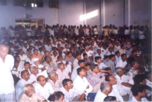
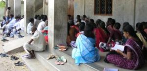
2002 planning meeting in Bhuj following the 2001 Gujarat earthquake. Photo by B.R. Balachandran, Environmental Planning Collaborative, Ahmedabad, obtained from Robert Olshansky.

Modern transportation and communications have changed all that, and as we became more instantly aware of hurricanes in Florida, earthquakes in Japan, and volcanoes in the Philippines, we began to realize that there were ways to help—and much to learn. Governments became more aware of a responsibility to assist with planning for long-term recovery, and the field of urban planning, which for decades saw natural hazards as outside its purview, by the 1980s began to undertake systematic studies of how to make recovery more effective. As disasters became more expensive in light of widespread urbanization in recent decades, the stakes have risen dramatically. Researchers and practitioners over the past 40 or 50 years have exchanged data and ideas at major international and national conferences, and national and local policies on post-disaster recovery have evolved rapidly. One can now find a substantial literature on the topic.

One recent and noteworthy entry into this literature is After Great Disasters: An In-Depth Analysis of How Six Countries Managed Community Recovery (Lincoln Institute of Land Policy, 2017; 380 pp.). The authors, Laurie A. Johnson and Robert B. Olshansky, are both highly experienced in the international arena and, I will add, good colleagues of mine in this field. Johnson is an independent consultant based in northern California with past ties to various firms engaged in hazards work. She was a major contributor to Planning for Post-Disaster Recovery: Next Generation (2014), a project I led at the American Planning Association. Olshansky is a professor and head of the department of urban planning at the University of Illinois in Champaign-Urbana. The two previously co-authored Clear as Mud (Planners Press, 2010), a book that chronicled recovery planning in New Orleans after Hurricane Katrina.

They have worked in the countries whose disasters they describe in the book: India, Japan, China, New Zealand, Indonesia, and the U.S. These are, of course, vastly different nations in wealth, geography, size, and circumstance, and the question that the authors confront is devilishly simple: Are there lessons from these nations’ experiences in managing long-term community recovery that are transferable? What, pray tell, does flood recovery in Iowa have in common with tsunami recovery in Indonesia or earthquake recovery in India?

My own international experiences have largely been different from those they describe: I have been involved in the Dominican Republic (after Hurricane Georges), Sri Lanka (after the 2004 tsunami), Taiwan, and New Zealand, under varying circumstances, and that very question has grown in my own mind over time. Those experiences have also provided background for assessing the lessons that Johnson and Olshansky derive from the countries they study. I think they do a very solid job of assembling data, shaping the narratives, and drawing useful conclusions from their case studies. At the same time, they make clear what is unique in each country, and where nuances and differences in national frameworks for disaster policy shed light on larger issues.

One fact that is clear from this book is that those national policies are anything but static. Every nation they study is learning from each major disaster and implementing changes over time. Except for New Zealand, these six are large nations with events occurring frequently enough that many of the lessons multiply and reinforce each other. It is equally clear that political history has a major influence on how these nations organize disaster recovery and how it evolves. Teasing out the lessons that are generally transferable is thus devilishly simple. They emerge only after researchers immerse themselves in the details and compare them closely.

For instance, India, like the United States, has a federal system of government. Both nations thus tend to push down to state governments a number of responsibilities that more centralized China and Japan might reserve at the national level. Prior to the 2001 earthquake in Gujarat, a state in India’s northwest, India had only a very small disaster management division within its Ministry of Agriculture, a location within the national bureaucracy that itself speaks volumes about how India once perceived the nature of most disasters.

It is worth noting, however, that the U.S. did not consolidate its own disaster relief and recovery functions within the Federal Emergency Management Agency (FEMA) until 1979, when the agency was created under President Jimmy Carter. The U.S. did not have any federal statutory framework for systematic disaster response until 1950, and created the National Flood Insurance Program in 1968. As the authors explain, the terrorist attacks of September 11, 2001, then completely reshaped the administrative landscape of American disaster management as Congress reacted to those events by creating the Department of Homeland Security and placing FEMA under its umbrella.

The fact that India was at most a generation behind in assuming greater responsibility at the national level should not be surprising in light of its development, but rapid urbanization has also forced reassessment of many issues of federal ministerial structure. India is also a nation that, because of its relative poverty, has relied much more on international assistance, even as it has steadily expanded its home-grown expertise on natural hazards and urban planning.

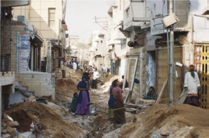
A sewer line is laid in the old city of Bhuj in Gujarat, India, in 2004. Photo by B.R. Balachandran, Environmental Planning Collaborative, Ahmedabad. Reprinted from the book with permission from authors.

Two weeks after the 2001 earthquake, the state established the Gujarat State Disaster Management Authority, led by the chief minister. Like state and national agencies in every other country studied, GSDMA experimented at times, made mistakes and enjoyed successes, and helped rebuild homes and infrastructure. There is no perfect way to recover from disaster, and there are always disappointments. For housing reconstruction, Gujarat, the authors report, employed both an owner-driven plan and a public-private partnership plan. The owner-driven approach had no precedent in India on such a large scale; the earthquake had flattened almost 6,500 buildings and killed 7,000 people. This fact alone illustrates one highly transferable lesson from international experience—that disaster recovery provides a compelling laboratory for such innovation, providing that authorities are prepared to accept the prospect of some measure of failure and to learn from it. A more positive way of making that same point is the “silver lining” theory, which sees disaster recovery as a unique opportunity to advance positive change in a “teachable moment.”

Such lessons take shape in very different cauldrons, however. New Zealand, for instance, which suffered the 2010-2011 earthquakes in Christchurch, the major city of the South Island, has a smaller population than any Indian state or most states in the U.S. The nation is also comparatively prosperous. With only 4.7 million people in an area about 70 percent the size of California, New Zealand has no need to decentralize most government functions, except for rural districts and municipalities. The national government thus found it easy to take control of some recovery functions from the city, and there was no intermediary authority. China, with the world’s largest population, tends to concentrate power but nonetheless also finds some decentralization of recovery functions a practical necessity. In the U.S., however, such power sharing is integral to the system and enshrined in the Constitution. These issues of central authority versus state or provincial and local autonomy tend to set the terms within which the experiments in recovery operate. Moreover, as the chapter on Indonesia following the  2004 tsunami through subsequent lesser disasters illustrates, disaster management institutions are evolving rapidly in developing nations as well as in those with more developed economies such as the U.S. and Japan.

So, what can we learn? This book provides a wealth of detail in its case studies, but the authors note that a key leader of Indonesian recovery efforts stated to them his belief that there are no general lessons to learn because “all disasters are unique.” It is certainly true that each event has its own special context and contours, but that simply makes drawing lessons more challenging, not impossible. The authors conclude with seven recommendations.

The first is to “enhance existing structures and systems to promote information flow and collaboration.” Often it makes sense to retain new agencies or programs because they serve more purposes than simply advancing disaster recovery. Second, the authors emphasize the need for data management, transparency, and accountability. The availability of information is crucial for citizens and stakeholders to make good decisions as they rebuild.

A village meeting discusses details of the post-tsunami resettlement in Nagapattinam, Tamil Nadu, India, in 2008. Photo by Divya Chandresekhar, obtained from Robert Olshansky.

The third point is to “plan and act simultaneously.” The paradox here is that reconstruction can never happen fast enough, yet it is important at times to slow the process down in order to inject some thoughtful deliberation into the process. In short, planners and public officials must learn to work efficiently with limited time to make things happen. In some settings, that may necessitate at least some decentralized decision making to prevent bottlenecks. It becomes essential to learn on the run because not learning can be extremely detrimental.

It is also critical both to budget for the costs of communicating and planning, because these functions are critical to success, and to increase capacity in local governments to make recovery decisions. Effective communication aids empowerment, but so does the ability to hire adequate staff with adequate training. Pushing some of that power and capacity down to individual citizens also expedites decision making. That requires sharing information.

The 2004 Indian Ocean tsunami dramatically affected shoreline communities in Tamil Nadu, India, but fishing families were often reluctant to relocate. Photo by Robert Olshansky (from the book).

The authors also suggest avoiding “permanent relocation of residents and communities, except in rare instances, and then only with full participation of residents.” The risk of forced relocation is greater in more authoritarian and highly centralized systems like that in China, while the U.S. heavily relies on voluntary relocation, and total community relocation remains a rarity. But the consequences of such relocation can be devastating unless the community has bought into the idea and clearly understands how it will benefit—presuming it actually will.

Finally, the authors, again picking up on the theme of time compression after disasters, say, “Reconstruct quickly, but do not be hasty.” Exactly when undue speed becomes haste is, of course, very much a matter of judgment, and good judgment often relies on experience, all of which strongly suggests the value of pre-planning for disasters in order to create the opportunity to evaluate options beforehand and train staff for the eventuality. It might be added that expanding the literature available to them that will expand their familiarity with the issues before disaster strikes is also valuable. This book, in its own way, helps advance that mission.

Jim Schwab

Connecting Hazard Science and Planning Down Under

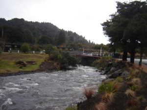
Much of New Zealand is a land of striking natural beauty riddled with natural hazards.

Much of New Zealand is a land of striking natural beauty riddled with natural hazards.

Nearly nine years ago, when I was invited to accept a three-week visiting fellowship in New Zealand with the Centre for Advanced Engineering in New Zealand (CAENZ) at the University of Canterbury, people began to ask me why the New Zealanders were so interested in me or the work of our Hazards Planning Center at the American Planning Association. My response was to ask another question: “Have you seen Lord of the Rings?”

The overwhelming majority of inquirers would say yes, and I would follow up by asking whether they were aware that the entire trilogy was filmed in New Zealand. Most were, though not all. “Look at the landscape in those films,” I would say, adding that “it ought to come to you” after doing so. Later, I wrote an article for Planning, APA’s monthly magazine, about the experience, titling it “A Landscape of Hazards.” New Zealand almost literally has it all: earthquake faults, active volcanoes, coastal storms, landslides, flash floods, and even occasional wildfires. One day, back in the states, I even learned that a small tornado had struck in Auckland. There were very good reasons CAENZ spent enough money to bring me there to consult on national hazards policy and land use.

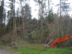
Damage following a coastal storm on the North Island in August 2008.

Damage following a coastal storm on the North Island in August 2008.

One serious consequence of the visit, which included my doing seven lectures and seminars around the country during that time, was that I established a number of valuable and lasting professional relationships, some of which are occasionally rekindled by meeting Kiwi researchers at conferences in the U.S. since then. One was a young researcher, Wendy Saunders, at GNS Science, who recently sent me a copy of a new report she co-authored for this crown research center, released in November. “The Role of Science in Land Use Planning: Exploring the Challenges and Opportunities to Improve Practice” made me realize that a common problem in U.S. planning, the introduction of scientific information related to natural hazards, is not much different halfway around the world, even under a rather different planning framework than ours.

Indeed, one other benefit of the trip was that, not only did they learn from me about the complexities and idiosyncrasies of land-use planning in the United States, but I learned a great deal about their system as well, and it broadened my perspective on how planning is practiced around the world. Things are somewhat simpler in this small nation of 4.2 million people on two islands that together are somewhat smaller than California. That led to an interesting comment from one gentleman to another in the front row of a modest crowd at the Christchurch regional council following one of my presentations. “We’re about the size of a small state over there,” he mused. Yes, I thought, we are two sovereign nations, but vastly different in size, with systems calibrated to very different needs as a result.

In the New Zealand context, the result is a system, based on 1989 reforms, in which there is no “state” layer of government between the national government in Wellington and local government at the municipal level. Under the nation’s Resource Management Act, however, a series of regional councils does provide oversight of environmental policy and reviews local decisions for compliance. Those regions are basically based on watershed boundaries, which may seem like nirvana to some bioregionalists in the U.S., but they entail their own political challenges. No system is perfect.

The challenge the GNS Science report addresses, in fact, is that of properly introducing natural hazards science into land-use policy at the local level, which is not an easy task even in New Zealand, where such hazards seem abundant and omnipresent. The report includes a case study of GNS’s own experience in intervening in a plan change in Hutt City, near Wellington on the North Island, where a major earthquake fault straddles and affects much urban development. The problem of how to introduce issues like climate and hazard mitigation into the planning process is one we have pondered repeatedly at the Hazards Planning Center at APA, precisely because that is our mission. As the GNS report notes, while local planners may complain that science is often presented In ways that lack translation into a local context, with no straightforward means of resolving conflicts between experts, scientists nonetheless “are often frustrated by the lack of uptake of their science in land use planning decisions.” Maybe Kiwis and Yankees, at least in this respect, have far more in common than we realize.

Inevitably, because there are no simple solutions that fit all cases, the report concludes that incorporating natural hazards science in land-use decision making is a “complex process influenced by numerous social levers and networks.” In the Hutt City case, economic development was paramount, but natural hazards took their place on the stage in part as a result of GNS Science’s intervention, a lesson to scientific researchers that it is important for them to find their voice even if local elected officials and policy makers may not absorb all the subtleties of scientific conclusions. It is not always a matter of scientists being poor communicators. Sometimes public officials must be better listeners. Scientists must be willing to learn more about the planning process, but planners must learn more about the nuances of scientific assessments. Public safety with regard to natural hazards risks is not a matter of stopping all development, but of using scientific knowledge wisely to make development better. We must all become better at reaching across disciplinary boundaries to reduce misunderstanding and misinformation and to receive information vital to making better decisions. The importance of this became very clear to me less than three years after my visit, when Christchurch, the home of CAENZ, was shaken by significant earthquakes from which the city is still recovering.


Jim Schwab

Symbolic Journey

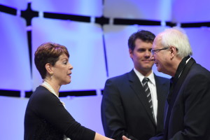
Sylvia Vargas and Ben Carlisle present FAICP medallion and certificate in Phoenix.

Sylvia Vargas and Ben Carlisle present FAICP medallion and certificate in Phoenix. Photo by Joe Szurszewski; copyright by American Planning Association.

Sometimes we find ourselves on a journey whose significance is bigger than the meaning for our own lives alone. In fact, if we are lucky, we come to realize that we can make at least some part of our lives much bigger than ourselves. Two weeks ago, while in Phoenix, being inducted into the College of Fellows of the American Institute of Certified Planners (AICP), one of the highest honors in the profession of urban planning, it became very apparent to me that I was not accepting this honor just for myself. I was also doing it for hundreds of other planners, if not thousands, who have incorporated disaster recovery and hazard mitigation priorities into their careers as essential parts of the ethical duty of planners to help promote public safety. Collectively, our work saves lives, reduces property damage, and reduces many of the negative impacts of human activities on the planetary environment.

Before I go farther in discussing those impacts, let me provide some context for the majority of readers who are not professional planners. AICP is a designation currently held by at least 15,000 professionals who have taken a certification exam, eligibility for which is based on a combination of education and experience. Most common these days as a starting point is a Master’s degree in urban planning, but there are other entry points, and there are undergraduate degrees in planning as well. AICP members, who are also members of the American Planning Association (APA), which has about 38,000 members, must maintain their status through a minimum of 32 hours of continuing education every two years, including 1.5 hours each of legal and ethical training. Only after a minimum of 15 years in AICP are planners eligible for consideration, through a rigorous review of their accomplishments and biography, for acceptance as fellows (FAICP). Only about 500 people have ever been inducted as fellows, including 61 in this year’s biennial ceremony, the largest group to date. I had the honor of being included in the class of 2016.

The very formal ceremony introduces each new fellow individually in alphabetical order while a member of the AICP review committee reads a 100-word summary of his or her achievements, during which the fellow receives a pin, a bemedaled ribbon, and certificate. Mine described my work as “pivotal” in incorporating natural hazards into the routine work of urban planners. That pivotal work is the point of my discussion that follows.

I did not start my work in urban planning with any focus on disasters, except perhaps the industrial variety. I did have an intense focus 30 years ago on environmental planning and wrote about issues like farmland preservation, Superfund, waste disposal, and other aspects of environmental protection. My first two books focused, in order, on the farm credit crisis of the 1980s and the environmental justice movement, the latter published by Sierra Club Books. I have joked in recent years, sometimes in public presentations, that even with that environmental focus in my academic training at the University of Iowa in urban and regional planning, I don’t recall ever hearing the words “flood,” “hazard,” or “disaster” once in all my classes. But I did hear about wetlands, air quality, water quality, and similar concerns. Frankly, in the early 1980s, natural hazards were simply not on the radar screen as a primary professional concern for any but a mere handful of planners. Even the Federal Emergency Management Agency (FEMA) came into being only in 1979, and these issues were seen largely as the purview of emergency managers. There certainly was no significant subdiscipline within planning devoted to hazards.

It was 1992 when Bill Klein, then the research director for APA, asked me to take over project management for an upcoming cooperative agreement with FEMA to examine planning for post-disaster recovery. As a preliminary step to this work, he sent me on a trip to south Florida for the APA Florida Chapter conference in October 1992 in Miami following Hurricane Andrew. Two aspects of that trip made a lasting impression. First was the keynote delivered by Bob Sheets, then the director of the National Hurricane Center. At one point, he showed a slide on the huge screen at the front end of the ballroom. It was an aerial photo of damage on two sides of a highway, with one side showing only modest damage and the other massive damage with roofs torn off and homes destroyed. There was no differential in wind patterns, he said, that could explain such differences at such small distances. The only plausible explanation, he insisted, lay in differences in the quality of enforcement of building codes. Florida then had stricter building codes than the rest of the nation for wind resistance, but they only mattered if code enforcement was consistent. Here, it was clear to me, was a problem directly related to development regulations. The second involved a field trip aboard several buses for interested planners to south Dade County. At one point I saw that the roof of a shopping center had been peeled off by the winds. It nearly took my breath away. Then our buses got caught in a traffic jam at the end of the afternoon. The cause was a long line of trucks hauling storm debris to landfills. This was already two months after Andrew.

Under the agreement, we didn’t start work on the project until October 1, 1993. In the meantime, floods had swept the Upper Midwest, making parts or all of nine states presidential disaster declaration zones. I decided to jump the gun on our start date and visit Iowa while it still was under water. Local planning departments in Iowa City and Des Moines cooperated in showing me their cities and sharing what had happened. It turned out that I was undertaking this project, in which I engaged several veteran planners to help write case studies and other material, at the beginning of America’s first big decade of disasters. (The next was even bigger.) In 1994, the Northridge earthquake struck the Los Angeles area. In 1996, Hurricane Fran struck North Carolina, followed by Hurricane Floyd in 1999. In the meantime, not only had our report, Planning for Post-Disaster Recovery and Reconstruction, been published in 1998, but so was another report of which I was the sole author: Planning and Zoning for Concentrated Animal Feeding Operations. Floyd left much of eastern North Carolina, liberally sprinkled with poultry and hog feedlots as a result of regulatory exemptions, devastated, with hundreds of thousands of animal carcasses floating downstream. Eventually, they were burned in mobile incinerators introduced by the U.S. Environmental Protection Agency. Suddenly, it became apparent to me that the environmental concerns aroused by such operations and the impacts of natural disasters were thoroughly intermingled. Bad public policy was exacerbating the impact of disasters like hurricanes and floods.

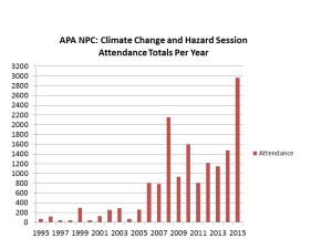
At this point, I need to make clear how low the level of engagement was back then between professional planners and disaster issues. In 1995, the APA National Planning Conference, which in recent years has typically attracted about 5,000 registrants, included two sessions related to disasters, at which the total attendance was 73 people. Disasters were anything but the topic du jour. Yet the events of that decade made clear, at least to me, that something had to change in that regard.

What I did not anticipate, based on past experience, was how quickly that would happen. For one thing, the Planning Advisory Service (PAS) Report grew on people and became a classic in the planning field. By 2005, after Hurricane Katrina, APA published a new edition, and FEMA made boxes of them readily available in the Gulf Coast, with planners like Stephen Villavaso, then the president of APA’s Louisiana chapter, voluntarily driving through stricken towns and passing out copies to local officials. In the meantime, I had worked on several other hazard-related projects addressing planning for landslides and wildfires and providing training on local hazard mitigation planning, among other efforts. After the APA conference in New Orleans in 2001, a group formed and continued to meet over dinner at every subsequent conference that billed itself as the “Disaster Planners Dinner,” an event that has become the subject of some legends among its veterans. The growing contingent of planners taking hazards seriously as a focus of their professional responsibilities was growing quickly and steadily.

Hurricane Katrina, more than any other event, added a powerful new element to the public discussion. It made crystal clear to the national news media that planning mattered in relation to disasters, and because of that perception, they called APA. Paul Farmer, then the CEO and executive director, and I shared those calls, and I logged no fewer than 40 major interviews in the two months following the event in late August 2005. I stressed that disasters involve the collision of the built environment with utterly natural events, and the resulting damage is not an “act of God” but the outcome of human decisions on what we build, where we build it, and how we build it. Planners have the responsibility to explain the consequences of those choices to communities and their elected officials during the development process, and those choices sometimes have huge social justice impacts. Katrina cost more than 1,800 lives on the Gulf Coast, most of them involving the poor and the physically disadvantaged. Better planning thus became a moral imperative. Making that perception stick produced a sea change in public understanding of the high stakes involved.

That afforded me considerable leverage to win funding for new projects with FEMA and other entities, most notably including the 2010 publication of Hazard Mitigation: Integrating Best Practices into Planning, a PAS Report that argued strongly for making hazard mitigation an essential element of all aspects of local planning practice, from visioning to comprehensive planning to policy implementation tools like zoning and subdivision regulations. Now the focus of a growing amount of federal and state guidance in this arena, that report was followed in 2014 with a massive update and revision of the post-disaster report, Planning for Post-Disaster Recovery: Next Generation, which dissected the whole process of long-term community recovery from disasters and argued fervently for pre-disaster planning to set the stage for effective recovery and resilience after an event. Those efforts came under the umbrella of the Hazards Planning Center (HPC), created by APA in 2008 along with two other centers as part of the National Centers for Planning. I have been the manager since HPC’s inception, and I was happy. We had succeeded in institutionalizing within the profession what had once been treated as a marginal concern of planners.

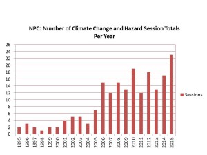
Along the way, that dinner group grew, attracting dozens of attendees by the end of the decade, and becoming large enough and attracting enough petition signatures to become APA’s newest membership division in 2015, the Hazard Mitigation and Disaster Recovery Planning Division. They now meet as such during the APA conferences. They are no longer an informal group. They are official and at last count had at least 250 paid members. But the interest is far larger. Remember those numbers from the 1995 APA conference? In Seattle at the 2015 APA conference, almost 3,000 people attended 23 different sessions related to climate change and natural hazards. I was the opening speaker for the very first session in the climate track, and the room was full. There was an overflow crowd in the hall outside. Hazards and climate change adaptation had arrived as a primary concern of planners. A growing number of graduate schools of planning, including the University of Iowa, where I have been adjunct faculty since 2008, now include curricula on such topics.

This bar graph and the one below were developed last year for a presentation I did in July 2015 at the opening plenary of the 40th annual Natural Hazards Workshop, in Broomfield, Colorado.

This bar graph and the one below were developed last year for a presentation I did in July 2015 at the opening plenary of the 40th annual Natural Hazards Workshop, in Broomfield, Colorado.

Slide1

I want to state that, although I often had only one intern working with me at APA, I have never been a one-man show. On most of those projects, I involved colleagues outside the APA staff as expert contributors and invited many more to symposia to help define issues. Those APA sessions attract numerous speakers with all sorts of valuable experience and expertise to share. This is a movement, and I have simply been lucky to have the opportunity to drive the train within the APA framework as the head of the Center.

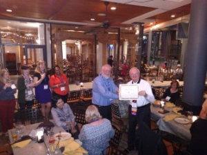
The night after the FAICP induction, at their division reception, members of the new APA division jokingly award me an "F" to go with my AICP. Alongside me is Barry Hokanson, HMDR chairman.

The night after the FAICP induction, at their division reception, members of the new APA division jokingly award me an “F” to go with my AICP. Alongside me is Barry Hokanson, HMDR chairman.

So let me take this story back to that moment two weeks ago when I walked on stage and accepted induction into FAICP. Before, during, and after that event, I received congratulations from many colleagues intensely interested in hazards planning, and I realized I was not simply accepting this honor for myself. My achievement was theirs too, and was literally impossible without them.

“You’ve gone from fringe to mainstream,” my colleague Jason Jordan told me the opening night of the Phoenix conference. He ought to know. Jason is the experienced governmental affairs director for APA and has a keen sense of the trends in planning and of government policy toward planning. But in order for his statement to be true, one important thing had to happen: Lots of other planners had to climb aboard that train for the journey. My success in winning this honor was symbolic for them, in that it served to validate the value of their commitment. I did not get there alone. A growing army of planners who care about public safety and community resilience helped make it happen, and I shall always be grateful—for them as well as for myself.


Jim Schwab


Drifting into Disaster

Scene from the Sacramento-San Joaquin Delta

Scene from the Sacramento-San Joaquin Delta

Across the United States of America, about one in five people live under the rules and structures of some sort of private association that governs common property interests. These can be condominium associations, homeowners associations, or similar entities that are somehow responsible for levying fees and maintaining communal property. To degrees they often may not realize, the residents are thus controlled and constrained by the decisions these associations make, which often may concern themselves with details that a local government would not even consider, such as the color of aluminum siding, allowable holiday decorations, and other matters with minor impacts on the quality of life. Many homeowners associations are established by developers at the time they get permits to create a new subdivision. In some states, local governments are happy to offload responsibility for infrastructure maintenance, such as private roads, onto these associations while coveting the property taxes they will still pay.

The implications of all this were brought to my attention in the past week or two by Chad Berginnis, the executive director of the Association of State Floodplain Managers (ASFPM). He has been working with me on material for a future report we plan to publish at the American Planning Association on subdivision design as it relates to areas with flood hazards. The issue that concerned him as he wrote a chapter on subdivision standards for local governments, which have the primary responsibility for permitting new development, is how well these private owner associations can sustain over time the financial responsibilities for infrastructure designed to protect their properties from disaster, most notably but not exclusively, flooding.

Among the items that have come to my attention is a paper by two California attorneys, Tyler P. Berding and Steven S. Weil, disturbingly titled, “Disaster! No Reserves. No Insurance. What’s Left if a Natural Disaster Destroys a Community Association?” They begin with a cautionary tale about the Bethel Island Municipal Improvement District, actually a California special district, not a homeowners association. Its mission is to maintain and improve the levees that surround the Sacramento Delta island of 2,500 residents, where the interior is seven to 15 feet below sea level. To say that their survival depends on well-maintained levees is no exaggeration. Moreover, in that part of California, the levees are subject to collapse from earthquake shaking as well as from overtopping in a flood. I have some idea of their peril because four years ago, a representative of the California Department of Water Resources (DWR) took me on a six-hour guided tour of the levee system in the delta area, plying me with a number of the background studies by DWR of the overall situation. There are hundreds of such islands throughout the Sacramento-San Joaquin Delta, many used for agriculture, and some developed. In their 2012 article, produced about the time of that tour, Berding and Weil note, “But the district is broke.” Voters “soundly” rejected a 2010 parcel tax measure to fund improvements, and much of the district staff was laid off. The levees were deteriorating, to some extent “suffering damage by beavers and rodents.”

It is disturbingly easy for homeowners association or other private association board members to take their eyes off the ball of maintaining adequate reserves and resources to address dangers that seem less than imminent, and even to forget why they are responsible for collecting assessments in the first place. And it is even easier for residents who must approve some of those assessments to lack meaningful knowledge of the consequences of either depleting or failing to maintain adequate reserves for unfortunate natural events like floods, earthquakes, or other disasters. Once they begin sliding down that slippery slope of amnesia and unawareness, it is not long before they have put a good deal of common and individual property at risk. The few who may be aware of the long-term consequences often may lack the ability to make their case to less concerned neighbors.

This issue is one of concern in the field of urban planning because new subdivisions, in particular, often arise at the edge of metropolitan areas in unincorporated county lands or small towns, where governance capacity may be limited and resistance to government regulation particularly high. The result is that oversight is weakest, and the desire for new development highest, precisely where the need for that oversight may be greatest. In regulatory terms, it is the theory of the weakest link. One of our motives for the new report (underwritten by the Federal Emergency Management Agency) is to help shore up those weak links with stronger guidance about sound practices in reviewing plans for new subdivisions. Berding and Weil were serving a similar purpose, at least in the California context, by describing sound practices for community associations, particularly in sustaining adequate reserves for contingencies such as disasters.

But finances are only part of the problem. Sometimes, the leadership of such associations can become so focused on issues like aesthetics and conformity that they lose sight of larger issues like public safety. In the past, the National Fire Protection Association, which supports the Firewise Communities initiative, has trained its attention on the question of covenants that run counter to public safety, for example, by inhibiting well-researched methods for containing wildfire threats. Many of these techniques involve either landscaping or building design, yet some associations have rules limiting tree trimming or landscaping that would aid in wildfire mitigation. In Safer from the Start, NFPA’s 2009 study of the issues involved in building and maintaining “firewise-friendly developments,” a sidebar notes that the state of Colorado’s recently passed “Colorado Common Interest Ownership Act,” among other measures, basically invalidated a number of types of association covenants and restrictions that inhibited defensible space around private dwellings in order to advance wildfire safety statewide. In effect, the state was saying, with regard to rules that made wildfire safety more difficult to enforce, “enough.” At the same time, the publication overall provided a significant amount of sound advice about best practices in wildfire protection in rural subdivisions and new developments.

That seven-year-old NFPA advice recently got a new boost from an interesting direction: Green Builder Media just recently issued its own e-brochure, “Design with Fire in Mind: Three Steps to a Safer New Home,” in cooperation with NFPA. Green Builder Media has more of a direct avenue to influence those developers who want to build safe, resilient, energy-efficient communities.

The fact that these resources have continued to materialize on a regular basis over the past decade or two indicates, to me, that the subject of good design and homeowner association responsibility is not going away any time soon. It is the job of planners, floodplain managers, and local and state officials to ensure that those responsibilities remain on their radar screens and are taken seriously. One-fifth of the American population depends to a significant degree on the quality of their oversight.


Jim Schwab

Drone Coverage in Napa

Readers may well be waiting for me to post something substantial soon, and I plan to compose a significant article this Labor Day weekend. It’s been very hectic for me the last two weeks, and I am currently in Washington on a round of ten meetings in two days, pursuing business new and old.

But while all that is happening, Mike Johnson from our IT department at the American Planning Association latched onto something very interesting, I think, and added it to our Recovery News blog. Amid all the debate about the proper and allowable uses of drones, Evan Kilkus in California has found one use that gives us handy new insights into the nature of damage from the recent earthquake in Napa, California. Use the link above to see his drone-filmed video of the damaged buildings from a perspective you won’t get from the street.

Recovery News is a vehicle we created to deliver news and resources pertaining to post-disaster recovery in connection with our project, nearing completion, with FEMA to prepare the Next Generation guidance on planning for post-disaster recovery. Kudos to Mike for turning up the latest innovation in this area, and to Evan Kilkus for getting it done.

Jim Schwab