Before and After and a Disaster Course Online

In two weeks, I will deliver my first online course with the Sustainable City Network (SCN), an organization I’ve become familiar with in recent years. Last October, I blogged about a keynote presentation by Kristin Baja at their annual conference in Dubuque. More recently, I signed an agreement with SCN to become an online instructor, starting August 21 with a course on planning for post-disaster recovery. The note below is theirs, transplanted from the Projects page of my business website at www.jimschwabconsulting.com. If you’d like to learn a lot in a hurry and want me to teach it, I encourage you to follow the link and check it out. I’m working overtime right now to put it all together.

Jim Schwab Signs on as Instructor for SCN

POST-DISASTER RECOVERY PLANNING BEFORE & AFTER – 4-Hour Online Course – Aug. 21 & 22, 2018

Sustainable City Network will host a 4-hour online course Aug. 21 and 22 for anyone responsible for initiatives related to resilience and disaster recovery planning. In the first 2-hour session, we’ll review the overall concept of recovery planning and the need for widespread involvement by various sectors of the community. The second segment will walk participants through information gathering, assessing the scale and spectrum of the disaster, and how to involve the public in meaningful long-term recovery planning. Instructor James Schwab, FAICP, is a planning consultant, public speaker and author who has taught since 2008 as adjunct assistant professor in the University of Iowa School of Urban and Regional Planning, with a master’s course on “Planning for Disaster Mitigation and Recovery.” Attend live or via on-demand video. Cost is $286 when purchased by Aug. 3.

Register now at https://www.eventbrite.com/e/post-disaster-recovery-webinar-series-registration-47309610318

Jim Schwab

When Denial Is Not an Option

Wildlife in the Louisiana wetlands. All images in this post by and courtesy of Kristina Peterson.

It has always amazed me how much time and energy has been wasted, particularly in the U.S., on the denial of climate change in the face of so much scientific evidence. Sea level rise is a directly measurable phenomenon. So are changes in precipitation patterns over time. The fallback denial position, once the data are made clear, is that we do not know what is causing the change that we see, and therefore it is pointless to point to human influence on the environment. This, too, is of course nonsense because the theory behind the impact of greenhouse gases on warming temperatures has been with us for more than a century and has been validated for several decades. Yet, in the world of politics, the silliness goes on. And on.

One intriguing aspect of this denial is that distance from the problem seems to lend itself to a greater disposition toward denial. It is easier to ignore a problem that does not confront you visibly and directly. This distance need not be geographic; it can also be social and economic. Those near the seacoast with greater wealth and the ability to protect their property may not feel the pain of increased flooding and sea level rise nearly as much as poor homeowners who have fewer options to move or rebuild. For the same reason, if one can avoid loaded political language and discuss practicalities, it is possible to get many farmers to observe that growing seasons have grown longer, droughts have grown drier, and that something has surely changed in recent decades. As the saying goes, it is what it is.

Elizabeth Rush will not let us forget what is. In Rising: Dispatches from the New American Shore, she gently but firmly seizes our attention to lead us through coastal communities that are already experiencing the ravages of sea level rise. She does not focus on projected damages or what may happen in three generations. She speaks powerfully, poetically, lyrically about what happens to people in communities that have depended on coastal ecosystems for generations but now must face the prospect of relocating or abandoning the places to which they belong, of which they have been an organic part. We visit communities in Florida, Louisiana, San Francisco Bay, and New England that are witnessing permanent change in their shorelines and the loss of neighborhoods and towns that are no longer viable. She takes us on hikes through forests and wetlands that are already changing or have changed permanently, where scientists are documenting the adaptation of plant and animal species to changing weather and higher water.

Albert Naquin (in Santa Claus pose)

Rush is not a scientist but a scientifically literate environmental journalist with poetry in her bones and empathy in her manner. She sits down with Isle de Jean Charles Indians in the Louisiana bayou to discuss their removal from a once robust island that has shrunk from 55 square miles to less than one square mile in the past century, a place where few can still live and many have left already. Albert Naquin talks in poignant terms about his tribe’s struggle to reassemble a homeland further inland on higher ground in the face of numerous bureaucratic obstacles at both the federal and state level. Rush allows many other actors, in places from Maine to Staten Island to Pensacola, to speak in their own voices and tell us firsthand of the wrenching experience of loss and relocation. This is not a book about those with the means to choose their homesite. This is about people who have known and adapted to one place for a long time and have no options left. The book reminds us vividly that the issue of climate change is as much about people as it is about abstract scientific concepts.

Members of the Isle de Jean Charles community.

Over the years, with the hurricanes and the land loss and flooding, many people have been displaced. It got to the point that if something wasn’t done eventually there would be no Native community, no more people of the Isle de Jean Charles. Many of those that left, it looks like they’re going to be included too, and I think for them especially this relocation can do some good. The island is already a skeleton of its former self and that’s what’s happening inside the community as well. When we relocate to higher ground we will at least be able to hold on to each other. I mean if we can stay together, then we haven’t lost as much.

. . . . I mean really we are talking about having to choose to move away from our ancestral home. I know a lot of people figure we would be celebrating, to be moving to firmer ground and all. But it’s not like I threw a party when I heard about the relocation. I’ll be leaving a place that has been home to my family for right under two hundred years.

Chris Brunet

Of course, many others have experienced the pain and mixed feelings of forced relocation. Coastal storms and inland flooding have led to the buyouts and relocations of thousands of Americans in recent decades, and the toll climbs with every Hurricane Katrina, Harvey, Irma, or Maria. The toll will continue and grow.

Nolia Naquin, Albert’s sister.

Still, Rush’s book is not the typical call to action of a climate change activist. Rush is engaged more clearly and subtly in attempting to adjust our mindset, showing us in real terms the impacts of a history of environmental racism in which the least fortunate live in the most vulnerable neighborhoods, less by choice than because of a historic lack of options. She is raising our awareness of our historic ignorance about the ecological value of wetlands, which has caused us to compromise their protective functions and make shorelines more vulnerable. She is introducing us to the powerful sense of place of traditional communities, a sense that is generally lacking in affluent vacation homes by the sea. She is sensitizing us to a sense of doom in some communities and the lost opportunity felt by the departing residents. In short, she wants us not just to know but to feel the immediate loss produced by sea level rise today.

There are many volumes of studies and reports where one can acquire detailed scientific data about climate change. I have cited many for readers of this blog, and they are important. But it is also important to understand this crisis on its most human level. Helping us do that is Rush’s forte. Rising is a great introduction to the human cost of our global environmental neglect.

Jim Schwab

FEMA Needs to Think about This One

Flooded property in Lyons, Colorado, after the St. Vrain River flooded in September 2013.

There is that old saying that, if it ain’t broke, don’t fix it. To that, one might add that, if you’re thinking about fixing it anyway, you may want to clarify exactly how you wish to improve things and why you think the improvement will be better.

In a February 27 notice in the Federal Register, the Federal Emergency Management Agency (FEMA) proposed a major change in long-standing hazard mitigation rules regarding grants for acquisitions of flooded properties that made almost no effort to meet that test. I wish I had noticed it earlier because the deadline for comments was April 30. I submitted a brief comment on that date and tried to rally others on Facebook, but the truth is that this one got away from me. I was busy on other fronts. I have subsequently spent a few days gathering background information.

I am very glad that a few national organizations like the Association of State Floodplain Managers (ASFPM), American Rivers, and the Natural Resources Defense Council (NRDC) found time to file substantial objections to FEMA’s notice on Property Acquisitions and Relocation for Open Space (Docket ID: FEMA-2018-0006). Their objections raise profound questions about both the process and the substance of FEMA’s proposed changes. Others have also submitted comments.

Here’s the bottom line: For 30 years since the passage of the Stafford Act, which provides the basic framework of most federal disaster law, federal hazard mitigation grant programs have required that lands being acquired from property owners whose homes have been flooded must be placed into perpetual open space following demolition of the structures. The clear intent is to reduce the ongoing exposure of the federal government and the National Flood Insurance Program to repeated losses by precluding further development in those flood-prone areas. By and large, those grants go through state and local governments, which then maintain those open spaces and must periodically certify to FEMA that the lands remain in that status. Today, those grant programs include not only the Hazard Mitigation Grant Program (HMGP), a sometimes-substantial source of mitigation funding that is available after a presidentially declared disaster; the Pre-Disaster Mitigation (PDM) program, created as part of the Disaster Mitigation Act of 2000, which amended the Stafford Act; and Flood Mitigation Assistance (FMA), part of which deals with Severe Repetitive Loss properties, which make up a disproportionate share of overall flood claims.

In the notice, FEMA has announced a new option to allow owners of flooded properties to retain the underlying land while being paid to demolish the structures, thereby permitting them to eventually rebuild on that same flood-prone land. Because mitigation grants have gone from FEMA through states to local governments, those governments have been responsible for the open space programs that result. This new approach would allow the property owner the option of taking the grant directly from FEMA. In its comments on the proposal, ASFPM noted that, in the 2004 NFIP reform legislation, it supported providing FEMA the option to deal directly with property owners, mostly because some local governments have lacked the capacity to monitor the open space requirements, but it still expected that FEMA would consult with those governments before using that option as a means of maintaining consistency with state and local hazard mitigation policy. The current notice makes no mention of such coordination.

Elevation of flooded properties remains a viable option in many cases.

It is not as if these owners do not have other options for mitigating future flood damage, including elevation of residential structures above the 100-year base flood elevation established on FEMA flood insurance rate maps, or floodproofing the structure. But, the thinking seems to be, some owners will be more willing to demolish if they can retain the land. One possibility for some might be to retain the land, rebuild in due course, and flip the improved property while leaving the NFIP with continued flood loss exposures. How that helps federal taxpayers or other flood insurance rate payers is not especially clear.

The Federal Register announcement does nothing to make that clear. If you follow the link and read the notice, you are likely to experience my reaction, which was that I felt left in the dark regarding the rationale for making this move, which is not explained. Nor does FEMA provide any data to support the idea that this initiative would do anything to reduce flood losses. The opposite could easily prove true.

In an April 26 article in Insurance Journal, former FEMA administrator Craig Fugate offers some support for the new option by noting that placing land in permanent open space through a buyout is often a “hard sell.” That may well be, but it is partly because the solution is meant to be effective and lasting. It is also not as if the approach has lacked success. As NRDC notes in its comments, citing ASFPM case studies, more than 30,000 floodplain properties have been removed from development since 1993, many of them following major cataclysms such as the 1993 and 2008 Midwest floods and various hurricanes.

Perhaps more telling is the question of homeowners’ motivation in making the difficult decision to sell and relocate. The idea that people would necessarily prefer to be able to rebuild in the same location is not as clear or straightforward as some might assume, though there are, no doubt, advocates of property rights who would prefer to create the new option. But this emotional decision contains some factors that should not be ignored. Perhaps straight to the point is this comment from American Rivers:

Our experience working with floodplain managers has taught us that convincing property owners to accept a buyout is an emotional and difficult decision, and many are only willing to accept the buyout offer after they are assured that the property will be preserved as open space for the good of the public. Offering direct grants that allow new construction where a structure was demolished could be at odds with local hazard mitigation plans and efforts to acquire flood prone properties for open space. FEMA should instead be working to support the implementation of open space goals in local and state hazard mitigation grants.

In other words, many of those choosing a buyout, having suffered the damages of severe and repetitive losses from flooding, and aware of the larger issues concerning the public good in these situations, would rather ensure that nothing like this happens again, at least in their community. But what happens to the motivation undergirding their willingness to sell if they become acutely aware that their neighbors now have the option of prolonging the pain by not placing the land in permanent open space? Will they still feel that they are accomplishing anything by pursuing the traditional option? In any event, are these not the people whose choices we most want to honor for the greater good of the community?

City-acquired open space in Cedar Falls, Iowa, near the Cedar River.

The essential reason all this is important is that we have learned much over the years about the natural and beneficial functions of floodplains, which include soil enrichment, wildlife habitat, reduced flood severity, and reductions in erosion and stormwater runoff, to name a few, in addition to the potential recreational functions of waterfront parks and open space. All this is in addition to the fiscal benefits of reducing future floodplain losses in the areas affected. If all that is not reason enough for FEMA to pause, rethink the question, and at least offer some solid scientific and economic documentation of the benefits of the proposed new approach, then I am not sure what is. Otherwise, count me a serious skeptic.

Jim Schwab

Norway’s Fjords: Up Close and Magnificent

There is something distinct about boarding a cruise ship. An airplane, after all, no matter how big, is essentially a long, metal tube that flies. You can dress it up for international flights, but when all is said and done, you are simply spending a few hours in the air in a seat, where you may be served half-way decent food (or not). You can talk to a few people around you, you can watch a movie on a small screen in front of you, but your options are limited.

My wife, Jean, and friend Carolyn Torma relax in the lounge on the MS Nordnorge.

Boarding a cruise ship is more like joining a small, floating city. Once aboard, you can wander the decks for fresh air, you can chat with hundreds of people, converse with crew members, and take in sights both near and far away. You can break out that camera you just bought. And you can visit coastal cities for a few minutes or a few hours, depending on the itinerary.

Welcome to my final blog post on our trip to Norway in July 2017. I have promised and teased, but I am delivering after three prior installments about our flight to Norway; our time in Oslo; and most recently, our train trip to Bergen and our visit to its intriguing and highly edfying art museums.

When the day visit of our gang of five to the center of Bergen ended, we gathered our bags at the Clarion Hotel Admiral and boarded a shuttle bus to the dock where we checked our bags with Hurtigruten, a wonderful cruise line dedicated to sustainable practices, watched an instructional video on cruise safety, and boarded the ship. Perhaps I am a bit romantic but crossing the gangplank into a ship stirs more ancient memories of human experience than flying ever will. Humans have been sailing for thousands of years, traversing seas and oceans, and the only serious difference is that the ships have grown larger and more mechanized and, these days, electronic as well. But you are still floating close to the water and the weather and nature.

You also know that you will be aboard this behemoth for several days. That makes accommodations important. In our case, in order to join the same cruise as our friends, my wife and I had to lose our inner cheapskate and splurge on a state room because the lower decks were sold out. Our friends were on Deck 3, but we were on Deck 6, in a room that had a nice television screen and a bed for two, plus a decent bathroom. Admittedly, things still seemed a little cramped, but how much time do you want to spend in your room? Especially as the ship moves north and the summer nights grow long above the Arctic Circle, the idea of sitting in a room seems almost absurd.

Wander the decks! There is a whole world of Norwegian fjords to see out there. There was a promenade on Deck 5, one level below us, and the stairs with their gold-colored railings seemed like a grand way to get there, far more inviting than the elevator. There was the entire lounge on Deck 7, with an outdoor viewing area at the front of the ship, where you could sit outside and monitor the ship’s progress through passages that offered stunning scenery on every side. More than once, I sat there in a deck chair with the movie function turned on for a new Sony camera I had bought in anticipation of this trip. At lower latitudes near the beginning of the trip, this was often great fun. Later, as temperatures grew cooler farther north, it sometimes became less comfortable—but no less impressive.

Inside, we soon also discovered an entire world of Scandinavian cuisine that was previously not part of our daily experience. It’s not that my wife and I have not tried a wide range of international food. We simply had not visited Norway, nor spent nearly a week investigating buffet options for breakfast and lunch in the remarkable dining room on Deck 4, which offered a range of Norwegian pastries, dark breads with savory cheeses, herring, salmon, ham and beef, and all manner of vegetable dishes and soups. Dinner was served at assigned tables and times but allowed us to get to know an interesting and intellectually curious family of educators from Seattle. The food was one of the bigger surprises for me because I had not previously learned to regard Norwegian cuisine highly. Never mind all the stories you may have heard about lutefisk. After this trip, I stand corrected. The best of Norwegian cuisine is a salivating safari for sophisticated palates.
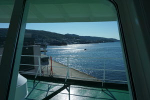
View out the front window of the lounge.

Amidst it all, relaxing in the lounge with a view of the shore in the distance or nearby, I plowed through my tome. On a long vacation, I like to take a long book I have wanted to read but never found the spare time to immerse myself in. For this trip, I tackled Doris Kearns Goodwin’s magisterial Team of Rivals, a 750-page exploration of Abraham Lincoln’s political genius in managing a team of strong wills and egos through the shoals of the Civil War. It filled the hours when I wanted to take a break from sightseeing and just enter another world and time. I chose well.

Viewing the Fjords

It is difficult to do justice to the scenery in words alone, but the beauty of the blog is that I can insert photographs to enrich the story. I had a small, aging Fuji digital camera; my iPhone; and a newly acquired Sony digital with zoom lens enhancements and movie features, all of which I was still trying to master on the fly. It often offered more options than I intelligently knew how to manipulate or had time to learn, as breath-taking scenery was often just around the next bend in the fjord.

There is nothing subtle about the Norwegian coast, but there is much that is sublime. It is not hard to imagine the awe of nature and the gods that must have filled the hearts of Vikings sailing along the coast or returning from their overseas explorations. Islands dot the sea lanes; some are inhabited, and many are not, usually because the terrain does not offer much solace. Shoreline communities occupy modest niches of flat land below hills and towering cliffs.

No two fjords are ever the same. Each has its own unique topography, its own paths to sheltered ports, its own dramatic waterfalls crashing off mountainsides into the seas, its own snow-capped peaks above the humble human intrusions below. Norwegians at times are remarkable engineers, but there must still be a sense of our own puniness in the face of such lofty natural beauty. We could never replicate the work of millions of years of geological transformations of earth’s landscape. It is better to sit back, gaze in admiration, and appreciate it.

What is remarkable, nonetheless, is the mastery of coastal navigation, even if modern ships benefit from a range of electronic wizardry to avoid danger. In a part of the coast known as the Trollfjord in the Lofoten Islands, it is my recollection that we were told we were crossing a passage with only 450 meters between rocky outcrops hundreds of meters high. On a cruise ship housing nearly 500 passengers and crew members, that does not leave much room for error, but the passage, admittedly in calm seas, seemed effortless and very precise. Our ship approached the passage in the evening; I was captivated by the scenery for the entire time and filmed it for 12 minutes. I cannot recall anything I have seen that compares.
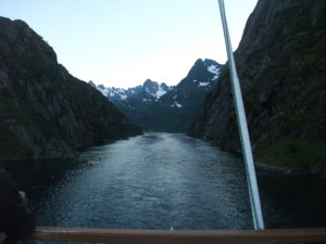
Passing through the Trollfjord.

Trondheim

Ports of call are a routine feature of cruises. In Norway, these are port cities along the coast, often away from the ocean itself within fjords, the long arms of the sea that often shelter such cities. On our second full day of the cruise, the MS Nordnorge docked in Trondheim for a 3 ½ hour visit. We disembarked and began a journey on foot to find Nidaros Cathedral, the oldest cathedral in Norway and the northernmost cathedral of its size in Europe. Trondheim was also at one time the capital; moving the capital south to Oslo, formerly known as Christiania, was a modern innovation. Nidaros Cathedral remains the scene of coronations for the nation’s constitutional monarchy.

The walk to Nidaros, which was under a half-hour, took us along the Nidelva River, lined by some colorful apartments on the far side, with some interesting urban architecture on our side as we moved into the heart of the city. The site of the cathedral became apparent as we drew near because the building is surrounded by impressive grounds and fencing. The soaring worship space was completed in 1300 but begun around 1070, with much of the construction occurring after 1190. Tours require tickets at a modest price, which visitors can obtain in the nearby gift shop, whose sales help support maintenance of this massive space. The cathedral sits above the grave of St. Olav, the nation’s patron saint, a tenth-century Viking king who converted his subjects—and himself—to Christianity after learning about the faith in England, which experienced numerous Norse raids in the Middle Ages. One must marvel at its height and size given the lack of modern tools, but a tour guide informed us that masons were in the habit of leaving their initials on the bricks that formed the foundation and walls. The building has both the sense of inner darkness typical of buildings lacking modern Illumination and a sense of spaciousness emanating from its massive ceilings and the size of its sanctuary. Originally, it was the seat of the archdiocese, but suffered a demotion to a huge parish church for Trondheim following Norway’s turn toward the Reformation, when Lutheranism became the state church.

Between its history and majestic architecture, my own judgment would be that, if one had time to visit only one thing in Trondheim, this would necessarily be the default choice. That said, we had a little time left after our tour. Jean and I, in touch with our friends by cell phone, wandered through a large, modern urban mall back toward the ship but stopped for a few minutes at a serendipitous discovery, a flowery pocket park inhabited by birds, where we simply imbibed the relaxing atmosphere in the middle of Norway’s third-largest city. Then we bought a couple of souvenirs at a shop atop the bridge we crossed as we made our way back to rejoin the cruise late in the afternoon. We still had a couple of hours to relax with our friends over drinks in the bar before dinner and another evening of scenery consumption.

Bodø

The next day, our long stop was at Bodø, a smaller city whose second syllable is pronounced somewhat like the “oo” sound in the English word “foot.” (Pronouncing that will give English speakers a vague sense of that distinctive sound of Scandinavian languages.) A slightly longer stay in a smaller city gave us ample opportunity to explore, but without the obvious choice of anything like Nidaros. One intriguing aspect of the day was passing beneath a tall bridge lined with spectators observing the passing of our ship beneath. Norway has plenty of bridges, no surprise, but this sort of welcome was a pleasant surprise.

In Bodø, one indicator of the changing cosmopolitan nature of Norwegian cities was the sign that greeted us not long after we became urban pedestrians again—Istanbul Kebab. Like other European nations, Norway has acquired its share of Middle Eastern immigrants, and restaurant options have diversified. No doubt, these newer options have also thrived as Norwegians seek a change of pace, just as Americans, Brits, and others have done. Still, even the shopping district near the shore affords an unhurried, uncrowded atmosphere that let us soak up the afternoon sun in peace and quiet.

Tromsø

Tromso Cathedral

Our fourth full day took us ever farther north with a four-hour stop at Tromsø. This is the last major city on the journey north, and not hard to wander. With my interest piqued by Nidaros, I sought out the Tromsø Cathedral, just a few blocks from the shore, only to find that it was closed and undergoing renovations—signs of which abounded with construction equipment parked just outside on the somewhat spacious Kirkeparken that surrounds the building itself. Reduced to simply looking at the building from the street, we instead joined our friends in a visit to the nearby Tromsø Gift and Souvenir shop, which sported a stuffed bear outside that was a magnet for tourist selfies. It was a great place to look at gifts that someone back home might want, as well as those souvenir mugs and hot pads that line one’s cupboards.

Once that novelty had worn off, however, we quickly discovered the Northern Norway Art Museum, which had a wonderful display of indigenous Sami clothing and handicrafts, with some explanation of the Sami culture that produced them. Here, I should note that one of the more moving lectures aboard ship, amid other daily offerings, was a presentation by a young Sami woman who was part of the Nordnorge crew. She shared stories of the discrimination suffered by Sami people at the hands of Norwegians, including herself in school and elsewhere. Things are looking up, and the king and queen offered an apology to the Sami on behalf of the nation, but racial and ethnic prejudice takes many forms and is not easily or quickly rooted out from any society.

The Sami number perhaps a modest 50,000 in modern Norway, a number larger than in any other Scandinavian nation or in Russia, where a small number also live. One of their traditional occupations has been herding reindeer, which are produced for their lean and nutritious meat, a result of consuming native grasses and herbs. The Sami, however, faced a serious public health crisis after the 1986 Chernobyl nuclear power accident in what is now Ukraine, as the released radiation dispersed westward over northern Scandinavia and contaminated the ground and the reindeer who roamed it. Many Sami, including the speaker, suffered some degree of radiation poisoning, which in her case produced red blotches across her back and shoulders. Her story offered a dramatic example of the environmental jeopardy facing indigenous populations around the world. To call it sobering is to understate the case. She indicated that, over three decades, those radiation levels have receded significantly but were not always regarded as a matter of concern by the Norwegian government. The Sami relied on their reindeer and suffered with them. Not everything in Norway involves love and kisses, and history must be accounted for. I had to respect Hurtigruten for offering such a heart-felt, sobering presentation amid a cruise meant largely for entertainment. If people did not hear this story here, when might they ever hear it?

Jean’s birthday dinner, complete with reindeer steak entree and cloudberry dessert.

On the last night of our voyage, our gang of five enjoyed a complimentary upgrade to a private three-course meal on Jean’s birthday. One of the entrée options was reindeer steak, which Jean and I chose. It is a dark red, very lean meat, but very tasty and tender. I may never have it again, the supply in places like Chicago being almost nonexistent. But it was well worth finding out. I also recall that Jean tried a dessert involving cloudberries, a species unique to northern Norway, mostly grown above the Arctic Circle. Hurtigruten is very good at local sourcing of agricultural produce for passenger consumption. They have identified small, sustainable producers along their route from whom they can obtain these products during the numerous short stops at ports of call, a practice that also supports the many small, struggling farmers in rural Norway.

Honningsvag

Our last full day involved a stop at Honningsvag, a small city in the North Cape area above the Arctic Circle as the shoreline bends east along the Arctic Ocean toward the Russian border. Honningsvag is at the southeastern edge of Nordkapp, translated as North Cape in English, actually a rugged island off the northern coast of Norway. By now, I was getting used to the possibility of waking up at 3 a.m. and peeking out our cabin window to see sunlight diffused across the seascape. Summer above the Arctic Circle can be disconcerting in that respect. It upsets your normal biological rhythms.

We visited the North Cape Museum, a small but key attraction in the city that sits at the water’s edge near the Hurtigruten dock.
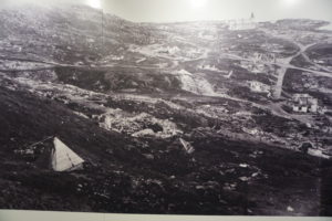
Honningsvag destroyed by German troops in the autumn of 1944. Photo taken in the museum exhibit.

There is one extremely sobering exhibit in the museum. To understand it, one must realize that all of Norway was occupied by the German army during World War II, after the country was betrayed by its own Vidkun Quisling, whose surname has become a synonym for “traitor.” Hundreds of thousands of German troops were pinned down in Norway because of fears of an Allied counterinvasion. As the war neared its end, Adolf Hitler also feared an invasion across the northern end of Scandinavia by the Red Army moving from Russia. Russia and Norway share the Arctic Ocean coast; Sweden and Finland reach only to the southern bounds of those two countries above the Article Circle. Hitler, to prevent such an incursion, ordered a scorched-earth policy for the German army in retreat.
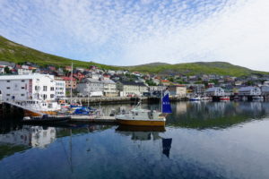
Honningsvag in 2017.

Several hundred soldiers had been stationed in Honningsvag. Very late in the war, they were ordered to torch the city, which they did. More than 20,000 citizens were evacuated to the mainland before that happened. When the war was over, and the residents of Honningsvag wanted to return home, a small contingent was sent to evaluate the state of their city. The museum’s photographs document the heartbreak they saw. With one notable exception, which was Kirkegata, the main Lutheran church south of the bay where the museum is located, everything in the city had been burned to the ground. My guess is that the church survived not because the Nazis spared it, but because the flames simply did not leap across the surrounding cemetery to the building. That church became the temporary home for the initial volunteers who helped rebuild until, step by step, the people of Honningsvag were able, with support from the national government, to rebuild their city and provide new, modern homes for thousands of displaced persons. It is a stunning reminder of the high cost of war and hatred but also offered insights into the heroism of the persistent and courageous Norwegian resistance, to which several museums throughout the nation have been dedicated.

Going Home

The next morning, at 9 a.m., our ship docked in Kirkenes, a small town that abuts the Russian border to the east. It was the end of our cruise, punctuated with a short bus ride to the local airport for a flight later that day to Oslo. On that flight, we had the chance to converse with a retired Norwegian airline pilot and his wife, who told us about an occasion on which the Russian government, seeking to dispose of Syrian refugees, had put them all on bicycles and sent them across the border into Kirkenes to let the Norwegian government deal with them. With a hint of sarcasm, he noted that the bicycles had to be destroyed once the refugees were taken into custody because the Russian vehicles did not meet Norwegian bicycle safety standards. I will let the reader make of this curious story what you will. I have no reason to doubt its veracity, but if true it certainly smacks of cynicism on the part of Russian officials.

Our three friends caught an earlier flight back to Bergen, where they chose to spend two more days. Jean and I stayed overnight at the Radisson Blu Airport Hotel, awoke for an early breakfast the next morning, and walked back across the pathway for a flight to London’s Heathrow Airport. There, with only a 75-minute layover to dash through the long halls of a monstrous facility, we made our way to a United flight back to Chicago. Our lives were about to return to normal.

Jim Schwab

Recovery in North Carolina One Year Later

Amid the whirlwind of disasters this fall—three major hurricanes hitting the U.S., earthquakes and another hurricane hitting Mexico, wildfires in northern California—it is easy to forget that people hit by other disasters as recently as a year ago are still laboring toward long-term community recovery from the damages those events left behind. One of those places is North Carolina, which suffered flooding in several small communities in its eastern Coastal Plain from Hurricane Matthew. The Federal Emergency Management Agency (FEMA), of necessity, may shift its energy and resources to new places, but the communities and states trying to recover cannot escape the realities of rebuilding their own futures.

I was in North Carolina just two weeks ago for the annual conference of the North Carolina chapter of the American Planning Association, in Greenville. This city of about 90,000 is just an hour west of the Outer Banks, depending on which roads are open. (Hurricane Maria was kicking up waves as it moved north out in the Atlantic Ocean while I was there.) Much of the surrounding area consists of farm country and small towns nestled in river valleys subject to flooding in major storms including tropical storms and hurricanes. In the 1990s, the area was visited by Hurricanes Floyd and Fran, both of which left their marks. I had hoped to travel the towns affected by Matthew with a colleague, but it did not work out. But I did listen to a keynote presentation by Gavin Smith, a research professor at the University of North Carolina (UNC) in Chapel Hill and director of the U.S. Department of Homeland Security’s Coastal Resilience Center of Excellence, located at UNC. I was there because I had been invited to speak at two sessions, one on September 26 on community resilience and another the next day on flood hazards and subdivision design.

Smith has worked with the North Carolina Department of Emergency Management on recovery planning in the past, and as a consultant following Hurricane Katrina, led recovery in Mississippi under Gov. Haley Barbour. He later returned to North Carolina to join the UNC faculty, but clearly is an experienced hand in this field. He has also written extensively on disaster recovery, including an Island Press book, Planning for Post-Disaster Recovery: A Review of the United States Disaster Assistance Framework.

What Smith served up was a primer in planning for climate change and disaster recovery with a side order of North Carolina case studies. I don’t say that to be cute, but because I have discussed at length the issues associated with the former, so here, I will concentrate on the latter. I will note first, however, that he highlighted some issues connected with disaster recovery that are worth considering:

  • Disasters tend to bring to the forefront of community planning existing conditions that may have been less obvious beforehand, but which are not new.
  • Disaster involves opportunity, a unique situation in which good planning can effect positive change. Because planners are generally interested in advancing equity, this is important, as developers are often dictating growth even when it negatively affects some economically marginalized people in the community.
  • This post-disaster environment provides an opportunity to engage in alternative dispute resolution, with planners using negotiation to help resolve difficult issues.
  • The reality of disaster recovery is time compression, the need to move quickly even though better planning may demand stepping back and investing more time in deliberation before making decisions. We can alleviate some of that pressure by developing plans for recovery before disaster strikes.

That is, in a way, all background to the simple fact that one role for planning is to help change the rules governing recovery through serious engagement between local officials, who generally better understand local needs, and those at state and federal levels of government, who generally control more of the resources needed for successful recovery. In other words, planners need to help solve the disconnect between means and understanding. Communities that passively await rescue by higher levels of government without undertaking the task of owning their own recovery may well face consequences in the misallocation of the resources provided.

The Hurricane Matthew Disaster Recovery and Resilience Initiative (HMDRRI) has specifically worked with eight communities in eastern North Carolina under the auspices of the North Carolina Policy Collaboratory. Smith is the project director. It began with a research period that ran from February through June of this year. The project included intake interviews with people in the affected areas who were willing to pursue buyouts of their properties, which would then be maintained in perpetual open space under rules of FEMA’s Hazard Mitigation Grant Program, and discussed with them where they were willing to relocate. The program developed housing prototypes for affordable homes in the $90,000 range that would allow buyers to stay in their communities without remaining in the floodplain. One major question was whether they could endure as a community after such relocation, which is affected by area geography and topography and the ability to identify and develop suitable alternatives. It should also be noted that eastern North Carolina has been through much of this before. Following Hurricane Floyd in 1999, the state undertook buyouts of more than 5,000 homes and assisted in elevating another 1,000.

Camp shelter in Windsor, NC, one of the communities assisted by HMDRRI. Photo by Gavin Smith

The HMDRRI research product is a 580-page report that outlines project objectives and documents economic, housing, and other conditions in both the region and the communities specifically targeted by the project: Kinston, Fair Bluff, Windsor, Princeville, Lumberton, and Seven Springs. This documentation is critical to an accurate assessment of the challenges facing the region. For instance, the standard determinant of housing affordability is the ability to limit spending on housing to 30 percent of income. People in lower-income brackets often struggle to find such housing, and often it requires subsidies or some sort of intervention in the housing market. Within the coastal counties studied, however, the reasons for shortages of affordable housing can vary widely, as can its quality. The resilience of affordable housing in an area subject to coastal storms and flooding is important, yet the abundance of mobile and modular housing in the region offers little resilience in the face of disaster, and septic systems associated with much modular housing often make those homes even more susceptible to flooding. Thus, solutions must address both resilience and affordability to provide some semblance of social equity in disaster recovery.

The intriguing model offered by HMDRRI, however, is the systematic engagement of the academic community in what is simultaneously a practical learning experience for students and faculty, an opportunity for introducing the skills of practicing design professionals to the area, and a direct connection to state and federal officials, for instance, by allowing student and faculty teams to work in the FEMA Joint Field Office (JFO) and thus access data that might not otherwise be readily available. This included interaction with FEMA’s Community Planning and Capacity Building team, part of the larger federal Disaster Recovery Framework. The report, more readable than its length might suggest, includes a substantial section called Home Place that helps facilitate the transfer of design practices to the community level to empower better local recovery planning.

An example of this occurred in Princeville, which Smith described as the oldest African-American community founded by freed slaves. In August, HMDRRI hosted a five-day charrette with visiting architects, three-quarters of them African-American, who worked directly with the community on land-use and design solutions for relocating homes from the floodplain to a higher, 52-acre site still within the city limits. Helping the community to understand and come to terms with the land-use changes resulting from the recovery from Hurricane Matthew is critical to long-term success. The verdict is necessarily still pending in this case, but it may provide a solid case study for future efforts elsewhere. Smith also noted one other important aspect of the charrette experience: Participants were asked to check in daily to document the time they spent. Creative people that they were, the initial reaction was some resentment at being subjected to this bureaucratic procedure until it was explained that documenting their contribution of time was essential to showing a local match for federal funds supporting the project. Approximately 100 people were credentialed for the purpose. At that point, they complied enthusiastically because they understood the purpose as something more than mere bookkeeping. They were helping the community marshal badly needed resources.

It is worth noting that the report recommends that the North Carolina Governor’s Office form a standing committee to provide recommendations for policy, programming, and funding strategies for development of adequate housing in eastern North Carolina. The report also notes interest from Texas and Rice University in the model for state/academic collaboration that HMDRRI offers. This is part of the silver lining of disasters: the emergence and dissemination of positive and innovative solutions to common problems.

Jim Schwab

Hurricane Harvey Interview on CBC

For those who have been reading the posts I have recently done since Hurricane Harvey made landfall, I thought it might be of interest to see this video clip of an interview I did with Canadian Broadcasting Corp. two days ago: https://youtu.be/UFslrKPd04s 

Jim Schwab

The People Affected by Harvey

A few days ago, in my last post, I wrote that Hurricane Harvey would last a few days, but the recovery would last years. However agonizingly long Harvey appears to be taking to inflict its misery on the Texas Gulf Coast, and now parts of southern Louisiana, it will go away. And then the real marathon will begin. People will have to face the necessity of reconstruction, both as individuals and as whole communities.

In writing about this now, I am crediting readers with a longer attention span than seems to be assumed of most Americans on social media today. I truly hope, however, that the news media does not forget about Harvey or the Gulf Coast as the recovery process grinds on over coming months and years. Certainly, most residents of the Texas coast will have little choice but to bear with the process, and ideally, they will participate. Recovery needs to be as participatory as possible to succeed fully.

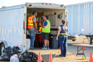
FEMA teams managing the distribution of water, and meals for hundreds of semi-trucks at an incident Support Base in Seguin, Texas. Photo by Dominick Del Vecchio – Aug 29, 2017 (from FEMA website) 

It will not always be a pretty picture. The news media in recent days have been full of photographic and video evidence of the best aspects of humanity—people in boats rescuing neighbors and strangers alike, public safety personnel risking personal safety as they save people from flooded homes and transport them to shelters, and other heroic acts away from cameras and too numerous to count. People from other states and nations will contribute to disaster-related charities to help people they have never known and may never meet. Politics and race and religion will all take a back seat to saving lives and reducing suffering. For just a brief moment in history, we can stop shouting at each other long enough to care for each other and be proud of one another.

Several years ago, Rebecca Solnit produced an intriguing book, A Paradise Built in Hell, that explored many of the positive community-building relationships that emerge when people are challenged by adverse circumstances such as major natural disasters. It is a journalistic journey through the informal alliances and communities created by people under what seemingly are the worst possible conditions, but which challenge our humanity and force us to consider how we value those around us. It is an optimistic book that forces readers to rethink what it means to live through a disaster. I have always hoped that it would spark similar efforts among academic researchers, particularly in the social sciences, to study this phenomenon more closely. I think that is happening to some extent, but perhaps not nearly enough.

The Texas Gulf Coast communities stricken by Harvey will need as much of that spirit as they can muster to produce successful long-term recovery. Recovery takes years because, while no one wants to delay rebuilding unnecessarily, hasty rebuilding that fails to consider the failure points that allowed destruction to occur is even more undesirable. Under considerable time pressures, which researchers Robert Olshansky and Laurie Johnson, both wonderful friends of mine, have notably referred to as the problem of “time compression” in disaster recovery, planners and local and state officials will need to meet with constituents, hear their concerns, explain both the obstacles and opportunities involved in reconstruction, and ideally, inform the public process to help lead to a better outcome. During this time, minor and modest repairs may go forward while the bigger decisions, like where to buy out damaged properties, how to rebuild infrastructure and to what new standards, and how to produce a stronger, more resilient community to handle future disasters may need to undergo vigorous debate.

I point this out because, inevitably, and despite Solnit’s rosy scenarios in the context of community building, tempers will rise and people will need to iron out significant differences and widely varying perceptions of the causes of, and solutions to, the damage that occurred. There will surely be some debate about Houston’s sprawling development patterns and relative lack of development controls. There may be debates about strengthening building or zoning codes or, in Houston, the absence of zoning. If there is any echo of Hurricane Sandy, there may be discussion of a greater role for green infrastructure in mitigating hazards, though that alone would have made only modest difference in the flooding from Harvey, but it might have helped.

More importantly, people will have undergone trauma that will make them deeply and justifiably emotional about the disruption of their lives. They will bring that trauma, and a need to vent and share their fears and anger, to public meetings. Public officials will need to exhibit patience because, as Christine Butterfield, another good friend who served as community development director in Cedar Rapids, Iowa, during and after the 2008 floods, has noted, those public gatherings will be therapeutic. People may cry, they may yell, they may accuse. Most of all, they need to know that someone else wants to hear and share their pain. They want to know that someone cares. Once most have achieved that comfort level, they may be ready to move forward and discuss options for recovery. But first, community leaders must build trust.

Some people may never trust, and the rest of the community may need to move on. Life is not perfect. Human beings are not perfect. Recovery cannot wait forever, but it must demonstrate compassion and a commitment to social equity.

In a few weeks, the entire process will begin, and people will decide what role they want to play. Leaders will arise in unexpected places. Just last week, my students at the University of Iowa School or Urban and Regional Planning, during a field trip with which I launch my course on “Planning for Disaster Mitigation and Recovery” every year, heard from United Methodist pastor Clint Twedt-Ball, a co-founder and executive director of Matthew 25, a community organization that arose from almost nothing after the 2008 floods in Cedar Rapids to help rebuild 25 blocks of downtrodden neighborhoods in the city, raising money but also making tough decisions about what would work and what would not. Nine years later, his organization is still working to make a difference. Before 2008, Clint would confess, he knew next to nothing about floods or community development. My guess is that now he could nearly write a book. Who knew?

Watch Houston, and Rockport, and Corpus Christi, and all the other cities on the Texas Gulf Coast for both surprises and struggles, and mostly for deep human engagement in solving massive redevelopment problems the likes of which most of us will never have to confront. And be ready to cheer them on when good things happen. They are likely to need the encouragement from time to time.

Jim Schwab

Initial Observations on Harvey

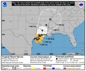
Map from National Weather Service. http://www.weather.gov/akq/Harvey

For the people of the Texas Gulf Coast, the rain and winds of Hurricane Harvey are just the beginning of a long journey. The storm will last a few days. The recovery will last years.

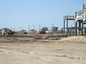
Destruction in the Bolivar Peninsula after Hurricane Ike in 2008

I am not there, so I can only surmise, based on the news coverage I have seen, the full extent of the damage and suffering that people are enduring in Corpus Christi, Houston, Galveston, and hundreds of other communities in a wide arc that has fallen under the impact of this storm. I do not even expect that people there will read this, certainly not right now. Nonetheless, it may be worthwhile to offer some insights to people elsewhere. I have never lived or worked in Texas, but I have been there numerous times and visited Louisiana more often than I can remember. I saw first-hand the devastation wrought in the Bolivar Peninsula and Galveston after Hurricane Ike. I have worked with people in Texas, including those at the Texas A&M Hazards Reduction and Recovery Center, over many years. They have educated me greatly on the vulnerabilities of their state.

With all due humility, therefore, but also with experience from other disasters over the past quarter-century, I offer some observations that may enhance what readers of this blog may learn from the news.

Photo from NOAA. The NOAA/NASA Suomi NPP satellite captured this infrared image of Hurricane Harvey just prior to making landfall along the Texas coast on August 25, 2017 at 18:55 UTC. NOAA’s National Hurricane Center has clocked Harvey’s maximum sustained winds at 110 miles per hour with higher gusts. Infrared images like this one can help meteorologists identify the areas of the greatest intensity within large storm systems, such as the areas with the most intense convection, known as overshooting cloud tops (dark orange), surrounding the eye and along the outer bands. https://www.nnvl.noaa.gov/MediaDetail2.php?MediaID=2086&MediaTypeID=1

First, this is apparently a somewhat unusual storm system. It approached the coast just northeast of Corpus Christi as a Category 4 hurricane, although it is now downgraded to a tropical storm. That does not make it less dangerous. The Saffir-Simpson scale that is used to rate hurricane strength deals only with wind speeds. Winds are certainly important, especially when they reach the 130 mile-per-hour range that was the peak for this event. Winds have, from all the visual evidence on the various news outlets I have watched, wreaked tremendous havoc along the coast, tearing apart buildings and overturning trailers and other vehicles. Moreover, hurricanes often spawn tornadoes, and some of the intermittent damage—that is, buildings ripped apart near others largely intact—suggests that this has occurred. In other words, if the more diffuse hurricane winds don’t get you, the tornado just might. It is no laughing matter. It is a wonder the death toll remains relatively low, although we almost surely don’t know the full tally just yet.

One specific impact that always accompanies coastal storms of this magnitude is storm surge, the waters pushed landward by the winds that in this case ranged from six  to twelve feet. These can do considerable damage in low-lying areas along the coast and may also exacerbate coastal erosion.

What makes the storm somewhat unusual also makes it dangerous even after being downgraded to a tropical storm. The storm system appears to have stalled a bit on Sunday and may even be backing out into the gulf for another landfall. At least two very serious consequences can flow from this. One is that the stagnant storm front will dump immense amounts of rain over consecutive days. The projected precipitation totals, even larger than what has fallen so far, mount up, so that projections for many communities range as high as 50 inches. Keep in mind that 30 inches is ample rainfall for an entire year in many parts of the country, and almost no city in the United States is prepared to absorb even half that amount in just a few days. The average yearly rainfall in Houston is just shy of 50 inches.

Moreover, as the storm moves back out over the Gulf of Mexico, it may regain strength that storms typically lose as they make landfall. Tropical storms draw their strength from the warmth of the water over which they pass until they make landfall, after which wind speeds begin to die down. The water of the Gulf right now is in the mid- to high 80s Fahrenheit, reportedly a full two to three degrees above average. That is the source of the strength of Harvey. Regaining any strength from the warm Gulf waters is not a good omen for the Texas coast, and as the storm moves slowly northeast, more of this will affect Houston than was originally the case. That is why we are seeing such intense scenes of flooding in Houston: The storm began with enormous amounts of moisture and has moved along the coast at a snail’s pace, at times just a mile an hour. As the week progresses, however, the storm is projected to move northeast over Louisiana and Arkansas, weakening along the way.

Of course, those warm waters raise questions about the influence of global warming, a topic that does not always receive a warm reception in Texas political circles. It is impossible to say that a specific storm like Harvey would not have happened but for climate change. It is also possible to say very credibly that warmer waters make stronger storms possible. Warmer waters can reflect seasonal and yearly variations, but over time they can also reflect climatic trends. For now, let’s leave it at that. People will have plenty of time later to debate this topic. In due course, as recovery proceeds, it should become a topic of reasonable, informed public discourse.

Other factors are at work as well. The sheer extent of flooding reflects the inexorable fact that the ground in any area has limited capacity to absorb rain. The hydrological cycle allows much rain under normal circumstances to drain into the ground, depending on the types of soil present in any given location. Sand absorbs very well but does not provide a very solid building foundation. Clay provides a better foundation but does not absorb water as quickly. Soil types matter, therefore, but in urban areas we have complicated matters greatly with large quantities of impervious surface that absorb little or no water by design. Impervious surface includes buildings (with the limited exception of green roofs), paved surfaces like roads, parking lots, and driveways, and other structural impediments to the movement and absorption of water. Houston is a very large metropolitan area with the fourth-largest population among major cities in the U.S. Although it is making strides, it is also far from the greenest city in America. Like most major cities, the percentage of impervious surface varies widely, depending on density levels in specific neighborhoods and corridors. Flooding is also influenced by the quality of the drainage systems; Houston is challenged in this respect by low-lying, flat terrain. It is criss-crossed with numerous bayous and canals that provide paths for the movement of water but also have serious limits to the water they can absorb before spilling over onto streets and highways. Those water-filled streets are the main obstacle to evacuation for those who stayed behind. There comes a point where people are better off remaining in place than trying to move, which is why Houston Mayor Sylvester Turner chose not to recommend evacuation.

Some dangers of mass evacuation for 6.5 million people are self-evident: clogged highways that are rapidly filling with water, producing death traps for people in stranded vehicles. Pedestrians cannot see steep drop-offs in elevation as they wade through high waters and can trip and drown. In Houston, the bayous may also contain alligators, water moccasins, and other wildlife hazards that are more easily avoided in dry weather. Moreover, the sheer volume of water can produce eddies and swirls that catch people off guard, and not everyone will be strong enough to regain their footing. Finally, flood water is always dirty water, sometimes just plain filthy, posing a potentially serious threat to public health.

All that said, many other major cities suffer from similar problems. I can think of no city that is prepared for the sheer volume of water currently falling along the Texas coast.

The Texas Gulf Coast communities, therefore, will emerge from this storm with a widespread pattern of both wind- and flood-related damage that will vary significantly from one area to the next, but collectively the costs will probably skyrocket into tens of billions of dollars. It is impossible to know the full costs just yet, but this will almost surely rank as one of the most expensive disasters in U.S. history. The recovery will take years of planning and implementation. If done well, it will involve a great deal of reassessment of patterns of development along the Gulf Coast and of the quality and importance of building codes. Social equity considerations will demand a new examination of the location and quality of low-income housing and the adequacy of affordable housing. Development regulations have seldom been politically popular in Texas, a state that still has never empowered counties to enact zoning codes. Some coastal communities may also wish to look more closely at the prospect of undergrounding utility lines to protect them from hurricane winds.

Events can push public attitudes in new directions. Part of that may depend on new lines of thought gaining traction in the discussion of rebuilding after the disaster. That may require some degree of courageous political leadership. Some very significant changes occurred in Louisiana after Hurricane Katrina, including consolidation of levee district management, adoption of a statewide building code, and a charter amendment in New Orleans that gave a new master plan more control over development regulations. We should not make perverse assumptions about outcomes, just as we also should not be naïve about the obstacles. But in my time at the helm of the Hazards Planning Center of the American Planning Association, we certainly worked hard to create a thorough blueprint for those willing to advocate better planning in response to major and catastrophic disasters, and I assume APA remains prepared to further that discussion and provide technical assistance where it can.

There will also be plenty of help available from the federal government, including the Federal Emergency Management Agency, the U.S. Department of Housing and Urban Development, and other agencies. We can only hope that Congress will sidestep much of its partisan bickering to ensure rapid allocation of the necessary resources. And we can hope that those resources and personnel are managed well to advance the recovery process, which is complicated and daunting.

One encouraging factor in the response has been the emergence of both willing volunteers and the effective use of social media to expedite search and rescue operations. The number of boats driven by volunteers rescuing people from rooftops and the interiors of flooded homes reminded me of the so-called Cajun Navy that operated throughout New Orleans in the desperate days that followed Hurricane Katrina. Disasters have a fortunate tendency in most cases to bring out the best in people, but we are also at a point in history where our new technologies facilitate the ability of willing heroes to find the people who most need help. Even the elderly and disabled are largely capable of dialing 911, or tweeting, or posting photos of their situation on Facebook, sharing their location, and pleading for help—and then finding their guardian angel at the front door with a motor boat. That is a huge advance from only a decade ago because it enables the willing volunteers to become effective heroes. If those civic and humanitarian instincts carry over into the slower grind of recovery, perhaps a stronger, more resilient Gulf Coast can yet rise from the mud, the grime, and the shattered buildings we see now.

Jim Schwab

Climate of Hope

For some time, it has been my intent to address the question of how we communicate about and discuss climate change, with a focus on books that have tackled the issue of how to explain the issue. Several of these have crossed my desk in the last few years, and I have found some time to read most. These include: Climate Myths: The Campaign Against Climate Science, by John J. Berger (Northbrae Books, 2013), and America’s Climate Century, by Rob Hogg (2013). The latter, independently published, is the work of a State Senator from Cedar Rapids, Iowa, inspired by the ordeal his city underwent as a result of the 2008 floods. I met Hogg while serving on a plenary panel for the Iowa APA conference in October 2013 with Dr. Gerald Galloway, now a professor at the University of Maryland, but formerly with the U.S. Army Corps of Engineers when he led a major federal study of the causes and consequences of the 1993 Midwest floods.

Another book that made it into my collection but still awaits reading is Don’t Even Think About It: Why Our Brains Are Wired to Ignore Climate Change, by George Marshall (Bloomsbury, 2014), an English environmentalist. To him and the others, I apologize. Many good ideas for blog posts went by the boards in past years when my occupational responsibilities at the American Planning Association sometimes kept me too busy to implement them. Whether it is still worthwhile to go back and review these works of past years is debatable, but at least I offer them up here as contributions to the literature. It is critical that we keep revisiting the issue of climate communication because, clearly, much previous communication has failed in the face of determined efforts by skeptics to sow doubt and uncertainty, to the point where the U.S. now has a president who has withdrawn the nation from the Paris climate accords, a subject I addressed here a month ago. It is imperative that we find better ways to share with people what matters most.

From https://www.climateofhope.com/

As a result, I was overjoyed to see two heavyweight voices, Michael Bloomberg and Carl Pope, offer what I consider a serious, well-focused discussion in their own brand new book, Climate of Hope: How Cities, Businesses, and Citizens Can Save the Planet (St. Martin’s Press, 2017). Bloomberg, of course, is the billionaire entrepreneur of his own media and financial services firm, Bloomberg L.P. I confess I read Bloomberg Business Week consistently because it is one business magazine that I find offers a balanced, thoughtful analysis of business events. Carl Pope, former executive director of the Sierra Club, is an environmental veteran with a keen eye to the more realistic political opportunities and strategies available to that movement and to those anxious to address the problems created by climate change. Theirs is an ideal pairing of talents and perspectives to offer a credible way forward.

This book will not seek to overwhelm you, even inadvertently, with the kind of daunting picture of our global future that leaves many people despondent. At the risk of offending some, I would venture that the most extreme and poorly considered pitches about climate change have nearly pirated for the Earth itself Dante’s line from The Inferno: “Abandon all hope, ye who enter here.” I know one person who literally suggests something close to that. I fail to see where that sort of message leads us. The harsh political and social reality is that most people need to understand how something they can do will make some concrete difference that may make their lives better now as well as perhaps a half-century from now. There are temporal factors in human consciousness that greatly affect how we receive messages, and most of us are not well programmed to respond to issues too distant in time or in space. Framing the message effectively matters.

The bond that brings these two authors together is that combination of hope and realism. They may understand that polar bears are losing their habitats, but their message focuses closer to home: Business opportunities await those willing to embrace solutions to climate change. Cities can make themselves more livable even as they reduce their negative impacts on the atmosphere. Despondency is not only counterproductive; it is downright pointless in the face of such golden eggs waiting to hatch. This is more than rhetoric. Climate of Hope provides a steady diet of details for investing in solutions, whether through public policy and programs such as Bloomberg highlights in New York and other cities, or in the business sector, which both authors do very well.

Of course, there are some very tough questions that must be addressed. The biggest involves the future of energy both in the United States and around the world. In a chapter titled “Coal’s Toll,” Bloomberg is unflinching after crediting Pope and the Sierra Club for bringing to his attention the public health costs of continued reliance on coal. He notes that pollution from coal emissions “was prematurely killing 13,200 Americans a year,” or 36 per day because of various lung and respiratory diseases, with a resultant financial toll exceeding $100 billion annually. In many other parts of the world, the figures are even higher. All this is in addition to the environmental damage of lost and polluted creeks and rivers wherever coal is mined or burned. To counter this toll, the Sierra Club, with support from Bloomberg Philanthropies, undertook a campaign to close outdated coal-fired power plants. It is also important to recognize the degree to which fossil fuel companies have benefited from public subsidies and relaxed regulation that has failed to account for the magnitude of negative externalities associated with coal and petroleum.

Inevitably, someone will ask, what about the jobs? The strength of Bloomberg in this debate is his understanding of markets, and he rightly notes that, for the most part, coal is losing ground because of the steady advance of less polluting, and increasingly less expensive, alternatives including not only natural gas but a variety of new energy technologies like wind turbines, energy-efficient LED lights, and electronic innovations that make coal essentially obsolete. The issue, as I have noted before in this blog, is not saving coal jobs but investing in alternative job development for those areas most affected. Once upon a time, the federal government created a Tennessee Valley Authority to provide economic hope and vision for a desperately poor region. Although the TVA or something like it could certainly be reconfigured to serve that mission today, the federal vision seems to be lacking. Instead, we get backward-looking rhetoric that merely prolongs the problem and makes our day of reckoning more problematic.

It is also essential to balance the problems of coal against the opportunities to shape a more positive, environmentally friendly energy future. In many parts of the world, off-grid solar can replace more polluting but less capital-intensive fuels like kerosene or wood for cooking. Hundreds of millions of poor people in India and other developing countries could be afforded the opportunity to bypass the centralized electrical facilities of the West through low-cost loans to build solar networks. Again, what may be missing is the vision of world banking institutions, but under the encouragement of international climate agreements, and with the proper technical support, places like India can make major contributions to reducing their own greenhouse gas output. The U.S. expenditures in this regard about which Trump complained in his announcement of the U.S. withdrawal from the climate accord are in fact investments in our own climate health as well as future trade opportunities. In chapter after chapter, Bloomberg and Pope describe these opportunities for private investment and more creative public policy. The intelligent reader soon gets the idea. This is no time for despair; it is instead a golden day for rolling up our sleeves and investing in and crafting a better future.

It is possible, but probably not desirable, for this review to roll on with one example after another. We face tough questions, such as reshaping the human diet to reduce the environmental and climatic impacts of meat and rice production in the form of methane, but there are answers, and Pope explores them in a chapter about the influence of food on climate. Food waste is a source of heat-trapping methane. Both en route to our plates and after we scrape them off, food waste can be a major contributor to our problems because of decomposition, but again there are answers. The issue is not whether we can solve problems but whether we are willing to focus on doing so. There will be disruption in the markets in many instances, but disruption creates new opportunities. We need to reexamine how the transportation systems in our cities affect the climate, but we should do so in the knowledge that innovative transit solutions can make huge positive impacts. We can reframe our thinking to realize that urban density is an ally, not an enemy, of the environment, when planned wisely.  Urban dwellers, contrary to what many believe, generally have much lighter environmental footprints than their rural and suburban neighbors. They ride mass transit more, bicycle more, and mow less grass.  Lifestyles matter, where we live matters, planning matters.

Quality of life in our cities is a function, however, of forward-looking public policy. Bloomberg notes the huge changes being made in Beijing to reduce its horrific air pollution. He notes:

One of the biggest changes in urban governance in this century has been mayors’ recognition that promoting private investment requires protecting public health—and protecting public health requires fighting climate change.

I have personally found that, even in “red” states in the U.S., it is easy to find public officials in the larger cities who recognize this problem and are attuned to the exigencies of climate change. Mayors have far less latitude for climbing on a soap box with opinions rooted in ideology because they must daily account for the welfare of citizens in very practical matters, such as public health and what draws investors and entrepreneurs to their cities in the first place. Hot air, they quickly discover, won’t do the trick.

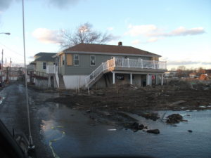
Staten Island neighborhood, post-Sandy, January 2013

Necessarily, the authors, toward the end of the book, come to terms with the potential consequences of failing to act. Bloomberg, in a chapter titled “New Normals,” describes the state of affairs in New York City after Hurricane Sandy, a storm that could easily have been far more destructive than it already was. For a dozen years, he was the mayor of a city with 520 miles of coastline. To its credit, New York City pursued numerous practical solutions and recognized that no one size fits all, that making the city more resilient would require implementing hundreds of individual steps that dealt with various aspects of the problem. Some of the solutions may seem insignificant, such as restoring oyster beds, but collectively they produce real change over time. Other changes can be more noticeable, such as redesigns of subway systems, changing building codes and flood maps, and rebuilding natural dune systems. The battle against climate change will be won in thousands of ways with thousands of innovations, involving all levels of government, but also businesses, investors, and civic and religious leaders.

All of that leads to the final chapter, “The Way Forward,” which seems to make precisely that point by identifying roles for nearly everyone. Bring your diverse talents to the challenge: the solutions are municipal, political, and financial, and require urban planning, public policy, and investment tools. In the end, although I recognize the potential for readers to quibble with specific details of the prescriptions that Bloomberg and Pope offer, I would still argue that they provide invaluable insights into the practical equations behind a wide range of decisions that our nation and the world face in coming years. The important thing is to choose your favorite practical solution and get busy.

Jim Schwab


New York City, Water, and Resilience

I was never a New York native, but I did not feel entirely alien, either, when I returned for the first of four visits to the area in January 2013, following Superstorm Sandy. My father lived in Queens most of his life and left only when my mother, who was from Cleveland, insisted on moving. New York City was not to her liking, and she wanted to go home. But my paternal grandparents remained on Long Island until they died in the 1960s, and we often visited. I was born in Bayshore Hospital, one of seven that were evacuated during the storm. My father had told me about living through the “Long Island Express,” the famous 1938 hurricane that also swamped much of New England. I was not a total stranger. I was certainly aware of many of the cultural traits that make New Yorkers famous (or infamous), though I think some consist more of popular stereotype than reality. But there is a certain toughness that comes from living in the Big Apple, even if it’s different from the toughness I have learned from my eventual attachment to Chicago, the alleged “City of Big Shoulders.”

Hence, despite all the vulnerabilities connected with a city of eight million people that is nearly surrounded by water, I instinctively understood the connection of the city with the concept of resilience. The city has withstood more than Sandy—this was the site of the worst 9/11 attacks, after all—and responds well to challenges. There are no feet of clay; the foundation of Manhattan is bedrock. But any map of the city makes clear that every borough but the Bronx is an island, and even that is a peninsula surrounded by water on three sides.

What brought me to New York after Sandy was a decision by the American Planning Association to assist our New York Metro and New Jersey chapters in preparing their members and communities for the arduous task of post-disaster recovery. To be honest, ours was a contribution more of solidarity and expertise than of resources, which had to come from the massive allocations of federal funds used or distributed by federal agencies, led mostly by the Federal Emergency Management Agency (FEMA) and the U.S. Department of Housing and Urban Development (HUD). What mattered to our members was our presence, our ideas, and the time we spent preparing and delivering a series of training workshops in April 2013 on planning for post-disaster recovery. It is fair to say that, as manager of APA’s Hazards Planning Center and the ringleader of that training effort, Sandy recovery dominated my life for the first half of 2013. And this is all context for my observations in reviewing a relatively new book from Island Press, Prospects for Resilience: Insights from New York City’s Jamaica Bay, edited by Eric W. Sanderson, William D. Solecki, John R. Waldman, and Adam S. Parris. Contributors include biologists, geographers, and engineers, among others with a wide range of expertise that contributes to the book’s comprehensive approach. its utility is clearly greater for professional practitioners in planning, civil engineering, public administration, and allied fields, as well as for academic researchers, than for purely casual readers.

Map from Gateway National Park, National Park Service, website. https://www.nps.gov/gate/planyourvisit/map_jbu.htm

The book focuses specifically on Jamaica Bay, although New York City matters greatly as the municipal government making critical decisions that affect the bay’s resilience. Jamaica Bay, however, is an interesting case study of the intersection of geographic, ecological, industrial, and urban planning factors in both weakening and enhancing the overall resilience of a highly stressed water body and the urban neighborhoods that line its shores. The book’s most noteworthy feature is not any one approach to the subject of resilience for Jamaica Bay, but the way in which it seeks to cross disciplinary lines to undertake a thorough analysis of the prospects for building resilience in an area like Jamaica Bay. Researchers there may have much to share with those examining other ecologically challenged urban water bodies across the nation.

It is important to understand the geographic context of Jamaica Bay, an area familiar to most people (including many New Yorkers) primarily as the scenery below the airplane as it makes its descent into John F. Kennedy International Airport (JFK). The airport, in fact, has a significant impact on Jamaica Bay because it sits at the eastern end of the bay in Queens, the linchpin between the rest of Long Island and the Rockaways, a long, densely populated peninsula that stretches west from JFK and forms the southern boundary of the bay. That, in turn, means that the Rockaways, home to 180,000 people, is extremely vulnerable in a major storm like

Fire devastated Breezy Point during Hurricane Sandy in 2012. Cleanup lasted for months. Photos courtesy of James Rausse.

Sandy. The Rockaways suffered some of the worst damages from the storm, including a fire that tore through Breezy Point, destroying 130 homes. Because of its isolation at the end of the peninsula, and the storm surge that inundated it, it was impossible for fire trucks to respond to the conflagration. For those curious about the origins of a fire in the midst of a flood or hurricane, it is worth remembering that a surge of salt water can easily corrode and short out electrical wires, triggering sparks. Much of New York’s subway system, well designed to pump out normal stormwater, was shut down during Sandy for the same reason.

What makes Jamaica Bay matter enough to devote nearly 300 pages to the subject? It is a great laboratory for resilience. The dense urban development that surrounds the bay stresses the natural ecosystems of the bay, whose biological composition has changed radically over time. The late 19th century witnessed the growth of a viable fishing industry, including oyster harvests, but pollution from sewage disposal and industry brought that to a sudden halt by the 1920s. The same factors reduced the bay’s recreational potential as well. Only in the last few years have there been efforts to restore the oyster beds, but like most such efforts, they will require ongoing research and attention to succeed.

Just as importantly, human communities need to become more resilient as part of a larger social-ecological system because the city is not about to disappear. There simply will be no return to pre-urban conditions. Urban stormwater drainage, sewage disposal, industrial activity, and transportation all have impacts that good urban planning must mitigate or prevent in trying to maintain a healthy urban relationship with the natural environment. Serious scientific inquiry may provide some answers. Greater levels of awareness and connectedness by area residents to the marine environment can also help, but that has often not been the case. An entire chapter explores neighborhood and community perspectives on resilience around Jamaica Bay. Few seasoned urban experts and planners will be surprised to learn that New York generally, and the Jamaica Bay watershed, feature remarkably diverse neighborhoods in terms of density, ethnicity and race, and income level, all of which influence those perspectives and influence community goals. New York is also a remarkably complex city in which residents of some areas in Queens can feel isolated from the center city in Manhattan, but may also feel more secure in their isolation. It is noteworthy that some areas at the western end of the peninsula were heavily populated by public safety personnel. All this influences people’s perspectives on proximity to, and connection with, the waterfront and public understanding of the relationship between human settlement and the ecological health of the bay, which is not always straightforward in any event. People can exert both positive and negative influences on that relationship. The good news is that the authors found that Sandy and the recovery process that followed had some useful impact on the perceptions that underlie those actions.

Given all that complexity, it will also be small surprise that the resilience of Jamaica Bay and its surrounding development is affected by a complex network of overlapping jurisdictional responsibilities that are sometimes in conflict. In addition to the city and its boroughs, a variety of federal and state agencies with varying agendas and authorities, including the New York-New Jersey Port Authority (responsible for airports including JFK), the National Park Service (Gateway National Park), and the National Oceanic and Atmospheric Administration (climate and coastal zones), overlay the influence of numerous private organizations and academic institutions. Add the flood mitigation and post-disaster recovery responsibilities of FEMA, and one is suddenly confronted with a multicolored collage that for some people can become bewildering.

The case of NOAA is interesting in that climate change is likely to affect the frequency of extreme weather events, which may further test the resilience of an already dynamic social-ecological system. As a scientific agency with significant meteorological and climatological expertise, NOAA has contributed to the array of modeling tools helping to analyze resilience in Jamaica Bay, although academic and other institutions have added to that toolbox. What is important ultimately is to bring together the various strands of research in cooperative efforts for integrative management. The good news, well described toward the end of this book, is that such cooperative efforts have produced the Science and Resilience Institute at Jamaica Bay for that purpose, with participation by decision makers from local, state, and federal agencies to help resolve those conflicting missions and adopt a comprehensive systems approach to the challenges facing the area. Let us hope that those decision makers, and the public officials controlling their resources, have the wisdom to maintain hard-won progress. As is true of many other areas in the U.S., those responsible for the health of Jamaica Bay have much work to do. The rest of us have much to learn from what they are doing and a stake in that progress.


Jim Schwab