Filming on the Texas Gulf Coast

It has been a couple of months since I last posted a video of our progress in filming for Planning to Turn the Tide. That last article summarized our film efforts in Jacksonville, Florida, in September 2023, but we had another trip in the offing then, to the Texas Gulf Coast. In between, as noted in a January 1 post, I underwent prostate surgery on September 29, which required at least a month of rest and inactivity at home before venturing out again, in order to ensure successful recovery. But on November 7, I met up with videographer David Taylor at Houston Hobby Airport and we drove to Corpus Christi, where the annual conference of the Texas Chapter of the American Planning Association was getting underway. The new blog video presented here was filmed there but edited and produced later.

Devastation in the Bolivar Peninsula from Hurricane Ike, 2009

Despite my own challenges, what compelled this schedule was that conference at the American Bank Center in Corpus Christi because it allowed us to interview eight Texas planners who have been prominently involved in efforts to confront and address resilience issues along the Gulf Coast, where coastal storms and flooding remain major concerns. Hurricane Harvey, which struck in the fall of 2017, may be the most famous, and famously expensive, disaster of recent history in the area but is certainly not unique. People with a longer memory can cite Tropical Storm Allison, which struck Houston in 2001, and Hurricane Ike, which devastated Galveston in 2008, as part of the long parade of such events.

It is easy enough to cite shortcomings of the past that made destruction in such storms worse than it needed to be, but it is also important to note the resources that Texas has created to tackle those problems, including Texas Target Communities, a program at Texas A&M University that aids resource-challenged communities. These groups were present at the Texas APA conference, and we interviewed both Jaimie Masterson, the director of Texas Target Communities, and Shannon Van Zandt, a professor of urban planning at the Texas A&M School of Architecture, who has long researched and advocated for better affordable housing solutions in disaster recovery.

Tornado impacts in Van Zandt County, Texas, April 2017. Seven tornadoes struck the area in one evening.

I should also note that disaster resilience has been a consistent theme of the Texas Chapter. Back in November 2017, I spent time in Texas at the behest of the chapter, which asked me to facilitate and keynote a recovery workshop in Canton, Texas, following a series of tornadoes there, but I also worked with their Harvey Recovery Task Force well into 2020. The film trip grew out of that partnership, which extends even further back to my speaking at chapter conferences in El Paso and Galveston after Hurricane Ike. We want to thank the Texas Chapter for their logistical and promotional support during the conference.

Peer exchange workshop in Rockport, February 2020, involving Harvey and Sandy recovery planners. Kim Mickelson, of Houston, with microphone, is moderating this session.

Following our time in Corpus Christi, we drove up the coast to Rockport, the site of the first landfall of Hurricane Harvey, where we interviewed four community leaders, including a city council member, the local newspaper editor, the public works director, and a former president of the local chamber of commerce, about Rockport’s experience in recovery. I have learned a great deal in recent years about Rockport, in large part because of my work with Amanda Torres, the former city planner there, now working for the Corpus Christi Planning Department, and Carol Barrett, a veteran planner now living in Austin, who led APA’s Community Planning Assistance Team in Rockport in 2019. They helped me design the Rockport case study for an interactive workshop, including both graduate students and practicing planners, that is part of a course I teach for the University of Iowa School of Planning and Public Affairs.

We ended our trip in Houston, which included a tour of largely Hispanic neighborhoods in the shadow of the city’s huge petrochemical complexes, where they face ongoing racially disparate environmental impacts. We were hosted on that tour by TEJAS Barrios, a local environmental justice advocacy group. We hope to return to Houston, but our challenge for now is to raise substantial money to try to complete the film project in the coming year. Fortunately, our core team has grown, with more hands on deck focused on fundraising. If you are willing to help, you can donate here or use the QR code below to contribute online at the APA website.


Jim Schwab

Tampa Bay and the Quest for Resilience

In my last blog post, I discussed the origins of a current active film effort, Planning to Turn the Tide, which I have been leading on behalf of the APA Hazard Mitigation and Disaster Recovery Planning Division. This post, which includes the first of a series of blog videos recorded during our travels, discusses what we learned during our meetings and interviews around Tampa Bay, especially during an afternoon at the Tampa Bay Regional Planning Council (TBRPC) in Pinellas Park, Florida, just north of St. Petersburg.

Click here to watch the summary video about the interviews at Tampa Bay Regional Planning Council.

One of our interviews featured Jerry Stickney, Director of the Sunshine Line, a Hillsborough County agency that provides transportation for disabled and disadvantaged people, including special services during natural disasters. That last point provided the bulk of our discussion because evacuating and sheltering these people during hurricanes, major storms, and other disasters is a major responsibility, but one that ensures some degree of social equity in the face of life-threatening circumstances. Hurricane Ian could easily have become the major hurricane that finally invaded the Tampa Bay region but instead turned east further south, striking the Fort Myers area.

Cara Serra, resiliency planner for TBRPC, discussed her role in facilitating the work of the Regional Resiliency Coalition, which consists of several working groups examining regional issues concerning shoreline management, infrastructure, stormwater management, and resilient building design and land use, among other concerns. They are currently developing a Regional Resiliency Action Plan.

In the quest for regional resilience, learning lessons from disasters elsewhere plays a major role, one that has not been neglected. Sarah Vitale, planning director for TBRPC, led the development of a new iteration of Project Phoenix, originally created in 2009, to help business leaders and others in the Tampa Bay region understand what the impact of a Category 4 or 5 hurricane might be if it took aim directly at Tampa Bay, something that last happened more than a century ago, when the population was barely one-tenth

Damage from Hurricane Michael, Bay County, FL. Photo by David Taylor

of what it is now. Her training workshop includes video clips of both a simulation of such a storm and real-life stories from Mexico Beach of economic recovery from Hurricane Michael, which struck the Florida Panhandle in October 2018.

Finally, we also spoke with Sean Sullivan, the executive director of TBRPC, whose engaging New England accent kept us captivated as he outlined his vision for a six-county region that is aware of its risks and prepared to handle the impacts of climate change. It is clear that he has a committed staff that is helping to implement that vision and develop the tools for effective change in that direction.

As promised in the video link above, here are links to the film trailer and the donations page to support Planning to Turn the Tide, the documentary film for which all this work is being done:

Film Trailer

Donations Page (QR code below)

Supplemental note:

The impacts of climate change are affecting us all, often in unexpected ways. As I write this, my own sinuses are recovering from the onslaught of smoky air, full of particulate matter, spread south by the winds from thousands of acres of Canadian forests being scorched by massive wildfires. Winds from such fires in Quebec swept through much of the Northeast two weeks ago, including New York City. Yesterday, it was the Midwest’s turn to suffer, and Chicago was one huge grey fog that burned the eyes and made even healthy people catch their breath. The Chicago Tribune reported that we had the worst air quality of 95 major cities worldwide.

If we needed a vivid illustration that climate change and its impacts know no borders, this is certainly it. That is one more reason we at HMDR find urgency in our mission to develop this film and discuss how better planning at local, regional, national, and even international levels can help us turn the rising tide of losses from natural disasters.

Jim Schwab

Softly Persuasive Planning Pioneer

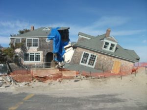
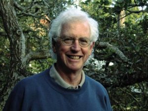
Photo from David Topping’s Facebook posting of his father’s passing.

I first met Ken Topping at the American Planning Association (APA) office in Chicago on a cold day in January 1994. Chicago was suffering one of its classic Arctic blasts at something like -20°F. Ken, a tall, very polite, and articulate gentleman, had his heavy winter coat for the ride back to O’Hare International Airport toward the end of the day. On January 17, just a day or so before he arrived in Chicago, the Northridge Earthquake struck Los Angeles, an area where he had worked for many years. Ken, who was already developing a significant history of advancing what was then the nascent role of urban planning in responding to disasters, became immediately involved. Exactly one year later, on January 17, 1995, the Great Hanshin earthquake leveled much of Kobe, a major city in Japan. With his extensive acquaintances there, Ken was again on the scene.

At the time, I gently needled him that trouble followed him wherever he traveled. But the reality was that Ken took the lead in planning solutions to some of the world’s most vexing environmental challenges: natural disasters. It took years for me to understand the degree to which that initial meeting with Ken changed my life and my perspectives on what I wanted to accomplish as a professional planner. Ken lured me into the world of disaster recovery and resilience planning in a way no one else did.

When we met, it was Bill Klein, then the research director at APA, who introduced us. Just a few months before, Bill, who had somehow negotiated a modest contract with the Federal Emergency Management Agency (FEMA) to produce a Planning Advisory Service (PAS) Report on planning for post-disaster recovery, offered me the opportunity to manage the project. This was not because I had any great expertise in the subject. It was because no one else at APA did, either, but I at least had a strong background in environmental planning, and disasters are, at least in part, an environmental problem. Actually, I learned, they are many problems rolled into one, and what I was about to undertake was a challenge well above any I had encountered before, even though I was already completing a book—my second—about environmental justice. But that left the question of why Ken Topping, with noteworthy contributions to the disaster field behind him, should be dealing with a greenhorn like me.

That’s not the way he saw it. Or ever saw it. If Bill had confidence in me, then for Ken it was a chance to mentor someone new to the field and help shape the project at its roots. Over the next few years, as the project grew and expanded from its original ambitions, Ken introduced me to numerous players in this then small arena of planning to reduce the impacts of natural hazards. I did not fully appreciate the significance of some of the people I met, a fact I still regret, but it was all such new territory that I did not always fully understand who was who.

Leaders of Tomorrow

My experience with Ken was far from unique. He mentored, nurtured, and influenced the professional development of people who became some of my best professional friends and colleagues in the growing subfield of hazards planning.

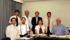
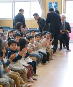
Ken and US-Japan team members meeting with community leaders of the Shin-Nagata North neighborhood that was heavily damaged in the 1995 Kobe earthquake. On the front row from left to right are: Robert Olshansky, Laurie Johnson, Kazuyoshi Ohnishi, and Ken Topping (U.S. team leader). Photo provided by Laurie Johnson.

Robert Olshansky, now professor emeritus at the University of Illinois and living in the Bay Area, met Topping and Laurie Johnson, then a young planner with a bachelor’s degree in geophysics, at a conference of the Central United States Earthquake Consortium in June 1994 in Louisville, Kentucky. The conference, which I also attended, drew mostly engineers, so these three planners “stayed up late in animated conversation,” Rob recalls. Frankly, I don’t remember much of what I did there, but I do recall meeting Laurie either there or a month later at the Natural Hazards Workshop in Boulder, Colorado. I was very much the newcomer to this business back then, in any case. But Rob, Laurie, and Ken engaged in a round of post-Northridge earthquake research meetings in California, which led to a proposal, led by Topping, to compare the Northridge and Kobe earthquake recovery experiences. Eventually funded by the National Science Foundation (NSF), their work began in 1998, but the important facet was that it involved extensive international collaboration between this American trio and four Japanese researchers. It was Ken who introduced Rob and Laurie to Japanese planning. Rob confesses he had never been to Asia before the Kobe earthquake, but he and Laurie developed close connections in Japan who remain good friends 25 years later. Rob says it was Ken who insisted on the close collaboration with the Japanese and helped select the neighborhoods they chose for comparative study.

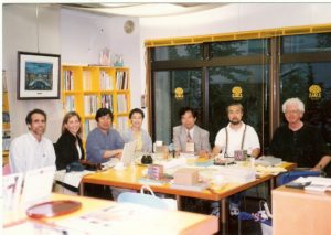
Ken with the US-Japan team conducting a long-term comparative study of rebuilding in Los Angeles and Kobe following the 1994 and 1995 earthquakes, respectively, during a team meeting in 2000 in Kobe. Left to right are: Robert Olshansky, Laurie Johnson, Ikuo Kobayashi, Hisako Koura, Yoshiteru Murosaki (Japan team leader), Kazuyoshi Ohnishi, and Ken Topping (U.S. team leader). Photo provided by Laurie Johnson.

The remarkable aspect of all this for Laurie Johnson, now a prominent hazard planning consultant based in San Rafael, California, was Ken’s acceptance and support though, she says, “I was barely in my 30s and had only a few years of relevant professional experience” when they first met. Their first contact, she says, came in 1990, when Ken spoke at the International Symposium on Rebuilding after Earthquakes, hosted at Stanford University by Spangle Associates, the firm for which she was then working. Spangle had produced a study that was among the first I studied in this emerging field, examining four case studies of post-disaster recovery. It profoundly influenced my view of what happens to communities in a disaster.

Ken, says Laurie, “wowed the group with his presentation on LA’s efforts to prepare a first-ever, pre-disaster recovery plan for the city before a major disaster like an earthquake struck.” Ken was then the planning director of Los Angeles. Fortunately, a draft of what became the Los Angeles Recovery and Reconstruction Plan had been completed when the Northridge earthquake occurred. The city formally adopted it a year later. Another NSF study led by Spangle Associates, in which Laurie was involved, found “that the plan was instrumental in contributing to the high level of staff performance” after the earthquake, helping most city departments to understand their responsibilities and prepare to perform them.

Innovations

By the mid-1990s, Ken was a tall, white-haired gentleman in his 50s, a strong intellect with a gentle voice. In coming years, in part working on the project I was leading, he made a significant impression on our colleagues at FEMA. Terry Baker, former National Team Leader for Hazard Mitigation Planning, recalled him as “always generous with his time and thoughts. A luminary in the field, although you wouldn’t know that from his kind and down-to-earth demeanor.” Similarly, Cecelia Rosenberg, who served as both project officer and grants manager at FEMA, recalls his “softly persuasive ways and quiet wisdom.” He was never a loud voice, but people knew they were speaking with someone who mattered.

He mattered because of a history of innovations, a willingness to try new things to solve emerging problems. He was well ahead of most planners in recognizing how planning could be used to reduce disaster risk. In a career that that was already well underway amid the environmental planning revolution of the 1970s, he consistently found ways to generate meaningful change. By 1973, he was planning director in San Bernardino County, California, where, as California Polytechnic State University-San Luis Obispo (Cal Poly) Professor William Siembieda notes, he “created one of the first wildfire mitigation programs and an overlay zone on 19,000 square miles of desert land for future regional conservation.”

Ken’s spirit of innovation was not limited to southern California. It was a hallmark of his career. Working with me and a team of contributors to Planning for Post-Disaster Recovery and Reconstruction (PAS 483/484, 1998), his singular contribution lay in crafting a model ordinance for post-disaster recovery that is still in use today. The model offers local governments a means of structuring governance of the recovery process after a major or catastrophic disaster, assigning responsibilities among city agencies and empowering them to handle such urgent tasks as post-disaster demolition and intergovernmental coordination. It helps them create order out of chaos with a management structure for long-term recovery that can be activated as soon as the city declares an emergency. It expedites recovery by saving precious time after disaster strikes. I can state with certainty that no more than a handful of jurisdictions had adopted any similar approach prior to the release of our report.

More than a dozen years later, after I had convinced FEMA to fund an overhaul of the original post-disaster study, adding a bevy of online resources to a new report (Planning for Post-Disaster Recovery: Next Generation, PAS 560, 2014), Ken sought to update the model ordinance as part of the project. When I directed his attention to what I considered an important innovation by the city of Cedar Rapids, Iowa, after its massive 2008 flood, he did not hesitate to contact former Community Development Director Christine Butterfield for details. The new model thus included language requiring municipal licensing of building repair contractors to prevent the sort of fraudulent repairs that had been rife in places like New Orleans after Hurricane Katrina. Ken knew a good idea when he saw one, and Cedar Rapids had done something important. A major contributor to the later PAS Report was Laurie Johnson, who produced two of the most important chapters, dealing with the recovery planning process and implementation of recovery plans. Like me, under Ken’s influence, Laurie had come a very long way in the planning field since first meeting Ken.

Bill Siembieda says this focus on innovation was also evident in Ken’s relationship with Cal Poly, which began in the spring of 2000 and lasted two decades. Ken was a part-time lecturer and George Hasslein Chair in the College of Architecture and Environmental Design, City and Regional Planning Department. His efforts included an international symposium on risk reduction, multidisciplinary courses focused on mitigation and risk reduction, and work with state agencies, most notably on the 2010 California Multi-Hazard Mitigation Plan, in which “he created a set of working groups within the state government” to discuss topics of mutual interest. He believed strongly in the value of cross-disciplinary discussions to achieve a more integrated approach to solving problems.

This focus on integration led to Ken’s involvement in what I regarded as my own signature project, which resulted in the PAS Report, Hazard Mitigation: Integrating Best Practices into Planning (PAS 560, 2010). For his accomplishments and leadership in city planning and management, environmental and hazard resilience planning, Ken was inducted into the College of Fellows of the American Institute of Certified Planners in 2000 and honored with a special session at the 2019 conference of the California chapter of APA.

Multiple Dimensions

Ken died on March 5 from complications of Parkinson’s Disease at 85. He and his wife, Phyllis, spent the last year or so in San Clemente Villas in a seacoast town in Southern California. I had a few last conversations by phone with him after that move from Cambria, California, where he had served at one point as the general manager for the Cambria Community Services District and later chaired the San Luis Obispo County Planning Commission, where he demonstrated his penchant for conservation by helping establish the Fiscalini Ranch as a Pacific Ocean coastal bluff park. Siembieda credits Ken’s “great persistence” and a “willingness to put time and energy into each work product” for his vision to support large solar farms in the county and his opposition to a “large petroleum industry oil train project.”

In one of those calls, he shared with me that he had recently fallen while trying to maneuver his walker in a parking lot. It was clear that time was taking its toll, but in a later call, ever cheerful, he gently told me how much he admired my own career path. He seldom missed an opportunity to encourage the people he had mentored.

Ken with Phyllis, his wife. From David Topping’s Facebook notice about his father’s passing.

One of the more fascinating aspects of his own story, however, was his birth in 1935 in Kobe, Japan, to a pair of American Baptist missionaries. Before the outbreak of World War II, his family found it necessary to return to the United States, where he grew up in San Francisco and Boulder, Colorado, before the family returned to Japan after the war. He later returned to the U.S. for college at the University of Redlands in California, where he met Phyllis, with whom he had two sons, and earned a degree in sociology, followed by further studies at the University of North Carolina at Chapel Hill. They returned to California, where Ken began a career as a regional planner in Los Angeles but also earned a Masters in Public Administration in 1972 from California State University, Los Angeles. That led to his becoming planning director for San Bernardino County in 1973, and later the city of Los Angeles, appointed in 1986 by Mayor Tom Bradley. One of his achievements was Los Angeles’s first zoning update using geographic information systems (GIS), then a new technology.

The environment was clearly one of his high priorities, something readily apparent in April 2012, when he and Phyllis walked my wife, Jean, and me through the Fiscalini Ranch Preserve before treating us to lunch at a local Cambria restaurant. But he also had a deeply empathetic personal side. I had been in Los Angeles the prior week at the APA National Planning Conference (NPC), much of which became for me a daunting experience as I suffered an attack of prostatitis, though I did not know the diagnosis before visiting a local urgent care center. Exhibiting my stubborn streak, on a Saturday evening early in the conference, I showed up in a hotel meeting room after getting dressed, despite feeling drained and weak, to lead a meeting of the project team for the Next Generation project. Ken took one look at me and would have none of it. His personal touch was evident as he turned to Kathy Smith, our FEMA project officer, and said, “Look at him. He’s in no condition to run a meeting.” At Ken’s urging, It was rescheduled subsequently for a remote meeting from Cal Poly the day after our visit to Cambria.

Ken seated along with children and staff at the Morioka Kindergarten in 2013. Photo provided by Laurie Johnson.

Laurie Johnson believes many of Ken’s finer traits can be attributed to his exposure to Japan. She recalls “a beautiful tribute to Ken and his family’s ties to Japan organized by Professor [Haruo] Hayashi (Kyoto University) and colleagues” in March 2013. They were documenting recovery efforts in northern Japan following the 2011 Tohoku earthquake and tsunami, but the group visited a kindergarten founded in the city of Morioka by Ken’s grandmother more than a century earlier. “The kindergartners assembled and tried to sit patiently as the history was explained and Ken was honored,” she says. “They then sang a song, “Small Garden,” that his grandmother had taught her classes many years ago and which classes still sing today.”

From David Topping’s Facebook notice of his father’s passing.

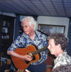
Ken tapped a beat, she says, which reminded her that Ken had taught himself to play the bass and guitar and had played before for the joint research team at home in Cambria in 2002. Music was another element of his humanity and family life (including a family band), and that focus influenced his two sons to pursue careers in music. Ken went on that day at the school to remind the children to continue to learn as they grew up, how he was there himself to learn about the earthquake, and about the value of friends around the world. “So please be my friend, too,” he told them, “and keep learning all of your lives so that you can help make the world a better place.”

Connecting People

As that vignette illustrates, there was nothing more important for Ken Topping than connecting people, particularly people of talent and determination, with the resources and networks they needed to succeed at making the world a better place. And that mission spanned international boundaries.

Professor Norio Maki of Kyoto University was one of those who benefited. He describes Topping as “my mentor on planning.” In addition to working with Ken in Japan, he learned greatly from collaboration on a project in Marikina, a city in the Philippines. The goal was to develop an earthquake mitigation plan through workshops with city staff. In what he describes as “real on-the-job training,” Ken advised him on workshop presentations and the use of GIS. Despite his university degrees, he says, “I think I got my degree in planning from Ken.”

Rob also facilitated Rob Olshansky’s now permanent connection to Japan. Ken helped arrange for Rob to follow him in a one-year visiting fellowship at Kyoto University, with Professor Hayashi. The cultural shift could have been deeply challenging, but Rob brought his children along for “a life-changing year at school in Japan.” Ken advised him on “important Japanese etiquette do’s and don’ts, in addition to navigating the Japanese train system.” Eight years later, Rob was able to pay it forward by doing the same favor for another visiting professor, Jim Goltz. And so the waves of influence move forward. Rob also believes that a book he and Laurie co-authored, After Great Disasters (reviewed on this blog), “would never have happened without Ken’s influence.”

I could go on, and Rob, Laurie, Terry, Cecelia, Bill, and Norio submitted numerous and extensive comments for my use, but the overall point seems clear. Ken is gone, but as with all such special and creative people, the lesson for the rest of us is simple—to continue to extend that positive influence into future generations in our chosen field. And beyond, wherever possible. I hope we are still doing that, in our own ways.

Jim Schwab

In Harm’s Way or Dodging Disaster?

President Joe Biden’s $2.3 trillion infrastructure bill aims to fix much that is ailing in America, and its sheer size is drawing predictable—and short-sighted—fire from Republicans in Congress. The nation has a great deal of aging infrastructure, which will eventually pose a massive challenge to economic development. But the American Jobs Plan also takes aim at a growing, urgent, and critical need for infrastructure to cope with the impacts of climate change. These affect many kinds of infrastructure, including transportation, water, wastewater, and energy and communications systems. There is nothing patriotic, it seems to me, in being so oppositional as to allow our nation to deteriorate, Texas-style, in the face of changing climate conditions. There is also nothing about what happened in Texas with frozen energy systems that contradicts “global warming.” The research clearly shows that climate instability, including seemingly less predictable winter storms, is part of the overall impact of a generally warming climate. Nobody but a charlatan ever promised that climate change would be a simple topic.

Earlier this year, I reviewed a book by a former Toronto mayor about what cities are doing about climate change. Later, I reviewed Doug Farr’s elaborate tome on how the design professions are providing solutions to climate challenges in new forms of housing and urban development. In addition, a year ago, I reviewed a new Planning Advisory Service Report by the American Planning Association on planning for infrastructure resilience. I remain committed to highlighting resources for planners, public officials, and interested citizens on issues of climate resilience.

In this post, I feature a new book on community solutions to climate resilience. In Harm’s Way, by John Cleveland and Peter Plastrik, provides a set of detailed ideas for building climate resilience in our communities. In my view, its dominant values in contributing to the discussion of climate change and community adaptation center on two crucial issues: first, how to finance investments in climate resilience, and second, how to build the policy foundations for managing retreat from the most vulnerable coastal areas as a means of avoiding major “natural” disasters. The two co-authors bring interesting backgrounds for such discussion. Cleveland is executive director of the Innovation Network for Communities (INC) and a member of the Boston Green Ribbon Commission, a group of business and civic leaders supporting the Boston Climate Action Plan. Plastrik is vice-president of INC and co-author of an Island Press book on networking for social change.

The Biden plan faces a challenging uphill climb toward passage in Congress. The money it promises for what it offers to do is heavily dependent on changes in corporate taxation that may face daunting opposition in Congress. In any case, even passage of the plan does not necessarily mean that every valuable potential investment at the local level in more resilient infrastructure will be assured of adequate funding, nor does it mean that local leaders will always agree with federal priorities for their own communities. The struggle to implement the plan will face years of challenges. In short, this is an important time for the vital discussion by Cleveland and Plastrik on how we can best find the money for essential investments in climate resilience.

Financing climate resilience is essentially an exercise in risk management. The first ingredient in successful risk management is recognition of the problem, which at a national scale has been a political football because of right-wing denial that a problem exists. For four years, this denial was centered in the White House, but the nation clearly chose a sea change on climate policy in the 2020 election. But that does not mean that nothing was happening outside the Trump administration—far from it. Local financial innovations were afoot in numerous American communities, including large cities like Boston, Miami, and San Francisco. Indeed, networks of such cities have been exploring avenues for fostering climate-related investments. The issue in many cases, because local governments seldom have large stores of cash awaiting brilliant ideas, is hunting for money in the financial markets. In many ways, the hunt for climate-resilient investments is a race against time for cities that may face climate-related disasters that may cost far more in damages than the investments they are contemplating to prevent such outcomes. Misalignments between resources and needs are commonplace, the environmental burdens of climate change, particularly on low-income and minority neighborhoods, are often enormous, and public revenue is often insufficient to address the problem. The authors thus focus on the need for innovations in climate resilience finance to meet this challenge. Given the likelihood that at least some of the Biden plan will require some level of local and state matching funds, this issue will remain potent. The authors outline a range of tools for creating these new financial structures. This task is far from impossible, however. Bond-rating firms and others are already recognizing the inherent risks involved in ignoring climate change. Why not invest on the positive side through mitigation and adaptation?

Case studies are always helpful in making clear that some community, somewhere, is at least testing solutions, many of them proving successful. The authors outline a playbook for paying for climate resilience, using eight examples in which communities have generated local revenue, imposed land-use costs on unwise development, leveraged development opportunities to achieve climate resilience, and pursued equity, among other options. Local governments in fact have a range of regulatory tools and incentives they use to leverage many other decisions by businesses and residents, many of the options, such as floodplain management rules, are already common. What is needed is the imagination for new ideas on how to use those tools, as well as accessible guidance on how well those ideas are working and under what circumstances. One city highlighted in this chapter is Norfolk, Virginia, a low-lying city on the Atlantic coast that faces a future laden with nuisance flooding due to sea level rise. Its system of four color-coded zones indicates relative levels of safety or vulnerability as a means of directing redevelopment to safer areas while demarcating those in need of protection. Zoning may not seem like a financial issue, but it is a quintessential financial tool in dictating what sort of development is permissible in what location, thus channeling investment to those areas the city deems acceptable for certain purposes. The problem is that the power of zoning has not always been used with a vivid awareness of the environmental hazards that are tied to urban geography.

In the U.S. system, municipalities are creations of the states, which establish the rules under which cities operate. Notwithstanding the magnitude of federal largesse, it is thus also fitting that the book contains a chapter on how states can help communities invest in climate resilience. States can serve as both barriers to and intentional supporters of local innovations in financing climate resilience.

Collapsed houses after Hurricane Sandy on the Jersey shore. The results of climate-driven disasters are seldom pretty.

In the end, however, all of this depends to some degree on political will, a subject addressed in a final chapter on managed retreat under the caption, “Can it happen here?” Communities have long shied away from open discussion of retreat from the shoreline or highly volatile riverfronts. Seashore land has historically been some of the most valuable real estate in the nation, and not only because it can become a haven for rich owners of second homes, but because beaches attract tourism and harbors attract economic development and transportation infrastructure. What public official wants to say no to new shoreline development, let alone talk of managing retreat from existing settlements? Yet the sheer long-term cost of such reluctance to lead with courage is something I discussed in another book review early last year. The Geography of Risk was a book that detailed wave after wave of catastrophic destruction on the New Jersey barrier islands as a result of investments by entrenched real estate interests that resisted risk-based land-use reforms.

But Cleveland and Plastrik insist that retreat will happen, and the question is not if, but when, and under what circumstances. Basically, they say, in coastal areas threatened by climate change and sea level rise, retreat will be driven either by disasters, or by the market, or by plans. In the first instance, nature itself will make decisions that force painful choices that we cannot control. In the second, recognizing the inherent dangers of such stubborn persistence, market forces will withdraw investment from areas that are no longer viable as a result of climate change, with major losses for those who either lack the means to move or who fail to read the tea leaves. The final choice, plan-driven retreat, is the only one that allows the community some degree of sovereignty in the matter, deliberating about the direction of retreat, the means of financing it, and ways of mitigating financial consequences for those involved. The problem is finding articulate, visionary leadership that can lead the community to its moment of truth.

Jim Schwab

The Need for Resilient Infrastructure

This summer, the Federal Emergency Management Agency (FEMA) is at last rolling out its Building Resilient Infrastructure and Communities (BRIC) program, and its first Notice of Funding Opportunity will likely be issued in September. In July, FEMA is airing a series of five weekly webinars to introduce BRIC to communities and state officials around the nation. BRIC is the practical result of provisions in the Disaster Recovery Reform Act, passed by Congress in 2018, to create a secure funding stream for what was formerly the Pre-Disaster Mitigation program. I plan to discuss all that in coming weeks on this blog.

But the personal impact on me was to remind me to attend to an egregious oversight on my part that began earlier this year with the release by the American Planning Association (APA) of a new Planning Advisory Service Report, Planning for Resilient Infrastructure. I read it, attended to some other business in Texas and Nebraska in late February and early March, and along came the coronavirus, upending most of my existing personal and professional plans and refocusing my attention. But it is time for me to give this report the attention it deserves.

First, there is the question of why it deserves attention. The National Oceanic and Atmospheric Administration (NOAA), which funded the project led by the Association of State Floodplain Managers (ASFPM), which partnered with APA, chose their joint proposal in funding the first round of projects under its Coastal Resilience Grants Program in 2016. As Jeffrey Payne, director of NOAA’s Office for Coastal Management, states in his preface, “Tomorrow isn’t what it used to be. Increasingly, coastal conditions include all the risks of the past, but risks that are amplified by a changing climate, rising seas, and more rapidly fluctuating Great Lakes.”

In the interest of full disclosure, I was involved with ASFPM executive director Chad Berginnis in co-authoring the proposal for this project in the summer of 2015. (After I left APA, ASFPM hired me back as a consultant in later stages of the effort to help refine and focus the PAS Report.) Our intent was both simple and bold. Local governments spend tens of billions of dollars annually on the construction and maintenance of various kinds of infrastructure. Much of that infrastructure, related to essential services including water, wastewater, and transportation, is subject to the impacts of climate change. While, as Payne goes on to state, this is true away from the coast as well, some of those impacts are particularly significant and noticeable in coastal states and communities. In short, a great deal of taxpayer money is at stake regarding the ability of that infrastructure to withstand future climate conditions and natural disasters. Planning for greatly increased resilience is a recipe for improved fiscal stability. This holds true even if, as planned by statute, a greater share of that funding for hazard mitigation projects comes from FEMA through BRIC. Taxpayers are taxpayers, whether the money used is federal, state, or local.

All that said, the serious work of completing the work fell to Joseph DeAngelis at APA, now the manager of the APA Hazards Planning Center, and Haley Briel, a research specialist for the Flood Science Center at ASFPM, along with Michael Lauer, a planning consultant with deep experience in growth management programs in southeastern coastal states.

Global average sea level rise from 1880 to the present, based on tide gauges and satellite measurements (US EPA). Reuse courtesy of APA.

Their collaborative report addresses the most significant issues of infrastructure resilience. Particularly in areas subject to coastal storms, these involve not just the impacts of major disasters but the everyday nuisance impacts of flooding because of high tides atop sea level rise that already are yielding closed streets and parks and flooded basements. Urban flooding has become a “thing” where the term never used to be heard. They include a small table with projections by the U.S. Global Change Research Program showing ranges of sea level rise between 0.5 and 1.2 feet by 2050, and 1 to 4 feet by 2100. Of course, these are rough ranges in part because various geological conditions, such as erosion or glacial rebound, cause different results from one region to another, although most of the East Coast faces serious problems over the coming century. A major part of the problem is that sea level rise amplifies the impact of high tides in storms, leading to increased flooding and erosion that is already evident in low-lying cities like Norfolk, Virginia, or Miami. The authors note that, “Over the last half-century alone, with just one to three inches of average sea level rise, daily high-tide flooding has become up to 10 times more frequent” in American coastal communities. Even in Midwestern communities, including those along the Great Lakes, problems result from climate-driven increases in high-precipitation storms that frequently overwhelm stormwater drainage systems built in an earlier era based on other, less challenging, assumptions.

Storm surge heights are cumulatively based on the mean sea level, the height of the tide, and the high volume of water pushed toward the shore by coastal storms (National Hurricane Center). Reuse courtesy of APA.

It is natural that a planning document is going to assert a role for planners in addressing these problems. The role the report asserts is entirely logical, starting with “assessing long-term infrastructure needs and understanding future risks to infrastructure assets.” Equally logical, however, is that the report builds upon prior APA literature to outline the need for coordinated action through the plan-making process to integrate climate risk into local plans as a means of “capturing the future conditions to which existing infrastructure and any planned infrastructure projects will be subjected.” Put simply, if the local planning process does not identify those risks and provide clear recommendations for creating resilient infrastructure, it is not likely to materialize in any coherent and consistent fashion. The third chapter outlines a step-by-step approach (see illustrations below) for developing an inventory of local infrastructure, identifying risks, and moving toward an effective plan for adaptation.

The process for conducting an infrastructure vulnerability assessment (Joseph DeAngelis). Reuse courtesy of APA for both diagrams.


A project or asset’s vulnerability to flood impacts is a product of its exposure, sensitivity, and adaptive capacity (Joseph DeAngelis).

Later, the report provides some examples of what such consistent planning for resilient infrastructure may look like. Its case study of San Francisco’s approach to assessing sea-level-rise impacts outlines how the Sea Level Rise Committee of the city’s Capital Planning Committee (CPC), a body responsible for overseeing capital investments for infrastructure, recommended using the upper end of estimates from a National Research Council report for the West Coast. These were fed into a CPC guidance document for assessing vulnerability and supporting adaptation to sea level rise, a primary outcome of climate change. Without engaging the full details here, the bottom line is that the City and County of San Francisco was working from a single play book for climate adaptation of project life cycles for future infrastructure. Capital planning could thus proceed in a more standardized manner based on common assumptions. The report also uses an extensive example from Toledo, Ohio, the site of one of two pilot projects supported by the ASFPM/APA project. Toledo, sitting on the shores of Lake Erie, has suffered from stormwater flooding and is approaching the problem with a mixture of green infrastructure and analysis of social vulnerability in affected neighborhoods. The report elsewhere delves into questions and methods of documenting and addressing environmental justice and social and racial inequities in environmental protection through appropriate local capital planning projects.

Both cases highlight the value for local planners of establishing credible data sources, which often rest within federal agencies such as NOAA and the U.S. Environmental Protection Agency. But, as one chapter illustrates, these can include experienced national nonprofits as well, such as Climate Central. Unquestionably, however, the best single assemblage of data and tools is NOAA’s own Digital Coast website. Planners can access additional high-quality resources on climate through other NOAA programs such as the Regional Climate Centers, located at a series of universities across the nation, and the Regional Integrated Sciences and Assessments, where RISA staff work directly with climate scientists to communicate the science to the public and local officials.

Just as important as understanding where to find the proper data and tools, however, is a knowledge of best practices in local capital improvements planning, the development of effective standards, guidelines, and regulations for creating resilient infrastructure, and, finally, the best means for financing such long-term investments in infrastructure, especially with an eye to climate resilience. Each of these three topics is covered in separate chapters in the second half of the report.

View of part of the Jersey Shore after Hurricane Sandy, February 2013.

Ultimately, the real challenge for local planners is overcoming a natural discomfort with the inherent uncertainties in planning for infrastructure that must withstand the impacts of climate change within a range of assumptions that, in part, depend on federal and even international action to mitigate rising global temperatures as a result of greenhouse gas emissions. Planners, and the communities they serve, must adjust to those uncertainties and the inherent complexities they embody. Planning, however, has always been a speculative enterprise riddled by uncertainties, yet cities have embraced assumptions about population growth, demographic change, and economic scenarios that have often been equally uncertain, for none of us has a crystal ball. What we do know, however, is the direction of existing and accelerating trends, and climate change is no myth. We are ultimately better off, and will better invest public resources, by anticipating climate change with the best projections available, so that our communities are not overwhelmed by future storms, sea level rise, and storm surge. We cannot say we did not see it coming. We can only hope to say we used a wise approach based on the best data available to avoid catastrophe for ourselves and future generations in the communities we serve.

Jim Schwab


Costly Coastal Arrogance

In the days shortly after World War II, writes Gilbert M. Gaul in The Geography of Risk, Morris Shapiro and his family were busy building their own version of Levittown, the famed suburban tract housing development of Long Island, on a barrier island in southern New Jersey known as Long Beach Island. The place had largely been the preserve of fishing villages in earlier years, but Shapiro had a vision, one he passed along to his son, Herbert, in due time.

Shapiro drained and built on what we now call wetlands, but in the 1940s, environmental values were a weak reed for resisting the onslaught of developers who believed in the next big real estate trend and the willingness of small villages to grow with them. And so, Morris persuaded Herbert to buy land around Barnegat Bay, and the few hunters and watermen who understood the value of salt marsh in preserving wildlife habitat were pushed aside. The suburbanization of the Jersey Shore soon took hold.

Nature heals its own wounds when the landscape is healthy, but damage to the built environment can be another matter altogether. Gaul details the impacts of the Ash Wednesday storm that struck the New Jersey coast in the spring of 1962, providing the nation with its first television-era glimpse of disasters yet to come and the high costs of having compromised the protective dunes and wetlands and installed thousands of bungalows on a narrow, highly vulnerable strip of land along the sea. “Nearly all the 5,361 homes on Long Beach Island . . . were damaged,” Gaul tells us, “including 1,000 that were severely impaired and 600 that were destroyed.”

As always, the immediate focus was on rebuilding, with urgent reminders from legislators and others of the economic value of shoreline development (but not its costs). In the face of that Category 5 juggernaut, Gov. Richard Hughes bravely proposed a six-month moratorium on new development, supported by the U.S. Army Corps of Engineers, and a ban on rebuilding along a 100-foot buffer along the beach. Looking back, it seems visionary for its time in anticipating the problems that would otherwise follow, and it attracted precisely the blowback we have come to expect. Federal support for rebuilding came from the Kennedy administration, and the long drift toward increased federal responsibility for recovery was underway.

Gaul goes on to detail the long tale of Jim Mancini, both developer and mayor of Long Beach Island, and cheerleader in chief for the coastal towns and what they saw as their inevitable growth. Still, governors and environmental officials in New Jersey were periodically game for a new try at restraining a situation where local officials controlled building and zoning while state taxpayers provided millions of dollars to repair storm damage and infrastructure. Gov. Brendan Byrne was next in 1979, starting with a conference on the future of the New Jersey shore, followed by initiatives from the state Department of Environmental Protection and the introduction of the Dune and Shorefront Protection Act in the legislature.

Predictably, the mayors rebelled, led by Mancini, who organized 1,500 protesters to attend a July 1980 hearing at the St. Francis Community Center in Brant Beach. Robert Hollenbeck, chairman of the Senate Energy and Natural Resources Committee, essentially presided over an ambush in which he was repeatedly shouted down by angry homeowners. Once again, the opportunity to take a creative regulatory approach to controlling shoreline damage was driven into wholesale political retreat. By the time Superstorm Sandy delivered its legendary hit in October 2012, it was all over but the shouting. The administration of Gov. Chris Christie was not about to seriously challenge the home rule prerogatives that dominate the politically fragmented landscape of New Jersey township government. The tough questions would have to wait.

What Gaul outlines in New Jersey, of course, has occurred in other forms in other places from the Carolinas to Florida to Texas over the subsequent decades. Gaul takes us to all these locations as the book progresses. What we have seen, time and again, are the costly consequences of a pattern of coastal development that has placed increasing quantities of homes and properties in harm’s way, then begged or even demanded that states and the federal government rescue the storm-damaged communities even as they fight bitterly against regulatory measures aimed at reducing future costs by restricting unwise development.

Of course, by now there are many residents caught in the middle. But surely, it is not impossible to sympathize with their plight and be willing to assist those who seek alternatives, while refusing to continue subsidizing unwise new development or bailing out those who refuse to accept the reality of the risks they have assumed. What is clear is that tough decisions await, and the public does not have endless resources. Wiser development and rebuilding decisions are imperative.

Not surprisingly, Gaul, a veteran Pulitzer Prize-winning author and reporter, is a New Jersey native. But he is also an astute historian and researcher who writes with a well-informed passion that brings us, in the end, to the fateful season of 2017—the year of Hurricanes Harvey, Irma, and Maria—and then 2018, when all looked calm on the meteorological front until Florence took its toll in North Carolina, followed by Category 5 Michael in the Florida Panhandle. Climate change, inducing hurricanes that become slow-moving rain bombs that flood cities like Houston, is still “not a thing” in the Trump White House. Neither, for the most part, are buyouts of repetitively flooded homes, even as the nation desperately needs to find ways to live more resiliently in the face of the risks it has embedded on its coastal landscapes.

But the costs keep climbing, and it is not impossible to imagine a serious political reckoning under a different administration with a more realistic handle on the stakes involved, which run into the trillions of dollars. It is not impossible, for instance, to imagine a $250 billion disaster if a catastrophic hurricane took direct aim at one of Florida’s major cities. For that reason alone, Gaul’s book may be worth a read. We need to improve the quality and depth of the conversation around issues with such drastic fiscal impact.

Jim Schwab

Housing the Needy after Disaster

This post will be brief. Rather than ask you to read my thoughts, I want you to listen–hard. It has long been known among disaster recovery planners that lower-income citizens are considerably more vulnerable to disasters largely because of the marginal resilience of most low-income housing. The affluent can afford to build fortresses, some of which may still be lost to the elements, but those in second-rate housing, poorly maintained multifamily buildings, and most certainly the homeless, face life-or-death dilemmas when disaster strikes in any form. They live with mold without the resources to make expensive repairs. They face shortages of affordable housing. Federal programs designed to help them often fall short.

Few people have worked harder to remedy these problems than John Henneberger, a 2014 MacArthur Fellow and the executive director of Texas Housers, a nonprofit advocacy organization that has been working with low-income communities in tracking recovery from Hurricane Harvey. This link will take you directly to a podcast page on the American Planning Association website to hear a 46-minute interview with Henneberger about this experience.

The podcast, the first in a series called Resilience Roundtable, is the product of collaboration between the APA technical staff in Chicago and the Professional Development Committee (PDC) of the APA Hazard Mitigation and Disaster Recovery Planning Division, of which I am currently chair-elect. In that capacity, I organized and have led the PDC. More such podcasts will be released in coming weeks, but this is the first, and we are very proud to introduce John Henneberger to a new audience. His message is detailed, highly informed, and eloquent. Please check it out.

Before I leave the soapbox, I wish also to provide you to a link to a recent study detailing why minorities are more vulnerable to the impacts of wildfires, a subject that has not been explored widely in the past. “The Unequal Vulnerability of Communities of Color to Wildfire,” available online as linked, was printed in the journal Plos One, and enriches our awareness of equity issues in disaster.

Jim Schwab

Fatal Attraction

Explaining the frustrations of first responders in searching Mexico Beach, Florida, for survivors after Hurricane Michael, Brock Long, administrator of the Federal Emergency Management Agency, told Associated Press, “Very few people live to tell what it’s like to experience storm surge, and unfortunately in this country we seem not to learn the lesson.” Mexico Beach was ground zero for landfall of the hurricane a few days ago.

But then Long was much more direct: “When state and local officials tell you to get out, dang it, do it. Get out.”

The desire or willingness to “ride it out” among people who think the storm will never be as bad as they are told is unquestionably one of the most troubling facets of disaster response, especially when there is adequate warning.

There are disasters, of course, where adequate warning is either extremely difficult or nearly impossible. I still vividly recall one evening in 1979, when, living in Ames, Iowa, I was awakened from a second-story bedroom at about 3 a.m. by the loudest roar I had ever heard. I turned to the window to see total darkness, and aside from the howling winds, no clue of what was unfolding. When it finally passed, I went back to sleep. The next morning, I learned from the newspaper that a small tornado had struck about a mile away, lifting the roofs from seven homes before skipping off into the sky again. On the other hand, we had no cell phones and no reverse 911 in 1979.

Wildfires often give but a few minutes of warning, and earthquakes generally none at all. Hurricanes are different, at least today. In 1900, when more than 6,000 residents of Galveston were swept to sea in the deadliest storm in American history, they had no meaningful warning. In 2018, we have the best satellites the federal government and private money can buy, and we typically know at least 48 hours in advance that a coastal storm is coming, although its strength can change quickly. What we surely know in any case is that, if you live on the Gulf Coast or the Atlantic Coast in the U.S., you can expect hurricanes. Only the frequency and severity vary, and they are not always predictable. But people generally have plenty of time to learn what to do when the time comes. The rest is a matter of cooperation.

There is, of course, the question of why people choose to live in the most vulnerable locations. Early in my quarter-century of involvement in hazards planning, I borrowed

No question about it. The seashore can be a profoundly attractive place in calm weather. The question is both how we build and where we build, and, in the process, what burdens we place on first responders.

the title of a 1987 mystery thriller, The Fatal Attraction, to describe the psychology of our very human attraction to seashores, wooded mountains, and beautiful sunrises. Living on the seashore can be indescribably beautiful under blue skies and balmy breezes. There is nothing wrong with enjoying all that under the right circumstances, but it is critical that we begin to learn our own limitations in adapting to such environments, the need to build appropriately in such locations, and when it is time to simply “get out,” as Long suggested. If we don’t do these things, we are often placing inexcusable burdens on first responders who must dig our dead or injured bodies from the wreckage or save our homes from raging wildfires.

In short, there are times in life when we must be willing to think about more than ourselves. Saving our own skin in the face of oncoming natural disaster is not only not selfish; it is downright thoughtful with regard to the burdens otherwise placed on police, firefighters, and emergency medical personnel.

I am aware that the issue is bigger than I have just described. In another month, I will be speaking about post-disaster recovery to an audience of long-term care health professionals. As a society, we also have obligations to ensure that the elderly live in homes that are removed from floodplains and other hazards, that children attend schools that are as safely located as possible, and that we do not force the poor and disadvantaged into neighborhoods that are at risk and where no one else would wish to live. In New Orleans during Hurricane Katrina, the system failed thousands of poor people who did not own cars by failing to provide means for carless evacuation. The sheer number of such people was never a secret to officials in Louisiana, but good planning never happened before it was too late. All that said, those who have the means should have the willingness to consider both where they choose to live or build and to evacuate when told to do so.

We can all hope that the body count from Hurricane Michael remains low. As of the moment I am writing this, authorities have counted 17 deaths, but it may rise.

Long-term recovery awaits communities affected by either Florence or Michael. As always, serious questions can be posed about where and how to rebuild, whether we can make communities more resilient against future disasters, and what vision states and communities should have as they move forward. In its Influencers series, the Charlotte Observer asked what leaders thought North Carolina could do for coastal and inland communities affected by flooding from coastal storms. Interestingly, many cited setbacks from the coast, accounting for climate change (something the Republican-dominated legislature has explicitly chosen not to do), and keeping new development out of floodplains. All these efforts would make it easier to plan evacuations in the first place. The issue is whether North Carolina, or any other state in the path of such storms, can muster the political will to do what is right.

And whether people who live in highly vulnerable locations can heed the call when told to evacuate.

Jim Schwab


The Predictable Impact of Florence

Flooding in Rosewood in Horry County, SC, September 24, 2018 (All photos by Allison Hardin with exceptions of FEMA photo from Hurricane Floyd and Charlotte image.)

It has been a few weeks of drought on this blog, but just the opposite in North Carolina, where Hurricane Florence dropped up to 30 inches of rain in some locations, and floods migrated downstream via numerous rivers to swamp cities both inland and near the coast. Now, Hurricane Michael threatens to compound the damage as it migrates northeast from its powerful Category 4 assault on the Florida Panhandle, with storm surges up to 14 feet in areas just east of the eye, which made landfall near Panama City.

The blog drought was the result of both a bit of writer’s block, mostly induced by a busy schedule that included two conference trips over the past three weeks, combined with a bit of fatigue and a few significant diversions of my personal time. But that may be okay. My intent was to write about the recent hurricane along the East Coast, and sometimes letting the subject ferment in the mind results in a more thorough and insightful perspective. I hope that is the result here.

Storms never happen in a vacuum. In a world with relatively few uninhabited places, their impact is the result more of patterns of human development and the legacy of past choices in land use and building practices than of the storm itself, which is, after all, simply a natural and very predictable event. Hurricanes were part of the natural cycle on this earth long before humans took over the planet (or thought they did).

Hurricane wind warning at bridge in Socastee, South Carolina

But they appear to be getting worse, and climate change, most of it almost surely attributable to human activity, is an increasingly evident factor. Meteorologist Ken Kunkel, affiliated both with the National Oceanic and Atmospheric Administration and North Carolina State University, stated that Florence produced more rain than any other storm in the last 70 years except for Hurricane Harvey last year. According to Kunkel, five weather stations over an area of 14,000 square miles in the Carolinas recorded an average of 17.5 inches. Harvey’s average was 25.6 inches. By comparison, Chicago averages about 37 inches for an entire year. Such heightened precipitation levels are in line with expected impacts of climate change.

What became obvious to me early on was that Florence would rehash a certain amount of unfortunate North Carolina history regarding feedlot agriculture. I am familiar with that history because 20 years ago I authored a Planning Advisory Service Report (#482) for the American Planning Association, titled Planning and Zoning for Concentrated Animal Feeding Operations. (In that same year, APA also published PAS 483/484, Planning for Post-Disaster Recovery and Reconstruction, for which I was the lead author and project manager.) I want to emphasize that what happened in North Carolina was not unusual. Nationwide, many states have laws dating to the 1950s that exempt all or most agricultural operations from county zoning ordinances. Most of these were intended to create a friendly regulatory environment for family farms, and they were often followed by other “right-to-farm” laws designed to shield farmers using conventional farming methods from nuisance lawsuits. Only later, as the large feedlots known also by the acronym “CAFO” became widespread, did it become clear that such exemptions, by then fiercely defended by industry groups, became giant loopholes for the detrimental environmental impacts of such operations. This story has been repeated in Iowa, Missouri, Utah, and numerous other states.

In North Carolina in 1991, State Senator Wendell Murphy, who owned a direct interest in the growing Murphy Family Farms, engineered passage of a law widening the state’s exemptions to include CAFOs. Within two years, as I noted in the report, North Carolina’s hog population shot up from 2.8 million to 4.6 million. Today, the number is at least 9 million. A public backlash at the impacts of CAFOs resulted in a new law in 1997 that included a moratorium on new waste lagoons, but by then, although the hogs were firmly ensconced in a growing number of feedlots, the figurative horse was out of the barn. Many counties in eastern North Carolina, where the industry was concentrated, were slow or reluctant to use their newly regained powers. In any case, various large operators were effectively already grandfathered into continued existence. Today, consolidation within the industry has left Smithfield Foods in possession of most of the business in North Carolina, yet Smithfield itself was acquired by the Chinese-owned WH Group several years ago.

Grenville, NC, September 24, 1999 — The livestock loss and potential health hazard to Eastern North Carolina is huge. Here volunteers have towed in dead and floating cattle from a nearby ranch at Pactolus, NC (just North of Greenville), trying to remove them as fast as possible to lower the potential health hazards associated.
Photo by Dave Gatley/ FEMA News Photo

Along came Hurricane Floyd in 1999. The low-lying plains of eastern North Carolina, always vulnerable to flooding, were deeply awash, but worse, filled with millions of pigs and poultry and their excrement in manure lagoons. Hurricane Dennis just weeks earlier had dumped 15 inches of rain on the region, and Floyd dumped even more in some areas. The Tar and Neuse Rivers, among others, badly overflowed their banks and inundated numerous farms. More than 110,000 hog carcasses, and more than 1 million chicken and turkey carcasses, floated downriver while waste lagoons were breached, creating a stench-filled public health disaster only partly solved when the U.S. Environmental Protection Agency brought in huge incinerators to burn carcasses, though most animals were buried. It was a fiasco that did not have to happen at the scale on which it occurred.

Fast forward to this year and Hurricane Florence, presuming a surfeit of lessons to be learned from the 1999 disaster as well as later storms. As Emily Moon notes in the Pacific Standard, North Carolina has had opportunities over the past 20 years to introduce serious regulatory change, but various factors foiled those chances, and North Carolina remains the nation’s second-largest hog producer, having pushed aside every state but Iowa. The industry has evolved, but the problem remains. The state has bought out 46 operations since 1999 and shut down their lagoons, but the vast majority remain in operation. The numbers changed in Florence—more than 3 million chickens and 5,500 hogs dead and afloat in the flood waters—but the devastation rooted in CAFO practices continued. Coal ash landfills associated with power stations added to the environmental impacts. And the beat goes on, in a part of the state heavily populated by African-Americans, many too poor and powerless to challenge the system effectively without outside help.

I mention all this aside from the obvious human tragedies of lost lives, ruined homes, and prolonged power outages affecting some 740,000 homes and businesses.

Flooding at Arrowhead Development in Myrtle Beach, SC, September 26, 2018

Still, there are significant lessons available from Hurricane Florence outside the realm of mass production of poultry and hogs, and I want to offer a positive note. One is that, while only about 35 percent of properties at risk of flooding in North Carolina have flood insurance, which is available from the National Flood Insurance Program, neighboring South Carolina ranked second in the nation with 65 percent coverage. While I do not know all the details behind that sizable difference, it seems to me there is surely something to be learned from a comparison of these results and how they were achieved. They come in the context of a “moonshot” by the Federal Emergency Management Agency to double flood insurance coverage nationally by 2022. That will happen when South Carolina becomes the norm rather than the exception. Sometimes we can use these events to push in the right direction. Texas, for instance, has added 145,000 new flood insurance policies in effect since Hurricane Harvey; the question will be whether the new awareness wears off as memory of Harvey fades, or whether the state can solidify those gains. For that matter, can the states in the Southeast—the Carolinas, Georgia, and Florida—leverage the lessons of Florence and Michael to push in the same direction?

Hidden Valley drainage restoration project, Charlotte, NC. Image courtesy of Tim Trautman.

Recently, Bloomberg Business News offered an example within North Carolina of how differently floodplains could be managed by highlighting the case of Charlotte and Mecklenburg County. I worked for several years in a series of training workshops on flood resilience with Tim Trautman, the manager for the engineering and mitigation program for Mecklenburg Storm Water Services, so I am familiar with their intriguing story. The county for many years has used a stormwater utility fee on property owners to fund its own hazard mitigation program, using the money to buy out flood-prone properties and increase open space in its floodplains. The result has been a significant reduction in flood-prone land and buildings. The question is not whether Charlotte is successful, but what state and federal programs and authorities can do to encourage and support such efforts and make them more commonplace.

Every serious disaster offers lessons and opportunities, and I am not attempting here to pick on North Carolina alone. Other states face their own challenges; Iowa, for one, is undergoing a somewhat muted debate about the impact of its own farm practices on downstream flooding and water quality, in part as an outgrowth of the 2008 floods. What is important is that we use these windows of opportunity, the “teachable moments,” as they are sometimes known, to initiate the changes that are surely needed for the long term in creating more resilient, environmentally healthy communities. What we do not need is a natural disaster version of Groundhog Day.

Jim Schwab

Taking Stock of Recent Disasters

Photo by Jeff Clevenger

We learn from disasters as we recover from them, but each disaster teaches slightly different things. Sometimes the lessons are significant and historic; in others, one community is learning what others already know or should have learned from their own past events. Some years are relatively quiescent, as 2018 so far seems to be. And some become relentless slogs, like 2017.

Adam Smith, lead scientist for the National Oceanic and Atmospheric Administration’s National Centers for Environmental Information, noted in a plenary panel in July for the 2018 Natural Hazards Workshop, in Broomfield, Colorado, that the tally for 2017 disasters had exceeded $200 billion. This is more than 40 percent of the tally so far of billion-dollar disasters for the entire decade beginning in 2010. Simply put, with three major hurricanes—Harvey, Irma, and Maria—striking parts of the southern U.S., followed in short order by some of the most expensive wildfires in California history, it was a wild, taxing year in the world of emergency management.

But our attention fades quickly. Right now, there are no equivalent disasters seizing our attention, but in time there will be. The people who remain painfully aware that recovery is a long, slow process are those directly affected, and even many of them will not fully grasp the ways in which past location choices and patterns of development have brought them to this pass. Many had no choice anyway. Our communities are frequently full of social inequities that compromise the life choices of the poor and disabled. In other cases, the losses inflicted on neighborhoods are the result of hubris on the part of developers, city officials, and homeowners themselves. It does not hurt, approximately one year after these combined events, to look at what we know so far about the recovery following them.

Apparently, the U.S. General Accountability Office (GAO), an arm of Congress, agreed that the time was ripe for review because it has released a study, 2017 Hurricanes and Wildfires: Initial Observations on the Federal Response and Key Recovery Challenges. Because of the severity of challenges in Puerto Rico, one may note from the graph below, reproduced from the report, that Hurricane Maria by far entailed the largest federal expenditures.

In spite of that level of effort, Puerto Rico has engendered the most significant criticism of the performance of the Federal Emergency Management Agency (FEMA). Maria struck Puerto Rico and the U.S. Virgin Islands (USVI) after Harvey had already drenched and flooded coastal Texas, and Irma had swept through much of Florida.

FEMA teams managing the distribution of water, and meals for hundreds of semi-trucks at an incident Support Base in Seguin, Texas. Photo by Dominick Del Vecchio – Aug 29, 2017

The report notes that, as a result, FEMA resources were severely stretched by then, only to have wildfires in California add to the pressure, though the personnel assigned in the last case were small compared to the hurricanes (as is typically the case). Adding to the challenge, Puerto Rico and USVI are offshore and were also poorly prepared for a Category 4 hurricane. Puerto Rico had already suffered years of neglect of crucial infrastructure, was burdened with oppressive debts, and was by far the least prosperous target of the 2017 storms. All this, combined with some incredibly inept public relations from the White House, led to a perfect storm in which nearly 3,000 people have died directly or indirectly as a result of the disaster. To my knowledge, that is a number exceeded in U.S. history only by the 1900 hurricane in Galveston, which killed more than twice as many people. The difference is that, in Puerto Rico, most people died because of blocked transportation, loss of electricity, and similar problems with critical facilities that prevented adequate transportation or medical attention in many isolated communities in the interior of the mountainous island.

Exactly what we learn from Puerto Rico remains to be seen. It is worth noting, in my view, that far more prosperous Hawaii has coped well with admittedly less-challenging disasters in recent years, in large part because state government has practiced response and committed resources to the problem. I say this despite being aware of gaps in Hawaii recovery planning that merit further attention. But if Puerto Rico is a logistical challenge for mainland responders, Hawaii is even more remote but better prepared. The difference in economic circumstances, however, is a dramatic and powerful variable in this comparison, as is Hawaii’s statehood. It is also worth noting that Hawaii is a long chain of islands, and storms (or volcanoes) never affect all at the same time. Effectively, that has always meant that emergency resources in Hawaii have been able to be moved from one or more islands to another that has been hit by a storm. All of Puerto Rico was devastated almost on the same day, with internal transportation, communications, and electric power nearly brought to a standstill, making access to many villages nearly impossible.

If Puerto Rico, followed closely by USVI, is the direst case for long-term recovery, there nonetheless remain serious challenges in Texas, not only in Houston but in dozens of other counties along the Gulf Coast. A recent Washington Post article used the term “Harvey homeless” to describe thousands of Texas families living in whatever parts of their flooded homes they have salvaged while struggling to accumulate the resources to repair the rest. They live with mold, dust, and any other environmental contaminants that endure in essentially unusable parts of their homes. In all, according to the Texas Department of Public Safety, at least 175,000 Texas homes were “badly damaged” by Hurricane Harvey, and 80 percent lacked flood insurance, thus relying on much smaller federal disaster payments (averaging $4,203) than flood insurance would have afforded. If there is one powerful lesson in Texas, it concerns public education on the value of flood insurance, particularly in the many areas outside the 100-year floodplain. Unfortunately, much of the public retains the illusion that flood insurance is either unnecessary or unavailable outside the legally defined floodplain. Yet Harvey’s 60 inches of rain in some parts of metropolitan Houston left vast areas beyond the regulatory flood boundaries under water because water does not care about such artificial boundaries. It goes where gravity compels it to go. Moreover, years of loose land-use regulation over the past half-century of rapid growth have expanded the floodplain and put numerous neighborhoods in greater danger than they faced in the past.

Moreover, as John Henneberger, executive director of the nonprofit advocacy group Texas Housers, noted in his keynote at the Natural Hazards Workshop, Texas does not have a noteworthy history of attention to social equity in disaster recovery. Henneberger called for a new model of disaster recovery in which we seek to use recovery planning to overcome racial and economic inequities, stating that “the legal framework already exists” in federal programs like Community Development Block Grant—Disaster Recovery (CDBG-DR) to “overcome inequalities,” but the rules are not always followed. Thus, his top recommendation for reform was simply to “obey the law” regarding the conditions that apply to state and local use of CDBG-DR funds.

Finally, Bloomberg Business Week chose recently to examine the questions surrounding rebuilding after the California wildfires. With a population already approaching 40 million, the state is under intense pressure to build adequate housing amid rising housing costs. California has repeatedly toughened its building codes in response to wildfire threats but faces a legacy problem of homes built under earlier standards. Not often known outside wildfire research circles is the fact that the average home contains seven to eight times the density of combustible materials as the surrounding forest in the wildland-urban interface. That means that every home that catches fire or explodes is a huge matchstick endangering every other home in its immediate vicinity. When one considers that California is unquestionably the most progressive state in tackling wildfire problems, one understands that the problem of retrofitting older homes built to lower building code standards—or none at all in some other western states—is a lingering and potentially very expensive problem. The dilemma serves to illuminate the value of pre-planning for recovery, learning how to seize the “teachable moment” for reform, to reduce the scope of the problem. The article also notes that, if California is to reduce pressure to build in the forest, its cities must be prepared to allow greater density to relieve the housing crisis in a state where a shortage of affordable housing has yielded a concomitant problem of growing homelessness. And so, we see why urban planning needs both to be holistic in its approach to social problems and guided by wise state policy with supporting resources. We all still have a long way to go.

This blog post can never be long enough to explore all these issues in depth. But in coming weeks and months, I hope to delve into specific issues more deeply, share interviews with individual experts, and explore what needs to be done. I am also watching intently for new books that will shed light on new solutions. One just arrived today. Stay tuned.

Jim Schwab