Discovering a Piece of Chicago

It is possible to live in a city as large as Chicago and be blissfully unaware of some wonderful things. Chicago, after all, includes 2.7 million people spread over 227 square miles. My wife and I have lived here since 1986, but we do not spend much of our time traversing unfamiliar neighborhoods. Like most people, we have well-worn paths, and at times we visit new areas where we know people and learn from them. Also, like most people with cars, we drive by certain areas without taking time to really see all that they contain, as one might on foot. Because I walk through my own neighborhood, I know a great deal about what is happening. But there are others where I have not a clue.

Chicago is nothing, however, if not full of pleasant surprises. Never mind unpleasant headlines or presidential tweets about crime rates. There are reasons why millions of people still live here. I discovered one this Labor Day weekend through sheer serendipity. I participated in a small workshop at a home on North Virginia Avenue, a street I had never visited before. I looked it up on Google maps and discovered that the homes on the west side of the street border a great park along the North Channel of the North Branch of the Chicago River, a drainage canal built more than a century ago. This channel extends straight north from where it joins the North Branch around Carmen St., just south of Foster Avenue, a major east-west artery that extends from Lake Michigan through Chicago’s North Side into the northwestern suburbs.

Entrance to Legion Park from Ardmore St.

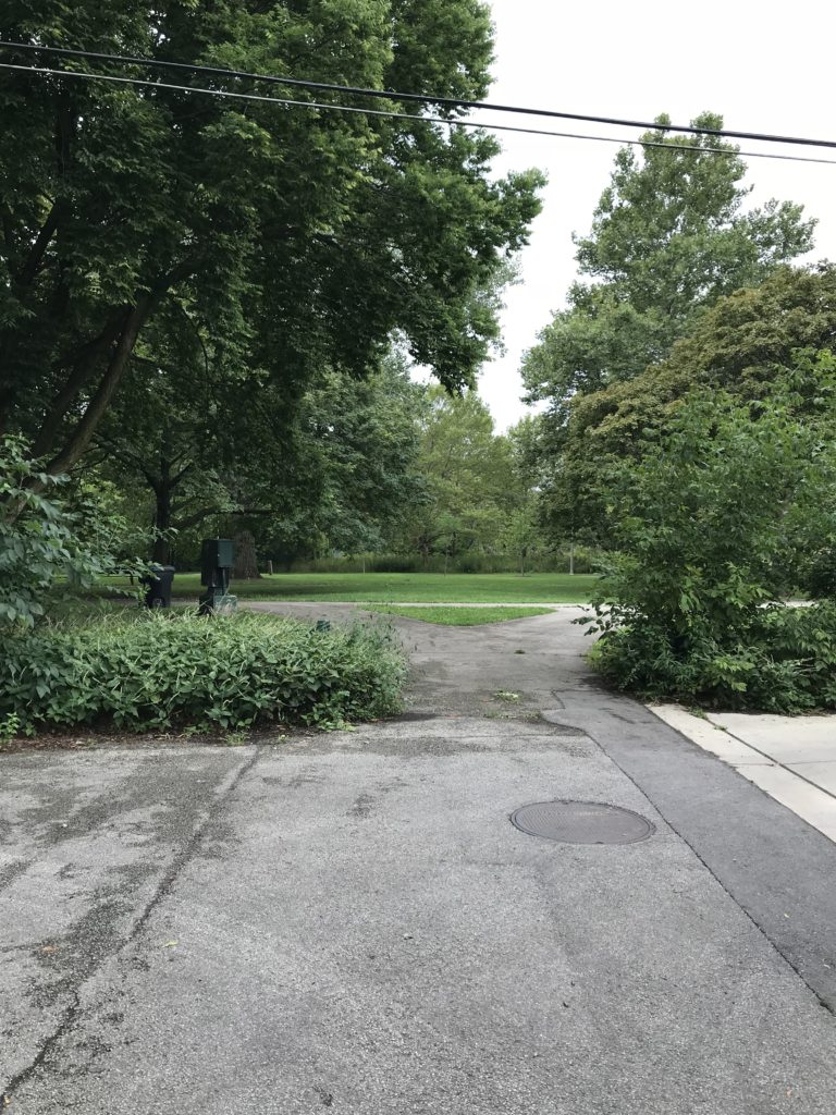
What I saw on the map invited me to explore after I left the event, a little more than half a mile north of Foster, several miles from downtown. I soon realized what a gorgeous asset this neighborhood has just beyond its western edge, and what a gorgeous day I had chosen for my short walk. As at other corners along N. Virginia Avenue, Ardmore terminates on a short stub that opens onto a trail inside Legion Park.

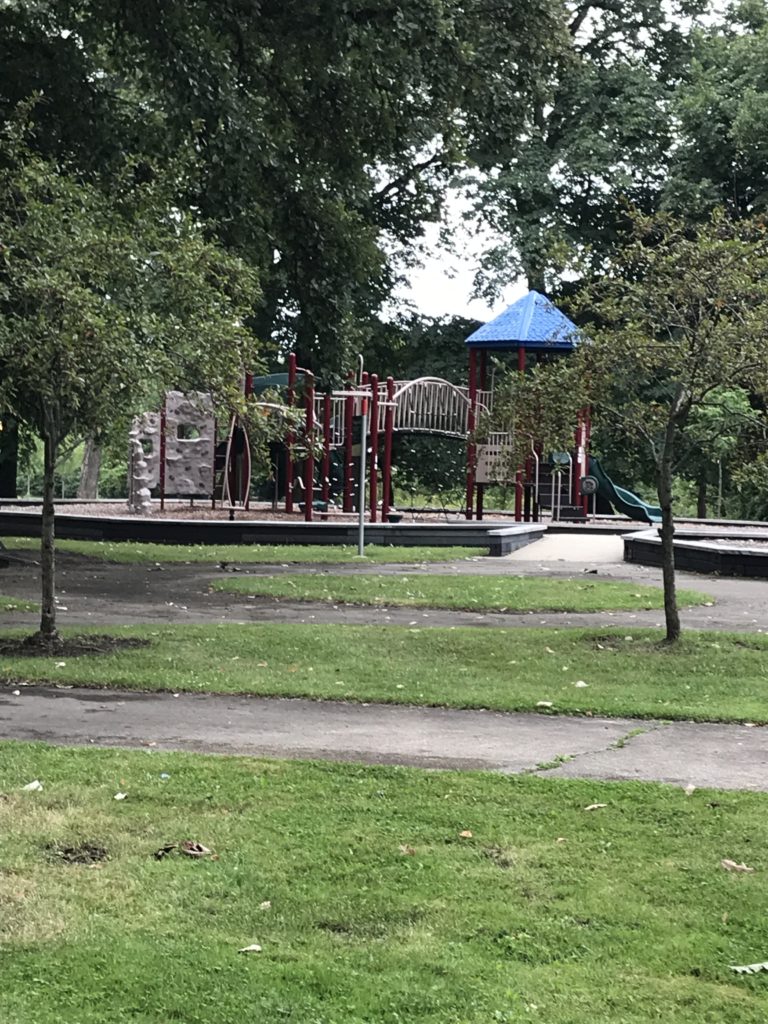
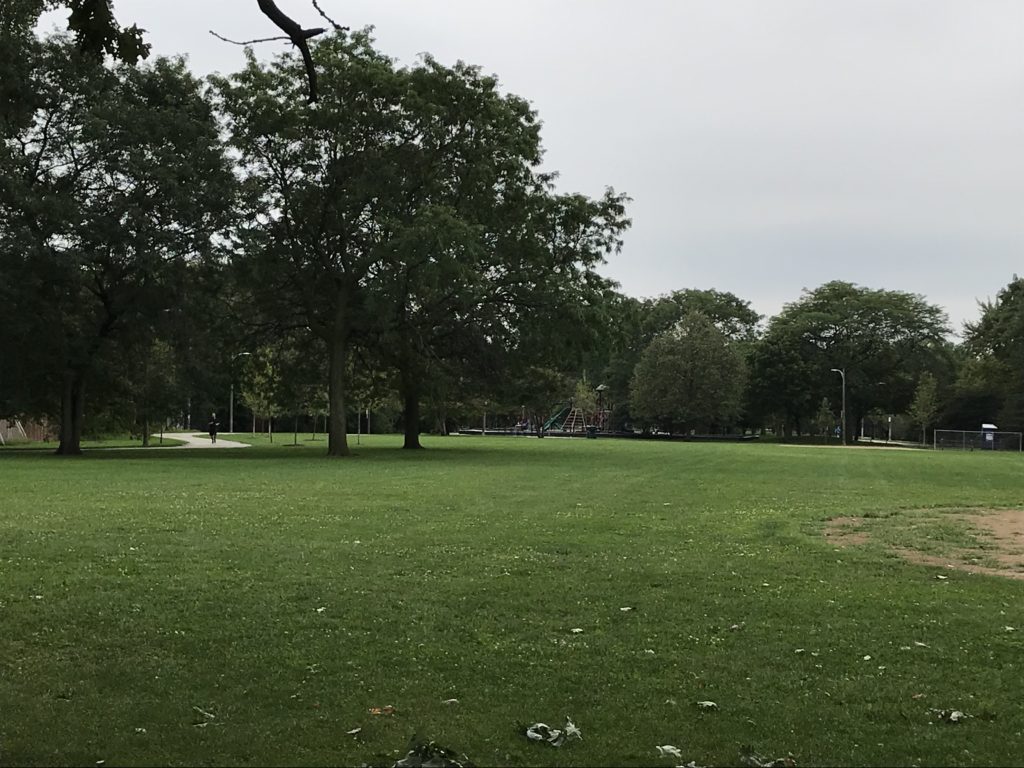
A couple of asphalt paths provide walking, jogging, and bicycle trails with a very modest amount of traffic behind an area largely composed of single-family homes. Between the paths stand a variety of well-maintained deciduous trees whose shade both quiets and cools the park space. As I walked south toward Bryn Mawr Avenue, a major street with a bridge over the channel, the Legion Park Playground, a small haven for children needing adventure and exercise, loomed ahead. A mother and two daughters were using the merry-go-round. In the distance, on the far trail, came bicyclists who never noticed my small camera and did not need to. It was past 1 p.m. on a Sunday afternoon, and it was all so peaceful I could have sat and communed with nature for hours, undisturbed. Someday I may return for that purpose, but today I wanted to explore.

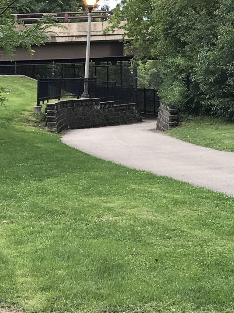
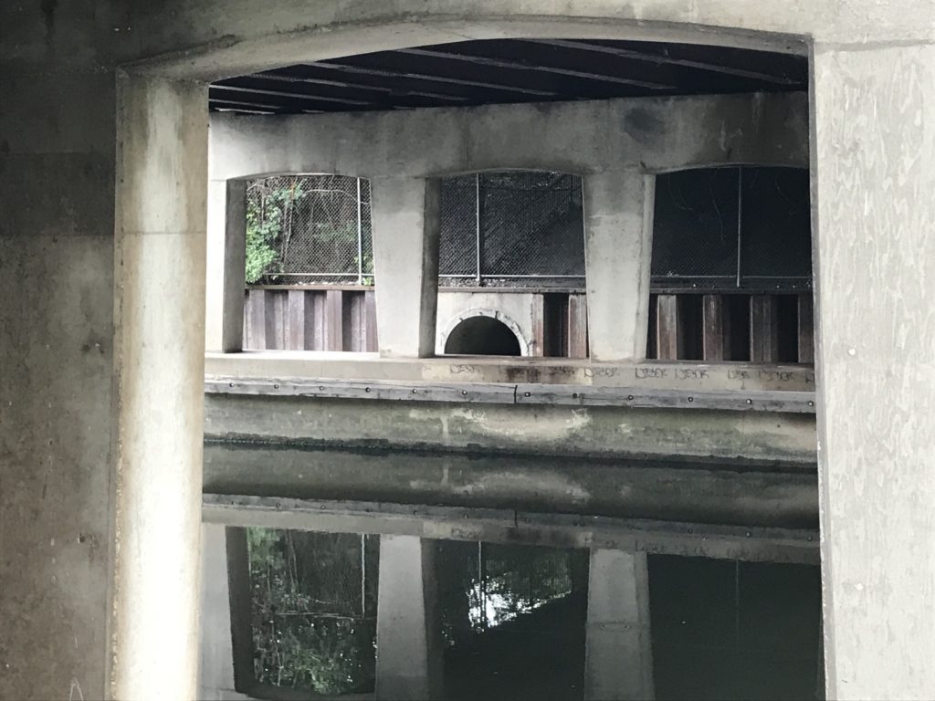
Exploration led me to a follow a cross-path to the North Shore Channel trail closer to the water, which, for the most part, lay hidden behind a screen of forest and uncut grasses, but the trail now led closer to the water by passing under the street above, leading me to a brick wall topped by wrought-iron fencing. Inside the tunnel I found the concrete support system for the road above, the sort of infrastructure that reminds you of what is necessary to allow a road to cross the waterway with minimal disturbance. If it was quiet in the park, it was even quieter down here. The water may not have been especially clean, but in its stillness, it provided a vivid reflection of both the steel girders and the verdant growth above it.

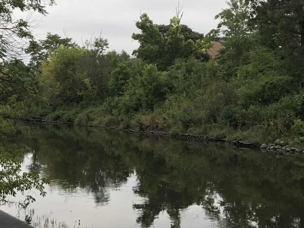
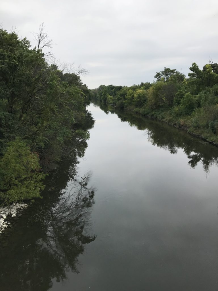
And then, just a few feet away, the waterway emerged in full daylight, with all the foliage that grew above its banks, all the way down to the riprap at the water’s edge. In a matter of seconds, I found myself south of Bryn Mawr, with a whole new section of the park emerging with its own paths, its own playground, and its own softball diamond. I quickly realized that the park was the backdrop to North Side Preparatory High School, which fronts on Kedzie Avenue, but enjoys a remarkable backyard view for those with the wisdom to take it all in.

All this took me perhaps 20 minutes of a slow stroll, with time to shoot photographs. I am aware from the map, and from the sight lines of the channel, that the park extends much farther both south and north from what I saw. But it reminded me, with my own knowledge of the urban landscape as a planner, that cities sometimes, accidentally or intentionally, remember that the best use of a floodplain often is open space, not development, and that the result can be a beautiful asset for the areas around it that are above the water. In Legion Park, even with what to my knowledge is a minimal history of flooding, there is ample room for the water to overflow its banks while harming nothing. The natural environment responds to the freedom we have allowed it and provides us with solitude, and beauty, and an abundance of ecological services. The city can co-exist with its riparian corridors, which afford habitat and recreation in the same space.

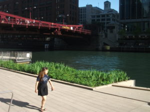
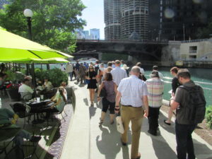
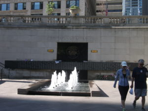
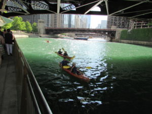
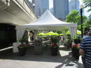
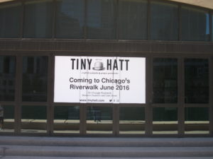
Chicago, in recent years, has been discovering that the sacred community space it has preserved so doggedly along its lakefront can and should include its riverfronts as well. The city has cleaned up and improved its Riverwalk along the main channel of the Chicago River downtown, a development I profiled on this blog about three years ago. In this morning’s Chicago Tribune, I read of new kiosk vendors doing business in a new covered space below Wacker Drive along the Riverwalk. But the Chicago River and its tributaries extend much farther into the heart of the city, and they can all serve a purpose in making the city more livable. In fact, in these less populated, less densely developed areas, the very openness and the greater stillness can inspire a spirituality that is harder to achieve in the downtown canyons that linger below skyscrapers and honking traffic. In Legion Park, I could not even hear the traffic. I could only see it in the distance—or witness it on two wheels as someone bicycled past me. What a magnificent gift. We should appreciate such treasures for all they are worth.

Jim Schwab

Riverwalk: A New Chicago Magnet

DSCF3110IMG_0239

Chicago is already quite rich in parks and tourist attractions. What can it add downtown?

In the past, I have written about the 606 Trail in Chicago, which is experiencing its first anniversary after opening a year ago. Despite some of its well-known challenges and problems, Chicago remains a city of quality destinations. Navy Pier, now a century old, just unveiled its redesign last month, including a new 200-foot Ferris wheel, and has been the top tourist attraction in Illinois. Millennium Park has few peers among downtown urban parks and has also been a second magnet for visitors since opening in 2004, ranking only behind Navy Pier.

But below the bridges and viaducts, down near the water’s edge, another jewel is nearing completion along the Chicago River—the Riverwalk. On June 2, I joined a tour sponsored by both the American Planning Association Illinois Chapter and the American Society of Landscape Architects Illinois Chapter and listened to an explanation of both completed and upcoming changes.

Chicago has no shortage of websites and museums devoted to its own urban history, which I won’t even try to summarize here. Suffice it to say that, when Haitian-French explorer-trader Jean Baptiste du Sable first encountered Potawatomi Indians (one of whom he married) at the shore of Lake Michigan in 1790, the Chicago River was still an indolent waterway barely crossing the sandbars to empty into the lake. In a little over 200 years, it has become home to one of the world’s largest cities, with all the pollution and navigation over two centuries that one might expect. In the 1890s, amid the city’s rapid industrial expansion, engineering reversed its flow away from the lake to the Mississippi River watershed, in large part to spare Chicagoans the pollution of their beaches and water supply that came with using the river as an open sewer. The river itself was not a place where you wanted to spend time unless you were in a boat, and even that was questionable. More than 800 picnickers died when the Eastland tipped over at the water’s edge in 1915. At street level on Wacker Drive, a plaque memorializes that notorious incident.

But times change, and in the 21st century, the Chicago River is once again a civic asset to which significant attention—and investment—are being paid. Over the last ten years, the first two phases of a rebuilding project have come to fruition, producing a Riverwalk that now extends on the south side of the main branch from Michigan Avenue west to LaSalle St. A third phase will extend the Riverwalk further west to the juncture of the North and South Branches. Even the term “main branch” may seem a little puzzling to non-natives because it extends only about one mile. Most of the length of the Chicago River is in the two branches, but the whole river in either direction is less than 20 miles. The Lake Michigan watershed in this instance barely reaches beyond the city and rises only about 20 feet above the lakeshore. Beyond that, you are in one of the sub-watersheds of the vast Mississippi River valley. Most people would never notice they had crossed this boundary if a sign did not tell them. The Continental Divide, this is not.

However, the controlled nature of the river and the short reach of the main branch make the creation of a downtown Riverwalk far more manageable and the experience of walking it thoroughly enjoyable. The firms of Jacobs/Ryan Associates, Sasaki Associates (with whom I have collaborated on disaster recovery issues), and Ross Barney Architects, involved in the design and engineering, have produced an experience that unfolds in “rooms” as one moves in either direction along the river, bringing users close to the water while allowing the occasional flood to muddy some steps without much damage beyond washing down the mud the next day. Phase 1redesigned and rebuilt an existing path between Michigan Avenue and the lake, an area popular with tourists as a loading zone below the stairs from Michigan Avenue down to the riverfront for tour boats. It then extended that two blocks westward to State DSCF3126Street and includes the Chicago Veterans’ Memorial Plaza, opened in 2006. One of its nice touches is a series of concrete stairs more suitable for lunch or relaxation than for climbing. It is a dignified but welcoming setting in keeping with its purpose. In Phase I, the idea began to emerge of adding river-level sidewalks that allow visitors to move from block to block without going up to street level and back down again, although some of these obviously had to intrude from the existing river’s edge into the waterway, and thus involved some negotiation among agencies responsible for navigation and safety, given the mix of water traffic still traversing the Chicago River. Congress also had to act to provide permission to allow building 25 feet into the river to create the necessary width for the new Riverwalk.

IMG_0242What has emerged in Phase II is the creation of the rooms: Marina, Cove, and River Theater, extending from State Street west. The first is opposite Marina City, occasionally nicknamed the “Corncob Towers” because of their design, and permits docking by river boats and lounging by pedestrians. The Cove, in contrast, is a favorite stopping point for kayaks and canoes, which provide a rich source of aquatic exercise for sports enthusiasts. The River Theater changes the nature of the experience yet again with the appearance of a riverside amphitheater, using a low-slope path woven into climbing stairs that can also double as points of relaxation for hikers. The theater, for the most part, is the activity on the river itself, although one can imagine a waterborne performance someday floating before the viewers. Most of this opened for public use just a year ago.

Phase III is adding a water plaza at the river’s edge; the Jetty, which places a series of floating gardens along the river edge that allow people to learn about river ecology and native plants, and the Boardwalk, providing an accessible walkway connecting to Lake Street. Although currently inaccessible at river level, one can view the construction on the final phase from street level. We were told the project will be completed by this fall.

O'Brien's is one of the existing restaurants, along with City Winery, that provide refreshment along the route.

O’Brien’s is one of the existing restaurants, along with City Winery, that provide refreshment along the route.

It is one thing to traverse this path with a crowd from a mobile workshop in the late afternoon. Not only does a crowd make a difference, so does timing. I returned the following morning, since my CTA Blue Line commute takes me to the Clark & Lake station. Instead of remaining on Lake Street, I walked to Wacker Drive and descended the stairway again, this time walking in the cool of the morning by myself at 8 a.m. Not that I was alone. The path was already being filled with pedestrians like me, and joggers, and even an occasional bicyclist, so I had to pay attention to those around me as I repeatedly set my camera to shoot many of the photos included here. Heat varies, of course, throughout the summer day, but one pleasant, enduring feature is the cool breeze off the water. In the morning, as well, the restaurants are not yet open, making for a slightly more solitary experience, which even a confirmed extrovert like me can enjoy in contrast to the crowds that by late afternoon are now finding their way to the

The collection of bars and restaurants on the Riverwalk is still growing.

The collection of bars and restaurants on the Riverwalk is still growing.

new bars and restaurants that are now exploiting the popularity of the Riverwalk, as intended, with more coming as the project moves along. The opportunity to sit outdoors at river level and enjoy snacks or dinner and drinks can be very pleasant, and very different from the usual experience high above on the city streets. I expect that most of these establishments will do quite well. I intend to enjoy some of them myself, with friends in tow.

Jim Schwab