The Struggle for Climate Sanity

It is Sunday evening as I start this blog post. Whether I finish it tonight is less important than simply getting it done. I had intended to get it done earlier, but other matters intervened, including a death in the family, so I am doing it now.

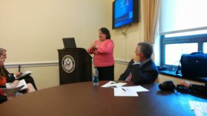
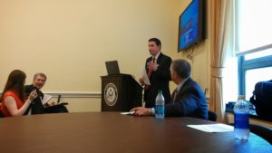
Part of my motivation is that I feel a small sense of empowerment from a successful start to a two-month series of Adult Forum discussions of climate change at my own church. I became the volunteer coordinator of the Adult Forum, which is the adult discussion group that meets during the Sunday school hour, in 2017, just in time for the 500th anniversary of the beginning of the Reformation. That is no small thing at a Lutheran church. Last week, introducing the moral and ethical questions surrounding the biggest existential question of our times—the radical environmental changes produced by humans in the industrial age—we had eight people in attendance, not huge but remarkably good as church attendance struggles to regain traction after two years of pandemic lockdowns and fears of new waves of COVID. Our congregation has taken the pandemic seriously, and many of the elderly and the immunocompromised watch the weekly services online. This week, Adult Forum attendance grew to ten. Most people seem committed to the series. And they have lots of questions and paid rapt attention. I supplement what we do in our one-hour discussions with email distribution of links and attachments to additional material.

We started on the first Sunday by focusing on Katharine Hayhoe’s new book, Saving Us: A Climate Scientist’s Case for Hope and Healing in a Divided World. My choice was deliberate. Before we tackled the science and the social and planning issues of climate change, it seemed important to consider how climate change became such a divisive issue for American society and the world. And there seemed no better place to start than with this excellent book.

Roots of Division

Why and how did climate change become such a divisive issue? Part of the answer is that climate simply became one of several issues that provided potent material for political polarization, which has also infected debates about racial justice, immigration, and a frequently paranoid distrust of science that has hampered efforts to address the COVID-19 pandemic. In other words, the larger political environment swept climate change into the cauldron of this hostile partisan warfare. Consider the timing. Newt Gingrich’s right-wing uprising in the Republican party during the Clinton administration, a predecessor of the later Tea Party during the Obama administration, came along just as climate change was emerging as a topic of serious scientific debate. In due course,
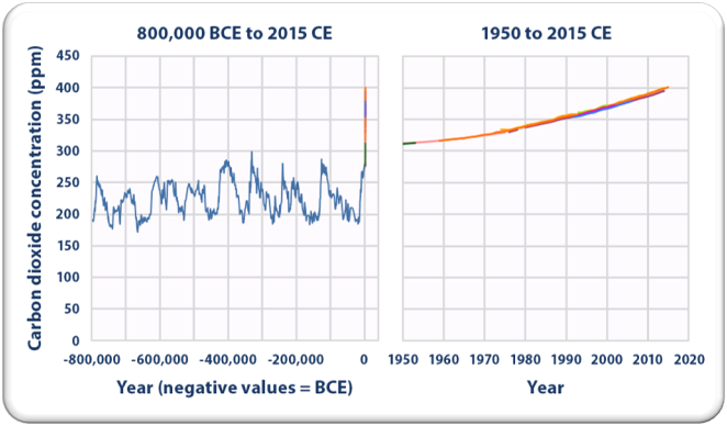
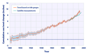
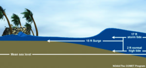
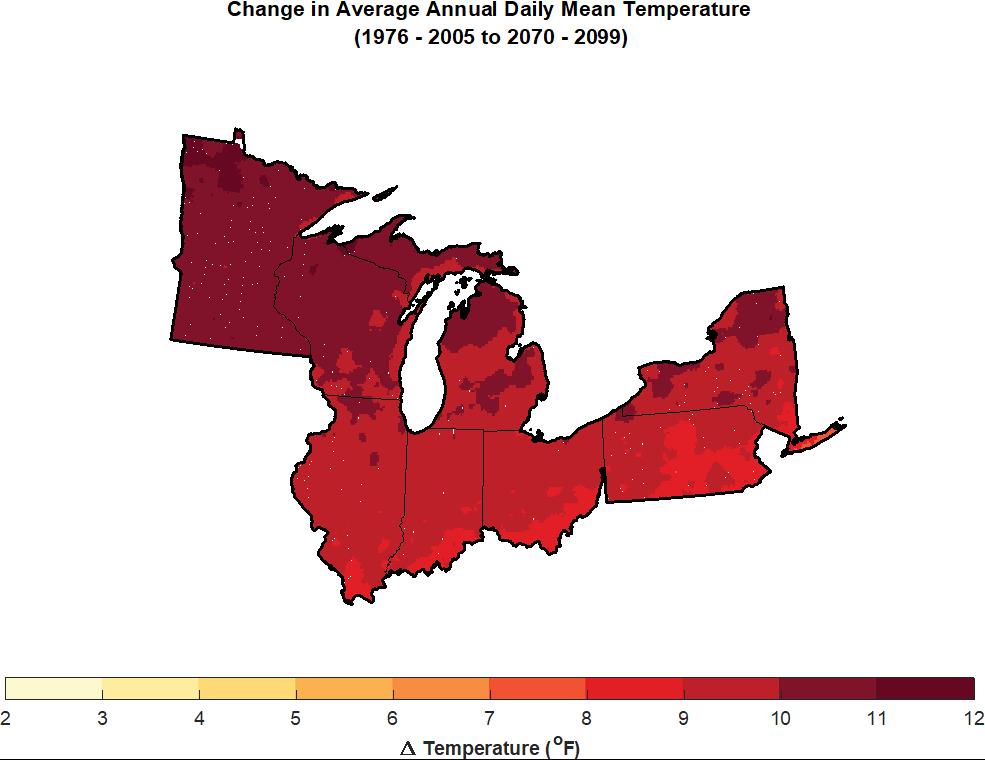
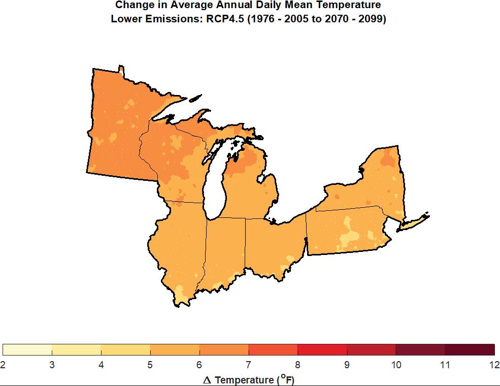
Source: US EPA

looking at the data, an overwhelming percentage of scientists in relevant fields came to accept the basic premise that human activities of the Industrial Age are the only credible cause of the warming effects we are seeing today, but the political discourse on the right largely dismissed the evidence. That discourse of dismissal was heavily supported by the fossil fuel industry and a public relations campaign to muddle the issue, a matter discussed in 2010 in the book by historians Naomi Oreskes and Erik Conway, Merchants of Doubt.

However, there is also the fact that climate change poses a long-term threat that many people find difficult to recognize as a more immediate crisis, at least before it is too late to reverse the damage. History is replete with examples of people failing in this way, and George Marshall, in Don’t Even Think About It: Why Our Brains Are Wired to Ignore Climate Change, published in 2014, explains why we are prone to disregard distant threats in favor of the problems immediately in front of us. Of course, in recent years, as evidence of the more visible and tangible impacts of climate change has accumulated, our attention to the larger problem has grown. But so, too, has the denial in some quarters, fueled in part by the growing distrust of science and scientists, who used to enjoy much higher regard in most quarters of modern society. But that was before they inherited the thankless task of explaining what Al Gore two decades ago called “the inconvenient truth.”

A Matter of Values

Katharine Hayhoe is one of those people who has found a mission in life. Such people are blessed because a positive mission, even or especially in the face of challenges, serves to help clarify one’s values. Hayhoe is clear about hers. An evangelical Christian from Canada, now working at Texas A&M University, she is committed to caring for the poor, the hungry, and the sick, but also to the truth, which means that, for her, facts matter. They matter greatly. She also likes to discuss what faith can teach us and how we communicate with each other in a civil and loving manner, something that is not always easily achieved. There are, in fact, times when the only option in a hostile conversation is to walk away.

The central point is to understand who we are and what we stand for as we undertake to persuade others not only that climate change exists and matters, but why it matters. And so, at the very outset, Hayhoe provides a chapter titled “Who I Am.” It is her suggested inventory of self-assessment:

  • Where I Live
  • What I Love Doing
  • Where I’m From
  • Those I Love
  • What I Believe
  • Be Who You Are

The underlying point, she stresses, is that people will care about climate change for different reasons, their own reasons. People, she notes, generally already have the values they need to care about the issue but often have not connected the dots. The only way those of who do care can help them connect the dots is by first inquiring about those values they share, and then listening. Without listening, we are largely talking past each other, which yields more tension than progress.

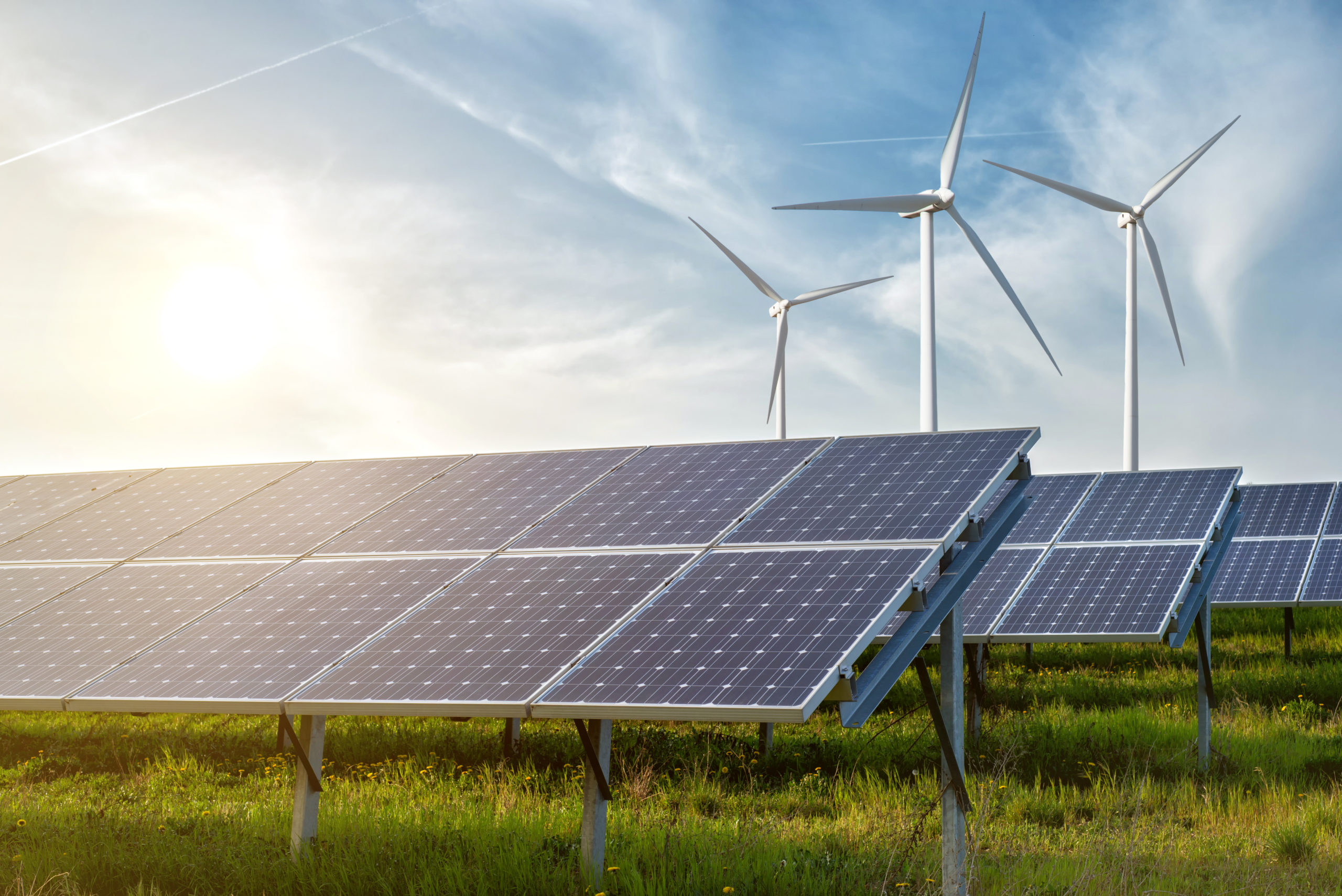
Photo from Shutterstock

As an example, she cites the day she spoke to the West Texas Rotary Club, whose banner declared “The Four-Way Test.” The test was, first, Is it the truth? Second, Is it fair to all concerned? Third, will it build goodwill and better friendships? And fourth, will it be beneficial to all concerned? She reports that she skipped the luncheon to spend the next 20 minutes reorganizing her presentation around those principles, noting, for example, that nearby Fort Hood, a military base, now draws 45 percent of its power from solar and wind, “saving taxpayers millions.” She won over some skeptics because, once they connected the dots, the whole proposition of confronting climate change became more meaningful in terms they understood and accepted.

Facts and Tribal Loyalties

Facts are stubborn things,” President John Adams once wrote. They don’t bend to our preconceptions or political wishes. Nonetheless, people like to be able to choose the facts they embrace while ignoring those that fail to confirm their biases. To varying degrees, this probably describes all of us because human nature is seductive about illusions, but reality can be harsh when it asserts itself. The role of education is, in large part, to help us learn how to learn and, in the process, be willing to confront our biases. Learning is a life-long challenge.

One crucial bit of learning regarding opinions on climate change is that not everyone is on one side or the other. There is a spectrum between the polar opposites. While completing work on Planning for Post-Disaster Recovery: Next Generation several years ago, I discovered the work of two researchers, Tony Leiserowitz and Ed Maibach, who had produced a journal article titled “Global Warming’s Six Americas.” They systematically described six camps, or tribes, of people with different perspectives on climate change. Two, one on either end of the debate, corresponded with our common tendency to divide people into “pro” and “anti” factions. One, the Alarmed, are those who see a serious and near-term threat to the planet from climate change. Another, the Dismissives, reject any mention of climate change and are most likely to buy into conspiracy theories and misinformation.

But between them are four other groups:

  • Concerned, who accept the premise of climate change but see the threat as less immediate;
  • Cautious, who still need some convincing but are open to persuasion;
  • Disengaged, who “know little and care less”; and
  • Doubtful, who don’t see a serious risk.

I was pleasantly surprised that Hayhoe introduced their work in her first chapter, noting that the percentages of Alarmed had grown in the past decade, basically siphoning some numbers from the Concerned. The two groups combined form a narrow majority, while the Dismissives constitute about 7 percent. The percentage of Cautious had remained at about 20 percent.

The most important fact emerging from the survey work of Leiserowitz and Maibach is that those totally dismissing climate change as a reality are in fact a distinct minority. One conclusion that flows from that is that those working to educate the public on climate change have a large field to work with and can reasonably sidestep the Dismissives. Arguing or even talking with them is likely to prove a waste of time.

The Futility of Guilt

One approach that Hayhoe almost categorically rejects is laying guilt trips on individuals over consumer choices, in part because the tactic seldom includes a realistic assessment of the alternatives that people face in deciding how to live their lives and get things done. She particularly dislikes what she calls purity tests. For example, she notes that one British colleague questioned why she flew to a speaking engagement in Alberta instead of taking the train from Texas. The problem is that no such direct train route exists. Hayhoe calculated the time, hours, and expenses involved in even attempting this approach through roundabout scheduling and found, for one thing, that the miles involved in driving to Oklahoma City to catch a train east and north into Canada from New York City, in order then to use the Canadian rail system to cross the country from Toronto were enough to get her colleague from London to Irkutsk in Siberia. It would also take several days in each direction. It simply was not a practical option.

Many potential alternatives for reducing our carbon footprints must first be created through the political or economic system before individuals can be held accountable for failing to use them. In many parts of the country, people lack the ability to meet online efficiently because our nation has yet to make adequate or high-quality broadband available. One cannot use options that one does not have. People cannot be blamed for driving a car to a meeting in a location where mass transit is not available. It is small wonder that people often feel their efforts do not matter when they are faced with a paucity of individual consumer choices, especially when powerful forces have worked to ensure that more desirable choices cannot be implemented. Understanding this fundamental point is essential in recognizing why the debate over infrastructure policy is a debate about what future we wish to create for ourselves. Once upon a time, our nation chose to facilitate nationwide mobility by creating the interstate highway system. Today’s debate is in part about creating a network of charging stations that will make driving electric vehicles feasible for the average motorist. Societal choices dictate many individual choices, and focusing guilt on individuals is in most cases an exercise in futility. We could better spend that time moving mountains on Capitol Hill.

Why Everyone Matters

There is a great deal more to the book than I am recounting here, as is the case with almost any book that is well worth reading. The important conclusion Hayhoe offers, however, is one that should be common sense but suffers from a surfeit of wishful thinking. Basically, climate change is a situation wrought by humankind and, ultimately, fixable only by humans. Hayhoe makes clear that, in her belief system, it is illogical and irresponsible to expect God to intervene to solve the problem because God has given us agency to tackle problems of our own making. She quotes Proverbs: “Whoever sows injustice will reap calamity.”

Our failure lies in not realizing that we are simply subject to the rules of physics. Put another way—one perhaps more akin to Eastern philosophies–we have not aligned our lifestyles and social systems with a sound understanding of natural systems. As Hayhoe states, “If humans increase heat-trapping gases in the atmosphere, the planet warms. Pretending we can defy physics by putting our heads in the sand or cultivating a positive attitude will merely keep us slightly happier until (and more surprised when) the axe falls.”

False hope is often fatal, and at the very least self-destructive. Hayhoe prefers rational hope, wherein we recognize risk and understand the stakes involved in the situation we have created, noting that this requires courage but also provides vision. Ultimately, vision is not simply some magical gift from the Almighty. It flows from the hard work of clarifying our goals and beliefs and acting on those beliefs. It is the hard but rewarding work of empowering the willing.

Jim Schwab

Rising from the Ashes

Wall art at the Peshtigo Fire Museum

Back on August 11, during a family vacation that involved circumnavigating the shores of Lake Michigan, my wife and I and two grandsons visited the small town of Peshtigo, Wisconsin, and spent an afternoon at the Peshtigo Fire Museum. It is housed in a former church that the museum acquired in 1963. While there, I decided to purchase some items from the small gift shop near the front; the museum sells a handful of books and mementoes. One was a reprint of a special edition of a local newspaper that commemorated the 1871 fire that destroyed the town. The other was a small book by the Rev. Peter Pernin, a Roman Catholic priest who wrote about surviving the fire.

I may have acquired another item or two, but if I did, I have no proof. Planning to write this blog post on the 150th anniversary of the Peshtigo wildfire and the Great Chicago Fire, which both occurred on October 8, 1871, I wanted to read the items and discuss them here. Hours of searching my home office and the rest of our home turned up nothing. This is excessively unusual because I tend to be meticulous about keeping track of such acquisitions, but the anniversary approached and a maddening sense of futility took hold.

In frustration, I wrote to the museum through its online contact form and asked whether they could send me a new copy, and I have sent a $100 donation for their trouble. When I finally get a chance to read the material, sometime in coming weeks, I will supplement this post with a discussion of the historical materials. But before going on with the story, I want to commend the museum for a quick response from Wendy Kahl, who promised to send me replacements and expressed appreciation for the donation. I don’t remember the price of the items, paid in cash, but it was a fraction of my offering. The point, however, is that this small museum, in a small town in a rural area, is staffed by volunteers and operated on a shoestring by the Peshtigo Historical Society. They are, however, helping to preserve a vital piece of American history. Although I don’t often appeal for donations on this website, I will now. Those willing to help this humble enterprise can send donations to the Society at 400 Oconto Avenue, Peshtigo, Wisconsin 54157.

Most of us can gain only the tiniest inkling of the scale of loss suffered by a town like Peshtigo, which was a thriving lumber company town along the Peshtigo River near the shores of Green Bay, an arm of Lake Michigan, after the Civil War when catastrophe struck. I was about to write “when disaster struck,” but I quickly realized that the word “disaster” does not begin to do justice to the deadliest wildfire in American history. The extent of the devastation was so severe that no one really knows how many people died, but 1,500 or more seems to have become a reasonable estimate. The best narrative of the event I have read is Firestorm at Peshtigo by Denise Gess and William Lutz, published in 2002, but the museum website lists a few other resources.

Those resources in total can do far more justice to the story than I can hope to do in a blog post. However, the point that I can make here is one that, curiously, seldom occurs, although it is clear enough in the book by Gess and Lutz: the organic connection between the two fires in Peshtigo and Chicago. Separated by more than 250 miles, it is not that their fires shared a proximate cause. That would clearly be impossible. Recently, syndicated Chicago Tribune columnist Clarence Page mused about theories propagated by Chicago-area writer Mel Waskin that meteors delivered the ignition while recognizing how far-fetched that sounds and confessing to his own belief in pure coincidence.

But one can rely on science while saying that the two fires on the same day were more than pure coincidence. The reality is that a hot, dry summer plagued the entire upper Midwest from Chicago to Wisconsin and the Upper Peninsula of Michigan and Minnesota. Such conditions are the natural breeding grounds for wildfire, as fire experts in California and Colorado have long known. During the long summer of 1871, note Gess and Lutz, various fires peppered the landscape from Lake Michigan to the Dakota Territory. Storms in Texas drove winds northeast to Michigan and Wisconsin. But, as we now understand, the conditions were ripe throughout the entire region for a much larger conflagration.

Photo of a burning building at the Peshtigo Fire Museum

And it came, a raging inferno that swept through more than 2,400 square miles of northern Wisconsin, literally destroying the small town of Peshtigo. One reason the Peshtigo Fire Museum struggles in some ways to tell the story is that so few of the town’s structures and valuables were left in any recognizable condition when the fire subsided: a pile of metal spoons forever fused together by heat, a badly charred Bible. Small wonder that much of the museum consists of other artifacts from the rebuilt town that are not really part of the fire story. It’s hard to populate a museum with what no longer exists and could never have been saved. But they can tell the story with what they know and with the paintings in which people reimagined the horrors they had faced.

There is another point, however, that is often ignored: Chicago and Peshtigo, economically and environmentally, were in those days joined at the hip. Peshtigo was essentially a company town, largely under the control of Chicago magnate William Butler Ogden, who owned a steam boat company, built the first railroad in Chicago, and served as the city’s first mayor. Ogden Avenue and a few other things in Chicago bear his name to this day. He was a legendary presence during the city’s first half-century.

In 1856, he also bought a sawmill in Peshtigo. The lumber industry was in high dudgeon in the upper Midwest in those days, shipping logs down rivers to Lake Michigan and down the lake to mills and yards in Chicago, where the new railroads could ship it to markets in the East and elsewhere. Chicago was a boom town with a dense downtown of largely wooden buildings, but the same milieu of sawdust and bone-dry lumber created the same conditions for a wildfire that existed in the northeastern corner of Wisconsin, just miles from the Michigan border. It is not clear that anyone knows definitively what actual sparks triggered the fires in each community, but the common ingredients of fuel, heat, and oxygen that power wildfires were clearly readily available in both cities at the same time, largely driven by commerce.

It is hard to imagine today how dangerous it all was. Even without a fire, logging was an inherently dangerous occupation, with many men maimed or felled by attempts to control rolling logs as they were corralled downriver to lake ports, or by trees that fell as they were being hewn (known ominously as “widow makers”) in a time that knew neither worker’s compensation funds nor work safety regulations. Expecting the owners of logging mills and lumber yards to understand the dangers of wildfire any more than they cared about reducing workplace injuries would have been unrealistic at the time, although a dawning awareness of the need for such regulation led to Wisconsin leading the progressive era with state-level reforms by the turn of the 20th century.

Aftermath of the fire, corner of Dearborn and Monroe Streets, 1871. Reproduced from Wikipedia.

But for the many people who fled or succumbed to the fire on the fateful day of October 8, 1871, that was all in the distant future. The immediate reality is that many were burned alive, some died after jumping into the Peshtigo River to escape the flames, and thousands lost homes and all they owned in a matter of hours as the fire spread. Meanwhile, the same happened in Chicago, where 17,450 structures fell to flames that swept through a three-mile area in just three hours, including the supposedly fire-proof new headquarters of the Chicago Tribune. More than 100,000 people, one third of the city’s population at the time, were displaced from their homes. For weeks, the city lay in ruins as community leaders sought ways to finance and rebuild a city from the ashes. Chicago, of course, even then had far better access to capital and media attention than lowly Peshtigo, which remains a town with a population of just 3,500, some fifty miles north of Green Bay, the nearest city of even modest size.

Chicago’s media dominance, and its ability to retell its own story, continues. The Chicago Tribune, for instance, produced a commemorative special insert magazine, “The Great Rebuilding,” with a great deal of useful documentation. The Chicago History Museum opened its special exhibit on the fire today. But at long last, Chicago media outlets are also paying attention to their sister in tragedy with articles like the one in the Tribune describing at length “the fire you’ve never heard of.”

Chicago also had the resilience, although the term was not in common use, to conceive of rebuilding in a way that would avert future disaster. If you notice a lot of masonry construction on your next visit, you are seeing the legacy of the Great Chicago Fire, which altered local thinking about building codes and fire resistance. Similar shifts of thinking about structural fire safety, of course, occurred throughout urban America over the next half-century because structural fire was strikingly common at the time, and insurance companies and firefighters alike realized something had to change. But that may be a longer story for a future blog post.

The fires also fed our nascent understanding of the dynamics of wildfires and how they are influenced by weather, in the short term, and climate over longer periods. As Gess and Lutz note, the Peshtigo fire gave us the word “firestorm” as the result of a growing scientific recognition that the intense heat of a large wildfire can create its own weather within the conflagration, including tornado-like winds up to 90 miles per hour, caused by the differential between the heat of the fire and the cooler temperatures of the surrounding atmosphere. Tornadoes, of course, are born of such meteorological conflicts, an endemic condition of the vast interior of North America where colder northwestern winds meet in mortal combat with warmer winds from the Gulf of Mexico throughout the summer and into autumn. In commemorating the two fires, we can also recognize that they came at the dawn of an entire science of wildfires that is working against time today to catch up with the deleterious impacts of climate change.

History matters. And I hope that I have sparked more than a smidgeon of interest among readers in what I consider a deeply intriguing and intellectually challenging topic.

Jim Schwab

Podcast on Hawaii Volcano Recovery

Volcanoes pose a unique challenge for hazard mitigation and post-disaster recovery in the parts of the world where they occur. In the United States, these regions are along the Pacific Rim and in the middle of the ocean itself—in other words, the Pacific Northwest, Alaska, and Hawaii. In Hawaii, an archipelago that grew from volcanic eruptions over millions of years, all active volcanoes are located on the island of Hawai’i, also known as the Big Island because, as Hawai’i County planner Douglas Le notes, the land area of all the other major islands could be fit into this one land mass.

As I have done with previous installments of the American Planning Association’s Resilience Roundtable podcast series, for which I have been host for the last year and a half, I am providing this brief introduction with a link to the podcast on the APA website. The series is sponsored by the APA Hazard Mitigation and Disaster Recovery Planning Division, of which I am currently chair.

The subject of this podcast is Hawai’i County’s planning for recovery from the numerous impacts of the 2018 Kilauea volcanic eruption, which buried homes in its path and disrupted life in several subdivisions on a largely rural and agricultural island. The issues involve displacement, social equity, native land rights, environmental quality, and economic recovery, to name a few. Please take time to listen to this 52-minute exchange between me and Douglas Le, disaster recovery officer for the county planning department, and learn more than you may have imagined about how planning can help address this fascinating problem.

Click here to listen.

Jim Schwab

Digital Coast Act Becomes Real

Last Wednesday, December 2, the U.S. Senate passed the Digital Coast Act in a final vote that sent the legislation to President Trump for his signature. If that happens, it may provide a very useful gift to thousands of coastal communities wrestling with a wide variety of coastal zone management challenges.

For more than a decade, the National Oceanic and Atmospheric Administration (NOAA) has sponsored through its Office of Coastal Management a program that has racked up stellar achievements while awaiting congressional blessing of its existence. Digital Coast began as an effort, in collaboration with five nongovernmental partners, to share federal geospatial data and tools with communities in ways that did not require a Ph.D. scientist to interpret them for local government uses.

Geospatial technology, not a familiar term for the average American, refers to “modern tools contributing to the geographic mapping and analysis of the Earth and human societies,” according to the American Association for the Advancement of Science (AAAS). In a coastal context, that includes tools for measuring, projecting, and visualizing sea level rise, as well as monitoring land uses and land cover in coastal areas, and mapping offshore areas as well. The mission of Digital Coast was to make these tools ever more useful for local government planners, resource managers, economic development agencies, and others with some sort of meaningful engagement with coastal issues and data.

Why is that important? For starters, because more than half of the U.S. population now lives in counties along either an oceanic or Great Lakes coast, and that percentage is growing. It matters greatly where these counties, and their cities, allow new development, how they court economic growth, and how they manage coastal resources, including marine life, tidal wetlands, and offshore resources, as well as ports and near-shore transportation. These coastal areas are huge drivers of the overall U.S. economy, and better data, and better access to data, will deeply affect the American future.

Digital Coast partners and staff at a 2015 meeting. I am at front row, right. 

Improving that access and making tools easier to use, and data more understandable, has been the mission of the Digital Coast Partnership that was assembled from 2008 on, initially with five organizations: Association of State Floodplain Managers (ASFPM); The Nature Conservancy (TNC); National Association of Counties (NACo); National States Geographic Information Council (NSGIC); and Coastal States Organization (CSO). In the summer of 2010, the American Planning Association joined the partnership, an initiative I led as manager of APA’s Hazards Planning Center. Allison Hardin, a planner for the city of Myrtle Beach, South Carolina, and immediate past chair of APA’s Hazard Mitigation and Disaster Recovery Planning Division (which I now chair), reports that in 2009, she vigorously advocated for the addition of APA. At the time, Allison, a certified floodplain manager, was helping to represent ASFPM in the partnership. Today, there are eight nongovernmental partners, all of which serve as links to professional user communities to ensure widespread uptake of the data, tools, and resources available from Digital Coast. The two additions have been the Urban Land Institute and National Estuarine Research Reserve Association.

Allison Hardin speaking at Capitol briefing. 

So, what difference does statutory authorization of Digital Coast make? According to John Palatiello, president of John M. Palatiello & Associates, Inc., a government relations and association management firm representing the surveying, mapping, GIS, and geospatial community, which helped lead the effort to get the act passed: “The Digital Coast Act will enable NOAA to partner with other government entities and the private sector to help protect and promote America’s coasts and shorelines. This legislation creates a program to utilize the extensive capabilities, competence, and qualifications of private sector geospatial professionals to provide the surveying, charting, remote sensing, and geospatial data of America’s coasts, harbors, ports, shorelines and ocean resources for economic growth, recreational activities, conservation, and resilience of our fragile coastal environment.” Put more simply, the new law stabilizes the authorization and budgetary support for Digital Coast within NOAA. There were times in the past when this was less than a sure thing. Now, its codification makes its program status official.

Digital Coast Act briefing, with NOAA Digital Coast staff Miki Schmidt (left) and Josh Murphy (right), standing near door.

But Digital Coast, I can attest from personal experience, has a remarkably astute and dedicated professional staff in love with public service. The Act itself begins with this finding: “The Digital Coast is a model approach for effective Federal partnership with State and local government, nongovernmental organizations, and the private sector.” It goes on to note, a few paragraphs later, some of the needs that Digital Coast can help address, including flood and coastal storm surge prediction, hazard risk and vulnerability assessment, and community resilience, as well as ecosystem health. I applauded the program more than six years ago on this blog.

Briefing at the Capitol: APA Policy Director Jason Jordan at the mike; ASFPM Executive Director Chad Berginnis to his right.

It is important to note that this legislation is not the product of some recent brainstorm, but of a slow, steady process of building support, starting with a handful of legislators from both parties who saw its value. Perhaps most notable was Sen. Tammy Baldwin (D-WI), accompanied in the House by Rep. Dutch Ruppersberger (D-MD), who noted in a press release that he had been advocating such action for nearly a decade. But Republican support came from Rep. Don Young (R-AK) and Sens. Lisa Murkowski and Dan Sullivan, both of Alaska, the state with by far the longest coastline. All of them, along with the Digital Coast partners, plus the indefatigable John Byrd of MAPPS, pushed relentlessly, year after year, to find the support necessary to move the bill across the legislative goal line. They have at last succeeded.

Jim Schwab

Charting a Path to Sustainability

A presidential transition has always been a time to look forward in American history, anticipating change, contemplating new directions. Sometimes we like the new direction, sometimes we don’t; sometimes we think it just doesn’t go far enough to remedy the problems we face. But never have we faced the narcissistic spectacle of a president unwilling to release his grip on power. Every president before Donald Trump has been enough of a patriot to cooperate with a new president of the opposite party, and losing candidates who never ascended to the White House have been willing to concede. It is extremely unfortunate that some Americans are trying to deny others the right to focus on defining a more positive future.

But they are only trying because the right to map out an alternative future is still ours. The capacity to imagine a different future is one of the defining characteristics of a society that is capable of renewal, resilience, and sustainability. It is vitally important that civic leaders, academics, and authors help us clarify the truth of our past and map out paths to a better future. And, presidential transitions notwithstanding, it can and should happen below the national level, to help states and communities explore their unique history and their opportunities.

It is in that context that I wish to introduce readers to Green, Fair, and Prosperous: Paths to a Sustainable Iowa, the work of Charles E. Connerly, who by next summer will be retiring as professor and the director of the University of Iowa School of Urban and Regional Planning, recently renamed the School of Planning and Public Affairs after Connerly’s successful push to incorporate a Master’s in Public Affairs to the program’s offerings. Connerly has been at Iowa since 2008 since migrating back to his Midwestern roots after a long tenure at Florida State University in Tallahassee. As a matter of full disclosure, he was also responsible for hiring me as an adjunct assistant professor to teach one course each fall that has come to be known as Planning for Disaster Mitigation and Recovery. His many years at Florida State, working alongside Robert Deyle, a colleague who worked with me on disaster issues as far back as the 1990s, made him supremely aware of the importance of addressing hazards in the planning process. I was hired in the immediate aftermath of the massive 2008 floods in Iowa.

Connerly (in gray jacket) during a 2014 field trip of post-flood redevelopment in Cedar Rapids.

Connerly is truly a comprehensive thinker in the best planning tradition, and this book shows it. While I am certain, because of publishing schedules, that he had completed his manuscript before the death of George Floyd at the hands of Minneapolis police over the Memorial Day weekend, his book is incredibly timely in the fall of 2020 because of his focus on the history of racial and ethnic disparities in Iowa. In fact, Chapter 4 is simply titled, “Why Is Iowa So White?”

Indeed, that is a very good question. It is not just a matter of Iowa being farm country. After growing up in the Cleveland metro area in Ohio, then moving to Iowa in January 1979 before ultimately enrolling in graduate school at the University of Iowa, I remember being struck by the apparent lack of diversity, especially outside the handful of cities above, say, 50,000 people. There is, after all, industry in these cities, and industry has often attracted multiracial work forces. Unless, that is, political and social forces intervene to prevent such an outcome. Most people, however, never notice such forces at work and never learn about them in school. History can be very silent about such matters unless diligent researchers insist on exposing that legacy to sunshine, aka “the best disinfectant.”

Connerly digs deep on this topic, all the way back to antebellum Iowa politics. Sitting just north of Missouri, a slave-holding border state, Iowa was both a frontier of the Underground Railroad and a harbor of typical northern mixed feelings about African Americans. In 1850, Iowa was no less than 99.8 percent white, and did not dip below 99 percent, Connerly notes, until 1970. Since then, there has been a substantial growth in minority populations. But African Americans have historically been concentrated in just four urban counties. All that said, it was also the Iowa Democratic caucuses in 2008 that launched Barack Obama on a streaking path to the presidency. What accounts for this paradoxical history?

From the early days of statehood, Iowa suffered from a typical northern moral conflict between supporting emancipation and not particularly wanting too many blacks in the neighborhood. That is not putting too fine a point on the matter. Connerly notes that before the Civil War, Iowa had enacted laws banning blacks from the state. The territory avoided enacting such black codes to win statehood, but once that was achieved, Iowa legislators had no problem backtracking on the issue. The bottom line was that Iowans, overall, opposed slavery but did not necessarily favor civil rights for freed slaves.

That changed somewhat after the Civil War, with Radical Republicans pushing through changes that liberalized matters considerably, but it was only following World War II and through the Civil Rights movement of the 1960s that serious, permanent change began to occur. By that time, however, previous history had done its work in making African Americans largely feel unwelcome. Iowa stayed overwhelmingly white, but not entirely by accident. At the same time, the state has been receptive to refugees, for example, after the Vietnam war, and remarkably progressive on some other issues. Northwest Iowa elected the remarkably ignorant Steve King to Congress, but Republicans themselves dethroned him in this year’s June primary.

Prior to white settlement and the rise of modern agriculture, much of the Iowa landscape enjoyed by Indians consisted of prairie. Photo by Suzan Erem

Connerly writes that African Americans were not the only minorities to feel the impact of 19th-century American racism. Before European settlement, which took place in earnest only after Iowa became part of the United States following the Louisiana Purchase, fourteen Native American nations had, over millennia, occupied some part of what became Iowa. Before the 1800s, their interaction with Europeans was largely through trade, but eventually their land ended up in the hands of white settlers. The short answer as to how that happened is simple: “We took it from them.” Today, only the Mesquaki settlement in Tama remains as a reminder of the formerly dominant Native American presence.

The Hispanic presence, and that of various Asian minorities, is a product of more recent history, some of it involving the evolution of labor relations, particularly in agriculture and meat processing plants, but today there is a distinct, but distinctly disadvantaged, Hispanic presence. It is no accident that earlier this year, some of the most intense controversy over coronavirus spread in states like Iowa, Nebraska, and South Dakota involved minority workers in the meat-packing industry and deficiencies in safety protocols among the companies involved. In a whole chapter dealing with labor issues over time in both the food and agricultural equipment industries, one can see the steady decline of leverage among white-dominated labor unions and the rise of cheap labor and mass production within the industry as it is today. It is hardly a stretch to suggest that these social and economic changes have had profound impacts on, and implications for, the future of Iowa’s economy and society. Iowa did not shift from supporting Obama in 2008 and 2012 to Trump in 2016 and 2020 without some massive strains within the body politic. How those tensions are resolved will go a long way toward determining whether Iowa can chart a successful path to a sustainable future, as Connerly’s book suggests. Iowans will have serious work ahead in improving social equity while adjusting to a changing demographic makeup across the state.

But I do not wish to create the impression that the book is strictly focused on such demographic issues, as important and critical as they are. It is important to notice that Connerly has tied together the issues of environmental health, fairness, and prosperity in his title. His larger point is that all these questions are inextricably related. To quote some planners I have known, “Everything is connected to everything else.”

Connerly takes us on a detailed, well-documented tour not only of Iowa’s demographic history, but of its environmental and economic history as well. Iowa clearly entered statehood as a predominantly rural, agricultural state, though not necessarily producing the corn and soybeans that predominate now. Originally, in fact, it grew more wheat, but trends shifted to corn and hogs. But the state is still heavily dependent on agriculture, with 43 percent of its 2015 manufacturing centered on either food processing or machinery used in agricultural production. These two gave rise in the twentieth century to some powerful unions representing workers who were largely able to achieve a blue-collar version of middle-class prosperity. Hogs, supported by state laws exempting agriculture from county zoning laws, gave rise to the growth of concentrated animal feeding operations (CAFOs) in the past 40 years, and the meat-packing industry itself became more concentrated and able to mechanize increasingly and replace high-wage jobs with lower-wage mass production and weaker unions. The people working in the newer factories are definitely more racially diverse but definitely not more empowered and definitely paid less. The growing inequities have resulted in a shrinking middle class.

One factor that distinguished the Iowa packing plants prior to the major, union-busting shifts of the 1970s and 1980s was that the plants were closer to the farms, and thus, unlike larger plants in Chicago and Kansas City, bought animals directly from farmers. Connerly maps out the consequences in urban development for Iowa, namely, that Iowa never developed the metropolitan magnets of neighboring states like Minnesota, Missouri, and Illinois because of the dominance of the Twin Cities, Chicago, and Kansas City, and instead has a number of smaller cities, the largest being Des Moines, which has about 215,000 people, though the entire metro area is about three times that size. Smaller cities have mostly grown around agriculture-related industries.

All this has had significant consequences not only for quality of life but the quality of the environment, with water quality problems arising from rural land use issues such as CAFOs, soil erosion, and nitrate concentrations in groundwater. Connerly’s final chapter asks whether Iowa truly is the “best state in the nation,” a title bestowed in 2018 by U.S. News and World Report. As a former Iowan, I do not offer this review as a way of trashing the state, nor does Connerly offer his book in that spirit, but the question is an opportunity to explore the complexity of a state that too many elsewhere see as simply white and rural. Iowa, with the right policies, the right incentives, and the right opportunities, has the potential to create a healthy environment and economy, but it must examine current trends and determine how to reverse those that are moving the state in the wrong direction. The last chapter is a succinct compendium of recommendations for moving Iowa toward a growing middle class, a healthier environment with better recreational opportunities, and a progressive approach toward making agriculture more ecologically sound and resilient in the face of natural hazards, most notably, floods.

Testing facility of the Iowa Flood Center, 2019.

The state has created some interesting mechanisms for doing this, but has a stubborn habit in recent years of shooting itself in the foot. In 1987, the legislature wisely passed the Groundwater Protection Act, which created the Aldo Leopold Center for Sustainable Agriculture at Iowa State University, which has done remarkable research on establishing a balance between economic and environmental needs in agricultural practices. Yet, in recent years, the legislature has significantly limited state funding for the center at the behest of corporate agricultural interests. In 2010, following the devastating floods in 2008, the legislature funded creation of the Iowa Flood Center at the University of Iowa, which has become a model in advancing flood prediction and mitigation that other states are considering copying, yet some question the need for continued funding. It is almost as if Iowa wants to replicate the larger national battle between science and an increasingly poisonous distrust of “experts.” Would it not be better to marshal and support the best intellectual resources Iowa can muster for an assessment of the opportunities that lie ahead?

Connerly points out, in contrast, how Iowa could take the lead in solving problems like climate change and excessive nutrient runoff in the Mississippi River basin that leads to both groundwater contamination locally and hypoxia in the Gulf of Mexico. This last chapter is the biggest single reason to read the book, but its logic is only fully clear after reading the thorough research that precedes it.

My final comment is that it may seem that this is a book that is primarily or perhaps solely relevant to Iowans. I think that conclusion, however, would be short-sighted. While I am profoundly aware of the many books others have produced about other states, regions, and metropolitan areas across the U.S., I think it is vitally important that other scholars across the nation undertake similar efforts to assess the path to sustainability for their own states, regions, and cities. We could sorely use such a book in Illinois, and the same is probably true for every neighboring state. As I suggested at the outset, it is not enough to chart a new national path. We need these serious explorations at subnational levels as well. In that sense, I believe Connerly has done a major service for the Hawkeye state. I’d like to see more such books.

Jim Schwab

The Need for Resilient Infrastructure

This summer, the Federal Emergency Management Agency (FEMA) is at last rolling out its Building Resilient Infrastructure and Communities (BRIC) program, and its first Notice of Funding Opportunity will likely be issued in September. In July, FEMA is airing a series of five weekly webinars to introduce BRIC to communities and state officials around the nation. BRIC is the practical result of provisions in the Disaster Recovery Reform Act, passed by Congress in 2018, to create a secure funding stream for what was formerly the Pre-Disaster Mitigation program. I plan to discuss all that in coming weeks on this blog.

But the personal impact on me was to remind me to attend to an egregious oversight on my part that began earlier this year with the release by the American Planning Association (APA) of a new Planning Advisory Service Report, Planning for Resilient Infrastructure. I read it, attended to some other business in Texas and Nebraska in late February and early March, and along came the coronavirus, upending most of my existing personal and professional plans and refocusing my attention. But it is time for me to give this report the attention it deserves.

First, there is the question of why it deserves attention. The National Oceanic and Atmospheric Administration (NOAA), which funded the project led by the Association of State Floodplain Managers (ASFPM), which partnered with APA, chose their joint proposal in funding the first round of projects under its Coastal Resilience Grants Program in 2016. As Jeffrey Payne, director of NOAA’s Office for Coastal Management, states in his preface, “Tomorrow isn’t what it used to be. Increasingly, coastal conditions include all the risks of the past, but risks that are amplified by a changing climate, rising seas, and more rapidly fluctuating Great Lakes.”

In the interest of full disclosure, I was involved with ASFPM executive director Chad Berginnis in co-authoring the proposal for this project in the summer of 2015. (After I left APA, ASFPM hired me back as a consultant in later stages of the effort to help refine and focus the PAS Report.) Our intent was both simple and bold. Local governments spend tens of billions of dollars annually on the construction and maintenance of various kinds of infrastructure. Much of that infrastructure, related to essential services including water, wastewater, and transportation, is subject to the impacts of climate change. While, as Payne goes on to state, this is true away from the coast as well, some of those impacts are particularly significant and noticeable in coastal states and communities. In short, a great deal of taxpayer money is at stake regarding the ability of that infrastructure to withstand future climate conditions and natural disasters. Planning for greatly increased resilience is a recipe for improved fiscal stability. This holds true even if, as planned by statute, a greater share of that funding for hazard mitigation projects comes from FEMA through BRIC. Taxpayers are taxpayers, whether the money used is federal, state, or local.

All that said, the serious work of completing the work fell to Joseph DeAngelis at APA, now the manager of the APA Hazards Planning Center, and Haley Briel, a research specialist for the Flood Science Center at ASFPM, along with Michael Lauer, a planning consultant with deep experience in growth management programs in southeastern coastal states.

Global average sea level rise from 1880 to the present, based on tide gauges and satellite measurements (US EPA). Reuse courtesy of APA.

Their collaborative report addresses the most significant issues of infrastructure resilience. Particularly in areas subject to coastal storms, these involve not just the impacts of major disasters but the everyday nuisance impacts of flooding because of high tides atop sea level rise that already are yielding closed streets and parks and flooded basements. Urban flooding has become a “thing” where the term never used to be heard. They include a small table with projections by the U.S. Global Change Research Program showing ranges of sea level rise between 0.5 and 1.2 feet by 2050, and 1 to 4 feet by 2100. Of course, these are rough ranges in part because various geological conditions, such as erosion or glacial rebound, cause different results from one region to another, although most of the East Coast faces serious problems over the coming century. A major part of the problem is that sea level rise amplifies the impact of high tides in storms, leading to increased flooding and erosion that is already evident in low-lying cities like Norfolk, Virginia, or Miami. The authors note that, “Over the last half-century alone, with just one to three inches of average sea level rise, daily high-tide flooding has become up to 10 times more frequent” in American coastal communities. Even in Midwestern communities, including those along the Great Lakes, problems result from climate-driven increases in high-precipitation storms that frequently overwhelm stormwater drainage systems built in an earlier era based on other, less challenging, assumptions.

Storm surge heights are cumulatively based on the mean sea level, the height of the tide, and the high volume of water pushed toward the shore by coastal storms (National Hurricane Center). Reuse courtesy of APA.

It is natural that a planning document is going to assert a role for planners in addressing these problems. The role the report asserts is entirely logical, starting with “assessing long-term infrastructure needs and understanding future risks to infrastructure assets.” Equally logical, however, is that the report builds upon prior APA literature to outline the need for coordinated action through the plan-making process to integrate climate risk into local plans as a means of “capturing the future conditions to which existing infrastructure and any planned infrastructure projects will be subjected.” Put simply, if the local planning process does not identify those risks and provide clear recommendations for creating resilient infrastructure, it is not likely to materialize in any coherent and consistent fashion. The third chapter outlines a step-by-step approach (see illustrations below) for developing an inventory of local infrastructure, identifying risks, and moving toward an effective plan for adaptation.

The process for conducting an infrastructure vulnerability assessment (Joseph DeAngelis). Reuse courtesy of APA for both diagrams.


A project or asset’s vulnerability to flood impacts is a product of its exposure, sensitivity, and adaptive capacity (Joseph DeAngelis).

Later, the report provides some examples of what such consistent planning for resilient infrastructure may look like. Its case study of San Francisco’s approach to assessing sea-level-rise impacts outlines how the Sea Level Rise Committee of the city’s Capital Planning Committee (CPC), a body responsible for overseeing capital investments for infrastructure, recommended using the upper end of estimates from a National Research Council report for the West Coast. These were fed into a CPC guidance document for assessing vulnerability and supporting adaptation to sea level rise, a primary outcome of climate change. Without engaging the full details here, the bottom line is that the City and County of San Francisco was working from a single play book for climate adaptation of project life cycles for future infrastructure. Capital planning could thus proceed in a more standardized manner based on common assumptions. The report also uses an extensive example from Toledo, Ohio, the site of one of two pilot projects supported by the ASFPM/APA project. Toledo, sitting on the shores of Lake Erie, has suffered from stormwater flooding and is approaching the problem with a mixture of green infrastructure and analysis of social vulnerability in affected neighborhoods. The report elsewhere delves into questions and methods of documenting and addressing environmental justice and social and racial inequities in environmental protection through appropriate local capital planning projects.

Both cases highlight the value for local planners of establishing credible data sources, which often rest within federal agencies such as NOAA and the U.S. Environmental Protection Agency. But, as one chapter illustrates, these can include experienced national nonprofits as well, such as Climate Central. Unquestionably, however, the best single assemblage of data and tools is NOAA’s own Digital Coast website. Planners can access additional high-quality resources on climate through other NOAA programs such as the Regional Climate Centers, located at a series of universities across the nation, and the Regional Integrated Sciences and Assessments, where RISA staff work directly with climate scientists to communicate the science to the public and local officials.

Just as important as understanding where to find the proper data and tools, however, is a knowledge of best practices in local capital improvements planning, the development of effective standards, guidelines, and regulations for creating resilient infrastructure, and, finally, the best means for financing such long-term investments in infrastructure, especially with an eye to climate resilience. Each of these three topics is covered in separate chapters in the second half of the report.

View of part of the Jersey Shore after Hurricane Sandy, February 2013.

Ultimately, the real challenge for local planners is overcoming a natural discomfort with the inherent uncertainties in planning for infrastructure that must withstand the impacts of climate change within a range of assumptions that, in part, depend on federal and even international action to mitigate rising global temperatures as a result of greenhouse gas emissions. Planners, and the communities they serve, must adjust to those uncertainties and the inherent complexities they embody. Planning, however, has always been a speculative enterprise riddled by uncertainties, yet cities have embraced assumptions about population growth, demographic change, and economic scenarios that have often been equally uncertain, for none of us has a crystal ball. What we do know, however, is the direction of existing and accelerating trends, and climate change is no myth. We are ultimately better off, and will better invest public resources, by anticipating climate change with the best projections available, so that our communities are not overwhelmed by future storms, sea level rise, and storm surge. We cannot say we did not see it coming. We can only hope to say we used a wise approach based on the best data available to avoid catastrophe for ourselves and future generations in the communities we serve.

Jim Schwab


Unequal Exposure

On April 29, I will be moderating “Demanding Equity: Planning for Post-Disaster Recovery,” a 45-minute session in a special three-day virtual conference of the American Planning Association, NPC20 @HOME. The online conference is an attempt to replace the experience of the canceled National Planning Conference, which would have taken place in Houston, April 25-28. For the first time in APA history, the annual event will not go forward as planned. Like numerous other conferences, it was untenable to assemble thousands of participants in the middle of the coronavirus pandemic. But it is possible to provide a decent educational opportunity in its place by broadcasting and recording distance learning and letting participants ask questions remotely.

But why do I mention this one session, when APA is offering two dozen? Because it touches on some issues so central to the social and economic impacts of coronavirus, and speaks so directly to what planners and planning can do as we recover from this experience, that I wanted to highlight the subject in this post. It has been said often that the coronavirus does not discriminate. That may be true, but our society has done so and still does, often in ways people are reluctant to consider or admit. The result is that, as happens with most disasters, minorities and low-income people, those with fewer opportunities in life or greater exposure to danger, are disproportionately affected. And so it will be when the histories of this pandemic are written. The evidence is already stark enough for passionate discussion.

To give credit where it is due, the session was the brainchild of Adrian Freund, a veteran, semi-retired planner in Oregon. Before the NPC was canceled, however, Adrian was hospitalized (not because of coronavirus) and realized he would be unable to go to Houston. He reached out through a former president of APA, David Siegel, also of Oregon, to ask me to take over, and I agreed. We are on the same page on this issue. When APA decided to replace NPC with NPC20 @HOME, this was one of the sessions they felt must be included, and I reassembled the speakers to modify our plans for the new format.

All of them have a ton of wisdom to contribute on the subject. Shannon van Zandt is a professor of urban planning and department head at Texas A&M, and has authored numerous articles and led many projects on subjects related to equity in disaster recovery, particularly in the Texas context in which she works. Marccus Hendricks, an assistant professor of planning at the University of Maryland, is a Texas A&M graduate who has focused on infrastructure issues and environmental justice, writing his doctoral thesis on stormwater management in Houston. Chrishelle Palay is director at the HOME Coalition in Houston. Obviously, the panel has strong Texas roots, but there are few states where one can get better insights into the impacts of environmental inequities.

But it is the screaming headlines of the past week that have brought renewed attention to the issue in the context of coronavirus. In Chicago, we have learned that African Americans are dying from the virus at six times the rate of whites. Gary, a predominantly African American city, is the new coronavirus hot spot in Indiana. It is also where it gets personal for me. A 12-year-old granddaughter lives there and, as of yesterday (April 10), appears to have COVID-19 symptoms. Her mother called and was asked not to bring her to a hospital, but to isolate her at home. She will not be tested because, as everywhere else, this nation has not gotten its act together on testing. Will she even be included in the statistics, then, as a known case? Good question. I have no idea how Indiana is tallying such numbers. But she is in for a rough ride in the immediate future, and Gary and surrounding Lake County are certainly not fully prepared.

But what is happening in Chicago, as numerous commentators and public health officials have noted in the past week, is not only not unique, but to be expected. Detroit is emerging as a hotspot with major disparities in racial impact. State health data reveal that, while blacks make up 14 percent of Michigan’s population, they account for one-third of the cases and 40 percent of the deaths so far. In Louisiana, with one-third of the population, blacks account for 70 percent of the deaths. New Orleans has clearly emerged as a southern hot spot for coronavirus infections. Across the nation, one can find similar racial disparities.

Beneath those figures, however, are other disparities that weave in and out of racial and ethnic numbers. Age is perhaps the best-known factor, but so are many others. People in low-income service jobs, for instance, to the extent that they are still working, are more dependent on public transit and much less likely to be able to work from home like white-collar professionals. Public transit contributes greatly to mobility in urban centers, but does little for social distancing. It is still unclear just how transit will be affected for the long term, although it remains a vital link to jobs for many of the working poor. But coronavirus is clearly challenging the economic viability of many transit systems, one reason they were the target of assistance in the CARES Act.

It goes without saying that health care workers are significantly more exposed, but they are not just doctors. Their ranks include nurses, nursing assistants, and many others, some with much lower incomes, who nonetheless are risking their lives every day. Some of them work in nursing homes, which have not been the focus of any noticeable attention at the federal level. There are many ways to slice and dice the data to identify patterns of exposure, including those for access to health care, quite possibly the single most important factor driving disparities in this particular disaster. Lack of insurance coverage and inability to afford adequate health care leave many people untouched by the system and untested until it is too late. Poor or nonexistent health insurance coverage, especially for undocumented immigrants, accompanied by food deserts in many inner-city neighborhoods, endemic poverty in many rural areas and small towns, and exposure to job-related ailments, can produce numerous chronic conditions that make exposure to a new virus fatal or disastrous instead of merely survivable.

It remains remarkable, in view of these factors, that the Trump administration can maintain its drumbeat of opposition to the Affordable Care Act, including the recent refusal to allow newly jobless Americans to sign up for coverage. But this is one of many ways in which this nation, through both federal and state policy, continues to resist expanded, let alone universal, health care coverage to shore up health care deficiencies for the most vulnerable among us. There is both a meanness and short-sightedness that underlies much of this resistance. As I noted just two weeks ago, these health care vulnerabilities, with all the racial and socioeconomic inequities they embody, form the weak links in the chain of overall vulnerability for our communities when pandemic strikes.

And that brings me back to the point of the session I will moderate. One essential element of the planner’s skill set should be demographic analysis. The coronavirus pandemic highlights the critical value of addressing public health in comprehensive plans and other efforts to chart the future of cities, counties, and regions. Issues of national health care policy may be well beyond the reach of planners and their communities, but exposing the glaring disparities that have been made evident as the data on coronavirus cases grows is critical to knowing how resilient our communities are or how resilient we can make them. Access to health care is not merely a matter of insurance, as important as that is. It is also affected by the practices of local hospitals, the access to open spaces for densely populated areas, environmental regulations controlling industrial pollutants, public education around personal health, access to healthy food, the quality of our food distribution systems, and a myriad of other considerations that can be addressed to one degree or another through local or regional planning and through policy commitments to social equity.

That is precisely why, as the White House dithers, and federal management of the coronavirus crisis continues to fall short, dozens if not hundreds of mayors and governors and other local and state officials have stepped up to fill the gap. It is sad that there is not better national leadership in this crisis, but we are learning who our real leaders are. Enabling planners and other policy makers to support those officials with essential and meaningful data is an ongoing task, but if we are going to emerge from this disaster in a better place, identifying the inequities that weaken our communities and finding ways to build resilience across those weak links is going to be essential. There is no good alternative.

Jim Schwab

Great Lakes Merit Protection

I grew up near the shores of Lake Erie, in suburban Cleveland. After a seven-year stint in Iowa and Nebraska, I ended up in Chicago, where I have lived since 1985. The Great Lakes have been part of my ecological and geographic consciousness for essentially 90 percent of my lifetime. As an urban planner, that means I am deeply aware of their significance on many levels.

It will surprise no one, then, that as a planner who has focused heavily on environmental and natural hazards issues, I have been involved in projects aimed at protecting that natural heritage. As manager of the Hazards Planning Center at the American Planning Association (APA), I involved APA as a partner with the Association of State Floodplain Managers (ASFPM) as ASFPM developed its Great Lakes Coastal Resilience website with National Oceanic and Atmospheric Administration (NOAA) support. Later, I prepared a successful grant for support from NOAA’s Sectoral Applications Research Program for a project on integrating climate change data into local comprehensive and capital improvements planning. In that project, APA collaborated with the Chicago Metropolitan Agency for Planning and the University of Illinois. That project, which involved work with five pilot communities in the Chicago metropolitan area, was (and still is) ongoing when I left APA at the end of May 2017. The aim was to develop applicable models for such planning for other communities throughout the Great Lakes region.

It is thus always encouraging to see others pick up the same mantle. It was hardly surprising that the Environmental Law & Policy Center (ELPC), a long-time Chicago-based staple of the public interest community, would see fit to do so. On March 20, in concert with the Chicago Council on Global Affairs, ELPC released “An Assessment of the Impact of Climate Change on the Great Lakes,” with 18 scientists contributing to the 74-page report. I spoke two weeks later with Howard Learner, the long-time president and executive director of ELPC, about the rationale and hopes for the report.

The impact of adding one more report to the parade is cumulative but important. Learner explained that national studies, particularly the National Climate Assessment, mention regional impacts of climate change, but that drilling down to the impacts on a specific region and making local and state decision makers aware of the issues at those levels was the point. Thus, he asked Don Wuebbles, an atmospheric scientist at the University of Illinois and a science adviser to ELPC, to assemble a team of experts for the purpose. Wuebbles recruited most of the team, with the goal not only of identifying problems but of developing or pinpointing solutions. Repeatedly, Learner emphasized the public policy role of ELPC as a “problem-solving” institution. The intended audience was governors, provincial ministers, congressional delegations from Great Lakes states, and other public officials, providing them with an assessment of the state of the science concerning the Great Lakes.

I won’t even attempt to review all the data in the report, but certain points are essential to an adequate public understanding. For one, the Great Lakes are simply huge and constitute a very complex ecosystem in a heavily populated region of more than 34 million people in the U.S. and Canada, the vast majority of whom repeatedly express support for protection of the Great Lakes in public opinion polls. It is the largest freshwater group of lakes on the planet, and second largest in volume. It is a binational ecosystem that demands cooperation across state, provincial, and national boundaries. It is home to 170 species of fish and a $7 billion fisheries industry. It has long been home to one of the most significant industrial regions of both nations. What happens here matters.

The term “lake effect” is most often associated with the Great Lakes because their sheer mass has a measurable impact on local and regional weather patterns. Winds pick up considerable moisture that often lands downwind in the form of snowstorms and precipitation. For instance, any frequent visitor of farmers’ markets along the Great Lakes is likely to be aware of western Michigan’s “fruit belt” offerings of apples, cherries, pears, and other crops dependent on the lake effect.

Figure 3. Observed changes in annually-averaged temperature (°F) for the U.S. states bordering the Great Lakes for present-day (1986–2016) relative to 1901–1960. Derived from the NOAA nClimDiv dataset (Vose et al., 2014). Figure source: NOAA/NCEI (Both images reprinted from report courtesy ELPC.

Figure 4. Projected change in annually-averaged temperature (°F) for U.S. states bordering the Great Lakes from the (a) higher (RCP8.5) and (b) lower (RCP4.5) scenarios for the 2085 (2070-2099) time period relative to 1976-2005. Figure source: NOAA/NCEI

The lake effect, of course, is a part of the natural system in a region carved out of the landscape by melting glaciers at the end of the last Ice Age. Recent climate change is another matter. The region has already experienced a 1.6° F. increase in average daily temperatures in the 1985-2016 period as compared to the 1901-1960 average. Those increases are expected to accelerate over the remainder of this century. It is not just temperatures that change, however, because changing weather patterns as a result of long-term climate change result in altered precipitation patterns. Summer precipitation is predicted to decline by 5 to 15 percent, suggesting some increased propensity for drought, while winter and spring precipitation will increase, producing an increased regional propensity for spring flooding. Increased intensity of major thunderstorm events will exacerbate the vulnerability of urban areas to stormwater runoff, resulting in increased “urban flooding,” often a result of inadequate stormwater drainage systems in highly developed urban areas. That, in turn, has huge implications for municipal and regional investments in stormwater and sewage treatment infrastructure. In addition, heat waves can threaten lives and public health. Public decision makers ignore these implications at the fiscal and physical peril of their affected communities.

Among those impacts highlighted in the report is the increased danger of algal blooms in the Great Lakes as a result of changing biological conditions. The report notes that the largest algal bloom in Lake Erie history occurred in 2011, offshore from Toledo, Ohio, affecting drinking water for a metropolitan area of 500,000 people.

There is also danger to the stability of some shoreline bluffs, an issue highlighted on the Great Lakes Coastal Resilience website, as a result of reduced days of ice cover during the winter. While less ice cover may seem a minor problem to some, in fact it means changes in water density and seasonal mixing patterns in water columns, but it also means the loss of protection from winter waves from storm patterns because the ice cover prevents those waves from reaching the shore until the spring melt. The result is increased shoreline erosion.

All of that harks back to the central question of my interview with Learner: What do you hope to achieve? “The time for climate action is now,” he insisted, noting that the Trump presidency has been “a step back,” making it important for cities and states to “step up with their own climate solutions.” Learner hopes the report at least provides a “road map” for governors and Canadian premiers to focus their actions on the impact of climate change on the Great Lakes, such as “extreme weather events.”

Curiously, one arena in which new action may be possible is the city of Chicago itself, which on April 2 elected a new mayor, Lori Lightfoot. Media attention has focused on the fact that she is both the first gay mayor and the first African-American female mayor in the city’s history, but equally significant is her history as a former federal prosecutor who campaigned against corruption. Learner notes that outgoing Mayor Rahm Emanuel convened a Chicago Climate Summit in November 2017, and that ELPC is now “looking to Mayor Lightfoot to step up Chicago’s game” to benefit both the local economy and environment with a stronger approach to climate change.

The same can be said, of course, for numerous other municipalities choosing new leadership and for the new governors of the region, including J.B. Pritzker in Illinois. They all have much work to do, but an increasing amount of research and guidance with which to do it.

Jim Schwab

New York City, Water, and Resilience

I was never a New York native, but I did not feel entirely alien, either, when I returned for the first of four visits to the area in January 2013, following Superstorm Sandy. My father lived in Queens most of his life and left only when my mother, who was from Cleveland, insisted on moving. New York City was not to her liking, and she wanted to go home. But my paternal grandparents remained on Long Island until they died in the 1960s, and we often visited. I was born in Bayshore Hospital, one of seven that were evacuated during the storm. My father had told me about living through the “Long Island Express,” the famous 1938 hurricane that also swamped much of New England. I was not a total stranger. I was certainly aware of many of the cultural traits that make New Yorkers famous (or infamous), though I think some consist more of popular stereotype than reality. But there is a certain toughness that comes from living in the Big Apple, even if it’s different from the toughness I have learned from my eventual attachment to Chicago, the alleged “City of Big Shoulders.”

Hence, despite all the vulnerabilities connected with a city of eight million people that is nearly surrounded by water, I instinctively understood the connection of the city with the concept of resilience. The city has withstood more than Sandy—this was the site of the worst 9/11 attacks, after all—and responds well to challenges. There are no feet of clay; the foundation of Manhattan is bedrock. But any map of the city makes clear that every borough but the Bronx is an island, and even that is a peninsula surrounded by water on three sides.

What brought me to New York after Sandy was a decision by the American Planning Association to assist our New York Metro and New Jersey chapters in preparing their members and communities for the arduous task of post-disaster recovery. To be honest, ours was a contribution more of solidarity and expertise than of resources, which had to come from the massive allocations of federal funds used or distributed by federal agencies, led mostly by the Federal Emergency Management Agency (FEMA) and the U.S. Department of Housing and Urban Development (HUD). What mattered to our members was our presence, our ideas, and the time we spent preparing and delivering a series of training workshops in April 2013 on planning for post-disaster recovery. It is fair to say that, as manager of APA’s Hazards Planning Center and the ringleader of that training effort, Sandy recovery dominated my life for the first half of 2013. And this is all context for my observations in reviewing a relatively new book from Island Press, Prospects for Resilience: Insights from New York City’s Jamaica Bay, edited by Eric W. Sanderson, William D. Solecki, John R. Waldman, and Adam S. Parris. Contributors include biologists, geographers, and engineers, among others with a wide range of expertise that contributes to the book’s comprehensive approach. its utility is clearly greater for professional practitioners in planning, civil engineering, public administration, and allied fields, as well as for academic researchers, than for purely casual readers.

Map from Gateway National Park, National Park Service, website. https://www.nps.gov/gate/planyourvisit/map_jbu.htm

The book focuses specifically on Jamaica Bay, although New York City matters greatly as the municipal government making critical decisions that affect the bay’s resilience. Jamaica Bay, however, is an interesting case study of the intersection of geographic, ecological, industrial, and urban planning factors in both weakening and enhancing the overall resilience of a highly stressed water body and the urban neighborhoods that line its shores. The book’s most noteworthy feature is not any one approach to the subject of resilience for Jamaica Bay, but the way in which it seeks to cross disciplinary lines to undertake a thorough analysis of the prospects for building resilience in an area like Jamaica Bay. Researchers there may have much to share with those examining other ecologically challenged urban water bodies across the nation.

It is important to understand the geographic context of Jamaica Bay, an area familiar to most people (including many New Yorkers) primarily as the scenery below the airplane as it makes its descent into John F. Kennedy International Airport (JFK). The airport, in fact, has a significant impact on Jamaica Bay because it sits at the eastern end of the bay in Queens, the linchpin between the rest of Long Island and the Rockaways, a long, densely populated peninsula that stretches west from JFK and forms the southern boundary of the bay. That, in turn, means that the Rockaways, home to 180,000 people, is extremely vulnerable in a major storm like

Fire devastated Breezy Point during Hurricane Sandy in 2012. Cleanup lasted for months. Photos courtesy of James Rausse.

Sandy. The Rockaways suffered some of the worst damages from the storm, including a fire that tore through Breezy Point, destroying 130 homes. Because of its isolation at the end of the peninsula, and the storm surge that inundated it, it was impossible for fire trucks to respond to the conflagration. For those curious about the origins of a fire in the midst of a flood or hurricane, it is worth remembering that a surge of salt water can easily corrode and short out electrical wires, triggering sparks. Much of New York’s subway system, well designed to pump out normal stormwater, was shut down during Sandy for the same reason.

What makes Jamaica Bay matter enough to devote nearly 300 pages to the subject? It is a great laboratory for resilience. The dense urban development that surrounds the bay stresses the natural ecosystems of the bay, whose biological composition has changed radically over time. The late 19th century witnessed the growth of a viable fishing industry, including oyster harvests, but pollution from sewage disposal and industry brought that to a sudden halt by the 1920s. The same factors reduced the bay’s recreational potential as well. Only in the last few years have there been efforts to restore the oyster beds, but like most such efforts, they will require ongoing research and attention to succeed.

Just as importantly, human communities need to become more resilient as part of a larger social-ecological system because the city is not about to disappear. There simply will be no return to pre-urban conditions. Urban stormwater drainage, sewage disposal, industrial activity, and transportation all have impacts that good urban planning must mitigate or prevent in trying to maintain a healthy urban relationship with the natural environment. Serious scientific inquiry may provide some answers. Greater levels of awareness and connectedness by area residents to the marine environment can also help, but that has often not been the case. An entire chapter explores neighborhood and community perspectives on resilience around Jamaica Bay. Few seasoned urban experts and planners will be surprised to learn that New York generally, and the Jamaica Bay watershed, feature remarkably diverse neighborhoods in terms of density, ethnicity and race, and income level, all of which influence those perspectives and influence community goals. New York is also a remarkably complex city in which residents of some areas in Queens can feel isolated from the center city in Manhattan, but may also feel more secure in their isolation. It is noteworthy that some areas at the western end of the peninsula were heavily populated by public safety personnel. All this influences people’s perspectives on proximity to, and connection with, the waterfront and public understanding of the relationship between human settlement and the ecological health of the bay, which is not always straightforward in any event. People can exert both positive and negative influences on that relationship. The good news is that the authors found that Sandy and the recovery process that followed had some useful impact on the perceptions that underlie those actions.

Given all that complexity, it will also be small surprise that the resilience of Jamaica Bay and its surrounding development is affected by a complex network of overlapping jurisdictional responsibilities that are sometimes in conflict. In addition to the city and its boroughs, a variety of federal and state agencies with varying agendas and authorities, including the New York-New Jersey Port Authority (responsible for airports including JFK), the National Park Service (Gateway National Park), and the National Oceanic and Atmospheric Administration (climate and coastal zones), overlay the influence of numerous private organizations and academic institutions. Add the flood mitigation and post-disaster recovery responsibilities of FEMA, and one is suddenly confronted with a multicolored collage that for some people can become bewildering.

The case of NOAA is interesting in that climate change is likely to affect the frequency of extreme weather events, which may further test the resilience of an already dynamic social-ecological system. As a scientific agency with significant meteorological and climatological expertise, NOAA has contributed to the array of modeling tools helping to analyze resilience in Jamaica Bay, although academic and other institutions have added to that toolbox. What is important ultimately is to bring together the various strands of research in cooperative efforts for integrative management. The good news, well described toward the end of this book, is that such cooperative efforts have produced the Science and Resilience Institute at Jamaica Bay for that purpose, with participation by decision makers from local, state, and federal agencies to help resolve those conflicting missions and adopt a comprehensive systems approach to the challenges facing the area. Let us hope that those decision makers, and the public officials controlling their resources, have the wisdom to maintain hard-won progress. As is true of many other areas in the U.S., those responsible for the health of Jamaica Bay have much work to do. The rest of us have much to learn from what they are doing and a stake in that progress.


Jim Schwab

Climate Resilience on the High Plains

For those who think only in terms of the politics of red and blue states, the conference I attended March 30-31 in Lincoln, Nebraska, may seem like a paradox, if not an oxymoron. It is neither. It is a matter of looking beyond labels to facts and common sense, and ultimately toward solutions to shared problems. The problem with climate change is that the subject has been politicized into federal policy paralysis. But the scope for local and even state action is wider than it seems.

The University of Nebraska-Lincoln (UNL) Public Policy Center with support from the High Plains Regional Climate Center (HPRCC) sponsored the conference on “Utilizing Climate Science to Inform Local Planning and Enhance Resilience.” I spoke first on the opening panel. The sponsors have been working with communities across Iowa, Missouri, Kansas, and Nebraska. Planners, floodplain managers, and civil engineers from eleven municipalities in those states participated, along with UNL staff, climatologists, the Nebraska emergency manager, and myself.

My job was to provide a national perspective on the subject from a national professional organization, representing the Hazards Planning Center at the American Planning Association. I talked about two projects we are conducting with funding from the National Oceanic and Atmospheric Administration: “Building Coastal Resilience through Capital Improvements Planning” and “Incorporating Local Climate Science to Help Communities Plan for Climate Extremes.” I made light of the fact that there was not a single coastal community among the four states of the region, but I added that the lessons from the first project are still relevant because every community plans for capital improvements, which generally constitute the biggest investments they make in their future. Capital improvements cover long-term expenditures for transportation and waste and wastewater infrastructure as well as other facilities potentially affected by climate change. In the Midwest and High Plains, instead of sea level rise, communities are watching a rise in the number and severity of extreme events on both ends of the precipitation curve—in other words, both prolonged drought and more intense rainfall. Drought taxes water supply while heavy rainstorms tax local capacity to manage stormwater. Both may require costly improvements to address vulnerabilities.

This park is part of the new urban amenity created for Lincoln residents.

I simply set the stage, however, for an increasingly deep dive over two days into the realities facing the communities represented at the workshop. Such input was an essential point of the conference. Different professionals speak differently about the problem; if planners or local elected officials are to interpret climate data in a way that makes sense politically and makes for better local policy, it is important for, say, climate scientists to understand how their data are being understood. There must also be effective information conduits to the general public, which is often confused by overly technical presentations. Moreover, what matters most is not the same for every group of listeners.

Glenn Johnson explains some of the planning of Antelope Valley.

Some of the challenges, as well as the successes, were clear from presentations by two speakers who followed me to talk about the situation in Lincoln. Glenn Johnson is retired from the Lower South Platte Natural Resources District. Steve Owen is with the city’s Public Works and Utilities Department and spoke about the challenges related to water supply and quality, as well as flooding. At the end of the conference, we spent three hours touring Lincoln’s Antelope Valley project, an interesting combination of using a weir (small dam) and landscaping tools to create adequate water storage to reduce flooding in the downtown area. This had the interesting impact of removing some land from the floodplain and sparking redevelopment in what are now some of Lincoln’s most up-and-coming neighborhoods. At the same time, the project through creative urban

Now you know what a weir looks like (if you didn’t already). Photo courtesy of UNL.

design has allowed the city to create new urban park space and trails that enhance the urban experience for residents. Responding to climate and flooding challenges need not subtract from a city’s overall prospects; it can help enhance its attractiveness to both citizens and developers. The result is that good planning has helped make Lincoln a more interesting city than it might otherwise have been. That is a message worth considering amid all the political hubbub over climate change. We can create opportunity, but we must also embrace the reality. My guess is that this is why the other ten cities were present.

Jim Schwab