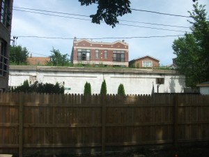
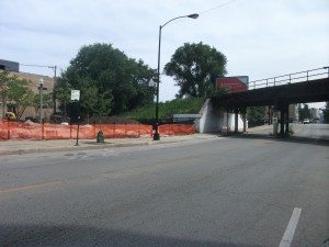
In my last blog post, I extolled some of the virtues of staying put, at least for a vacation, as opposed to roaming the world, a charge to which I plead guilty on a regular basis, though more in connection with work than pleasure. That was a teaser to my real goal of introducing readers to one of the most intriguing projects in Chicago in recent years. The wonderful thing is that my wife and I live just 50 feet from the Bloomingdale Trail. I can even overcome my dislike for the name the larger project surrounding the trail has acquired: The 606. Intended to convey the idea that this is everyone’s project in Chicago by using the first three digits of the city’s many ZIP codes, I find it as unappealing as most things numerical when a real name using words could have been found. But this decision has been made, and it does not necessarily harm anything. The idea seems to have been that the simple name, “Bloomingdale Trail,” which we started out with, and which simply parallels the name of the narrow street beneath it, would confuse people. There are towns named Bloomingdale, after all, and somehow we would not understand, or people elsewhere in the city would think the trail is not theirs because it is ours. I don’t follow all that, but I’ll live with it. The project is still worthwhile. And Bloomingdale remains the name of the trail itself.
What we are discussing here is a public amenity born of an old railroad spur line. Beginning in 1873, the Chicago and Pacific Railroad operated this 2.7-mile span through some dense neighborhoods, serving various small factories. Despite these economic merits, the line caused a good deal of consternation when its trains tied up traffic, blocked fire trucks, and otherwise displeased the neighbors in Logan Square, West Town, and Humboldt Park, the three North Side neighborhoods in Chicago that it traversed. The residents pleaded and demanded with City Hall that the tracks be raised above street level to minimize conflict, and over several years, beginning in 1910, the city did just that. Instead of the railroad continuing to run down the center of Bloomingdale Avenue, it was raised 20 feet with the construction of two concrete triangles into which dirt was poured, with the tracks laid on top. A total of 38 viaducts then allowed street traffic to cross beneath the railroad. However, by 1994, when we built our house on Campbell Avenue, the railroad was barely operational, and the question was what would become of it. Tearing it down would have been very expensive.
So the question arose: Why not turn it into linear public open space?
And so the Bloomingdale Trail began to emerge as a conceivable alternative. By 2004, the Friends of the Bloomingdale Trail had emerged as leading advocates in the community for such a course. Plans began to be laid, and by the time Rahm Emanuel became mayor in 2011, efforts were underway through the city to use federal transportation enhancement funds to develop such a park, including bicycle and pedestrian trails as well as street furniture and trees, all within a design that would allow people in this elevated space to enjoy magnificent views of the city below while finding peace and quiet, and maybe even some wildlife, in a high place.
Of course, as with any such project, there were issues to be addressed, problems to be solved. How would the city protect the privacy of homeowners and condominium dwellers adjacent to the trail? How would it provide adequate access to the trail not only for the physically fit, including bicyclists, but for the disabled? A system of winding ramps emerging from existing public park spaces throughout the span of the trail showed up on diagrams and maps at public meetings. Chicago responded as Chicago does, and hundreds of us showed up at neighborhood sessions to discuss, debate, suggest alternatives, and ask questions of the Chicago Department of Transportation, the lead agency in the project, the Chicago Park District, and the staff of the Trust for Public Land, which was representing the Park District in the process of acquiring public input. This transpired throughout the last two years, and finally, the 606 Project, which includes all the accessory amenities to the trail, was inaugurated, and work on the trail began this summer. The mayor wants to be able to ride the trail by the end of next year; certainly, it is likely to be finished before the next municipal elections in the spring of 2015, however ambitious that schedule may seem. This is, after all, the City of Broad Shoulders. Things get done. One of those broad shoulders is about to become a trail—and only the second elevated rail-trail in the U.S., after the High Line in Manhattan.
It is also likely to become a source of joy, exercise, and exposure to urban nature for thousands of nearby residents and those throughout the city who are willing to find their way to this combination of concrete, dirt, trails, and trees that towers just beyond our property line.
Jim Schwab


